Visitors’ Site Guide
The Coastal Biological Assets at Pembroke Alan Deidun
Rocky shores are the most widespread coastal habitat in the Maltese Islands, constituting ca. 90.5% of the 272 km coastline of the islands, as opposed to the 2.4% constituted by ‘soft sediment’ shores (Schembri et al., 2005)
The rocky shore within the Pembroke SAC is typical of gently-sloping (12-15 degrees) Lower Coralline Limestone shores (Cassar et al., 2007), being relatively exposed (mainly to waves from the north-east and northwest) and unpolluted (as evidenced by the relative absence of green algae typical of eutrophic conditions).
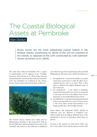
Posidonja | Posidonia | Posidoniaoceanica
The vertical zonation scheme most widely used for Mediterranean shorelines is that proposed by Pérès & Picard (1964) who replaced ambiguous terms such as the ‘intertidal’ (also known as the eulittoral or midlittoral
zone) which does not have much bearing in the microtidal Mediterranean. The main ‘zones’ within this scheme are: i.
the supralittoral - a vertical zone which is very rarely immersed in seawater but is under the effect of seamediated factors, such as sea spray. This is often taken to delineate the highest landward extent of the coastal zone. ii. the mediolittoral – a zone which is alternately exposed and immersed by wave action. It corresponds to the mean sea level or the highest level of wave immersion on microtidal Mediterranean shores. iii. the infralittoral – a zone that is permanently immersed and is never exposed by wave action. Its lower extent is that level where normal photosynthesis is no longer possible due to the low light intensity. Some authors, like Jedrzejczak (2002), identify an additional zone, the adlittoral or backshore zone, which extends from the highest landward limit of the supralittoral to the foot of sand dunes, where these are present. Contrary to the situation on sandy shores, where very few, if any, surface biotic features persist, zonation (the
23