2 minute read
Canyonlands National Park
Located in southeastern Utah just a 30-minute drive from Arches, dramatic Canyonlands National Park — a place of quietude — somehow feels worlds away. A wilderness of canyons and buttes, it has four districts: Island in the Sky, resting on sheer sandstone cliffs over 1,000-feet above the vast terrain; The Needles, studded with striped, colorful spires; rugged, off-thebeaten-path The Maze; and the combined Green and Colorado Rivers, which carved two large canyons into the Colorado Plateau, each with character of their own.
Inhabited for over 10,000 years, traditions and ways of life developed and changed as cultures interacted with one other and the land itself. Nomadic hunter-gatherers roamed throughout the region from 8,000 B.C.E. to 500 B.C.E. Ancestral Puebloans, who farmed and lived in Canyonlands, thrived. The group’s descendants — modern-day Native American tribes — continue to call the eroded, kaleidoscopic landscape home.
The Flora And Fauna
Tucked amid the Colorado Plateau’s high desert in this land of canyons, rock formations and river corridors, desert environs protect many nocturnal species, like bobcats, mountain lions, skunks, ringtails, foxes, bobcats, small, desert-adapted rodents, bats and owls. Most active at dawn and dusk are coyotes, mule deer, desert cottontails, porcupines and blacktailed jackrabbits, while snakes and lizards sun themselves in the heat of a summer day.
Joining them are tiny lichens that adhere to the sandstone; cottonwood trees at the canyon bottoms; and plumes of grass that punctuate the park’s open country. Wildflowers bloom in spring, maidenhair ferns spring from shaded alcoves near seeps and cacti appear from bumpy, lumpy biological soil crust.
The Weather
Canyonlands has a cold, semi-arid climate that sees, on average, less than 10 inches of rain annually. Summers are hot and mostly dry, while winters are cold and occasionally wet.
Big temperature fluctuations are common in the high desert. April through May and mid-September through October are most pleasant, though summer can — and often does — hover above 100 F and late summer, storm cells can lead to flash floods. Snowfall is typically light, though winters are cold, ranging on average between 30 F and 50 F and dropping between 0 F and 20 F.
Be aware of trail and road closures, as well as weather events, by visiting the park’s website prior to arrival.
THE HIKES, DRIVES AND VIEWPOINTS
Mesa Arch
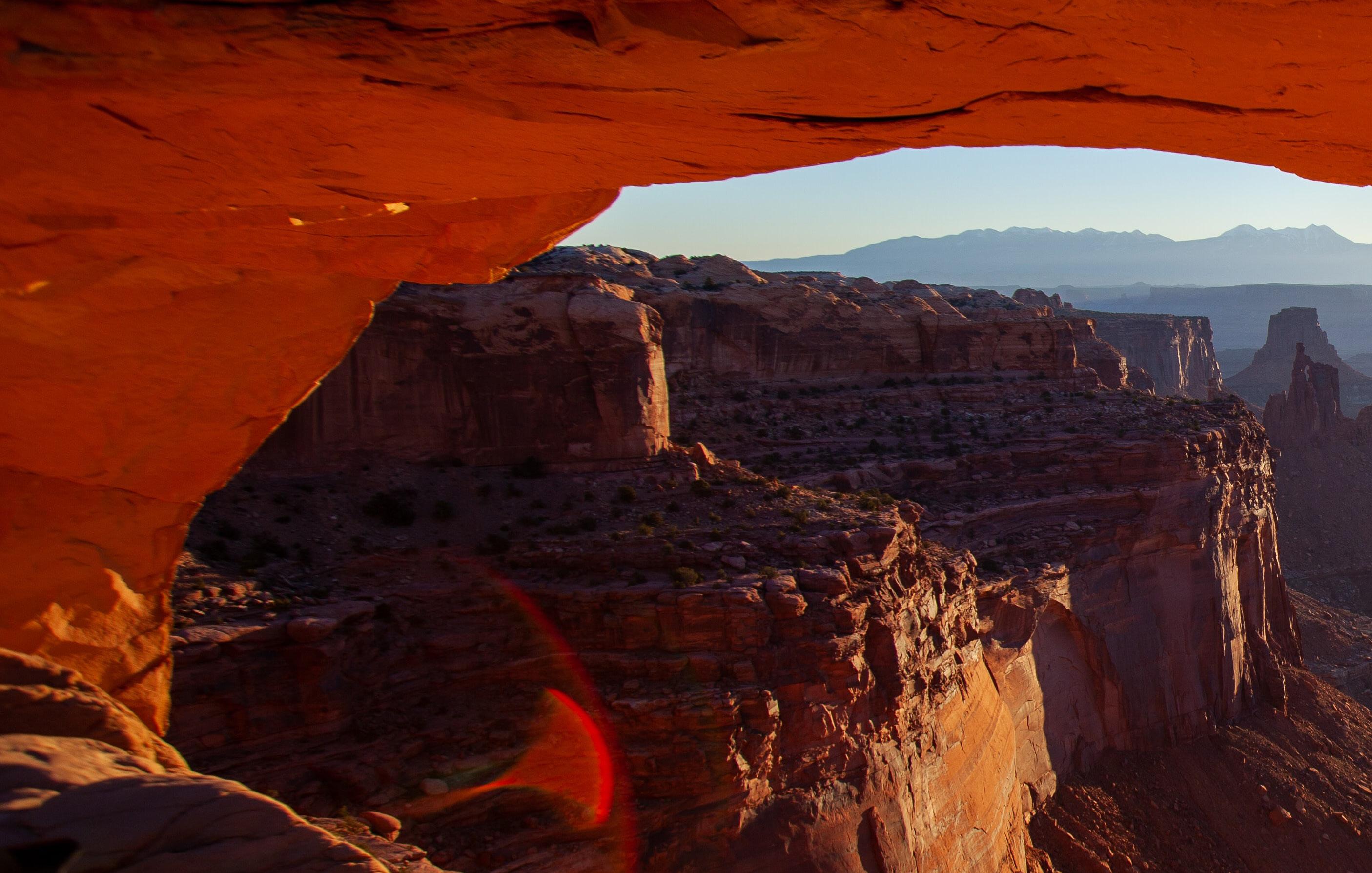
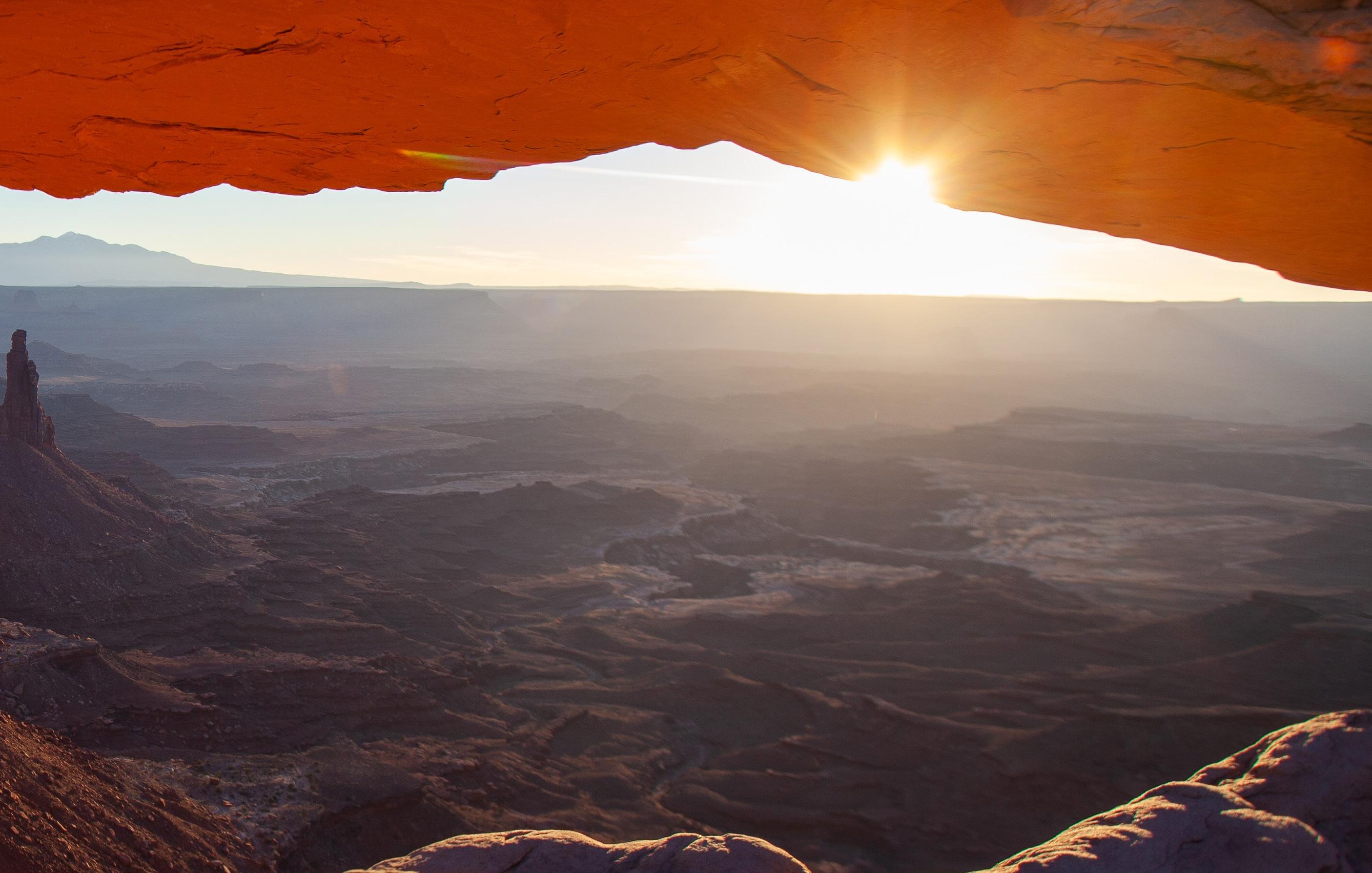
Among the most photographed vistas in the park, Mesa Arch — set in the park’s Islands in the Sky section — is reached by a .7-mile stroll. An amazing spot to view the sunrise, the arch rests at the edge of a sheer cliff, providing a natural window into Buck Canyon and the distant La Sal Mountains.

White Rim Overlook Trail
Also in Islands in the Sky is the 1.8-mile, out-and-back White Rim Overlook Trail at the Gooseberry Trailhead. Head here in the afternoon, when the sun illuminates the canyon, marveling at views of the La Sal Mountains, the Colorado River, Monument Basin and ultra-scenic White Rim Road.
Grand View Point Trail
Another Islands in the Sky stunner, the 1.8-mile, out-and-back Grand View Point Trail skirts the top of the canyon, for seemingly endless vantage points of it and the rivers that carved it below.
Confluence Overlook Trail
For a challenging hike, hit the 10mile Confluence Overlook Trail for an out-and-back adventure. Tracing the northern edge of the geologic fault that shaped The Needles, it brings you to the impressive viewpoint its name implies.
CHESLER PARK/JOINT TRAIL
For great panoramas of The Needles District, the 10.4-mile Chesler Park/ Joint Trail journeys through varied, colorful terrain, from ravines to ridges and slickrock. Particularly noteworthy is a 1.5-mile section of the Chesler Park loop, which climbs .6 miles up Chesler Canyon. After crossing a broad wash and cutting through a crop of sandstone knobs, you reach the narrow, slot canyon-esque “joint.”
34-MILE SCENIC DRIVE
Carve out time to drive the length of the awe-inspiring, 34-mile, outand-back scenic drive through the park. Its overlooks, from 1,000 feet above, showcase the valleys and other districts in the park from an elevated vantage point.


