2 minute read
Capitol Reef National Park
Situated in the red rock country of south-central Utah, Capitol Reef National Park is a less-frequented gem replete with canyons, domes, cliffs and bridges in the Waterpocket Fold, a geologic “wrinkle” on the earth that spans almost 100 miles. Archaic hunters-gatherers migrated through the canyons before the Fremont Culture solidified around 500 C.E., shifting from food foraging groups to corn, squash and bean farmers, etching petroglyphs and painting pictographs on rock walls. By the 1800s, Mormon pioneers, and other explorers settled in what is now the Fruita Rural Historic District, planting and cultivating pear, apple and peach orchards. Today, you can pick the heirloom bounty provided you follow a few simple rules.
The Flora And Fauna
A place of wondrous geological formations, unique animals and plants and seriously dark skies (it received International Dark Sky Park designation), Capitol Reef is marked by basalt boulders, fossils and biological soil crusts, a living groundcover of soil lichens, green algae, mosses, bacteria and micro fungi.
Nearly 10,000 feet of sedimentary strata was deposited in the Capitol Reef area, the sequence of layers recording upwards of 200 million years of geologic history. Later, the entire region was vertically uplifted on account of large-scale plate tectonic forces. Meanwhile, the monocline of Waterpocket Fold arose between 50 and 70 million years ago, when the Laramide Orogeny reactivated an ancient, buried fault, at which point overlying sedimentary layers were draped above the fault. By contrast, in the Cathedral Valley, erosion shaped freestanding monoliths from soft, red entrada sandstone.
Shrubs, cacti and desert succulents are joined by the likes of grasses, Utah junipers, two-needle pinyon trees, western bristlecone pines and ponderosa pines, accented by showy, colorful wildflowers in spring and summer. Hosting residents big and small, park species include gray foxes, bighorn sheep, mountain lions and beavers, plus snakes, lizards, toads, frogs and more than 230 species of birds.
The Weather
An arid environment, the park averages 7.91 inches of precipitation at the visitor’s center, much of it falling during the June through September monsoon season, when flash floods are a risk. The long, narrow park sees varied elevations; as a result, there can be a considerable swing in temperatures. Summers are hot, averaging between 87 F and 91 F. The coldest month of the year, December experiences average highs of 40 F, and dips to around 21 F.
Keep up on park and road conditions on the national park website.
THE HIKES, DRIVES AND VIEWPOINTS
Hickman Bridge Trail
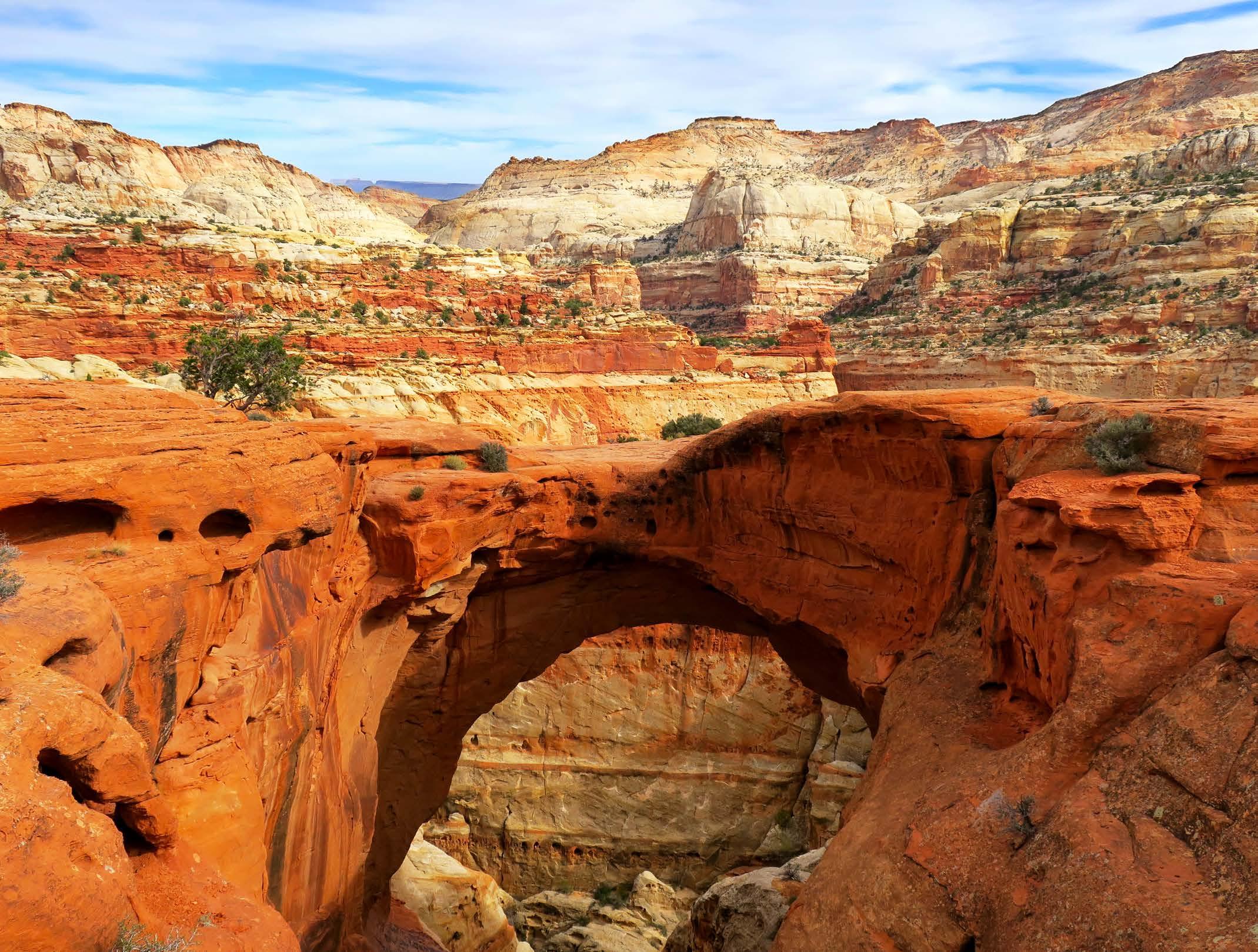
The 1.7-mile, out-and-back Hickman Bridge Trail is flanked by tall, tan rock walls, ancient sand dunes, juniper and cottonwood as you head to the natural sandstone arch, which stands 125 feet high and 133 feet long. You can opt to continue hiking another 2.4 miles, gaining 500 feet of elevation to reach Navajo Knobs for 360-degree panoramas of Capitol Reef.
A PLACE OF WONDROUS GEOLOGICAL FORMATIONS, UNIQUE ANIMALS AND PLANTS AND SERIOUSLY DARK SKIES (IT RECEIVED INTERNATIONAL DARK SKY PARK DESIGNATION), CAPITOL REEF IS MARKED BY BASALT BOULDERS, FOSSILS AND BIOLOGICAL SOIL CRUSTS, A LIVING GROUNDCOVER OF SOIL LICHENS, GREEN ALGAE, MOSSES, BACTERIA AND MICRO FUNGI.
Cassidy Arch Trail
A 3.1-mile hike along the out-and-back Cassidy Arch Trail is among the park’s most thrilling. Named for bank robber Butch Cassidy, who once hid in these hills, it features a series of switchbacks that climb out of the canyon and into the multihued lands.
GRAND WASH TRAIL
Journey through the narrows on the easy, 4.5-mile, out-and-back Grand Wash Trail, which brims with small caves, honeycombed rock and rockysandy terrain along a wash bordered by towering walls.
Chimney Rock Loop
The Chimney Rock Loop is a difficult-but-rewarding, 3.3-mile trek highlighting colorful badlands, linear cliffs and the mouth of a narrow canyon, as well as the eroded pillar of Chimney Rock itself.
Capital Reef Scenic Drive
Wind your way through the park along the 7.9-mile scenic drive — not a loop — for a chance to witness many of the park’s scenic formations at once, including the historic fruit orchards, Grand Wash and Capitol Gorge.
ABOUT THE PARK
LOCATION
South central Utah
ESTABLISHED
December 18, 1971
AREA 241,904 acres


