2 minute read
Black Canyon of the Gunnison National Park
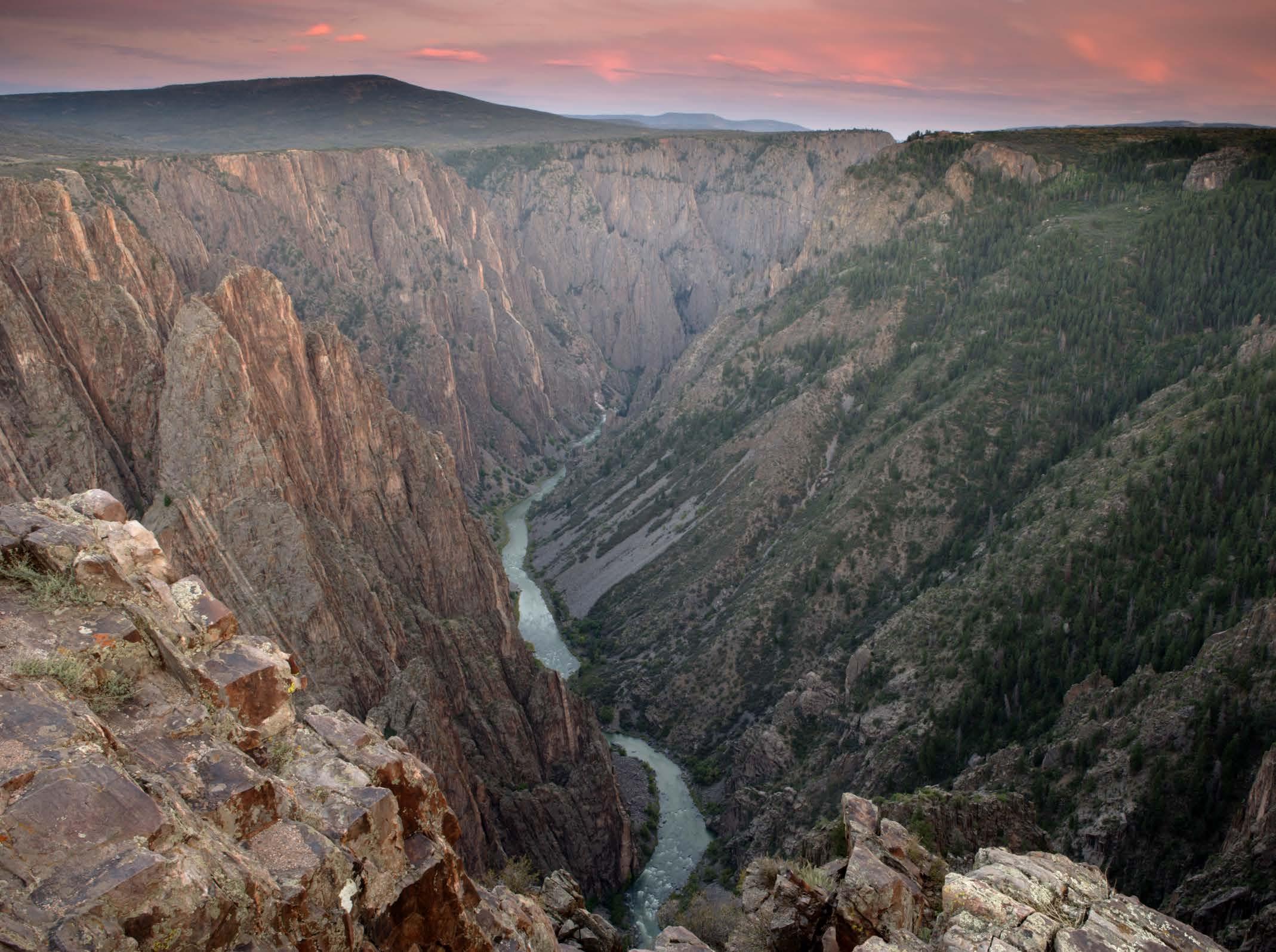
Set in western Colorado, the history of Black Canyon of the Gunnison National Park can be traced back some 60 million years to the Gunnison Uplift, when a small area of land uplifted 1.8-billion-year-old metamorphic rock, bringing it to high elevations.
Then, about 30 million years ago, large volcanoes erupted on either side, covering the area in volcanic rock. The park that you see today envelops part of a deep, steep-walled gorge that was later carved through Precambrian rock by the Gunnison River. Home to some of the United States’ sheerest cliffs, oldest rock and craggiest spires, what you see is the work of two million years of weathering.
The Flora And Fauna
Uplift, volcanism and the erosive force of water have shaped a geologic story for the ages, creating an environment where species thrive from rim to river. In the pinyon-juniper forests, vibrant collared lizards laze away for days on sun-drenched rocks, while cottontail rabbits and mule deer rustle around in the dense berry, oak and sage brush. Meanwhile, bighorn sheep navigate steep slopes with ease as peregrine falcons soar overhead; river otters bob along the river; black bears make their way through tall grass; and mountain lions stalk prey beneath impossibly starry skies.
The Weather
Black Canyon of the Gunnison experiences a warm summer humid continental climate, with average lows dipping to 12 F in January, its coldest, snowiest month, and swinging from an average low of 52 F to an average 82 F high in July, the warmest month.
Seasonal road closures impact the park’s accessibility during winter months, including at East Portal Road and North Rim Road and its ranger station. South Rim Road beyond the visitor center is typically closed to vehicles during the winter season as well.
Be sure to plan accordingly and do confirm conditions in advance.
THE HIKES, DRIVES AND VIEWPOINTS
US HIGHWAY 50 & COLORADO HIGHWAY 92
Among the main attractions of the park are the scenic drives along U.S. Highway 50 and Colorado Highway 92, as well as the South Rim.
Warner Point Nature
TRAIL
Short-and-sweet, 1.5-mile Warner Point Nature Trail is an out-and-back stunner that takes you to Warner Point for sublime views of Black Canyon and distant panoramas of the San Juan Range.
NORTH VISTA TRAIL
The moderate, 7-mile, out-and-back North Vista Trail reveals Gunnison River overlooks, exceptional canyon views and the satisfaction of reaching the summit of Green Mountain, starting from the North Rim ranger station.
Red Rock Canyon Route
Of the backcountry options, the challenging Red Rock Canyon Route
HOME affords some of the most spectacular views in the park as you make your way to the inner canyon of the Gunnison River — not to mention some of the area’s best fly fishing. Remember, though, a permit is required.

Rim Rock Nature Trail
For an easy option, the Rim Rock Nature Trail is not to be missed. Beginning at the South Rim Visitor’s Center, the 2-mile, point-to-point hike offers memorable overlooks like Tomichi Point, where you can witness the majesty of the valley walls firsthand.
About The Park
LOCATION
Carved by the Gunnison River, in western Colorado
ESTABLISHED
October 21, 1999
AREA 30,750 acres


