3 minute read
The Coastal Plains

from Quiz on Rivers
by Umeopedia

The soil in this region contains calcareous deposits locally known as kankar. The newer, younger deposits of the flood plains are called khadar. They are renewed almost every year and so are fertile, thus, ideal for intensive agriculture.
The Peninsular Plateau
Advertisement
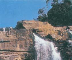
The Peninsular plateau is a tableland composed of the old crystalline, igneous and metamorphic rocks. It was formed due to the breaking and drifting of the Gondwana land and thus, making it a part of the oldest landmass. The plateau has broad and shallow valleys and rounded hills. This plateau consists of two broad divisions, namely, the Central Highlands and the Deccan Plateau. The part of the Peninsular plateau lying to the north of the Narmada river covering a major area of the Malwa plateau is known as the Central Highlands. The Vindhyan range is bounded by the Central Highlands on the south and the Aravalis on the northwest. The further westward extension gradually merges with the sandy and rocky desert of Rajasthan. The flow of the rivers draining this region, namely the Chambal, the Sind, the Betwa and Ken is from southwest to northeast, thus indicating the slope. The Central Highlands are wider in the west but narrower in the east. The eastward extensions of this plateau are locally known as the Bundelkhand and Baghelkhand. The Chotanagpur plateau marks the further eastward extension, drained by the Damodar river.
Figure 2.8 : A waterfall in Chotanagpur Plateau
PHYSICAL FEATURES OF INDIA
The Deccan Plateau is a triangular landmass that lies to the south of the river Narmada. The Satpura range flanks its broad base in the north while the Mahadev, the Kaimur hills and the Maikal range form its eastern extensions. Locate these hills and ranges in the physical map of India. The Deccan Plateau is higher in the west and slopes gently eastwards. An extension of the Plateau is also visible in the northeast– locally known as the Meghalaya, Karbi-Anglong Plateau and North Cachar Hills. It is separated by a fault from the Chotanagpur Plateau. Three Prominent hill ranges from the west to east are the Garo, the Khasi and the Jaintia Hills.
The Western Ghats and the Eastern Ghats mark the western and the eastern edges of the Deccan Plateau respectively. Western Ghats lie parallel to the western coast. They are continuous and can be crossed through passes only. Locate the Thal, Bhor and the Pal Ghats in the Physical map of India.
The Western Ghats are higher than the Eastern Ghats. Their average elevation is 900–1600 metres as against 600 metres of the Eastern Ghats. The Eastern Ghats stretch from the Mahanadi Valley to the Nigiris in the south. The Eastern Ghats are discontinuous and irregular and dissected by rivers draining into the Bay of Bengal. The Western Ghats cause orographic rain by facing the rain bearing moist winds to rise along the western slopes of the Ghats. The Western Ghats are known by different local names. The height of the Western Ghats progressively increases from north to south. The highest peaks include the Anai Mudi (2,695metres) and the Doda Betta (2,637 metres). Mahendragiri (1,501 metres) is the highest peak in the Eastern Ghats. Shevroy Hills and the Javadi Hills are located to the southeast of the Eastern Ghats. Locate the famous hill stations of Udagamandalam, popularly known as Ooty and the Kodaikanal.
One of the distinct features of the peninsular plateau is the black soil area known as Decean Trap. This is of volcanic origin hence the rocks are igneous. Actually these rocks have denuded over time and are responsible for the formation of black soil. The Aravali Hills lie on the western and northwestern margins of the


