Arnica Studios
(This is an academic project.)
(This is an academic project.)

We would like to take a moment to acknowledge the Treaty 7 traditional lands of Métis Nation (District 5 and 6); the Blackfoot Confederacy, Tsuut’ina First Nation and the Îethka Nakoda Wîcastabi First Nations where our community project is situated. We honour the generations of Elders who have protected these sacred gathering places and are committed to respectfully support their heritage. Arnica Studios is dedicated to advocating truth, reconciliation, and the celebration of cultural practices. This acknowledgement will serve as guidance as we produce the development proposal, ensuring our approach and design reflects these values.
Arnica Studios consists of three MPlan students (Alexus Dang, Juhee Jani, and Kaden Szentmiklossy). This project was completed for the PLAN 630: Advanced Planning Studio under the guidance of under the guidance of Zach Hoefs (Instructor | University of Calgary). The Steering Committee includes Allison Davelaar of CMLC, Maggie Dycke of the City of Calgary and Evan Goldstrom of the City of Calgary.


Juhee Jani, originally from Pickering, Ontario, is in her final year of Master of Planning at the University of Calgary. She holds a bachelor’s degree in Urbanism with a minor in Architectural Studies at Carleton University. Through a strong theoretical foundation from her academic studies and previously interning as a 3D-modeller, Juhee is passionate about applying her knowledge to enhance public spaces, transportation systems, and promote sustainability.
Alexus Dang, a Calgary native, is in her final year of the Master of Planning program at the University of Calgary, where she also earned her Bachelor of Science with a concentration in Geography. With a diverse background that includes experience in the energy sector as a surface land administrator and junior advisor in sustainability and emissions, Alexus is currently working as a planning assistant. Her passion for urban planning is rooted in a commitment to enhancing communities and improving the public realm through thoughtful, sustainable design and development.
This report presents the findings of a four-month intensive academic urban planning project conducted as part of the University of Calgary’s Advanced Professional Planning Studio, under the guidance of Zach Hoefs In collaboration with the Falconridge Castleridge Community Association (FCCA) and our team at Arnica Studios, this project offers a comprehensive set of recommendations aimed at enhancing the Falconridge, Castleridge, and Westwinds communities
Through a combination of historical, community, and spatial analysis, policy review, public engagement, and conceptual design, we have developed strategies to address the current and future needs of these neighborhoods. The primary focus of the proposed implementation strategies is to improve public safety enhance transportation efficiency, promote land use alongside housing diversity, and foster greater community engagement

Kaden Szentmiklossy is Calgary local and in his final year of the Master of Planning at University of Calgary. His undergrad degree was also a Bachelor of Arts in Urban Studies where he discovered his love for the built environment and public participation. Currently working as a drafter and 3D-modeller, Kaden integrates his affinity for design into making accessibility and equity a priority for urban environments.
Our team at Arnica Studios offers a strong foundation of diverse academic backgrounds including international project settings, hands-on practical experience in both the private and public sector, and exposure to different local contexts. Together, our shared passion for equitable, sustainable, and community-focused designs combined with a wide array of skills allows us to meaningfully tailor design solutions for our clients that reflect vibrancy, innovation and inclusion.
Land use districts / zones:
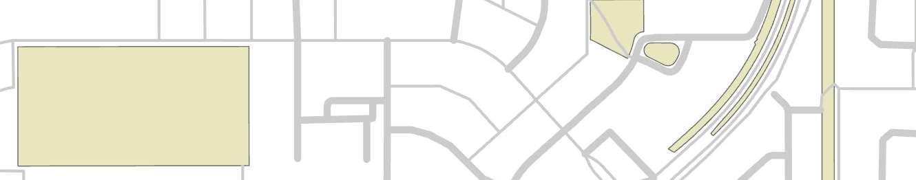
Westwinds Area (C-C1) Commercial Community is a developing area in the airport vicinity protection area
Castleridge contains a special purpose (S-SPR) and is also a developing area in the airport vicinity protection area
Falconridge mainly contains R-CG (residential grade-oriented infill)
The Guide for Local Area Planning:
• Principles for Great Communities: Opportunity and Choice, The Natural Environment, Health and Wellness, Economic Vitality, Social Interaction, Identity and Place
LAP Content Policies:
LAP should include vision for the future of an area that align with the MDP and the guide for LAP
LAPs should be informed by community characteristics and attributes
Include an urban form categories and scales maps
Contain community-specific policies
Explore and identify opportunities through the engagement process for future significant projects, studies or investments to be included in the local area plan;
• iv. identify unique sites, such as landmark or gateway sites, and provide community specific policy to guide future development in these areas;
• v. identifies transit station areas, supported by appropriate urban form categories and scale modifiers
Incorporate climate change policy that contributes to achieving and implementing Calgary’s Climate Resilience Strategy; and,
• viii. incorporate policy to support the protection and enhancement of tree canopies to achieve and implement the Urban Tree Canopy policy of the Municipal Development Plan.
The Guide for Local Area Planning is a nonstatutory plan that offers tools and policies
to develop a future vision for communities by indicating what to include design-wise and how to best engage with the community. We will use this guide to set our community priorities and navigate the implementation of strategies to achieve these goals.
Both the Municipal Development Plan (MDP) and the Calgary Transportation Plan are overarching, non-statutory plans that outline a long-term vision for Calgary’s growth and development. They focus on land use and transportation to guide future planning and decision-making.
The Calgary Climate Strategy is a non-statutory plan that aims to achieve net-zero greenhouse gas emissions by 2050 and enhance the city’s resilience to climate change. This plan will guide us in achieving sustainable and environmentally conscious designs.
January 17, 2025
Falconridge/Castleridge Community Association 95 Falshire Dr NE
Calgary, AB T3J 1P7
Arnica Studios 2500 University Dr NW Calgary, AB T2N 1N4
Dear President Dhruv Sharma, General Manager Lee Pederson, and the Falconridge/Castleridge Community Association,
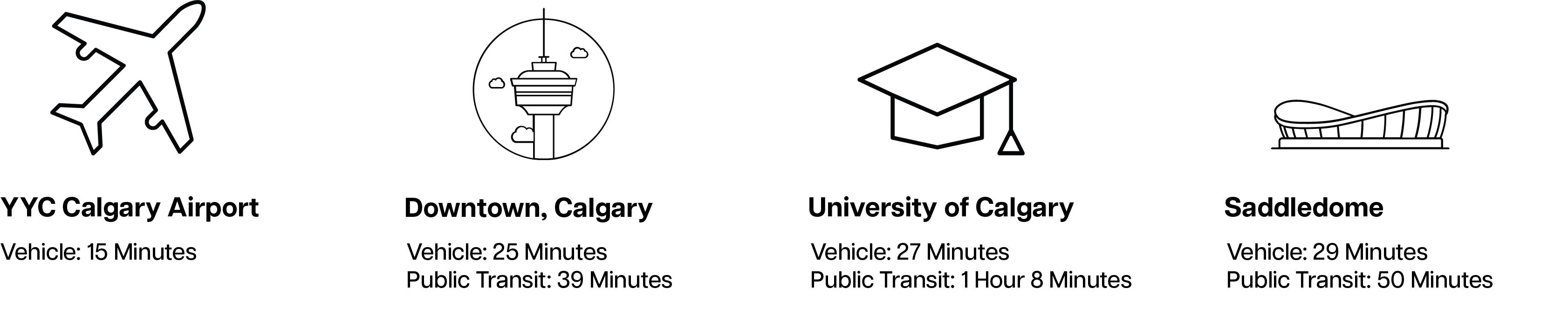
On behalf of Arnica Studios, we are excited to formally accept your request to propose an enhanced Masterplan for Falconridge, Castleridge, and Westwinds in Calgary. As these communities continue to mature, they hold significant potential for transformation to support the diverse and evolving needs of their residents. This potential can be realized through strategic big moves and meaningful community engagement, effectively addressing the current and future urban challenges. Arnica Studios’ main office, located in the NW quadrant, comprises three employees working on this project, bringing years of academic experience in urban planning, architecture, and geography alongside practical experience in both the private and public sector. Driven by innovative, sustainable, and thoughtful solutions, we have consistently delivered effective urban planning Masterplans and detailed, smallscaled proposals for a diverse range of clients in local and international contexts.
To effectively contribute to the proposal, our team will conduct comprehensive research including historic, community and site analysis, SWOT assessment, studying policy documentation while engaging with the community association, key stakeholders, and the public through various phases of conceptual designs. Our team is dedicated to revitalizing the vibrancy of these communities by ensuring a safe environment, promoting efficient transportation, and hosting year-round activities to bring the community together. Using a holistic approach, we seek to enhance the community’s strengths through infrastructure, public and open space, transportation and social factors. In collaboration with FCCA, Arnica Studios is confident that combining local experience and knowledge alongside our skills and extensive experience, will enable us to successfully deliver this project and reinforce the community’s vision. We look forward to collaborating on the development of this proposal, thank you for this opportunity. Please email arnicastudios@gmail.com if additional information is required.
Best regards,
In referencing the background review and methodology assessment, including a site visit and community tour with the President of the Falconridge Castleridge Community Association, Dhruv Sharma, Arnica Studios has identified a plethora of concerns and areas of interest. These issues have been closely reviewed which subsequently produced a list of key issues that will inform the generation of ideas for the rest of the project. These
Key Issues are outlined on the following page.
1. Mobility and Pathways:
• Improve all modes of mobility, ensuring a safe and vibrant pedestrian experience.
• Enhance pedestrian infrastructure at busy intersections.
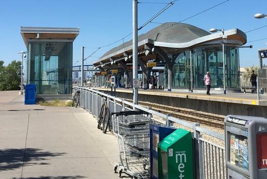
• Improve connectivity between the communities and the McKnight LRT station.
• Ensure pathways lead to existing areas of interest or create landmarks.
• Promote active Park & Ride facilities.
2. Safety and Public Spaces:
• Address existing issues with safety, crime, and homelessness.
• Increase public spaces that meet CPTED standards and improve existing spaces that do not meet these standards.
• 3. Amenities and Open Spaces:
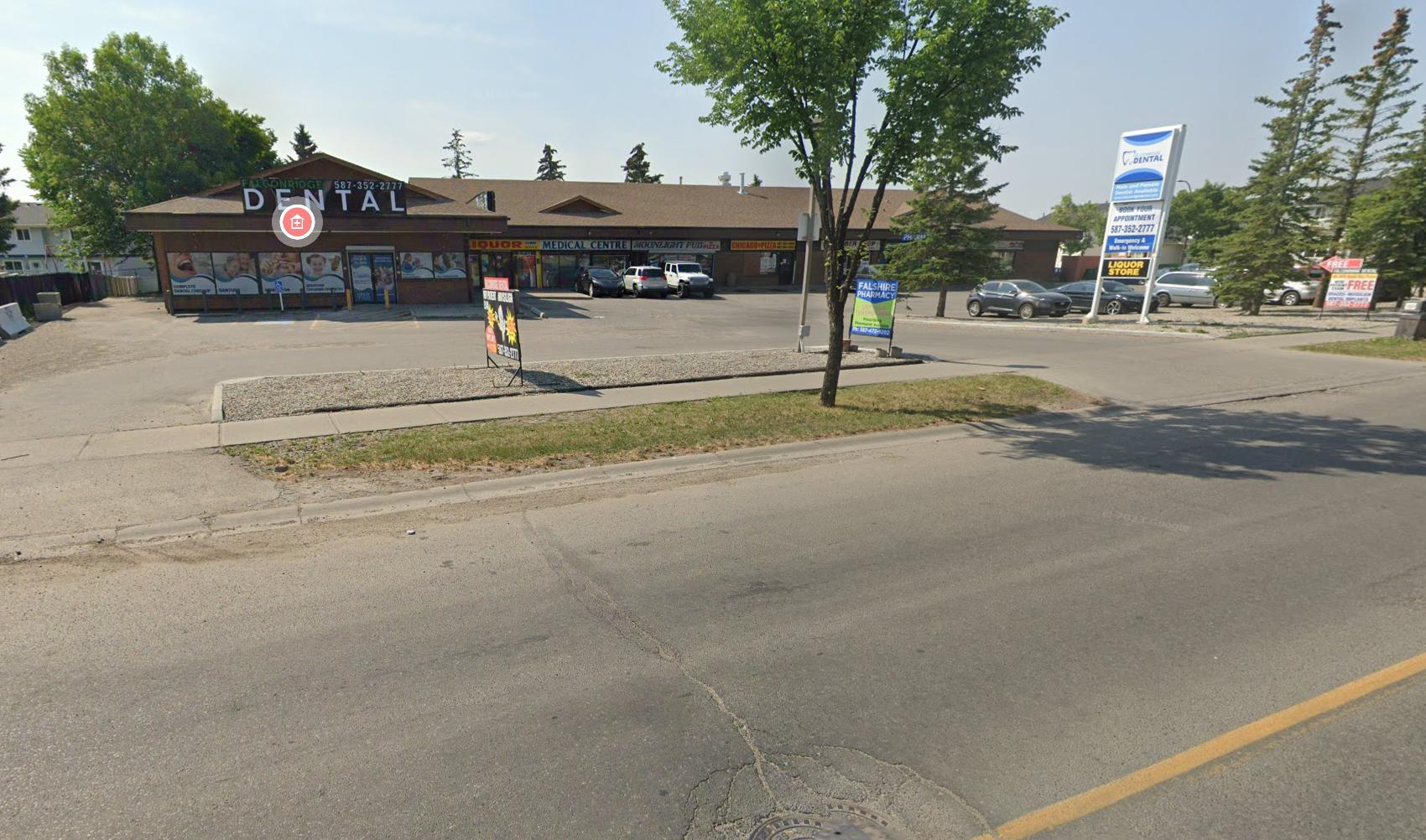
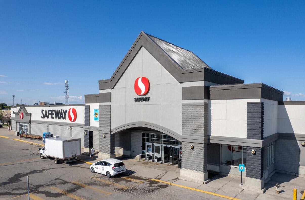
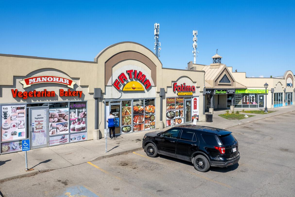
• Enhance the strip mall since it is the primary area for commercial use.
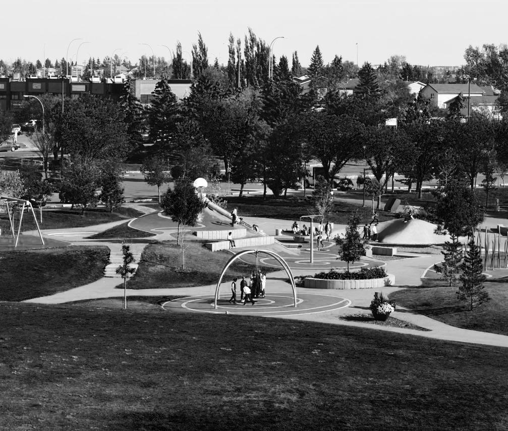
• Achieve year-round use of the Prairie Winds Park using strategies such as lighting.
• Make more activities accessible such as soccer and cricket.
4. Unity & Placemaking
• Develop a strong sense of place by acknowledging the multicultural and multi-generational demographic.
• Design spaces that not only accommodate multiple cultures but also encourage intercultural interactions.
• Paint murals on street walls that visualize this sense of unity.
1.8
The first phase aims to gather a basic understanding of the community and its needs by reviewing existing policies and creating a plan for the subsequent phases. In the second phase, we will conduct a more in-depth analysis of the community through mapping exercises and sociodemographic and historical analyses. The third phase involves completing the conceptual design by proposing interventions based on our analyses. After receiving feedback from the Steering Committee in the fourth phase, we will incorporate this feedback into our designs and revise the policies accordingly. This ensures that the final submission aligns with the project’s requirements and the committee’s expertise. In the fifth and final phase, we will submit the revised document after presenting our updated conceptual design to the Steering Committee once more.
1.9
This section has been created to provide a comprehensive outline of our approach and the procedures we will follow, which are divided into five distinct phases. The first phase involves conducting a thorough background review and performing an in-depth neighbourhood analysis. This will enable us to better understand the project’s scope and identify key stakeholders who will be integral to the project’s success. In the second phase, we will perform an analysis of the community profile. This includes actively engaging with the
community through workshops and gathering feedback on our proposed implementations. During the third phase, we will begin designing our concept for the Falconridge/Castleridge community. The fourth phase focuses on the review and revision of our initial designs. We will take into consideration all feedback received during community engagement and from the Steering Committee to make necessary adjustments to refine our concept. In the final phase, we will submit the finalized conceptual design and its accompanying posters. By following these five phases, we aim to ensure that our approach is systematic, inclusive, and responsive to the community’s feedback, resulting in a conceptual design that truly reflects the needs and aspirations of the Falconridge/Castleridge community.
• Phase 1 – Background Review and Neighbourhood Analysis
• Review of legal framework (existing policies and plans)
• Create base maps
• Environmental analysis
• Land use and functional analysis
• Historical analysis (timeline, evolution etc.)
• Infrastructure analysis
• Housing and building typology
• Public realm walkability
• Phase 2 – Community Profile and Public Engagement
• Socio-demographics (description of stakeholders)
• Review of analysis and workshop with community members
• Community mapping
• SWOT Analysis
• Open house and return to community
• Phase 3 – Conceptual Design
• Land use and projected growth
• Proposed housing and commercial spaces
• Identification of large parcels, open spaces, and natural areas
• Phase 4 – Concept Design Review and Revisions
• Presentation to Steering Committee
• Revise work based on steering committee’s comments
• Phase 5 – Final Submission
• Final submission of plan document and posters
P h a s e B a c k g o u n d R e e w n d N g h b o u h o o d A n a s
Review of legal framework
Create base maps
Environmental analysis
Land use and functional analysis
Historical analysis
Infrastructure analysis
Housing and building typology
Public realm walkability
P
Socio-demographics
Review of analysis and workshop with community members
Community mapping
AD100%1-14-251-17-25
AD100%1-14-251-19-25
75%1-14-251-20-25
0%1-14-251-20-25
AD100%1-14-251-16-25
0%1-16-251-20-25
100%1-17-251-20-25
0%1-18-251-20-25
Arnica Studios will be working with the communities Falconridge, Castleridge, and Westwinds, Calgary in five phases during a four-month period from January 14th till April 22nd. Firstly, in Phase 1 the team will begin with an on-site and research-based site analysis alongside a legal framework and meeting the FCCA to situate and better understand local concerns first-hand. Following this in Phase 2 a SWOT analysis, stakeholder meetings, Steering Committee engagement, community workshop, and a first draft conceptual design will be crafted. Phase 3 will involve a Steering Committee meeting for design refinement and 3D modelling. Phase 4 progresses with further refinement through an open house engagement session to ensure the masterplan effectively meets the needs of its residents whereas in the last Phase 5, a final design and presentation will be provided to Council.
0%1-20-251-27-25
0%1-20-252-4-25
0%1-20-251-27-25
SWOT Analysis 0%1-27-252-4-25
Open house and return to community
0%1-27-251-30-25 P
Land use and projected growth
Proposed housing and commercial spaces
Identification of large parcels, open spaces, and natural areas
P
Presentation to Steering Committee
Revise work based on steering committee’s comments
0%2-24-253-14-25
0%2-24-253-14-25
0%2-24-253-14-25
0%3-17-254-22-25
0%3-17-254-22-25
0%3-17-254-22-25 Track expenses
0%3-17-254-22-25
Our allocated project budget equals to a total of $51,300 including all associated expenses, fees, funding, and GST/PST.
Phase 1: Project Initiation
Phase 1.1 | A comprehensive workplan proposal
Letter of interest
Legal framework
Firm & team member descriptions
Project understanding & key issues
Stakeholders
Methodology
Project schedule
Base mapping
Phase 2: Data Collection & Analysis
Phase 2.1 Analysis Presentation to Steering Committee
Site Introduction
Urban Morphology
Environment Analysis
Built Form
Infrastructure
Summary of Analysis
Phase 2.2 | Public Workshop
Phase 3: Conceptual Design
Phase 3.1 Wholistic Concept Presentation to Steering Committee
Project/Site Intro
Summary of Key Issues/Opportunities/Constraints Visually
Invoicing
• We suggest billing for each consultant within Arnica Studios on an hourly basis
Assumptions
• Our proposal methodology, schedule and budget are based on the project’s outlined requirements. Furthermore, we have made the following assumptions: Data collection
• The SANDS team at the University of Calgary will provide all basemapping data required in an ESRI compatible format to our Team.
Summary of “What We Heard” from Phase 2.2
Presentation of Draft Concepts/Ideas/Strategies
Potential “Special Site”
Schematic Diagrams to illustrate ideas
Specific intervention locations Mapping
Phase 4: Concept Design Review & Revisions
Phase 4.1 Open House
Revision of Interventions and What We Heard Report
Five 24” x 36” Posters
Phase 4.2 Steering Committee Presentation
One Digital PDF presentation, less that 50Mb
Phase 5: Final Submission
Phase 5.1 Report Submission
One PDF ready for print - 8.5” x 11” or 11” x 17”
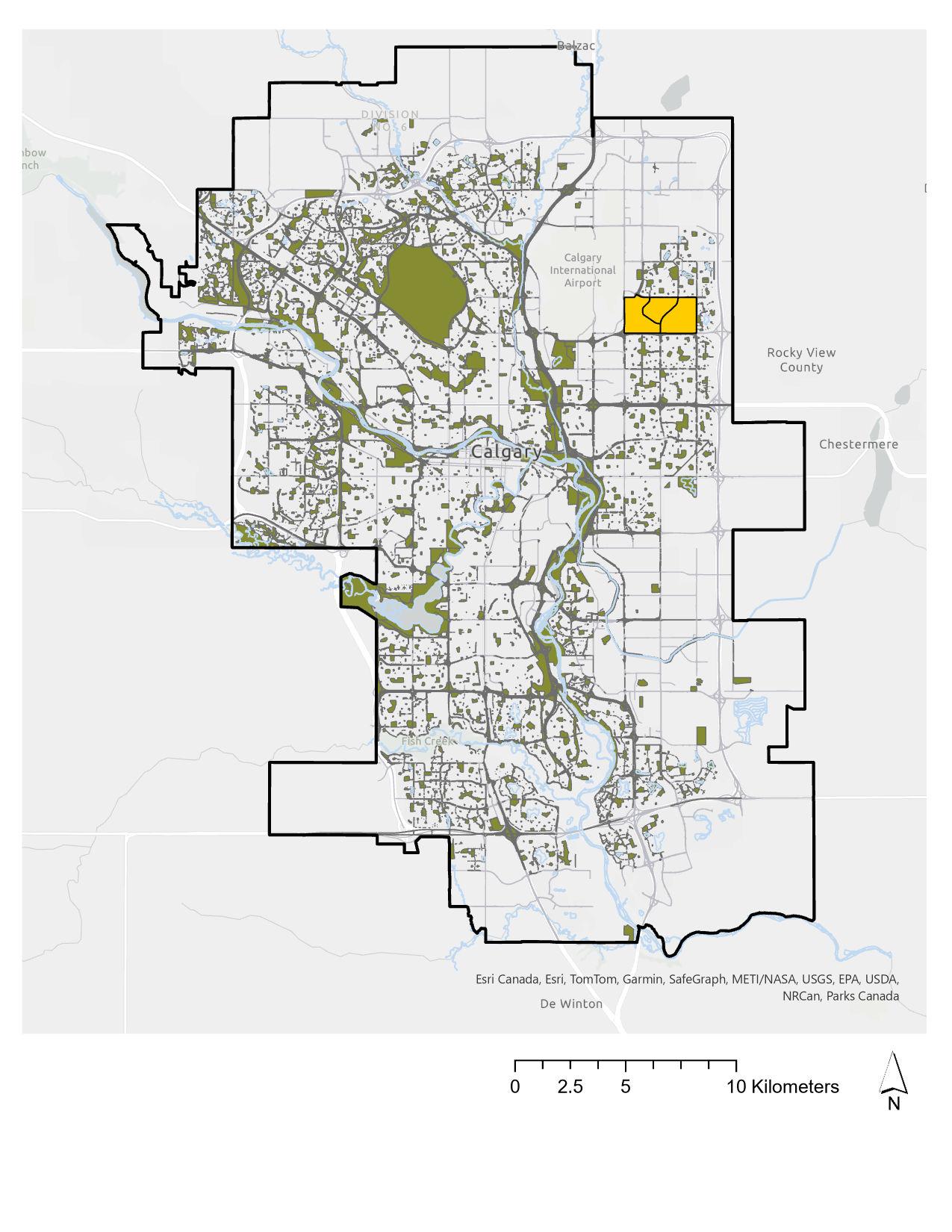
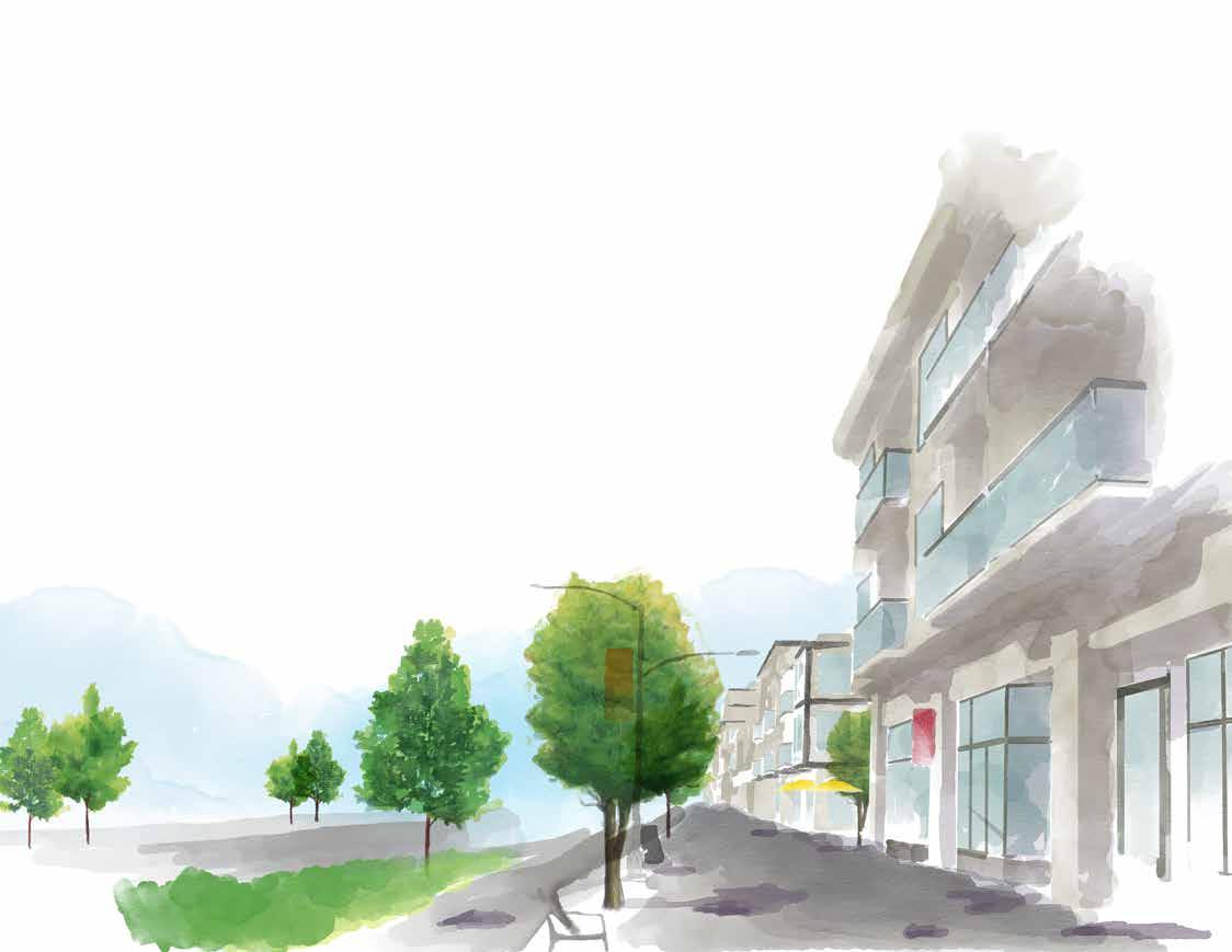
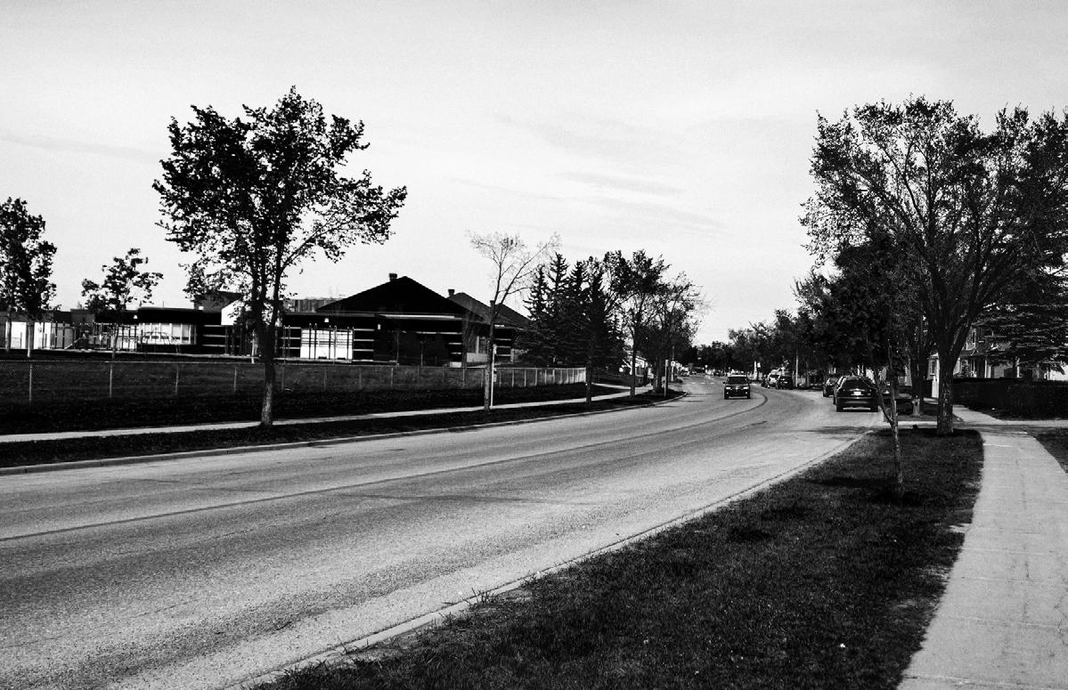
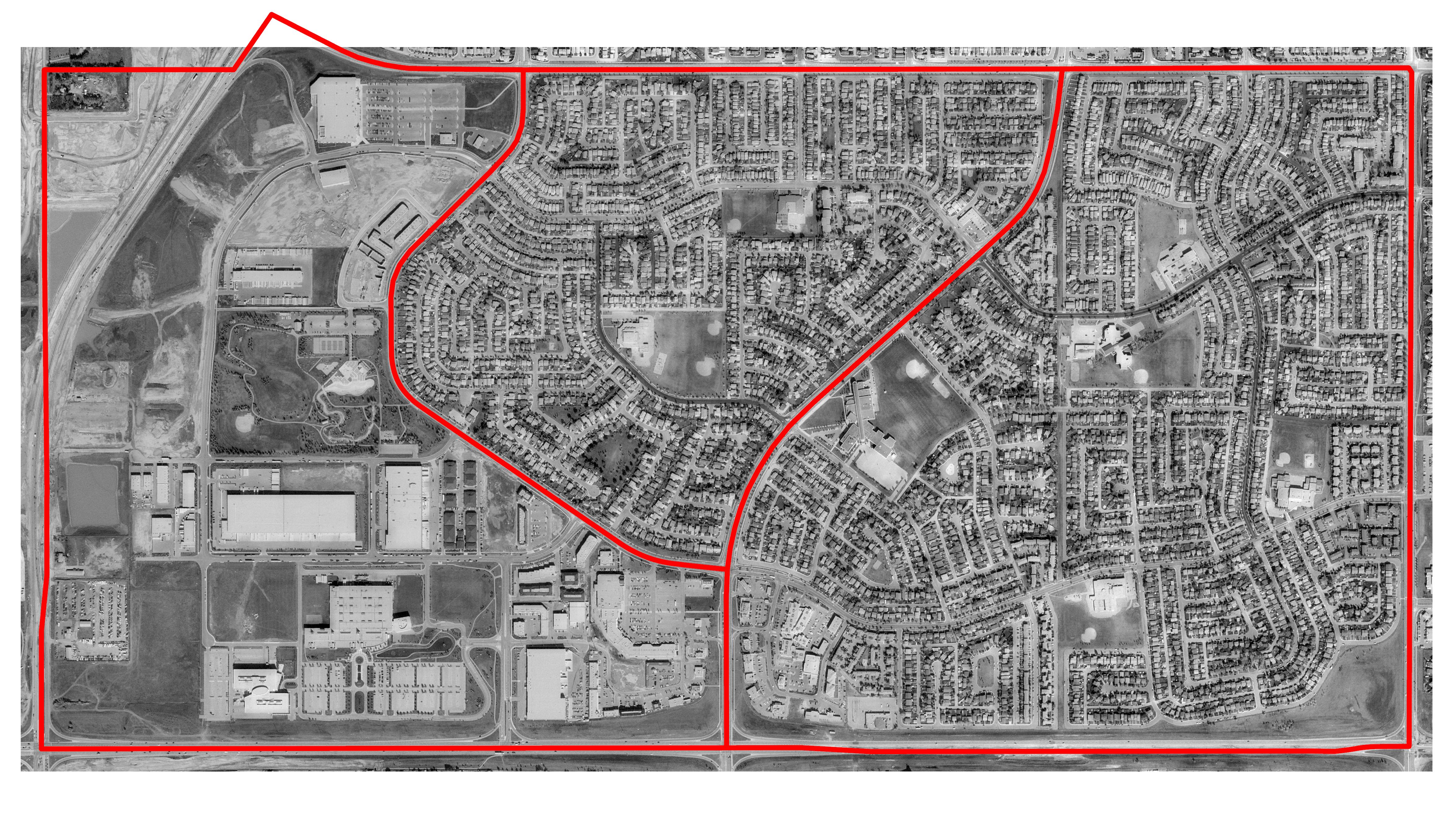
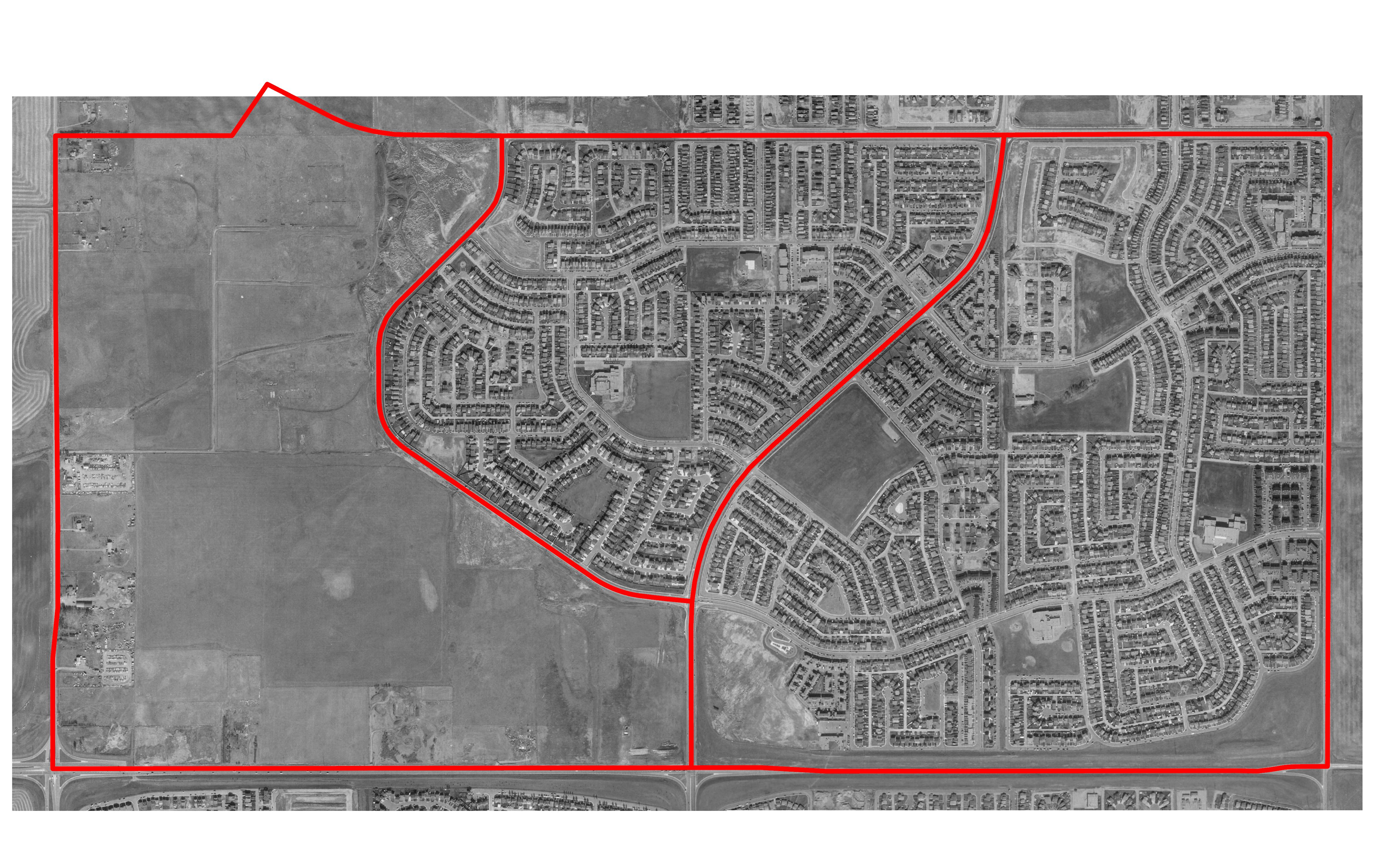
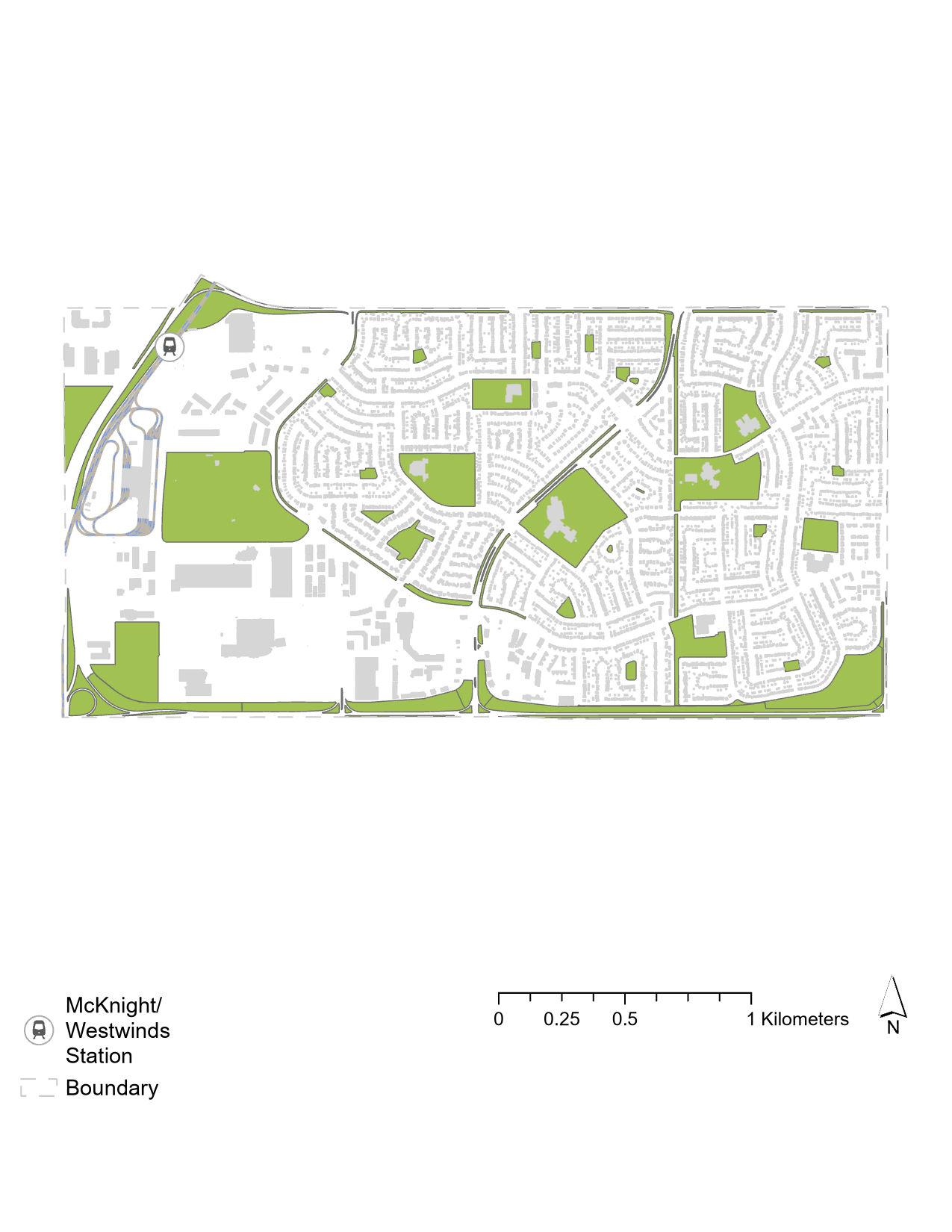
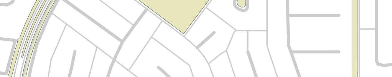
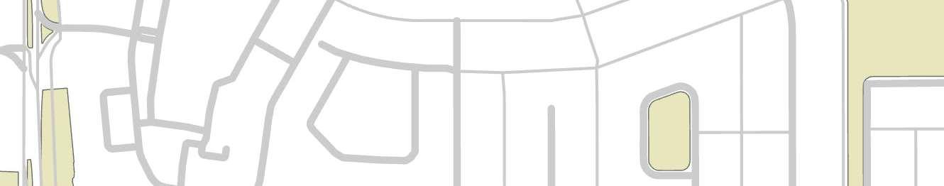
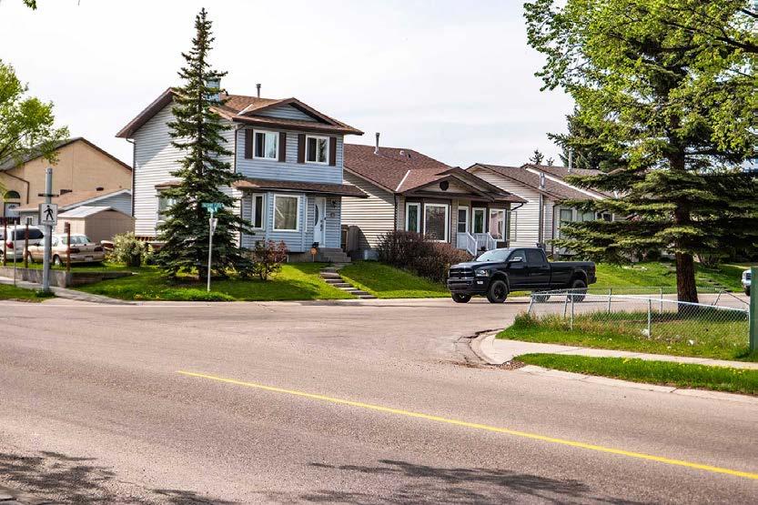
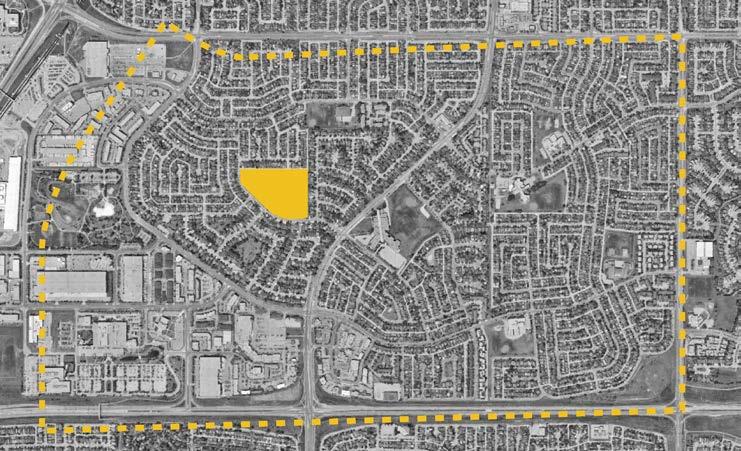
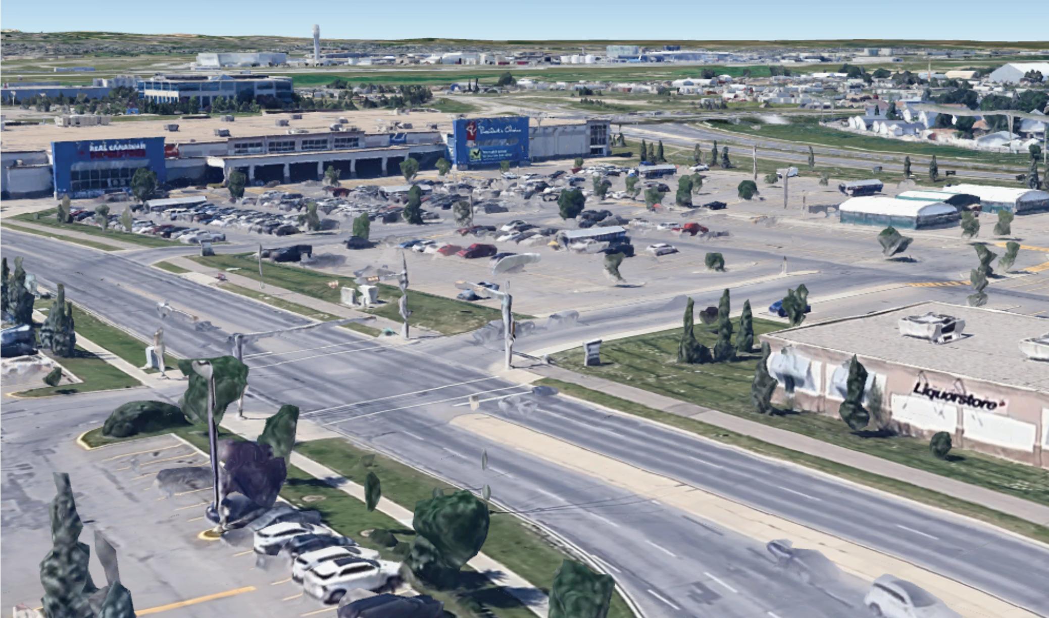
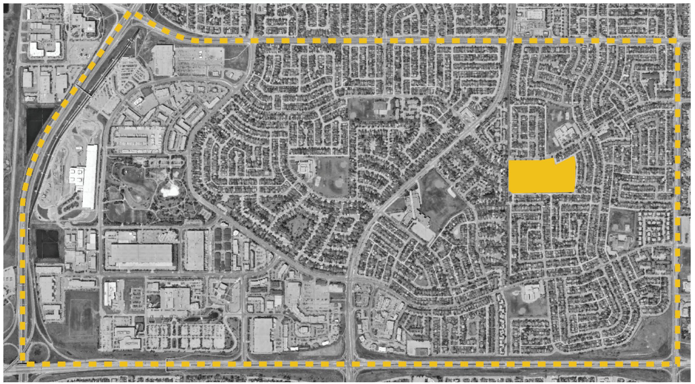
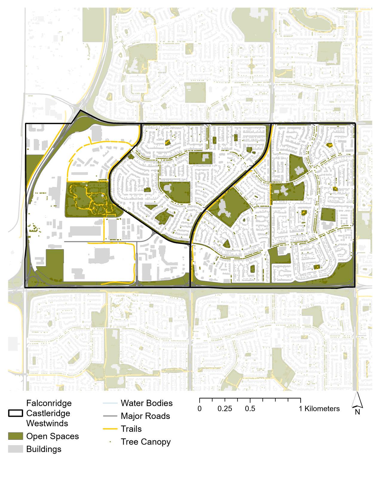
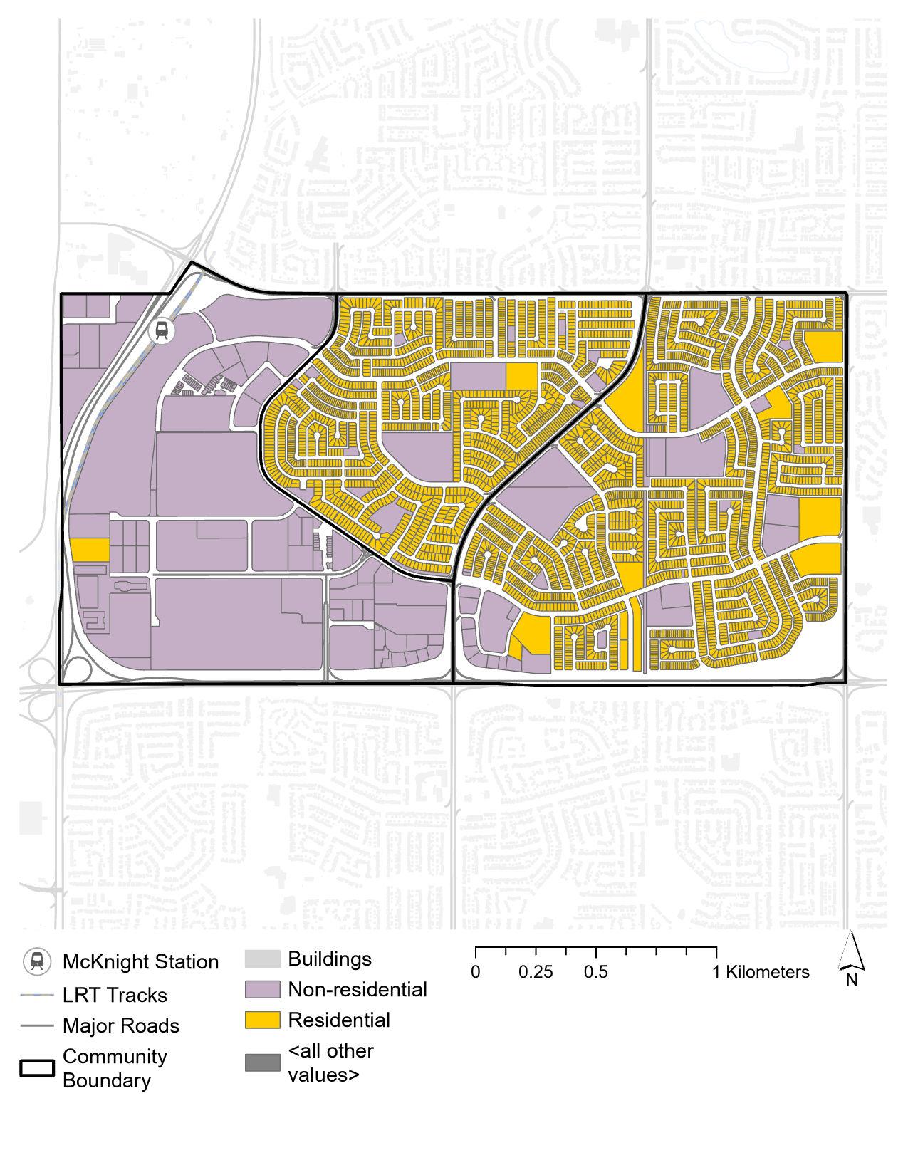
The Falconridge and Castleridge communities, located in the northeastern quadrant of Calgary, Alberta, are characterized by their diverse and vibrant populations. Falconridge and Castleridge are well-positioned to offer a high quality of life, with access to green spaces, educational institutions, and convenient transportation links.
These neighborhoods benefit from their strategic location, providing easy access to downtown Calgary and proximity to Calgary International Airport. However, there are notable gaps in the communities’ connectivity, particularly regarding comprehensive pedestrian infrastructure. Addressing these gaps is essential for ensuring the continued growth and integration of these neighborhoods within the broader Calgary area.
This analysis document aims to provide a comprehensive overview of the demographic, socio-economic, and infrastructural aspects of Falconridge and Castleridge, offering insights into the gaps and strengths of these communities.
Falconridge Castleridge
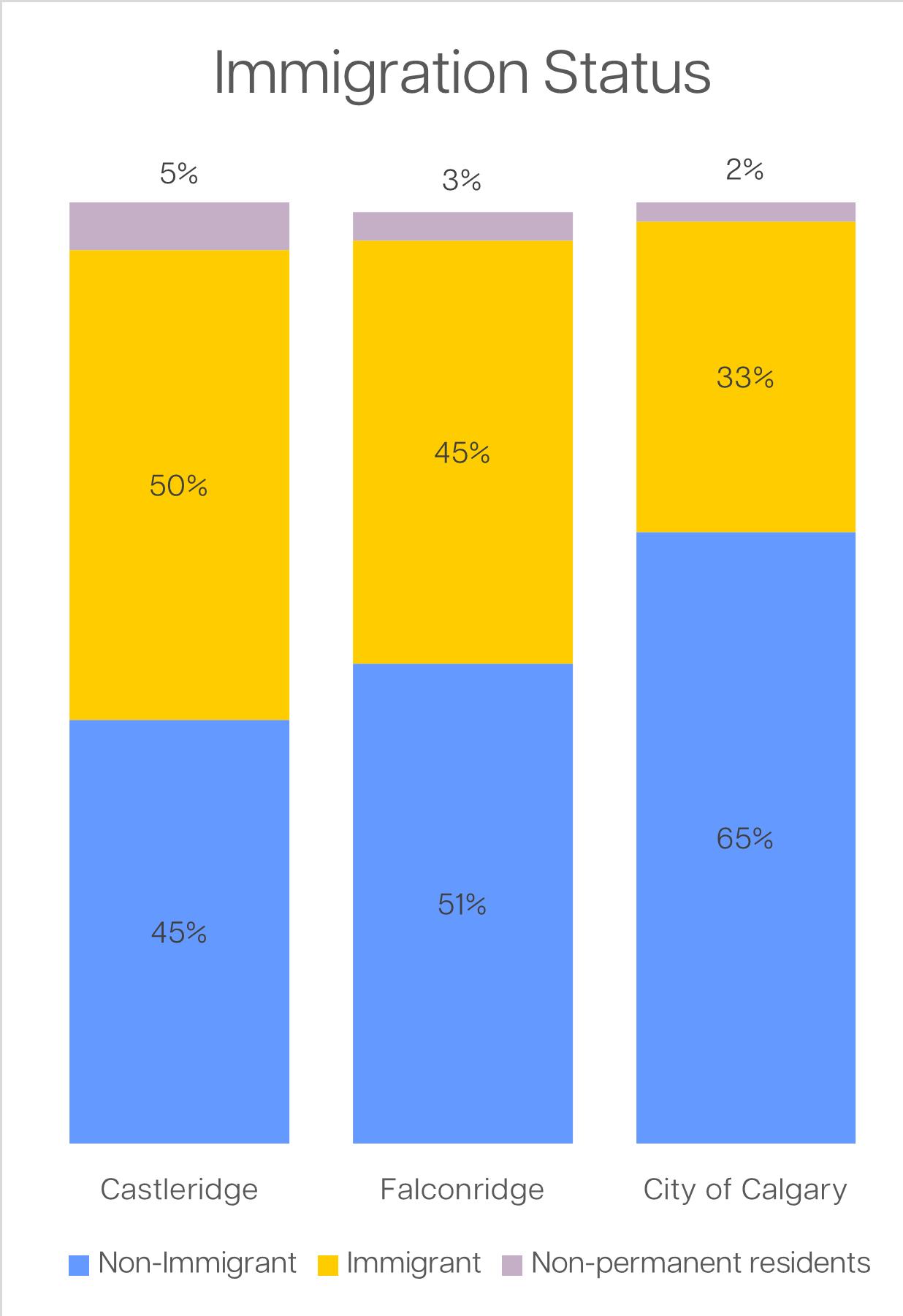
Demographically, Falconridge and Castleridge have a higher percentage of middle-aged residents compared to the Calgary average. The median household income in these communities is lower than the city average, and the immigrant population percentage is significantly higher. Additionally, a higher percentage of individuals in Falconridge and Castleridge speak a non-official language.
The demographics of Falconridge and Castleridge communities reflect a rich multicultural landscape. This diversity is further evidenced by the array of cultural events and community programs that celebrate different traditions and customs. Schools in the area often incorporate multicultural education, reflecting the diverse student body.
The local businesses, from restaurants offering global cuisines to shops selling international goods, also showcase the multicultural essence of Falconridge and Castleridge.
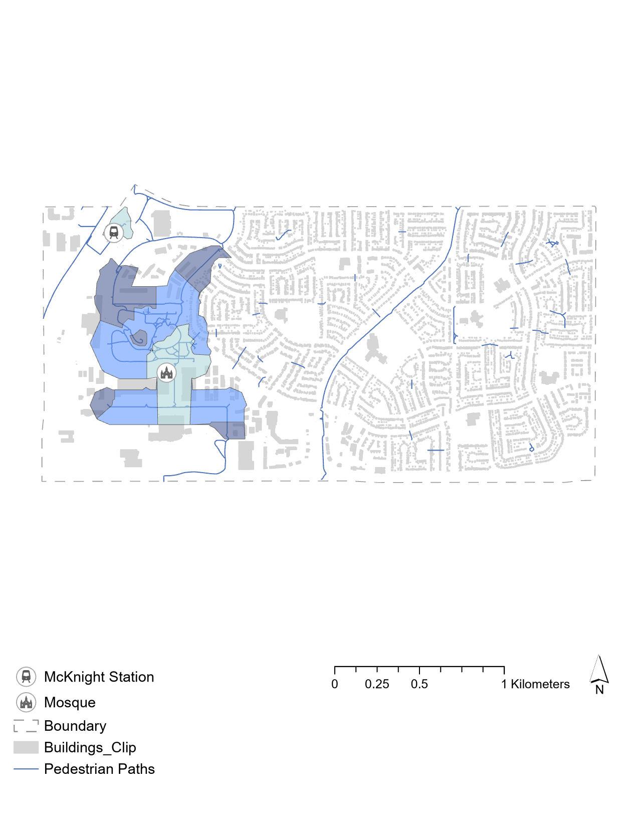
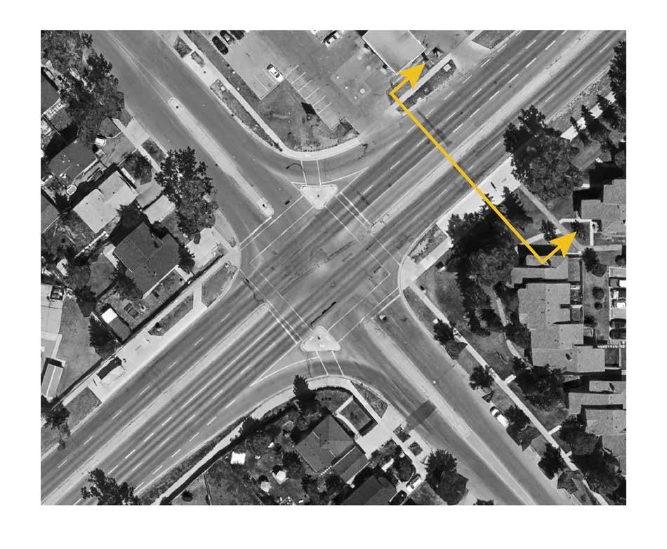
In this network analysis we wanted to show the difficulties of pedestrians walking from two main landmarks, the McKnight-Westwinds Station, and the mosque. In dark blue is the distance they could walk within 5-10 minutes, medium blue is 10-15 minutes, and light blue is 15-20 minutes. We concluded that from these major landmarks, pedestrians are only able to get as far as the parking lot highlighting the need for more walkable pathways.
Strengths:
• Highlights issues with the current pedestrian experience.
Opportunities:
• Enhancing pedestrian infrastructure can foster a safer and more connected community.
• Improving pathway connectivity can encourage walking and cycling, promoting healthier lifestyles.
Weaknesses:
• Major roadways create safety hazards for pedestrians.
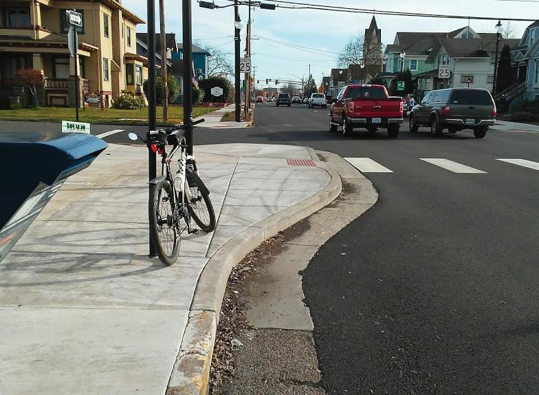
• Existing sidewalks are narrow and disconnected, making it difficult for pedestrians to navigate safely.
Threats:
• Narrow and disconnected sidewalks may lead to continued safety concerns if not addressed.
• Without development and improvement efforts, the pedestrian experience will remain compromised, impacting the overall quality of life for residents.
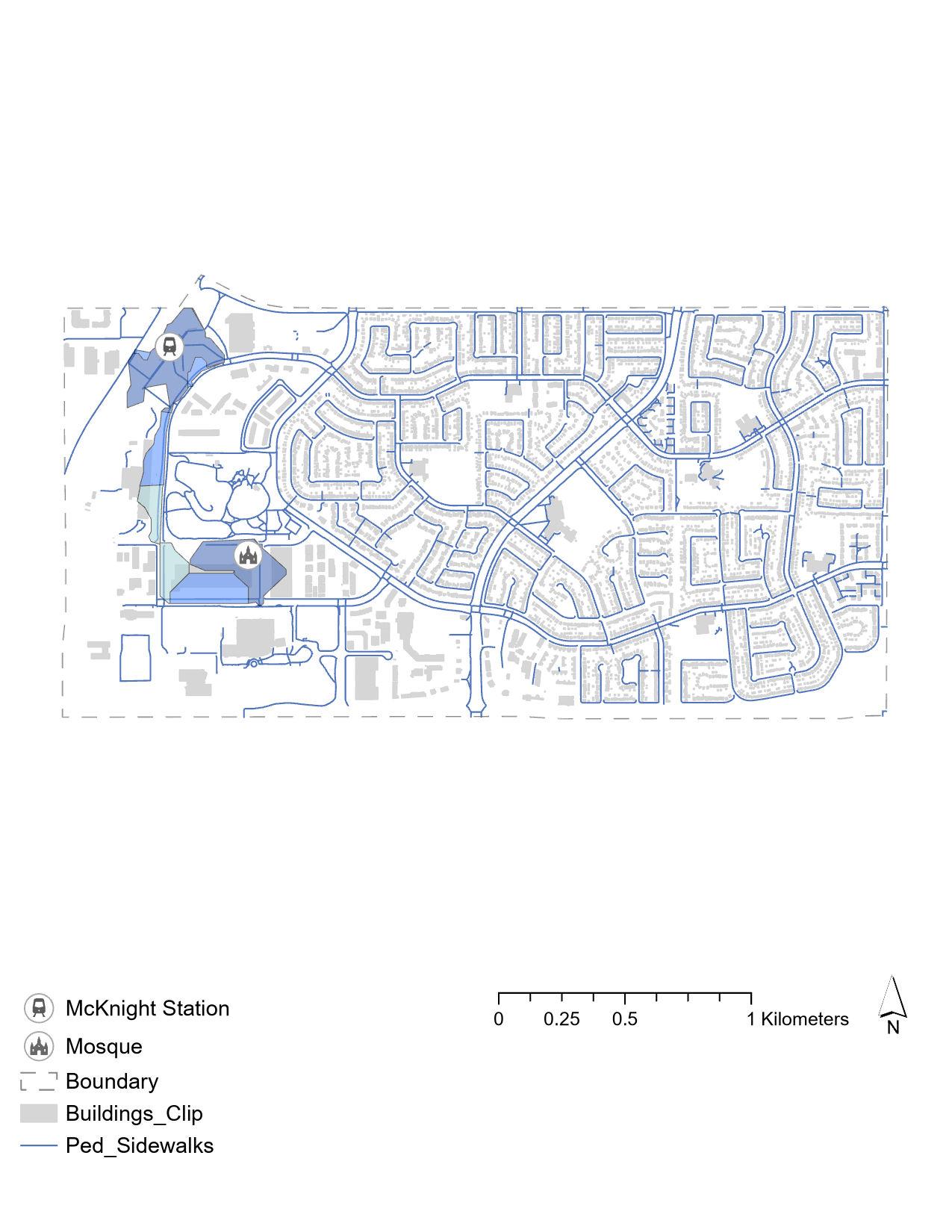
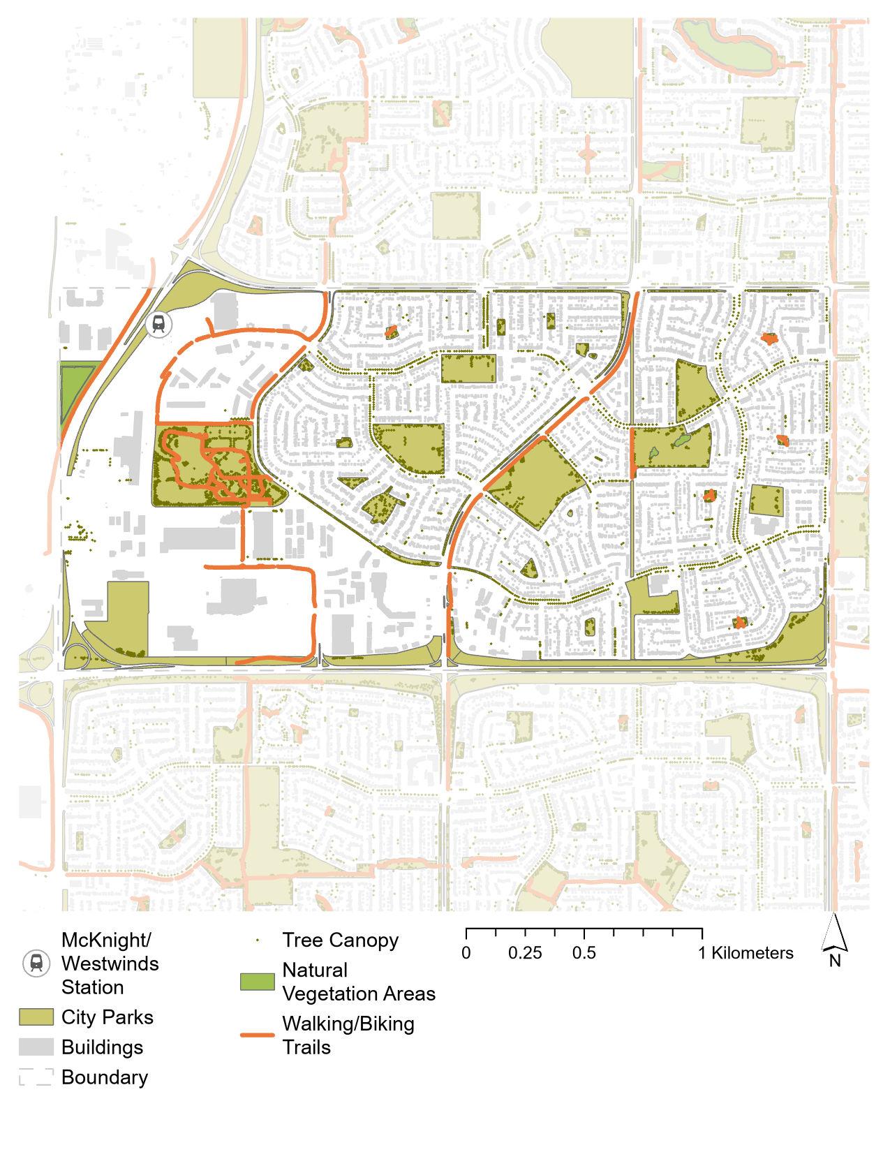
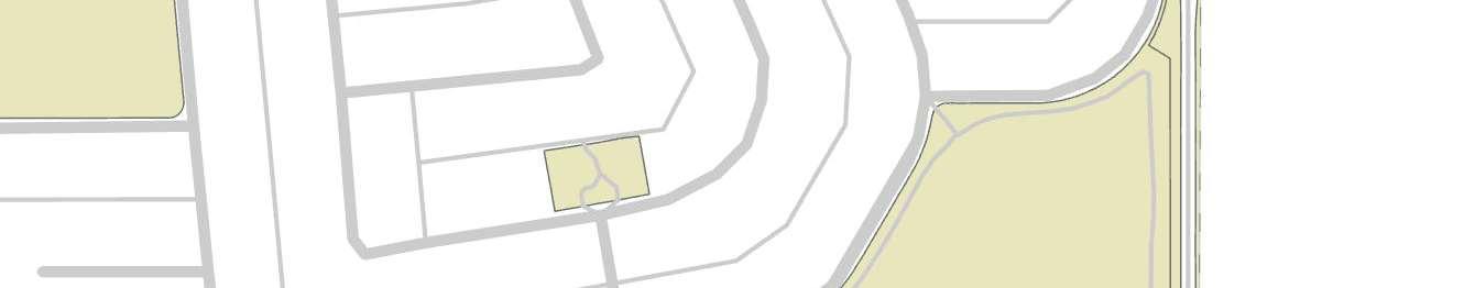
In this analysis of the sidewalks in the three communities, we wanted to highlight them in orange so the audience can see how the sidewalks and pathways interact with existing greenspaces.
The main observation we wanted to emphasize is how the sidewalks end abruptly in many of the cul-de-sacs. We also wanted to show the location of pedestrian bridges in blue which seem illogically placed since they don’t seem to lead anywhere significant.
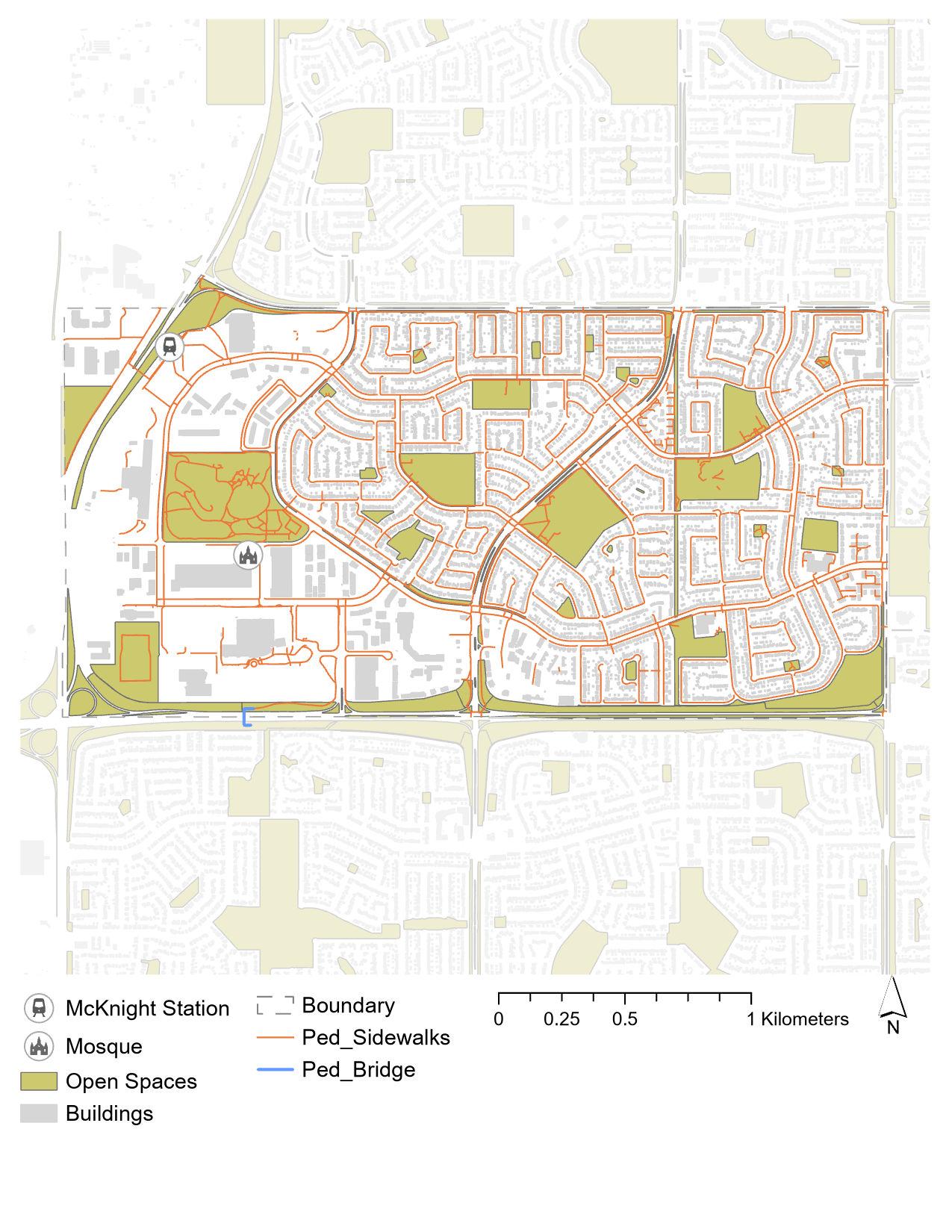
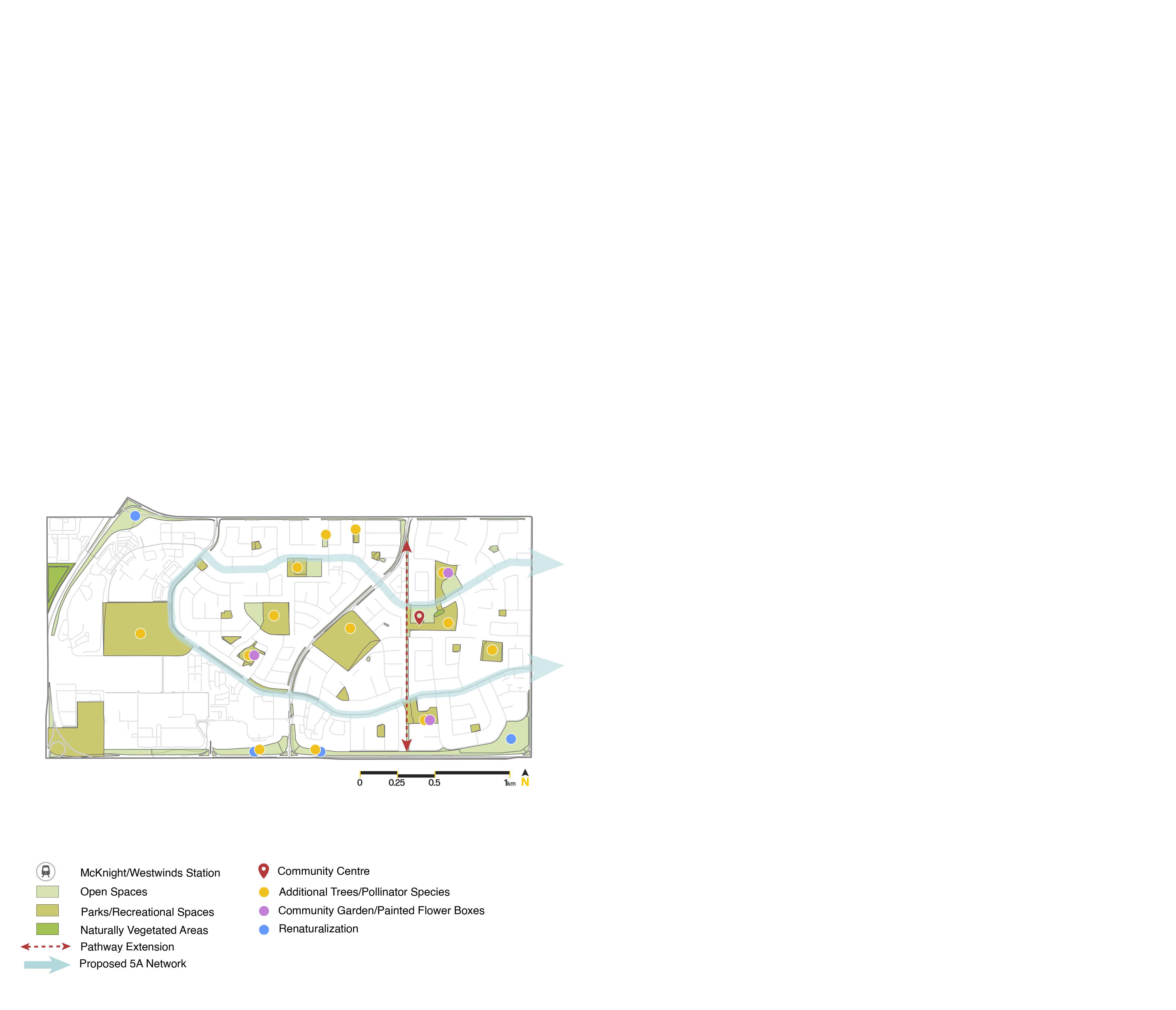
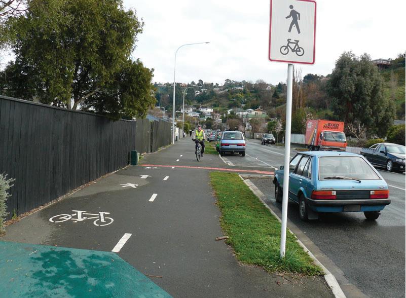
In blue is the City’s proposed 5A network which we intend to expand on in our proposed mobility and greenspace interventions.
Based on the location of this network, it seems to follow the major collector roads throughout the site.
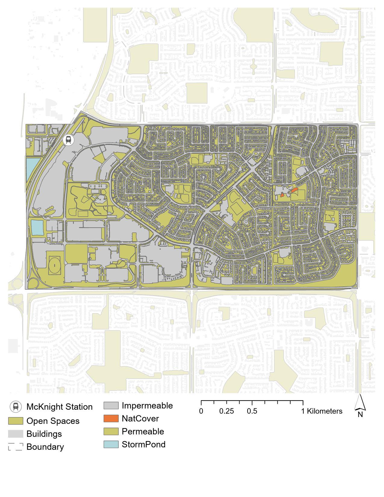
In this analysis of the community’s permeability, we wanted to highlight the significant amount of hardscape in comparison to permeable surfaces.
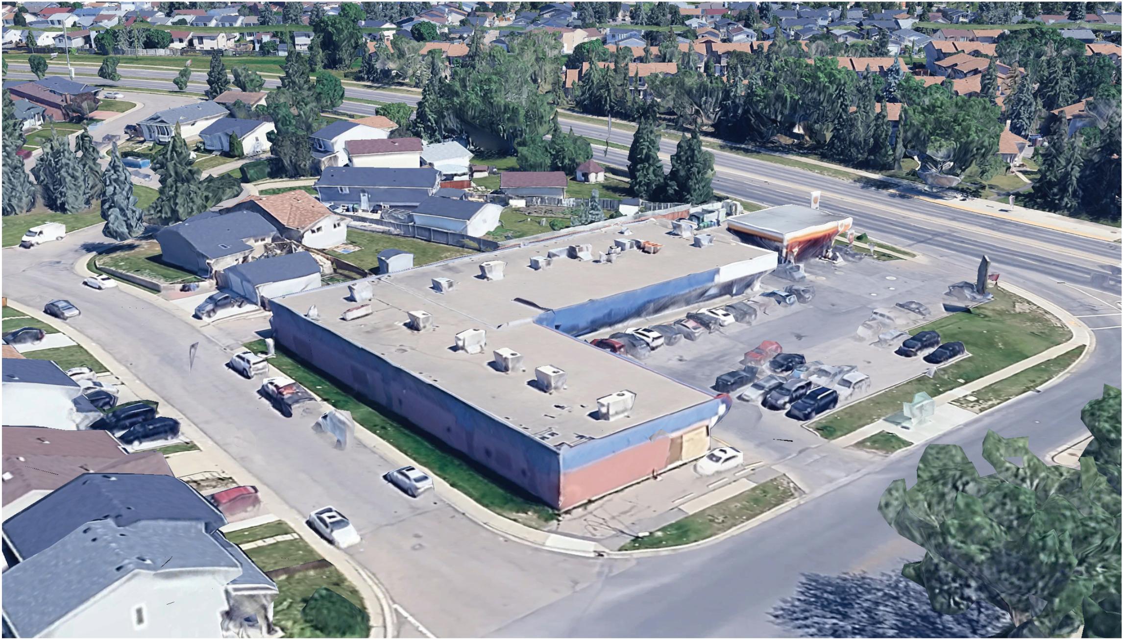
In Westwinds especially, this hardscape is prevalent since this is where the community focuses its industrial and commercial uses. This seems like a wasted opportunity especially around the LRT station.
The community has a moderate number of trees mainly located at the perimeter of the school yards leaving the center of these yards fairly empty. There is also a lack of trees along major boulevards.
Although there is a good existing trail going down Falconridge Blvd NE and throught Prairie Winds Park, there are no trails along major collector roads. This gap may be addressed by the 5A network but could be expanded on as well.
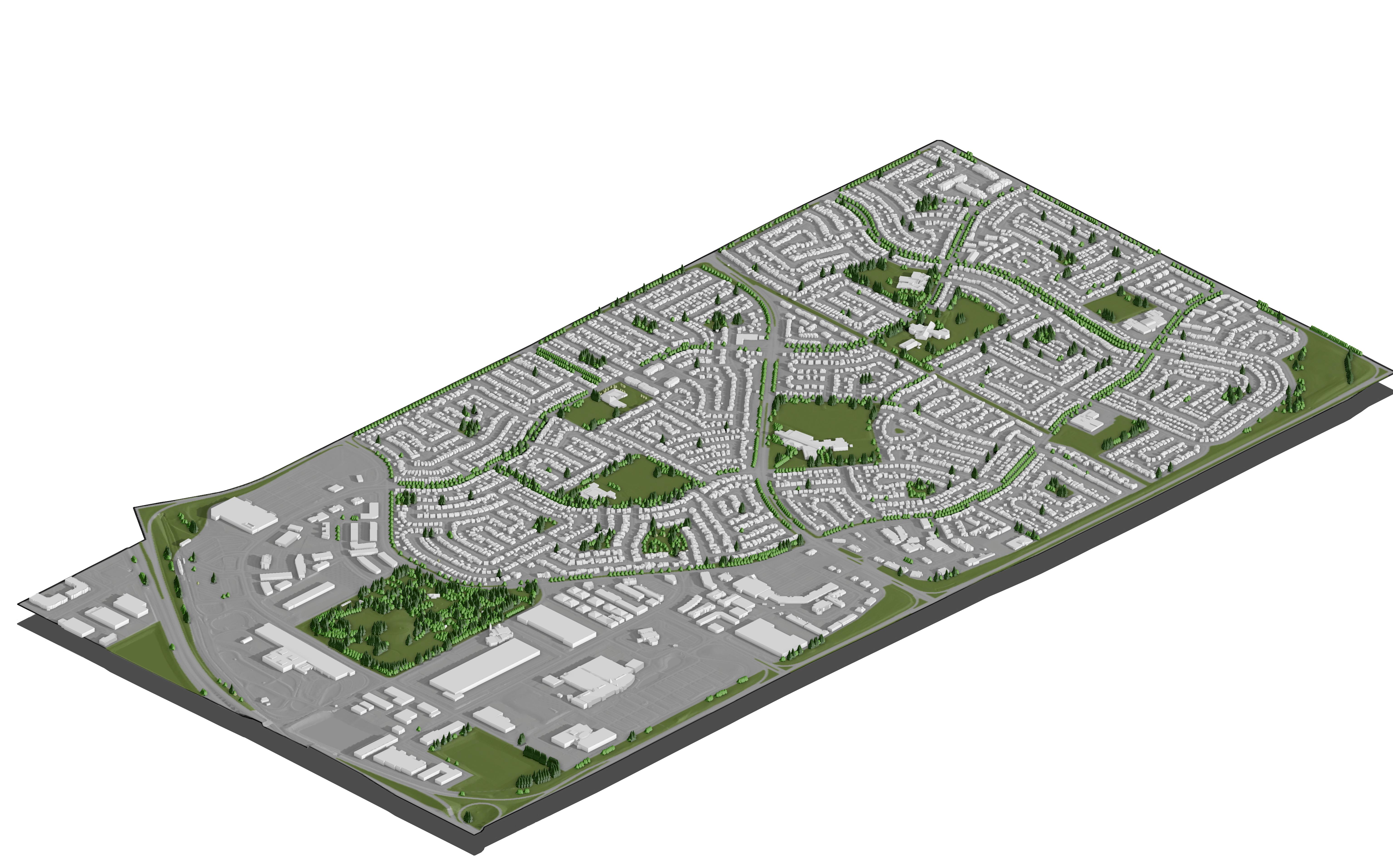
As seen by this axo showing different tree typologies, the main typology are deciduous trees.
We believe this is another gap because coniferous trees are native species and do not require as much water or maintenance as deciduous trees.
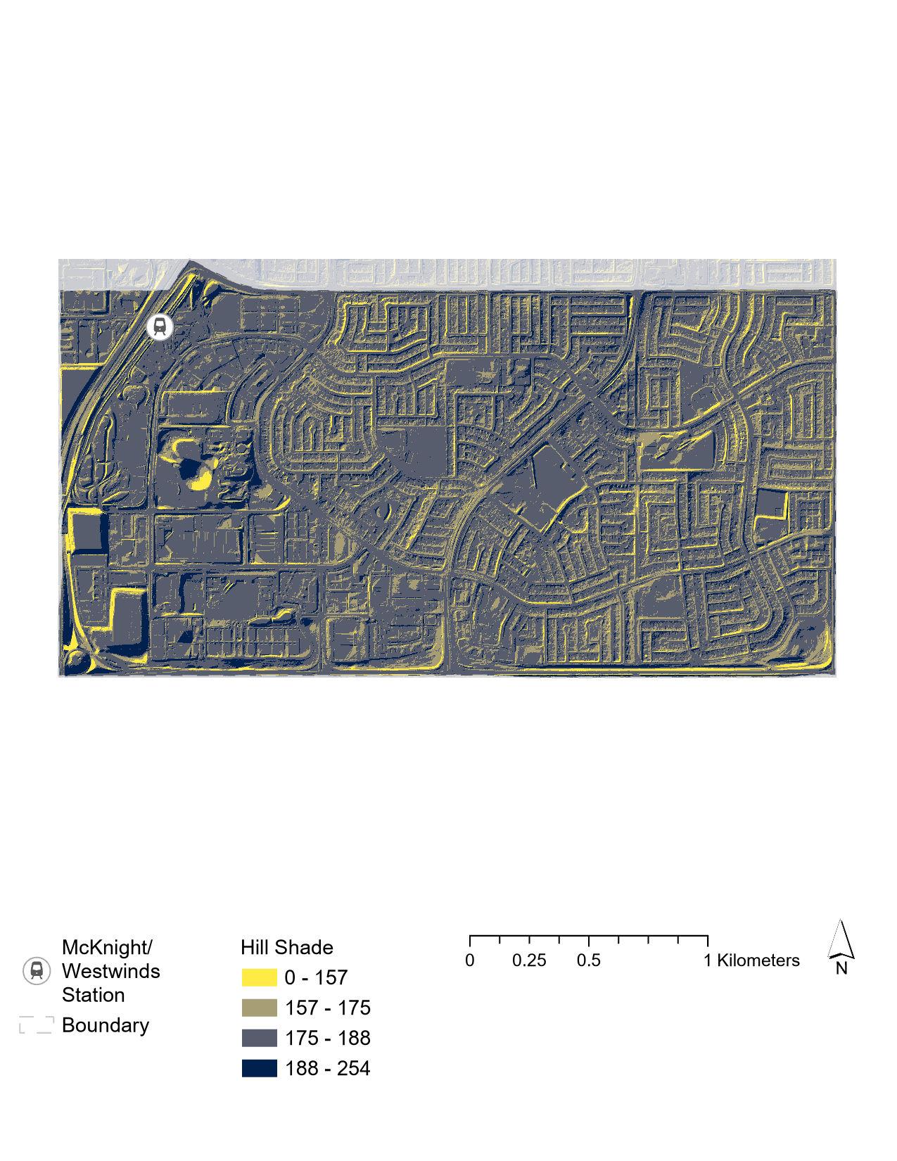
From the hillshade analysis we determined Westwinds has the steepest slopes while Falconridge and Castleridge remain relatively flat. This is optimal for potential developments.
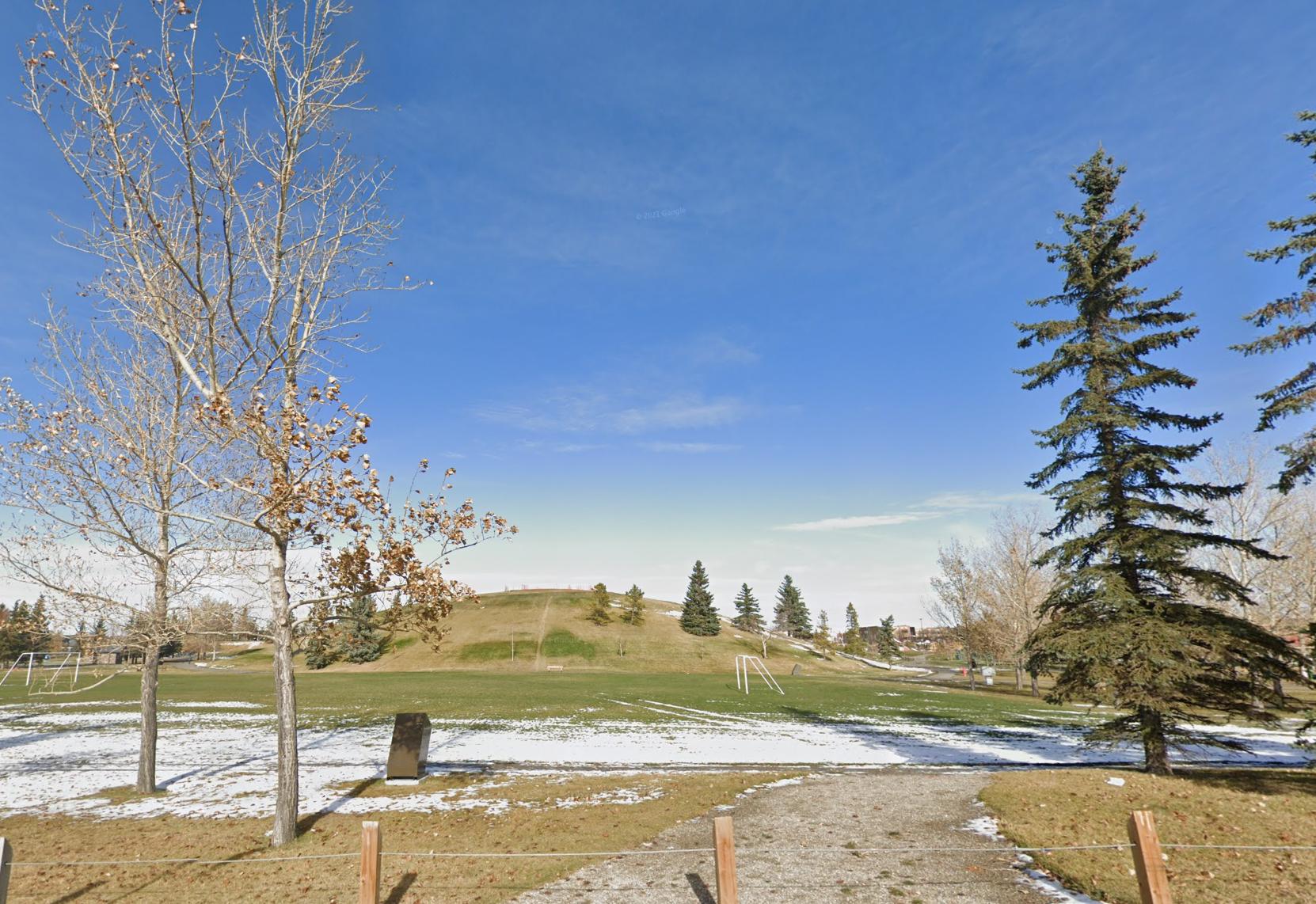
Prairie Winds Parks has the most variation in slope due to the hill in the center of the park.
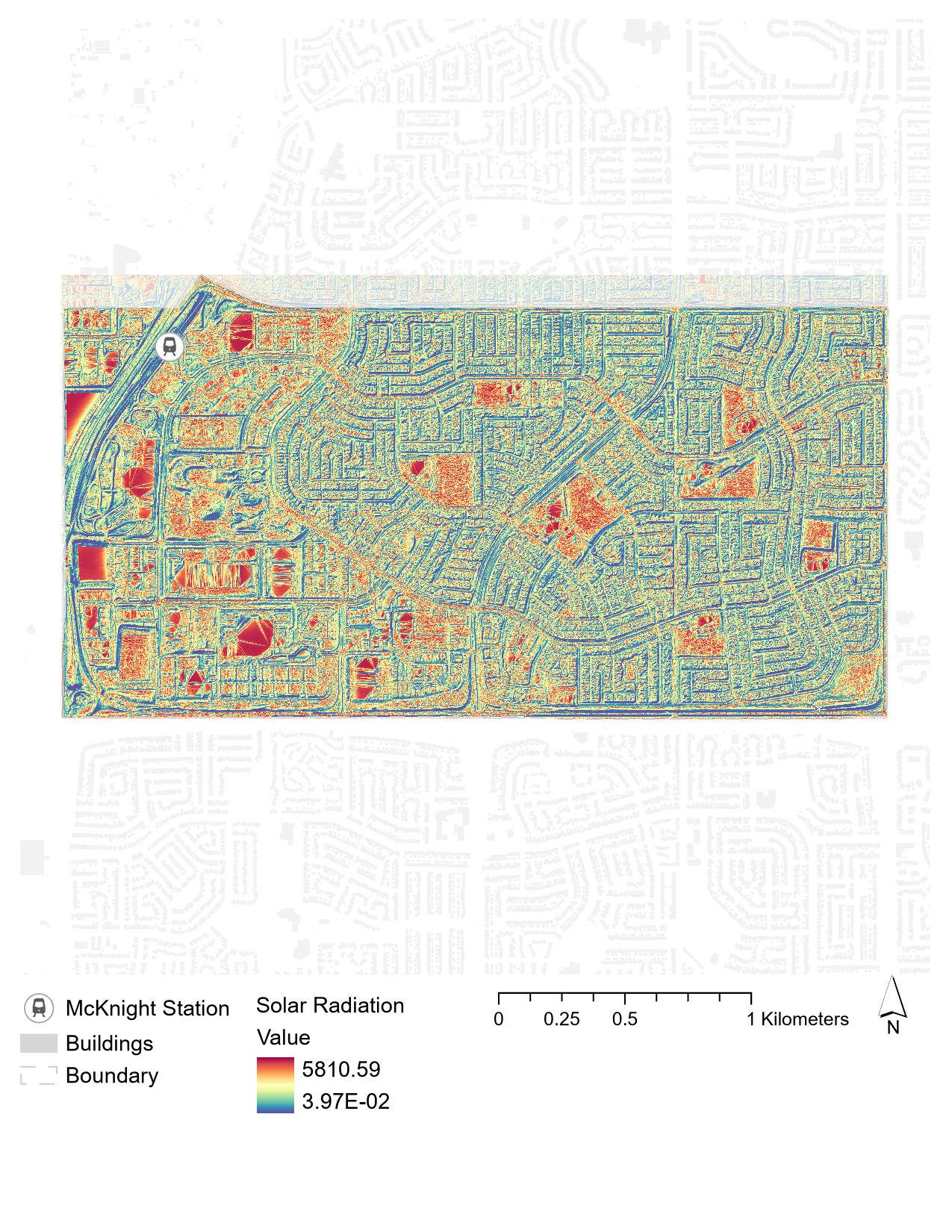
Because of the hardscape in Westwinds and the lack of trees in the open spaces, this is where these communities receive the most solar radiation.
The stormponds on the left and the police headquarters receives the most sunlight.
Strengths:
• Relatively uniform elevation is ideal for future developments.
• Identification of areas that need improved connectivity and pedestrian pathways.
Opportunities:
• Developing connected pathways can enhance accessibility and create a more unified community.
• Integrating open spaces within Westwinds can address the lack of permeable surfaces.
• Enhancing connectivity across all areas can foster a stronger sense of place and community identity.
Weaknesses: Fragmented and disconnected pathways detract from the community’s overall accessibility. Lack of permeable surfaces in Westwinds.
Threats: The existing disconnected pathways might continue to hinder accessibility. The lack of permeable surfaces can contribute to environmental issues, such as increased runoff. Without addressing these environmental concerns, the quality of life for residents may not improve.
Vicinity Protection Area
The AVP Area covers all of Westwinds and some of Castleridge but the development potential within this area is entirely determined by the NEF contours. The NEF contour with the most restrictions in terms of development is over 40 decibels and does not allow any residential uses. The contour that is 25-30 decibels does allow for mixed-use developments though.
The most recent additions to the community includes all of Westwinds with the police headquarters being the first to be built in Westwinds.
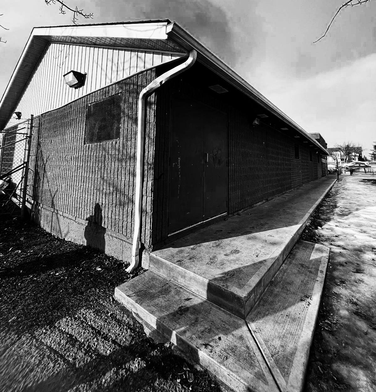
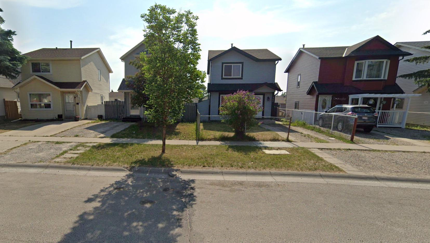
The oldest developments are the single family homes located in the south portion of Falconridge. The most recent homes in Falconridge and Castleridge were built around the 90’s. This indicates that most of the housing in these two communities are reaching the end of their lifecycles.
Strengths:
• Identified areas that have reached the end of their lifecycle.
• Variety of residential units and lot shapes already exists.
Opportunities:
• Lots of potential for new developments especially in areas with low quality housing stock and in proximity to schools.
• High amount of servicing in residential areas is also good for development.
Weaknesses:
• Low quality housing stock
• Proximity to the airport means Westwinds is mainly affected by noise pollution.
• Current land uses are distinctly separated.
• High proportion of single detached houses.
Threats:
The AVP Area as well as the NEF contours somewhat puts limits on development potentials.
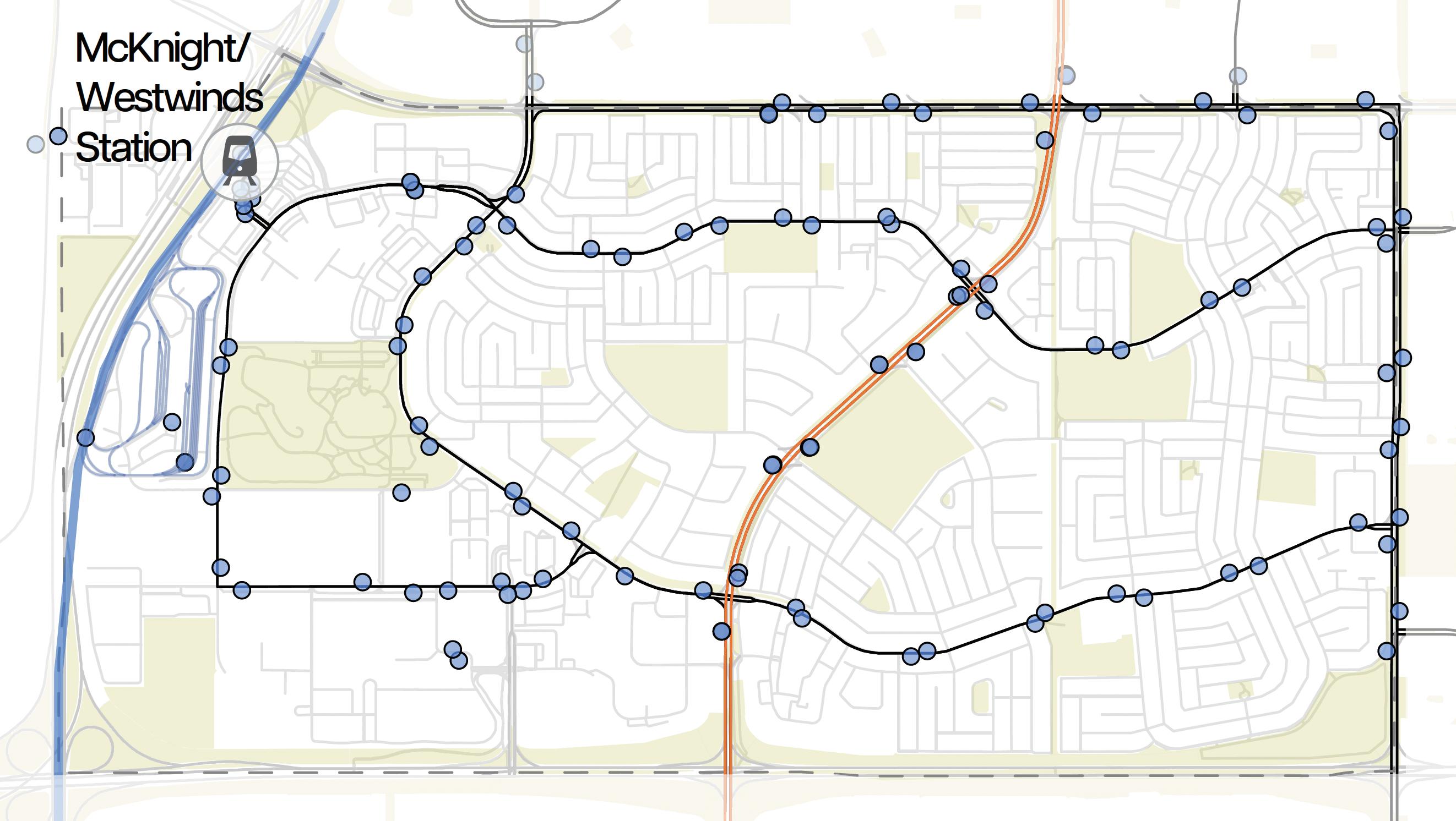

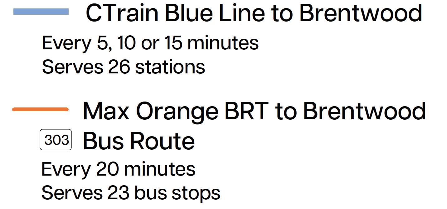
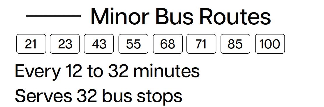
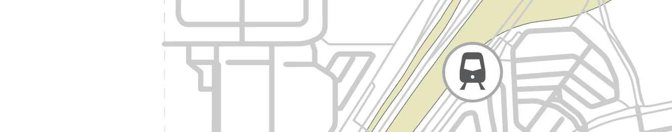
There are many bus routes within the site, including the Max Orange BRT that goes to Downtown and Brentwood. Numerous bus stops throughout the communities ensure coverage allowing residents to be within walking distance of a stop.
However, local bus routes often have longer wait times, up to half an hour, making them unreliable for traveling within the communities. Finally, the LRT Mcknight Station acts as a key transit hub.
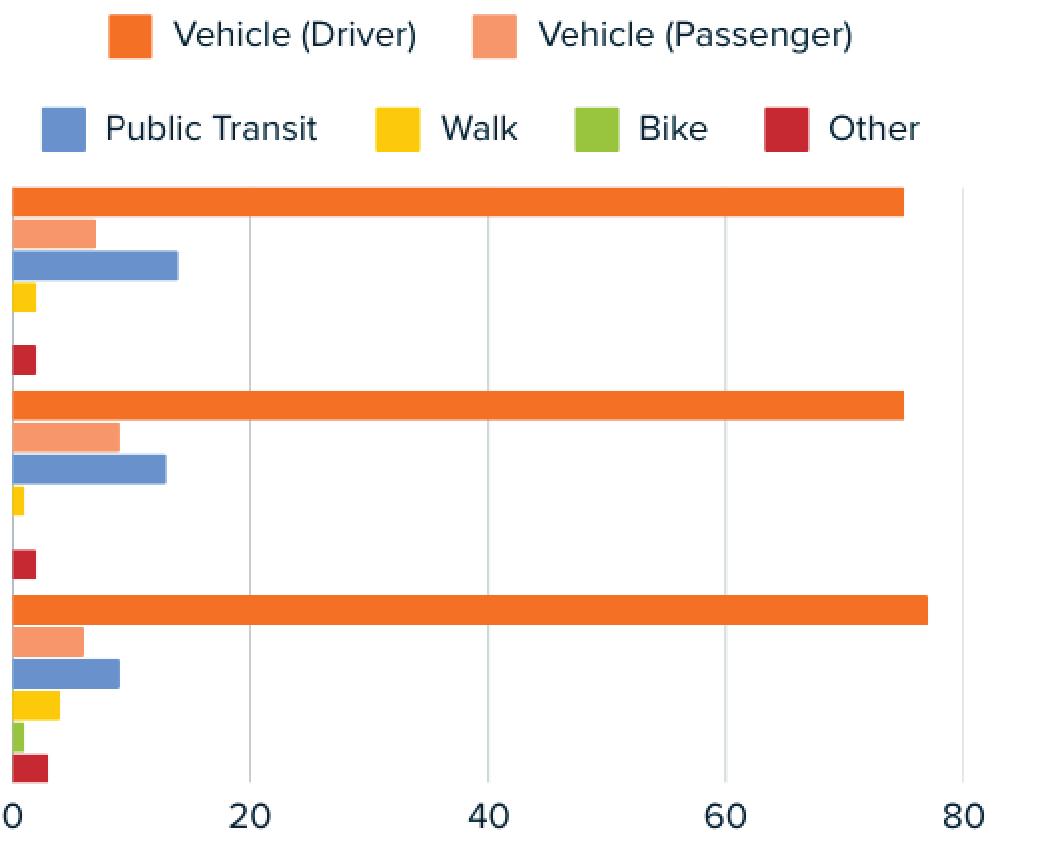
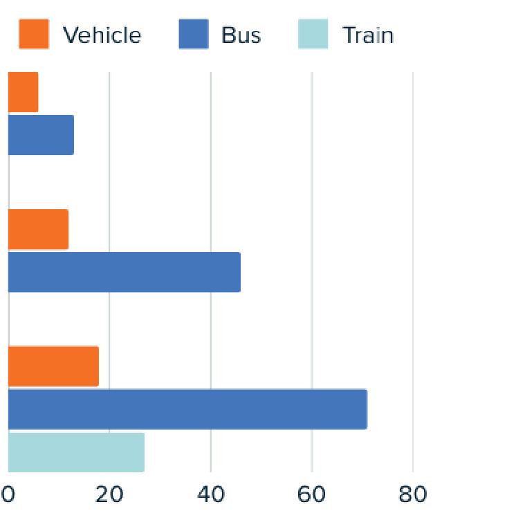
It is evident the main mode of transportation is by car followed by public transit less than 20%. This highlights the need for improved road infrastructure, investment in public transit, and more active transportation options.
When comparing commute durations from the LRT station, cars take significantly less time compared to public transit where commuting to downtown by bus takes over an hour.
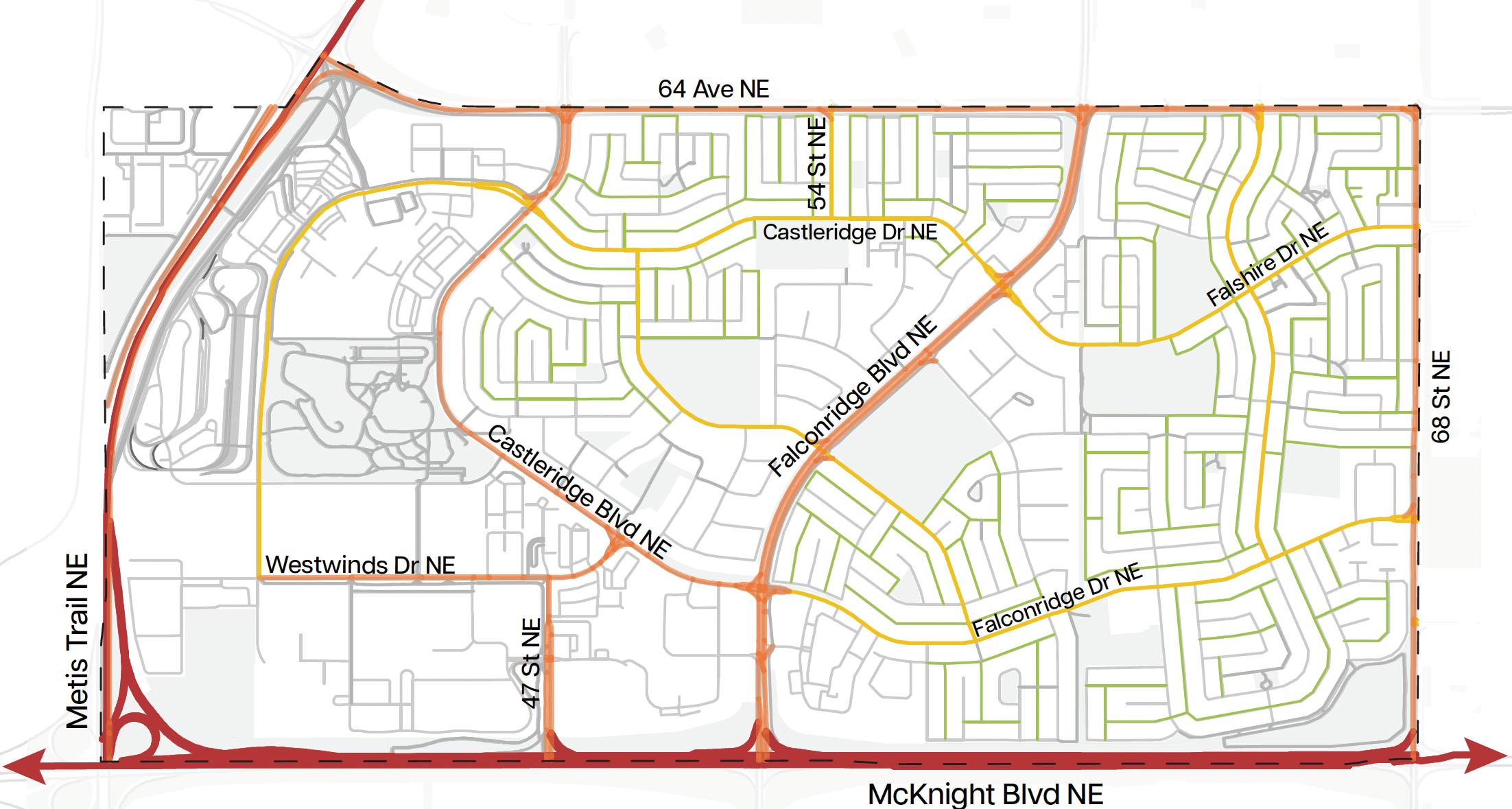


The main streets frame the community, with skeletal roads supporting high traffic volumes and arterial roads connecting the residents with the commercial area. Both these road typologies facilitate movement within the site and serve as key access points. This road hierarchy is complemented by a loop and lollipop street typology.
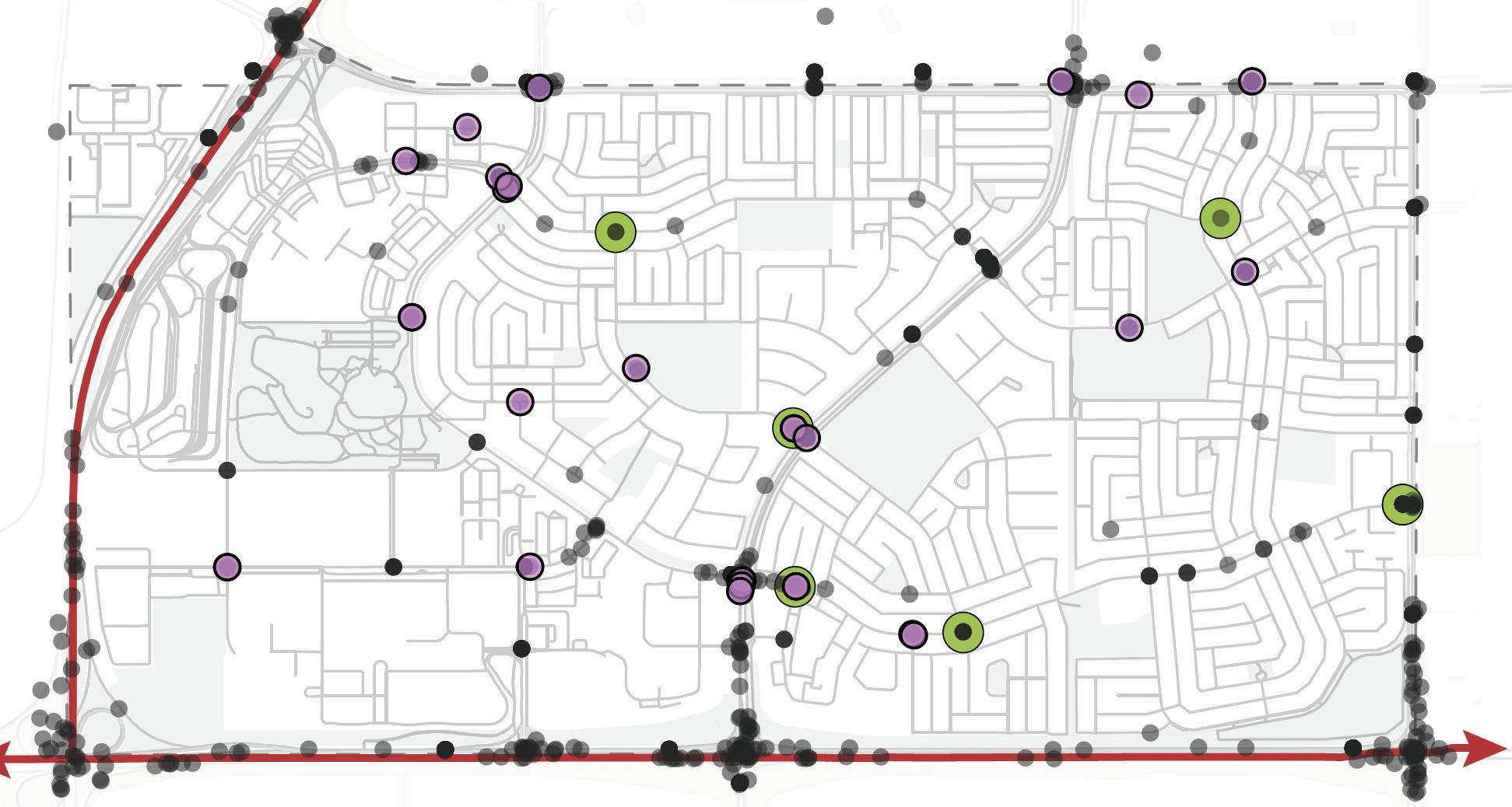
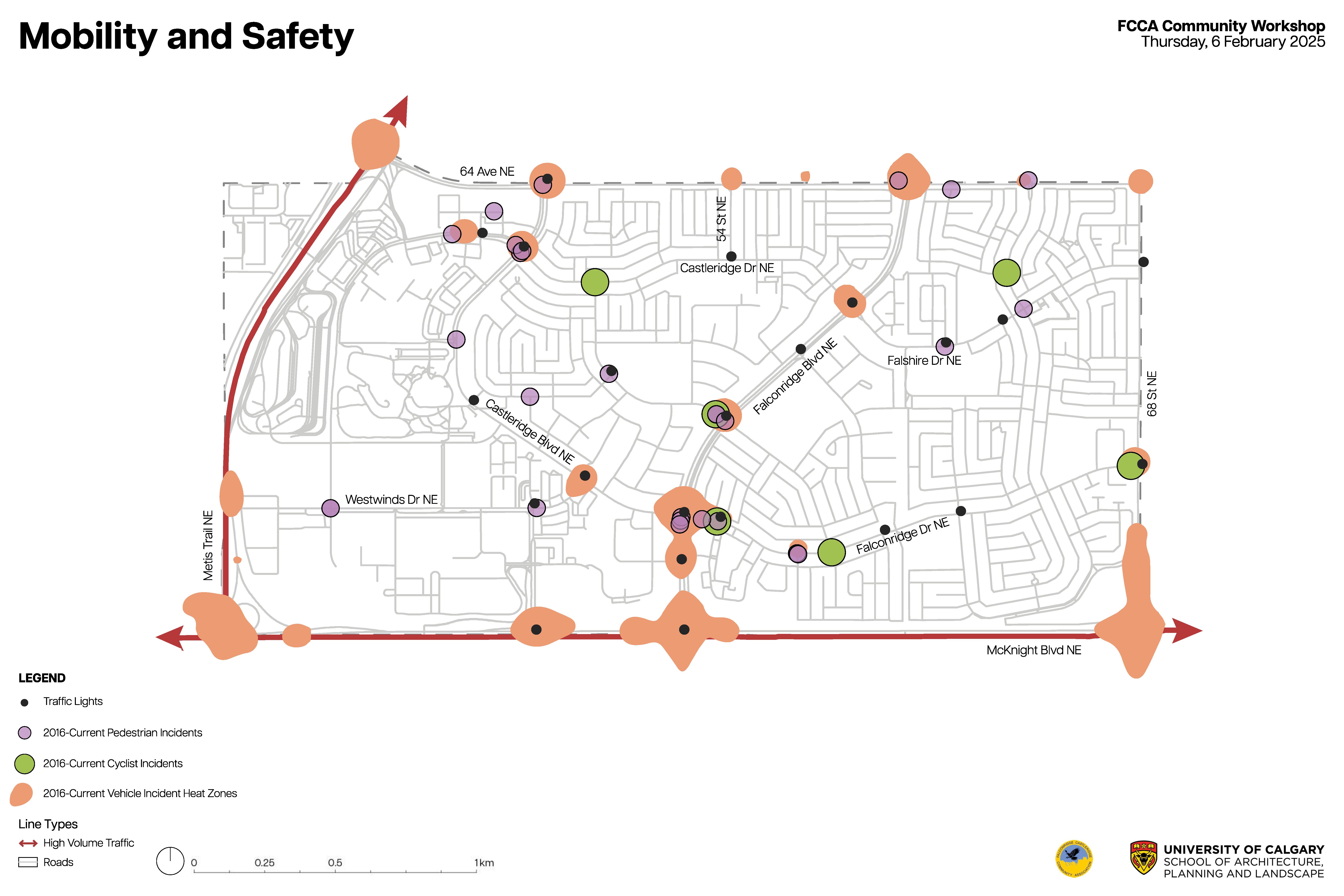
There are many pedestrian incidents scattered throughout the site as well as 6 cyclist incidents. They are also prominent in the Westwinds community and lower half of the site.
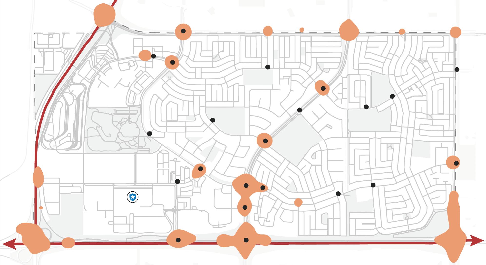
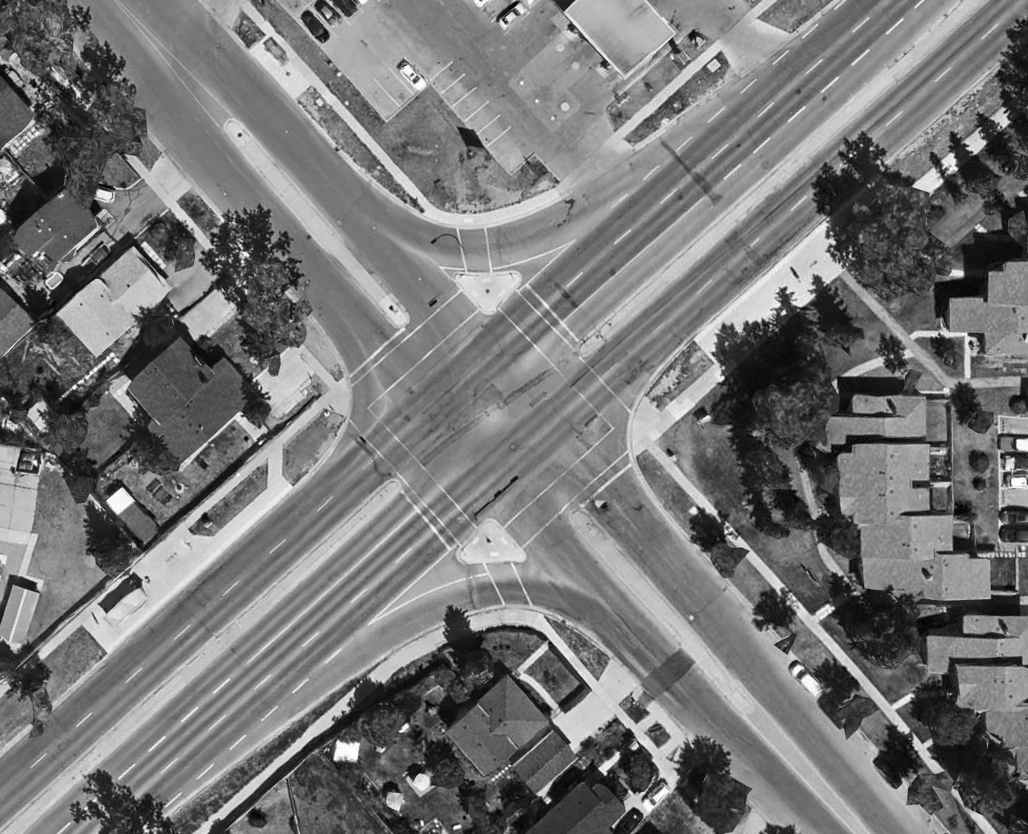
The findings showed the highest occurring traffic incidents are located on Metis Trail NE and McKnight Boulevard NE. Many of the incidents occur in areas with traffic lights suggesting drivers may be running through red lights.
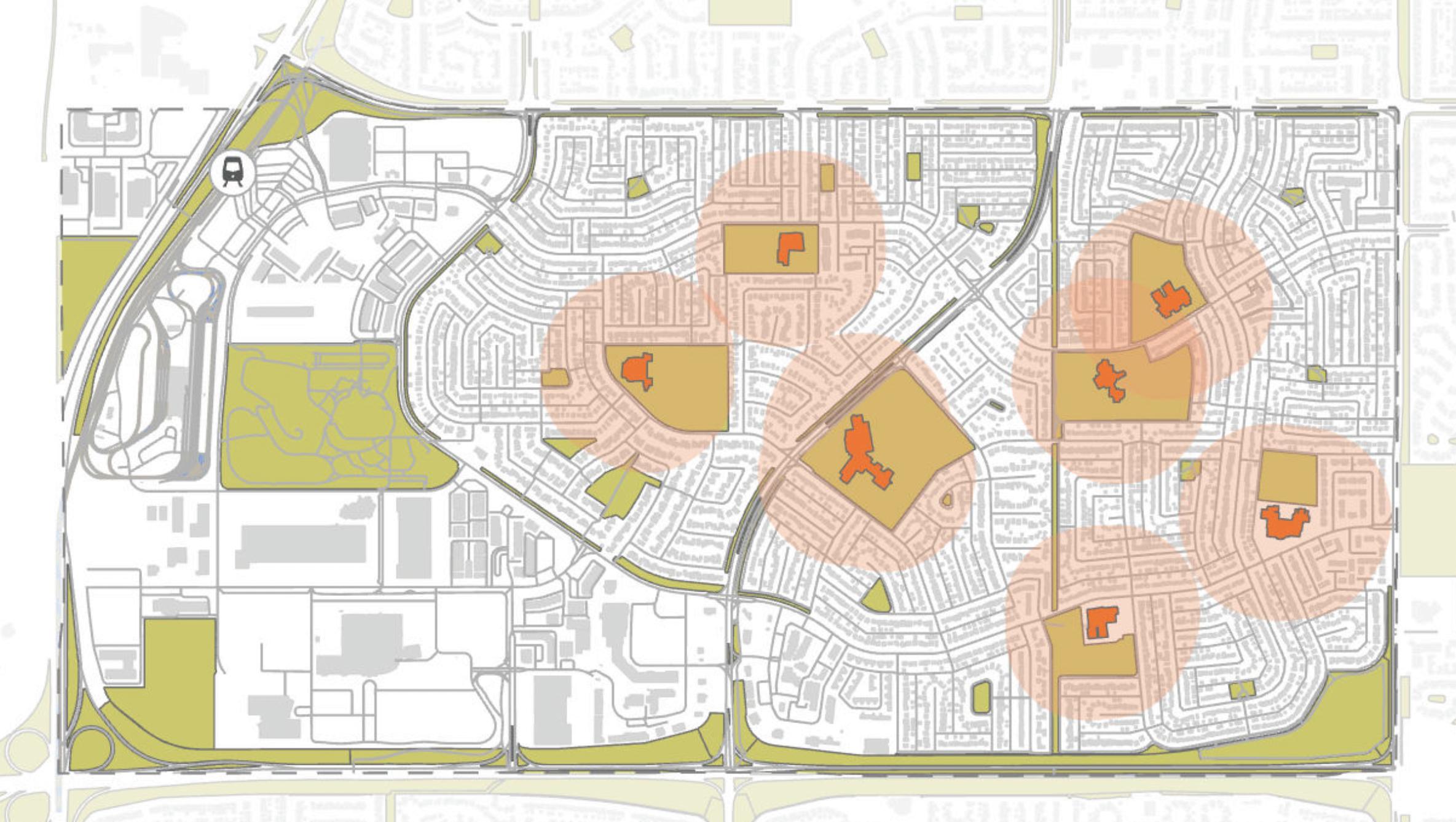
Schools within the communities are strategically located, ensuring that many residents are within a short walking distance, as shown by the 10-minute walking buffer. This encourages active transportation and promotes accessible education. However, the central school is situated at a major intersection on Falconridge Boulevard, which has a history of traffic incidents, highlighting the urgent need for improved safety measures.
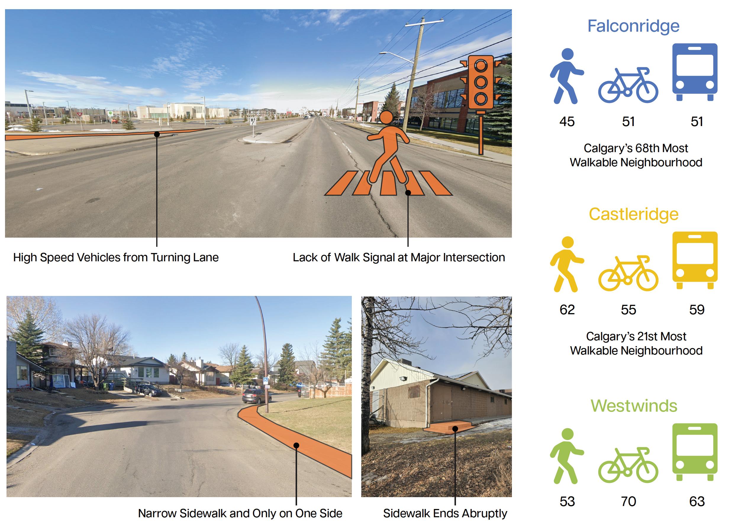
Addressing walkability issues is crucial for safety and community health.
• High-speed vehicles from turning lanes and the lack of walk signals pose serious risks at major intersections
• Narrow sidewalks, often only on one side, limit pedestrian accessibility and safety
• Abruptly ending sidewalks force pedestrians onto roads, increasing accident risks
Improving these areas will enhance safety, promote active transportation, and support healthier communities.
• Falconridge is ranked as Calgary's 68th most walkable neighborhood, indicating significant room for improvement
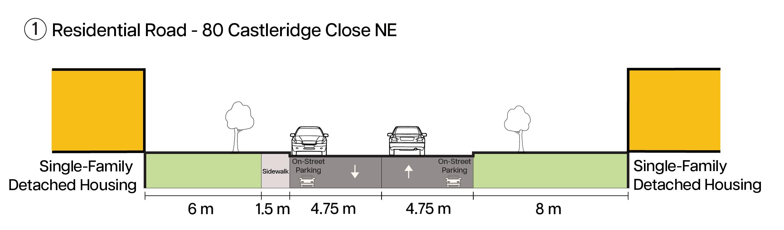
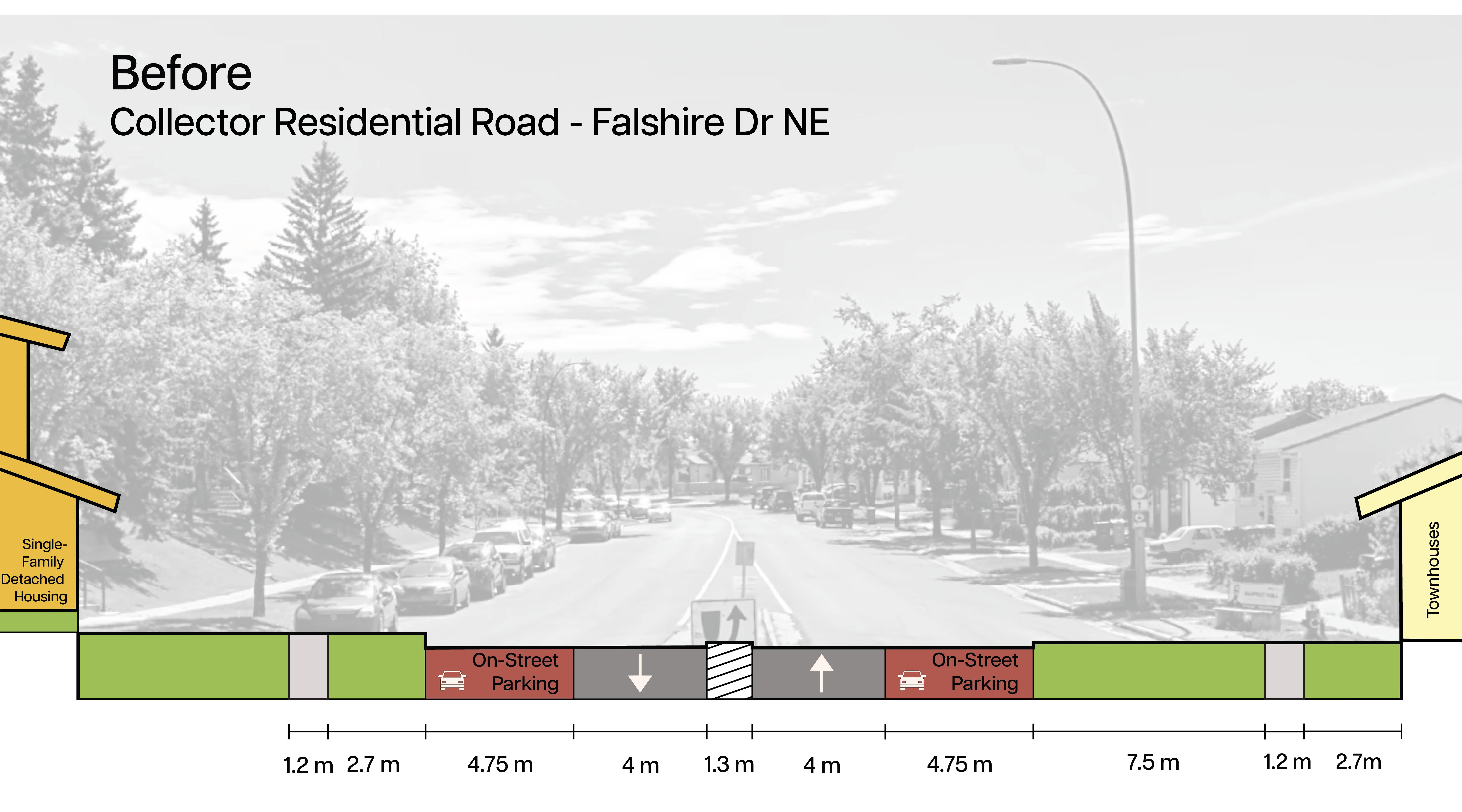
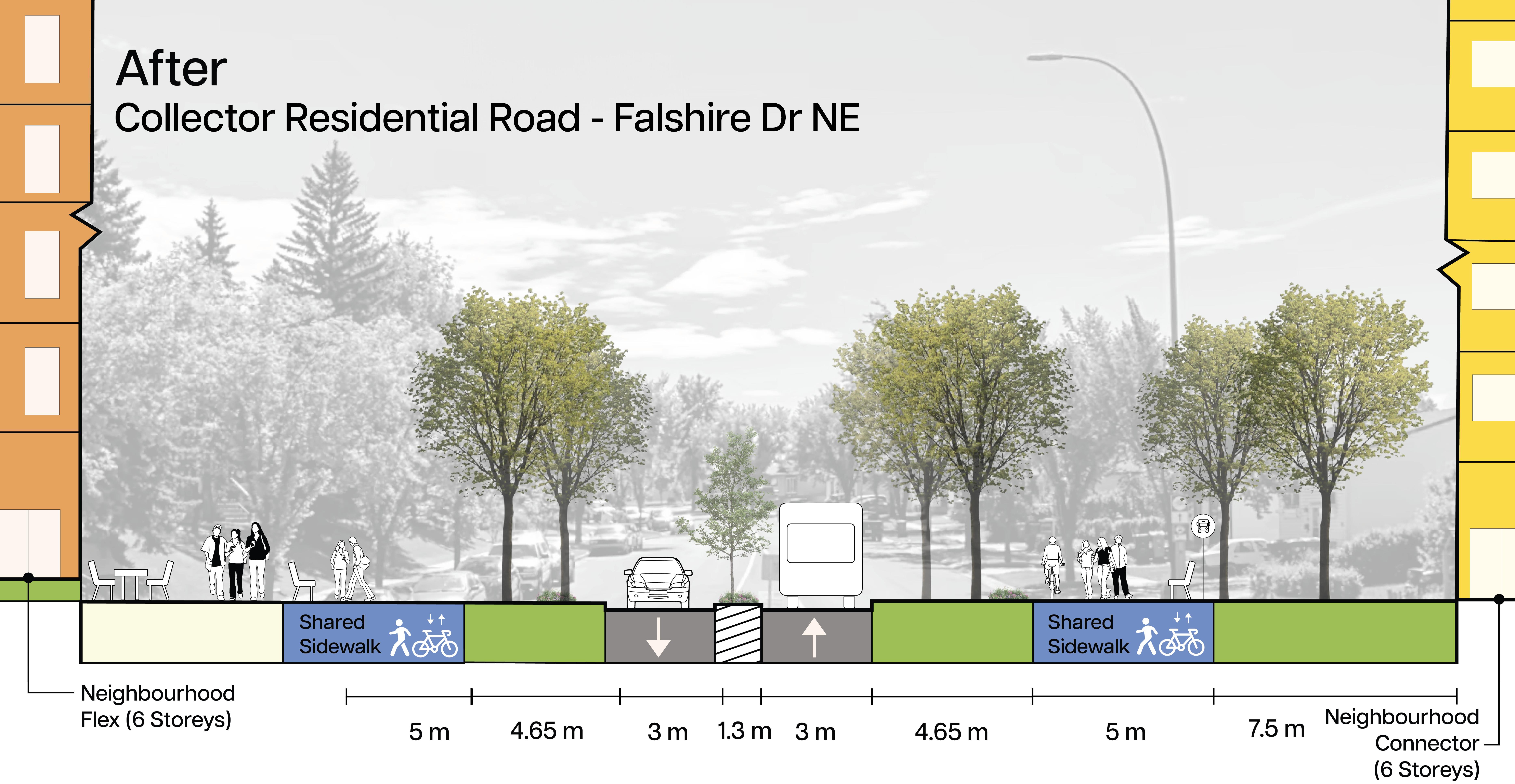
Section 1: The section shows a standard residental street with single, narrow sidewalks on one side and a large lawn in the front. On the opposite side, where storage is located has unpaved roads.
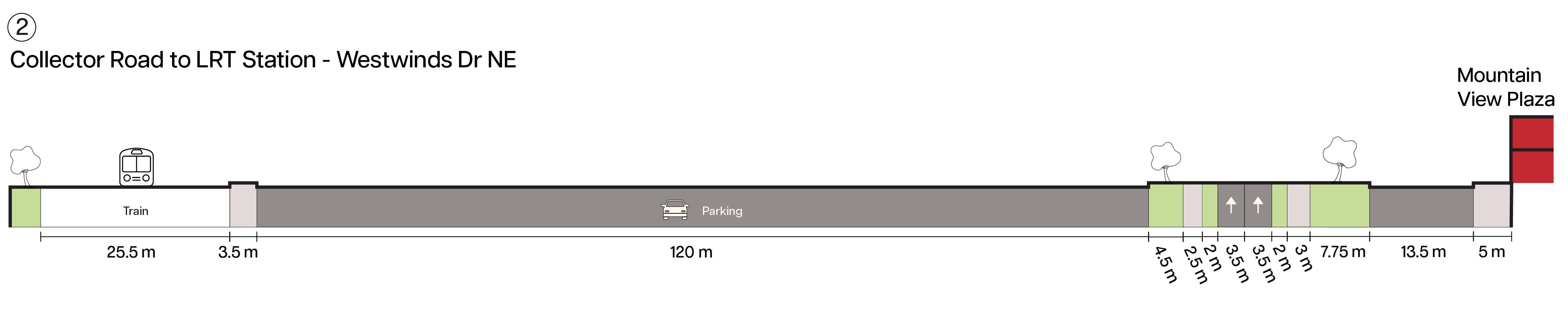
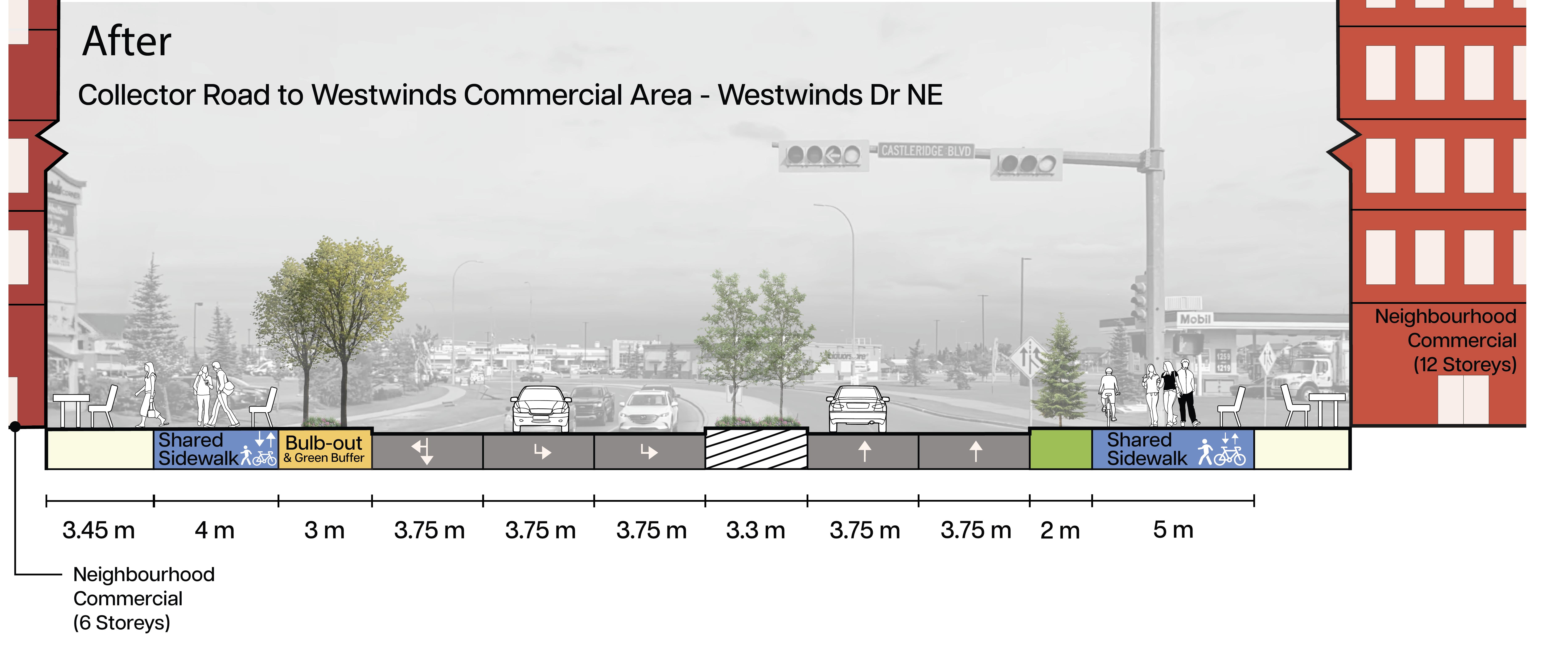
Section 2: The collector road to the LRT station highlights multimodal transportation options and train accessibility on the commercial side of Westwinds. However, this location is farfrom the residential area, which may make the train less convenient for residents and contribute to car dependancy.
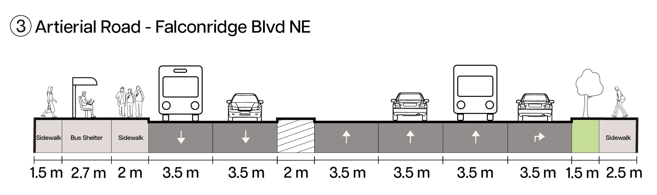
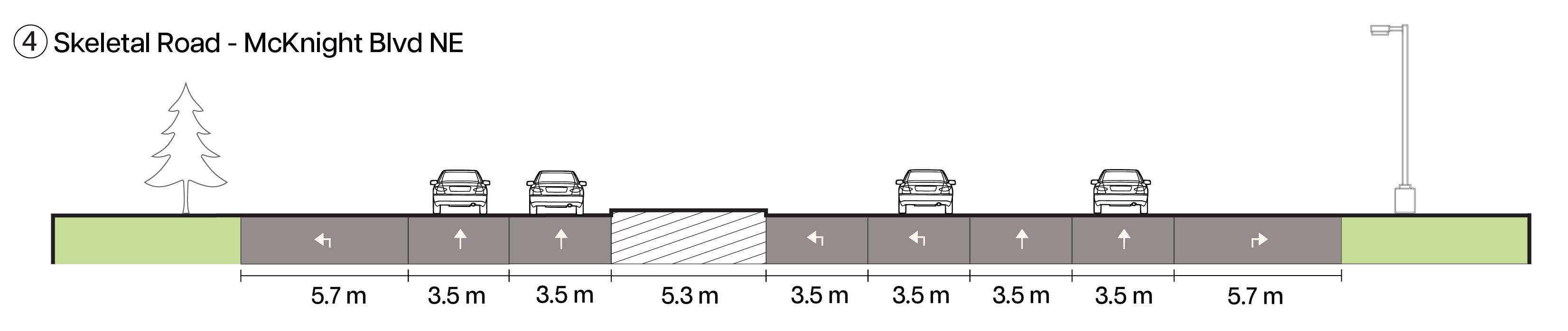
Section 3 and 4: The major skeletal and arterial roads identify the routes with heavier traffic, showcasing their multi-lane structure. These roads are where most of the traffic incidents have occurred, highlighting the need for targeted safety measures.
Strengths:
• Many bus routes to Downtown and Brentwood.
• Various schools are a short 10-minute walk from bus stops.
• Extensive bike trails by Prairie Winds.
• Improve frequency of minor bus routes can enhance reliability.
• Alleys at a 26.1% ratio to residential roads (better for development).
• Expanding the bike trail connectivity allows for different modes of transportation.
• Enhancing road infrastructure can foster a safer and more connected community.
• Implementing traffic calming measures.
Weaknesses:
• Longer wait times for minor bus routes indicate a gap in connectivity.
• High traffic incidents at key intersections.
• Many sidewalks abruptly end or exist on only one side.
Threats:
• High traffic incidents, especially in areas with traffic lights, pose ongoing risks to pedestrians and drivers, necessitating urgent safety measures and suggests drivers may be running red lights.
• Without mobility infrastructure improvements, the commuting and pedestrian experience will remain compromised.

Land use districts / zones:
Westwinds Area (C-C1) Commercial Community is a developing area in the airport vicinity protection area
Castleridge contains a special purpose (S-SPR) and is also a developing area in the airport vicinity protection area
Falconridge mainly contains R-CG (residential grade-oriented infill)
• Principles for Great Communities: Opportunity and Choice, The Natural Environment, Health and Wellness, Economic Vitality, Social Interaction, Identity and Place
LAP Content Policies:
LAP should include vision for the future of an area that align with the MDP and the guide for LAP LAPs should be informed by community characteristics and attributes
Include an urban form categories and scales maps
Contain community-specific policies
Explore and identify opportunities through the engagement process for future significant projects, studies or investments to be included in the local area plan;
• iv. identify unique sites, such as landmark or gateway sites, and provide community specific policy to guide future development in these areas;
• v. identifies transit station areas, supported by appropriate urban form categories and scale modifiers
Incorporate climate change policy that contributes to achieving and implementing Calgary’s Climate Resilience Strategy; and,
• viii. incorporate policy to support the protection and enhancement of tree canopies to achieve and implement the Urban Tree Canopy policy of the Municipal Development Plan.


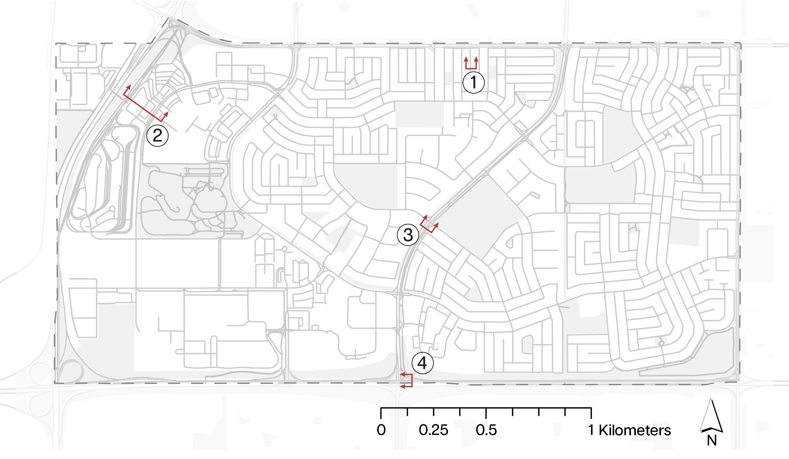
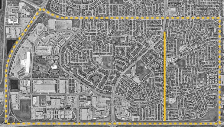
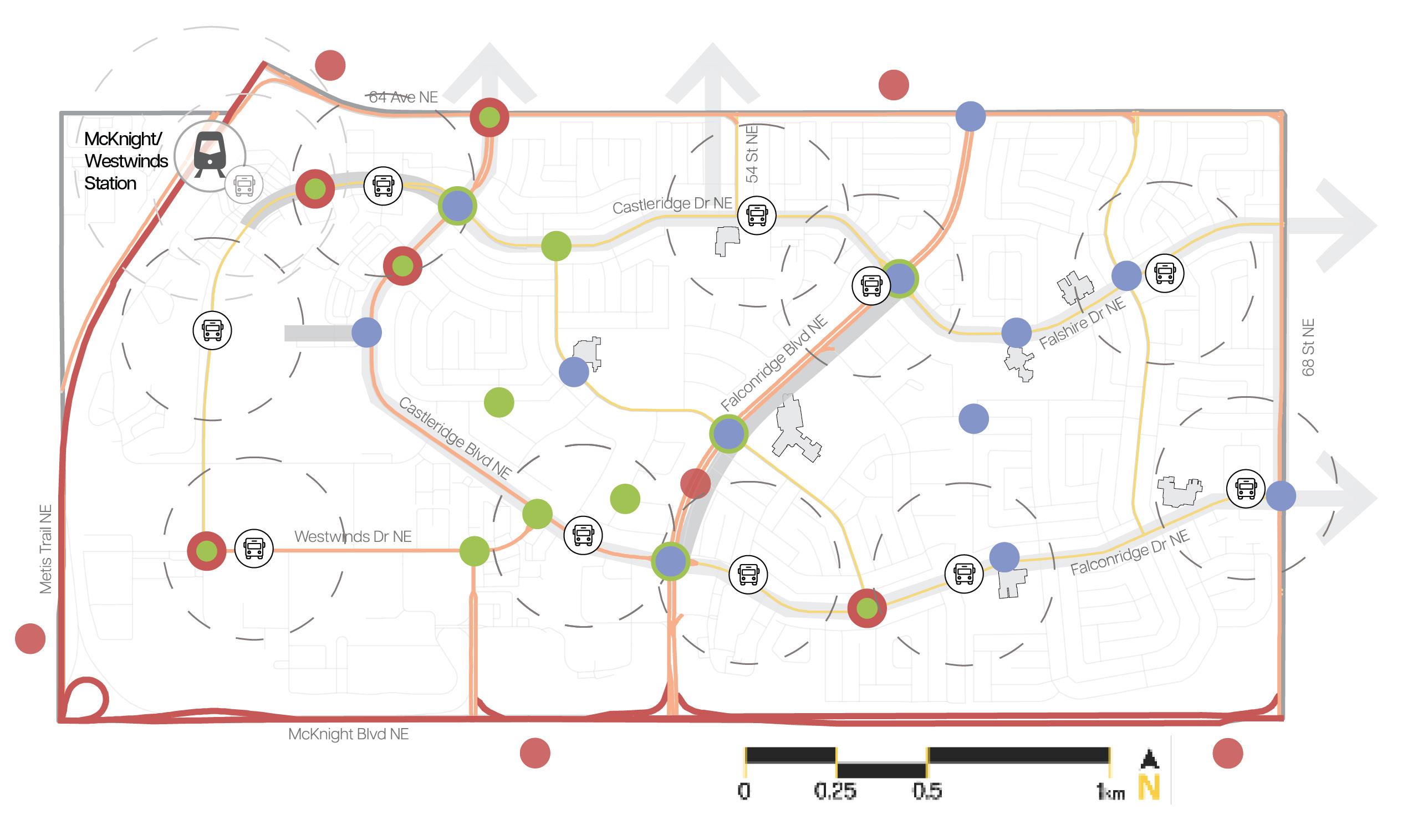
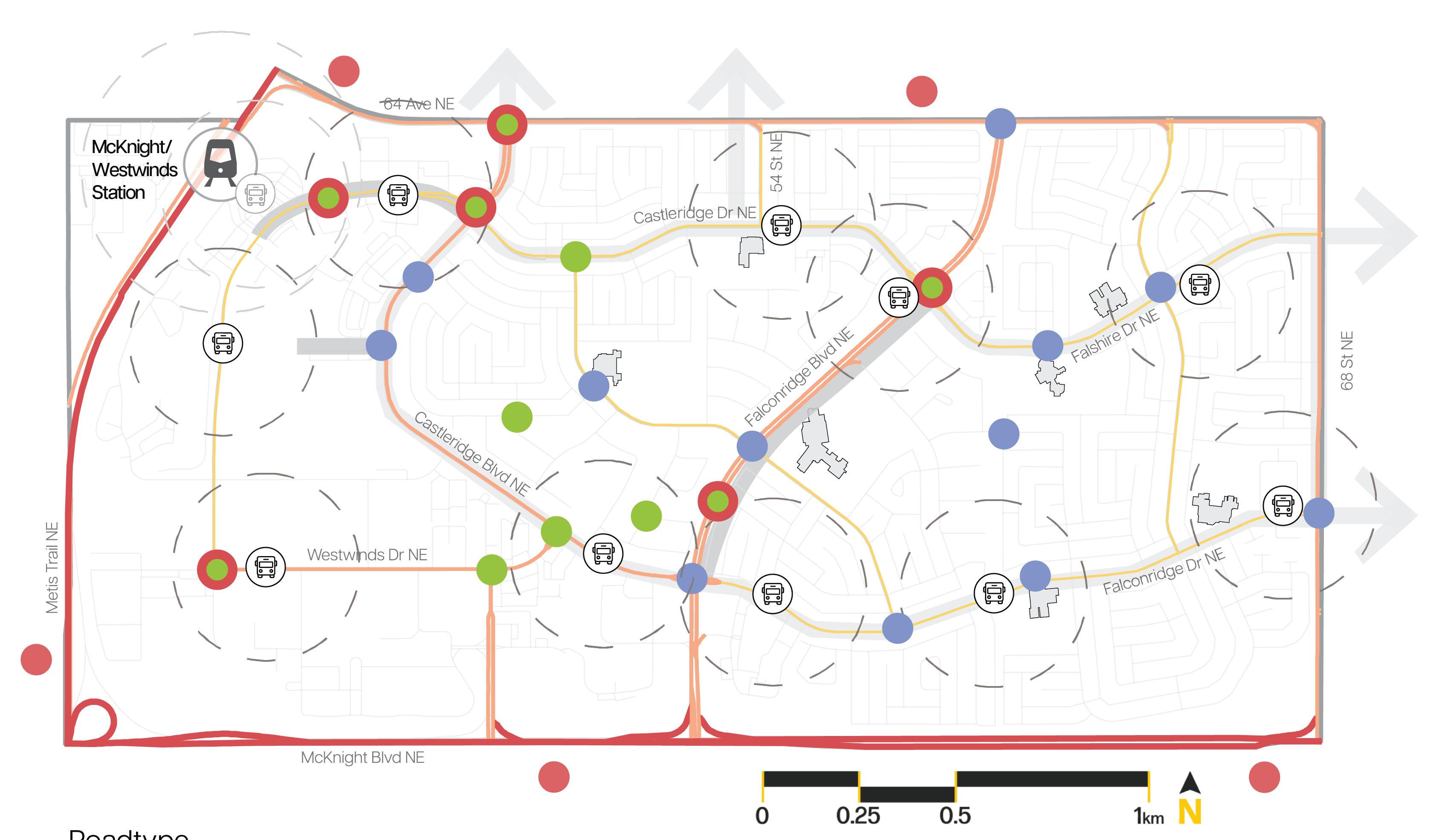
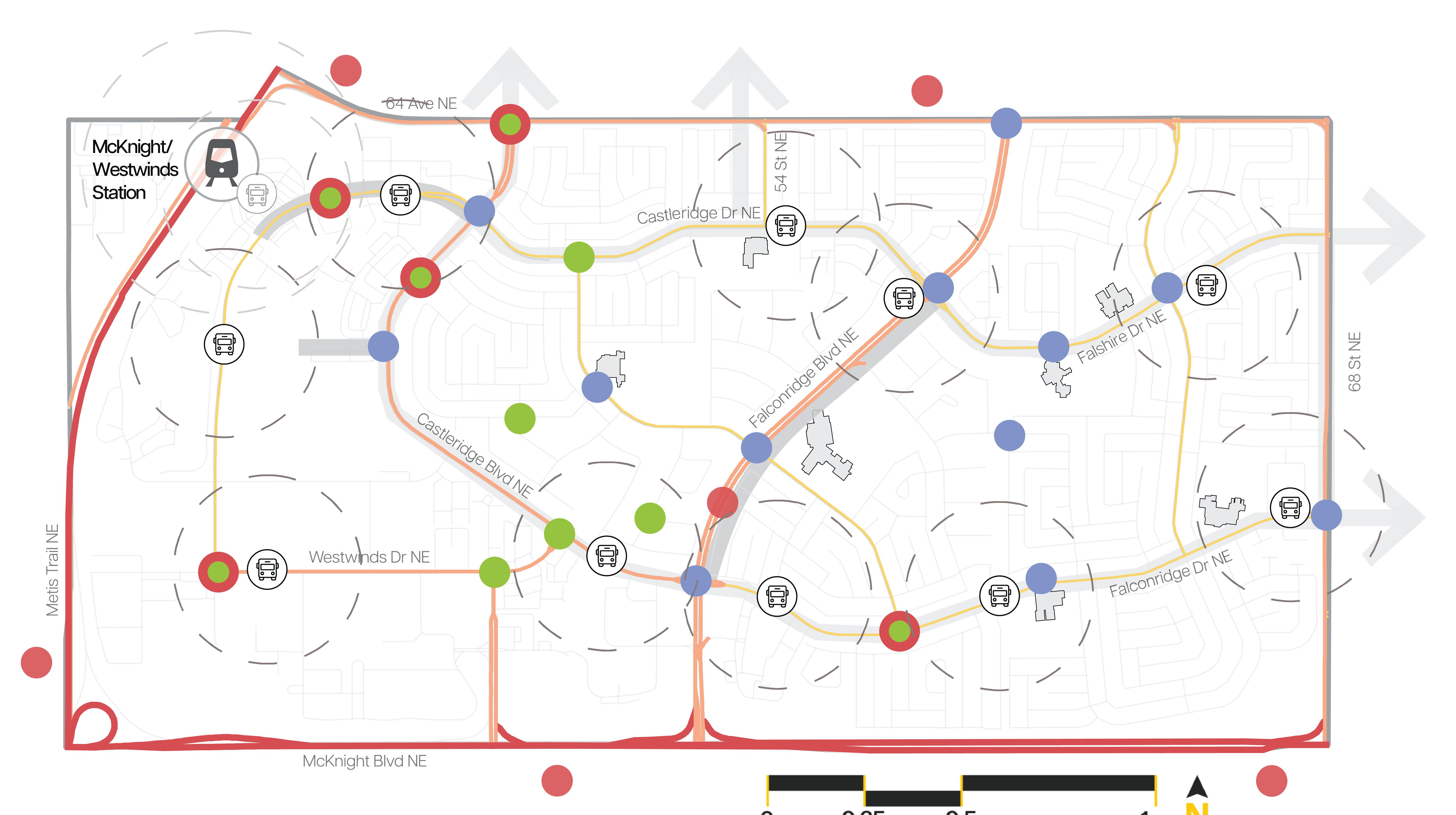
For this board, our focus was on communicating the different pathways for mobility such as the City’s proposed 5A network in light blue, major arterial roads in dark orange, and collector roads in medium blue.
The dark blue arrow indicates the major skeletal road known as McKnight Blvd. This will help to provide residents with context when looking at this map.

The focus of this board was to better understand the travel pattern of resident’s on where they go and how, what their commuting safety concerns are, and further define problem areas for improvement.
Strengths:
•
• Plenty of Commercial
• Strong Sense of Culture
• Variety in Built Form typology
• Transit Coverage (Comprehensive BRT) Weaknesses:
Opportunities:
• Potential for new developments


In this poster board, we wanted to graphically summarize our findings on the analysis of the community in a digestible way. For this reason, we included our SWOT and only three main infographics aligning with our multiculturalism theme from the sociodemographic statistics we found. Along with this are our main design principles to guide the interventions boards and a list of key “positives” and “negatives” we identified in the communities.
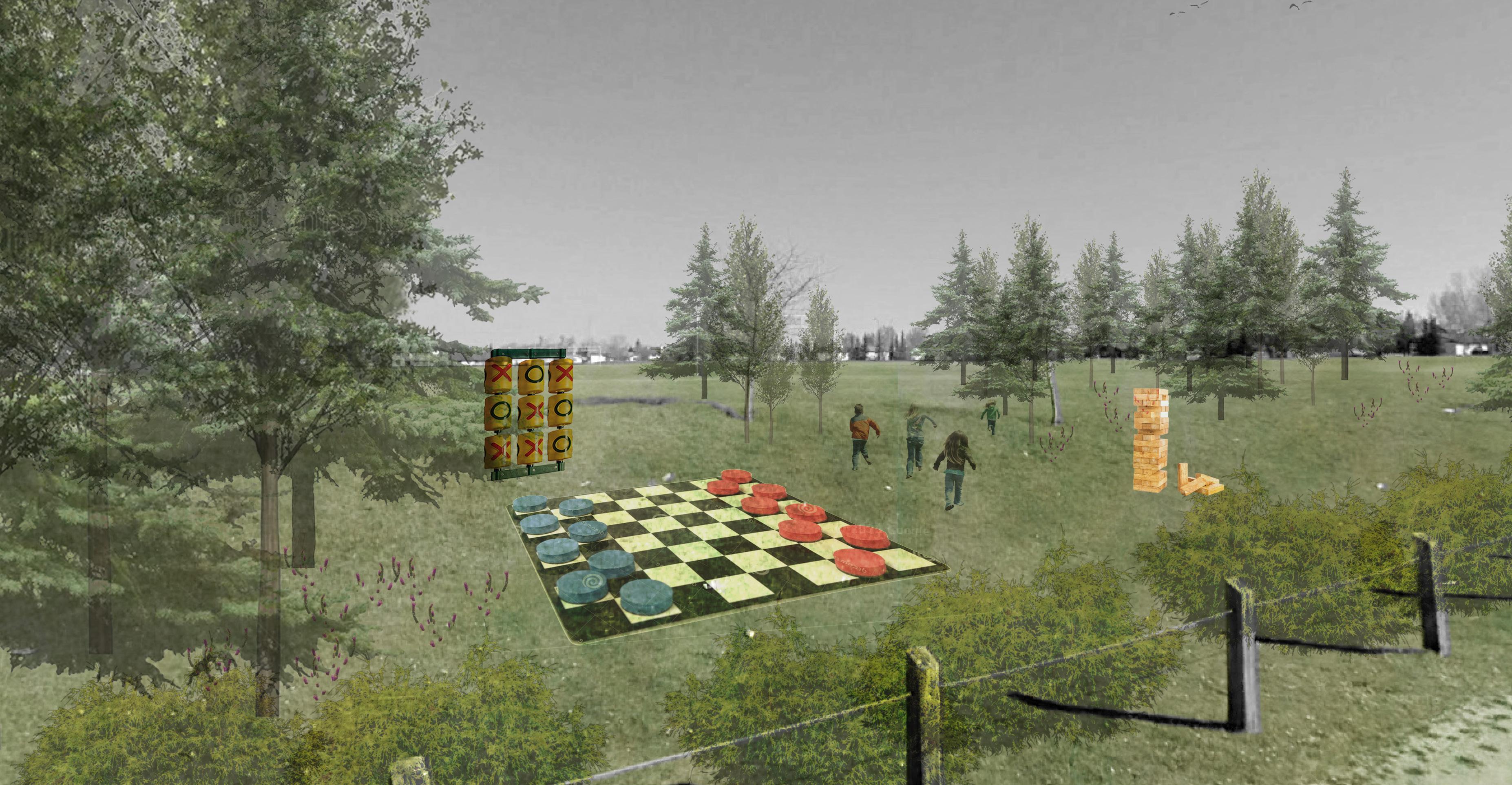
Our goal for this board is to ask residents what ideas they had in terms of ways to program their open spaces. We numbered the renders with the ideas we proposed to also receive their feedback on these.
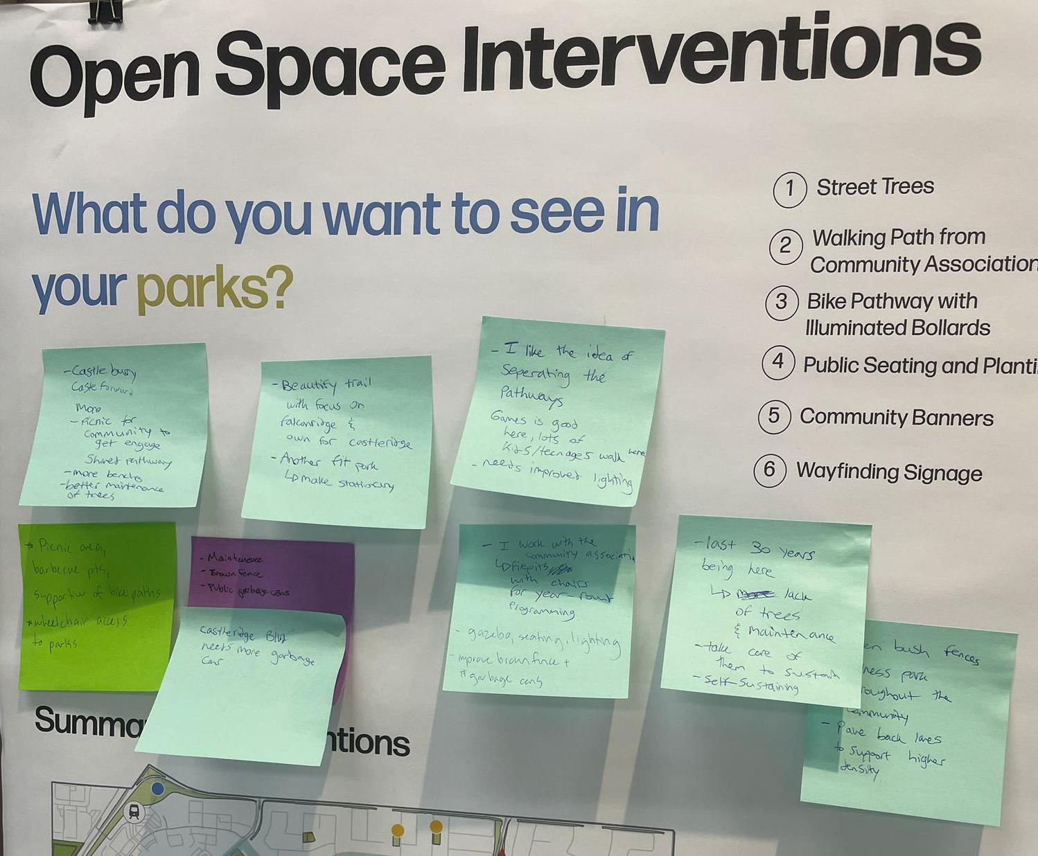
Based on their feedback, a reoccuring message was that there was a great desire for picnic tables and barbecue pits because of the oversaturation of people in Prairie Winds Park. There was also concern for any programmable methods that are movable or could be stolen or vandalized. Many of the smaller parks were also left unused because of safety concerns and a lack of activities.
Where do you live and what changes do you want to see there?
The guiding question for the land use interventions was strategically written to inspire ideas about what residents want to see in their neighbourhoods. The massing renders and typology graphic is meant to make the density we are proposing seem less intimidating. They are also meant to introduce the idea of mixed-uses within the community and forms that step down towards residential homes.
Are there areas you avoid travelling through? If so, why?
Summary of Interventions
What this will look like

Our focus for the traffic and safety board is figuring out where the residents feel the less safe whether they are walking or cycling. We also wanted to gather their feedback on our proposed traffic calming measures.
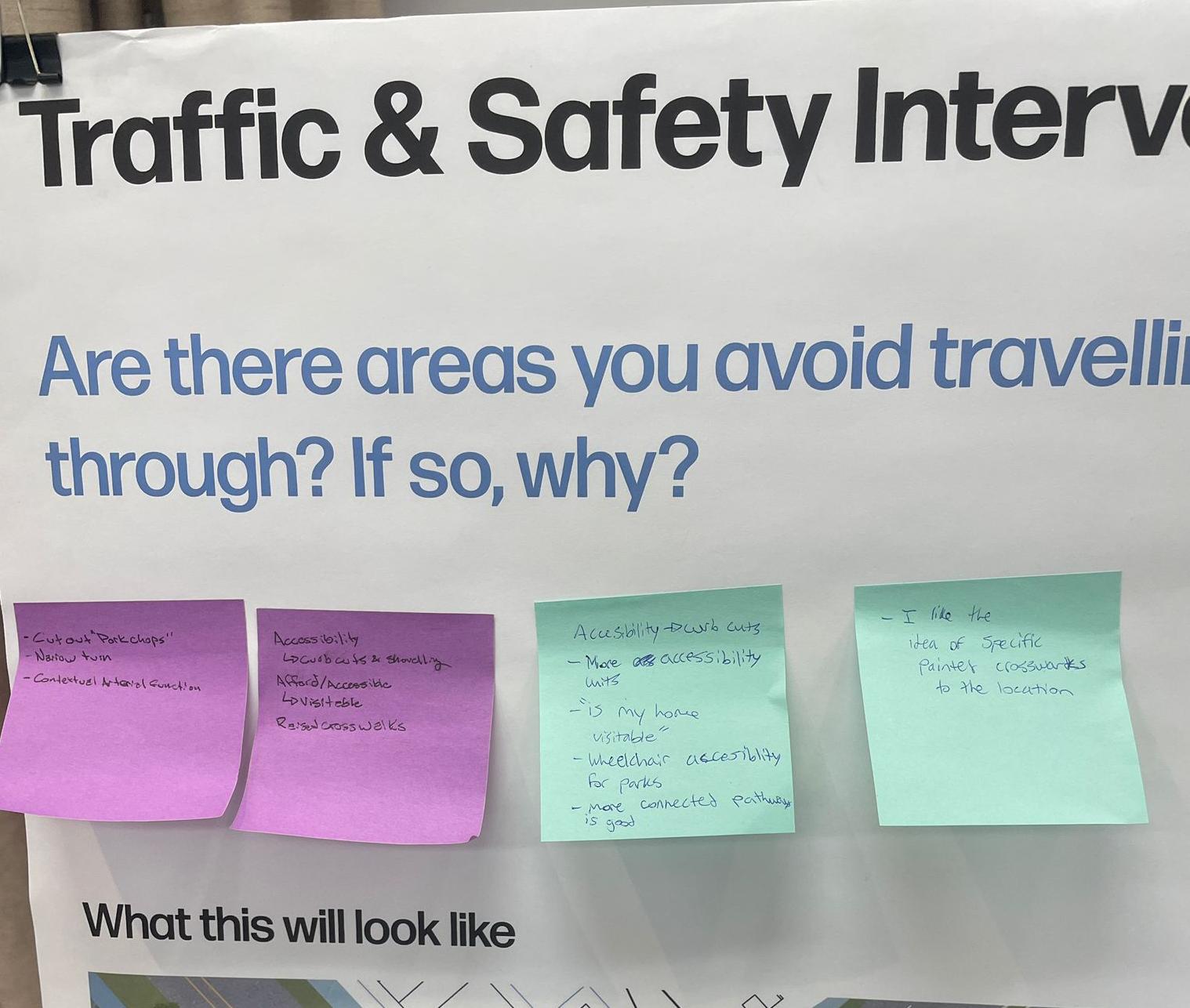
In summary, the reaction to our traffic calming measures were very positive since there is such a large safety concern surrounding the major intersections. The key intersection that residents were concerned for is the one next to the community association (Falconridge Blvd and Falshire Dr NE) as someone got fatally injured there just the week beforehand. This highlights the need for these traffic calming measures in all three communities.
What is unique to your community and how do you want it to be showcased?

For our main theme of “multiculturalism”, we decided to create a board that consists mostly of visuals so residents can see what this may look like at street level. From this, we wanted to hear what residents valued in terms of what sets the community apart from others. We also wanted to hear feedback on our proposed interventions for the community association and what they thought about the proposed signage designs.
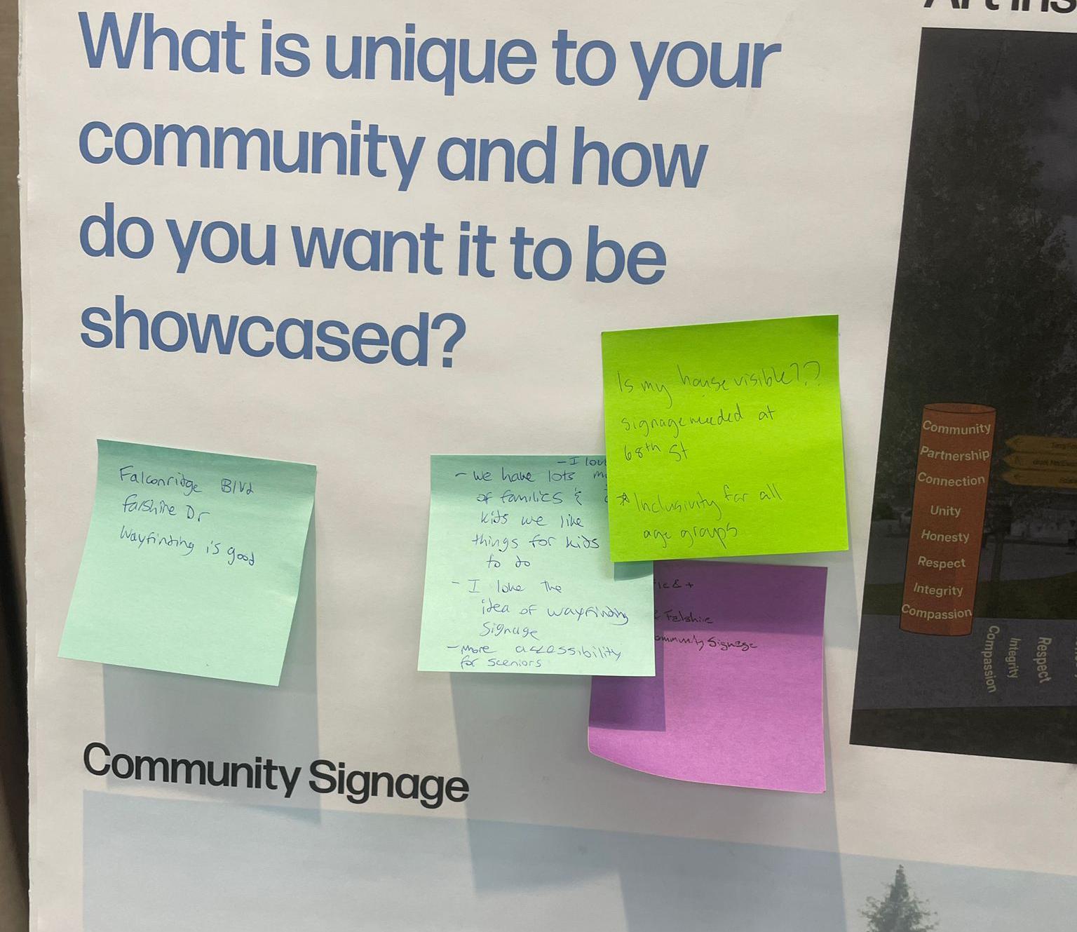
The multiculturalism theme received a predominantly positive response, especially regarding the signage and community banners. Many felt that these elements could help their community establish a stronger, more distinct identity. They also responded positively to the wayfinding signage as it adds to the safety aspect for those who have kids that walk to school.
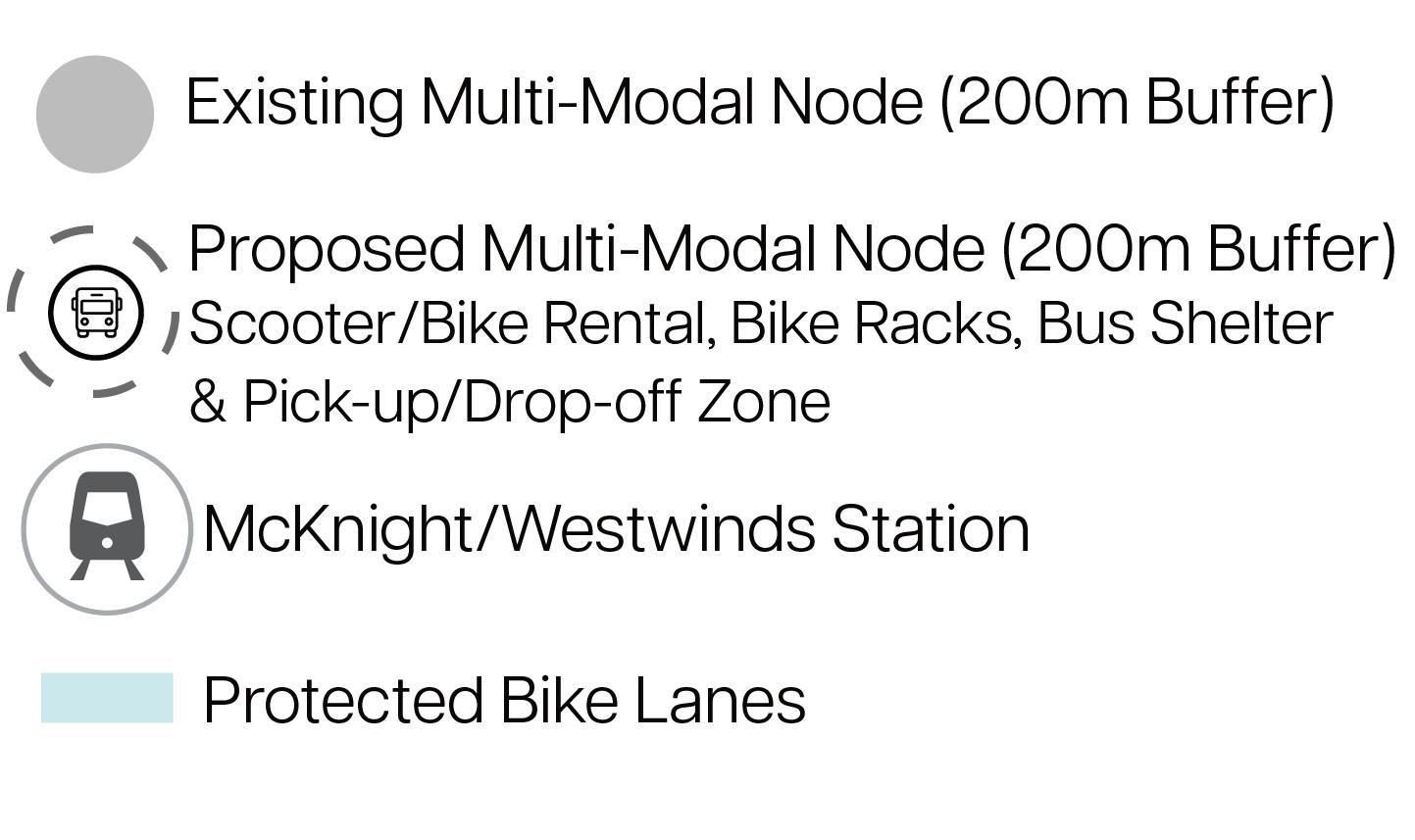
• Make the legend for the multimodal points more descriptive in the transportation map.
• BRT system needs to be emphasized more in the transportation map.
• Castleridge Mixed-Use Hub needs to discuss the commercial evolution in its rationale.
• Pathway interventions could include less tactical urbanism and more permanent fixtures.
• Move the “What We Heard” at the beginning of our document.
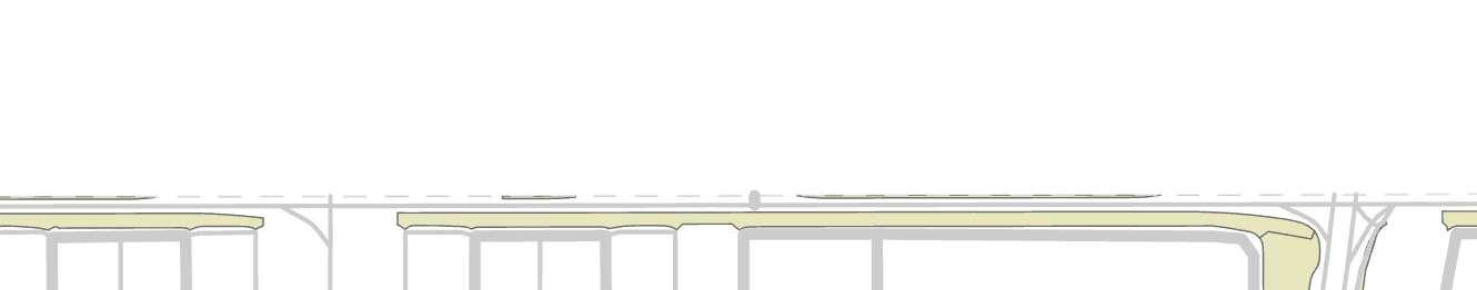
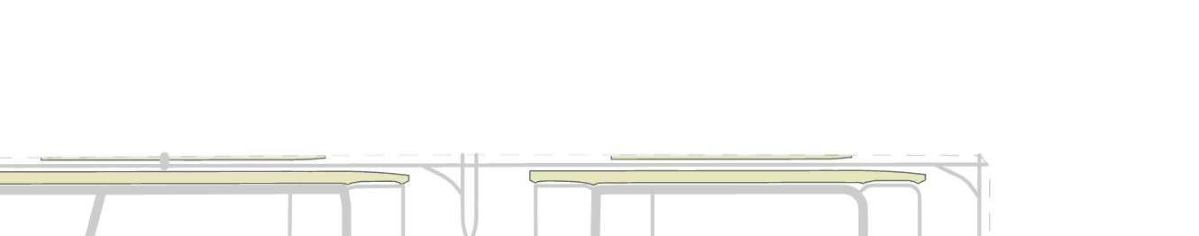
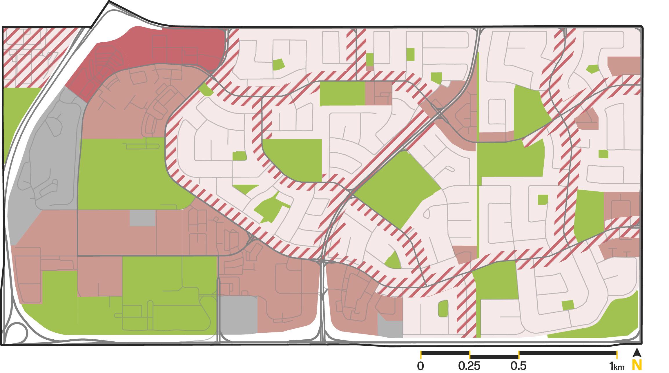
Using GIS, we created buffers based upon the collector and arterial roads which were subsequently used to create the extents for the Urban Form Draft and Bulding Scale Modifer Draft.
These areas were subsequently overlayed on top of the existing Land Use Map to further contextualize the area and how our vision for the community fits contextually.
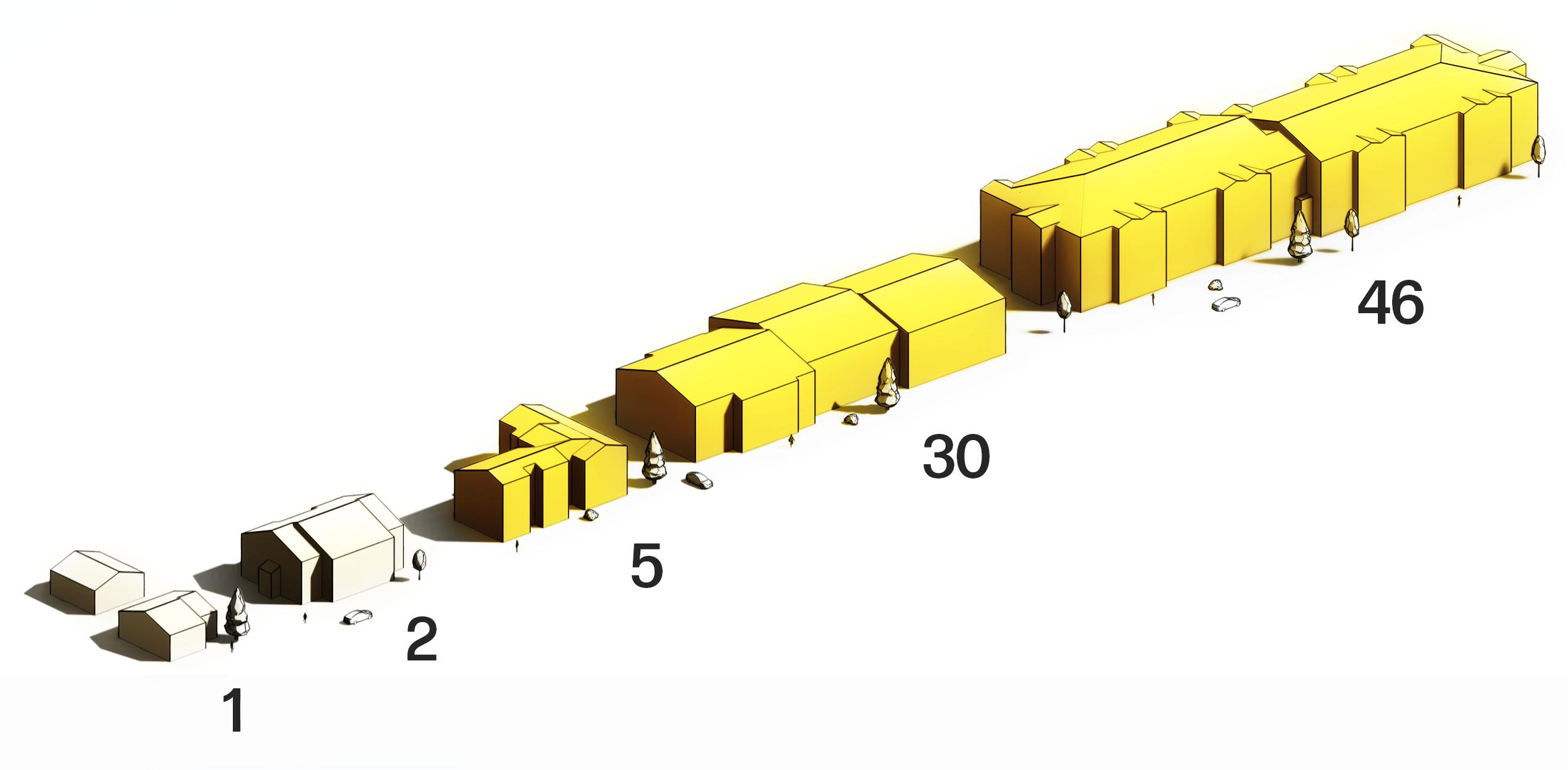
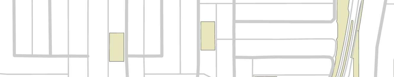
Joining the year of construction from the lots with outlines of the buildings we were able to create a map that demonstrated the year o f construction for each building in the community. This helped to inform the potential for redevelopment based upon the age of the building. As buildings begin to reach the end of their life span, they are more likely to be redeveloped.
Using GIS and adjacencies, we created a map that demonstrated the laneways within the community and the lots that are touching these laneways. This map informed the ability for multi-residential developments on these parcels as these lots have increased access relaitve to lots with front only access.
We identified a 26% alley-toresidential street ratio. relative
The combination of these four maps (Road Buffers Map, Existing Land Use Map, Year of Construction Map, and Laneways Map) lead to the creation of the Urban Form Draft and the Building Scale Modifier Draft which displayed our intitial intentions for evolving the community. These maps followed the conventions and categories that are utilized by the City of Calgary and their Local Area Plan documents, specifically Heritage Communities LAP as it conatined the necessary Urban Form Categories that we were trying to achieve. These maps were used as conceptual designs in our second steerting committee session.
In the Urban Form Draft, we utilized categories that covered the intentions and uses that we saw for the community. We based Neighbourhood Collector on the Road Buffer Map to allow for the evolution of use and form in areas where the street network could support it which enabled us to respect the existing community vision of single-family homes.
Neighbourhood Flex was applied to areas in which we saw the potential for mixed use developments that would enable commerical opportunities throughout the community, these were primarily based upon housing age and multi-residential zoning, which would allow for higher scale developments without overwhelming the surrounding residential forms.
Commerical Centre and Neighbourhood Commerical are both applied to areas where the existing land use allows for comerical development to allow slow realization of the plan.
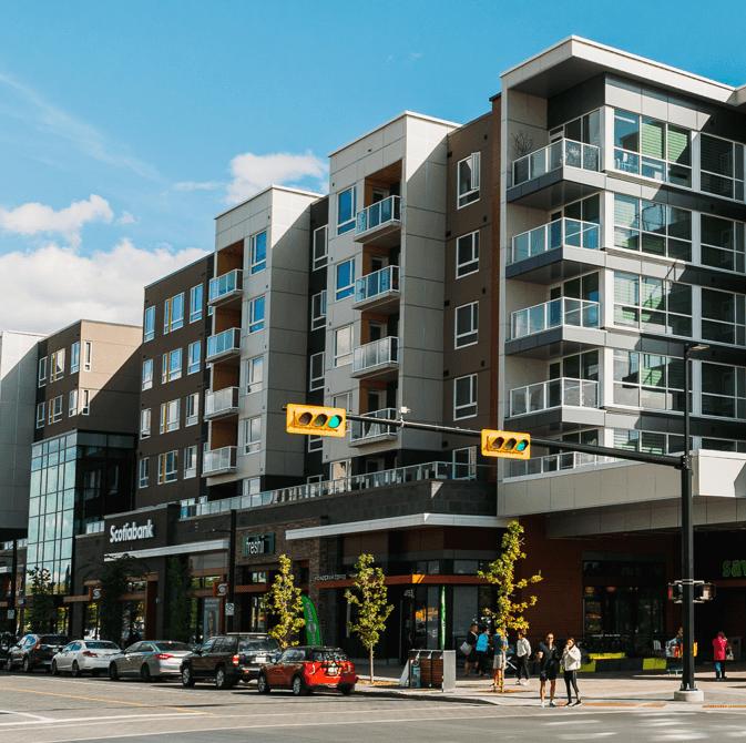
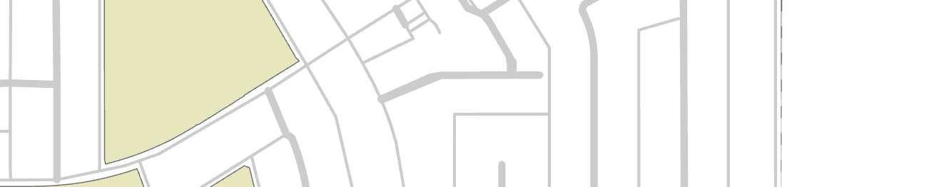
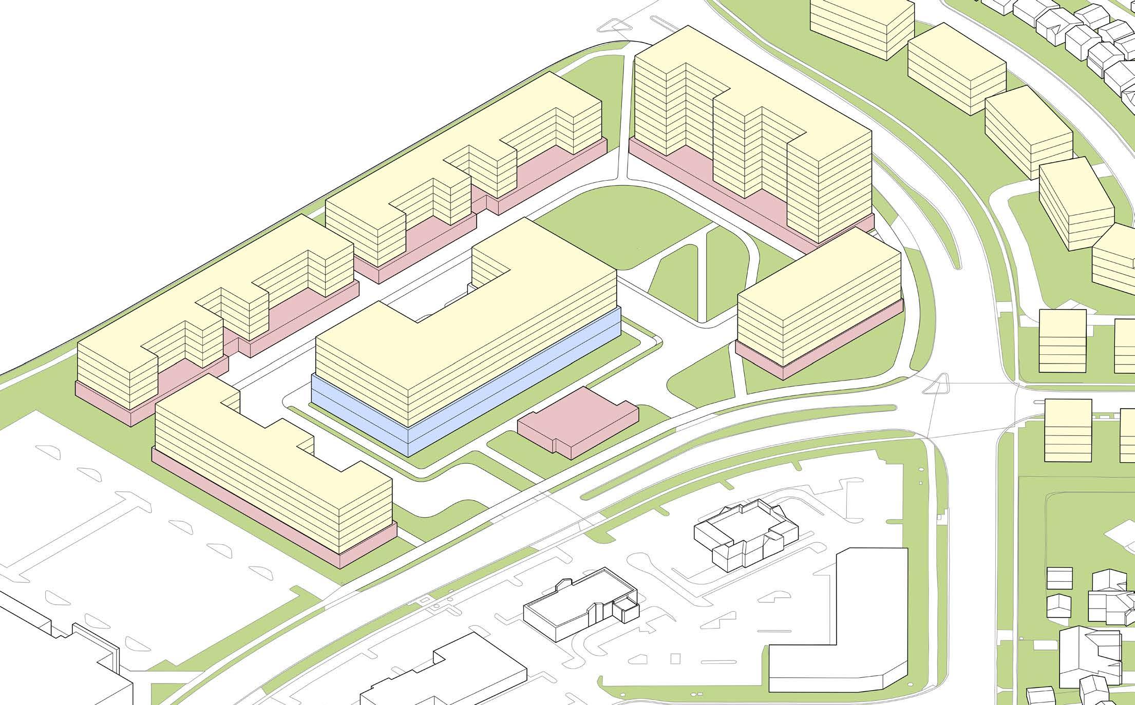
For the master plan of Westwinds Centre, we looked to University District in NW Calgary, Ablerta. University District is a master-planned community adjacent to the University of Calgary. This community mixes residential, institutional, and commerical spaces around a central park space that is used year-round. We attempted to emulate this concept for Westwinnds centre and integrate park space into our concept, encouraging year-round use and creating an amenity rich destination.
Using the available data for roads and lots, we began masterplanning Westwinds Centre. Using building footprints based off of the university district precedents, we drafted a plan that utilized a the site in a way that could take advantage of the proximity to the train and produce a functional site that demonstrated our land use intentions.
5
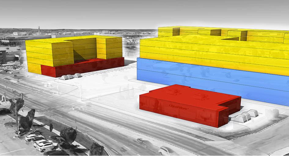
These graphics depict our draft massing for Westwinds Centre. Our intention was to propose six new buildings that mixed institutional, commercial and residential uses all within a maximum of six storeys. The resdiential and commercial buildings are all a similar shape that emulates a modular conceptualization of the University District Precedents.
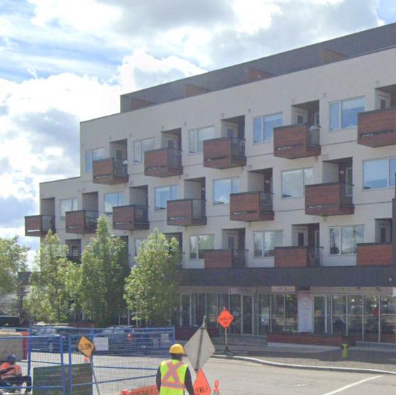
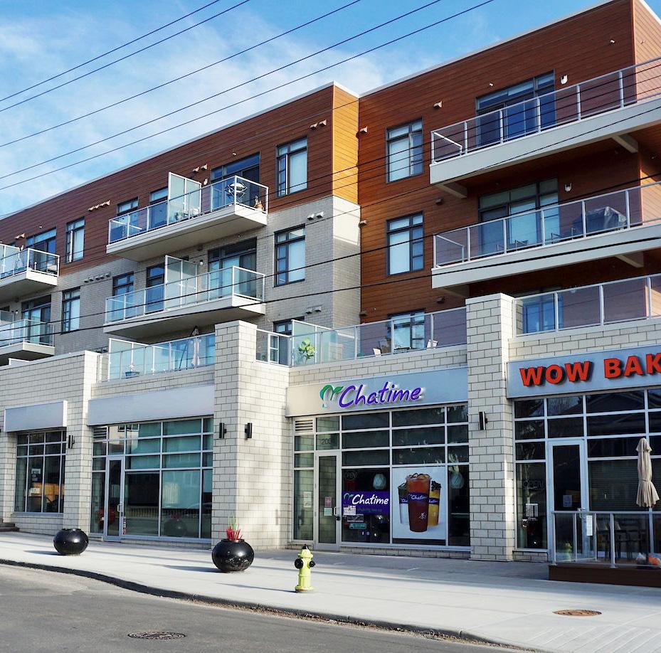
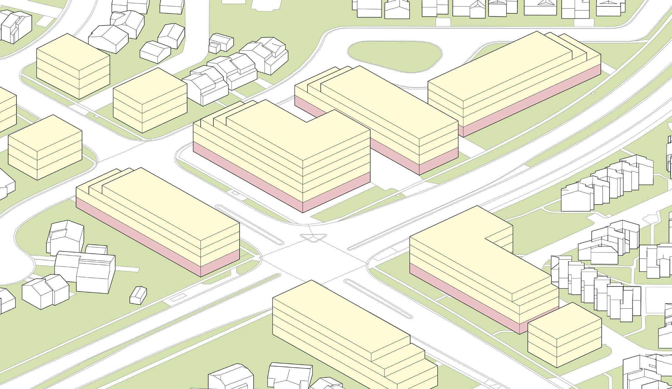
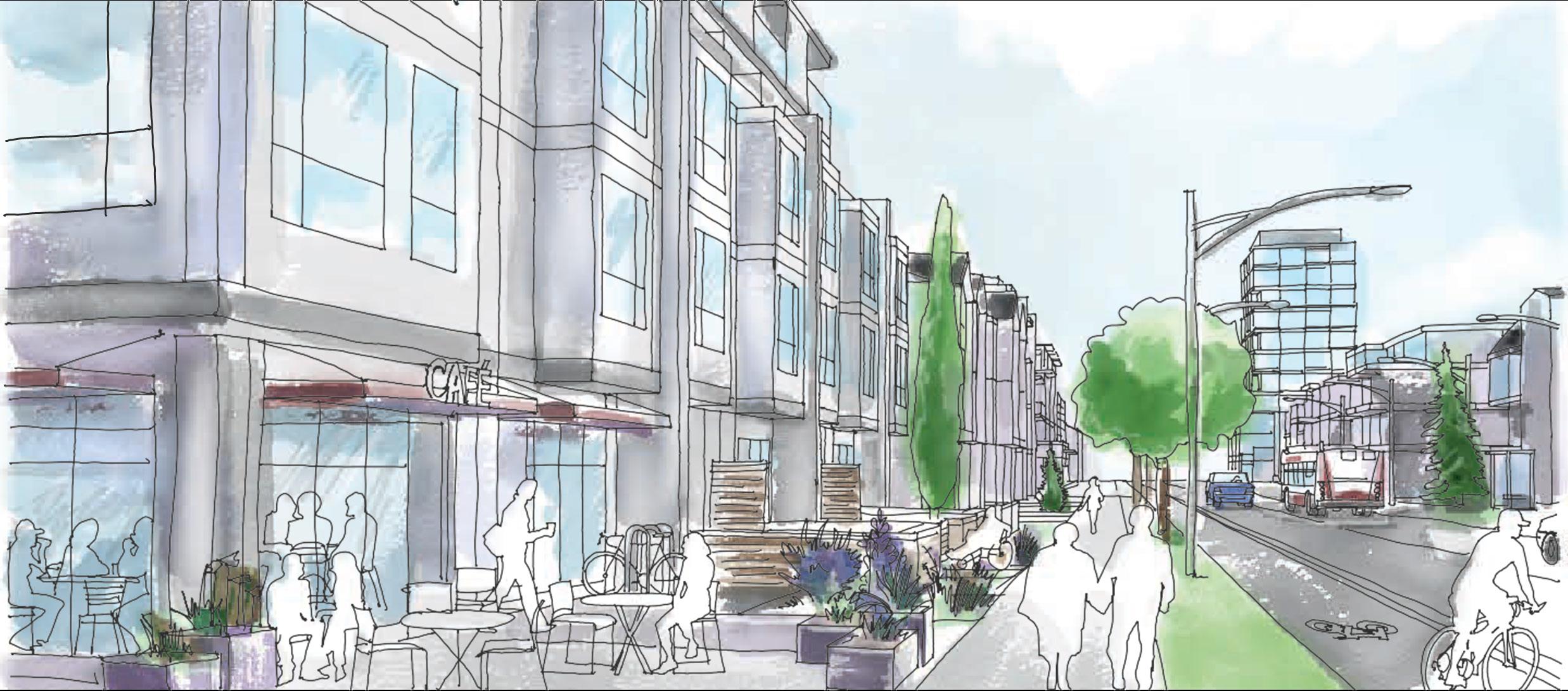
For the masterplan of Castleridge MixedUse Hub, we looked to areas such as Marda Loop in Calgary, Alberta. Marda Loop features a number of mixed-use buildings in the scale that we intended to emulate. These buildings have 3-4 storeys of residential with a ground floor of commerical spaces. These precendents are successful developments that fit into the context of their respective communities, which is a concept that we looked to for inspiration. With existing commerical on the site, we were intending to reimagine the surrounding parcels with contextually appropriate forms, similar to what is depicted here.
The draft master plan for Castleridge Mixed-Use Hub was inspired by the shape of the existing forms and parcel orientation. Our intention was to keep the existing commerical form, with the potential to increase it’s scale by one storey of institutional, while two other mixed-use buildings would be added adjancently. Otherwise we added surface parking to alleviate the concerns of adjacent properties that parking would become an issue.
The massing for the Castleridge Mixed-Use Hub was intended to step down towards the collector road to the south while building upon the existing commercial form. The two mixed use buildings were designed at a maximum of four storeys to minimize shadowing and impact on the single family houses across the street. This design was presented during the second steering committee presentation.
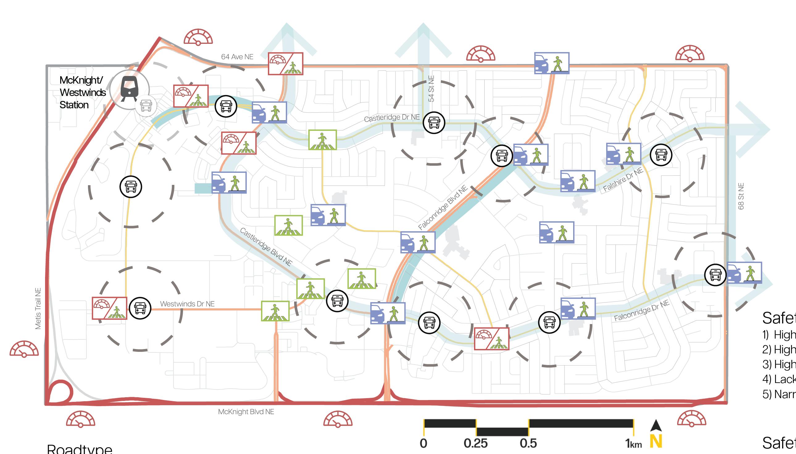
Safety Issues:
1) High traffic Incidents: vehicle, cyclist, and pedestrian
2) High car dependancy
3) High-speed vehicles and red-light running
4) Lack of walk signals at major intersections
5) Narrow, disconnected sidewalks force pedesttrains onto roads
Safety Goals:
1) Improved safety at schools and major intersections
2) Promote multi-modal connectivity
3) Promote active transportation through shared pathways
4) Slower speed cars
5) Intall wal signals at major intersections
6) Wide, connected sidewalks
7) Improve connectivity between commercial areas, residential neighbourhoods, and school zones
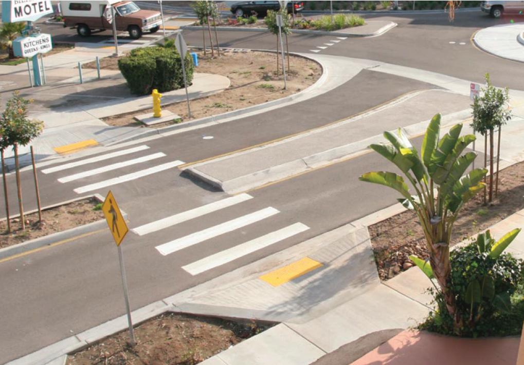
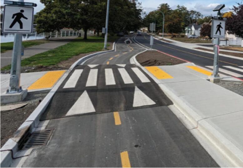
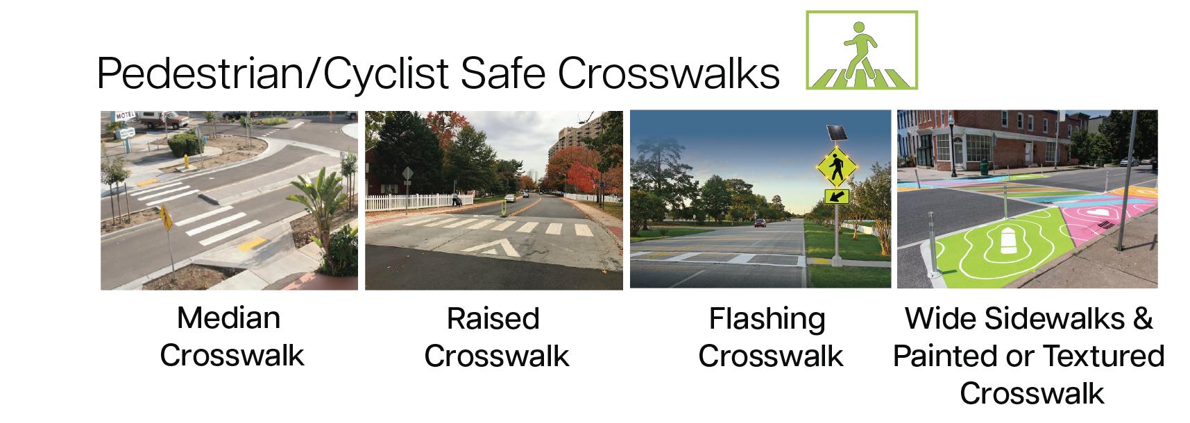
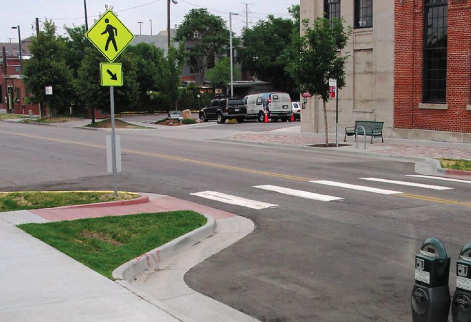
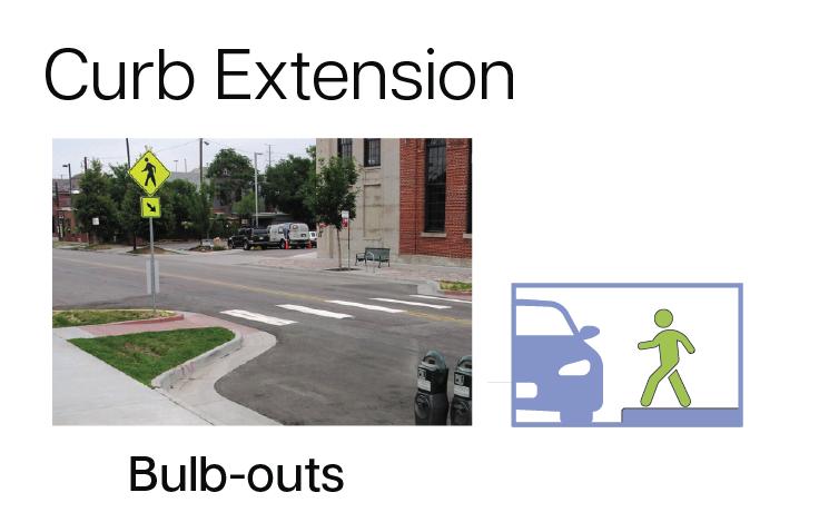
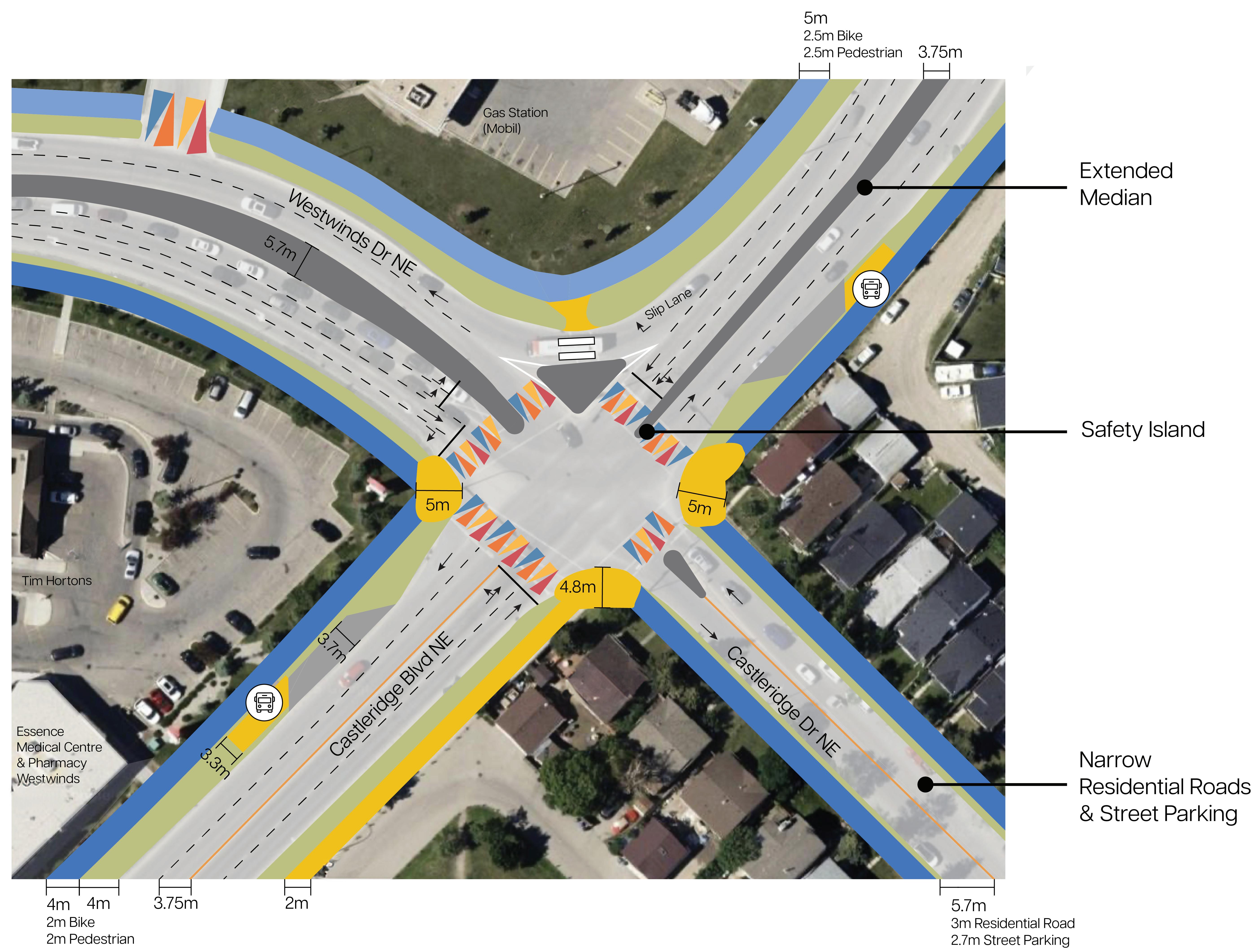
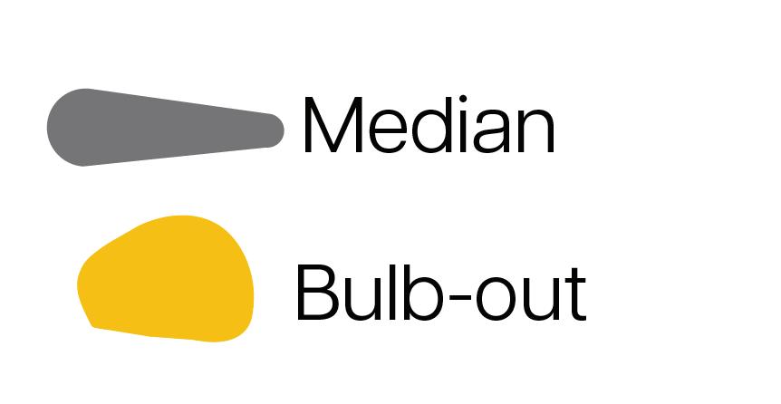


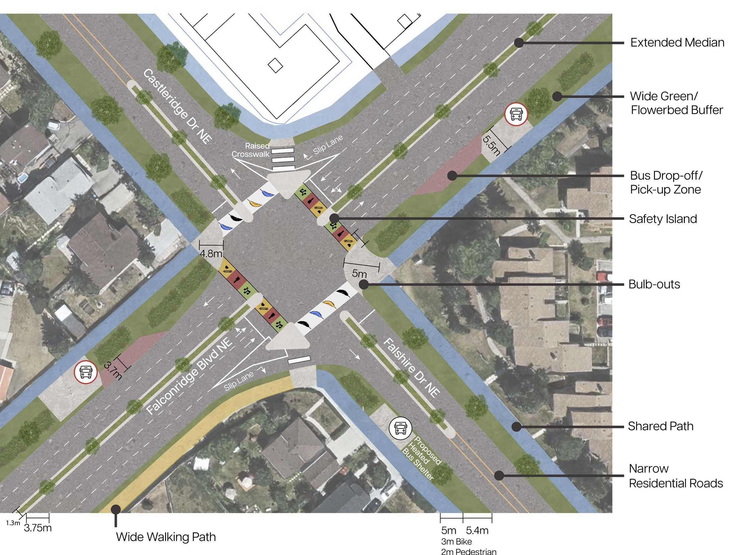
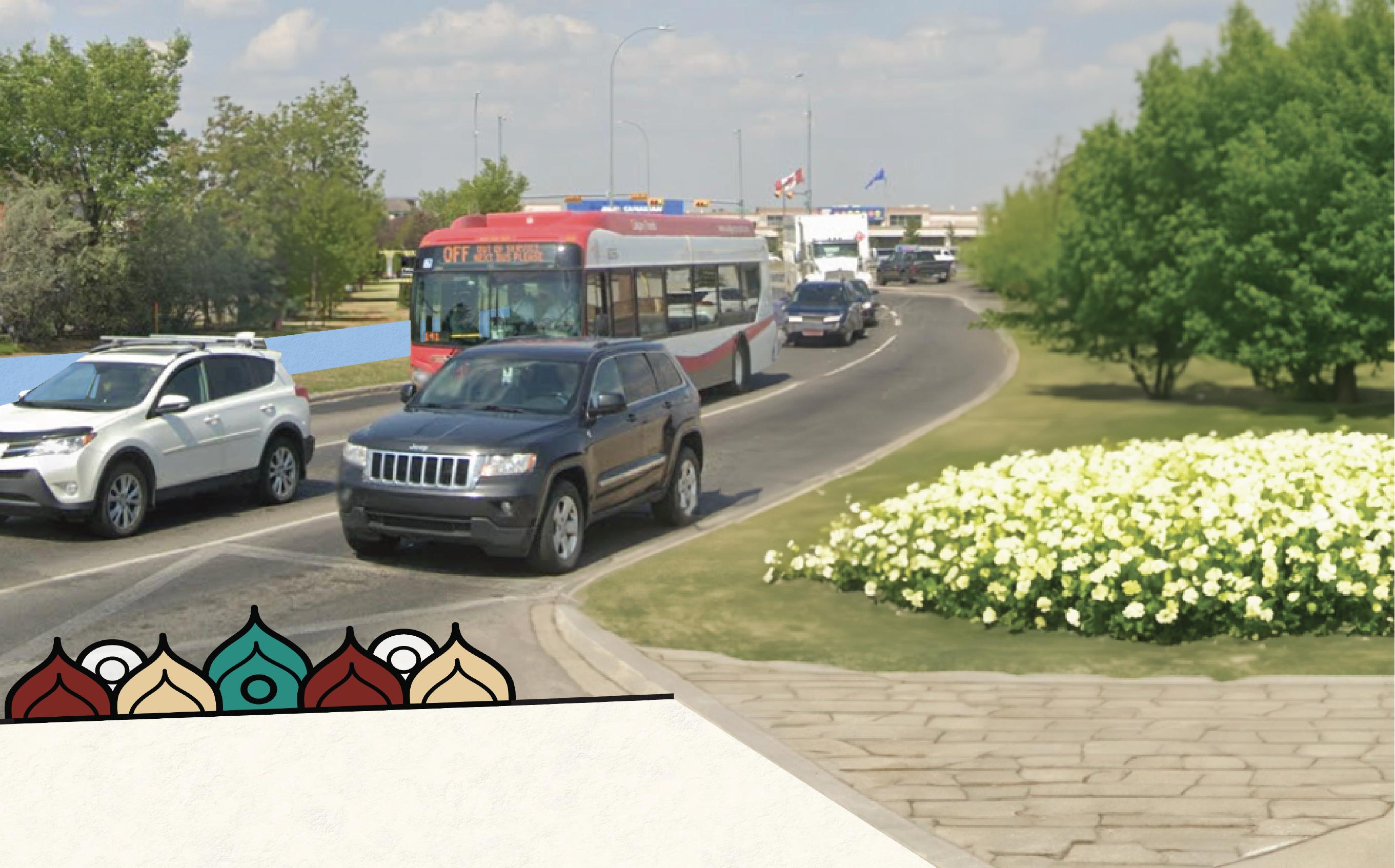
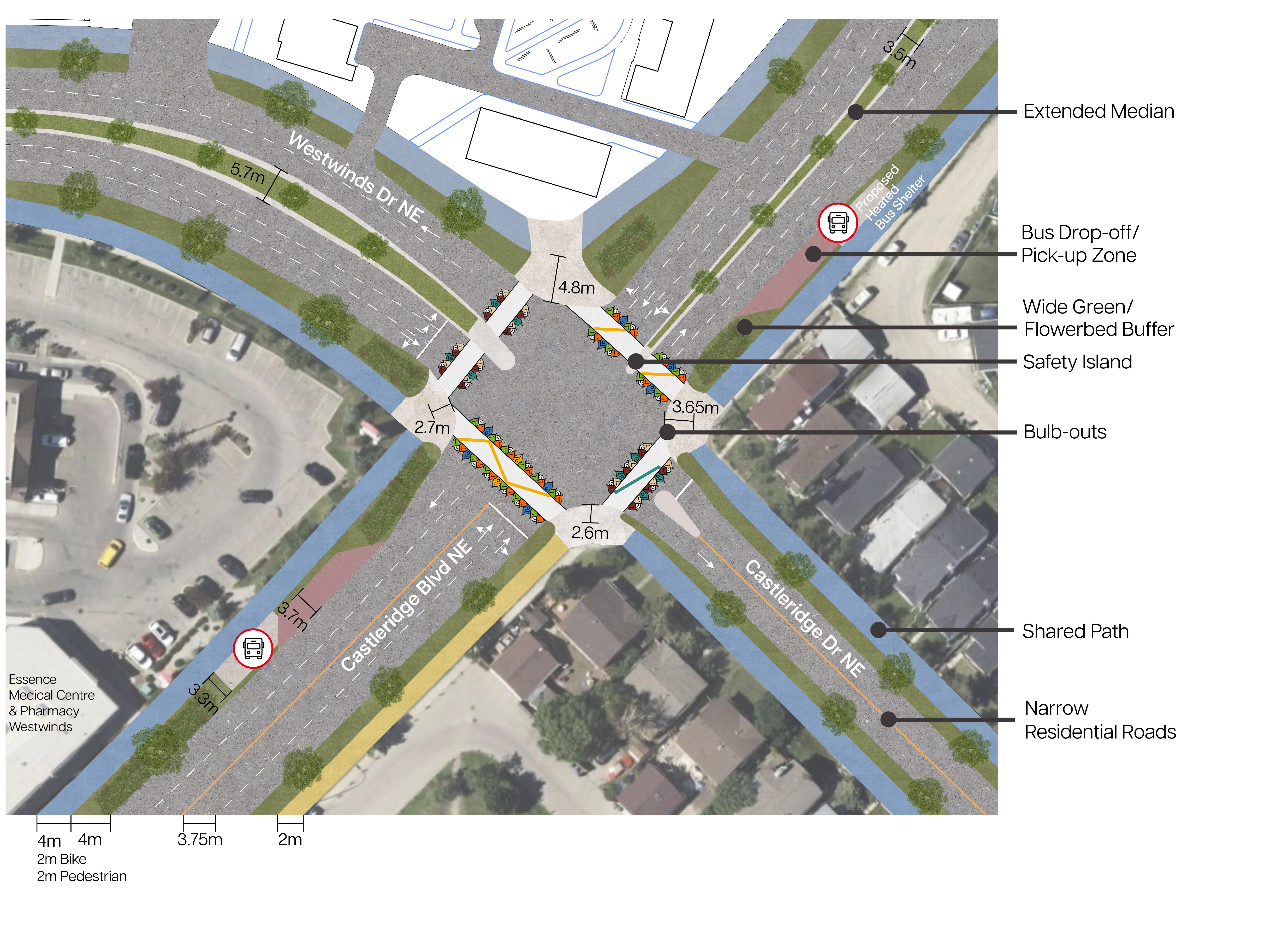
This area has a history of high-traffic incidents, including one pedestrian accident. Next, bulb-outs at crosswalk ends and median crosswalks separate pedestrians and vehicles, reduce crosswalk length, and slow vehicle speeds. The crosswalk was also realigned to run straight to the traffic island for improved safety.
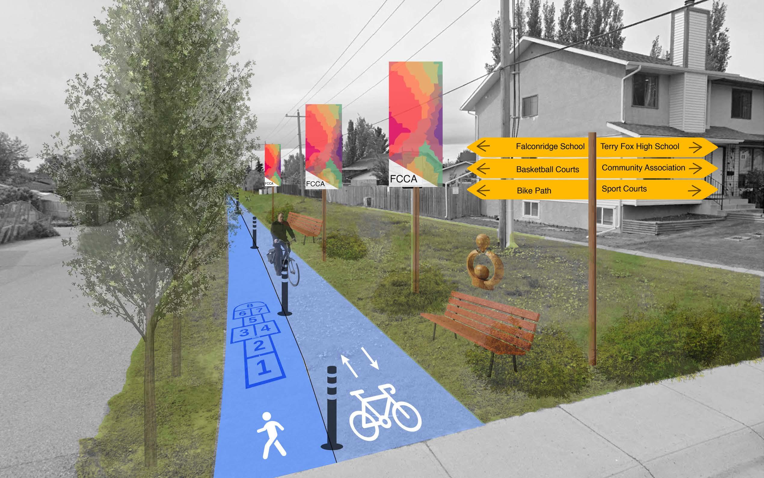
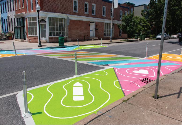
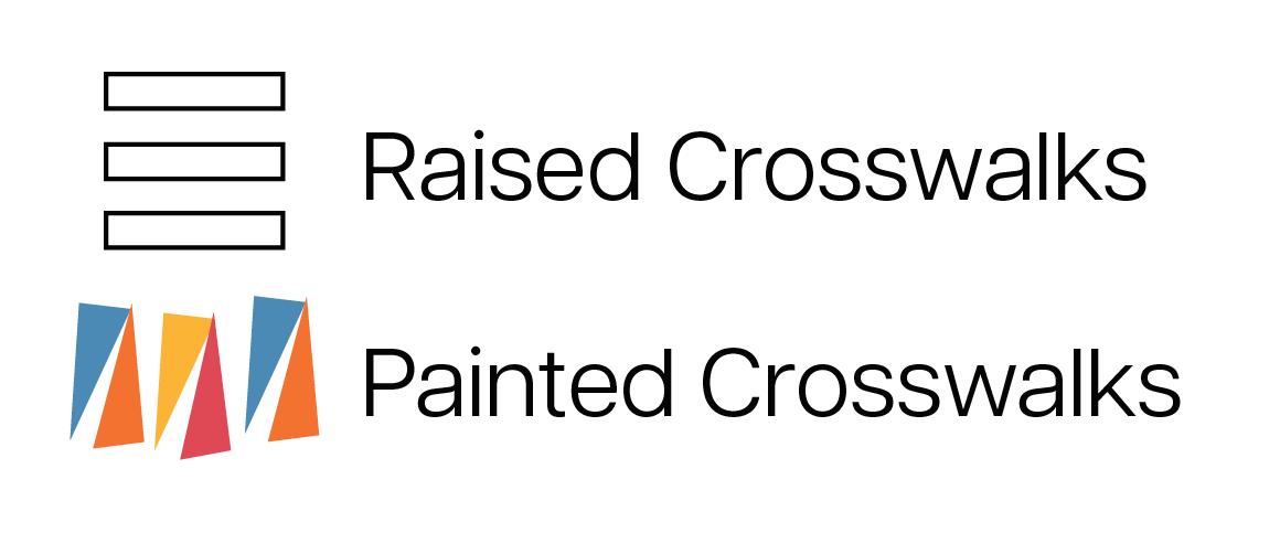
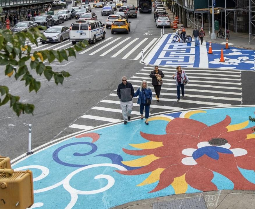
To increase visibility, painted pathways incorporate colours from the community association, reflecting the area's cultural identity.


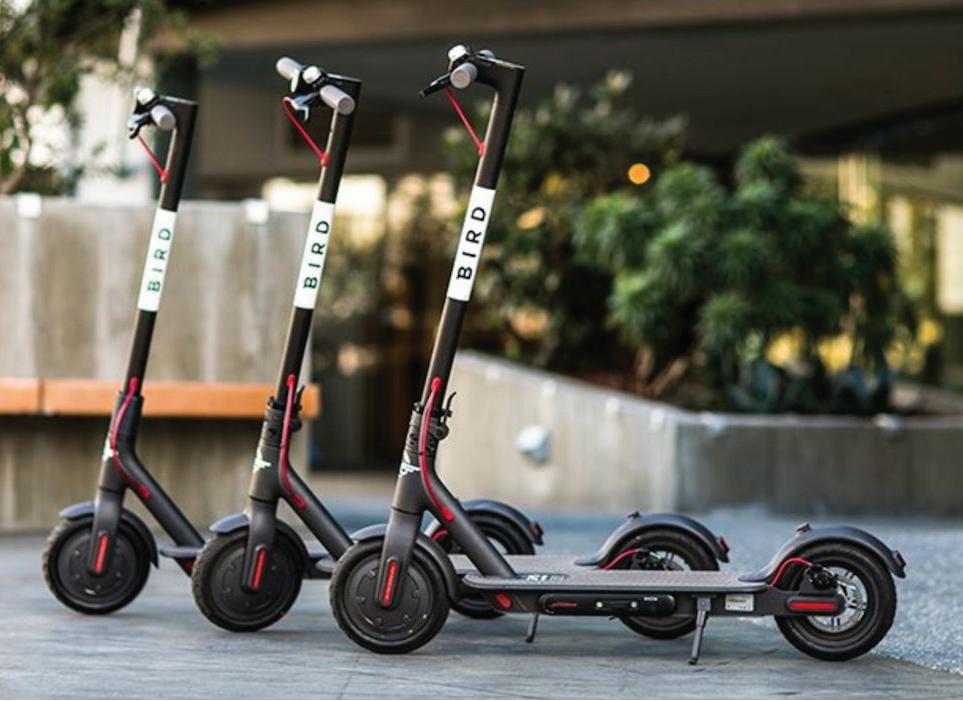
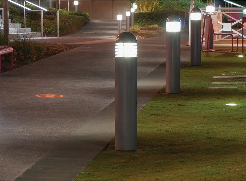
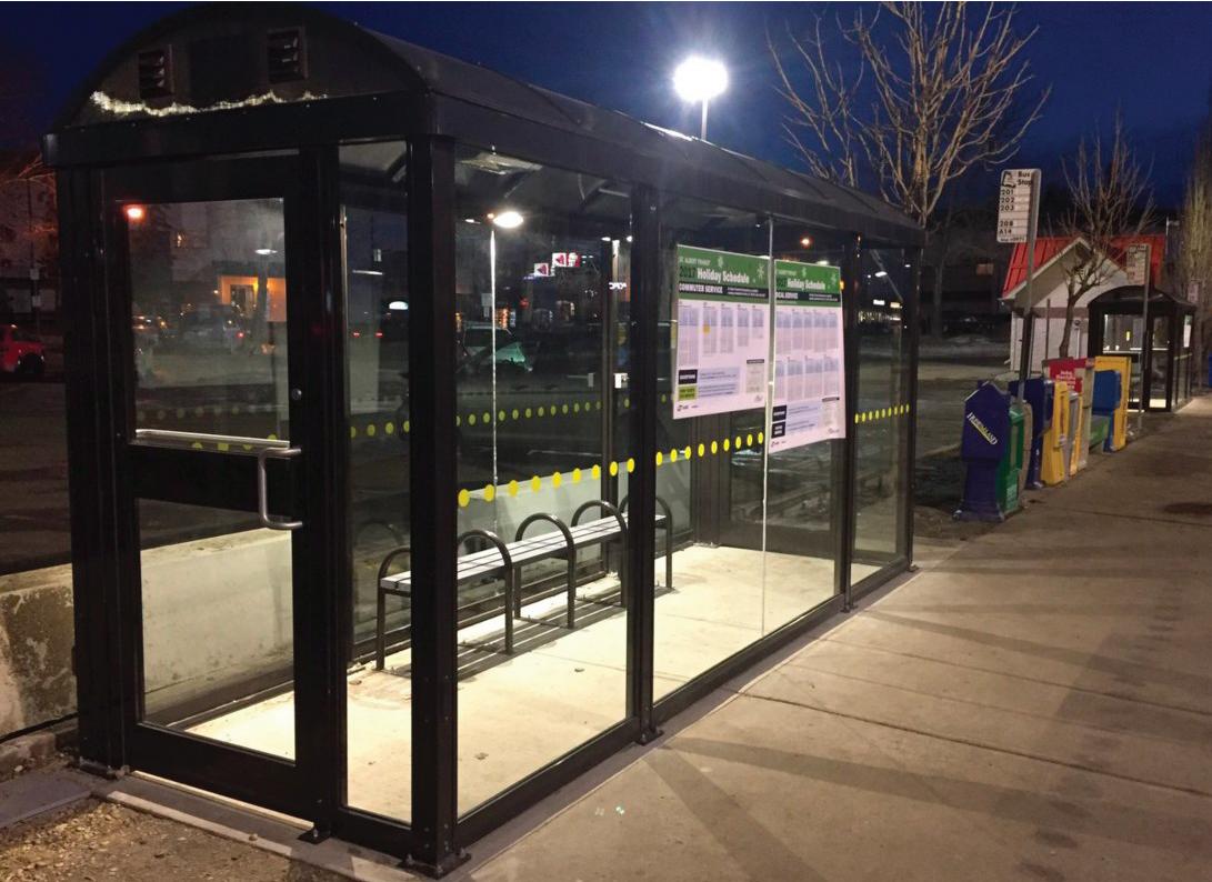
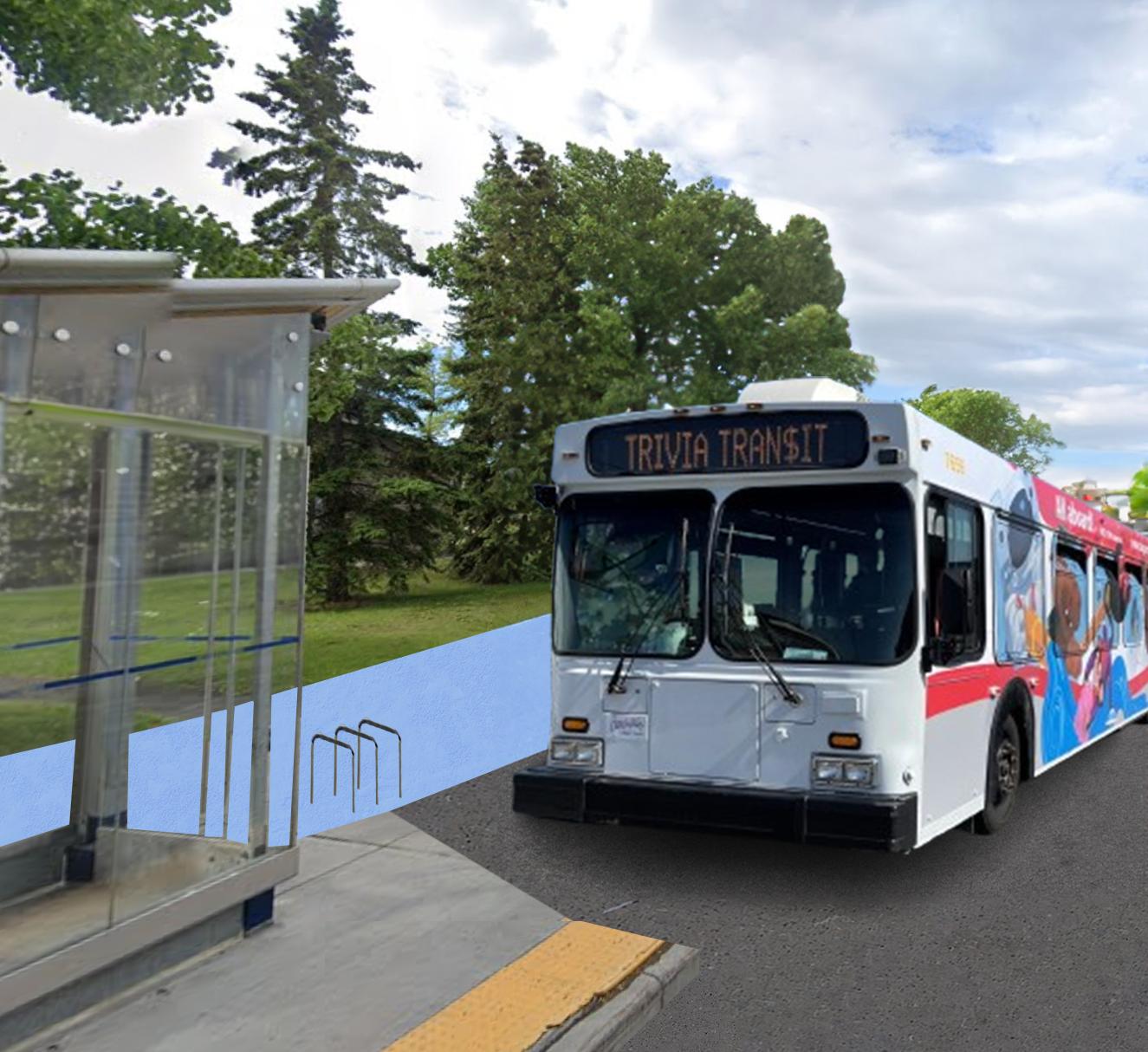
The design highlights shared pathways with wide bi-directional lanes for bikes and pedestrians, enhancing the commuting experience. Multi-modal connectivity is emphasized with bike racks, scooters, a heated bus shelter, and safety features like lit bollards. These elements promote usage of active transportation modes, ensuring accessibility and safety for all users.
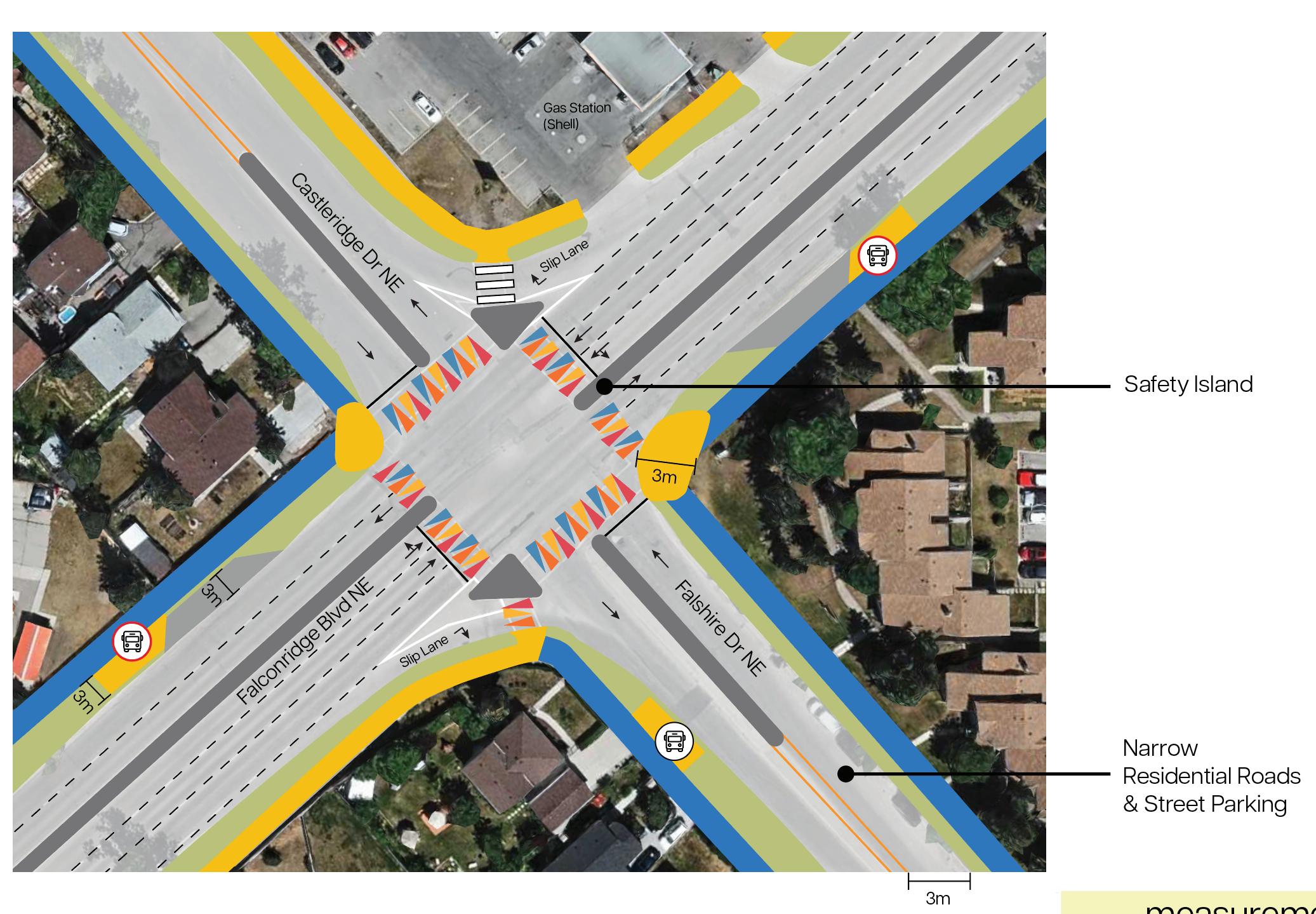
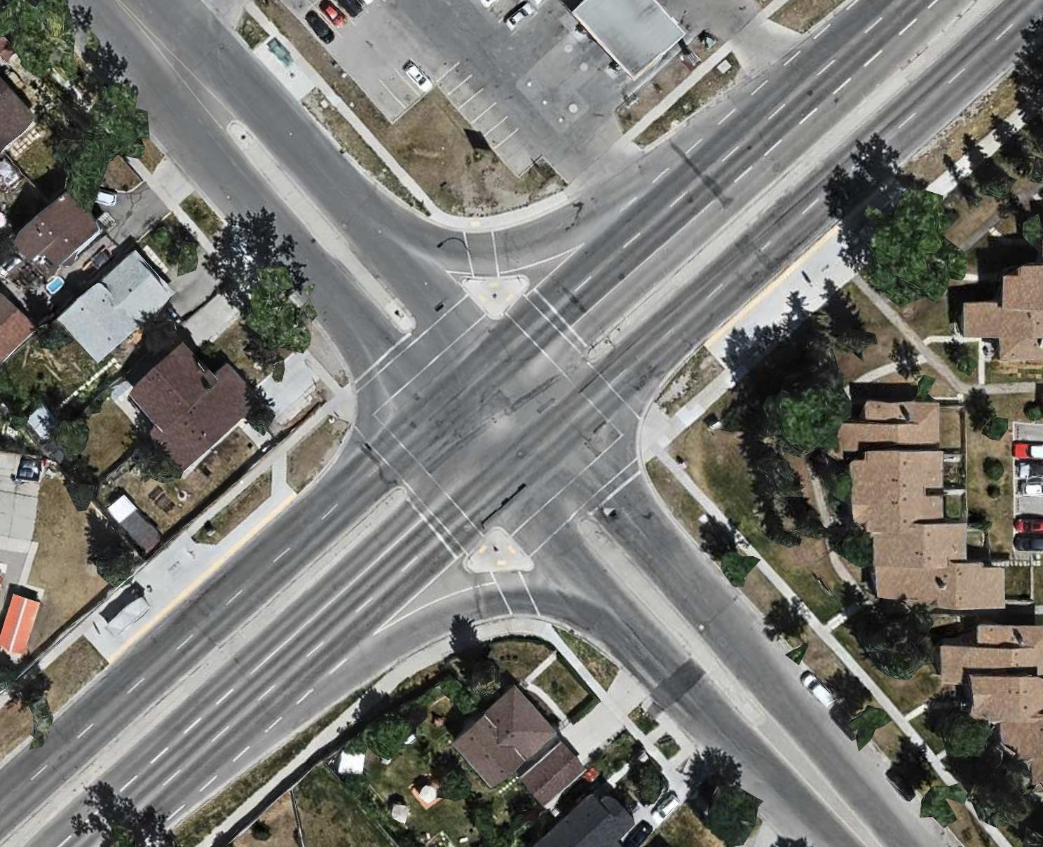
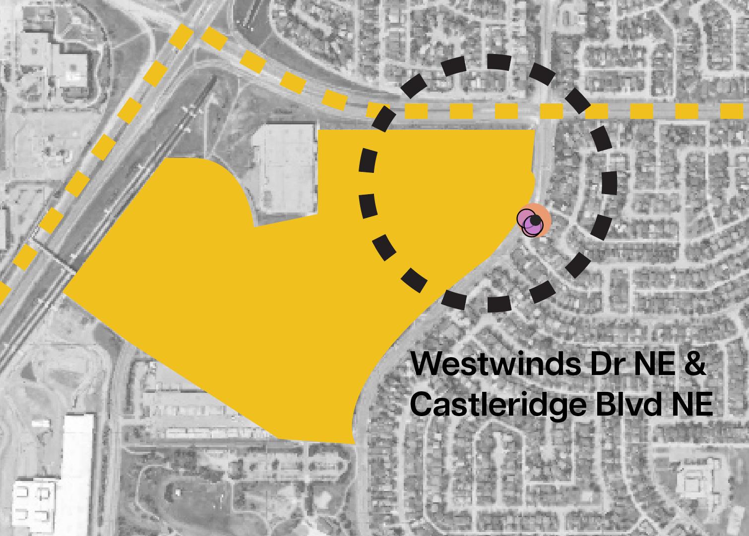
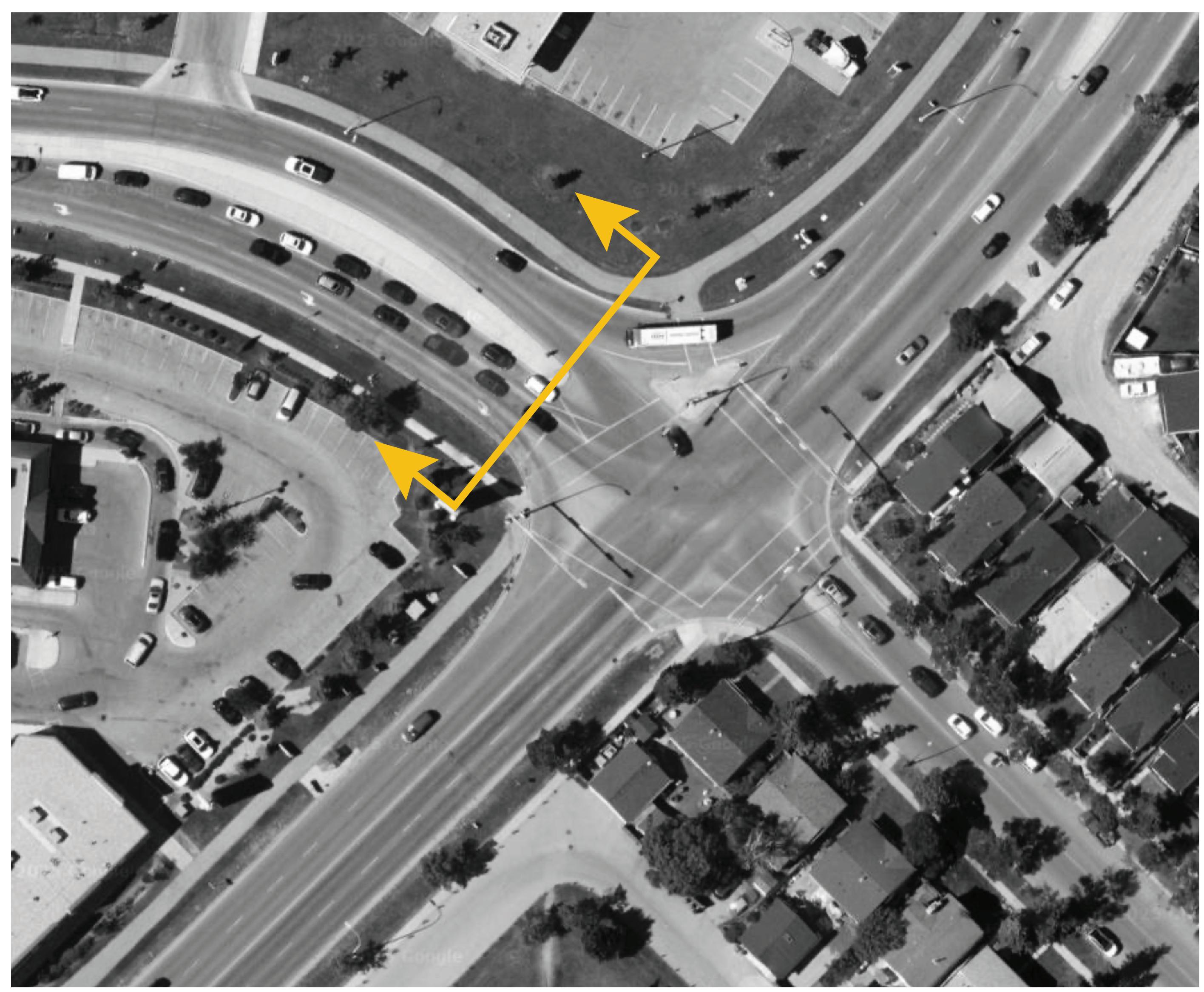
This area has a history of frequent traffic incidents, as it merges the main arterial and collector roads at the top-center of the site.
Building off the safety principles, key features include a dedicated bus station with heated shelters to keep buses separate from general traffic, improving flow and reducing wait times.
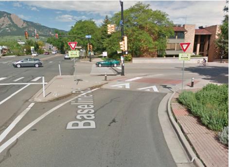
Although the slip lane must remain for arterial-collector connection (as per Calgary’s 2020 “Design Guidelines for Subdivision Servicing”), a raised crosswalk enhances pedestrian safety while allowing drivers to save time.
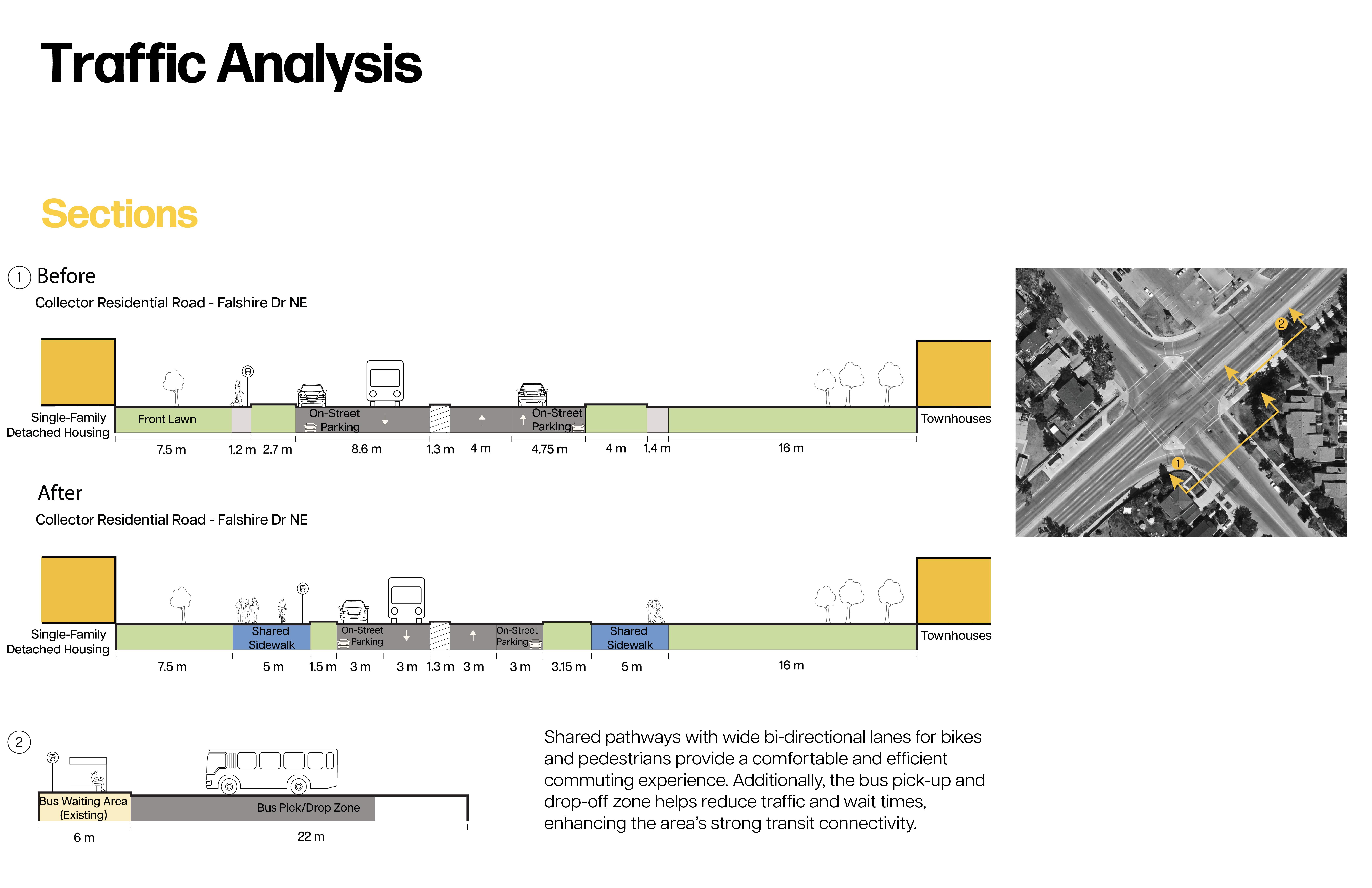

The heated bus shelters and bus pick-up/drop-off zone complement the activated frontage of the mixed-use hub. Together with shared pathways, these interventions encourage vibrant activity, promotinga seamless and engaging experience for both pedestrians and cyclists.
A draft of our proposed open space interventions including the proposed 5A network.
A first render of the pathway extension from the community association to Falconridge School. The Steering Committee commented that the pathway’s extent should go farther north and south than just these landmarks.
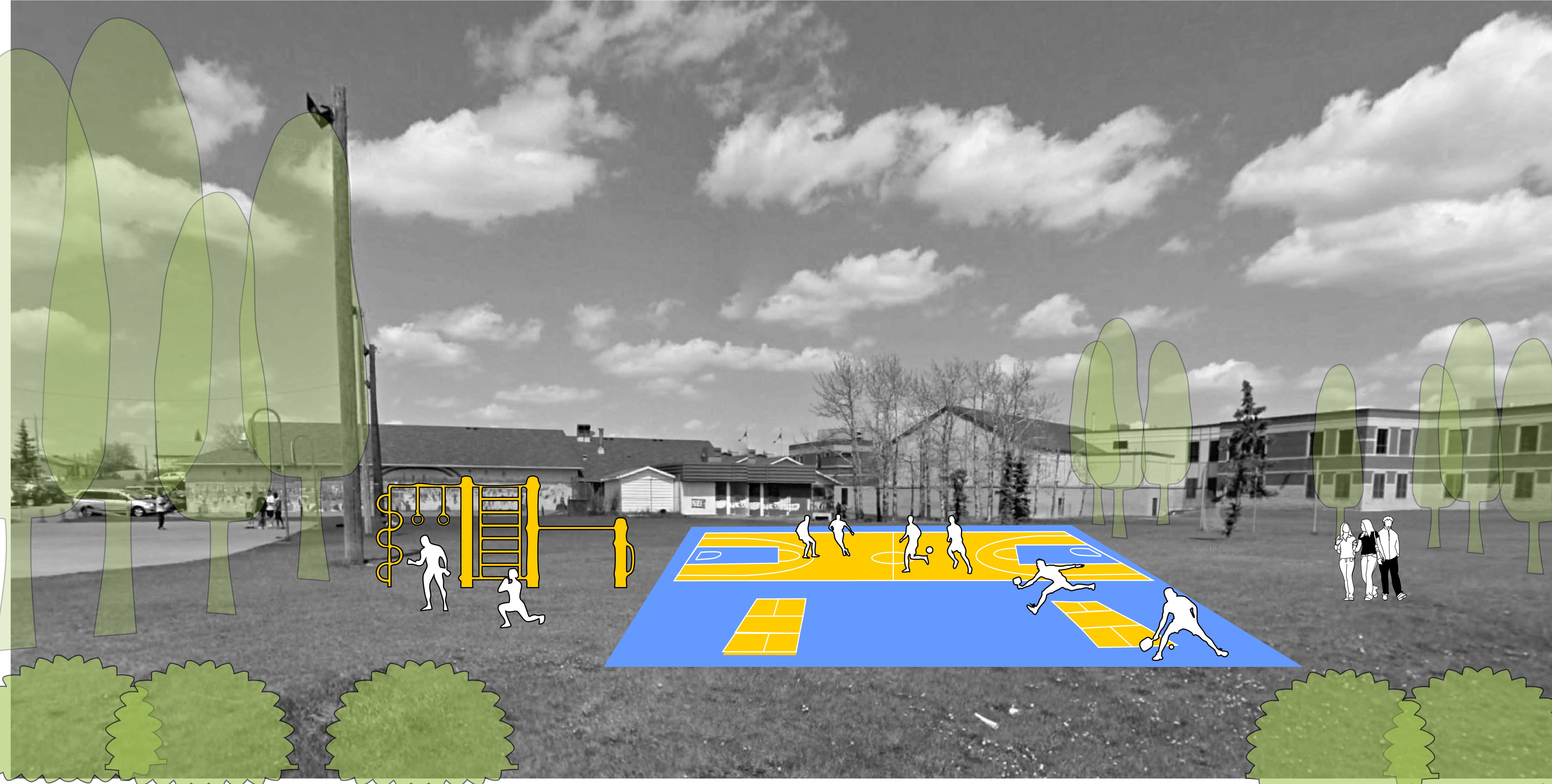
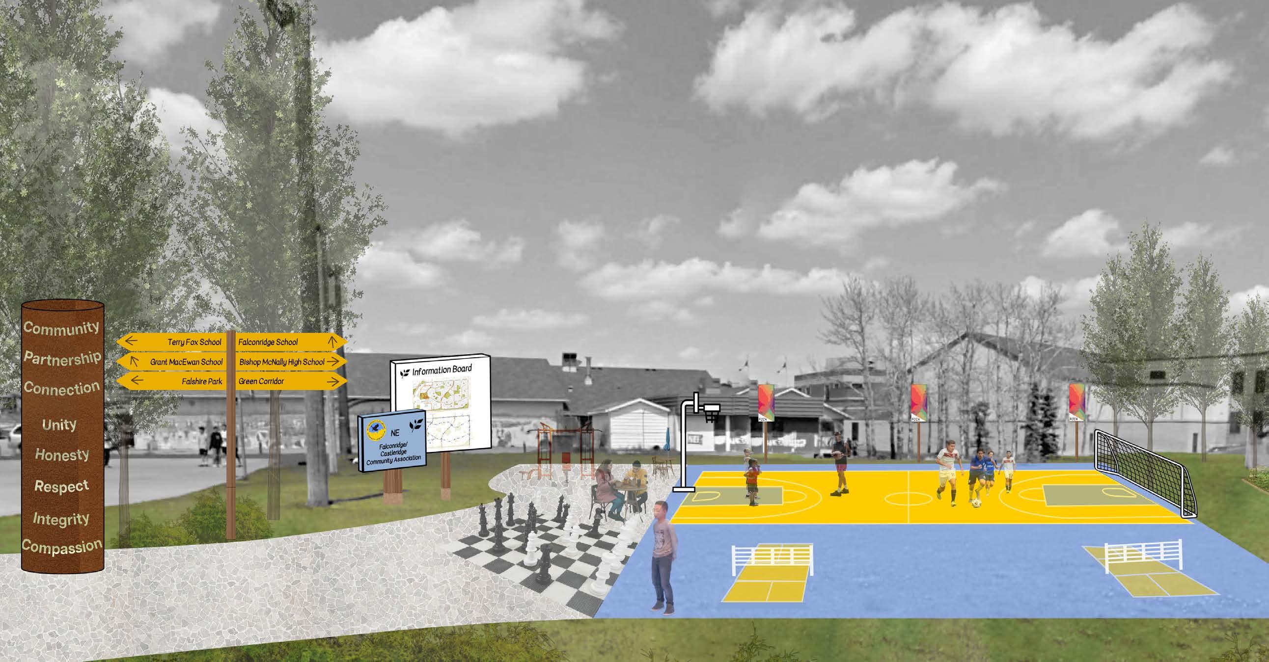
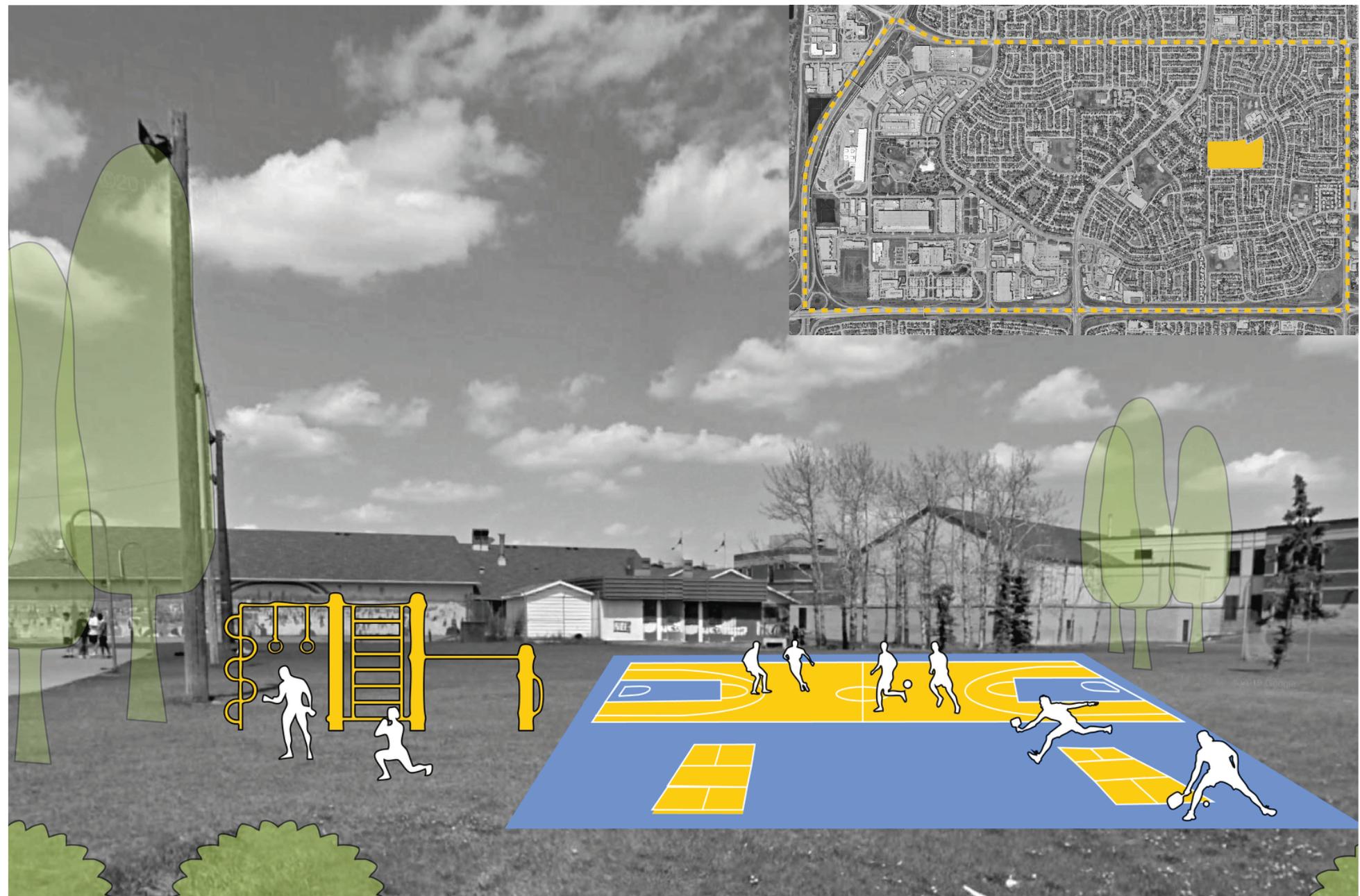
A render of our proposed multi-sports court behind the community association. Beside it is an outdoor fitness gym and some additional plantings bordering these features.
Currently there is only a group of trees beside the community association.
“Neighbourhood Commercial areas are characterized by the widest range of commercial uses compared to other urban form categories. Buildings are oriented to the street with units that support commercial uses on the ground floor facing the higher activity street with a range of uses integrated behind or located above. Commercial frontages have frequent entrances and windows along the street to encourage pedestrian activity.” (Heritage Communities LAP)
Neighbourhood Commercial has been applied to areas with intention to create mixed-use nodes throughout Falconridge Castleridge and Westwinds
Neighbourhood Flex
“Neighbourhood Flex areas are characterized by a mix of commercial and residential uses. Buildings are oriented to the street with units that may accommodate commercial uses, offices, personal services, institutional uses, recreation facilities, residential uses and, in areas also identified with the Industrial Transition, light industrial uses on the ground floor. Uses may be mixed horizontally or vertically within a building or a block.” (Heritage Communities LAP)
In Falconridge Castleridge and Westwinds communites, Neighbourhood Flex categories have been applied in areas where there is existing commerical forms and where there are intersections between high priority roads that will give the required carrying capacity for future commercial forms.
“Neighbourhood Connector areas are characterized by a broad range of housing types along higher-activity streets. These areas may accommodate smallscale commercial uses to meet residents’ daily needs and often provide connections to other communities. The public realm may include features such as wide sidewalks and cycling infrastructure.” (Heritage Communities LAP)
In Falconridge Castleridge and Westwinds communites, the Nrighbourhood Connector category is applied along connector and arterial roads to utilize the capacity of the roadways and spread the potential for mixed use throughout the community.
Centre
“Commercial Centre areas are characterized by hubs and corridors that support regional commercial activity, typically arranged in larger blocks in a non-grid pattern. These locations are serviced by public transit and are defined by direct vehicular access and large parking areas. Pedestrian activity primarily occurs along internal, private pedestrian routes. As redevelopment occurs, these sites are intended to support intensification through new buildings that frame public and private streets, improve connectivity and provide a comfortable pedestrian experience.“ (Heritage Communities LAP)
In Falconridge Castleridge, and Westwinds, the Commercial Centre urban form category is inteded to reimagine the large industrial commerical areas north of Prairie Winds Park
“Commercial Corridor areas are characterized by a range of commercial uses, typically concentrated at key nodes or along key corridors. Existing development may be vehicle-oriented, with parking areas between the building and the public street. As redevelopment occurs, the intent is that these sites will support intensification through new buildings that frame public and private streets, improve connectivity and provide a comfortable pedestrian experience.” (Heritage Communities LAP)
With the Falconridge Castleridge and Westwinds Communties, commerical corridor is to be applied to a regional commerical destination in an attempt to improve pedestrain access and experiences in the area.
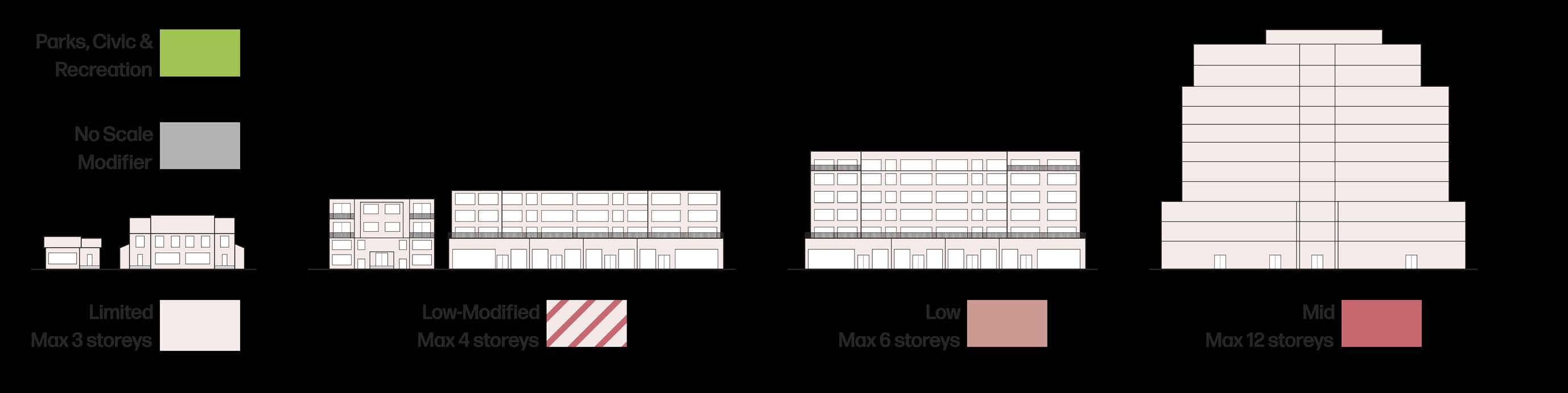
Limited Scale accommodates developments that are three storeys or less. This modifier includes a broad range of ground-oriented building forms, including single-detached, semidetached, rowhouses, townhomes, stacked townhomes, mixed-use buildings, commercial, and some industrial buildings.
Development in Limited Scale areas should be three storeys in height or less.
Development in Limited Scale areas may limit building mass above the second storey in Neighbourhood Local areas.
In Neighbourhood Connector and Neighbourhood Local areas, each residential unit in Limited Scale Areas should have an individual entrance at grade.
Low–Modified accommodates developments that are four storeys or less. This modifier includes forms such as, but not limited to, single-detached, semi-detached, duplex, rowhouse residential development, apartments, stacked townhouses, stand-alone or small mixed-use buildings.
Low Scale accommodates developments that are six storeys or less. This modifier includes forms such as apartments, stacked townhouses, mixed-use, office and industrial buildings.
Mid Scale accommodates developments up to twelve storeys in height. This modifier includes forms such as apartments, offices and mixeduse buildings in a variety of configurations.
Development in Low Scale – Modified areas should be four storeys or less in height.
• Development in Low Scale areas should be six storeys or less in height.
• Development in Low Scale areas should: be designed to reduce the impacts of wind at the ground floor and to optimize sunlight access to streets and open spaces; and, use variation in building heights, rooflines and massing to reduce building bulk, avoid long, uninterrupted building frontages and create architectural interest.
• Development in Low Scale areas may limit building mass above the street wall to provide separation between adjacent developments and maximize exposure to natural light.
Development in Mid Scale areas should be twelve storeys or less in height.
Development in Mid Scale areas should:
• be designed to reduce the impacts of wind at the ground floor and to optimize sunlight access to streets and open spaces; and,
• use variation in building heights, rooflines and massing to reduce building bulk, avoid long, uninterrupted building frontages and create architectural interest.
Development in Mid Scale areas may limit building mass above the street wall to provide separation between adjacent developments and maximizeexposure to natural light.
The final Master Plan for Castleridge Mixed-Use Hub has an arrangement of three new mixed-use buildings that utilize the site in a more productive way. This iteration significantly reduces the amount of land dedicated to onsurface parking and vehicle access to the sites, enhancing the pedestrian realm and creating a much more inviting area. Instead of keeping the original commerical form on the corner, a new six storey mixed use residential and commerical building takes the place. The orientation of the new building maximizes street frontage and produces an environment that will be attractive to residents and businesses.
The Castleridge MixedUse Hub Massing shows the intention that was given to integrating the new built forms into the surrounding community. The additional buildings demonstrate the scale modifications that surround the node and show the intention for the built forms to be integrated contextually by stepping the building form down where it meets existing residential.
Castleridge Mixed-Use Hub Before and After shows the proposed changes to the site and how these buildings will interact with the adjacent built forms. Shadow analysis was conducted and the buildings were situated and modified to minimize the impact that shadows will have on the adjacent buildings. This Before and After demonstrates the existing commerical which is one of only a few commercial areas that are dispersed throughout the residential areas of the community.
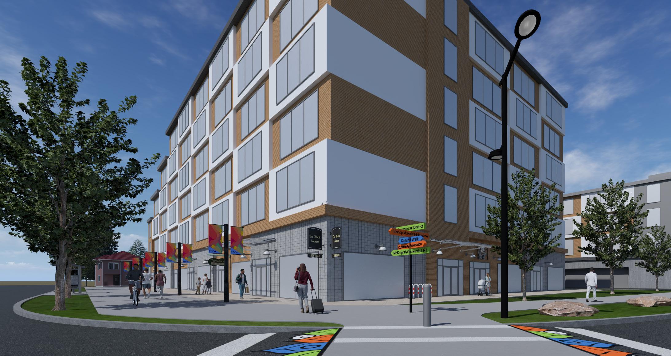
Castleridge Mixed-Use Hub showing pedestrian access to the site. The main interventions of the project are featured in this rendering enabling clear visualization of the space from a human perspective. This view shows the vertical integration of uses for the buildings on the site.
The final Master Plan for Westwinds Centre shows the progression of the most important concepts. With a significant reduction in parking and impermeable surfaces, the site now features a much more usable park space that allows for multi-season utilization. The site now makes use of the proposed building scale by increasing the building height of the east building to twelve storeys. With proximity to Mcknight-Westwinds LRT station, Westwinds Centre acts as a Transit Oriented Development and creates an attractive desitination for residents to Live, Work, and Play.
Westwinds Centre
Massing shows the proposed building heights for the node and how the integration of uses into each new building. These forms have been intentionally designed to utilize the site and produce an attractive destination for residents of the node and the surrounding community. This massing image also serves to contextualize the proposed building scale changes for the areas that surround the node. These surrounding buildings demonstrate the intention to transition the scale and density in relation to the adjacent single-family houses.
Westwinds Centre Before and After shows the proposed changes to the site and how these buildings will interact with the surrounding areas. As is apparent, the node will replace large surface parking lots and underutilized open spaces. This rendering shows the propsed multi-use pathway and the built forms for the node. The parking that the site will replace will be relocated underground similar to the University District precedent.
Westwinds Centre Pedestrian Entrance showing pedestrian access to the site. The main interventions of the project are featured in this rendering enabling clear visualization of the space from a human perspective.
1. Community Banners
2. Painted, Raised Crosswalk
3. Wayfinding Signage
4. Wide, multi-use Pathway
5. Street Trees
6. Illuminated Bollards
7. Street Lighting
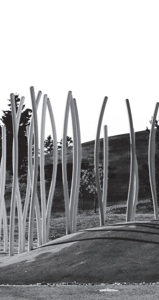
1. Themed Sculptures
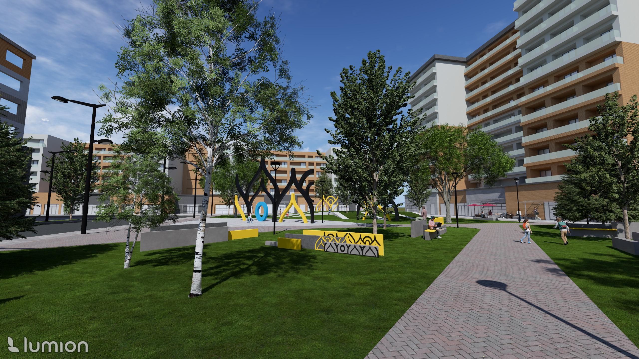
As a view of the Westwinds Centre Plaza, this rendering demonstrates the most important aspects of the plaza. The mix of all of the elements from a human perspective allows clear visualization for the proposed vision of the site.
2. Cafes
3. Surrounding Businesses
4. Native Plantings and Green Space
5. Themed Seating/ Sculptures
6. Residential Facing Park
Lighting
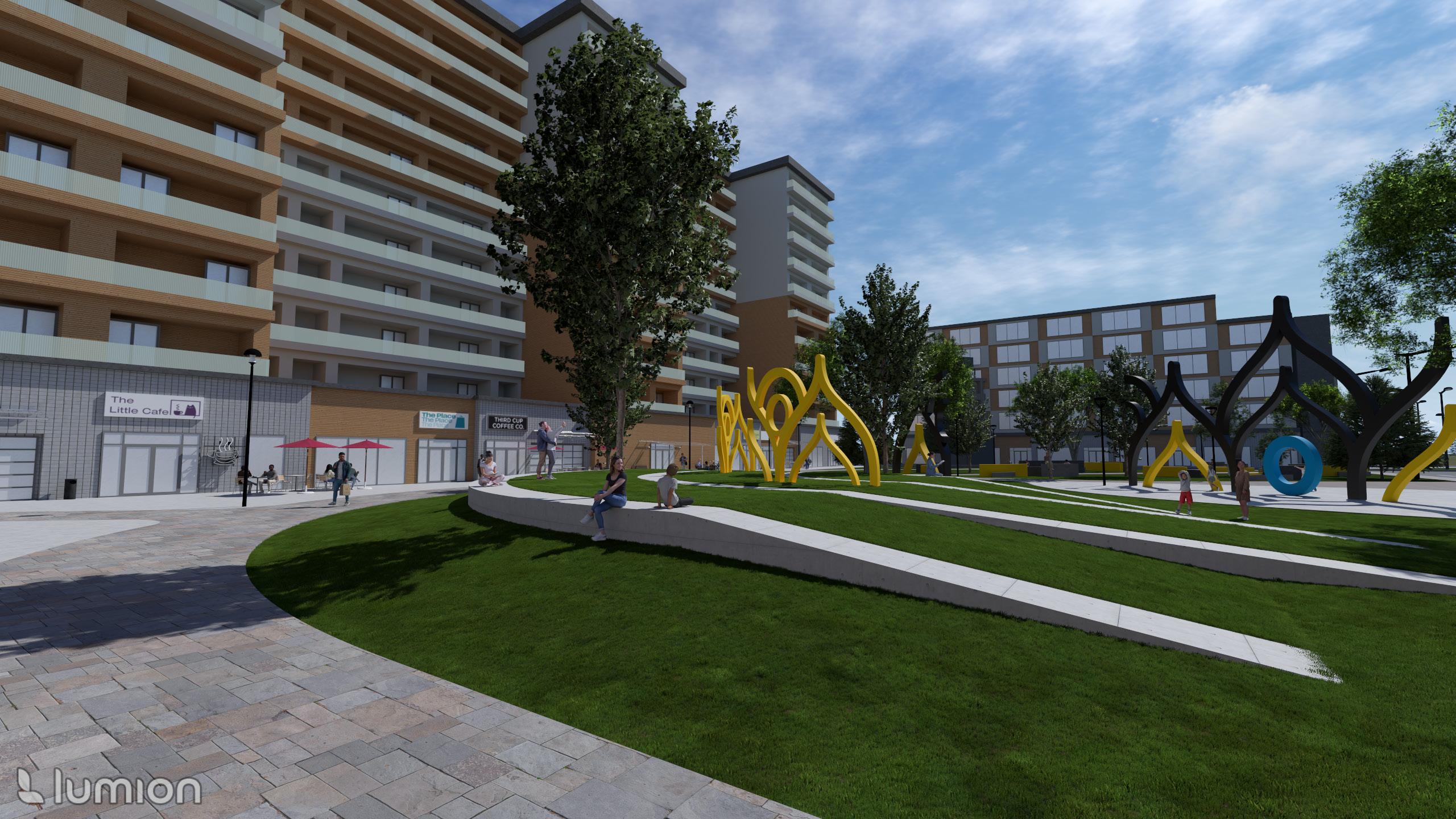
Another view of the Westwinds Centre Plaza, this rendering demonstrates the pedestrian experience for the cafes and businesses that surround the plaza. Large patio spaces allow the businesses to have outdoor seating and rolling doors to encourage spillover into the plaza increasing the utilization of the areas.


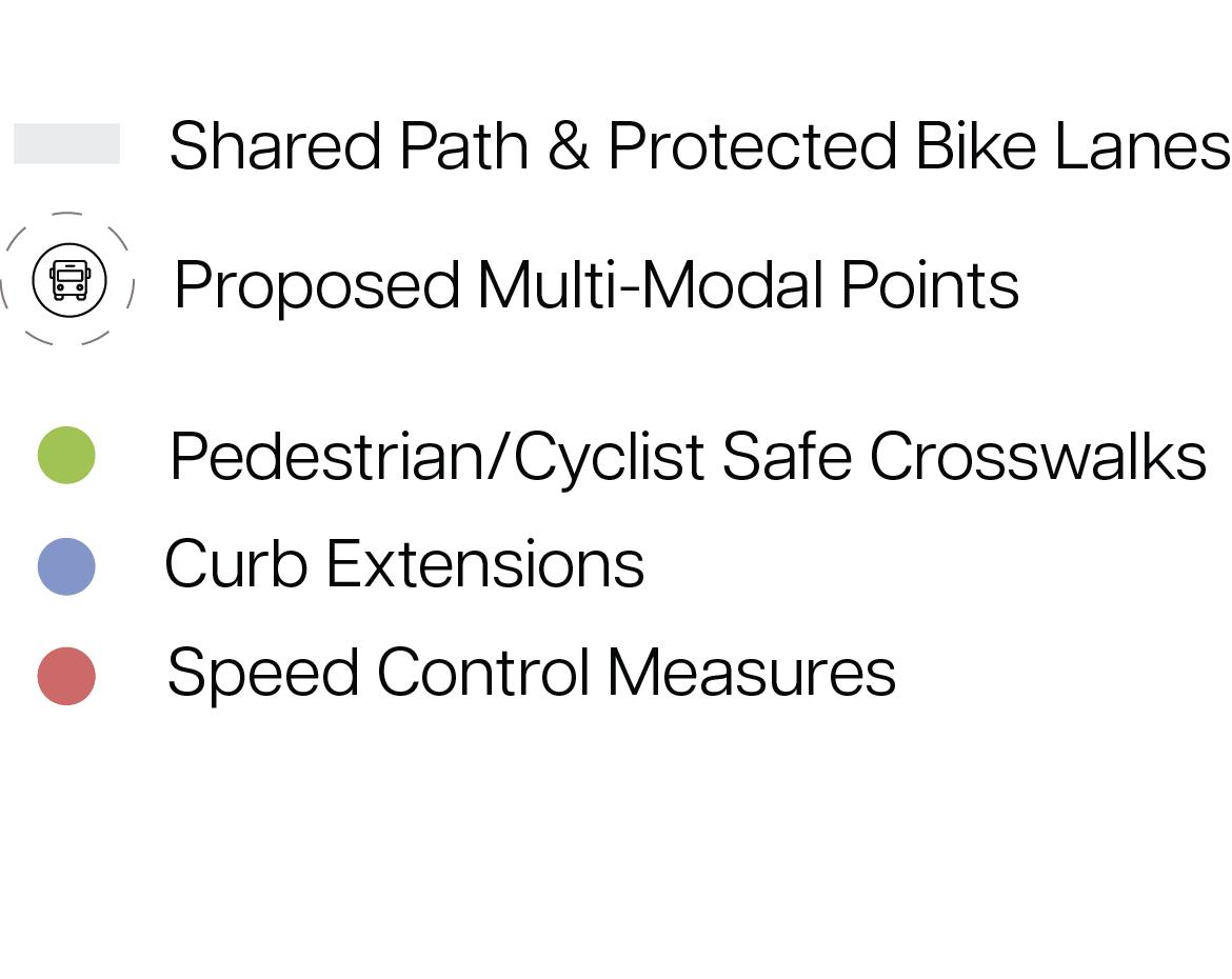
To enhance safety, best-practice traffic calming measures will be implemented at high-incident intersections and high-traffic roads. These interventions included bulb-out intersections, crosswalk modifications, speed control measures, and increased lighting and visibility.
To further support mobility, multi-modal connections are enhanced through first-last mile connectivity at key locations such as the LRT station, multicultural institutions, schools, and commercial areas—promoting active transportation. The 5A Network also expands shared pathways to bridge Falconridge and Castleridge, and to create seamless connections with Prairie Winds Park and the LRT station.


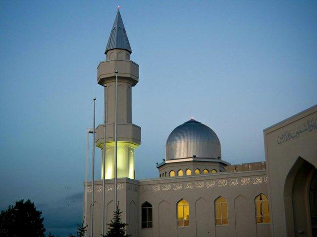
The community has responded positively to the initial traffic safety interventions, noting increased safety and an improved commuting experience. Key features include bulb-outs and green medians at crosswalk ends to improve pedestrian-vehicle separation, as well as median crosswalks that offer safe resting points. Painted crosswalks incorporate auspicious colours inspired by nearby mosques, celebrating the community’s cultural identity.
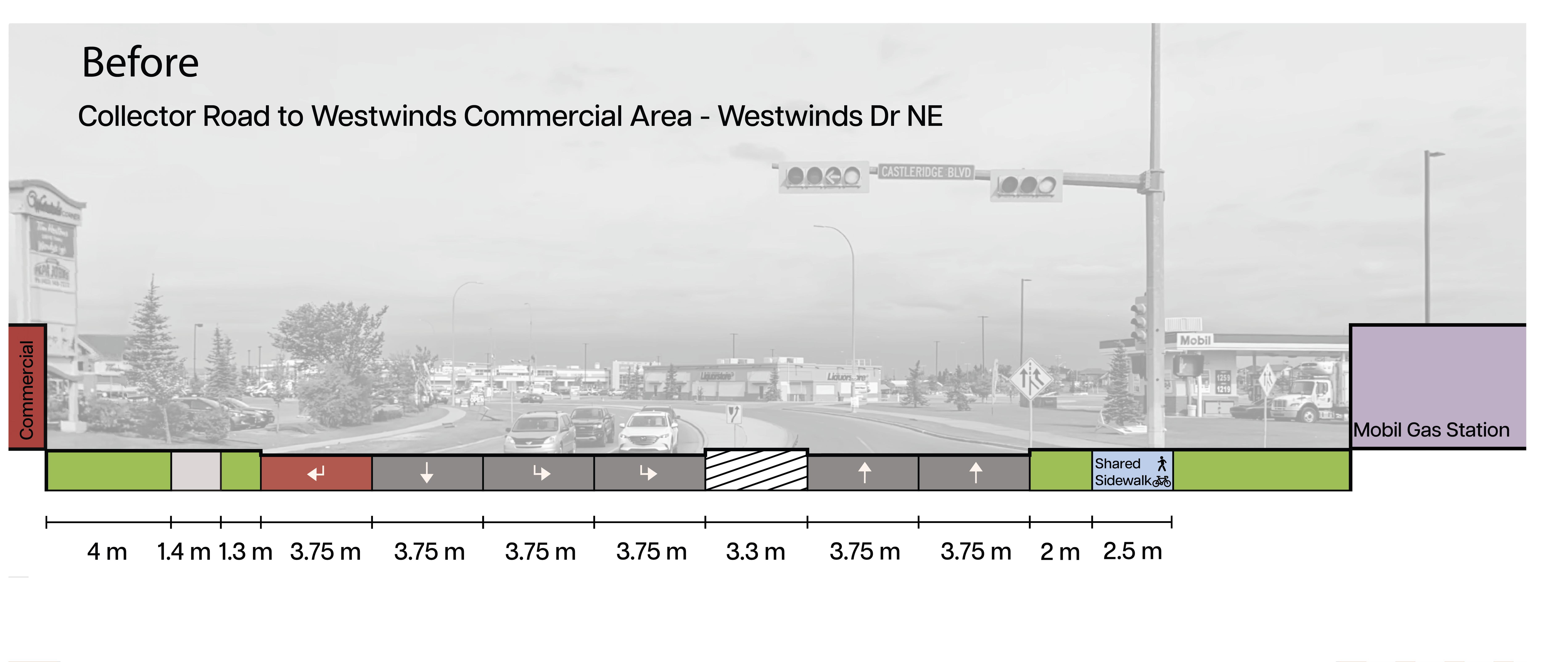
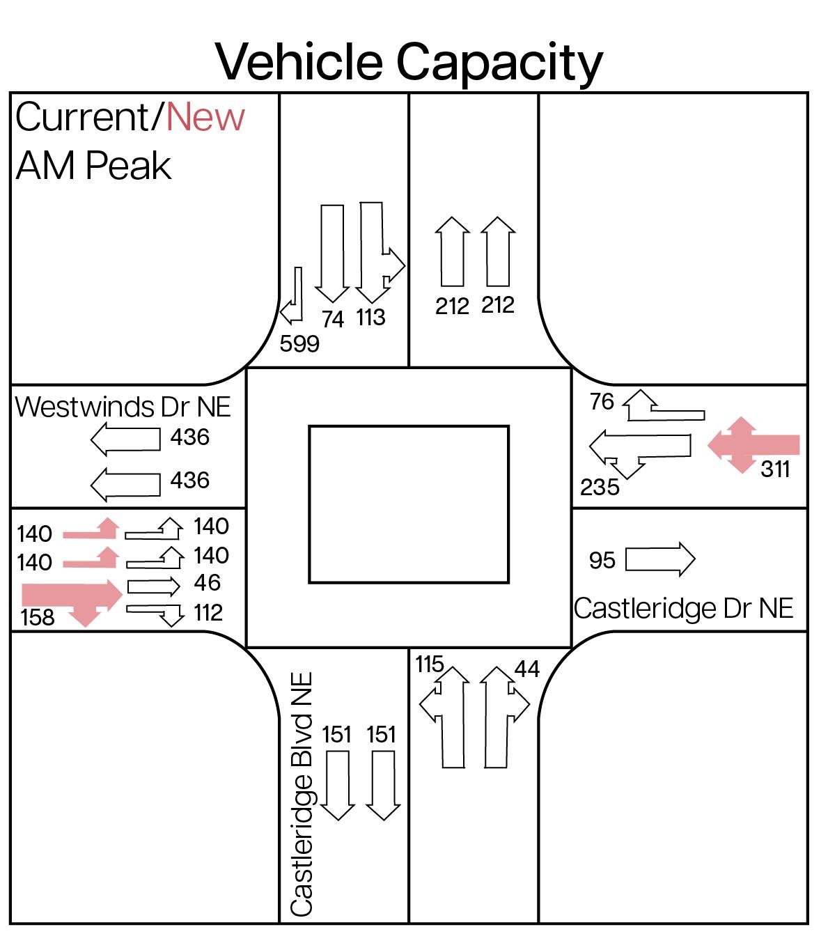
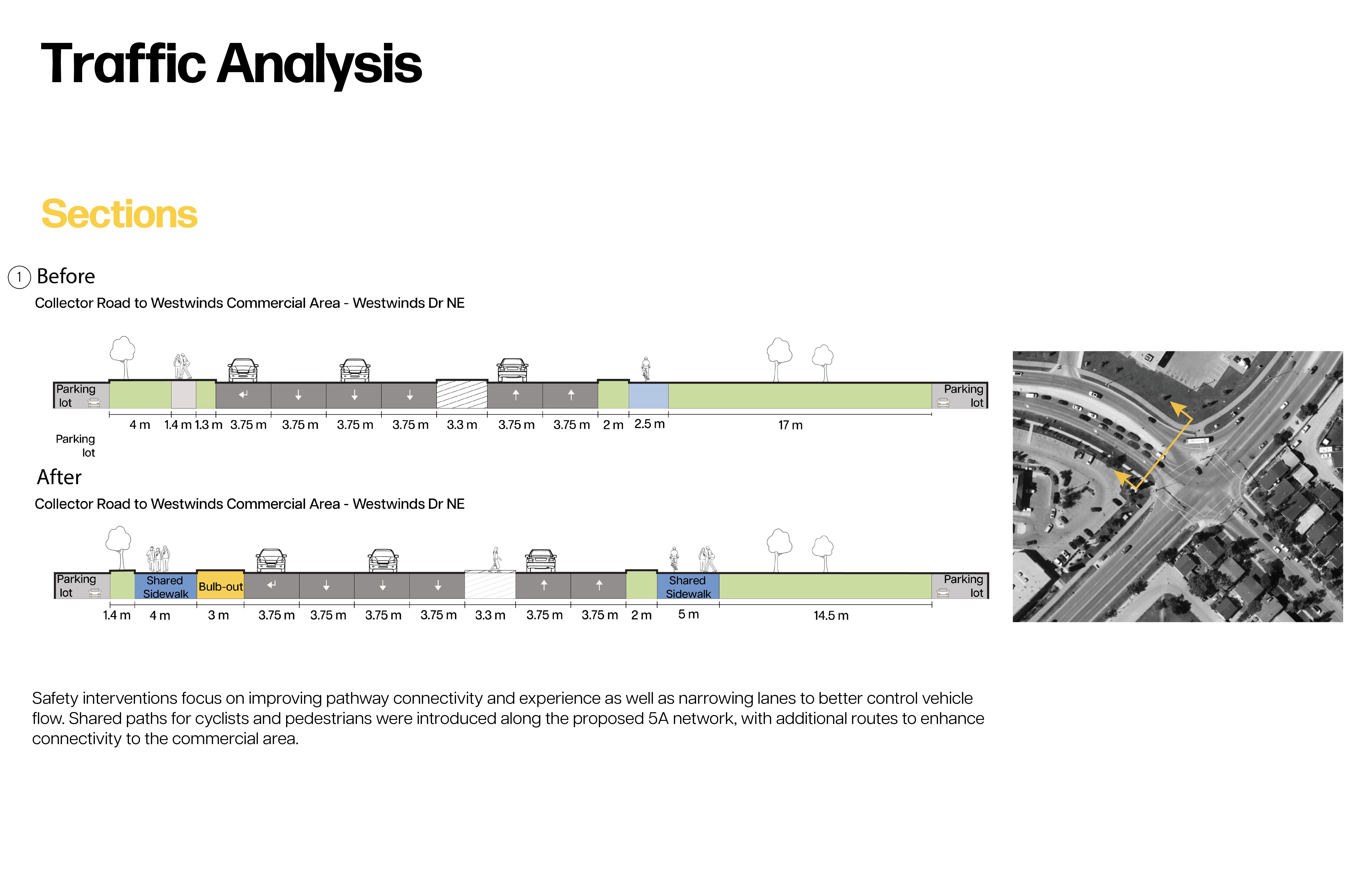
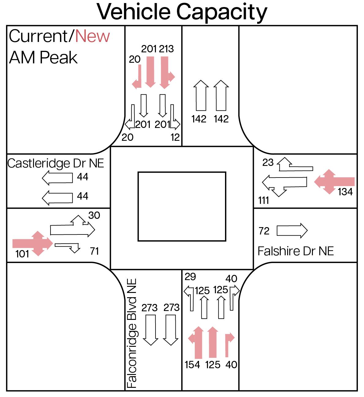
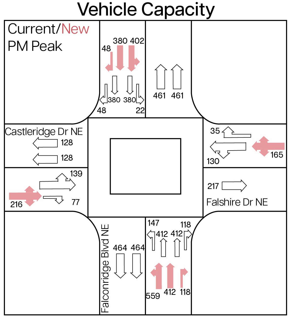
This road diet diagram illustrates projected AM and PM peak vehicle volumes through the area, showing how traffic flow is redistributed following lane removal. It demonstrates that even with reduced lane capacity, the reconfigured street can effectively accommodate projected traffic volumes —promoting pedestrian safety while maintaining smooth traffic flow.
Building on the interventions, the design is further refined through the removal of slip lanes and the implementation of road dieting to reduce vehicle dominance and speeding. Programmed green buffers have been added to further enhance pedestrian and cyclist safety. Together, these interventions create a calmer, more pedestrian and cyclist-friendly environment.
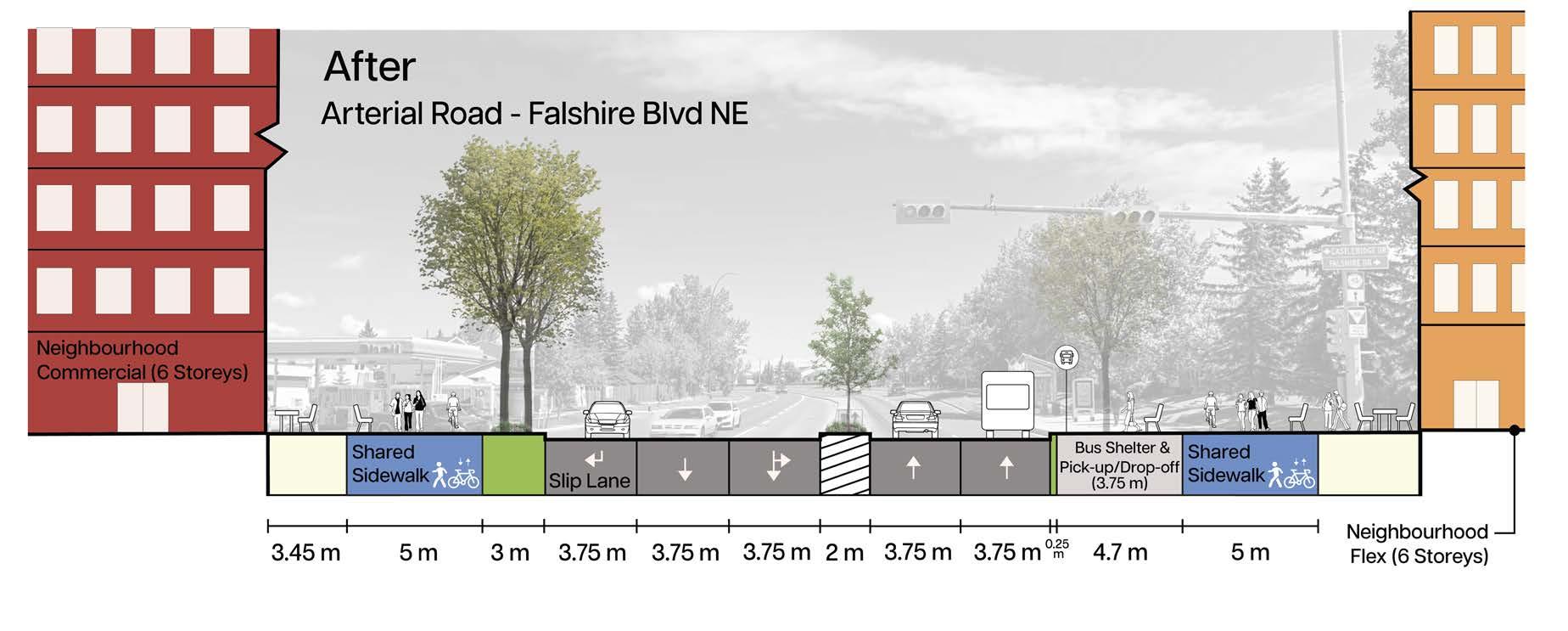
The arterial road required a more strategic approach due to its higher traffic volumes and connection from the collector road. Lane capacity has been minimized according to Calgary's Complete Street minimum standards. Safety and accessibility is also enhanced through realignment of crossings.
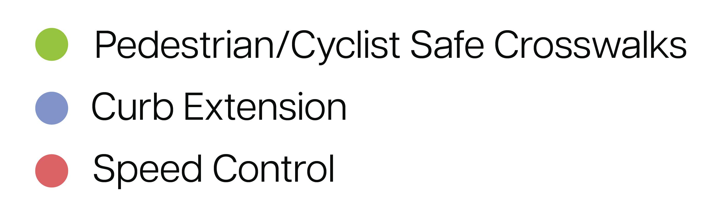
Main Interventions:
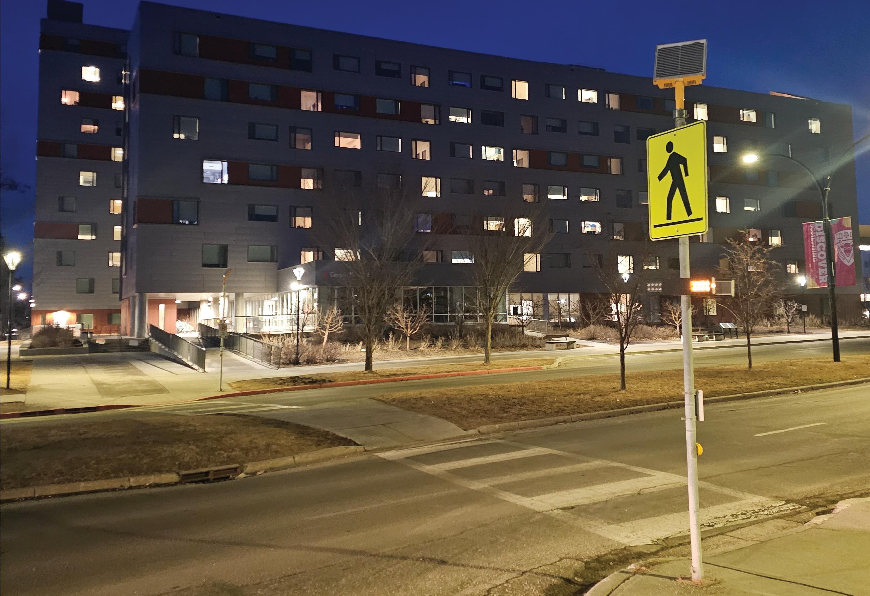
Pedestrian and Cyclist Safe Crosswalks: Provide right-of-way for pedestrians and cyclists on wide, bi-direction pathways and implement clearly-marked crosswalks Extension of the 5A Network (Always Available for All Ages & Abilities)

Traffic Calming measures (to give priority to pedestrians):
• Bulb-outs
• Lane reductions (road dieting)
• Green medians and green buffers
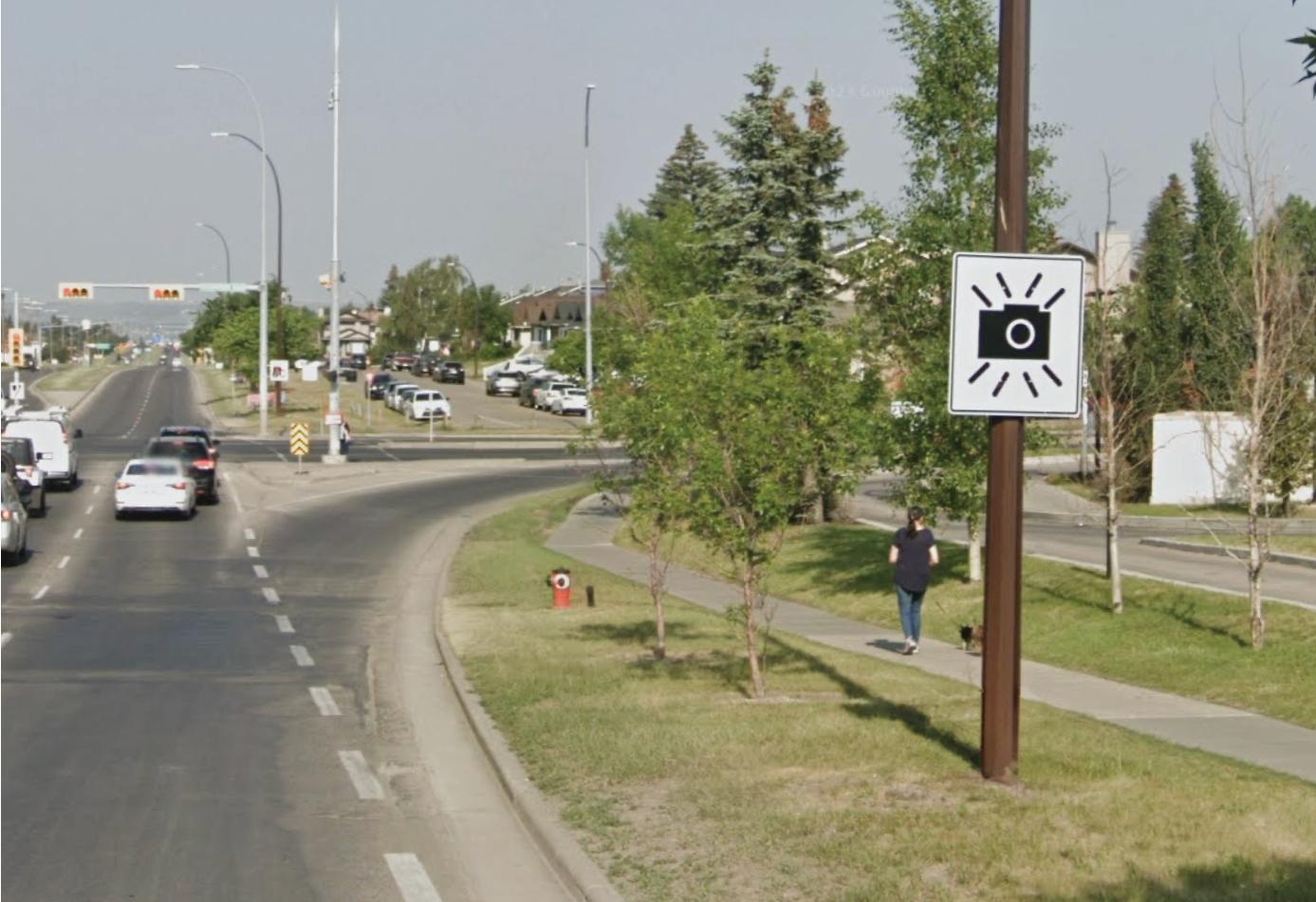
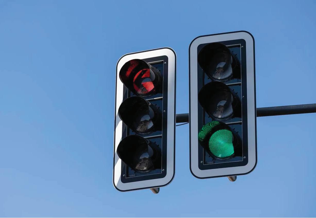
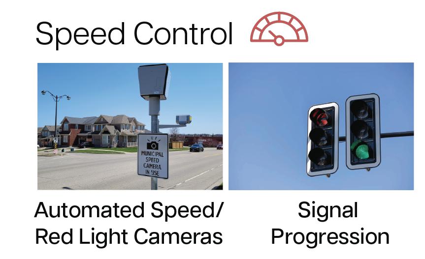
• Speed control through automated speed/red light cameras
Transit Improvements: Heated bus shelters to improve year-round usage and designated bus pick-up/drop-off zones to improve transit wait times and reduce vehicle congestion
Enhance Connectivity: Create multi-modal nodes for first-last mile connectivity at high-interest destinations throughout the community
Policies Support & Alignment:
• In alignment with Calgary’s 202 Transportation Plan
◦ Ensure transportation service and active modes are safe, efficient, and accessibility for all citizens
▫ Improve bus transit efficiency during on/off loading
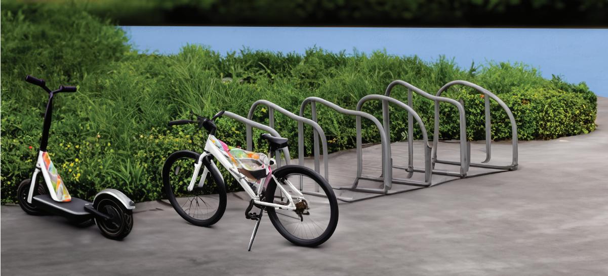
◦ Increase mobility options and designated bike/e-scooter parking
◦ Create Complete Streets
◦ Promote transportation safety workshops with the public and key stakeholders
The residential section provides even softer edges and increased greenery through programmed medians and overarching trees to create a calmer and quieter environment. Multimodal infrastructure continues to support active transportation right from the resident's doorstep.
◦ Ensure connectivity of bikes and e-scooters to the train and bus stations as well as for first-last mile
◦ Enhance corridors through 5A Network expansion
▫ Prioritize pedestrian and cyclist right-of-way
• Identify major traffic incident zones for strategic best-practice safety measures (based off lane sizes, incident history, and alignment with Calgary’s 2014 Complete Street Guide
• Establish a road diet in alignment with the minimum requirements of Calgary’s Design Guidelines for Subdivision Servicing 2020 and Calgary’s 2014 Complete Street Guide
• Establish active connectivity to the Westwind’s commercial hub and employment centers through TOD (Transit-Oriented Development) density and multi-modal nodes for first-last mile
• Ensure alignment of TOD density with multi-modal nodes and the Westwinds/McKnight LRT Station
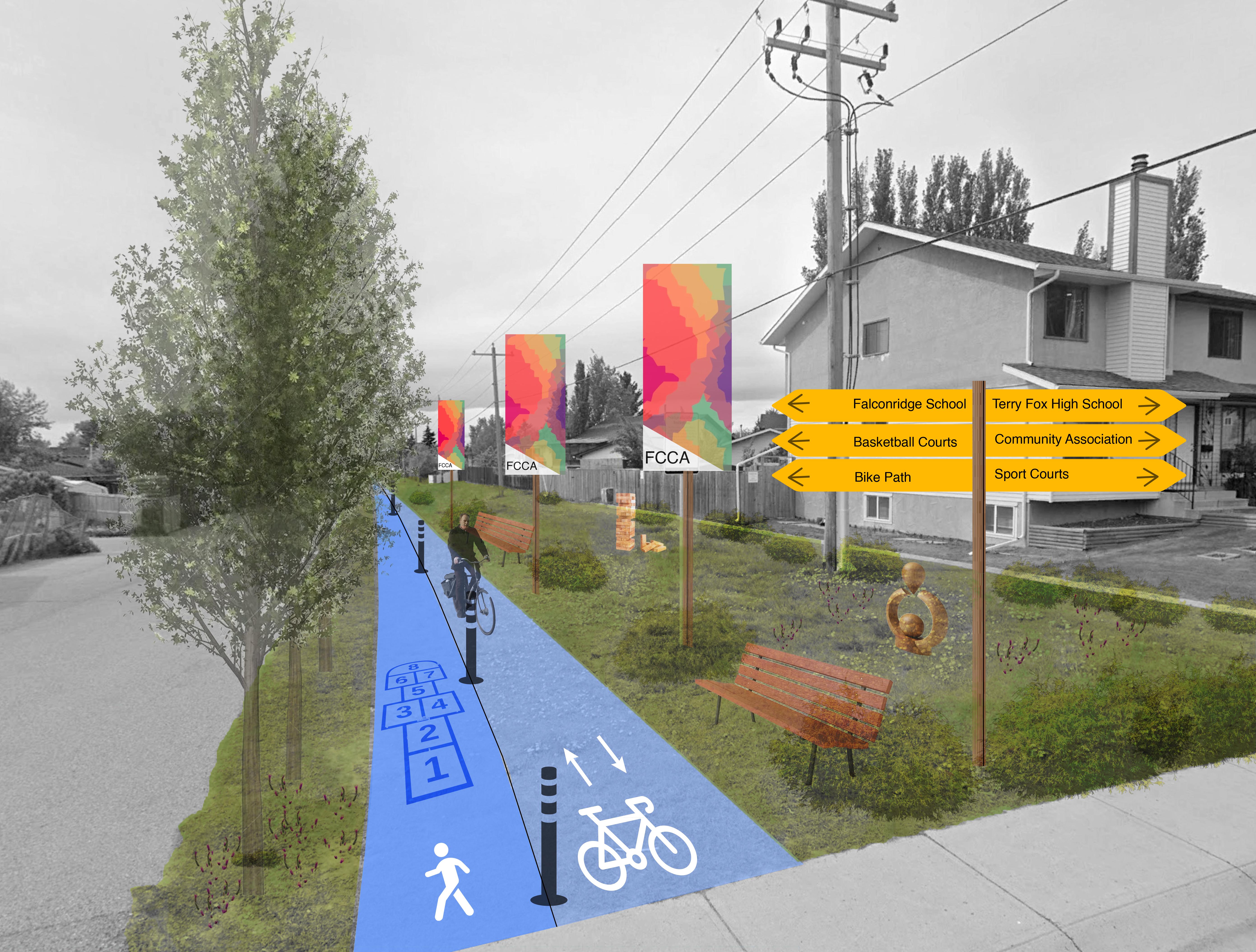
Our final render rof the pathway extension with a greater emphasis between the walking and biking paths as well as interactive games such as hopscotch along the walking path.
Other additional features include seating and plantings along the right side where the power lines are. Native plantings will also be found in this greenspace and games such as Jenga and art sculptures will line this path.
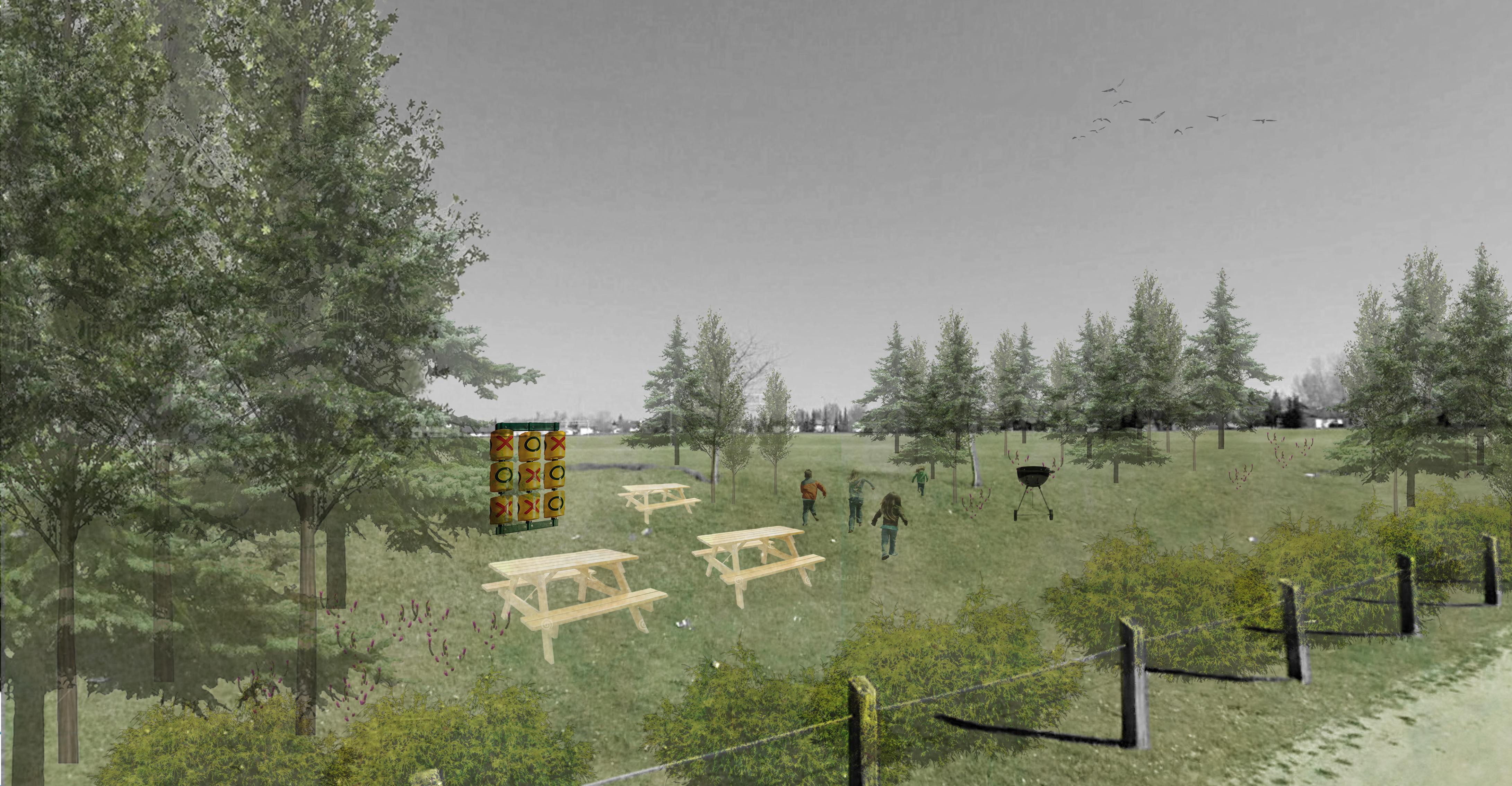
In our revision of the Castlebrook Park interventions we heard from the community and the steering committee that having games such as checkers and jenga in a space like this may not be sustainable because of theft. Instead there was a desire for picnic tables and barbecue pits because of the oversaturation of people in Prairie Winds Park.
The boulevard naturalization render at McKnight Blvd and Falconridge Blvd NE also includes signage we designed for the community and street trees.
Main Interventions:
• Extension of pathway
• Community Gardens and painted flower boxes
• Additional trees/plantings
• Renaturalization of areas next to major roads
Policies Support and Alignment:
Boulevard naturalization is a key solution to boulevard greenspaces that only contains grass and a skinny sidewalk currently.
• Align interventions with the Municipal Development Plan and the City’s Guidebook for Great Communities to enhance connectivity and accessibility within the community.
• Host workshops and educational programs aimed at teaching residents about gardening and promoting the advantages of community gardens.
• Provide grants to businesses and non-profits to support tree planting and care initiatives focused on Falconridge/Castleridge.
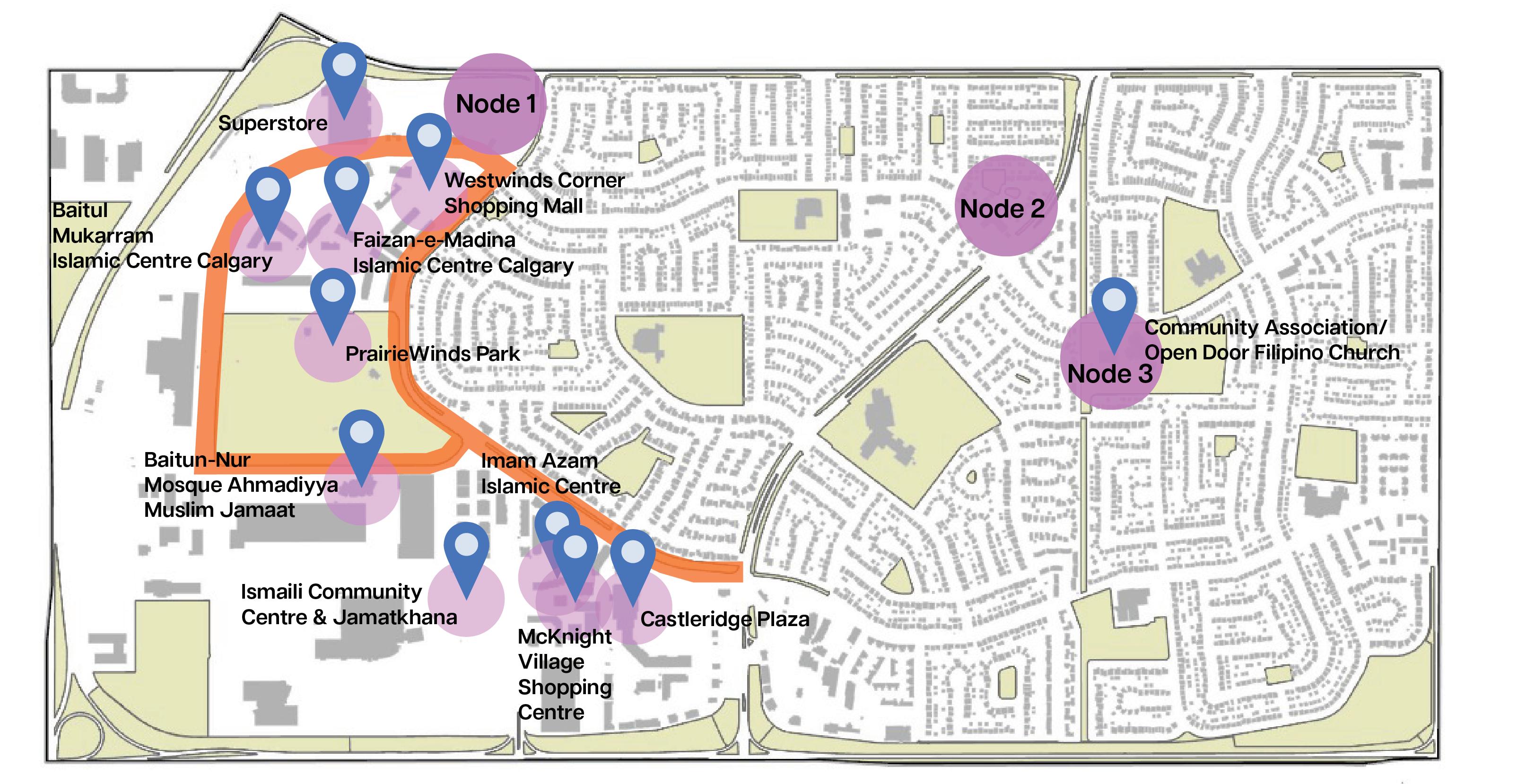
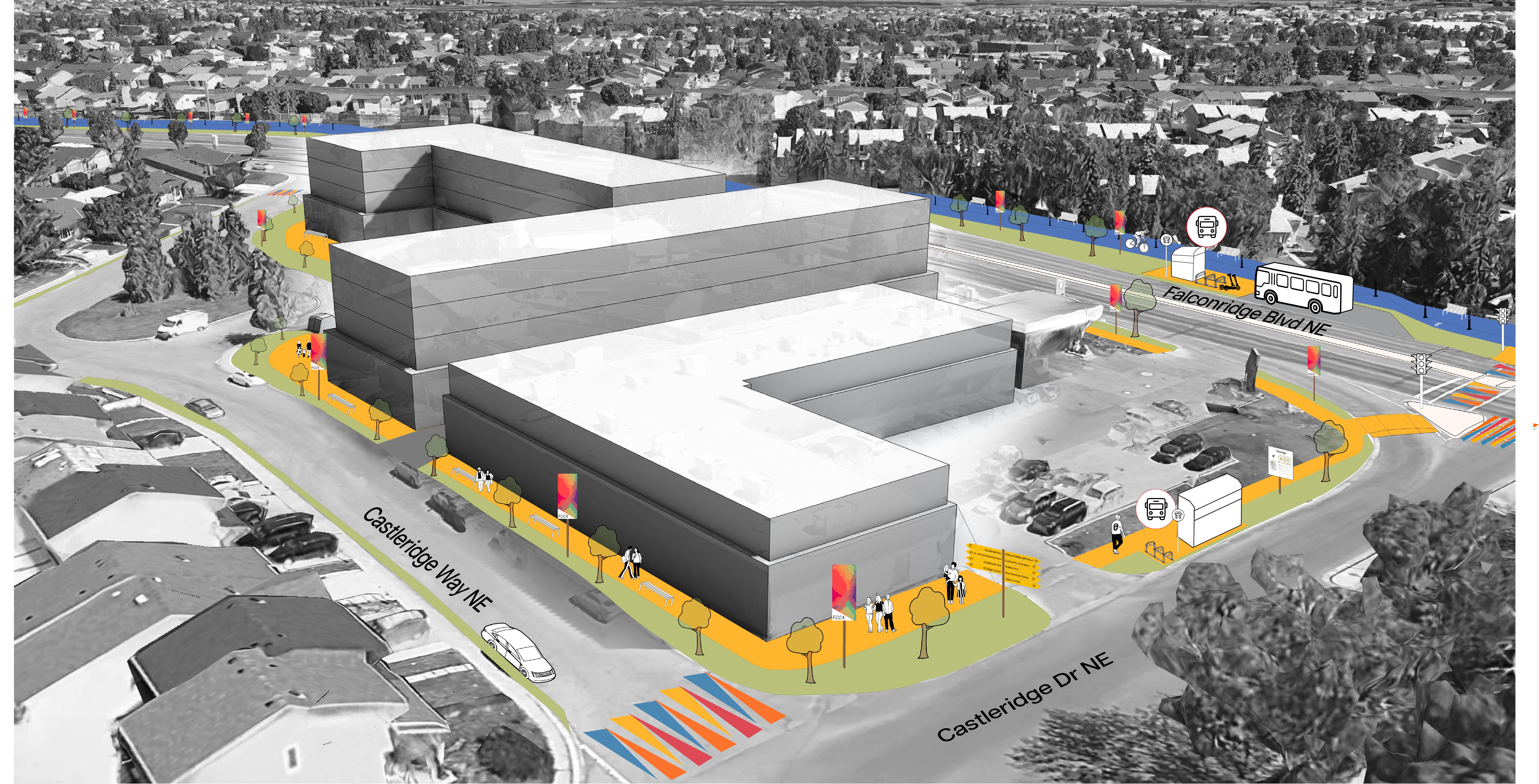
This strategy focuses on strengthening unity and community engagement by introducing cultural pathways and multi-lingual wayfinding signage to guide visitors to key multicultural destinations. In addition, the strategy promotes community active living through the development of programmed greenspaces and playgrounds.
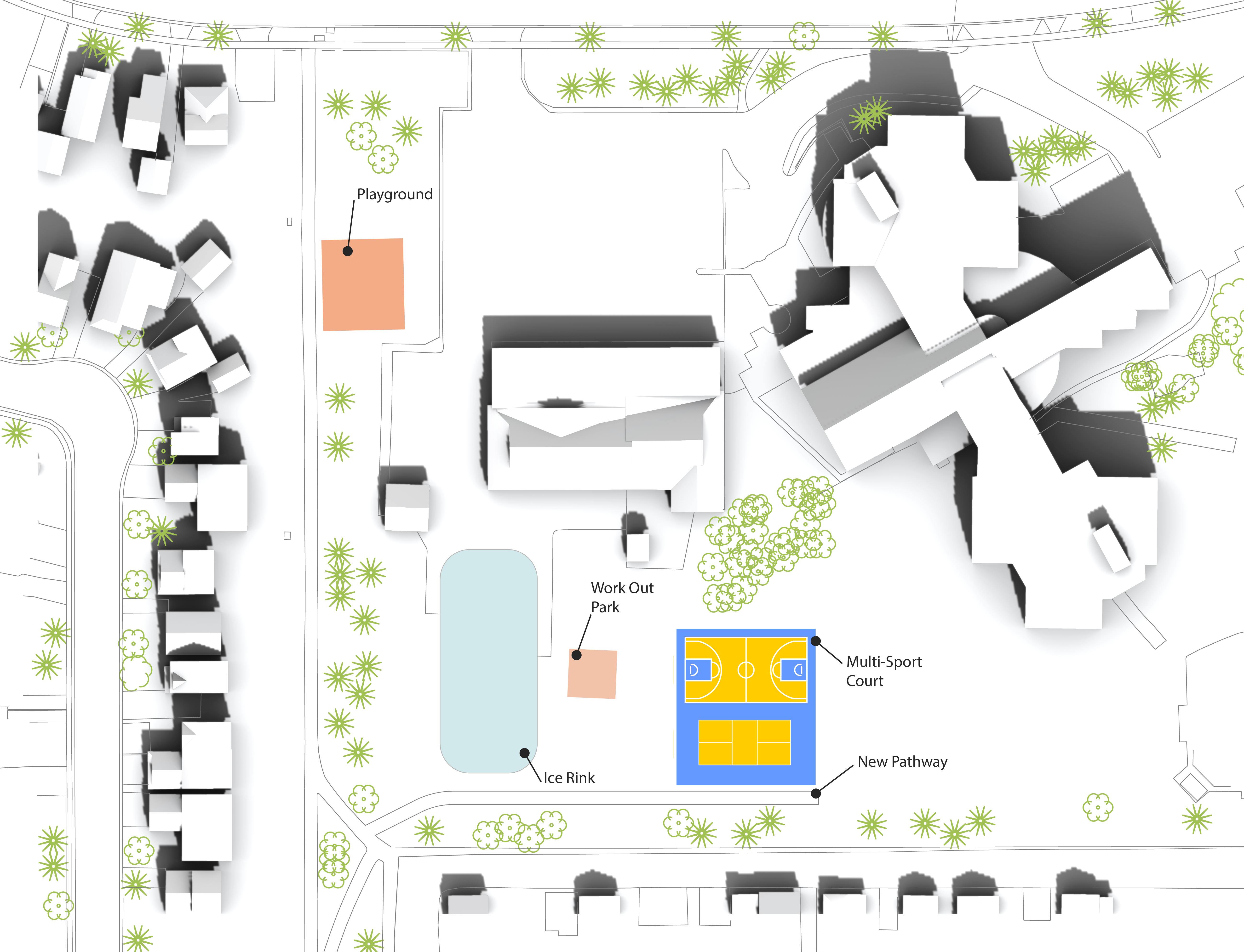


The site plan enhances community engagement by introducing three key elements: a playground, a multi-sport court designed around the community’s interests, and improved pathway connections for better accessibility.
Located beside Terry Fox School, the addition of a playground and a multi-sport court will enhance community unity and encourage greater social interaction, activating a field that is currently underutilized.
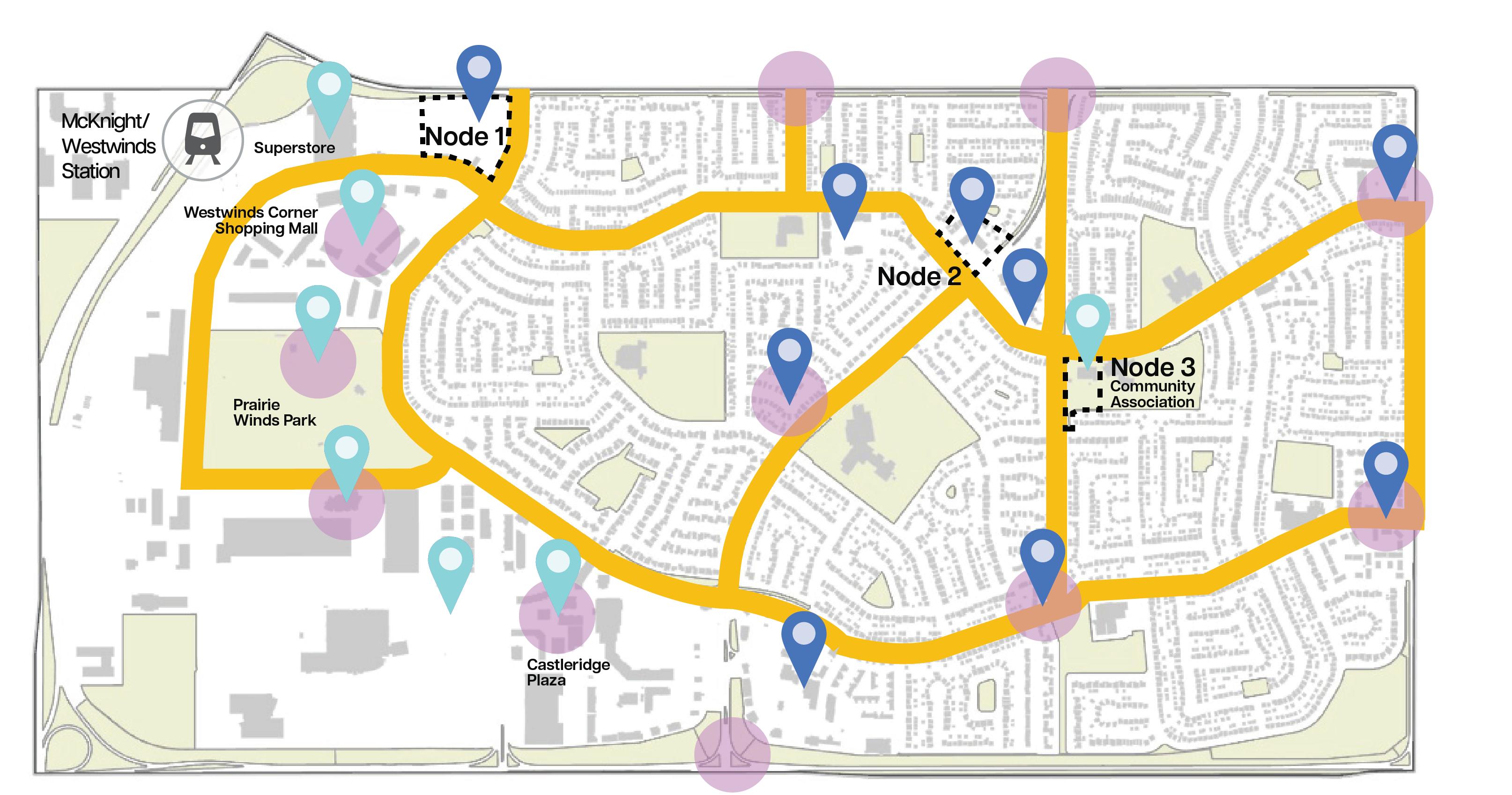
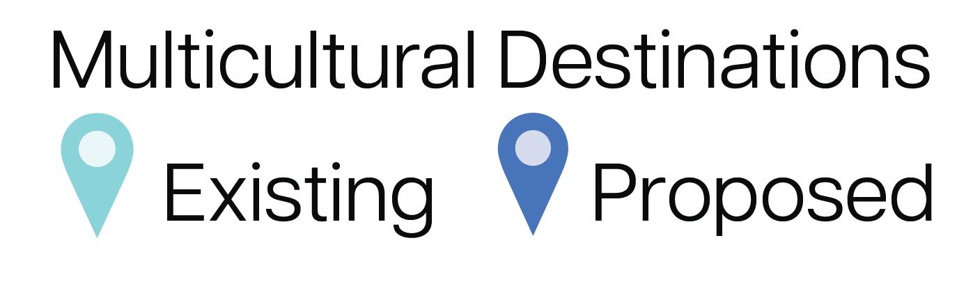


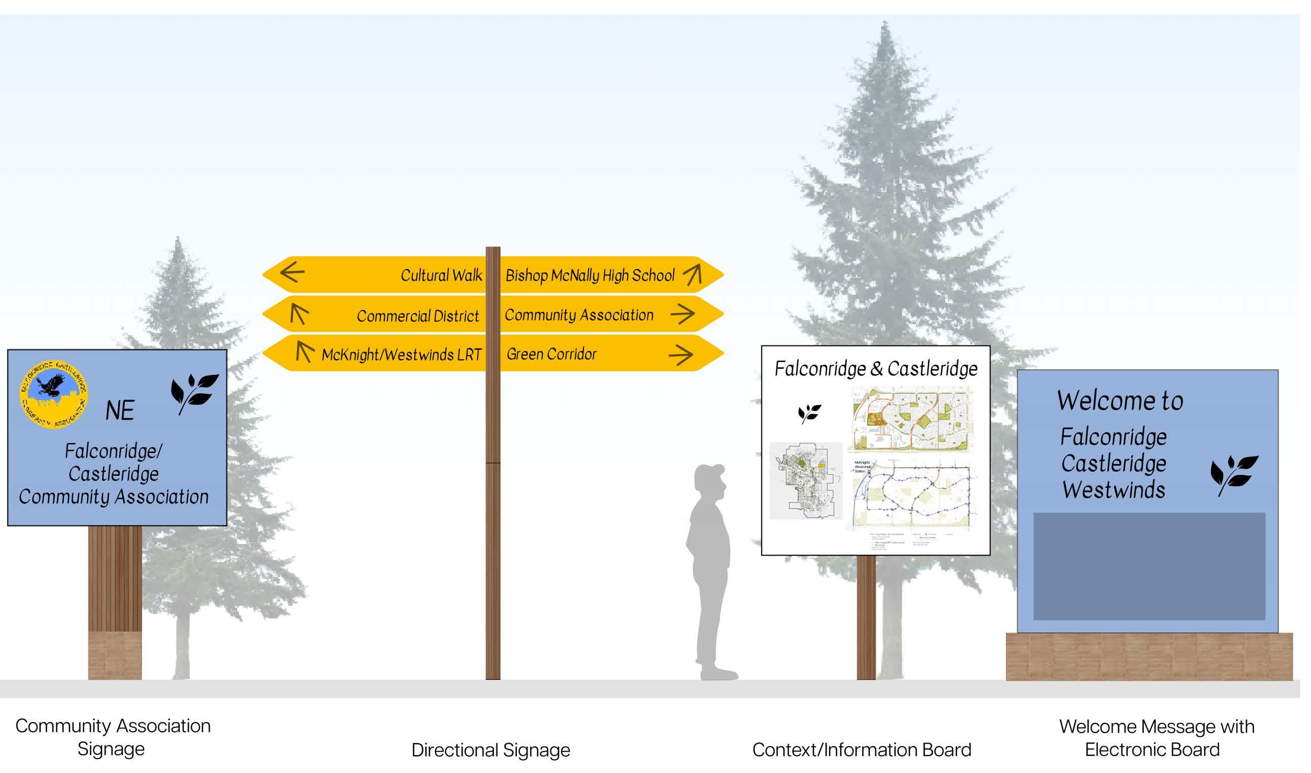
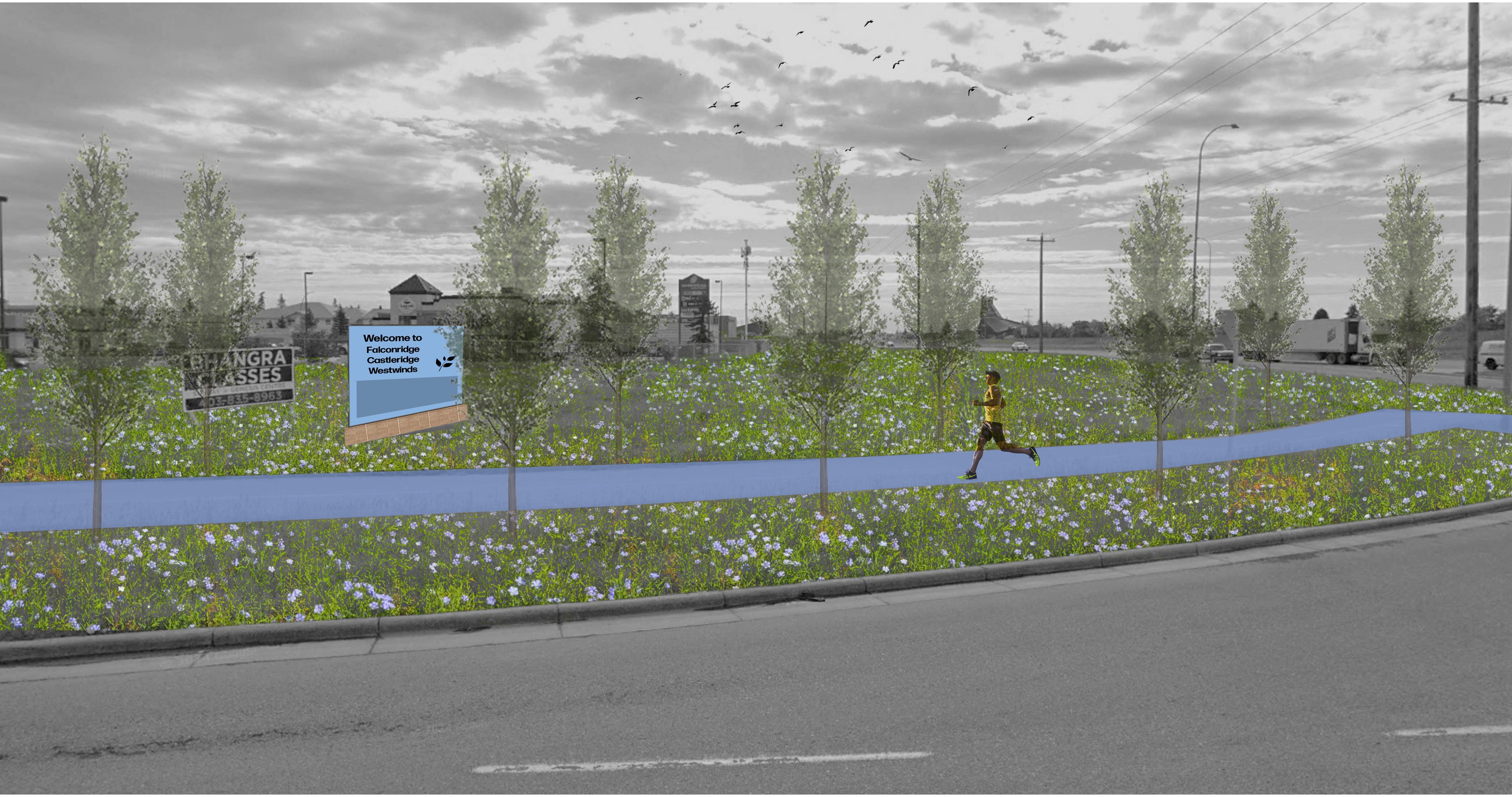
The cultural pathway has been extended to follow the 5A Network, aiming to strengthen unity and community engagement by connecting residential areas across all three neighbourhoods. Additional multi-lingual wayfinding signage has been introduced to guide visitors to multicultural destinations and support placemaking at key site entry points. The following three key sites are identified for activation.
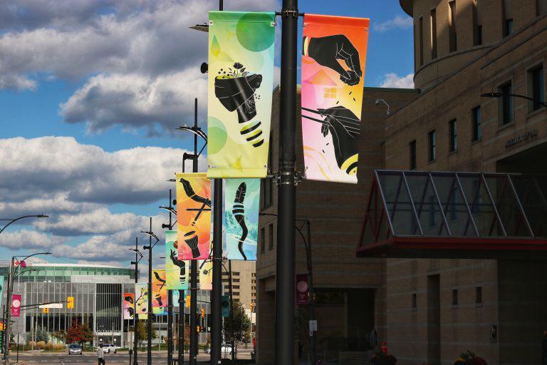
The goal of the proposed wayfinding signage and placemaking strategies is to enhance the public realm by promoting social interaction and strengthening community unity. This will be achieved through the integration of engaging activities and sheltered flexible seating, and the beautification of streets with illuminated community banners, and vibrant painted pathways that represent the cultural identity of these communities.
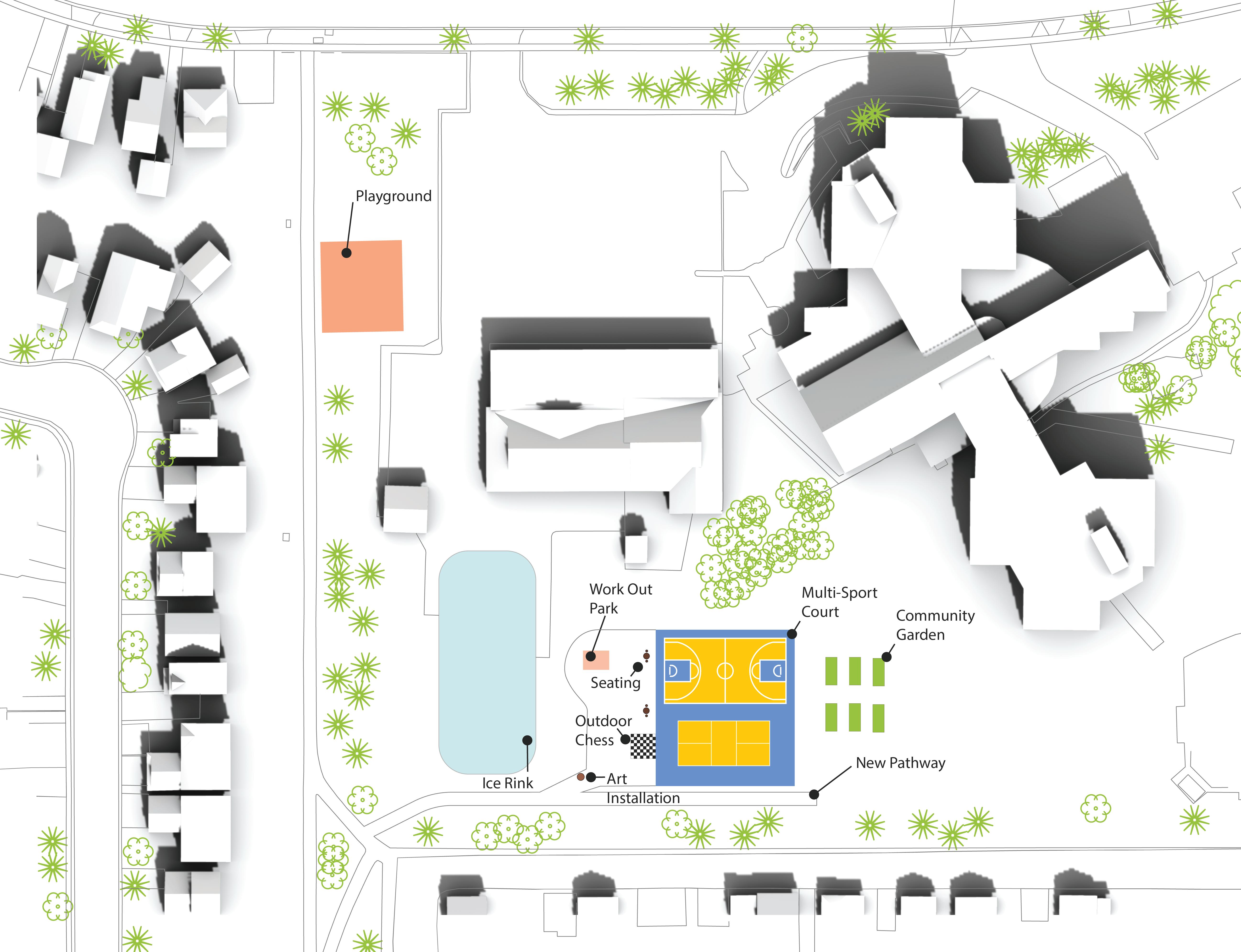
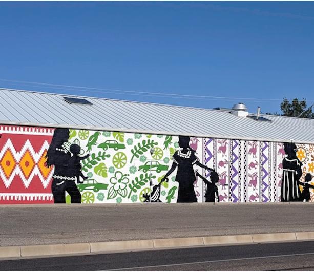
The FCCA field was further enhanced to promote greater community engagement and social interaction, incorporating a multi-sport court, a community garden, a textile mural that visually narrates a story through its patterns, and an art installation serving as a distinctive community landmark.

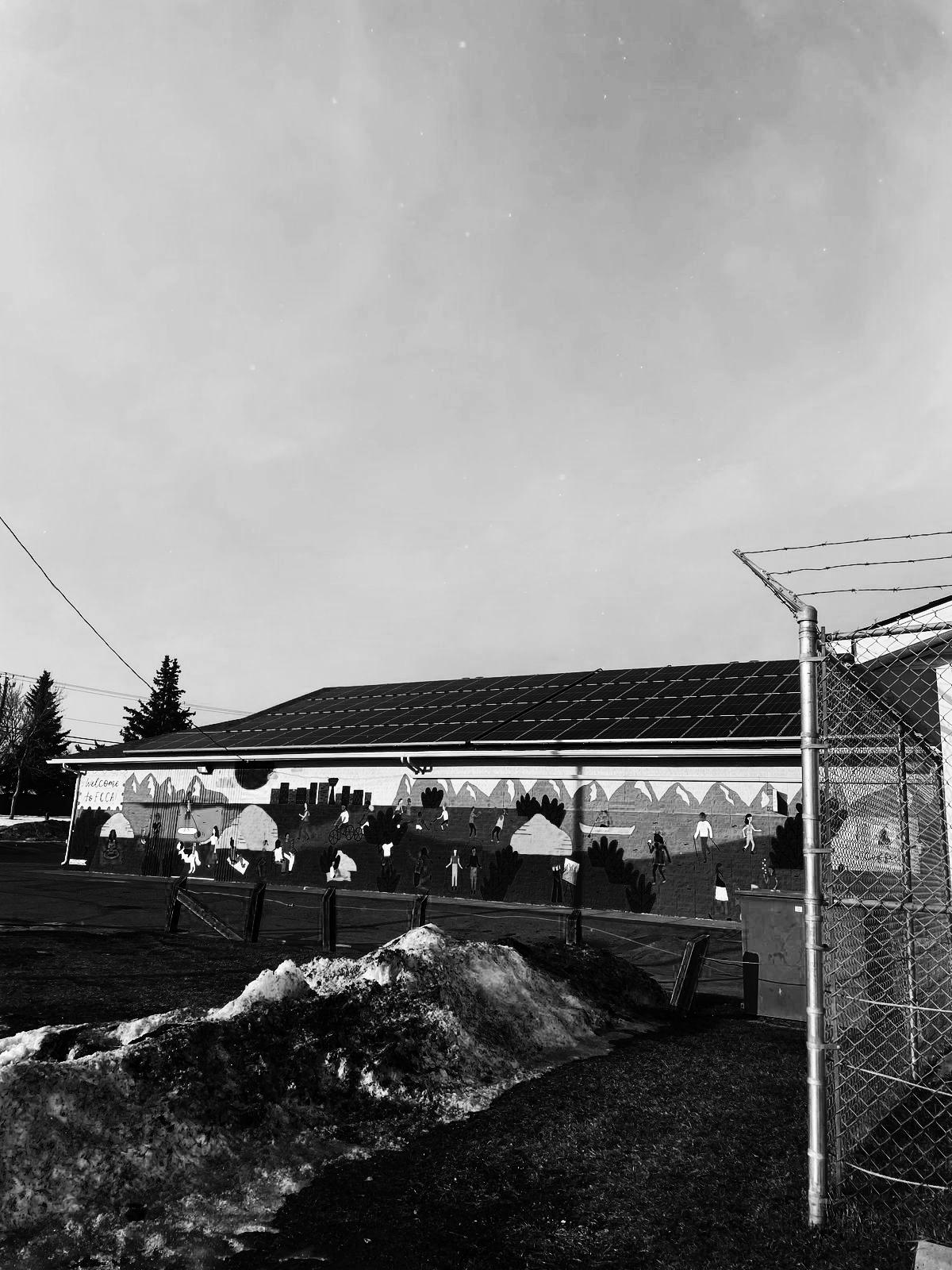
At the exterior of the FCCA building, cultural interventions reflect and celebrate the community’s identity. These include design elements inspired by the community association’s colours, a textile-inspired mural drawing from local traditions, and the use of auspicious colours significant to the area’s cultural demographics, all reinforcing a strong sense of place and belonging.
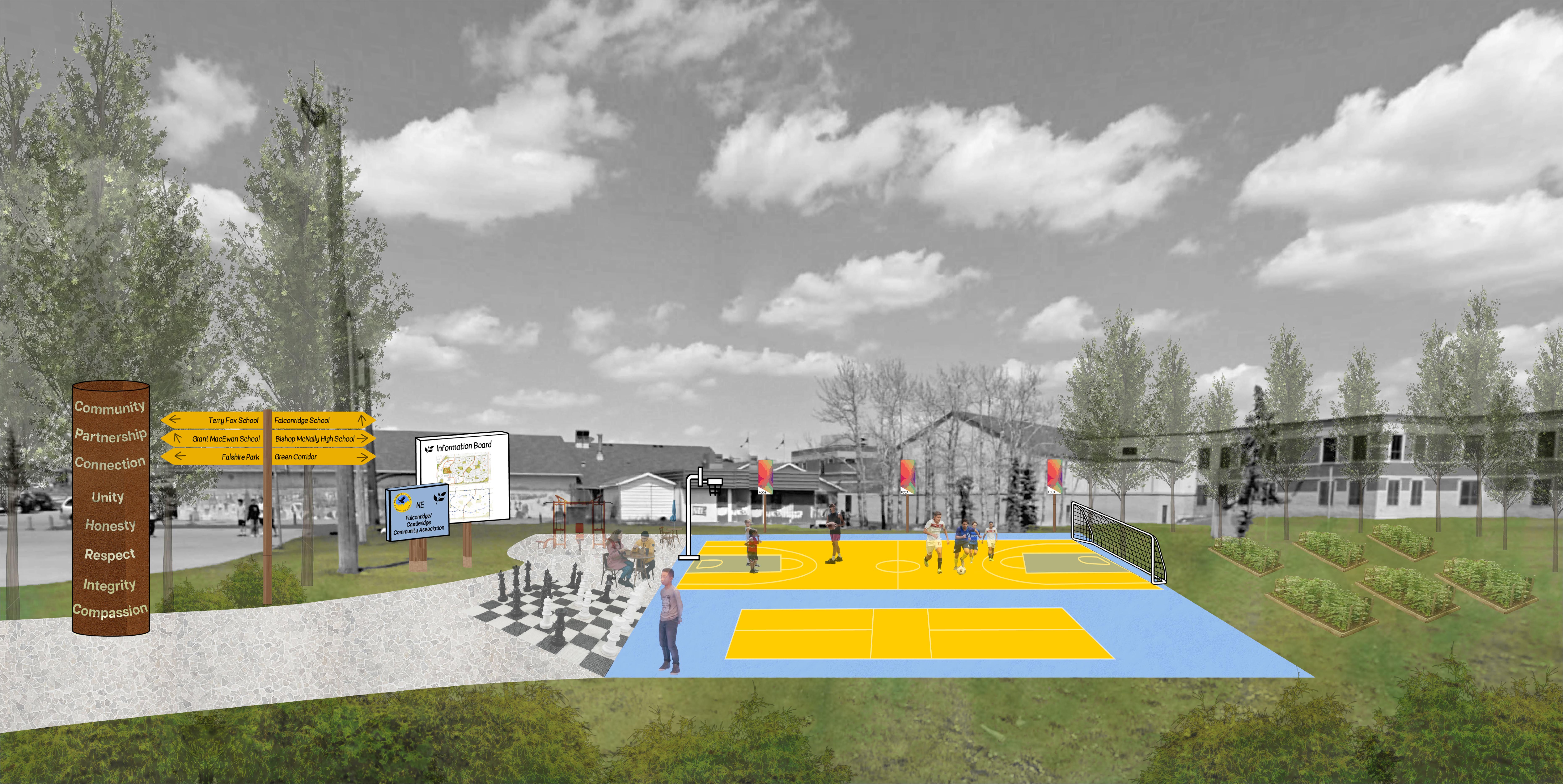
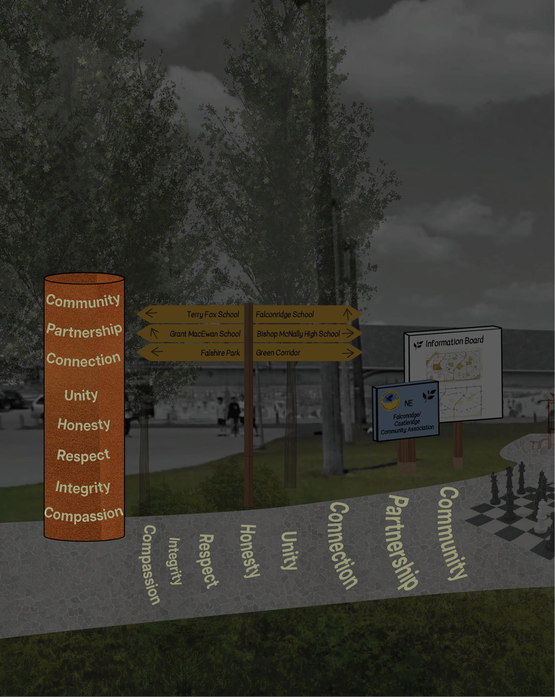
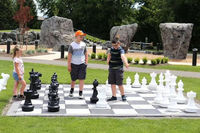
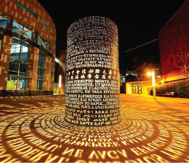
During community engagement, residents emphasized the need to activate open spaces. It was noted that many travel long distances to access amenities, such as playing chess at the Confederation Park Activity Centre near Banff Trail. In response, a variety of new activities have been introduced, including a life-size chess game, various sport courts, and a community garden. Sheltered seating has been added to encourage socialization and foster community unity. Additionally, a copper art installation enriches the space by illuminating keywords from the FCCA’s mission and vision statements, bringing the community’s identity to life, especially at night.
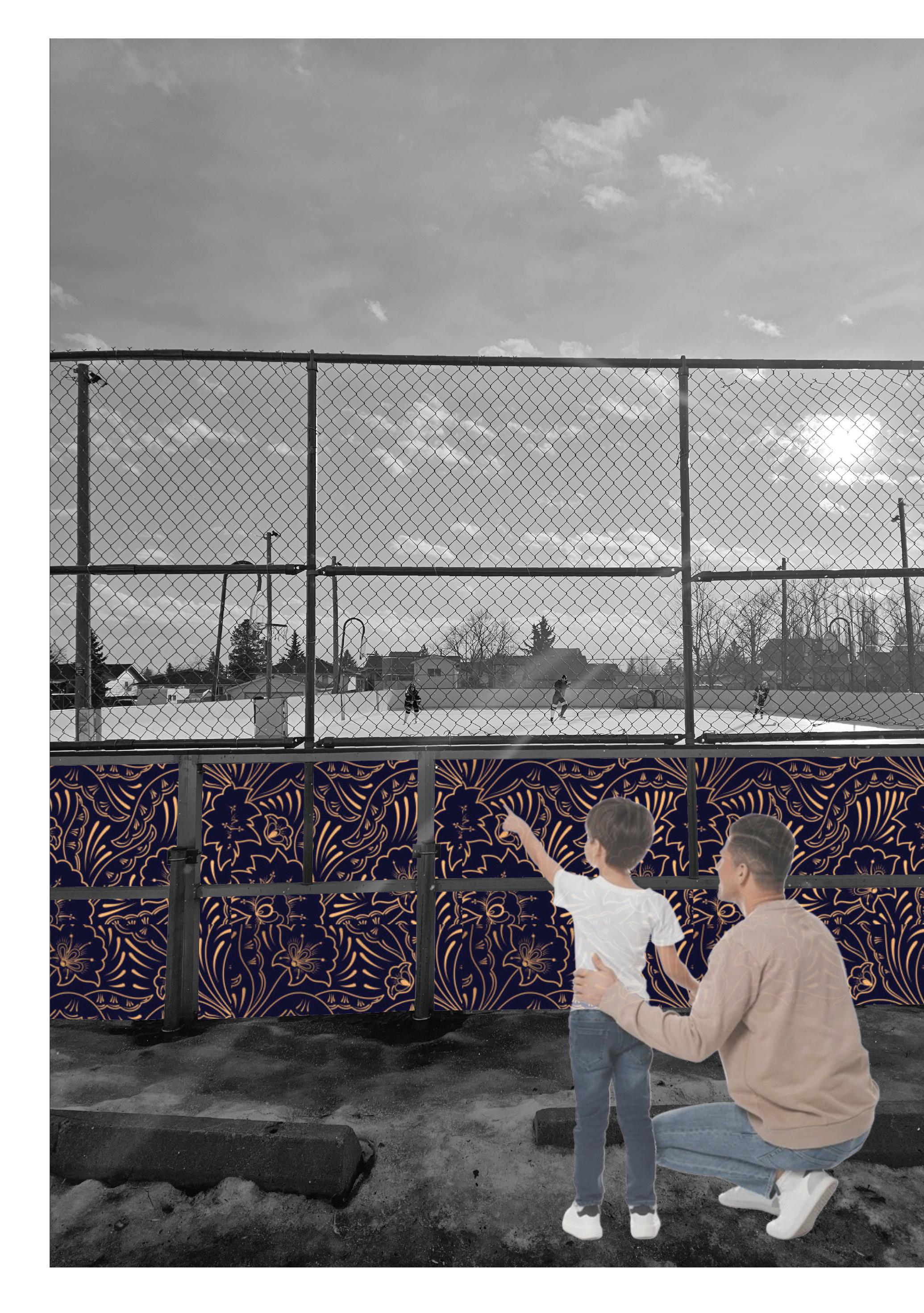
The mural strategy at the FCCA building is continued at the ice rink, featuring local design elements. This enhances the space's visual appeal while reinforcing community identity and promoting a sense of belonging.
Main Interventions:
Cultural Pathway: A continuous pedestrian corridor celebrating the diverse cultures of the communities, connecting residents to key multicultural destinations
• Painted Crosswalks/Paths: Context-specific vibrant art from schools to multicultural destinations and community institutions while also enhancing pedestrian and cyclist safety
Lit Up Community Banners & Art Installations: Celebrates local heritage, cultural identity, and values
Wayfinding Signage: Bold, directional signage that enhances neighborhood identity, strengthens placemaking, and improves navigation
Activated Public Realm: Encourage social interaction through outdoor board games, sports activities, and movable covered seating
Flexible Event Space: Flexible space at the rear of FCCA for socialization, celebrations, and events
Policies Support & Alignment:
• In alignment with Calgary’s Cultural Shift Summary Plan’s ten priority actions and The Cultural Plan for Calgary
• Identify and activate cultural and wayfinding nodes to strengthen placemaking and community unity
◦ Designate Falconridge/Castleridge Community Association as the central cultural hub, anchoring community events and identity
• Promote social interaction and celebration of the community’s diverse cultures through accessible, inclusive public spaces
◦ Increase access to outdoor social spaces such as board games and seating to encourage interaction
• Create heritage and cultural programs to spread awareness of new implementations and importance of tangible and intangible strategies
• Provide grants to multicultural businesses and nonprofits to support promotion of culture identity
• Collaborate with Calgary’s Public Art Program to curate installations that authentically reflect the history, identity, and diversity of Falconridge, Castleridge and Westwinds.
In conclusion, our analysis highlights key challenges within the community, such as frequent traffic accidents at school-adjacent intersections, disconnected pathways, a lack of programming in their open spaces, a lack of unity and sense of belonging, a lack of housing diversity, and stark divisions in land use.
To tackle these issues, we propose a series of design interventions aimed at fostering a more connected and cohesive community. These include extending pathways to enhance pedestrian safety and accessibility using best practice traffic calming measures, planting trees as effective noise buffers, and incorporating signage and artwork to cultivate a shared identity and sense of unity By revitalizing green spaces along the 5A network into dynamic community landmarks with diverse programming, we seek to encourage engagement and activity. Additionally, introducing more affordable housing options and evenly distributing commercial spaces across the area will promote inclusivity and help address traffic concerns. Finally, recognizing multiculturalism as a central theme for the Falconridge, Castleridge, and Westwinds community, our proposed interventions aim to celebrate and enhance this vibrant cultural mosaic by thoughtfully reflecting these communities’ unique demographics.
Chess House. (2025). Giant Chess: Shop Premium Selections at Chess House. https://www.chesshouse.com/collections/giant-chess/style-unweighted-pieces
City of Calgary. (2014). Complete Streets Guide. Retrieved April 21, 2025, from https://www.calgary.ca/content/dam/www/transportation/tp/documents/ctp2010/complete-streets-guide-2014-web.pdf
City of Calgary. (2016). Culture Shift: A Summary of the Cultural Plan for Calgary (CPS2016-0867). Retrieved April 21, 2025, from https://www.calgary.ca/content/dam/www/csps/recreation/documents/arts-and-culture/coccultureshift.pdf
City of Calgary. (2017). Cultural Plan for Calgary. Retrieved April 21, 2025, from https://calgaryartsdevelopment.com/news-information/reports-research/cultural-plan-for-calgary/
City of Calgary. (2020). Calgary Transportation Plan 2020: Volume 3 of the Municipal Development Plan. Retrieved April 21, 2025, from https://www.calgary.ca/content/dam/www/transportation/tp/documents/ctp2020/CTP-2020-P12.pdf
City of Calgary. (2020). Design Guidelines for Subdivision Servicing (Version 2020). Retrieved April 21, 2025, from https://www.calgary.ca/content/dam/www/pda/pd/documents/urban-development/publications/design-guidelines-for-subdivsion-servicing-2020-oct.pdf
City of Calgary. (2022). Vision Zero Safety Plan. https://www.calgary.ca/transportation/traffic-safety/vision-zero.html
City of Calgary. (2024). Civic Arts Policy: Phase One – What We Heard Report. Retrieved April 21, 2025, from https://hdp-ca-prod-app-cgy-engage-files.s3.ca-central-1.amazonaws.com/8117/3801/8738/Civic_Arts_Policy_Phase_One_WWHR.pdf
City of Calgary. (2025). Calgary Transit Routes. Retrieved April 21, 2025, from https://data.calgary.ca/Transportation-Transit/Calgary-Transit-Routes/hpnd-riq4
City of Calgary. (2025). Calgary Transit Stops. Retrieved April 21, 2025, from https://data.calgary.ca/Transportation-Transit/Calgary-Transit-Stops/muzh-c9qc
City of Calgary. (2025). Current Traffic Incidents. Retrieved April 21, 2025, from https://data.calgary.ca/Transportation-Transit/Current-Traffic-Incidents/4jah-h97u
City of Calgary. (2025). Heat map – Based on all Traffic Incidents. Retrieved April 21, 2025, from https://data.calgary.ca/Transportation-Transit/Heat-map-Based-on-all-Traffic-Incidents/yj8z-ptzu
City of Calgary. (2025). Open Data Portal. Retrieved April 21, 2025, from https://data.calgary.ca/browse?sortBy=newest&page=1&pageSize=20
City of Calgary. (n.d.). Calgary Traffic Counts System (CalTRACS). Retrieved April 21, 2025, from https://trafficcounts.calgary.ca/
City of Edmonton. (2021). Transportation Master Plan. https://www.edmonton.ca/transportation/transportation-master-plan
City of Mississauga. (2020). New Downtown Public Art to Support #MississaugaMade. https://www.mississauga.ca/city-of-mississauga-news/news/new-downtown-public-art-to-support-mississaugamade/ City of St. John's. (2022). Curb Extensions. https://www.stjohns.ca/en/streets-parking/curb-extensions.aspx
Confederation Park 55+ Activity Centre. (2025). Classes & Events. Retrieved April 21, 2025, from https://yycseniors.com/Classes-%26-Events
Confederation Park 55+ Activity Centre. (2025). Game Afternoon. Retrieved April 21, 2025, from https://yycseniors.com/event-5897889
District of Invermere. (2022). Transportation Master Plan: Public Information Session [PDF]. https://invermere.net/wp-content/uploads/2022/03/2022-03-02-public-session-1-v2.pdf
Esri. (2019). Calgary Roadway Classification [Interactive map with layer ID b4d88e98685f4476b9d5a40c9b5d2ebf]. ArcGIS. Retrieved April 21, 2025, from https://www.arcgis.com/apps/mapviewer/index.html?layers=b4d88e98685f4476b9d5a40c9b5d2ebf
EV Experience Centre. (2019). East Village Weekly Round-Up: June 5–11. https://www.evexperience.com/blog/2019/6/4/east-village-weekly-round-up-june-5-11
Falconridge Castleridge Community Association. (2025). Clubs and Events. Retrieved April 21, 2025, from https://falconridgecastleridge.ca/clubs-and-events/ Falconridge Castleridge Community Association. (2025). Community Association. Retrieved April 21, 2025, from https://falconridgecastleridge.ca/fccacommunity/ Hudson, A. (2017). New Bus Shelters Heat Up St. Albert Centre Exchange. St. Albert Gazette. https://www.stalbertgazette.com/local-news/new-bus-shelters-heat-st-albert-centre-exchange-1297499 Muros ABQ. (n.d.). Kei Tsuzuki and Molly Luethi – Making Our Way. https://murosabq.com/kei-tsuzuki-and-molly-luethi-kei-and-molly-textiles/ National Association of City Transportation Officials. (2013). Urban Street Design Guide. Island Press.
New York City Department of Transportation. (n.d.). The Beauty of Four Life Essentials Asphalt Art Murals by Chenlin Cai – NYC DOT Art. https://www.nyc.gov/html/dot/html/pedestrians/dotart.shtml
NZ Transport Agency Waka Kotahi. (2025). Cycling Facilities. In Traffic Control Devices Manual: Part 5 – Traffic Control Devices for General Use – Between Intersections. https://www.nzta.govt.nz/roads-and-rail/traffic-control-devices-manual/part-5-traffic-control-devices-for-general-use-between-intersections/cycling-facilities/ Skyhall Fence. (2024). Stainless Steel Bollard 410. https://skyhallbollard.com/stainless-steel-bollards-with-lights/
St. Albert Gazette. (2017). New Bus Shelters Heat Up St. Albert Centre Exchange. St. Albert Gazette. https://www.stalbertgazette.com/local-news/new-bus-shelters-heat-st-albert-centre-exchange-1297499 Sortir à Paris. (2020). Electric Scooters: New Rules Implemented from July 1, 2020. https://www.sortiraparis.com/en/news/in-paris/articles/223055-electric-scooters-new-rules-implemented-from-july-1-2020
The City of Calgary. (2022). Vision Zero Safety Plan. https://www.calgary.ca/transportation/traffic-safety/vision-zero.html
The City of Edmonton. (2021). Transportation Master Plan. https://www.edmonton.ca/transportation/transportation-master-plan
The City of Toronto. (2022). Public Art Installation at Nathan Phillips Square. https://www.toronto.ca/services-payments/public-art-installation/
YouFine. (2020). Square Metal Letter Sculpture Art Project with Lights [Product page]. https://www.you-fine.com/product/square-metal-letter-sculpture-art-project-with-lights.html
https://myuniversitydistrict.ca/wp-content/uploads/2023/01/Homepage_Hero@2x-scaled.jpg
https://myuniversitydistrict.ca/wp-content/uploads/2022/09/Retail-Hero.png
https://www.avenuecalgary.com/things-to-do/central-commons-park-university-districtcalgary/ https://mardaloopinfinity.com/wp-content/uploads/2022/04/1-MLI.jpg