THE ARCHITECTURE OF LANDSCAPE
Portfolio of Maria Thoner
Master studies in International Landscape Architecture
Oslo School of Architecture and Design
1
Member of Norwegian Association of Landscape Architects (NLA)
Arkitektenes Fagforbund (AFAG)
28.06.96
Oslo
Phone: 46544465
mail: maria.ch.thoner@ gmail.com
EDUCATION
2022-2023:
2021-2022:
2020-2021:
2016 -2019:
MARIA THONER
Motivated architecture graduate and landscape architecture graduate. Skilled in researching and interpreting ideas through digital and physical media. I hope for an career focused on research-based design and appreciate unconventional yet sensitive and analytical approches to the field of architecture and landscape. I look forward to learn, discover and get inspired together with other within a studio and in conversations between different disciplins and fields.
International Master in Landscape Architecture
Oslo School of Architecture and Design
Master in Architecture
Bergen School of Architecture
1 year Master in Architecture / 1 year Master of Landscape Architecture
Oslo School of Architecture and Design
3-years Bachelor in Architecture
Bergen School of Architecture
PROFFESIONAL EXPERIENCES
2023
Landscape / Vega Landskab
Internship in an landscape office, Copenhagen. Responsible for site analyises and site visits to prepare future projects at DTU ( det tekniske universitet). Proposing approach and analytical work of Høstet, and touristic routes of Stensrup in Sjællland. Client meetings and plannings of backyards in Copenhagen.
2022
Architecture and landscape / Lamprecht & Thoner
Atached structure and a garden; Lillehammer, Norway
2020
Architecture and landscape / Hallstein Arkitekter
Internship in an architect office, Oslo. Typical work as an intern; drawing construction drawings and building physical models. Also joined with proposals and concepts during the first phase of projecting. Prepared site-analysis.
2019
Landscape and urbanism / UNDER BROEN / Bergen
School of Architecture / K31
Project leader together with Helene Sørland, development and implement of an urban project and event, as "urban archipuncture" in the city of Bergen.
Urbanism and Landscape
Architecture
Architecture
Urbanism and Landscape
Architecture
2
Software
PROFESSIONAL SKILLS
Autocad
Archicad
Rhinoceros
Vray
Escape
Qgis
Instant Terra
Adobe Photoshop
Adobe Illustraitor
Adobe Indesign
Microsoft Office
Model Making
Hand Techniques
3D printing, cnc, laser
ACHIEVMENTS AND AWARDS
2023
Nominated / Best Landscape Diploma of AHO 2023
Diploma Project published in the magazine +KOTE vers. 18
2022
Pre-diploma in International master of landscape architecture
2021
2020
Exhibiting ”deep sea” project at Lisbon Architecture Triennale/ Terra
Shortlisted/ included in the 7 finalists for the 6th edition of the Lisbon Triennale Millennium bcp Universities Competition Award.
World Water Day; presentation of waterprecedent analysis and research of Tyrol watersystems (online event)
2019
2016
Winner of the Urban Life Prize during the Bergen City Conferance, with the urban project; Under Broen
Developed and built an ice-construction / musical instrument with supervision from ice-musician Terje Isungseth
Nomineed to Peer Gynt talent-prize for classical musical composition
Cellist in IYSO: International Youth Symphony Orchestra Bremen, Germany
Cellist in Cello Ensemble- Oslo, Praha, Berlin
LANGUAGE SKILLS
English Norwegian French (beginner)
INTERESTS
Drawing
Cello / Piano
Running
Skiing
Mountain randonee
Diploma / River Tracings / aho Studio / If the rivers played the leading role / aho
Studio / Ocean space / bas
Studio / Ocean space / bas
Studio / Make do water do / aho
Studio / Klientkurs / bas
Construction / Material / Music
Musical career
3
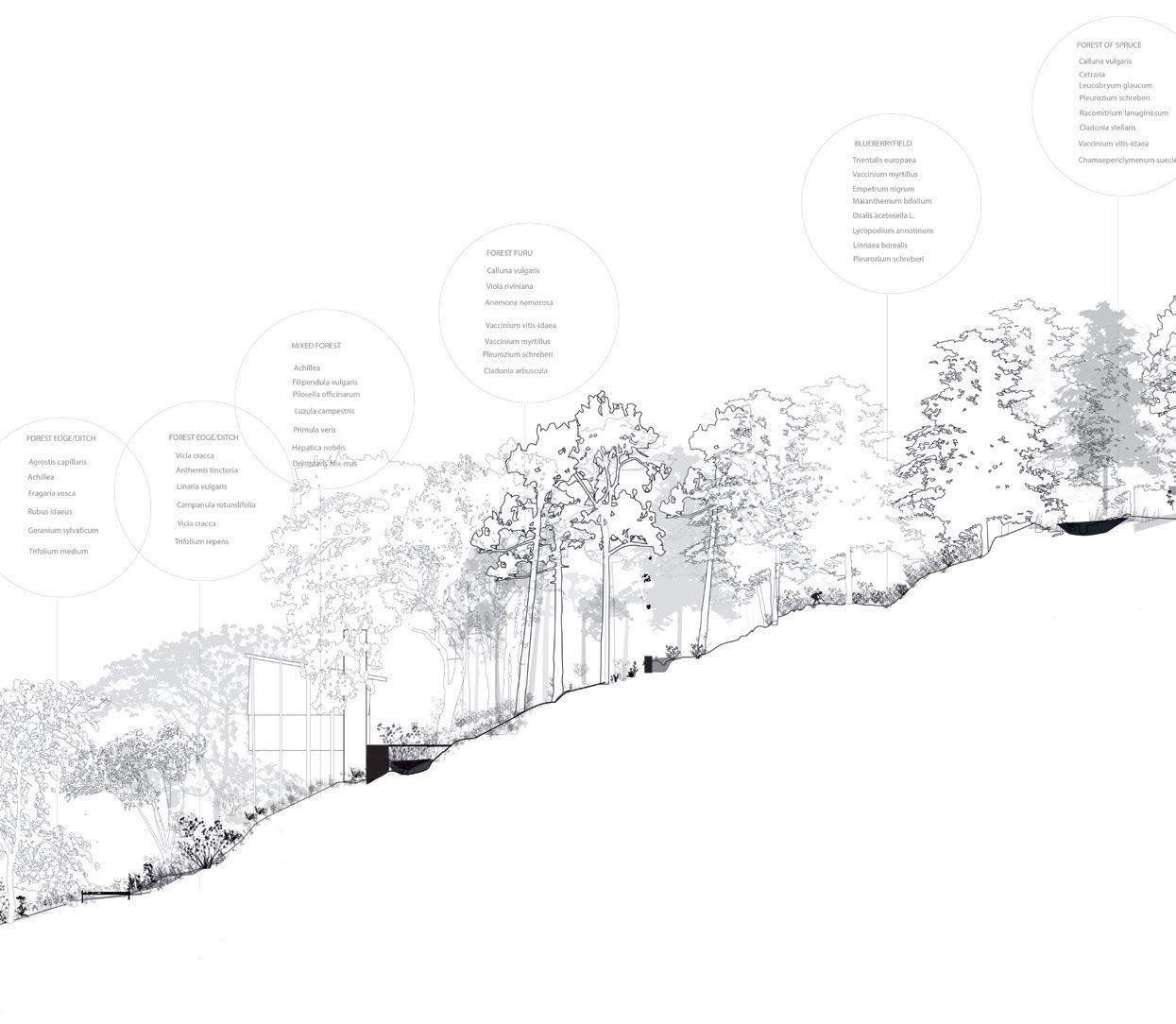
Chapter 1
River Tracing
Chapter 2
Ilinger
Chapter 3
Patchwork landscape
Diploma Landscape Architecture
Fall 2023
Diploma Architecture
Spring 2022
Master studio
Spring 2021
4
6-53 54-75 76-95
Supervision
Sabine Muller Proffesor, International Master in Landscape Architecture, Aho
Karin Helms Proffesor, International Master in Landscape Architecture, Aho
AHO: Diploma project/ International master in landscape architecture / 2023
CHAPTER 1: River Tracing
6
7
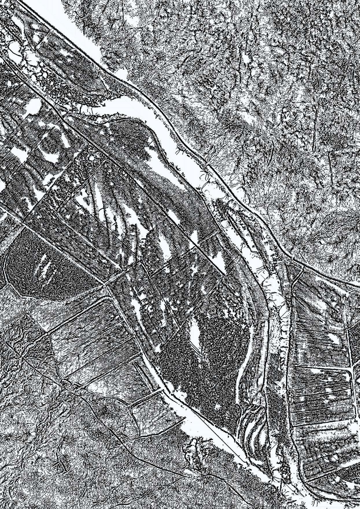
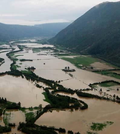
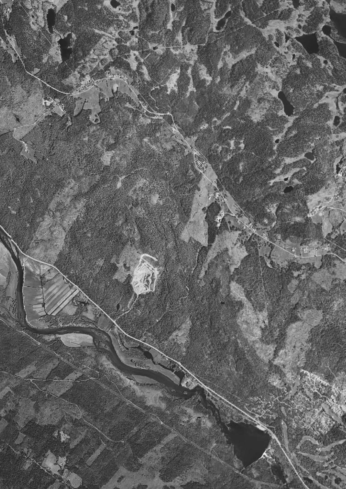
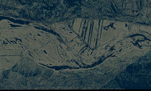
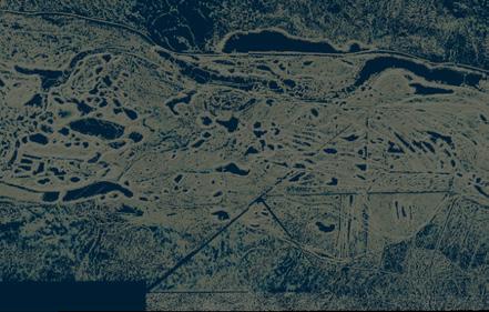
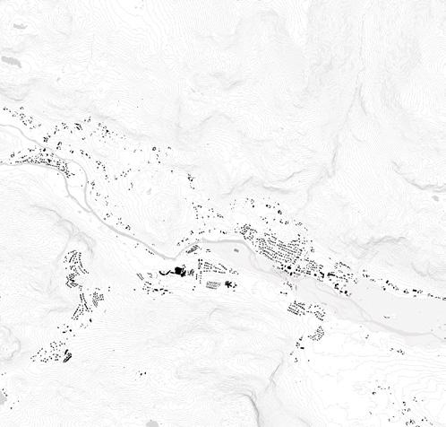
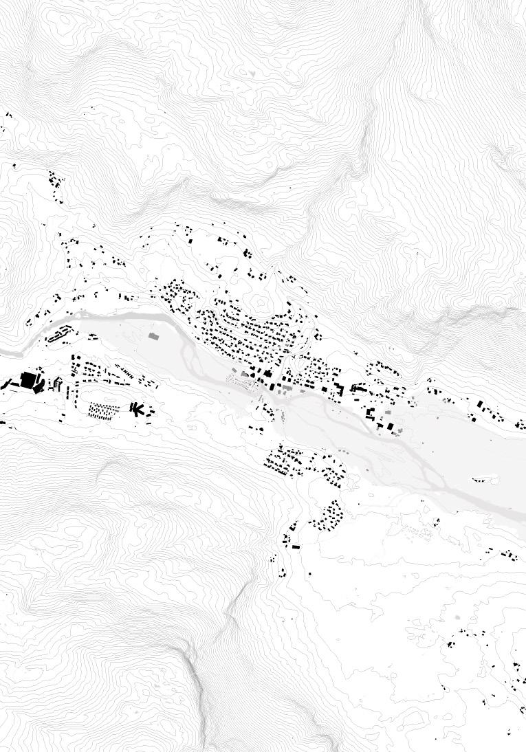
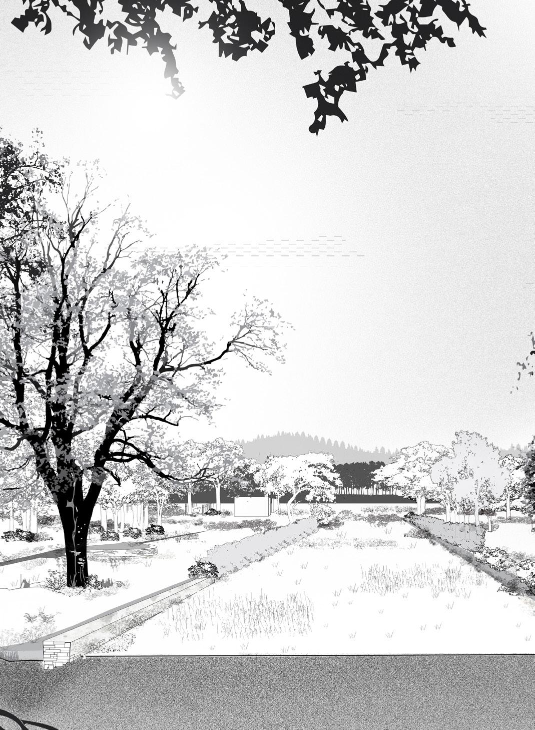
RIVER TRACING
providing land for future water events
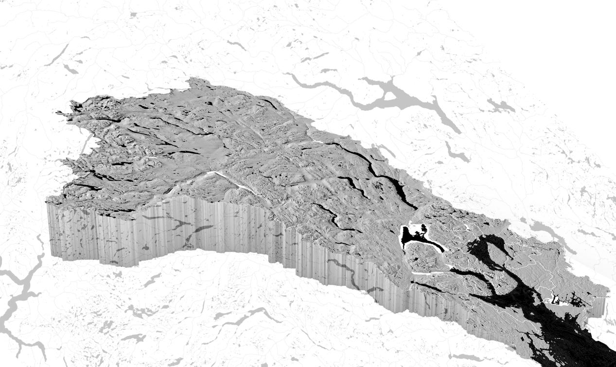
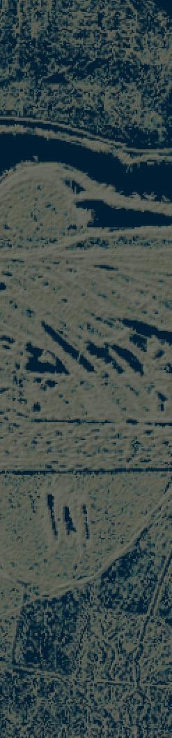
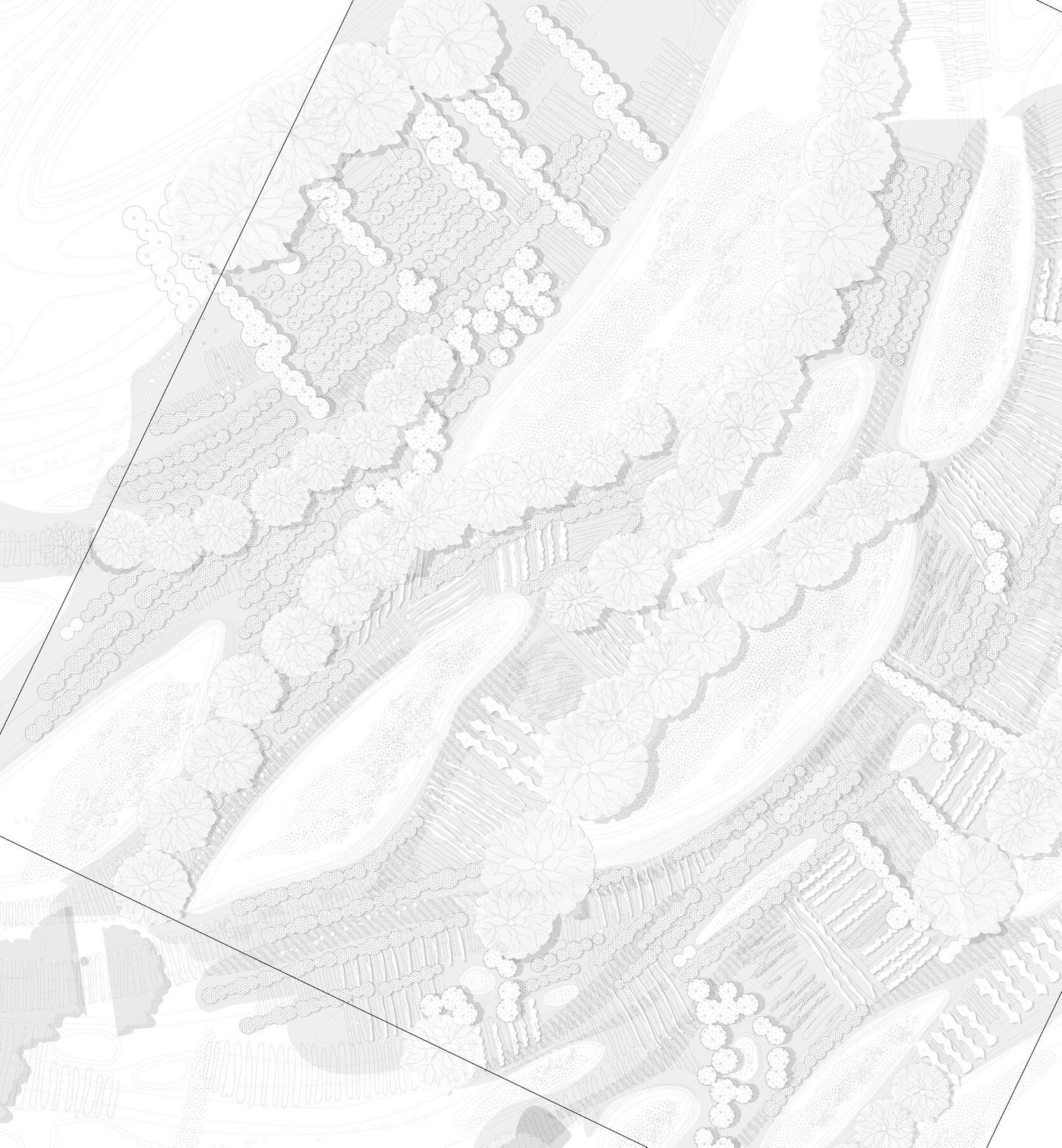
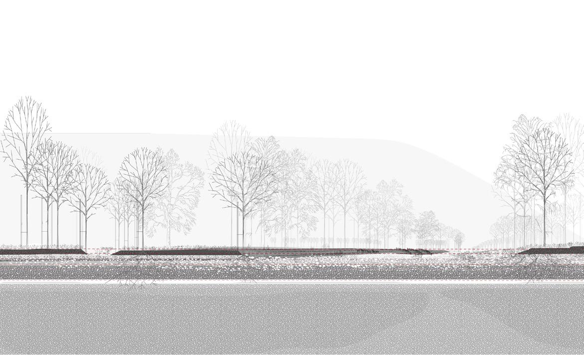
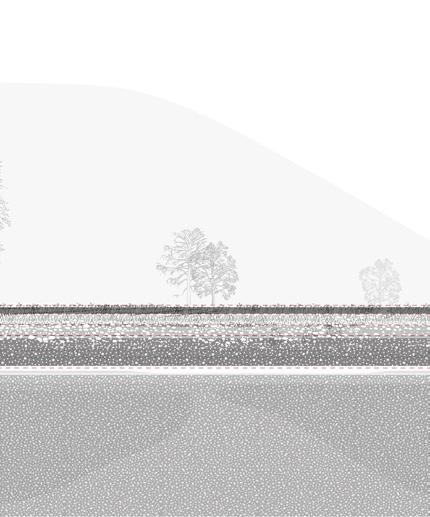
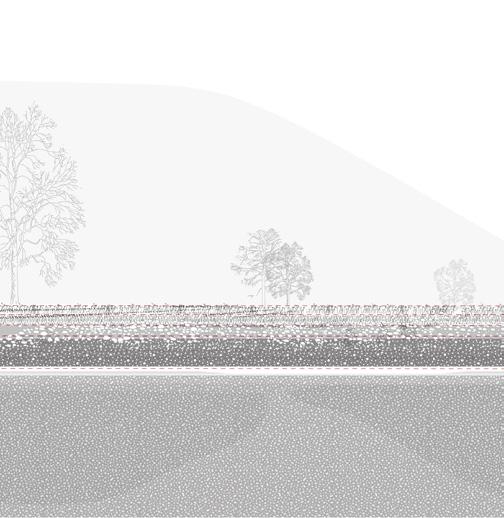
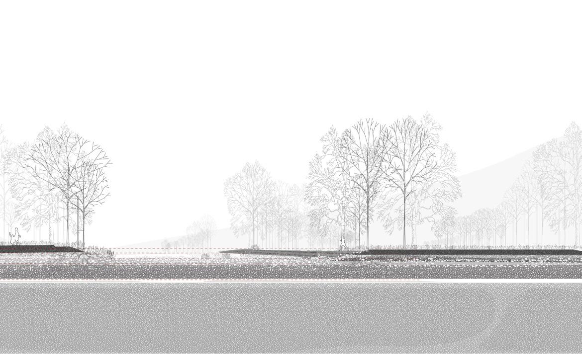
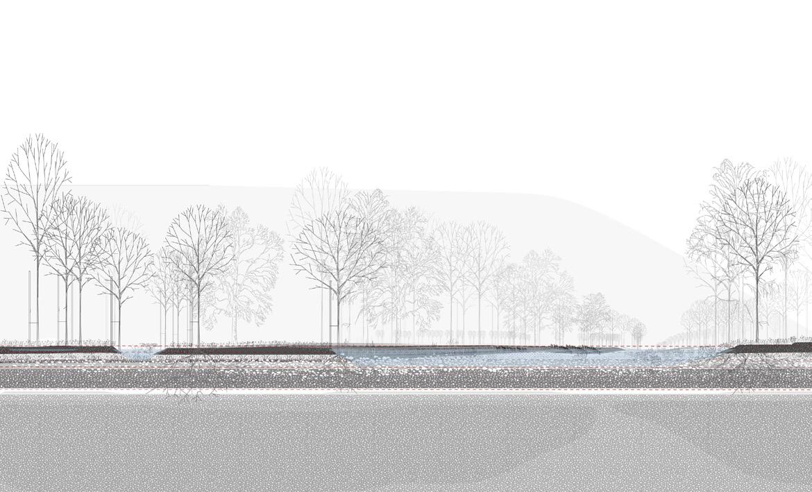
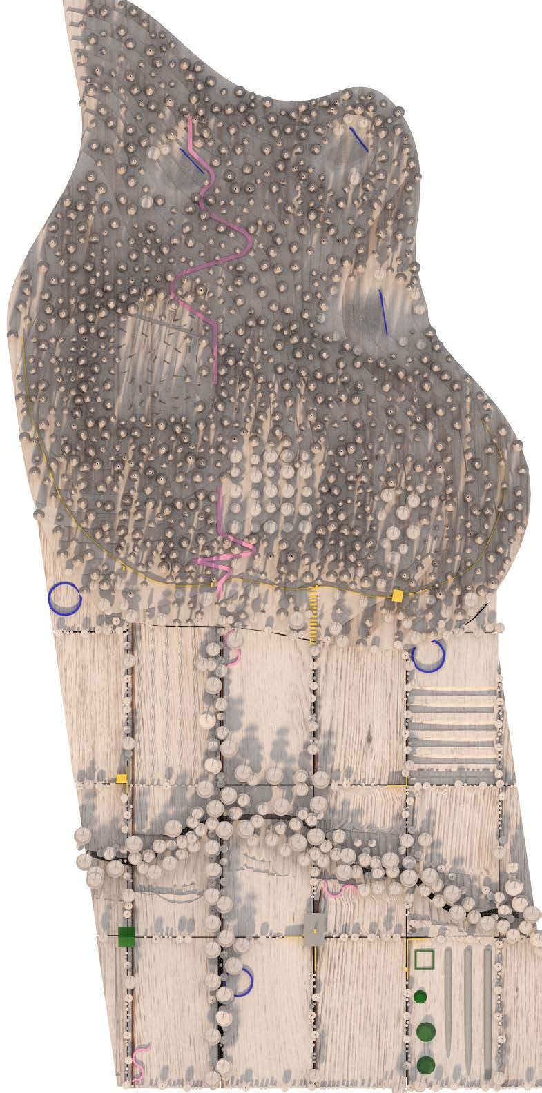
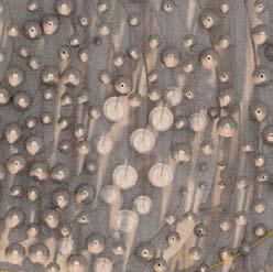
The project proposes an accumulating copperhancing planning of landscape through scales to handle flooding and future water events in the riverways of the Norwegian mountain landscapes, based on the logic of water and topograhy. Through digital water accumulations and tracings of the valley and river in Hemsedal, the project challenge the act of separation of land and water. This seperation”line” has come into sharp focus during extreme floods, with proposals of walls, levees, natural defenses, land retirement schemes and recomendations for retreat. These responses raise questions on where this line is drawn, but they also raise questions on the separation that this line facilitates. Is this separation found in nature or does nature follow from its assertion? When people see flood, they see water tragressing this line.
Tracings of wateraccumulations function as a method to find the underlying landscape and propose a siteplan of potential waterflows and escapes if the water were let free from its predicted wayes of the river and into the landscape. The micro topography still speaks about the dynamics and logic of water. This becomes a landscape which can take the floods, give the water its space and propose an organisation of water and land due to the logic of water; a landscape design embedded from the present geological and climatic record, erasing the line seperating land and water.
8
INTRO
PART 1 - adressing the water strategy
PART 2 - site description
PART 3- design proposal / a
- method
- space and intention
- function
PART 4 - design proposal / b
- method
- space and intention
- function
9
avalanche avalanche
warmer tempratures
snow sharger weeks with snowfall
sudden heavy rain
snow sharger weeks with snowfall
sudden heavy rain landslides
sudden colder tempratures
sudden warmer tempratures
DRY COLD WINTER
VERY WET
AUTUMN
sudden heavy rain
VERY WET SPRING
sudden warmer tempratures
earlier snow melting
heavy spring flood
sudden heavy rain
DRY SUMMER
dry soil
weeks without rain
sudden heavy rain
increasing evaporation in the valleyfloor
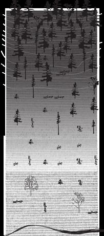
Seasonal moments of the present norwegian mountain landscape
10
PART 1 - adressing the water
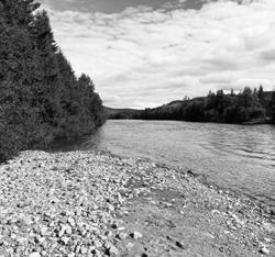
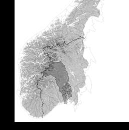
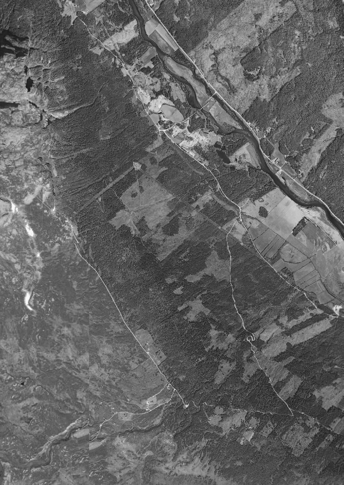
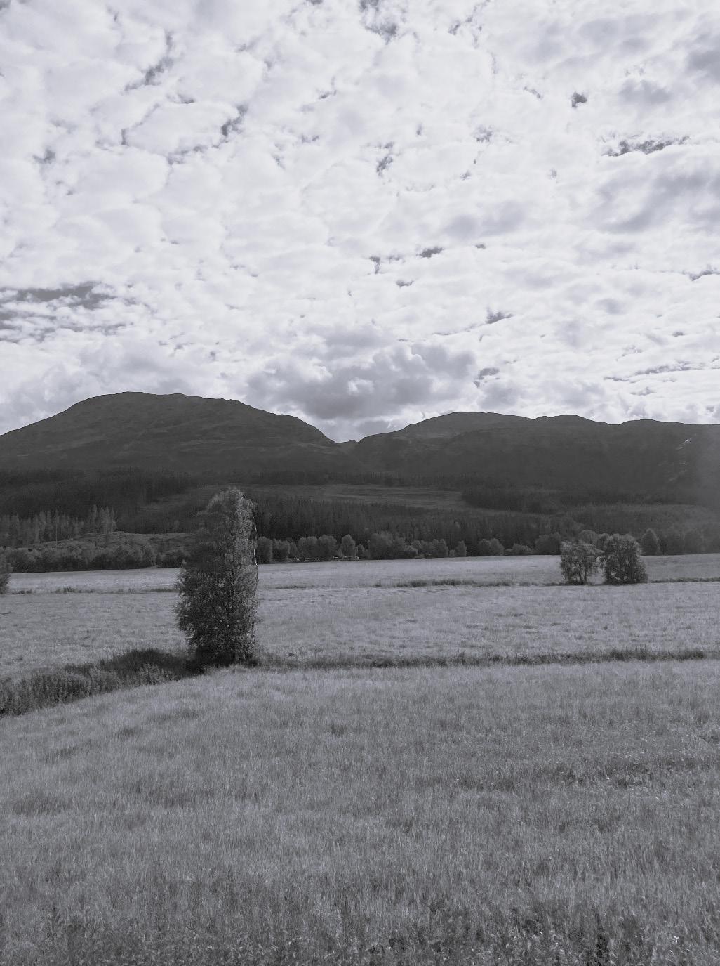
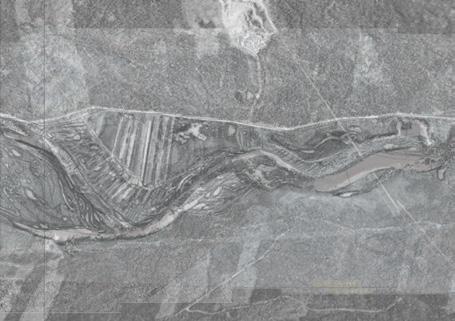
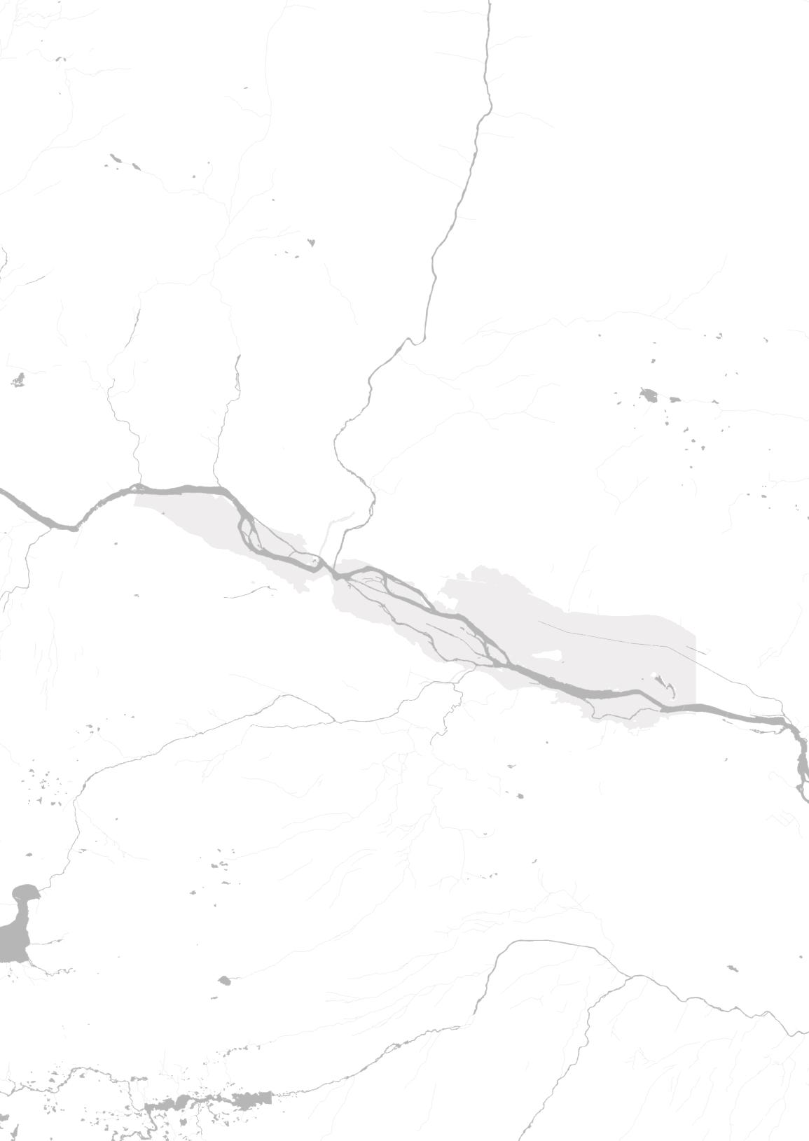
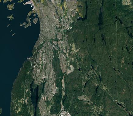
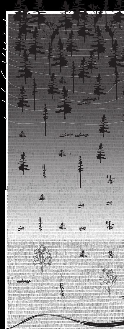
Hemsedal valley
Hemsila watershed
Hallingdøl watershed
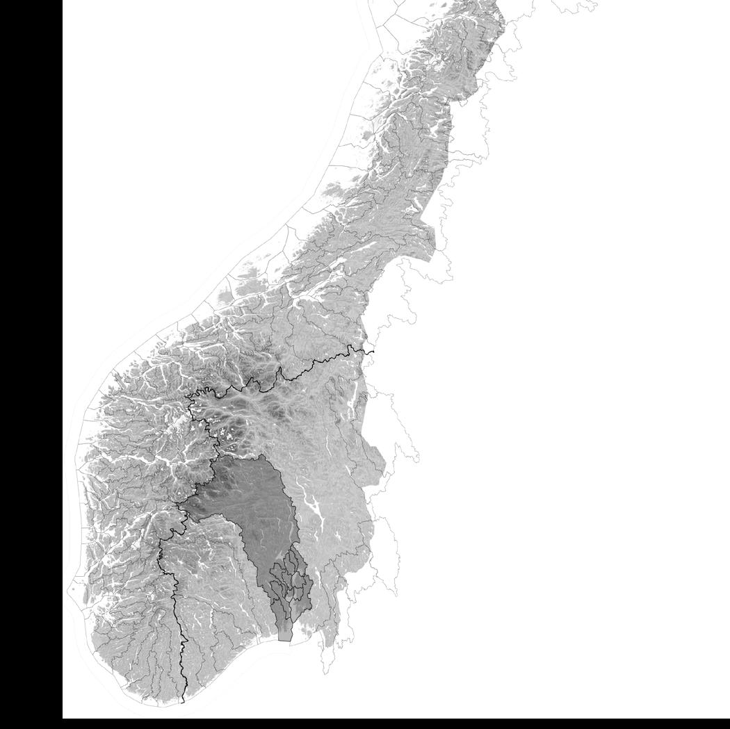
Drammens watershed
11
CLIMATE CHANGE IN THE NORWEGIAN MOUNTAIN LANDSCAPE Location
12 Hemsedal ca 600 m a.s Nes ca 200 m a.s Drammen ca 10 m a.s Gol ca 400 m a.s
watershed area
Drammen
PART 1 - adressing the water / strategy
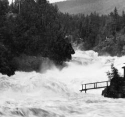
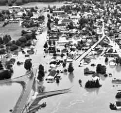
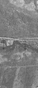
Nesbyen / ekstremværet Hans 2023
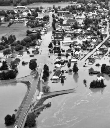
The water flow through the watersheds due to the logic of water and topography, raising the question of who has the responsebility of the water. Should the upstream places hold the water to buffer the downstreamplaces?

13 TOPOGRAPHIC RESPONSEBILITY
flooding in Glomma / Gudbrandsdalen 2011
Nesbyen / ekstremværet Hans 2023
Holding the water in the upstream places
Buffering the downstream places

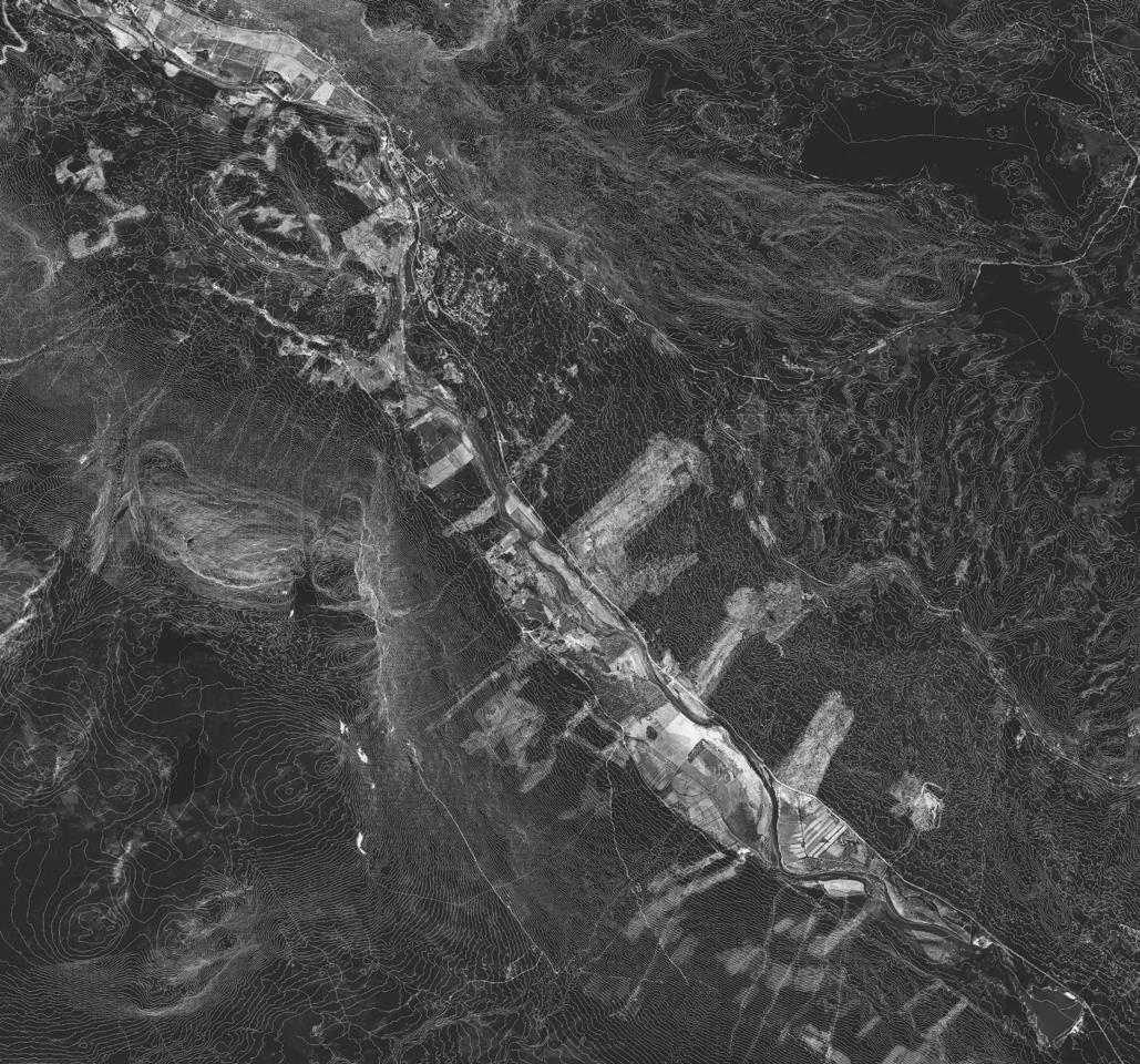
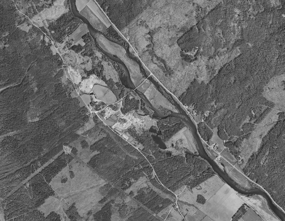
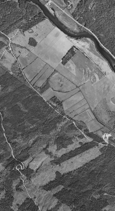
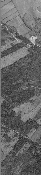
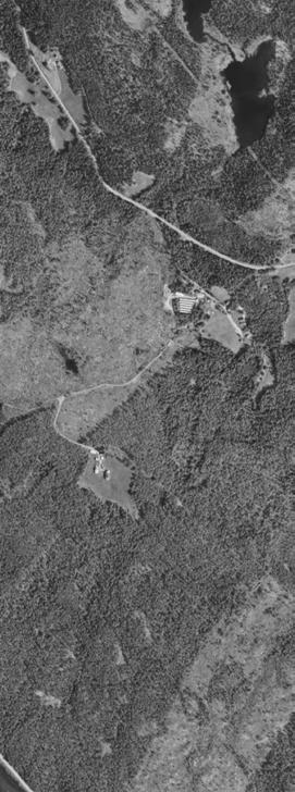
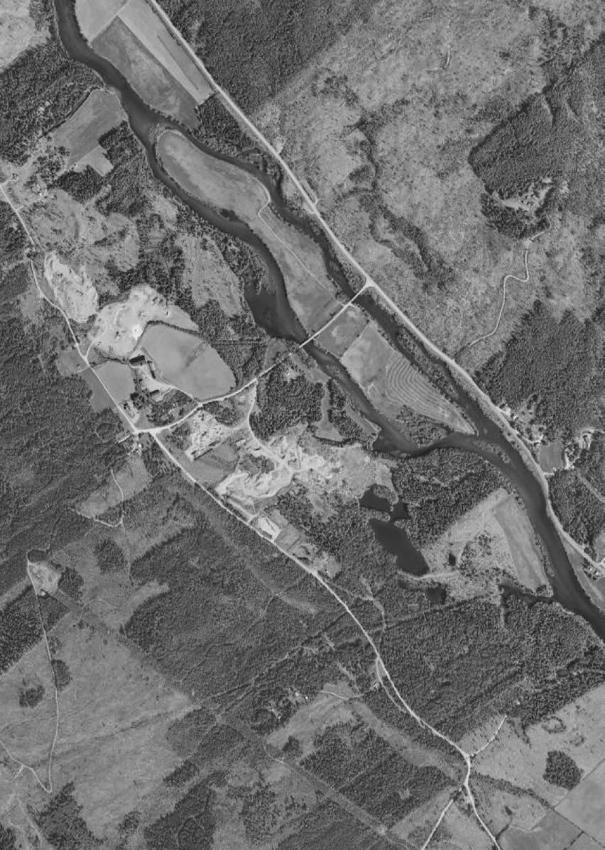
One of the upstream places that could hold the water is Hemsedal, placed on the ”beginning” of the waterflows, on the ridge where the rivers devide to east and west.
14
PART 2 - site description
Hemsedal ca 600 m a.s
HEMSEDAL / THE UPSTREAM PLACE ON THE RIDGE
A landscape for holding water
20 km2
16 PART 2 - site description
17
18
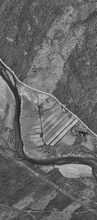
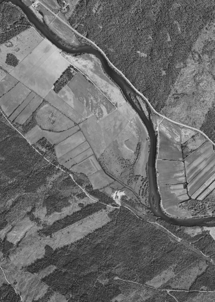
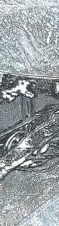
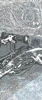
the draineged fields and memory of water
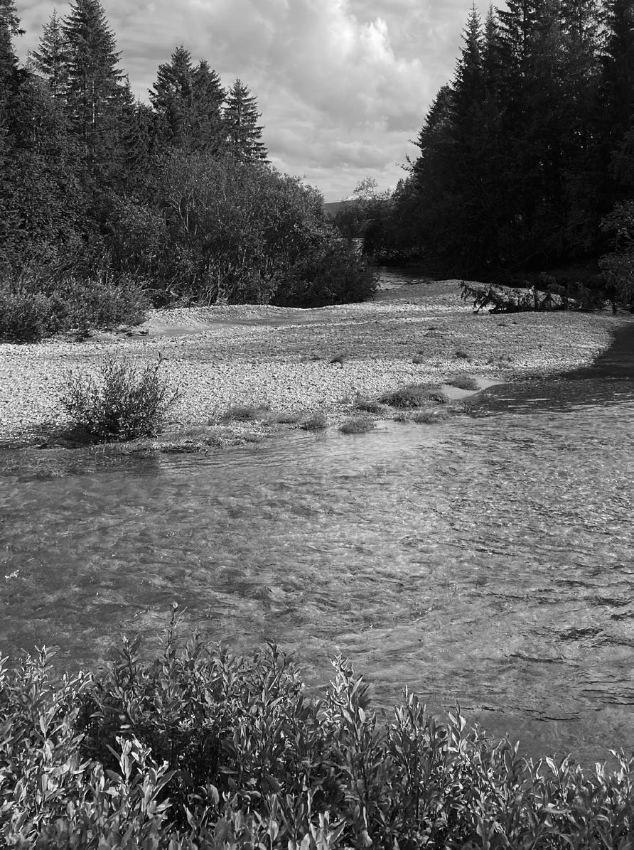
19
gravel placed by the water flows
20 PART 2 - site description

21
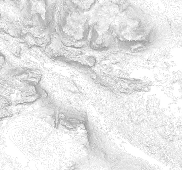
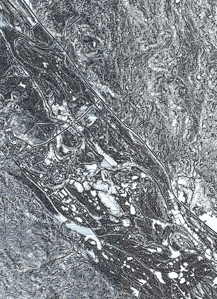
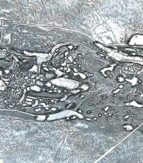
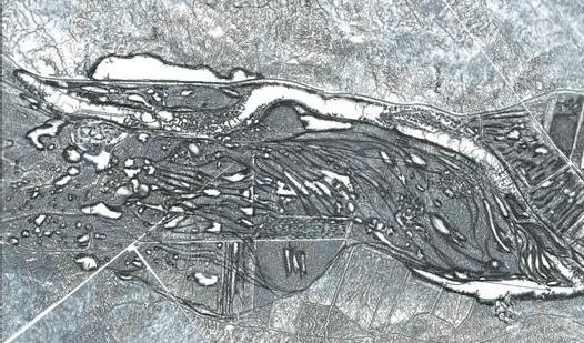
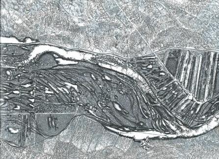
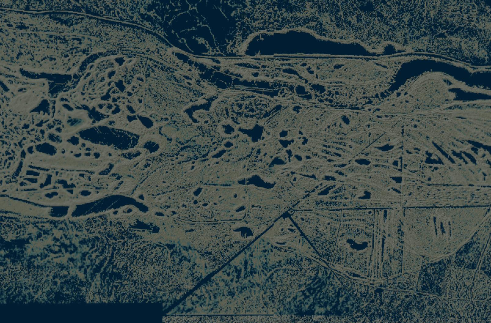
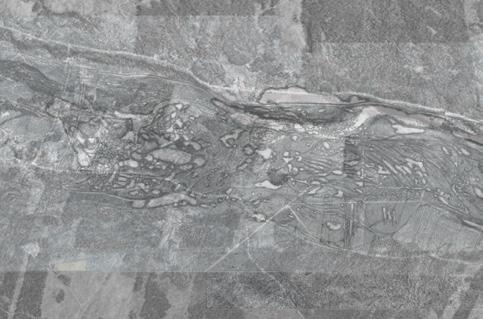
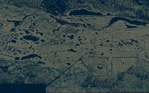
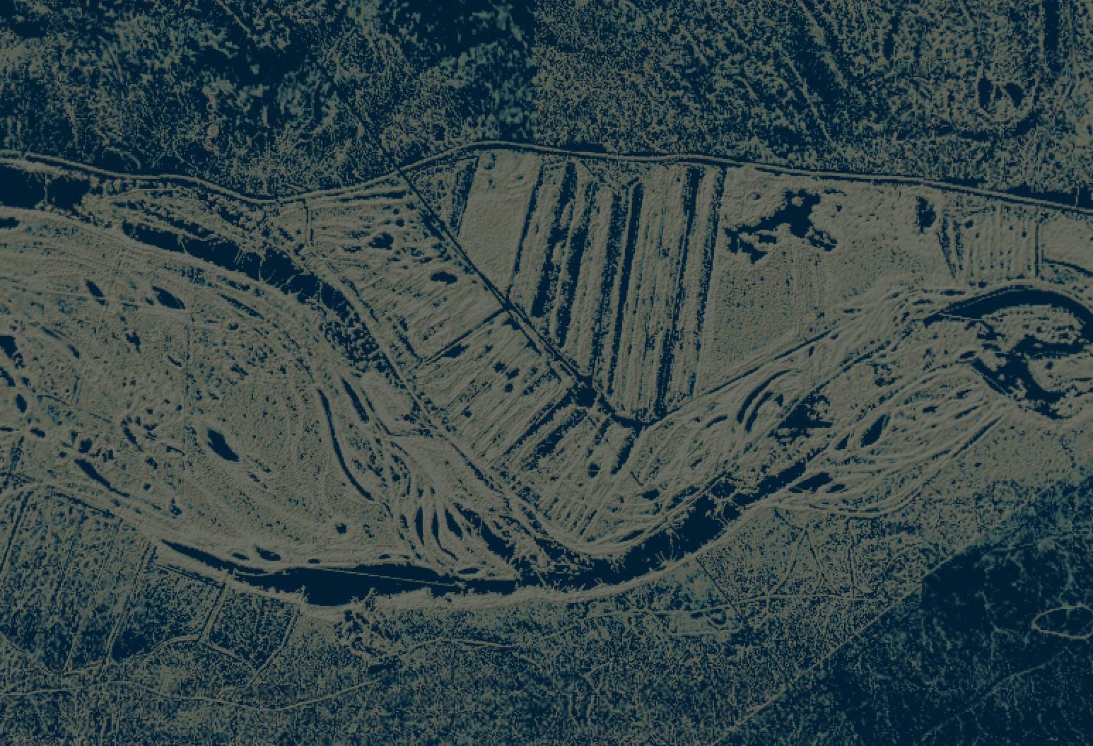
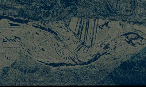
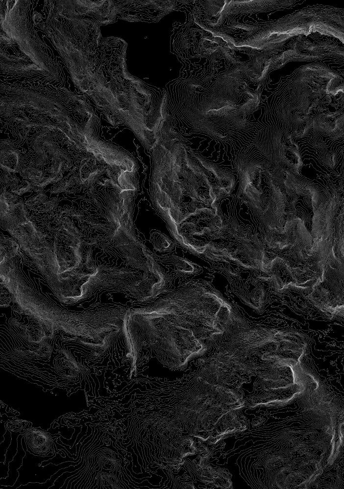
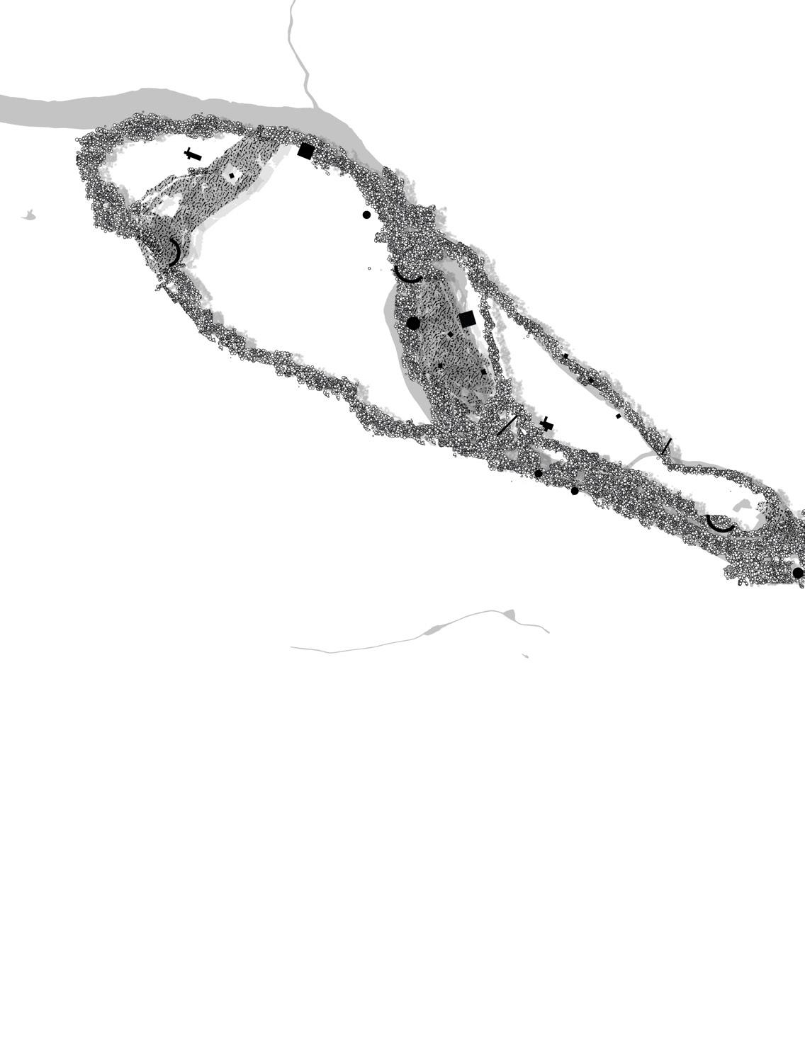
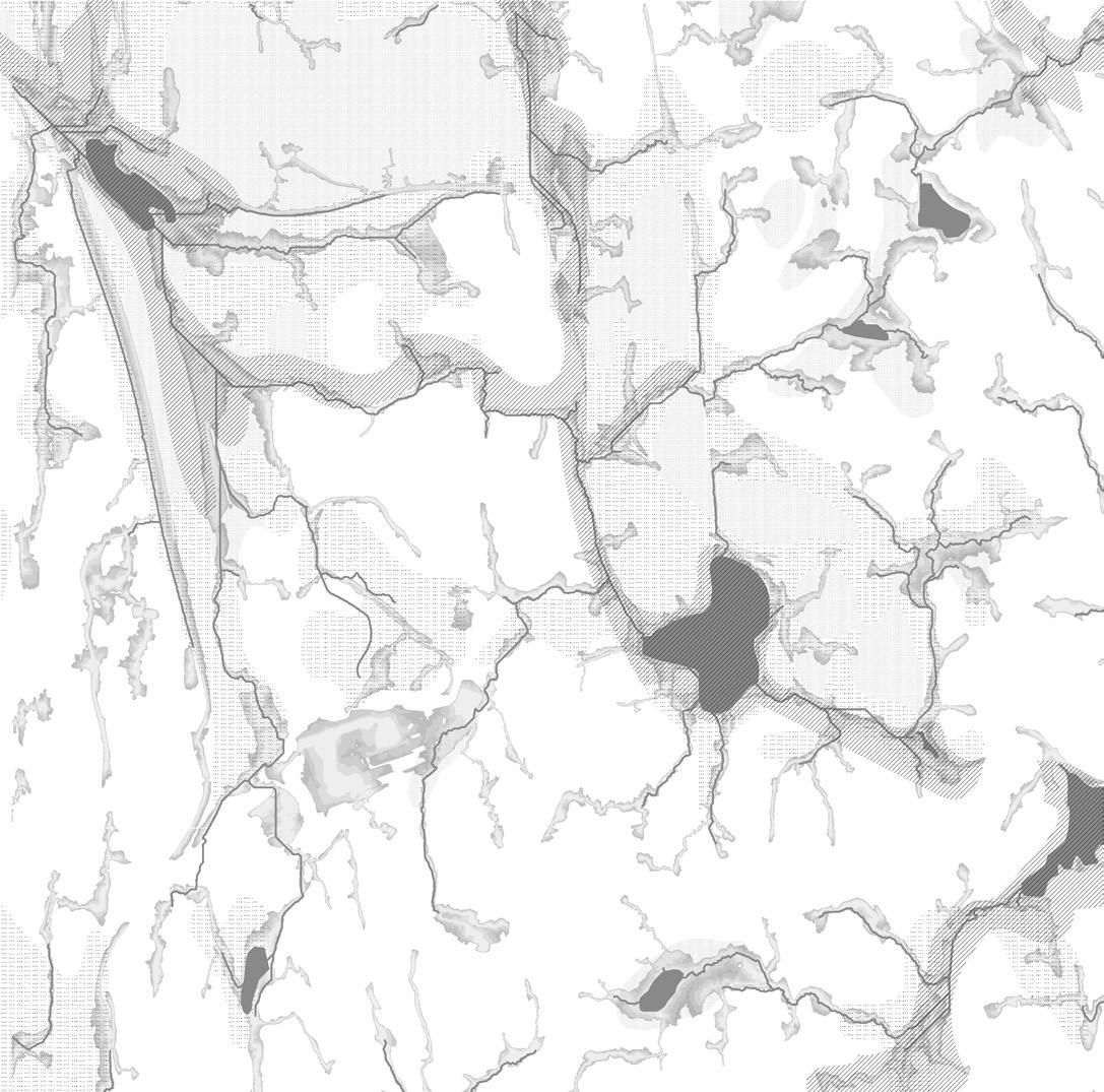
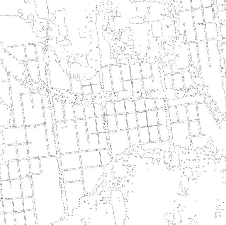
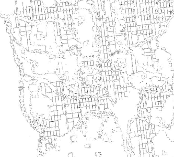
revealing the underlying landscape through digital water accumulations / qgis
22 PART 2 - site description
23
revealing the underlying landscape through digital water accumulations / qgis
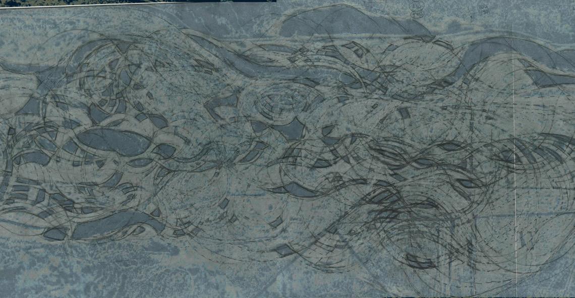
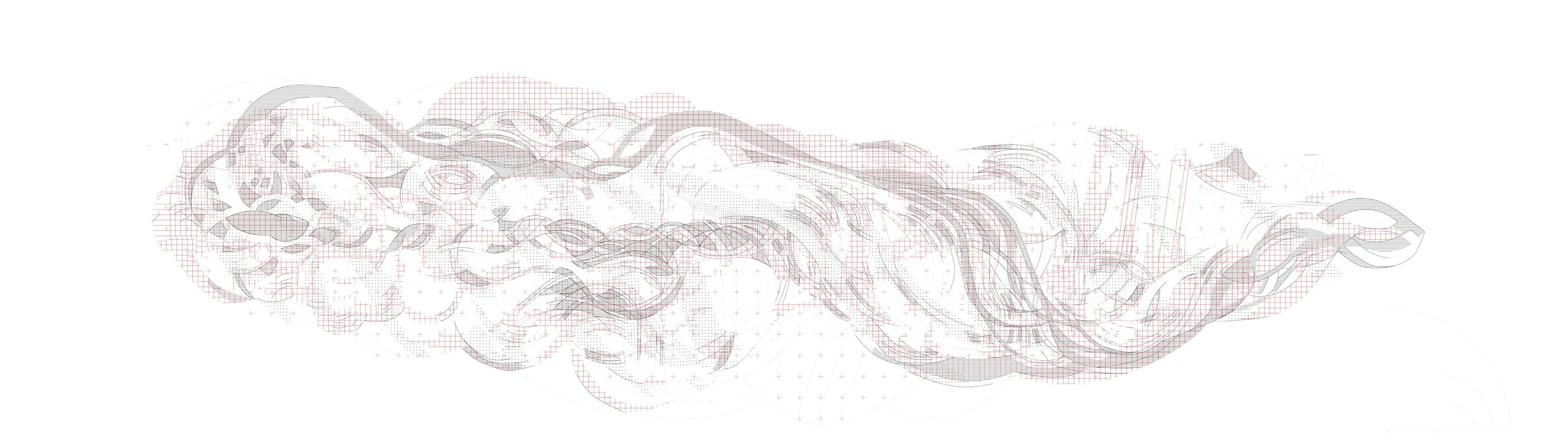
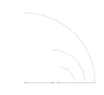
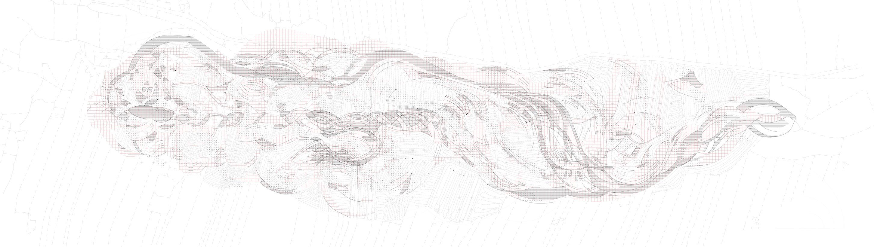
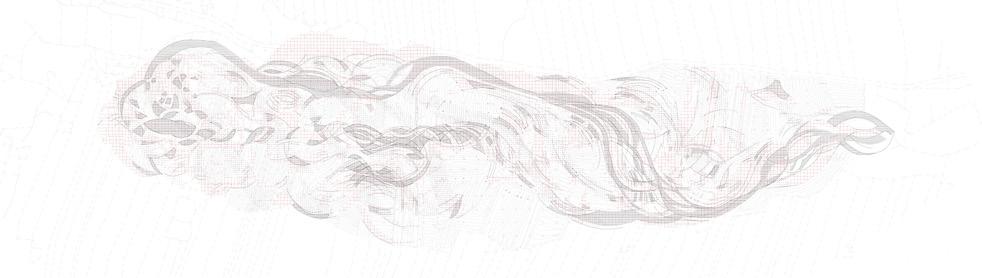
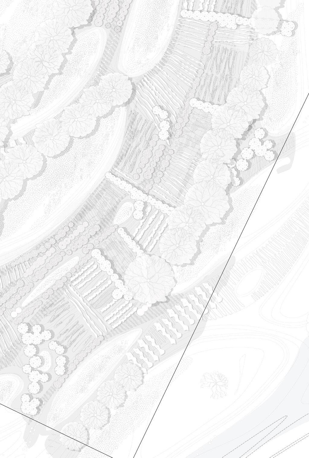
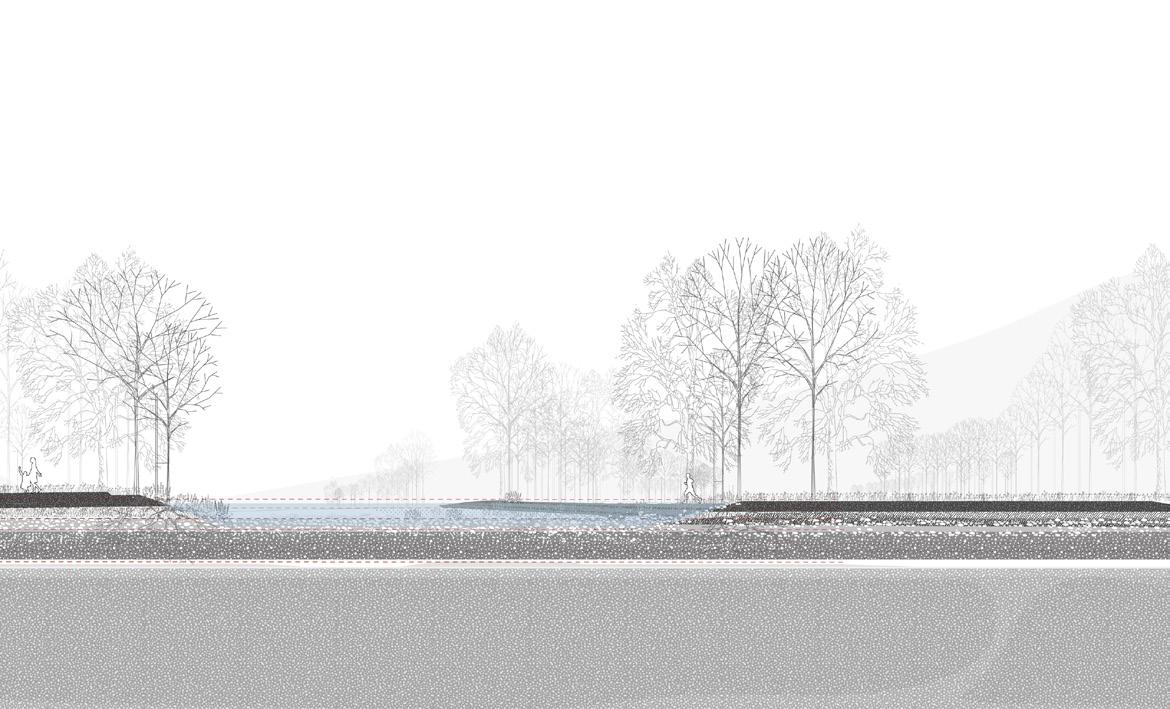
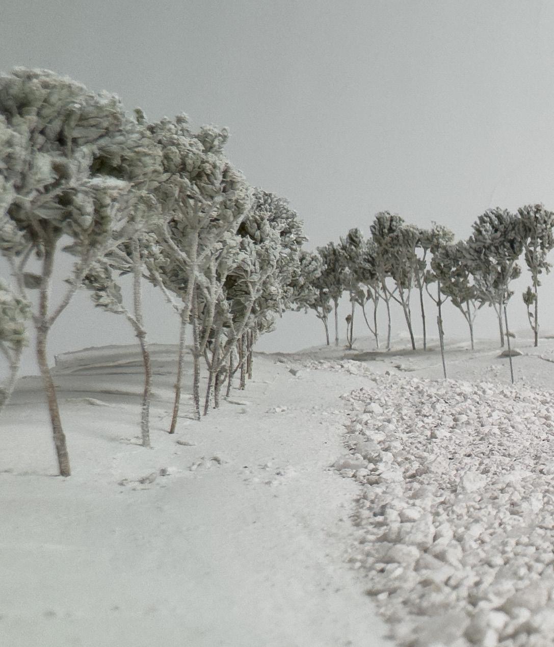
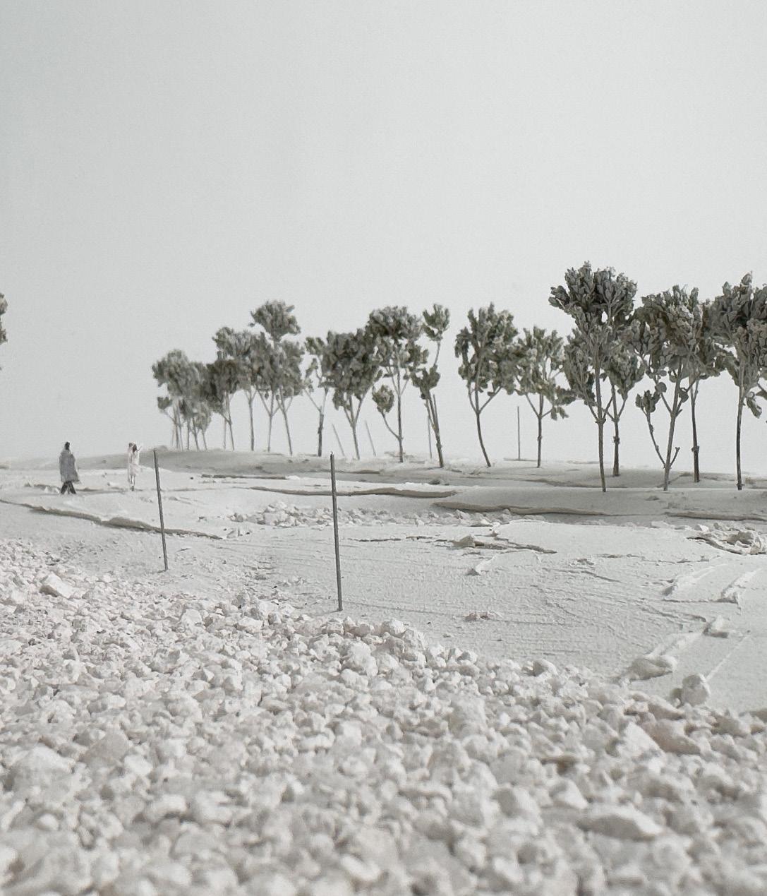
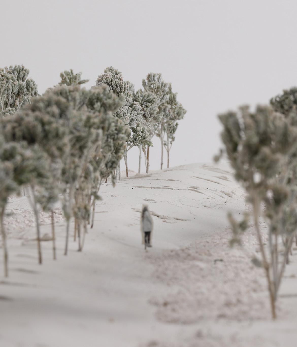
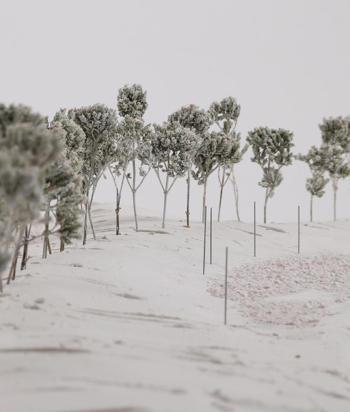
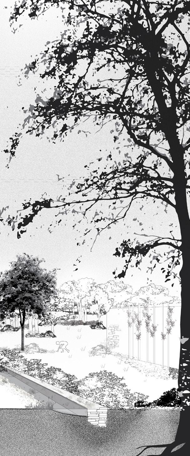
Tracings of water accumulations, extracted into digital models, function as a method to find the underlying landscape and propose a siteplan of potential waterflows and escapes if the water were let free from its predicted wayes of the river and into the landscape.
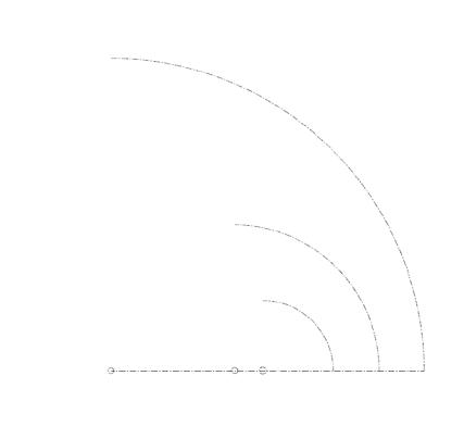
125 m 250 m 500 m
24 PART 3 - design proposal / method
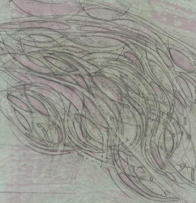
THE LINE SEPERATING
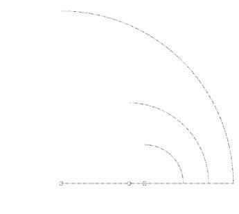
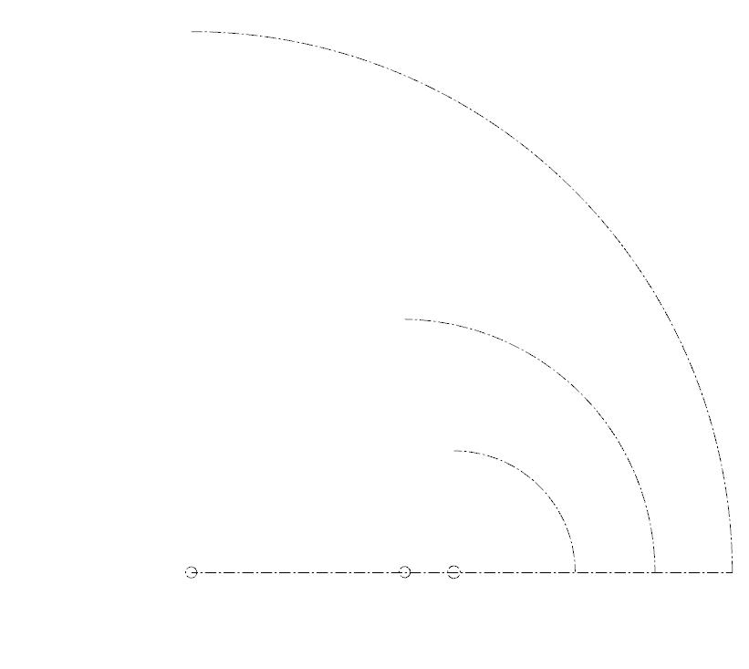
THE HIDDEN repetative flow radiuses
TRAGRESSING
FINDING

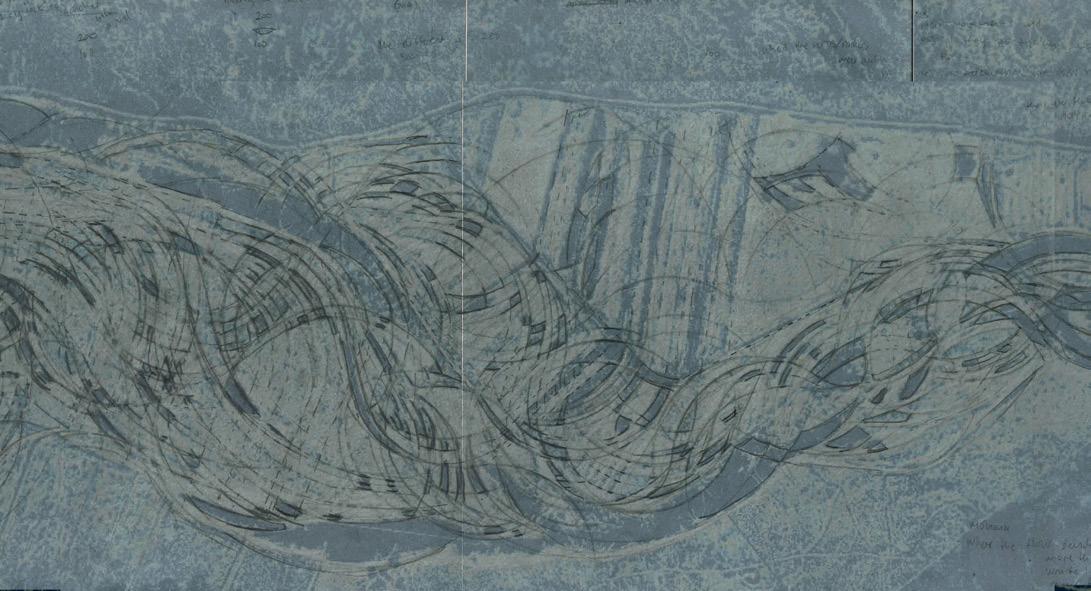
25
AND WATER
WATER(E)SCAPES
OF WATERFLOWS
LAND
HIDDEN
EXTRACTING ELEVATIONS AND DEPRESSIONS OF THE UNDERLYING LANDSCAPE LOGIC
A new organisation of land and water
The micro topography still speaks about the dynamics of the water and the past wet landscape. The flood distributes these spaces, proposing its space during spring-flood and demanding its space during extreme flood. This becomes a landscape which can take the floods, give the water its space and propose an organisation of water and land due to the logic of water.
26 PART 3 - design proposal / space and intention
27 repetative flow radiuses 125 m 250 m 500 m LOGIC OF WATERFLOWS A new organisation of land and water
28 provided land for future waterevents PART 3 - design proposal / space and intention
LOGIC
Providing land for future water events
29
OF WATERFLOWS
30 waterlevel raising runoff infiltration gravel groundwater the water PART 3 - design proposal / space and intention
EXISITNG PLOTLINES / DISTRIBUTING THE LAND
inserting the provided land within the social and production landscape

cultivated land
gravel and moraines deposits with high inflitration abilities
mower 10 m worklength runoff infiltration
31
water ”gates”
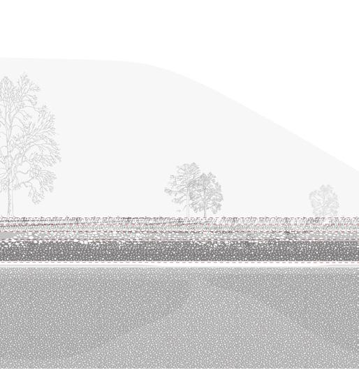
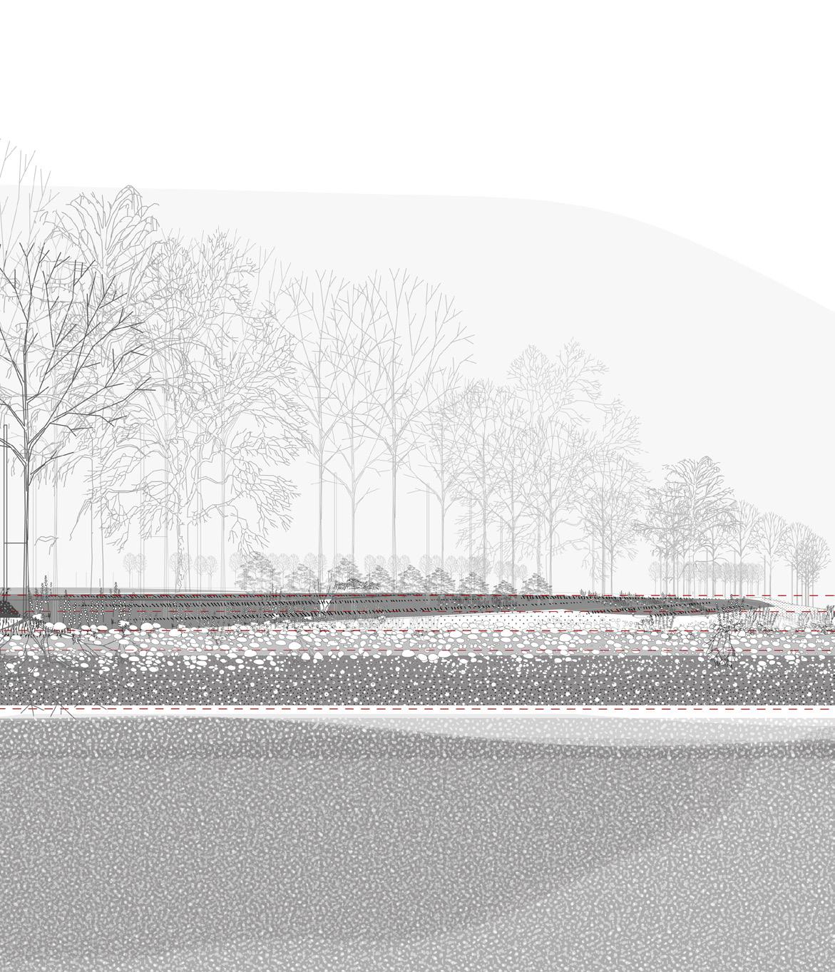
On a day of heavy rains the water arrives. From the mountains it comes as runof into the river, some of it infiltrated in the soil. The ground water is raising and the soil of the valleyfloor is filled with water. The moraines deposists appears as repetative sequences under the surface, becoming ””watergates” with their high infiltrationabilities, tranfering and infiltrating water between the surface and the deepsoil. These watergates appears as gravelbeds.
runoff
waterlevel raising
river / Hemsila bedrock
river room/ secondary river arm
groundwater groundwater
some infiltration water transportation
32
568 m.a.s.l
573 m.a.s.l
PART 3 - design proposal / function
surfacewater
gravel beds / water”gates” transportation between gravelbeds
floodlevel 500 y
heavy rains
river
groundwater
trees holding water and soil
gravel and moraines deposits with high inflitration abilities
573 m.a.s.l
571 m.a.s.l
569 m.a.s.l
568 m.a.s.l
<567 m.a.s.l
surfacewater
groundwater
33 THE MORAINE DEPOSITS AND THE WATER”GATES”
The flows hints to different functional units which could take the water in different ways and systems.
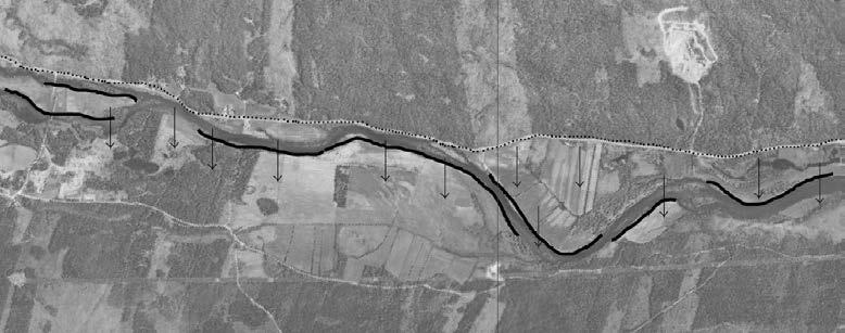
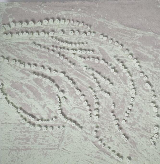
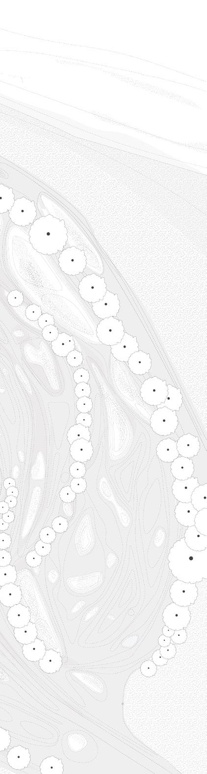
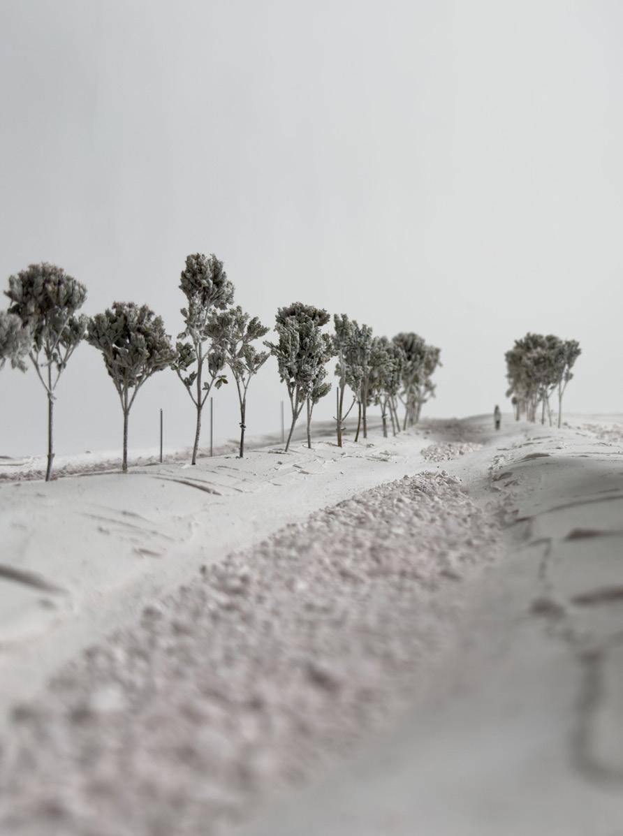
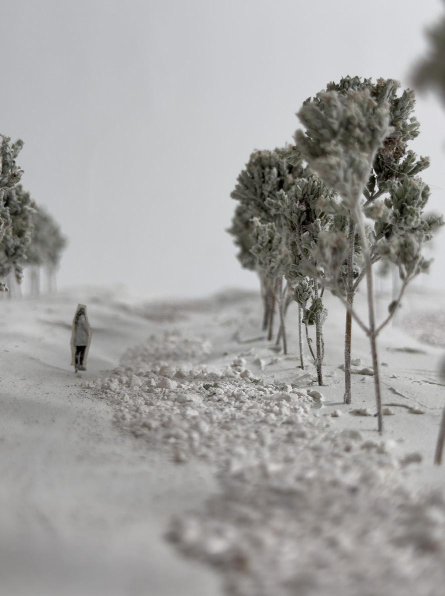
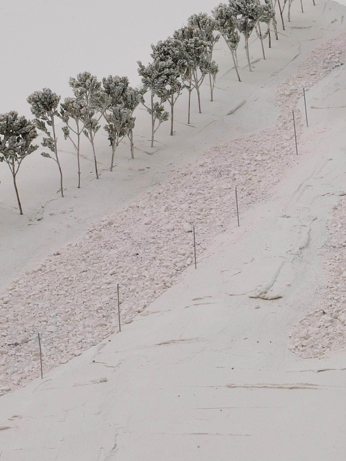
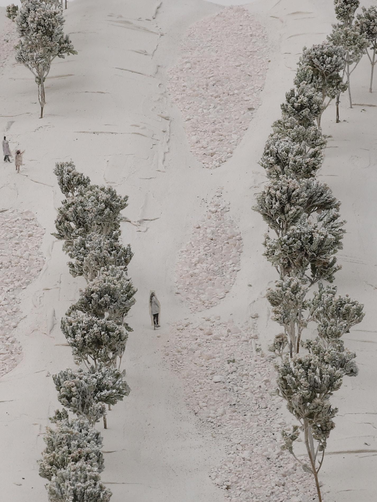
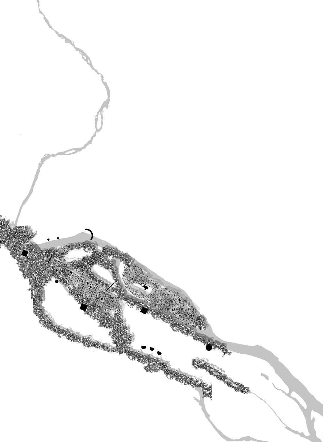
The area where the river meanderings are visible, has been chosen to further explore how this landscape of waterflows can appear. The meanderings of the river organise water and land depressions and elevations in certain ways which vizualise the forces, flows and the slow but demanding movements of water.
Extracting the site from the digital model into a model of elevations and depressions, filling it with sand to pronounce it more
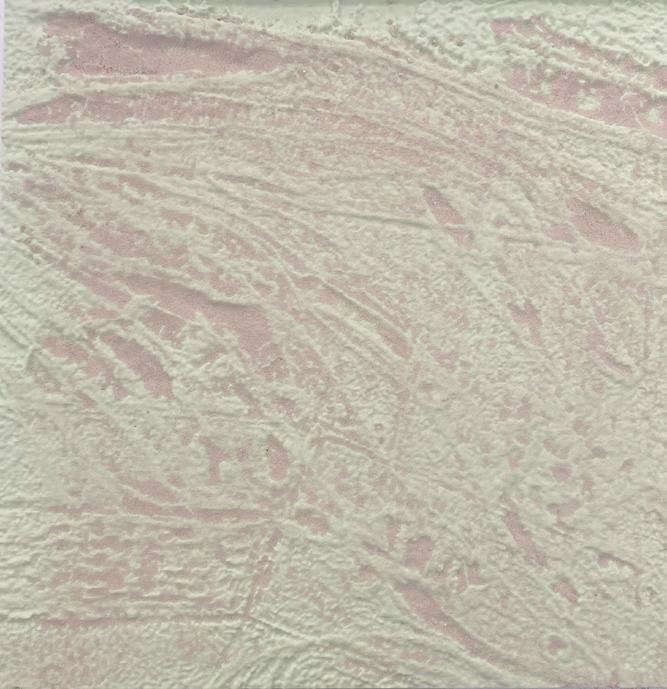
34 PART 4 - design proposal / method
Providing
35 repetative flow radiuses 20 m 40 m 80 m LOGIC OF WATERFLOWS
land for future water events
Salix Alba
Salix Alba
Poplus Tremula
Salix Alba
Salix Alba
Betula Pubesces
Betula Pubesces
Poplus Tremula
Betula Pubesces
Betula Pubesces
Poplus Tremula
Poplus Tremula
Poplus Tremula
Poplus Tremula
Poplus Tremula
Betula Pubesces
Betula Pubesces
Fraxinus Excelsion
Fraxinus Excelsion
Fraxinus Excelsion
Fraxinus Excelsion
Tremula
Salix Alba
Betula Pubesces

Poplus Tremula
Fraxinus Excelsion

36 b a 20m 10m 50m
Poplus
PART 4 - design proposal / space and intention
repetative flow radiuses
20 m
40 m 80 m
The meanderings of the river, are pronounced through vegetation, soil and gravel. The flows and dynamics of the river becomes visible through lines of vegetation and water. When the river escapes is predicted wayes, during heavy rain and springflood, it enters this stage and fills in the meanderng tracings. when the water arrivesit runs into the site, pushed by the descreasing alltitude, downstreamdirection and from the valleysides
37
BEDS, SOIL BANDS AND VEGETATION LINES
GRAVEL
Poplus Tremula
Poplus Tremula
Tremula
Betula Pubesces
Salix Alba
Fraxinus Excelsion
Betula Pubesces
Poplus Tremula
Excelsion
Salix Alba
b a
1:1000
PART 4 - design proposal / space and intention section 20m 10m 5m (twisted to relate to section)
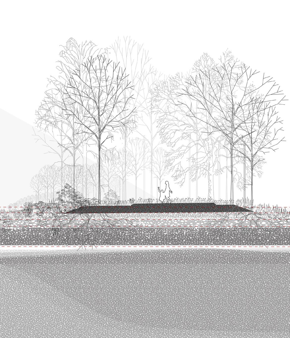
Within this landscape the vegetation lines create sequences of narrow and wide spaces where the meanderings almost meet, and where they move apart.
39 CULTIVATION AND INFILTRATION
0.2 m contourlines 1:200
-Making this landscape "act" or function by removing the topsoil and place it aside and revealing the moraine deposits and gravel underneath, with high infiltration value. The removed soil placed aside, becomes soil bands of raw earth, with cultivationvalue
Through this act of moving the topsoil aside the original infaltration abilitites of the landscape is reactivated: The geological record of moraindeposits and gravel and the present climatic record of water events meets.
Topsoil
Glacier deposits
Groundwater
Bedrock

40 PART 4 - design proposal / space and intention
Removed topsoil placed aside
Original topsoil / Waterlevel s.f
Removed topsoil / Gravelbeds
Gravel /Exposed moraine deposits
Groundwater
Bedrock 1 2 3 4 5 6
1
2
3
4
5
6
41 Topsoil Glacier deposits Groundwater Bedrock Flood Topsoil removed Topsoil placed aside Topsoil Glacier deposits Groundwater Bedrock
The water will infiltrate through the gravelbeds which becomes watergates between the surfacewater and groundwater.
floodlevel 500 y
heavy rains
river
573 m.a.s.l
571 m.a.s.l
569 m.a.s.l
568 m.a.s.l
<567 m.a.s.l
42
PART 4 - design proposal / space and intention
43
44 PART 4 - design proposal / space and intention
45
46
The tracing of waterflows, and the meandering echos finds a lansdcape were the water can escape the riverbed into the provided land.
47
48
49
50
51
Within this landscape the river as a dynamic element becomes visible and preformative, leaving reminders and traces of its forces and wayes.
52
53
Supervisor
Jokim Skajaa Professor Architecture, Bas
Hedvig Sherdal Professor, Archtiecture, Bas
BAS: Diploma project/ master in architecture / spring 2022
CHAPTER 2:
Ilinger / Hemsila Tributaires

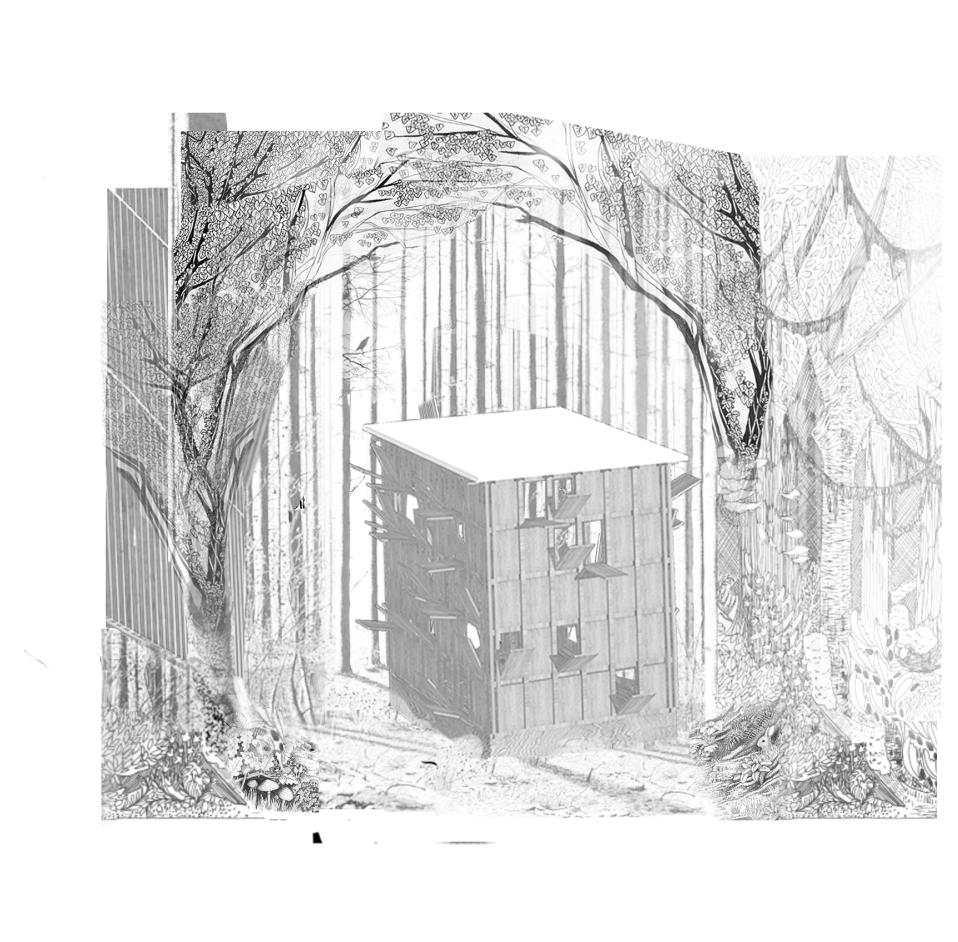
54
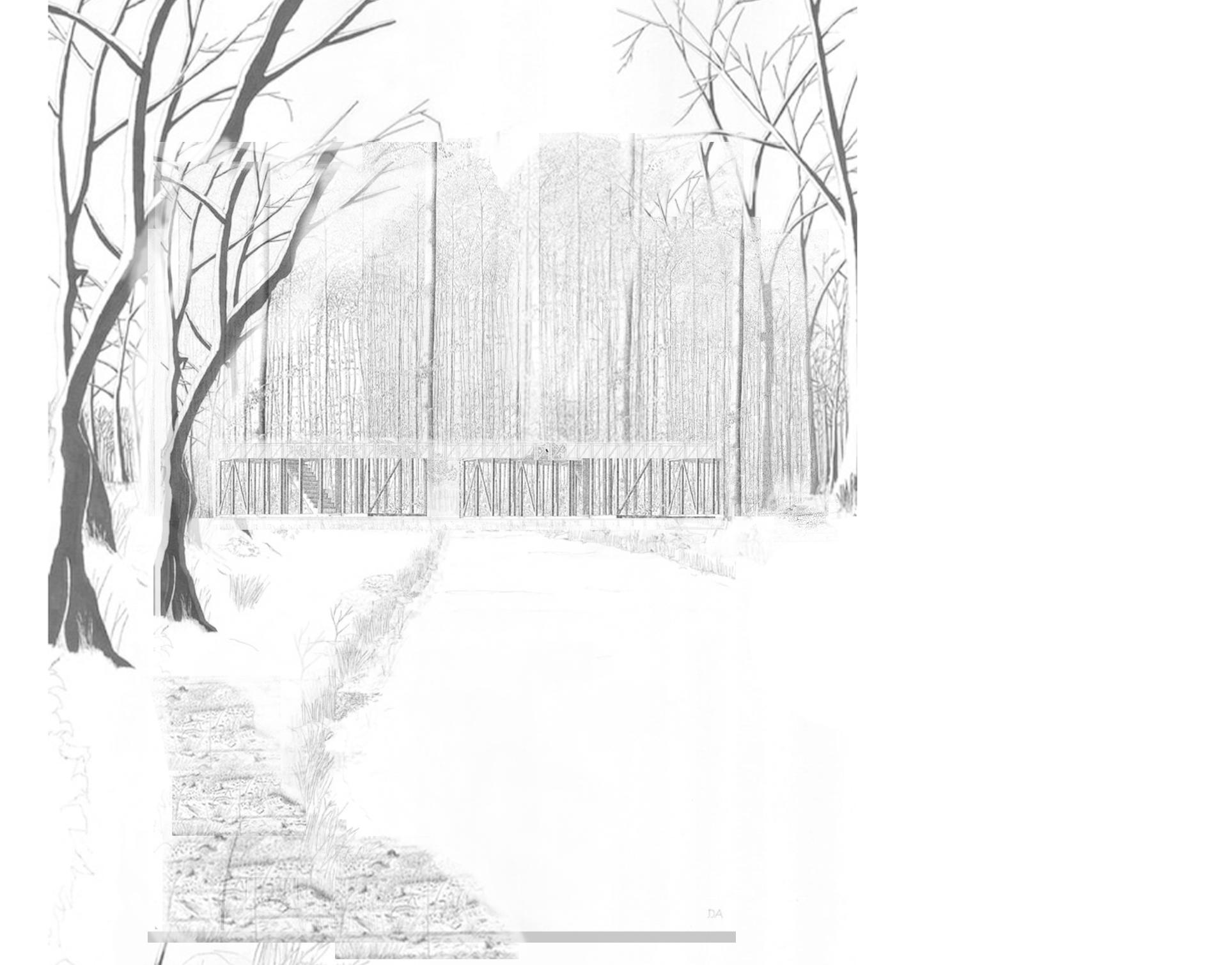
The chambers in the forest
55
56 Intro
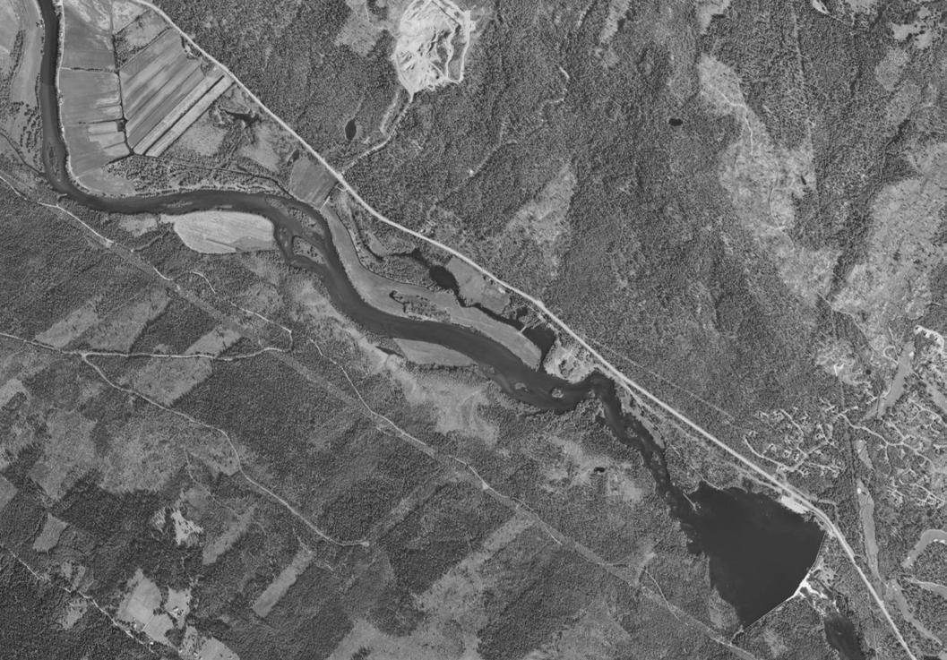
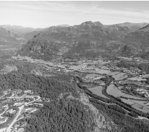
HEMSEDAL CENTRUM / TRØYM
Can the mountain village also become a river village?
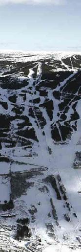
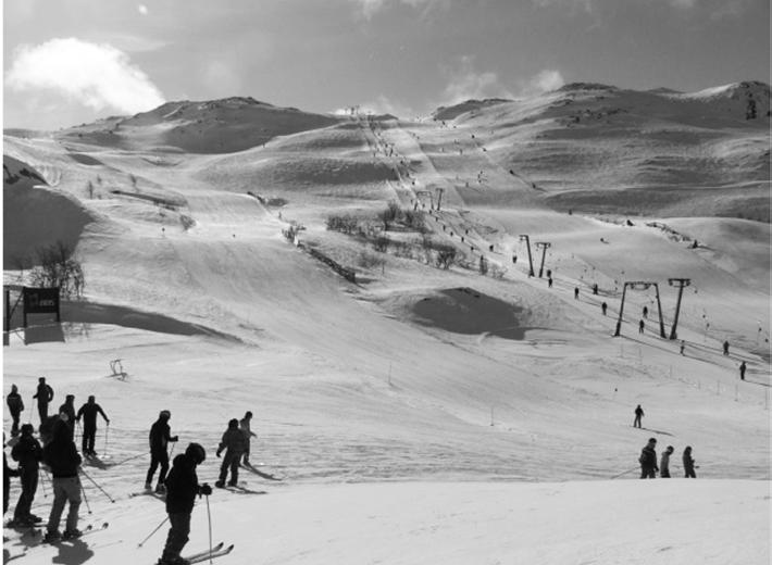
Trøym is a typical norwegian mountain village in the valley of Hemsedal. The skiresorts in the valley sides attracts people to the mountains of Hemsedal.
The project is set in the riverscape of Hemsila, where the river meets the village centrum. The project envisions the vitalisation of the Hemsedal center and the valley floor by placing multitudes of architectural landscape structures within typical spaces of the riverscape. The structures will facilitate river activities and offer common spaces where the locals and tourists alike can host and gather.
Can the mountain village also become a river village?
TIME LINE
FORCE OF ATTRACTION
Valley floor Valley sides
1700-1990
Farmland
The river and fields in valley floor
Animals grazing in the valley sides
1900-2020
Ski resorts
The river and Trøym centrum in the valley floor
Future scenario
The river and Trøym centrum in valley floor
The ski resorts in the valley sides
The ski resorts in the valley sides
58
Strategy
The importency of the river, Hemsila, has been lost in modern times. The ski resorts in the mountain sides attracts people, and leaving Trøym centrum in the valley floor empty.
How can the spaces and the riverscapes of the valley floor become a force of attraction in the future scene of Trøym?
59
REACTIVATING THE VALLEYFLOOR
COUNTER FORCE
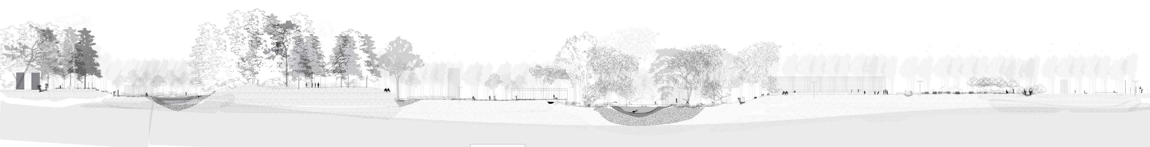
Adding valuable activities into the valley floor, facilitated by the structures, or the tributaires of Hemsila. This gesture becomes a counter force to the attraction to the skiresorts in the valley sides.
60 climbing mountain skiing mountain biking alpine skiing afterski mountain hub village hub bathing kayak playing race cycling cultivating picking sauna downhill biking cross country hiking horse riding horse riding river fishing lakefishing
Design Proposal / I
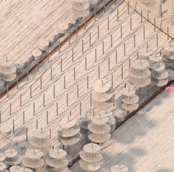
HEMSILA TRIBUTAIRES
Placing landscape structures within the riverscape to provide new public spaces
The architectural structures within the riverscape are designed to their spesific placemenT and the spacial qualities of each plot. These qualeties are found and selected through different analytical tools and methods, collected into a toolbox for designing.
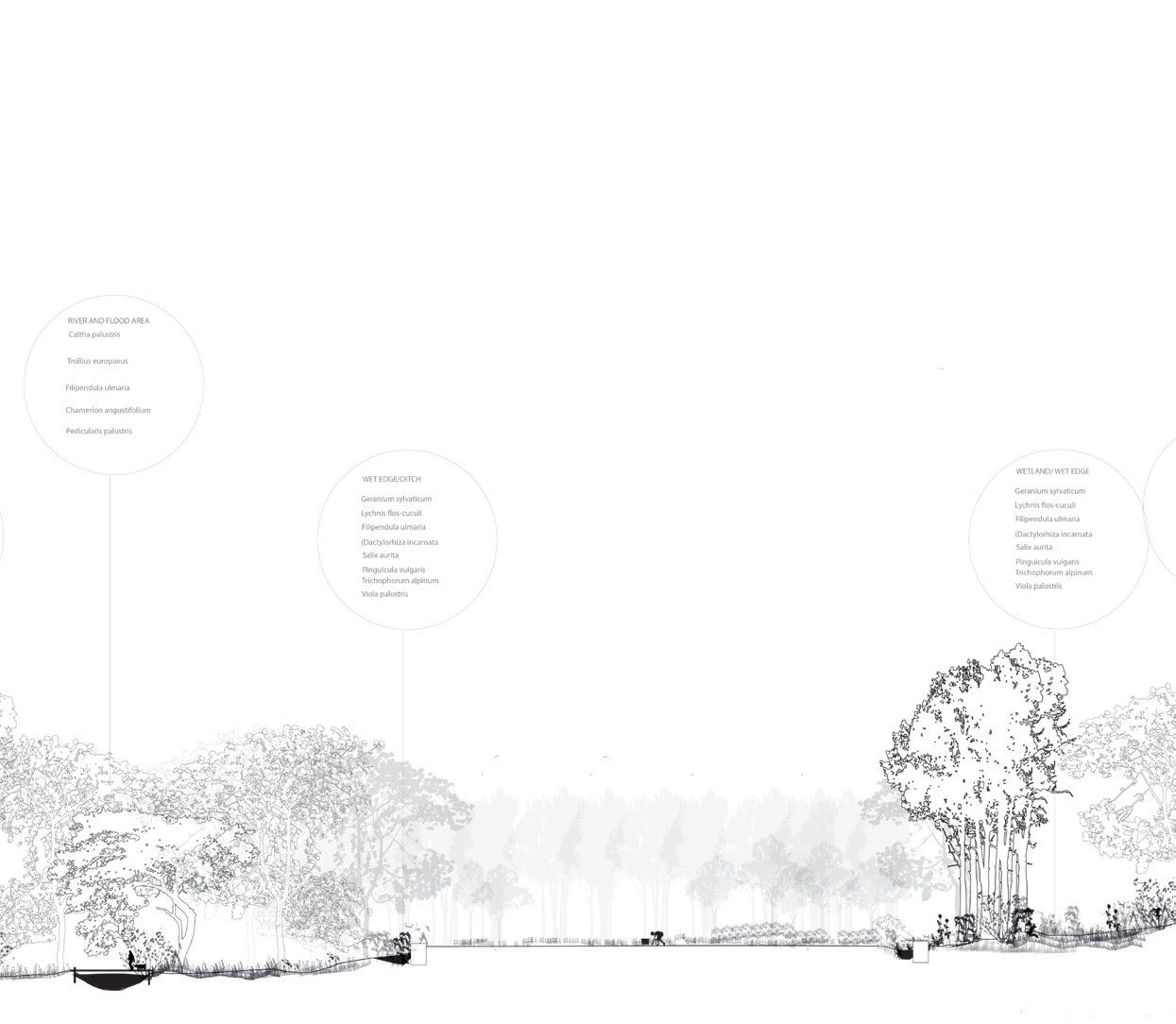
The architecture appear as objects, commenting, extracting and enhancing their state and position within the riverscape. Three of these plots are in the fields, the forest, and the river edge
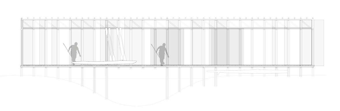
The room by the river
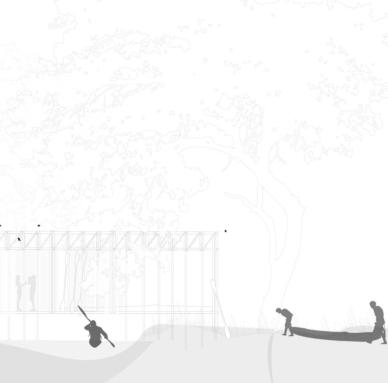
The chambers in the forest
The hall in the field
61
62
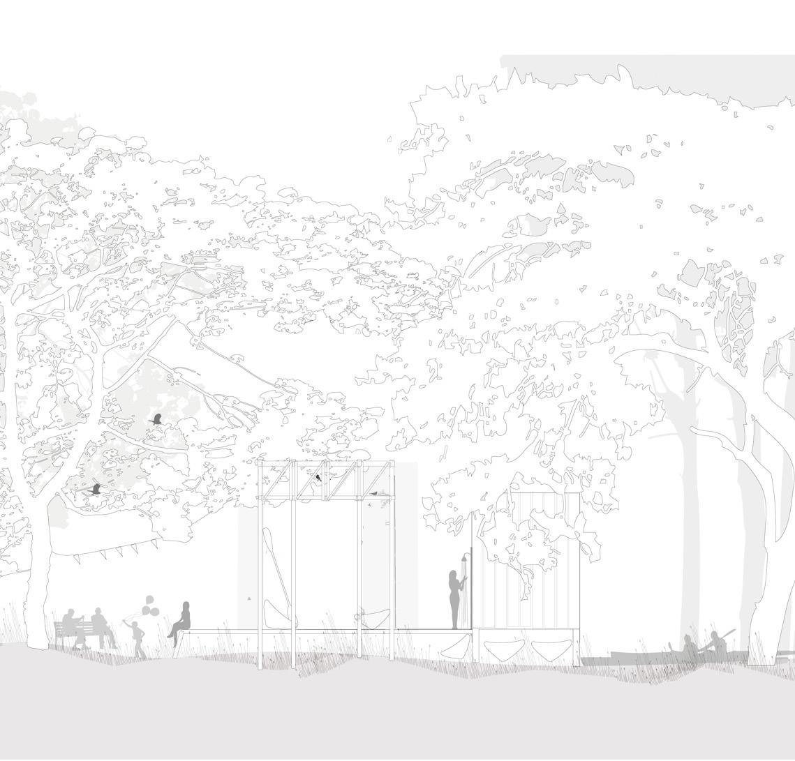
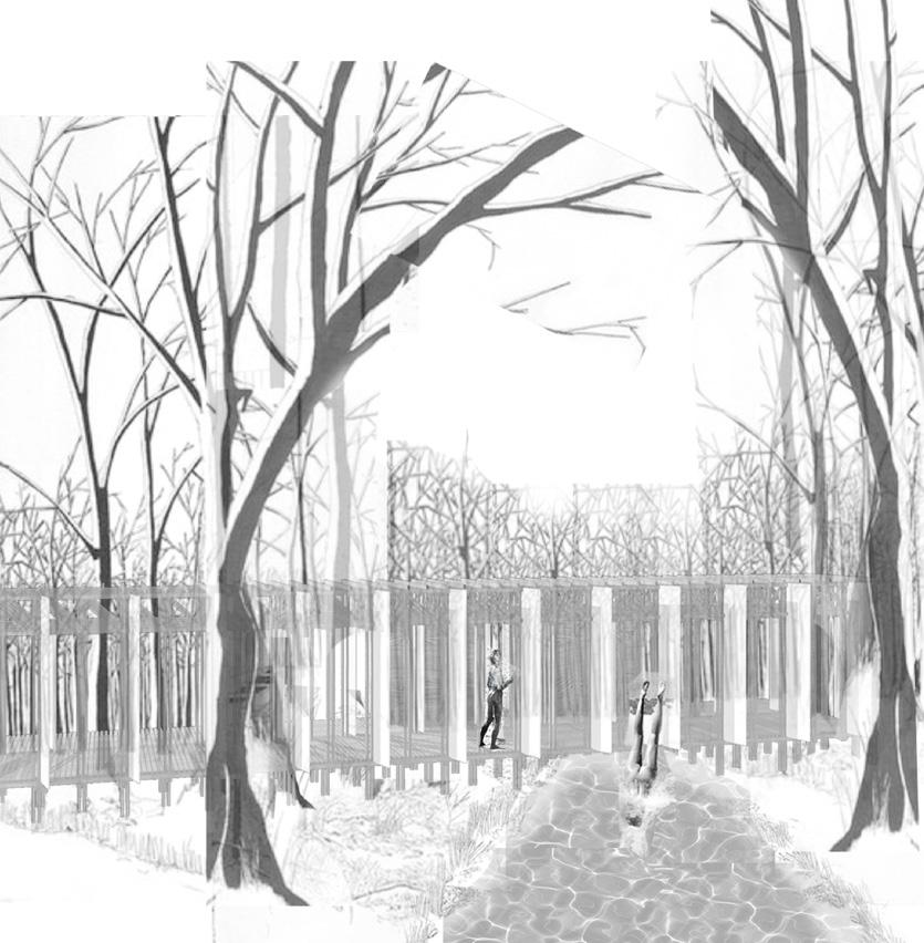
The chambers in the forest
Another structure
The river
Design Proposal / I
Landscape furnitures
CONCEPT LONG SECTION / THE FORCE OF THE RIVERSCAPE / HEMSILA TRIBUTAIRES
Adding landscape structures within the riverscape
Landscape furnitures

63
The room by the river
The river
The river edge
The hall in the field
Design Proposal / II


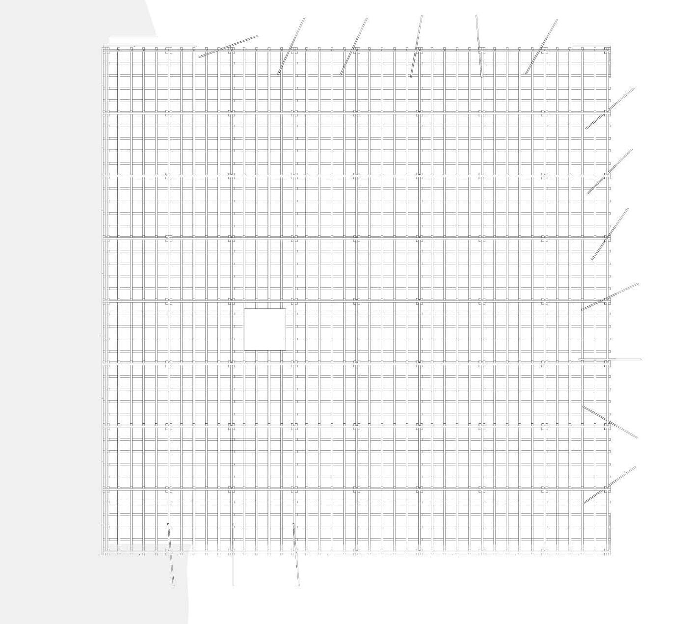
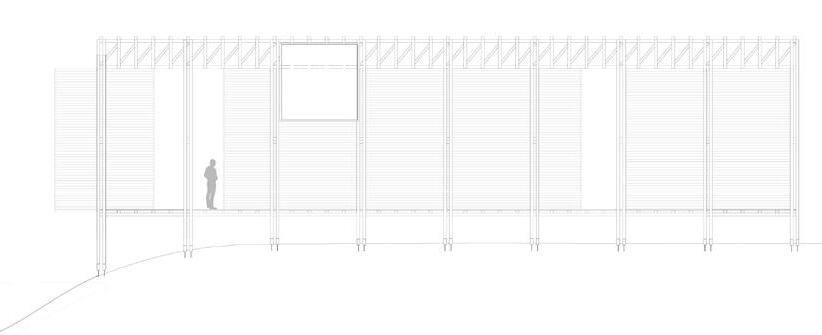
66 10m 5m Design Proposal / II
THE HALL
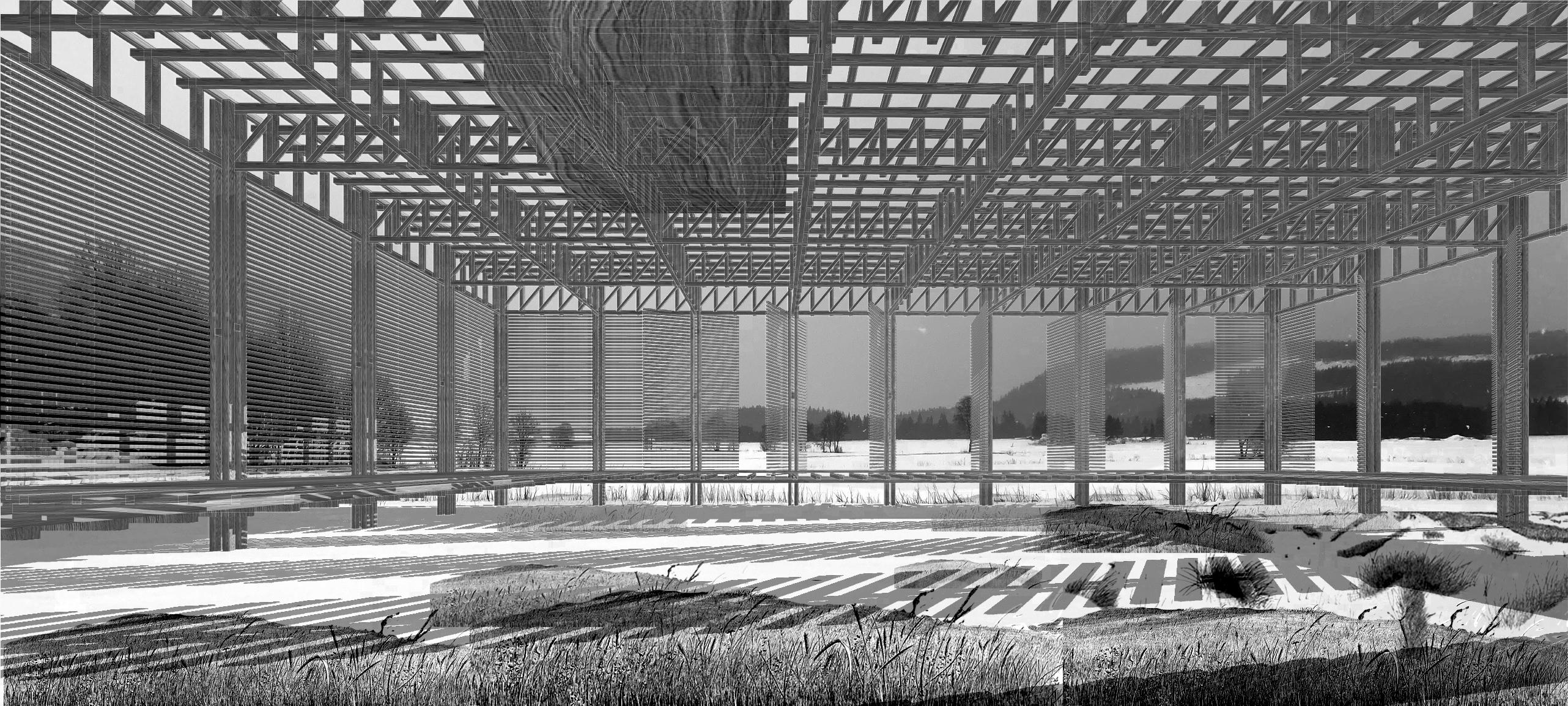
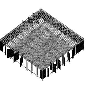
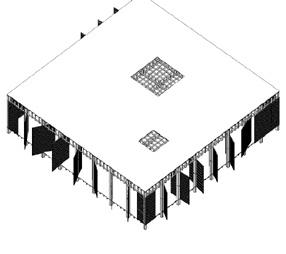
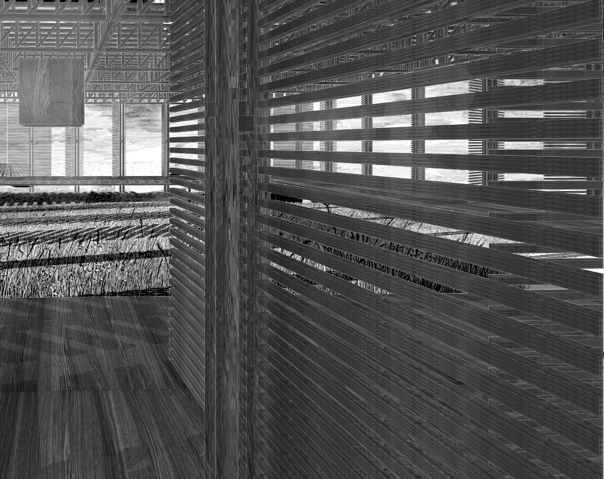
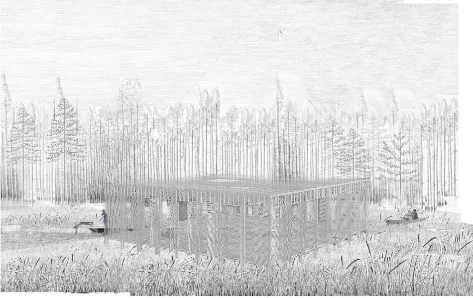
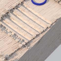
The hall works like a community house. Kids from the elementary school walk through the field in rows leaving long thin trails in the grass leading to the big hall by the river. They concur it with leaps and screams and open all the doors to let the wind from the field through. After gym class the children jump straight off the floor into the cold, slow moving river. Later in the evening a whole orcherstra fills the room to have a rehearsal.
The room in the field is an expansive space in an expansive landscape. It can appear completely silent and enclosed, blinding into its sorrounding landscape of the field and the river. A moment later be filled with action and screams of children playing dodgeball or having a gymclass.

67
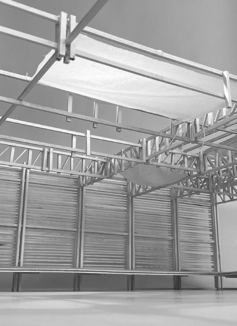
Photo / physical model
-Roterende dører
-Roterende dører
-Oppbevaringsrom 5m2, - Takkonstruksjon i bindingsverk for materialbesparende og bæreevne.
-Oppbevaringsrom 5m2, - Takkonstruksjon i bindingsverk for materialbesparende og bæreevne.
68
Design Proposal / II
swimming fishing performance consert theater
commmunity house sports
yoga
paddle tennis classes
kayak course workshops
69
70 10m 5m Design Proposal / II
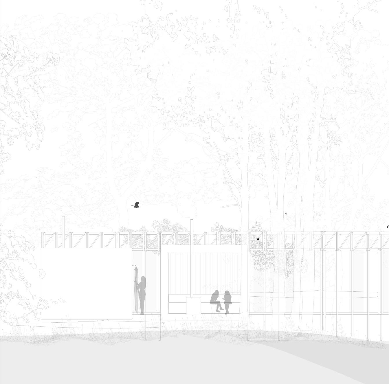
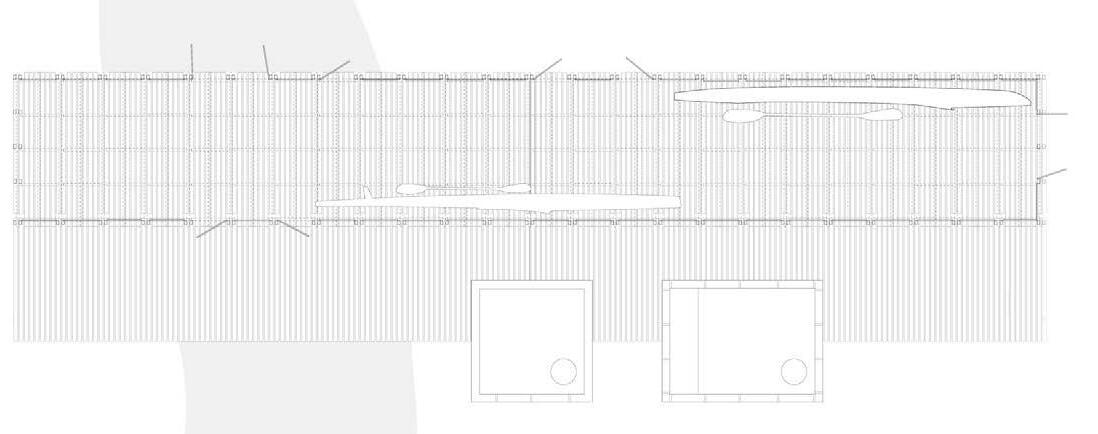
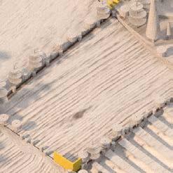
The room by the river is a place to shower the canoe, rinse river mud off you body after diving and step inside the warm sauna. It is a hub for canoes and diers. Two friends are holding onto a rope lifting a canoe out of the river. They shower it on the wooden floor with glips letting the water through, and stack it in the racks. After hanging their wetsuits in the sun to dry, thay take one bath in the river.
The whole river is frozen and a family from the village goes to the room by the river edge to take a ice cold bath in the river. Then they go to the very hot sauna. In the summer the room is full of people busy showering, bathing and preparing for river activites. In the autumn and spring the sun will warm up the room through the glassdoors.
71
BY THE
THE ROOM
RIVER
72 Design Proposal / II
place for canoes
fishing
showering
bathing
sauna
iceskating
chaningroom
73
74
The room by the river
75
The chambers in the forest
Supervisor Sabine Muller Professor Intitute of Landscape Urbanism, Aho
Miguel Hernandez Assistent Professor, Institute of landscape Urbanism, Aho
AHO: Master studio / make do water do / spring 2021
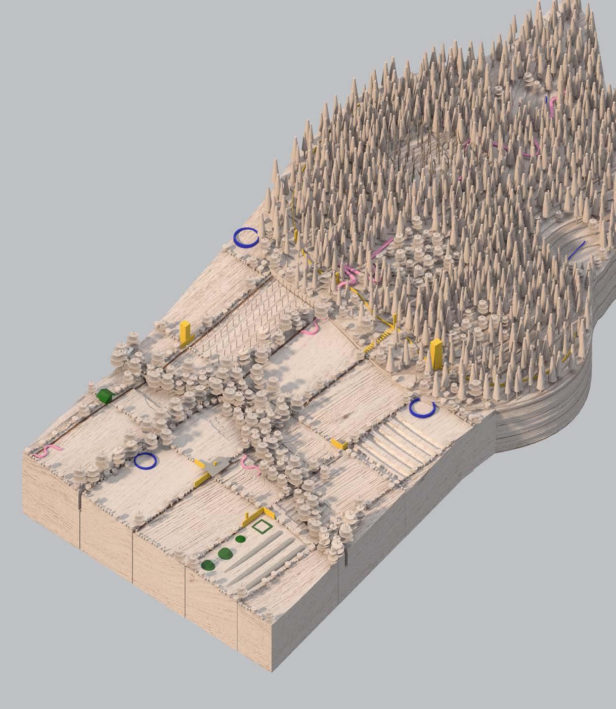
CHAPTER 3: Patchwork Landscape
76
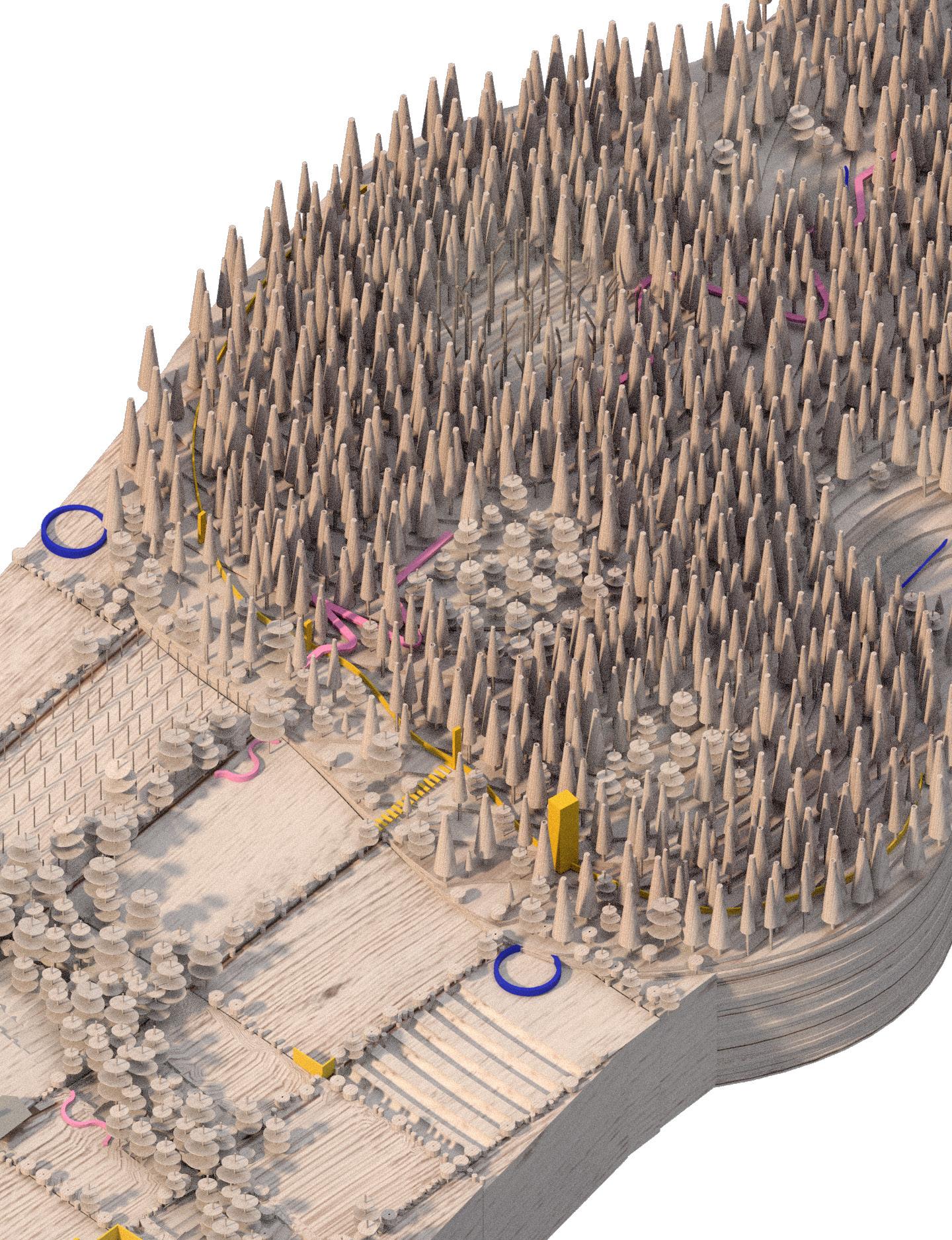
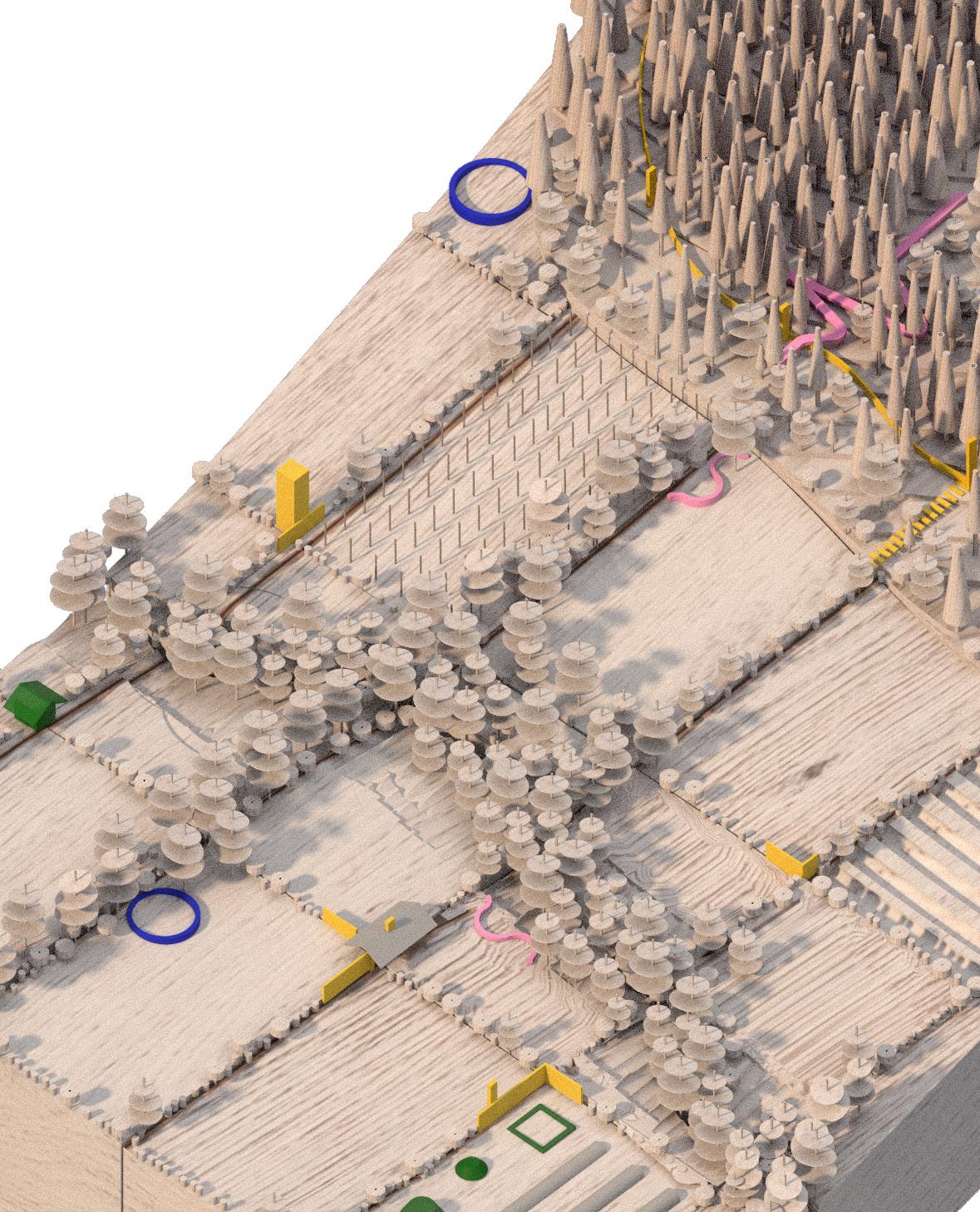
PATCHWORK LANDSCAPE
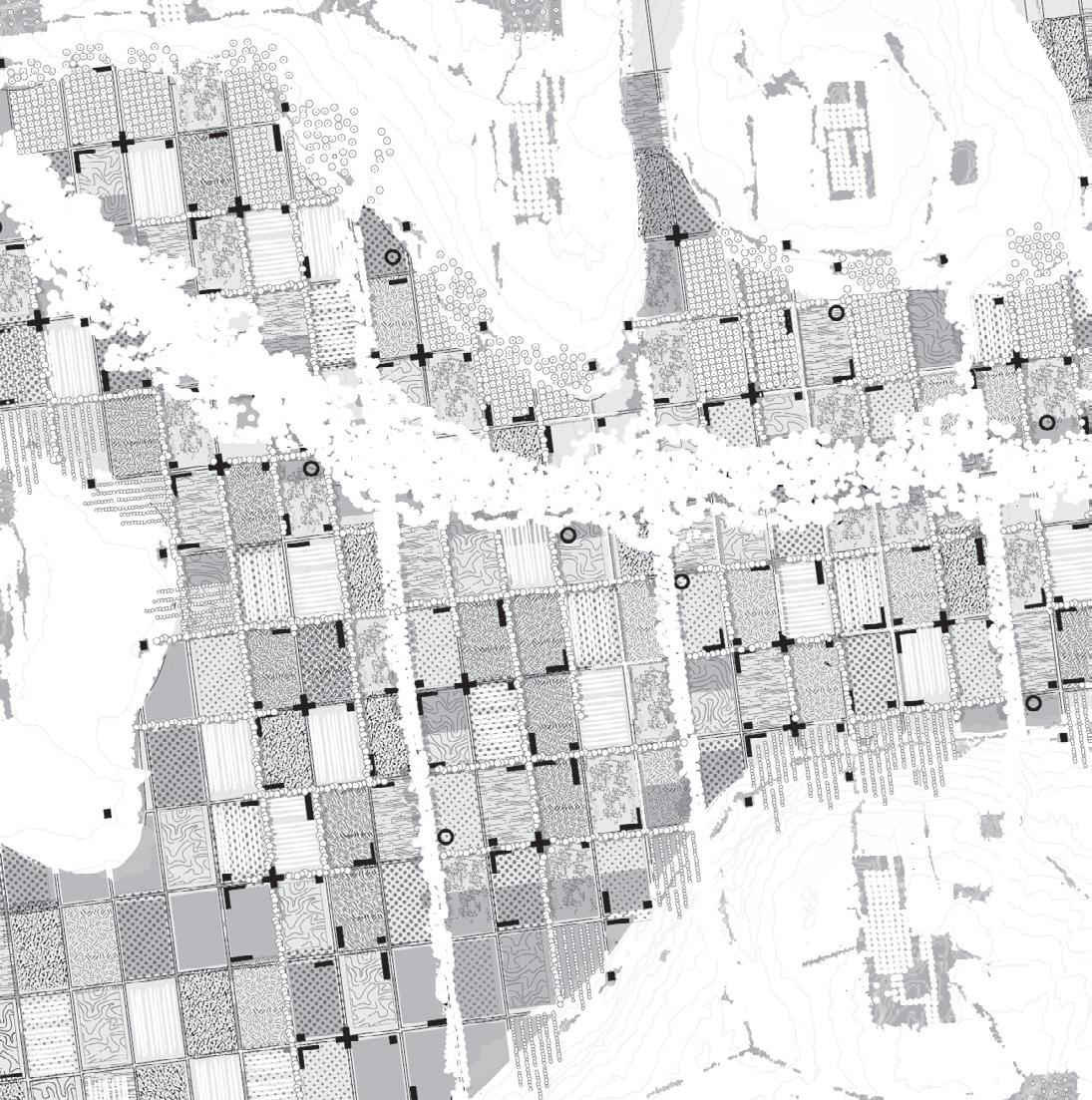
The water structure enables a green structure to emerge, becoming the framework. The matrix connects the hilltops and bridges the different areas of ecology to enforce ecological succession and increase diversity. On the hilltop, there are satellites of clearings connected to the gridded structure on the valley floor.
The green structure divides the plains into spatial chambers with different characteristics depending on the trees, hedges, shrubs.
By working with the different types of vegetation as walls, we create various combinations of spatiality between the sky and the ground plane.
78
Intro
PART 1 - site description / framework
PART 2 - infill / space
PART 3 - objects / patches
79
STENSRUD: FARMLAND
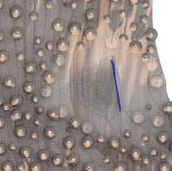
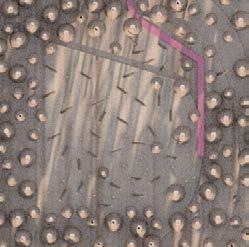
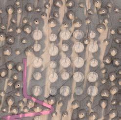
Whilst the landscape of Stensrud-Gjersrud is dominated by cobbled, pine-clad hills, the lower-lying areas are well fitted for farming. Indeed, Stensrud is one of the last remaining village societies and farming areas within the Oslo building zone. Loose finds of shaft hole axes, dating back to the Neolithic (6 000–3 500 BC) indicate that the area has been partially cleared and cultivated since thousands of years. Today, 70% of the area is forested, 12% farmland.
SYNCHRONIC LAYERS: WATERBDIES, FLOODRISK, WETLANDS AND INFILTRATION
80
SITE DESCRIPTION PART 1 - site description / framework
FRAMEWORK: WATERSTRUCTURE
Forested hilltops: Rainwater harvesting, retention ponds
Valley floor: Water grid
FRAMEWORK: LAYERS OF FRAMEWORK
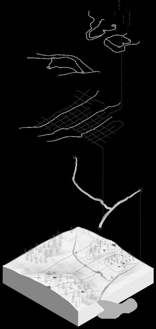
81
watercourse 1 2 3
Existing
Hills, plains and grid New waterstructure New matrix of vegetation Accessibility FRAMEWORK
FRAMEWORK: VEGETAL STRUCTURE
Vegetation: matrix of connectivity.
The water structure enables a green structure to emerge, becoming the framework.
The matrix connects the hilltops and bridges the different areas of ecology to enforce ecological succession and increase diversity. On the hilltop, there are satellites of clearings connected to the gridded structure on the valley floor.
The green structure divides the plains into spatial chambers with different characteristics depending on the trees, hedges, shrubs. By working with the different types of vegetation as walls, we create various combinations of spatiality between the sky and the ground plane.
82
PART 1 - site description / framework
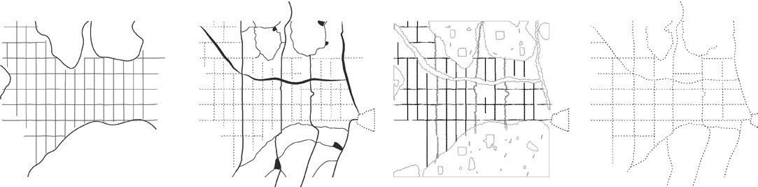
HILL + PLAIN + GRID
Riparian vegetation
Green bands
Green lines
Hills
FRAMEWORK: VEGETAL STRUCTURE, CLOSE-UP
The framework consists of hills, plains, and a grid. Waterbodies, expanding the network of wetness, adding ponds and channels based on drainage patterns and terrain. And lastly Vegetation, consisting of a riparian zone, bands and lines.
83
INFILL:
A BEGINNING OF AN ARCHITECTURE (ANTE-TYPES)
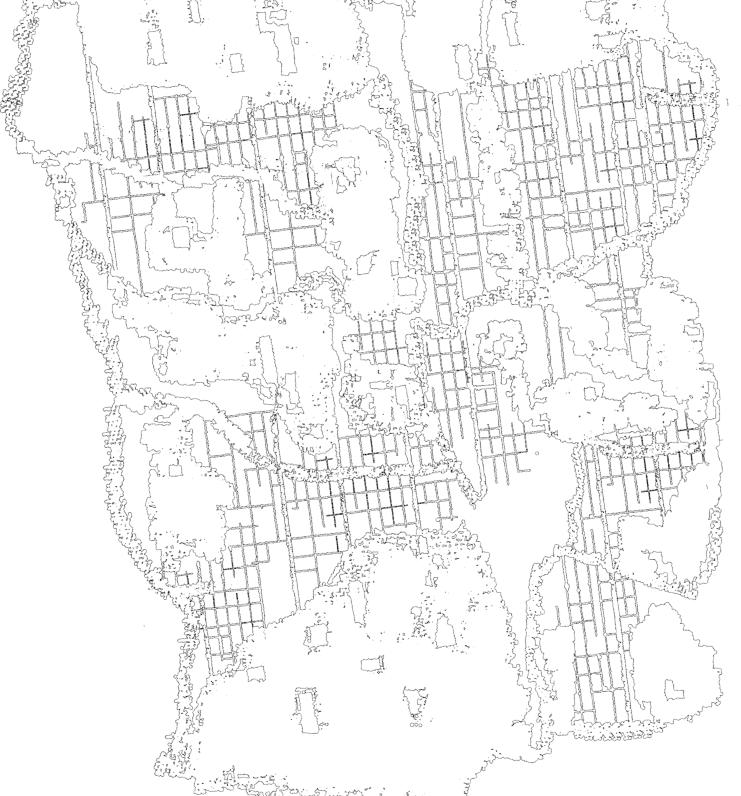
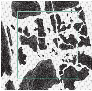
Patchwork landscape is a project that studies Broad-acre city of Frank Lloyd Wright as a precedent for urban organization and adapts the territorial gridded system as a tool of measurement to ensure equal and just land division.
In Stensrud-Gerjsrud, the gridded system reacts to its surroundings and applies differently on the valley floor than on the hills. The grid is rotated to follow the direction of the geology and is overlaid as a carpet with the hills pushing through. This creates two very different entities: the rocky hills and the soft plains, depicting sequences of different situations from the higher and dryer forested hills and the lower moistened valley floor.
84
PART 2 - infill / space
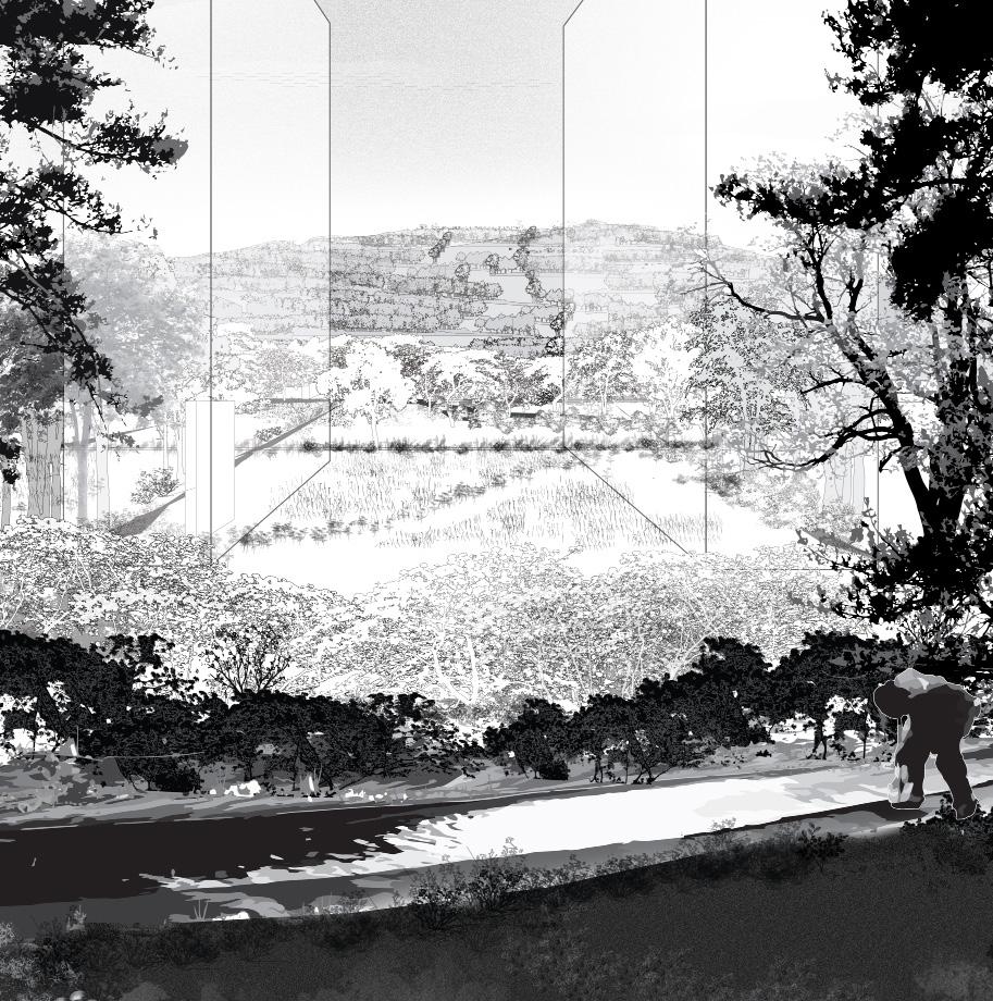
A perspective of how the framework of vegetation transforms the open valley floor of Stensrud into fields of different characteristics, and dynamic spaces, affected by water, wind, and seasons. The spaces are composed from layers of vegetation as walls with different widths, densities, transparency, and heights.
85
INFILL: SECTION ALONG GREEN BAND.
The rain water collects in ponds in the hillsides and get nutrited by the soil of a decayed fores and grazing annimals. Then its led by channels along the steep hillsides and then into the fields of the valley floor
86
PART 2 - infill / space
87
88 PART 3 - Objects / Patches
OBJECTS
Enforcing framework
Greenhouse
Walls / ante-types
Beggining of architecture
Roofs, catchment
Chimney

Earthworks
Free objects
Ribbon of accessibility
Water resevoirs

Spots with ommen functions, washing basins, sitting objects, ramps, etc.

Composting
89
PATCHES
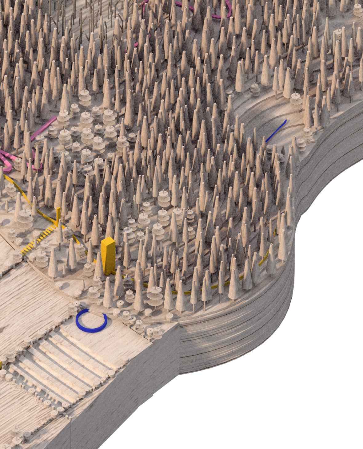
The patches in the forest consist of clearings around ponds where the rainwater is retained. Areas of forest decay provide vital nourishments to the forest floor, locking up nutrients into the ground to be led down to the fields by the runoff. The patches of leaf forest and mixed forest create versatile habitats and help increasing biodiversity , improving the forest quality.
90
PART 3 - Objects / Patches

Ponds
Decayed forest
Mixed forest
Leaf forest
Orchards
Crops
Shrubby pastures
Peatland
91
92
A perspective of how the framework of vegetation transforms the open valley floor of Stensrud into fields of different characteristics, and dynamic spaces, affected by water, wind, and seasons. The spaces are composed from layers of vegetation as walls with different widths, densities, transparency, and heights.
93
Maria Charlotte Thoner
Oslo
Phone: +47 465 44 465
mail: maria.ch.thoner@gmail.com
96
