1 minute read
Forgotten Facts

from 08202021 WEEKEND
by tribune242

The original West Bay Street
Advertisement
MY wife and I moved into our then new home on January 7, 1987 and moved out on August 10, 2021. We now live in a bungalow where I no longer have climb 32 steps to get to my study. What a pleasure that is. Now, when I go for short walks, I use the streets of a totally different section of Lyford Cay.
This morning, I pointed out to a friend the remains of the old West Bay Street, where it used to run through what is now the golf course.
My friend is too young to remember this part of the island as it was when E P Taylor created today’s gated community in the 1960s and he questioned my calling the old road West Bay Street.
Why? Because the road signs at the Old Fort roundabout claim that West Bay Street stops when it reaches that roundabout, and the Western Road starts on the other side. Even Google Maps uses the name Western Road for the road from the Old Fort roundabout to Clifton.
Being a nitpicker, I claim that West Bay Street continues past West Bay (where Jaws Beach is), all the way to Clifton.
I know it’s hard to realise just how much the roads have changed in more modern years, but a roundabout (what I often call by its Swahili name - a ‘keep-lefty’) is a very recent addition to the original layout. Before the RAF built Windsor Field in the 1940s, today’s Windsor Road (connecting the airfield to West Bay Street) did not exist, so there was no logical reason to change the name at Old Fort (which was a private residence not a community of many families),
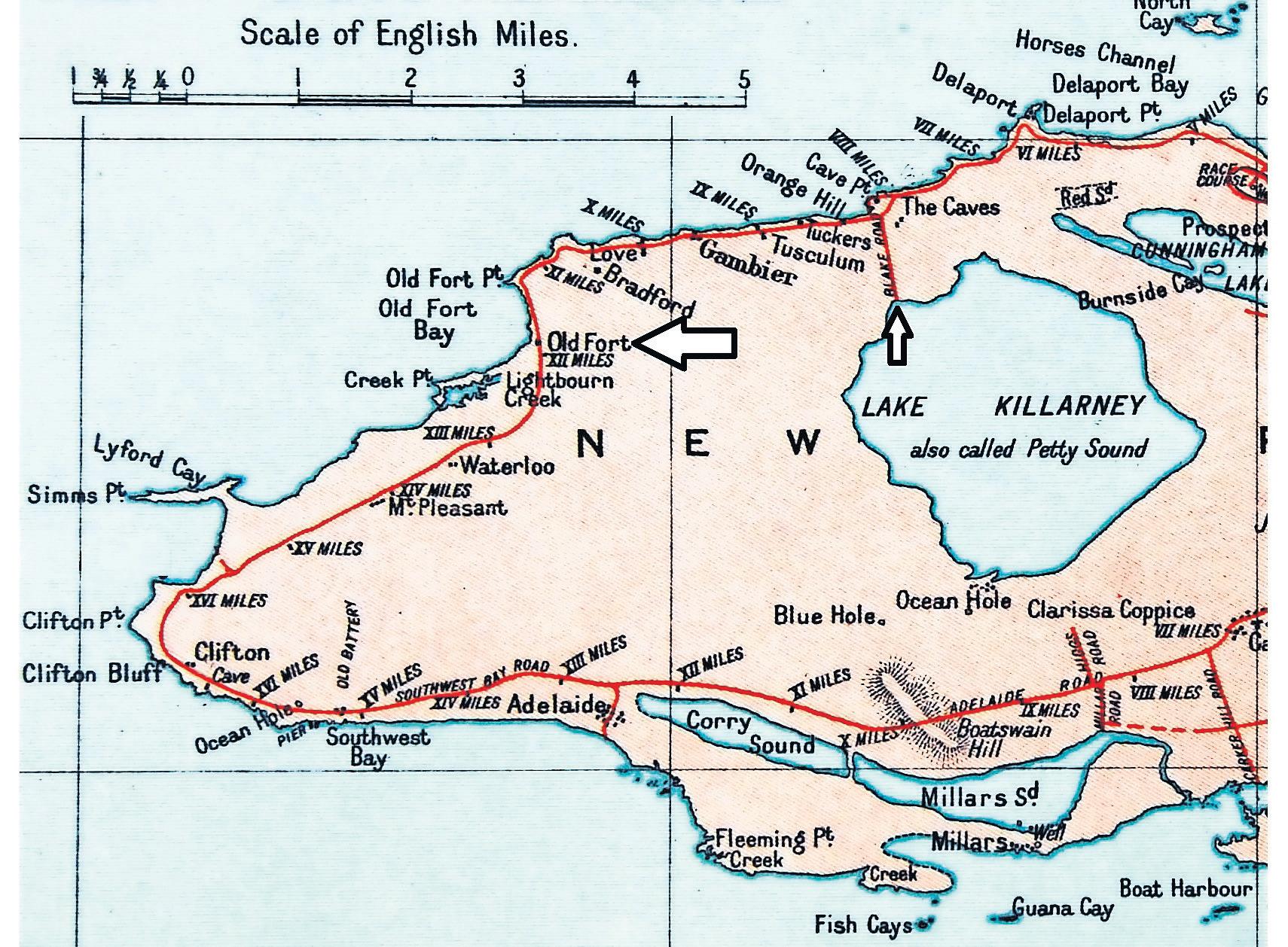
My article on July 30 contained a much-altered version of my father’s 1926 map of New Providence.
Today, I offer only the western portion of the island, on which I have highlighted (with arrows) Old Fort and Blake Road.
Hopefully, this will make it easier to see how the roads once were.


