HORSHAM SOCIETY
A SURVEY OF
HORSHAM’S GREEN SPACES 2013
HORSHAM SOCIETY
©2013
Published by The Horsham Society Maps courtesy G I Barnett www.horshamsociety.org The Horsham Society is an independent body supported by members’ subscriptions and a registered charity (No. 268949)
A SURVEY OF
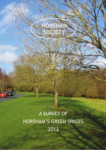
HORSHAM’S GREEN SPACES Among the essential characteristics of Horsham are its proximity and easy access to the surrounding countryside and its many urban green spaces. These range in size from the sweeping vistas of Horsham Park to small oases of green space tucked among the dense town centre streets. Some, like recreation grounds and allotments were provided for public use as the town expanded, others were small amenity areas created to serve and enhance new estates. Many are simply pieces of land left over after new roads and housing had been laid out. In 1994 the Horsham Society, worried that some open spaces such as school playing fields and sites on the urban fringe were under threat from developers, compiled, mapped and published an inventory of over 80 green spaces. Now almost 20 years later the Society has updated this to provide a contemporary record and act as a spur to our communities and Horsham District Council to protect and enhance this important aspect of our town’s heritage.
Why are our green spaces important? Together our green spaces provide residents and visitors with opportunities for formal and informal recreation, sometimes just a pleasant space to sit and rest. They play an important role in creating our street scenes and our sense of place. Frequently a haven for wildlife, they often host our remaining large forest trees which create a sense of scale and continuity, and frame what would otherwise be relentlessly urban street scenes. They are an essential part of what makes Horsham such an attractive place to live, work or visit.
Are our green spaces under threat? Although few of the green spaces identified in 1994 have been lost there have been a number of threats of development ranging from very small greens to large areas on the urban fringe. Not all by any means were from speculative developers: in recent years Horsham Council itself attempted, unsuccessfully, to develop a small open space for housing. This was only defeated because local residents managed to have it registered as a Town Green (which protects the site in perpetuity). The Society has repeatedly urged the District Council to register voluntarily the many spaces in its ownership as Town Greens but in 2010 it even refused our request to protect just five carefully chosen sites. West Sussex County Council has also tried, so far unsuccessfully, to develop a large field in the south of the town which it bought many years ago for a school. As recently as 2011 the District Council considered Chesworth Farm, which it originally
purchased to protect the southern fringe of the town, as a possible strategic site for 1,500 new homes. It is ironic that the greatest threat to our open spaces has come from the councils we elect to protect our local environment.
So what can be done? At the end of the day it all depends on the strength of public opinion, and keeping up the pressure on elected councillors to ensure that planning policies recognise the value of our green spaces and protect them. Prior to the changes in the local planning system open spaces, particularly the larger ones, could be designated as urban open spaces with a presumption against development. Now there are only generic policies concerning the provision and protection of open space which are much less effective. Recent changes to the planning system have also made it much more difficult to register green spaces as town greens particularly where landowners plan development. There is, however, one change which could make a positive difference if the District Council has the will to make it happen. The 2012 National Planning Policy Framework introduced a new Local Green Space designation to protect greens of particular importance to local communities. We urge Horsham District Council to include specific policies within its new Local Development Framework to protect our open spaces and to designate the most important as Local Green Spaces. And we will continue to press the Council to register greens it owns voluntarily as Town Greens. Finally, the best way to ensure that our green spaces are protected for future generations is to use them.
Inventory of Horsham’s Green Spaces For the sake of convenience the town has been divided into quarters - NW, NE, SW and SE with a keyed map and list of greens for each.
Bennett’s Field, Brighton Road (61)
North West Quadrant
11 12
14 10
19 16 3
8
6
17 15 7
20 4
1 18
1
2
3
4
5
6
13
5
9 2
Caterways Green, Merryfield Drive
Cootes Green, Merryfield Drive
[Registered Town Green]
[Registered Town Green]
Redford Avenue Football Ground, Redford Avenue
Greenway School Playing Field , Greenway
Recreation Ground, behind Greenway School
Redford Avenue Allotments, off Redford Road
North West Quadrant - continued 7
Victory Recreation Ground, off Victory Road
8
Dog and Bacon Green, Warnham Road
10
Woodstock Close Sports Ground
9
11
Horsham Park, North Street
Pondtail Copse, Pondtail Road, and parallel with and north of Amundsen Road
12
Pondtail Close open space
14
Warnham Nature Reserve, Warnham Road
13
15
Collyer’s School playing field, Hurst Road
Riverside Walk: Warnham Road to Guildford Road
16
Rookwood Golf Course
18
Wildwood, j/w Guildford Road
17
19
20
[Remnant of Horsham Common]
Redford Avenue Copse
Ramsey Green, Ramsey Close
[Registered Town Green]
Trafalgar School playing field, Victory Road
< Cootes Green (2)
Dog and Bacon Green (8) >
< Riverside Walk (15)
North East Quadrant 49
45
54
46
55
57
48
42
53 47
32
24 51
27
JACKDAW
23
57 B
50
BLUE
52
43
30
LL
57 A
29
BE
21
C L
26
33 34
41
35 36 37
56 22
31
39 38
28
40
25
21
North Heath Community Primary School playing field, Erica Way
22
Novartis sports ground, Parsonage Road
24
Riverside Walk: St Mark’s Chennels Brook, North Heath Lane
26
Rusper Road Allotments, Lower Barn Close
28
Oak Tree Way open space, off Redkiln Way
23
25 27
Holbrook Club, North Heath Lane
Kingslea Primary School playing field, Harwood Road Little Barn Copse, off Rusper Road
44
North East Quadrant - continued 29
Lambs Crescent open space, off Lambs Farm Road
30
Littlehaven Infant School grounds, Hawkesbourne Road
32
All Saints Primary School playing field, Tylden Way
31
33
34
Manor Fields open space, also via Earlswood Close
Bryce Close Palying Field, adj Roffey Recreation Ground
Roffey Playing Field, adj Roffey Recreation Ground
Harwood Road landscaping (39) >
35
36
37
38
39
40
41
42
43
44
Roffey Recreation Ground, off Crawley Road
Northolmes Primary School playing field, off Crawley Road
Roffey Cricket Club sports ground, off Crawley Road
Leechpool Primary School playing field, Leechpool Lane
Harwood Road landscaping, bet Manor Fields and Woodland Way
Harwood Road Allotments, bet Manor Fields and Woodland Way
Roffey Cemetery, Crawley Road
Earles Meadow recreation space, south side railway, Crawley Road to Farhalls Crescent
Bracken Green, bet Bracken Grove and Crawley Road
South Holmes Playing Field, Owl Beech Way
< Roffey Cemetery (41)
North East Quadrant - continued 45
Holbrook Tythe Barn Play Area, Pondtail Road
47
Dutchells Copse, Rusper Road opp Tylden Way
49
Bakehouse Barn Path and Green, off Pondtail Road running north to A264
51
Heath Way playing field, near Holmbush Close
46
48
50
52
53
Holbrook Primary school playing field, Holbrook School Lane
Dutchells Common, bet Wordsworth Place and Burns Close
Moorhead Road open space, bet Moorhead Road and Crawley Road Jackdaw Lane playing field, near Coltsfoot Drive
Bartholomew Way woodland glade, by Holbrook Surgery running north
54
Lemmington Way open space, j/w Rusper Road north to A264
56
Adelaide Close play area, bet Adelaide Close and Little Haven Lane
55
57
57A 57B
Roffey Football Club playing fields, off Bartholomew Way
Lemmington Way woodland stream, j/w Rusper Road south
Open space, bet Chennels Way and North Heath Lane Beech Road allotments and open space
< Dutchells Copse (47)
Moorhead Road (50) >
< Lemmington Way (54)
South East Quadrant 69
58 62
73
72
63
59
67
66 64 71
70 61
75
65 74
60
58
59
Ayshe Court Lakes, Depot Road / Ayshe Court Drive
Clarence Road Allotments, Clarence Road
60
Oaklands Close open space
62
Depot Road Allotments, Depot Road
61
63
64 65 66
67
Bennettâ&#x20AC;&#x2122;s Field Recreation Ground, Brighton Road Millais School playing field, Depot Road
Forest School playing field, Comptons Lane
Domesday Green, Domesday Lane, urban fringe Heron Way School playing field, Heron Way
Benâ&#x20AC;&#x2122;s Acre open space, woodland and riverside
68
South East Quadrant - continued
< Forest School playing field (64)
Kingslea Pond (69) >
< Hampers Lane (72)
68
Horsham RFC, Hammerpond Road
70
Bennettâ&#x20AC;&#x2122;s Road Allotments
69
71
72
73 74
75
Kingslea Pond, Harwood Lane
Glebe Crescent open space, woodland and riverside Hampers Lane open space
Smithbarn open space, j/w Hampers Lane
Muggeridge Field open space, off Athelstan Way
Land adjacent to Muggeridge Field, off bridle way at end of Arun Way
81
80
79
78
77
82
83
84
88
85
86
87
90
89
101
91
94
92
100
93
95
76
97 96
99
98
South West Quadrant
South West Quadrant - continued 76
Stanley Walk green
77
Irwin Drive open space
79
Hills Cemetery, Guildford Road
78 80
Irwin Drive riverside
Hills Farm Allotments, off Guilford Road
81
Hills Farm Lane (south) playing fields
83
Hills Farm Recreation Ground, Hills Farm Road j/w Blackbridge Lane
82 84
85
86
87
Arunside Green, bet Ridgehurst Drive and Shandys Close Arunside School sports ground
St John’s Catholic Primary School sports ground
Pennybrook Green, Guildford Road
Tanbridge Park amenity area, in front of Tanbridge Place
88
Tanbridge Park Green
90
Riverside Walk: Worthing Road to Blackbridge Lane
89
Cricket Ground, Cricketfield Road
91
Riverside Walk: Town Mill to Remembrance Gardens
93
Chesworth Farm, off Queensway
92
94
Denne Road Cemetery
Barrack Field, south of St Mary’s Church
< Irwin Drive (77)
Hills Farm Lane (south) (81) >
South West Quadrant - continued
< Pennybrook Green (86)
Tanbridge Park Green (88) >
< New Street Green (96)
95
96
97
98
99
100
101
YMCA Football Ground, off Gorings Mead
New Street Green, behind New Street Chapel
Gardiners Court green, New Street
Chesworth Allotments, Arun Way
New Street Garden, New Street
Denne Road open space, j/w Hadmans Close
Worthing Road open space, south of Horsham Library