The joint IFAO/Cnrs-Univ Montpellier 3 mission, directed by Christophe Thiers (Cnrs, USR 3172-CFEETK), continued the archaeological survey in Armant in Nov 2016, focusing on the area W of the naos of the Montu Temple. The removing of the debris allowed this season to complete the uncovering of the W side of the Ptolemaic Temple. As expected in this area of the foundation, MK limestone blocks were discovered. L. Postel (Univ Lyon 2) resumed the study of the MK blocks and cultic furnishings. Other limestone blocks of Ramesses II were found. S. Biston-Moulin (Cnrs, USR 3172-CFEETK) studied the NK blocks, especially those of Thutmose III and Hatshepsut found this season, reused on the
Project continued its work in Oct/Nov 2016. The campaign focused mostly on the OK area started in 2012 (Zone 2), which covers a surface about 1000 sqm located less than 20 m W of the Ptolemaic temple of Horus. After several seasons excavating the remains of domestic installations and open courtyards from the early 6th Dyn and FIP, the occupation level connected to three phases of OK mudbrick enclosure walls and a massive building have been finally reached in most of the area. The latter construction, characterized by mud-brick walls of 2.30–2.80 m thickness with an unusual sloping outer face, is flanked on the S side by another massive building complex, whose subsidiary buildings were severely burned before abandonment. Obviously of an official nature, both constructions are respectively enclosed by a small precinct with a large open space to the E. Initially considered as possibly dating to the end of the 4th Dyn or the beginning of the 5th, a reassessment of the ceramic material from this monumental level made it possible to adjust this to a slightly later date. The discovery of several official clay sealings, one mentioning king Djedkare Isesi, also confirmed the foundation and the short-
Wadi el-Hudi. Photo: Kate Liszka.
Dime es-Saba. Photo: Centro di Studi Papirologici.
façade of the Roman pronaos foundations. W to the Ptolemaic naos, the E limit of the foundation of the ‘western structure’ was found, indicating that a second temple was built on the same axis of the Montu Temple, less than 7 m away. P. Mégard (topographer, MAEDI-CFEETK) and M. Gaber (topographer, IFAO) undertook photogrammetric surveys of that area in order to complete the architectural and archaeological surveys. H. el-Amir (conservator, IFAO) continued the conservation-restoration programme, focusing on the Ptolemaic crypts and loose sandstone blocks. He also led a field school with four MSA conservators. ht t p: //recherche .univ- mont p3.fr/ egyptologie/ermant/
lived functioning of those two monuments in the second part of the 5th Dyn. They were built simultaneously, in an area never settled before, erected ex-nihilo directly onto the natural river sand, which here is exclusively constituted by Nile stream deposits. Trenches on the various OK, FIP and MK enclosure walls were also continued this season in the S part of the site and the entire N section of the FIP enclosure was cleaned over a length of 75 m. The Tell Edfu project also participated in the site management by renewing the lighting of several rooms of the temple of Horus and carrying out extensive cleaning operations at the foot of the tell. https://telledfu. uchicago.edu
100 m of sandstone paving along the S side of the Ramesses III mortuary temple. In addition to capping Ramesses III mud-brick walls along the stone pavement with new bricks, L. Hassan and the conservation team completed the mortar infilling of the blocks on the Domitian Gate, which is now finished. ht t p: //o i .u c h ic ago.e d u /r e s e a rc h / projects/epi/
Armant:
Tell Edfu: Conducted by Nadine Moeller
and Gregory Marouard (OI), the Tell Edfu
34
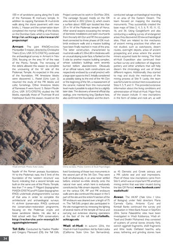
Wadi el-Hudi: In autumn 2016, the
Wadi el-Hudi Expedition, led by Kate Liszka (California State Univ San Bernardino),
conducted salvage archaeological recording in an area of the Eastern Desert. The team focused on mapping the standing monuments. They successfully created the base maps of Sites 2, 4, 5, 6, 9, 10, 11, 12, 16, and 36. Using GoogleEarth and also conducting a walking survey of endangered areas, they discovered 20 new archaeological sites. Most are related to the mechanics of ancient mining practices that often are not studied, such as watchposts, desert routes, overnight depots, areas of ancient prospecting and areas where the ancient miners acquired tools for mining. The Wadi el-Hudi Expedition also continued their surface survey and collection of diagnostic pottery and other artefacts that will help discern the chronology and use of these different regions. Additionally, they started to map and study the mechanics of the mining process at Site 9. Lastly, the team was fortunate to conduct test excavations at Sites 4, 5, 9, and 11. This provided extensive information about the living conditions and administration of Wadi el-Hudi. Major finds of the season include 11 new inscriptions in the form of stelae and rock art, as well
as 45 Demotic and Greek ostraca and a MK calcite seal and seal impressions. Most of these new inscriptions came from Site 4, which was an important MK amethyst mining centre that was later reused during the late GR Period. www.facebook.com/ wadielhudi/
Aswan: The AKAP (Yale Univ / Univ
of Bologna) under field directors Maria Carmela Gatto, Antonio Curci and Kimball Banks continued the survey and excavation in West Bank Aswan in Sep/Oct 2016. Some Palaeolithic sites have been investigated in Wadi Kubbaniya, Wadi elTawil and Sheikh Mohamed: they consisted of scatters of animal bones (mostly fish), ostrich eggshell fragments, shell fragments and lithic tools. Deflated hearths, ashy areas, tethering and grinding stones have