EGYPTIAN
ARCHAEOLOGY
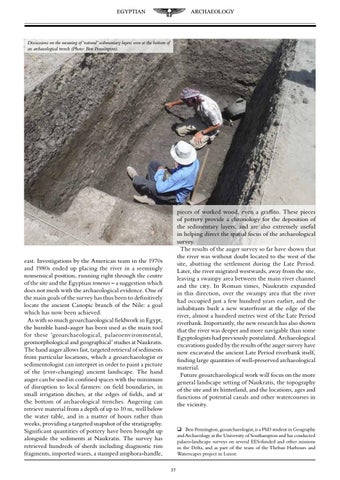
Discussions on the meaning of ‘natural’ sedimentary layers seen at the bottom of an archaeological trench (Photo: Ben Pennington).
pieces of worked wood, even a graffito. These pieces of pottery provide a chronology for the deposition of the sedimentary layers, and are also extremely useful in helping direct the spatial focus of the archaeological survey. The results of the auger survey so far have shown that the river was without doubt located to the west of the site, abutting the settlement during the Late Period. Later, the river migrated westwards, away from the site, leaving a swampy area between the main river channel and the city. In Roman times, Naukratis expanded in this direction, over the swampy area that the river had occupied just a few hundred years earlier, and the inhabitants built a new waterfront at the edge of the river, almost a hundred metres west of the Late Period riverbank. Importantly, the new research has also shown that the river was deeper and more navigable than some Egyptologists had previously postulated. Archaeological excavations guided by the results of the auger survey have now excavated the ancient Late Period riverbank itself, finding large quantities of well-preserved archaeological material. Future geoarchaeological work will focus on the more general landscape setting of Naukratis, the topography of the site and its hinterland, and the locations, ages and functions of potential canals and other watercourses in the vicinity.
east. Investigations by the American team in the 1970s and 1980s ended up placing the river in a seemingly nonsensical position, running right through the centre of the site and the Egyptian temenos – a suggestion which does not mesh with the archaeological evidence. One of the main goals of the survey has thus been to definitively locate the ancient Canopic branch of the Nile: a goal which has now been achieved. As with so much geoarchaeological fieldwork in Egypt, the humble hand-auger has been used as the main tool for these ‘geoarchaeological, palaeoenvironmental, geomorphological and geographical’ studies at Naukratis. The hand auger allows fast, targeted retrieval of sediments from particular locations, which a geoarchaeologist or sedimentologist can interpret in order to paint a picture of the (ever-changing) ancient landscape. The hand auger can be used in confined spaces with the minimum of disruption to local farmers: on field boundaries, in small irrigation ditches, at the edges of fields, and at the bottom of archaeological trenches. Augering can retrieve material from a depth of up to 10 m, well below the water table, and in a matter of hours rather than weeks, providing a targeted snapshot of the stratigraphy. Significant quantities of pottery have been brought up alongside the sediments at Naukratis. The survey has retrieved hundreds of sherds including diagnostic rim fragments, imported wares, a stamped amphora-handle,
Ben Pennington, geoarchaeologist, is a PhD student in Geography and Archaeology at the University of Southampton and has conducted palaeo-landscape surveys on several EES-funded and other missions in the Delta, and as part of the team of the Theban Harbours and Waterscapes project in Luxor. 37