EGYPTIAN
ARCHAEOLOGY
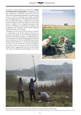
excavations, results of which can be seen online at http:// www.britishmuseum.org/naukratis. Alongside this, the new programme of fieldwork, directed by Dr Ross Thomas and comprising topographic and magnetometer surveys as well as excavations, has greatly expanded our knowledge of the city. Through the help of a grant from the EES Delta Survey, a programme of focused geoarchaeological work has also begun, in order to help answer a number of very important questions about the port of Naukratis: in particular the position and navigability of its waterfront, and its overall landscape setting within the western Delta. Naukratis was never a port on the coast; it was always an ‘inland port’, some 70 km upstream from the sea, situated on the banks of one of the long-disappeared branches of the Nile in the Delta – the Canopic branch. It was this great river that provided the lifeline of the port and its connection to the sea and Mediterranean trade. Unfortunately, despite over a century of archaeological research at the site, before the current investigations the position of the river relative to the site remained a mystery. Petrie suggested the river lay on the western side of the site; Hogarth instead thought it was on the
Retrieving sediments from the hand auger for analysis (Photo: Ben Pennington).
Augering in progress with the location of the old excavations (the ‘lake’) in the background (Photo: Alexandra Villing). 36