EGYPTIAN
ARCHAEOLOGY
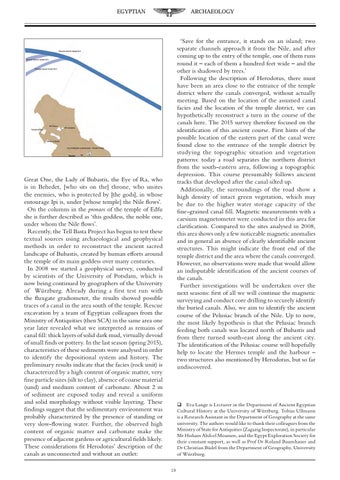
‘Save for the entrance, it stands on an island; two separate channels approach it from the Nile, and after coming up to the entry of the temple, one of them runs round it – each of them a hundred feet wide – and the other is shadowed by trees.’ Following the description of Herodotus, there must have been an area close to the entrance of the temple district where the canals converged, without actually meeting. Based on the location of the assumed canal facies and the location of the temple district, we can hypothetically reconstruct a turn in the course of the canals here. The 2015 survey therefore focused on the identification of this ancient course. First hints of the possible location of the eastern part of the canal were found close to the entrance of the temple district by studying the topographic situation and vegetation patterns: today a road separates the northern district from the south-eastern area, following a topographic depression. This course presumably follows ancient tracks that developed after the canal silted up. Additionally, the surroundings of the road show a high density of intact green vegetation, which may be due to the higher water storage capacity of the fine-grained canal fill. Magnetic measurements with a caesium magnetometer were conducted in this area for clarification. Compared to the sites analysed in 2008, this area shows only a few noticeable magnetic anomalies and in general an absence of clearly identifiable ancient structures. This might indicate the front end of the temple district and the area where the canals converged. However, no observations were made that would allow an indisputable identification of the ancient courses of the canals. Further investigations will be undertaken over the next seasons: first of all we will continue the magnetic surveying and conduct core drilling to securely identify the buried canals. Also, we aim to identify the ancient course of the Pelusiac branch of the Nile. Up to now, the most likely hypothesis is that the Pelusiac branch feeding both canals was located north of Bubastis and from there turned south-east along the ancient city. The identification of the Pelusiac course will hopefully help to locate the Hermes temple and the harbour – two structures also mentioned by Herodotus, but so far undiscovered.
Great One, the Lady of Bubastis, the Eye of Ra, who is in Behedet, [who sits on the] throne, who smites the enemies, who is protected by [the gods], in whose entourage Ipi is, under [whose temple] the Nile flows’. On the columns in the pronaos of the temple of Edfu she is further described as ‘this goddess, the noble one, under whom the Nile flows’. Recently, the Tell Basta Project has begun to test these textual sources using archaeological and geophysical methods in order to reconstruct the ancient sacred landscape of Bubastis, created by human efforts around the temple of its main goddess over many centuries. In 2008 we started a geophysical survey, conducted by scientists of the University of Potsdam, which is now being continued by geographers of the University of Würzburg. Already during a first test run with the fluxgate gradiometer, the results showed possible traces of a canal in the area south of the temple. Rescue excavation by a team of Egyptian colleagues from the Ministry of Antiquities (then SCA) in the same area one year later revealed what we interpreted as remains of canal fill: thick layers of solid dark mud, virtually devoid of small finds or pottery. In the last season (spring 2015), characteristics of these sediments were analysed in order to identify the depositional system and history. The preliminary results indicate that the facies (rock unit) is characterized by a high content of organic matter, very fine particle sizes (silt to clay), absence of coarse material (sand) and medium content of carbonate. About 2 m of sediment are exposed today and reveal a uniform and solid morphology without visible layering. These findings suggest that the sedimentary environment was probably characterized by the presence of standing or very slow-flowing water. Further, the observed high content of organic matter and carbonate make the presence of adjacent gardens or agricultural fields likely. These considerations fit Herodotus’ description of the canals as unconnected and without an outlet:
Eva Lange is Lecturer in the Department of Ancient Egyptian Cultural History at the University of Würzburg. Tobias Ullmann is a Research Assistant in the Department of Geography at the same university. The authors would like to thank their colleagues from the Ministry of State for Antiquities (Zagazig Inspectorate), in particular Mr Hisham Abd-el Moamen, and the Egypt Exploration Society for their constant support, as well as Prof Dr Roland Baumhauer and Dr Christian Büdel from the Department of Geography, University of Würzburg. 19