EGYPTIAN
ARCHAEOLOGY
Avaris, its harbours and the Perunefer problem Ancient Avaris is well known as the capital city of the Hyksos and the location of the later city of Piramesse, but was it also the site of the Eighteenth Dynasty harbour of Perunefer? Irene Forstner-MĂźller adds new evidence from the latest Austrian excavations. The ancient city of Avaris (modern Tell el-Daba and its surrounding area) was, like all important historic towns in Egypt, situated on a major branch of the Nile - in this case the Pelusiac branch. This was the easternmost branch in antiquity, forming the eastern limit of the fertile Delta during the second millennium BC. By this time Avaris was not only the capital of the Hyksos rulers of Egypt but also one of the largest and most important cities in Egypt and the ancient Near East. It covered an area of c.260 hectares and had an estimated population of between 29,000 and 34,500. Its strategic position on the route out of Egypt to the east served as a link and a gateway between the Nile valley proper, the Mediterranean and the neighbouring countries of the Near East. From the late Twelfth Dynasty onwards Avaris had been an important harbour town for both Nile and seagoing shipping and thus for international trade, and in the Ramesside Period the harbour of the capital Piramesse was at Avaris, which then formed the southern part of the town. The discovery of an Eighteenth Dynasty palace
Tomasz Herbich carrying out the vertical electrical sounding survey
decorated with Minoan frescoes led to the hypothesis that Avaris might also be identified as the port of Perunefer, attested in texts and representations. For this discussion see: Bietak, EA 26, pp.13-17; Jeffreys, EA 28, pp.36-37; and Bietak, EA 34, pp.15-17. Recent research at Tell el-Daba by the Cairo Branch of the Austrian Archaeological Institute has focused on the possible locations of ancient harbours and mooring places. This is based on more than 800 auger drillings, an extensive geomagnetic survey (Forstner-MĂźller, EA 34, pp.1013) and, most recently, a VES (vertical electrical sounding) survey (Herbich, EA 41, p.12) undertaken to gain a better knowledge of the fluvial system and Nile branches. In 2013 a large research project was launched at the site of the supposed main harbour of Avaris, its location suggested by OSL (optically stimulated luminesence) and archaeological evidence obtained from boreholes. It lies in an area which is still visible in the modern landscape as a large, seasonallyinundated depression north-west of the excavation house and close to a modern Islamic cemetery, and
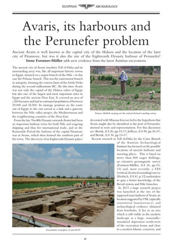
Excavations in progress in area R-IV 32