EGYPTIAN
ARCHAEOLOGY
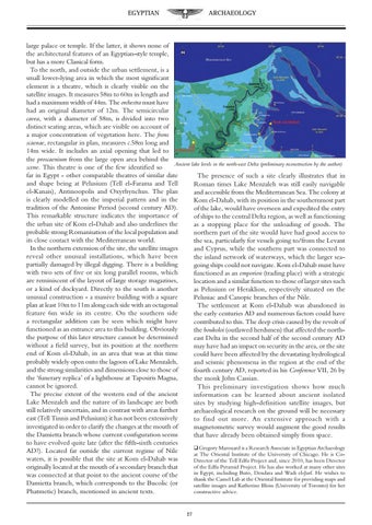
large palace or temple. If the latter, it shows none of the architectural features of an Egyptian-style temple, but has a more Classical form. To the north, and outside the urban settlement, is a small lower-lying area in which the most significant element is a theatre, which is clearly visible on the satellite images. It measures 58m to 60m in length and had a maximum width of 44m. The orchestra must have had an original diameter of 12m. The semicircular cavea, with a diameter of 58m, is divided into two distinct seating areas, which are visible on account of a major concentration of vegetation here. The frons scaenae, rectangular in plan, measures c.58m long and 14m wide. It includes an axial opening that led to the proscaenium from the large open area behind the Ancient lake levels in the north-east Delta (preliminary reconstruction by the author) scene. This theatre is one of the few identified so far in Egypt - other comparable theatres of similar date The presence of such a site clearly illustrates that in and shape being at Pelusium (Tell el-Farama and Tell Roman times Lake Menzaleh was still easily navigable el-Kanais), Antinoopolis and Oxyrhynchus. The plan and accessible from the Mediterranean Sea. The colony at is clearly modelled on the imperial pattern and in the Kom el-Dahab, with its position in the southernmost part tradition of the Antonine Period (second century AD). of the lake, would have overseen and expedited the entry This remarkable structure indicates the importance of of ships to the central Delta region, as well as functioning the urban site of Kom el-Dahab and also underlines the as a stopping place for the unloading of goods. The probable strong Romanisation of the local population and northern part of the site would have had good access to its close contact with the Mediterranean world. the sea, particularly for vessels going to/from the Levant In the northern extension of the site, the satellite images and Cyprus, while the southern part was connected to reveal other unusual installations, which have been the inland network of waterways, which the larger seapartially damaged by illegal digging. There is a building going ships could not navigate. Kom el-Dahab must have with two sets of five or six long parallel rooms, which functioned as an emporion (trading place) with a strategic are reminiscent of the layout of large storage magazines, location and a similar function to those of larger sites such or a kind of dockyard. Directly to the south is another as Pelusium or Heraklion, respectively situated on the unusual construction - a massive building with a square Pelusiac and Canopic branches of the Nile. plan at least 10m to 11m along each side with an octagonal The settlement at Kom el-Dahab was abandoned in feature 6m wide in its centre. On the southern side the early centuries AD and numerous factors could have a rectangular addition can be seen which might have contributed to this. The deep crisis caused by the revolt of functioned as an entrance area to this building. Obviously the boukoloi (outlawed herdsmen) that affected the norththe purpose of this later structure cannot be determined east Delta in the second half of the second century AD without a field survey, but its position at the northern may have had an impact on security in the area, or the site end of Kom el-Dahab, in an area that was at this time could have been affected by the devastating hydrological probably widely open onto the lagoon of Lake Menzaleh, and seismic phenomena in the region at the end of the and the strong similarities and dimensions close to those of fourth century AD, reported in his Conference VII, 26 by the ‘funerary replica’ of a lighthouse at Taposiris Magna, the monk John Cassian. cannot be ignored. This preliminary investigation shows how much The precise extent of the western end of the ancient information can be learned about ancient isolated Lake Menzaleh and the nature of its landscape are both sites by studying high-definition satellite images, but still relatively uncertain, and in contrast with areas further archaeological research on the ground will be necessary east (Tell Tinnis and Pelusium) it has not been extensively to find out more. An extensive approach with a investigated in order to clarify the changes at the mouth of magnetometric survey would augment the good results the Damietta branch whose current configuration seems that have already been obtained simply from space. to have evolved quite late (after the fifth-sixth centuries q Gregory Marouard is a Research Associate in Egyptian Archaeology AD?). Located far outside the current regime of Nile at The Oriental Institute of the University of Chicago. He is Cowaters, it is possible that the site at Kom el-Dahab was Director of the Tell Edfu Project and, since 2010, has been Director of the Edfu Pyramid Project. He has also worked at many other sites originally located at the mouth of a secondary branch that in Egypt, including Buto, Dendara and Wadi el-Jarf. He wishes to was connected at that point to the ancient course of the thank the Camel Lab at the Oriental Institute for providing maps and Damietta branch, which corresponds to the Bucolic (or satellite images and Katherine Bloin (University of Toronto) for her Phatmetic) branch, mentioned in ancient texts. constructive advice. 27