EGYPTIAN
ARCHAEOLOGY
Ancient Theban temple and palace landscapes Building on the successful results of the first season in 2012, the Egypt Exploration Society’s Theban Harbours and Waterscapes Survey (THaWS) continued work in early 2013. Angus Graham and Kristian Strutt report on the latest results, which have raised new questions. strong anomaly on the line of the central temple axis also indicates a possible extension of a central processional way into the fields. Could it be possible that we had two processional routes into the temple prior to the construction of the mud-brick pylon later in Tuthmosis III’s reign or does the southern linear anomaly represent architecture related to the central axis? At the Royal Cult Temple of Amenhotep III (Kom el-Hettan), in collaboration with Hourig Sourouzian and the ‘Colossi of Memnon and Amenhotep III Temple Conservation Project’ team, we continued our investigation of the channel identified in the Third Court and the possible channel to the east of the Colossi of Memnon (EA 41, p.24). A GPR area survey (AG01) in the First Court indicates the presence of a possible wall or court enclosure to the north of the Colossi, with walled sides of a possible route or axis running behind each of the monuments. Other large stone rubble is visible in a possible pit measuring some 5m across to the north of the Colossus of Memnon. It would be wishful thinking to suggest that, if this is a rubble-filled pit, it might contain fragments of Memnon’s head! Three ERT profiles (P21, P22, P23) and two GPR profiles were carried out across the central axis in the First Court and to the east of the temple. In the Second
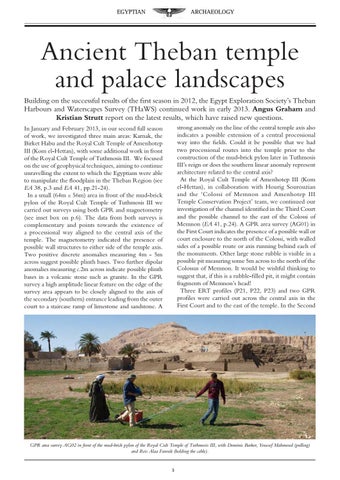
In January and February 2013, in our second full season of work, we investigated three main areas: Karnak, the Birket Habu and the Royal Cult Temple of Amenhotep III (Kom el-Hettan), with some additional work in front of the Royal Cult Temple of Tuthmosis III. We focused on the use of geophysical techniques, aiming to continue unravelling the extent to which the Egyptians were able to manipulate the floodplain in the Theban Region (see EA 38, p.3 and EA 41, pp.21-24). In a small (64m x 56m) area in front of the mud-brick pylon of the Royal Cult Temple of Tuthmosis III we carried out surveys using both GPR and magnetometry (see inset box on p.6). The data from both surveys is complementary and points towards the existence of a processional way aligned to the central axis of the temple. The magnetometry indicated the presence of possible wall structures to either side of the temple axis. Two positive discrete anomalies measuring 4m - 5m across suggest possible plinth bases. Two further dipolar anomalies measuring c.2m across indicate possible plinth bases in a volcanic stone such as granite. In the GPR survey a high amplitude linear feature on the edge of the survey area appears to be closely aligned to the axis of the secondary (southern) entrance leading from the outer court to a staircase ramp of limestone and sandstone. A
GPR area survey AG02 in front of the mud-brick pylon of the Royal Cult Temple of Tuthmosis III, with Dominic Barker, Youssef Mahmoud (pulling) and Reis Alaa Farouk (holding the cable).