EGYPTIAN
ARCHAEOLOGY
Digging Diary 2012-13 Summaries of some of the archaeological work undertaken in Egypt in Winter 2012-13 and Spring 2013 appear below. The sites are arranged geographically from north to south, ending with the oases. Field Directors who would like reports on their work to appear in EA are asked to e-mail a short summary, with a website address if available, as soon as possible after the end of each season to: patricia.spencer@ees.ac.uk PATRICIA SPENCER Abbreviations: EDP Early Dynastic Period; OK Old Kingdom; FIP First Intermediate Period; MK Middle Kingdom; SIP Second Intermediate Period; NK New Kingdom; TIP Third Intermediate Period; LP Late Period; GR GraecoRoman; ERT Electrical Resistivity Tomography; GPR Ground Penetrating Radar. Institutes and Research Centres: ARCE American Research Center in Egypt; CFEETK FrancoEgyptian Centre, Karnak; CNRS French National Research Centre; CULTNAT Center for Documentation of Cultural and Natural Heritage, Cairo; DAI German Institute, Cairo; HIAMAS The Hellenic Institute of Ancient and Medieval Alexandrian Studies, Athens; MMA Metropolitan Museum of Art, New York; MSA Ministry of State for Antiquities, Egypt; OI Oriental Institute, University of Chicago; PCMA Polish Centre for Mediterranean Archaeology, Warsaw; Swiss Inst Swiss Institute for Architectural Research and Archaeology, Cairo; USR CNRS research group. WINTER 2012-13 (November to March) Lower Egypt Saqqara: The Leiden Museum/Leiden Univ team, directed by Maarten J Raven and Christian Greco, continued fieldwork in the NK necropolis. The substructure of the anonymous tomb excavated in 2010 (see EA 37, p.25, photograph) was emptied and proved to consist of a 7.5m deep shaft and four burial-chambers, one with a sarcophagus pit. Some objects retrieved from the floors joined others
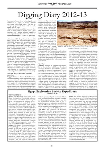
thrown out by robbers and found during previous seasons, enabling identification of one of the occupants of the burial complex as the ‘Scribe of the Temple of Ptah, Sethnakht’; his name will therefore be assigned to the tomb. A new area was cleared W of this tomb, S of that of Meryneith and E of that of Pay and Raia. It contained a further anonymous late 18th Dyn mud-brick tomb which, like that of Sethnakht, is markedly unfinished. It has an E gateway, a courtyard with a rubble floor and a central El-Sheikh Ibada. The footings of a Roman Period bridge across the wadi which crosses shaft, and a single W chapel with Antinoopolis. Photograph: Peter Grossmann only four remaining relief slabs. A sondage made N of Meryneith’s tomb to locate when the temple was used for domestic purposes the entrance to the underlying EDP galleries was and as an animal shelter. Later much of the temple unsuccessful as later walls and shafts impeded access was deliberately destroyed as indicated by a massive to the bedrock. Two more replicas were installed layer of smashed limestone. The crypt under E6 in the tombs of Horemheb and Ptahemwia, copied was investigated. Epigraphic work focused on by laser scanning from reliefs in Bologna Museum. collating texts in various rooms and recording of www.saqqara.nl newly discovered texts. More than 130 collapsed blocks were transported out of the temple and Upper Egypt stored nearby. Consolidation and restoration was Athribis: The Univ of Tübingen/MSA project, undertaken on collapsed blocks and single finds, led by Christian Leitz and Mansour Boreik and mainly on polychrome reliefs and plaster. The directed in the field by Marcus Müller, continued wooden shelter over room C5 was renewed to its work in the limestone Repit temple of Ptolemy protect the best preserved polychromy. XII, with the excavation of two rooms. Room El-Sheikh Ibada (Antinoopolis): The start E6 was decorated with fine raised reliefs, mostly of the season of the Istituto Papirologico ‘G. smashed to pieces in Late Roman times, though Vitelli’ (Univ of Florence) mission, directed by some fragments mention the offering of myrrh to Rosario Pintaudi, was delayed for security reasons. Min. In contrast, the reliefs of room K1 are almost Fieldwork concentrated on repairs necessitated by fully preserved. They show Ptolemy XII and damage caused by local people during the absence Tiberius offering to various gods, mainly Repit of the mission. In addition to numerous illegal and Min-Re. The W half of the S part of the diggings in various areas of the town, newlylarge ambulatory L1 was excavated, revealing six repaired walls had been destroyed and slabs of well columns. All three rooms are preserved to a height preserved pavements lifted. To try to avoid further of 2m-3m and the debris is all later than AD 642 destruction, the crypt of the church beside the
Egypt Exploration Society Expeditions WINTER/SPRING Quesna: The Minufiyeh Survey team, led by Joanne Rowland (Free Univ, Berlin), undertook post-excavation analysis for the first monograph on the GR cemetery to be published in 2013. The osteological team analysed the human skeletal remains, including the teeth, and also studied and lifted three additional burials (T9/ T11 including one ceramic coffin burial) that had been detected at the end of the previous season. The remains of various samples of ‘mummified’ remains were examined to assess the oils/ resins used. Outstanding ceramic analysis was completed, as was drawing of all finds from the cemetery. All the ceramic sarcophagi lifted since 2007 were fully recorded, reconstructed where possible, drawn and photographed. Details of the brick and very fragmentary wood coffins were recorded. http://minufiyeh.tumblr.com/ Imbaba: The Imbaba Governorate Prehistoric Survey, led by Joanne Rowland, was initiated, focusing on the area W of the Rosetta Nile branch and extending from the modern town of Khatatba, in the N, to S of the neolithic site of Merimde Beni Salama. The aim of the project is to investigate all prehistoric findspots and sites and to examine them within their wider environment context, by study of satellite images and with a drill core survey in collaboration
(www.ees.ac.uk)
with the geoarchaeological department of Cairo Univ. An initial examination of the area was made, revealing a large increase in cultivated land since we last visited the Khatatba region in 2011. A pedestrian survey was undertaken along the desert edge W of Merimde and in the area around the current antiquities’ land and a magnetic survey was carried out at, and to the W of, Merimde. Tell Basta: The EES/Univ of Würzburg/ MSA team, led by Eva Lange, concentrated on completing excavation of the Late Dynastic/ Ptolemaic casemate-buildings in the entrance area of the Bastet temple. The vicinity of the temple dromos was also investigated, revealing masses of limestone chips and a sand foundation more than 3m deep, suggesting the former existence of a Late Dynastic sanctuary or small temple close to the dromos. Documentation of architectural remains as well as epigraphic work was started in the OK elite cemeteries N of the temple. A new cooperation with Manfred Bietak (Austrian Academy of Science) was initiated to document the building phases of the so-called ‘Governor’s Palace’ of the MK, giving already interesting hints about the building chronology of the whole area, as well as of the extent of the palace, which seems to have been considerably larger than previously assumed. http://tellbasta.tumblr.com/
28
Luxor: The Theban Harbours and Waterscapes Survey (see further pp.5-7), led by Angus Graham, continued the use of ERT with 10 profiles on the W bank and a further four at Karnak totalling 3.2km of survey at ground level. GPR was also used to complement the ERT profiles and earlier work, with 33 GPR profiles c.18.7km along the ground surface recorded. Seven small GPR area surveys were carried out – four at Karnak and three on the W bank. One hand auger was undertaken to test new equipment and as a check on previously recorded sedimentary data. A GPR profile over the Birket Habu mounds, in collaboration with the Malqata expedition (see p.30), revealed evidence of tip lines and two different platforms built on the mounds. ERT in the SE corner of the Birket has shown the depth of the mounds below the modern ground level. At Kom el-Hettan, in collaboration with Dr Sourouzian’s team (see p.30), investigation of the theory that canals facilitated transport of the colossi continued. At the temple of Tuthmosis III, both GPR and magnetometry before the pylon revealed evidence of a probable processional way. At Karnak much data needs to be processed but initial results suggest that the foundation of the central ramp S of the W tribune extended to the W. http://eestheban.tumblr.com/