EGYPTIAN
ARCHAEOLOGY
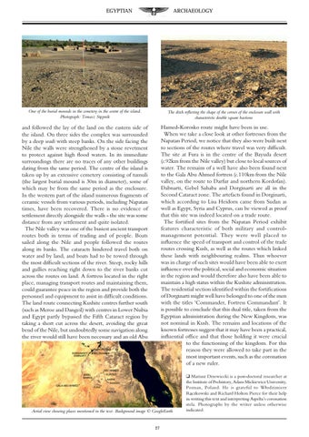
One of the burial mounds in the cemetery in the centre of the island. Photograph: Tomasz Stępnik
The ditch reflecting the shape of the corner of the enclosure wall with characteristic double square bastions
and followed the lay of the land on the eastern side of the island. On three sides the complex was surrounded by a deep wadi with steep banks. On the side facing the Nile the walls were strengthened by a stone revetment to protect against high flood waters. In its immediate surroundings there are no traces of any other buildings dating from the same period. The centre of the island is taken up by an extensive cemetery consisting of tumuli (the largest burial mound is 30m in diameter), some of which may be from the same period as the enclosure. In the western part of the island numerous fragments of ceramic vessels from various periods, including Napatan times, have been recovered. There is no evidence of settlement directly alongside the walls - the site was some distance from any settlement and quite isolated. The Nile valley was one of the busiest ancient transport routes both in terms of trading and of people. Boats sailed along the Nile and people followed the routes along its banks. The cataracts hindered travel both on water and by land, and boats had to be towed through the most difficult sections of the river. Steep, rocky hills and gullies reaching right down to the river banks cut across the routes on land. A fortress located in the right place, managing transport routes and maintaining them, could guarantee peace in the region and provide both the personnel and equipment to assist in difficult conditions. The land route connecting Kushite centres further south (such as Meroe and Dangeil) with centres in Lower Nubia and Egypt partly bypassed the Fifth Cataract region by taking a short cut across the desert, avoiding the great bend of the Nile, but undoubtedly some navigation along the river would still have been necessary and an old Abu
Hamed-Korosko route might have been in use. When we take a close look at other fortresses from the Napatan Period, we notice that they also were built next to sections of the routes where travel was very difficult. The site at Fura is in the centre of the Bayuda desert (c.92km from the Nile valley) but close to local sources of water. The remains of a well have also been found next to the Gala Abu Ahmed fortress (c.110km from the Nile valley, on the route to Darfur and northern Kordofan). Dabnarti, Gebel Sahaba and Dorginarti are all in the Second Cataract zone. The artefacts found in Dorginarti, which according to Lisa Heidorn came from Sudan as well as Egypt, Syria and Cyprus, can be viewed as proof that this site was indeed located on a trade route. The fortified sites from the Napatan Period exhibit features characteristic of both military and controlmanagement potential. They were well placed to influence the speed of transport and control of the trade routes crossing Kush, as well as the routes which linked these lands with neighbouring realms. Thus whoever was in charge of such sites would have been able to exert influence over the political, social and economic situation in the region and would therefore also have been able to maintain a high status within the Kushite administration. The residential section identified within the fortifications of Dorginarti might well have belonged to one of the men with the titles ‘Commander, Fortress Commandant’. It is possible to conclude that this dual title, taken from the Egyptian administration during the New Kingdom, was not nominal in Kush. The remains and locations of the known fortresses suggest that it may have been a practical, influential office and that those holding it were crucial to the functioning of the kingdom. For this reason they were allowed to take part in the most important events, such as the coronation of a new ruler.
Aerial view showing places mentioned in the text. Background image © GoogleEarth 27
q Mariusz Drzewiecki is a post-doctoral researcher at the Institute of Prehistory, Adam Mickiewicz University, Poznan, Poland. He is grateful to Włodzimierz Rączkowski and Richard Holton Pierce for their help in writing this text and interpreting Aspelta’s coronation stela. Photographs by the writer unless otherwise indicated.