EGYPTIAN
ARCHAEOLOGY
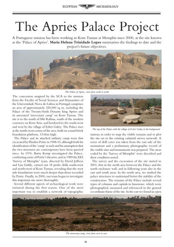
The Apries Palace Project A Portuguese mission has been working in Kom Tuman at Memphis since 2000, at the site known as the ‘Palace of Apries’. Maria Helena Trinidade Lopes summarises the findings to date and the project’s future objectives.
The Palace of Apries, view from south to north
The concession assigned by the SCA to the mission from the Faculty of Social Sciences and Humanities of the Universidade Nova de Lisboa in Portugal comprises an area of approximately 220,000 sq m, including the Palace of the Twenty-Sixth Dynasty king Apries and its associated ‘mercenary camp’ on Kom Tuman. The site is to the north of Mit Rahina, south of the modern cemetery on Kom Aziz, and bordered to the south-west and west by the village of Ezbet Gabry. The Palace rises at the north-west corner of the area, built on a mud-brick foundation platform, 13.66m high. The Palace and its attached military camp were first excavated by Flinders Petrie in 1908-10, although both his identification of the ‘camp’ as such and his assumption that the two structures are contemporary have been queried since. In 1976, Barry Kemp investigated the Palace, confirming some of Petrie’s theories, and in 1989 the EES ‘Survey of Memphis’ team, directed by David Jeffreys and Lisa Giddy, carried out 18 probe drills south-west and north-west of Kom Tuman, revealing that the west side foundations were much deeper than those recorded by Petrie. Finally, in 2000, our team began to investigate this important site more thoroughly. Several different aspects of archaeological work were initiated during the first season. One of the most important was to establish a network of topographic
The top of the Palace with the village of Ezbet Gabry in the background
stations in order to map the visible remains and to plot the site on to the existing cadastral survey network. A series of drill cores was taken from the east side of the monument and a preliminary photographic record of the visible sites and monuments was prepared. The areas coded by the ‘Survey of Memphis’ were described and their condition noted. The survey and the excavation of the site started in 2001, first in the north area between the Palace and the north enclosure wall, and in following years also in the east and south areas. In the north area, we studied the palace structures to understand better the stability of the construction. The remains of the Palace include several types of columns and capitals in limestone, which were photographed, measured and referenced in the general co-ordinate frame of the site. In the east we found an open
The mercenary camp, view from west to east 36