EGYPTIAN
ARCHAEOLOGY
Kom el-Gir in the western Delta The second season of geophysical research at Kom el-Gir revealed houses, street plans and a previously unknown temple enclosure, as Robert Schiestl and Tomasz Herbich describe. Kom el-Gir is c.5km north-east of Buto (Tell el-Farain) in the western Delta, c.20ha in extent, and is not overbuilt by modern constructions. The pottery on the surface of the tell is predominantly of Roman date, although auger core drillings have revealed some possibly Ptolemaic or Early Roman sherds as well as Late Roman material. Kom el-Gir is being investigated as part of the Regional Survey around Buto (see EA 40, pp.18-20), conducted under the auspices of the German Archaeological Institute, Cairo (DAI). Informative results had been expected from the geophysical survey since at almost all previously surveyed Delta tells magnetometry had been very successful, as, for example, at Buto (EA 24, pp.14-17) and Tell elBalamun (EA 29, pp.16-19 and EA 41, p.13). Moreover, GoogleEarth images indicated a good state of preservation of structures, especially on the western part of the tell, and their presence very close to the surface. Some 9ha of Kom el-Gir have now been prospected by magnetometry in the western and central part of the site, using fluxgate gradiometers and with measurements taken in a grid with a density of eight measurements per square metre (0.25m x 0.50m). On the magnetic map, the layout of a densely built-up settlement is visible, characterised by a north-east to south-west grid of streets, some laid out in straight lines, while others deviate from the grid and run in gentle curves. In some areas the structuring of the settlement is clear; for example, in the west narrow rows of buildings between 8m and 10m wide are set between parallel streets. Many individual house plans can be recognised throughout the settlement.
Satellite image (ŠGoogleEarth 2009) showing Buto/Tell el-Farain (bottom left corner) and Kom el-Gir (upper right corner)
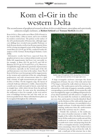
A large rectangular enclosure interrupts this dense arrangement of houses. An area 115m wide and at least 177m long is enclosed by walls which are between 4m and 5m wide. The south-eastern end of the enclosure is obscured by a wide strip of magnetic anomalies, possibly corresponding to ancient rubbish. At two points the walls were investigated by auger core drillings and proved to be of sun dried mud-brick and still extant to a height of at least 3m. The area inside the enclosure is, unfortunately, not very clear, and in parts it is heavily disturbed. Based on the thickness of the walls and the shape and the size of the enclosure, it is most likely to be a temple enclosure. A wide strip which is visible running north-west from the north-western wall of the enclosure may be a dromos. Outside this enclosure, to the south-east, the corner of another structure is visible. The lengths of the walls (c.5m thick) uncovered so far are 84.8m south-west to north-east and 42m north-west to south-east. On the exterior of its north-west corner and projecting from the wall is a rectangular structure, most probably a tower, measuring c.10m x 12m. Further towers or bastions may also jut out from the walls. As Magnetic prospection at Kom el-Gir in October 2012. Photograph: Robert Schiestl only a small part of this structure has to date 28