EGYPTIAN
ARCHAEOLOGY
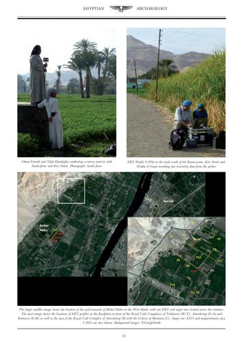
Omar Farouk and Talat Handagha conducting a survey traverse with Sarah Jones and Kris Strutt. Photograph: Sarah Jones
ERT Profile 4 (P4) on the track south of the Ramesseum. Kris Strutt and Warda el-Najar recording raw resistivity data from the probes
The larger satellite image shows the location of the spoil mounds of Birket Habu on the West Bank, with our ERT and auger sites located across the entrance. The inset image shows the locations of ERT profiles in the floodplain in front of the Royal Cult Complexes of Tuthmosis III (T), Amenhotep II (A) and Ramesses II (R) as well as the area of the Royal Cult Complex of Amenhotep III with the Colossi of Memnon (C). Auger site AS35 and magnetometry area 1 (M1) are also shown. Background images: ©GoogleEarth 23