EGYPTIAN
ARCHAEOLOGY
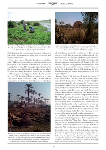
The writer and Angus Graham studying an island in the Nile, standing on the sandy bar with the Nile to the left (behind the bushes) and the swampy core of the island to the right Photograph: Omar Farouk
Biahmu in the Fayum, with the base of one of the colossi on the edge of Amenemhat III’s lake. The king’s major irrigation works in the area may have diverted the western branch of the Nile at Memphis
fields between the communities bloomed, making it a garden city with two waterfronts; one to the east and another to the west. The western river at Memphis flowed past most of the great Old Kingdom pyramids and may have carried royal processions to the harbours of Khentkawes excavated by Mark Lehner at Giza. This channel was probably the river that Sinuhe crossed in his flight from Egypt and which he called the Maaty. Somehow, towards the end of the Middle Kingdom, it disappeared. Where did this western river go? The last firm sighting seems to have been at Lisht, where Sarah Parcak and a BBC TV team sank an investigative borehole into the sediments of what they
identified as an ancient levée of the river. Five metres down, embedded in the muds of the old river bank, they found carnelian and amethyst, the types of precious stone that were favoured by the jewellers of the ancient capital, Itj-tawi, suggesting that the river still flowed in the early Middle Kingdom. Later pyramid builders focused their attention on Lahun at the entrance to the Fayum and by the New Kingdom there is little evidence for large settlements along the former western branch of the Nile north of Lahun. Perhaps future EES projects will solve the puzzle of what happened to this river but for now the prime suspect in its disappearance is the late Middle Kingdom ruler Amenemhat III, who irrigated the Fayum to form a mighty lake and develop the agriculture of what would ultimately become the bread-basket of the Roman world. We conjecture that his works diverted the western channel (known further south as the Bahr Yusuf) through the Hawara gap into the Fayum and paved the way for New Kingdom development in the area: the Gurob Harem Palace, with its great wealth and international trade relations. Since Memphis still had command of the channel that flanked it to the east, the supply of food and taxes from the developing Fayum may have been a fair exchange for the loss of the Maaty, especially at a time when climate change had reduced the Saharan area from a game-rich, grassy savannah to a howling desert. At Memphis and Karnak the landscape setting of sites has changed both during and since their occupation. The palimpsest of the Nile Valley shows that we must assume that the river is moving unless we have evidence to the contrary. Fortunately, the tools are to hand so that sites all along the Nile can be placed in their landscape context. q Judith Bunbury is a Fellow of St Edmund’s College, Cambridge. She is grateful to her students at the University of Cambridge: Ben Pennington and Laurence Pryer (Earth Sciences Department) and Pedro Goncalves (Archaeology Department) whose research has contributed to this article. She would also like to thank David Jeffreys and Angus Graham for their collaboration and inspiration. Photographs by the writer, unless otherwise indicated.
A view of the excavations at Memphis, showing a First Intermediate Period cemetery to the left, with stone blocks, and to the right Middle Kingdom remains that lie over 10m-deep deposits containing Old Kingdom pottery. Since beach sand flanks the cemetery below the Middle Kingdom deposits, we interpret this as the core of the Old Kingdom island of Memphis 17