Source: Authors’ own elaboration
Source: Authors’ own elaboration
URBAN PROGRAM
Problem: Low program mix
Impact: Less social interaction
PUBLIC SPACES
Problem: Privatizated spaces
Impact: Reduced Urban appropiation
URBAN PERMANENCE
Problem: Scarce permanence
Impact: Empty spaces
LOCAL ECONOMY
Problem: Absence of local commerce
Impact External dependence
LAND USE
Problem: Separation of uses
Impact: Fragmented city
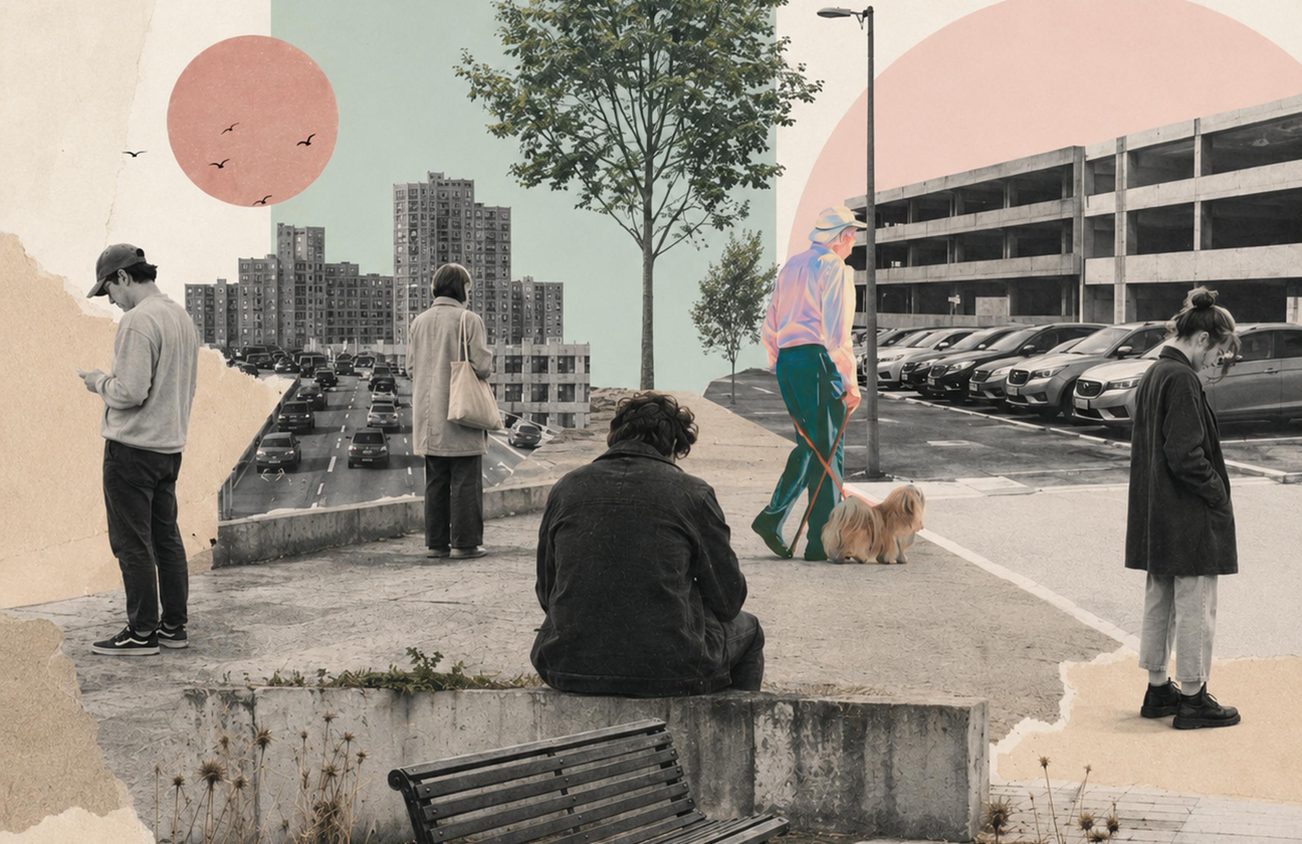
The contemporary urban model in Querétaro has largely developed through a system of rigid zoning, where housing, commerce, work, recreation, and mobility are distributed as separate and independent functions throughout the city. Rather than creating integrated urban environments, this fragmented structure has produced isolated sectors that depend heavily on constant movement between destinations. Daily life becomes defined by transition: moving from home to work, from work to commerce, from commerce to recreation, often through long vehicular journeys disconnected from the public realm.
As a consequence, the city experiences low walkability, extended commuting times, and a growing dependence on private vehicles. Public space loses permanence and social intensity because urban life is reduced to circulation rather than interaction. Streets function primarily as infrastructures of movement instead of collective spaces for encounter, exchange, and community life. Pedestrian experiences become secondary, while large-scale roads, parking areas, and isolated developments dominate the urban landscape.
At the architectural scale, many contemporary developments reinforce this condition of fragmentation. Residential towers, commercial complexes, and mixed-use projects frequently operate as autonomous objects disconnected from their surroundings. Their ground floors remain inactive or privatized, limiting permeability and reducing opportunities for social interaction. Open spaces are often residual rather than intentional, lacking the spatial quality necessary to encourage permanence, activity, or collective appropriation.
Instead of contributing to the continuity of the city, these developments produce urban fragments with weak relationships to the pedestrian network and limited integration with public life. The result is an urban fabric composed of isolated interventions that coexist physically, yet fail to connect socially or spatially. Architecture becomes an object within the city rather than an extension of it.
This condition has also weakened the relationship between people and the urban environment. Spaces of transition dominate over spaces of encounter, while the experience of the city becomes increasingly individual and transient. The absence of active public interfaces, shaded pedestrian environments, vegetation, and mixed social programs diminishes opportunities for spontaneous interaction and collective identity. Urban density grows, but social connectivity does not necessarily grow with it.
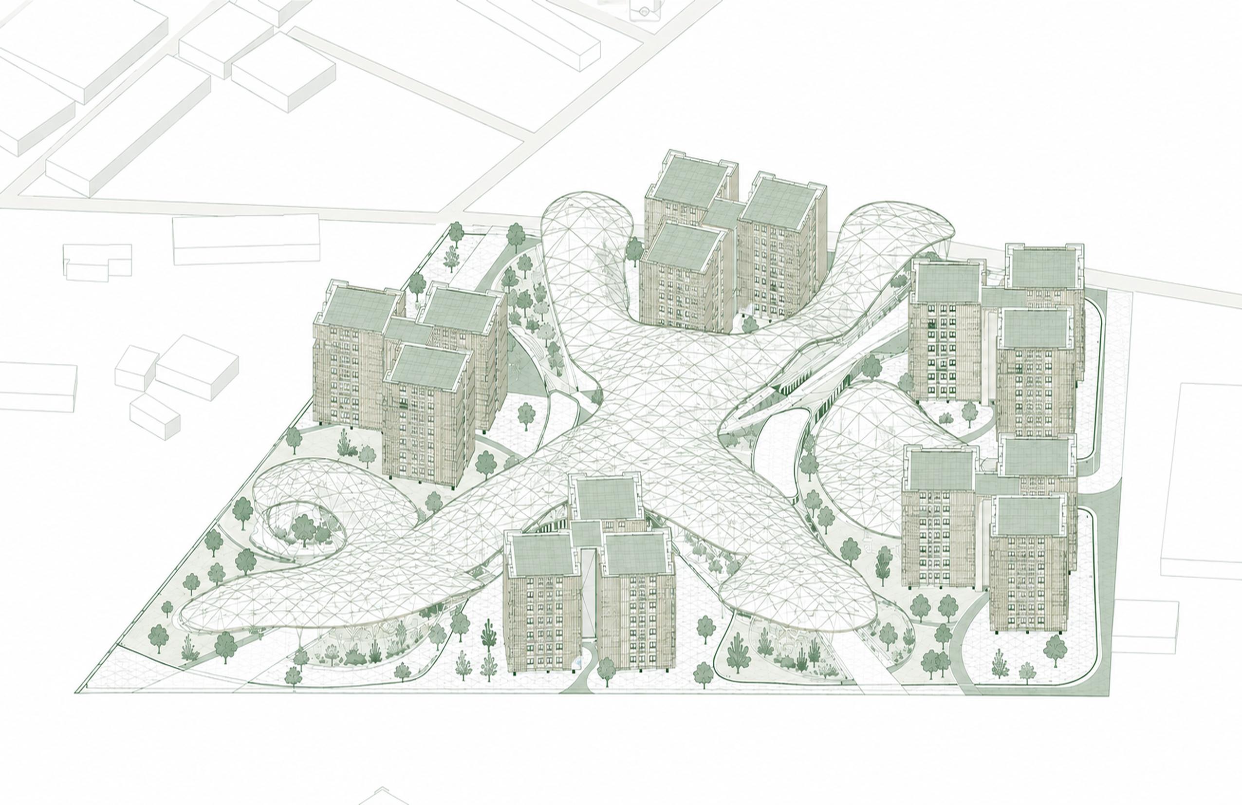
In response to these challenges, the project proposes a more integrated urban strategy that understands architecture as a catalyst for connectivity, permanence, and public life. Rather than functioning as an isolated object, the proposal seeks to reconnect fragmented urban conditions through permeability, mixed-use activation, environmental systems, and pedestrian continuity. The ground floor becomes a social and urban extension of the city, encouraging interaction, accessibility, and collective occupation.
Through active public spaces, bioclimatic strategies, vegetation, and flexible communal programs, the project aims to transform movement into experience and infrastructure into place. The proposal challenges the contemporary tendency toward urban isolation by promoting a more human-centered approach in which architecture contributes not only to density, but also to social cohesion and urban continuity.
Ultimately, the project questions how architecture can move beyond the production of isolated buildings and instead participate in the construction of a more connected, walkable, and socially integrated city. In a context increasingly defined by fragmentation and speed, the project proposes permanence through interaction, environmental awareness, and the recovery of meaningful public space.





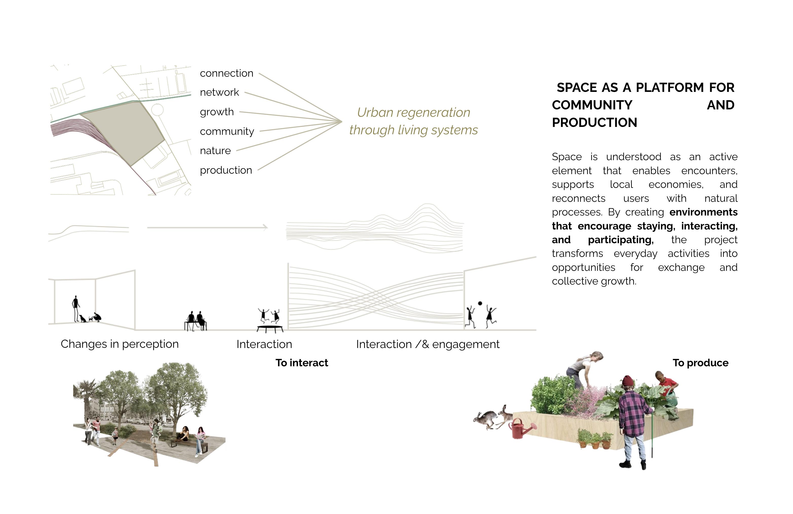
Source: Authors’ own elaboration65
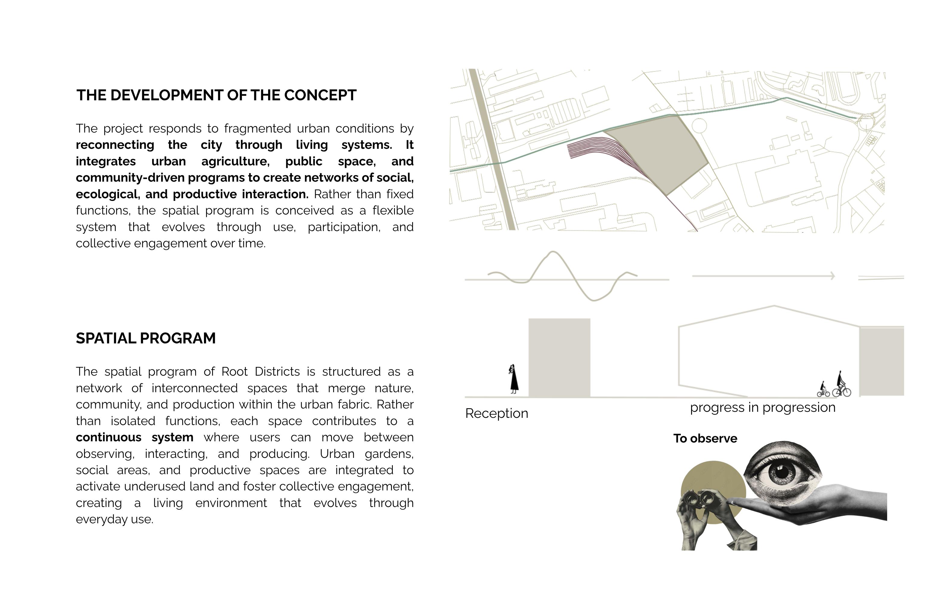
Space is understood as an active element that enables encounters, supports local economies, and reconnects users with natural processes. By creating environments that encourage staying, interacting, and participating, the project transforms everyday activities into opportunities for exchange and collective growth.
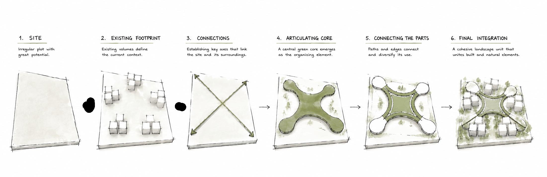
1. Base plane
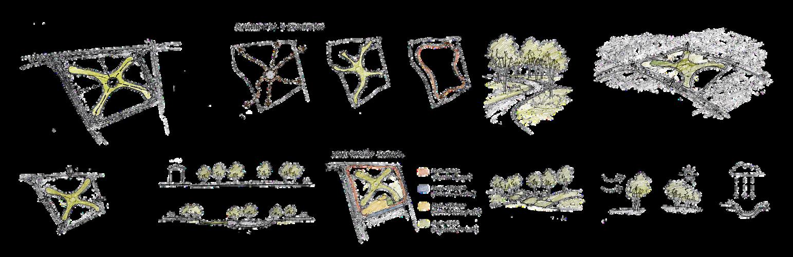
The process begins with a clean plane that represents the site as an open, undifferentiated surface.
2. Existing footprint
Current built volumes are mapped to understand existing conditions and areas of consolidation.
Source: Authors’ own elaboration
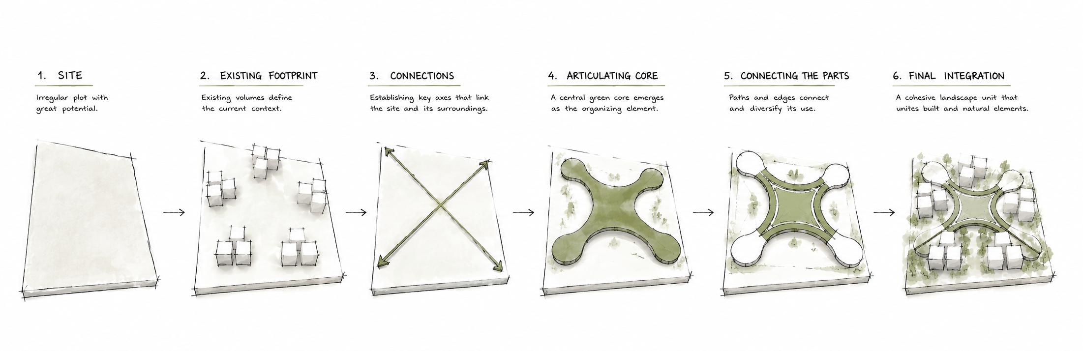
3. Connections and tensions
Lines are drawn between key points, revealing flows, movement patterns, and relationships within the site and its surroundings.
4. Articulating core
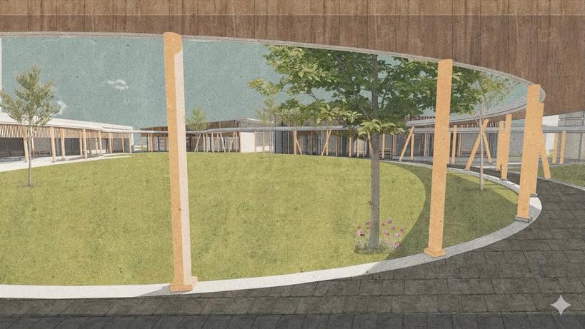
From these tensions, an organic central form emerges, acting as a public space and main point of interaction.
5. Programmatic nodes
Different activity nodes (services, retail, amenities) are placed around the core, activating the space and diversifying its use.
6. Final integration
The proposal comes together by integrating housing, public space, and mixed-use programs into a cohesive system where built and open spaces interact dynamically.
1. Converge People + Place Bringing together community, movement, and nature within a shared urban environment.
2. Connect + Link Paths and spatial connections guide activity toward a collective center.
3. Blend + Mix Programs, users, and landscapes overlap to create hybrid social spaces
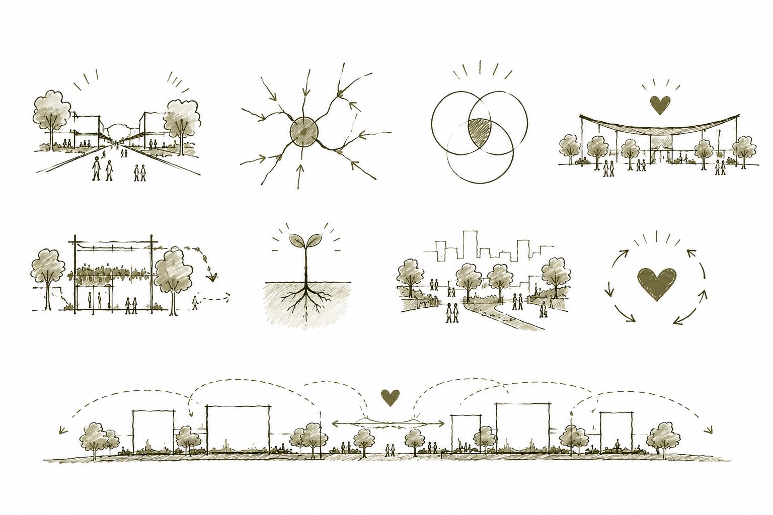
4. Activate + Gather
Open public areas encourage interaction, events, and everyday life.
Convergence Theory proposes that meaningful urban environments emerge when people, movement, landscape, and architecture interact within a shared system. Instead of separating functions and spaces, the theory focuses on integration; Creating places where circulation, public life, ecology, and built form continuously connect and reinforce one another. Through this approach, urban spaces become more dynamic, adaptable, and community-oriented.
At its core, convergence is about connection and coexistence. Public spaces act as the meeting point between different users, activities, and environments, encouraging interaction, accessibility, and a stronger sense of belonging. The theory also promotes flexibility, allowing spaces to evolve over time according to social and environmental needs.
5. Root in Context
The project grows from the identity, vegetation, and rhythms of the site
6. Create Value
Shared spaces generate environmental, social, and cultural benefits.
7. nspire + Multiply Connections extend beyond the site, creating a broader urban impact.
8. Flow + Integrate
Landscape and architecture operate as one continuous spatial system.
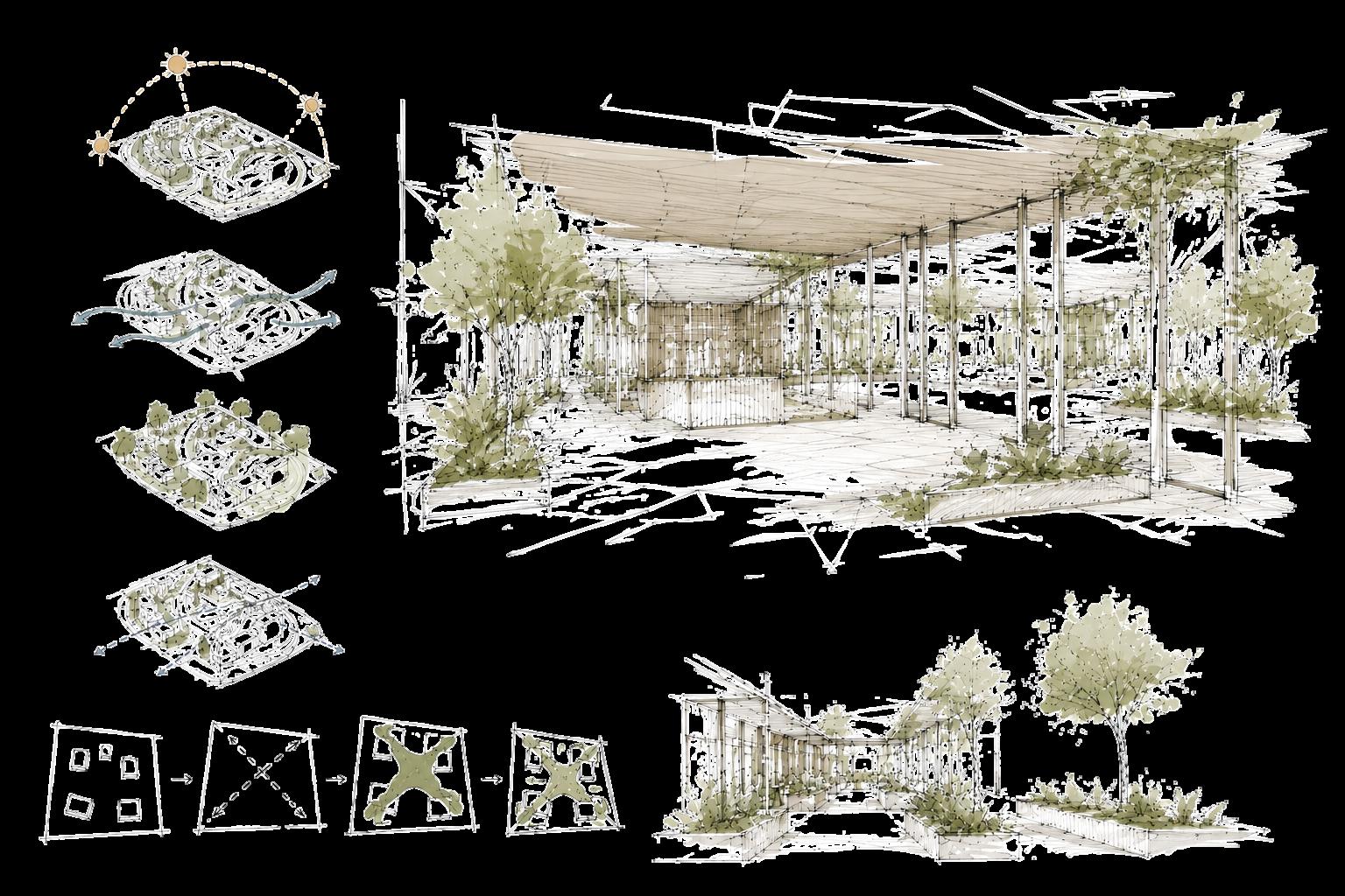
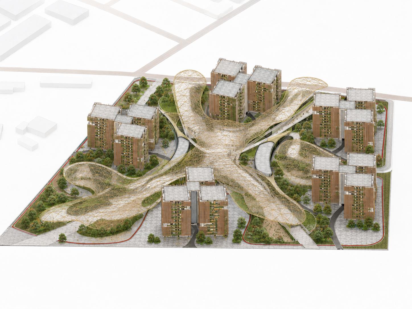
Within Root District, Convergence Theory becomes the conceptual foundation of the project. The proposal is designed as a permeable and interconnected urban ecosystem where landscape, mobility, commerce, and community life merge into one continuous experience. Through fluid pathways, integrated green systems, and open gathering spaces, the project encourages interaction while strengthening the relationship between architecture, nature, and collective identity.
Source: Authors’ own elaboration
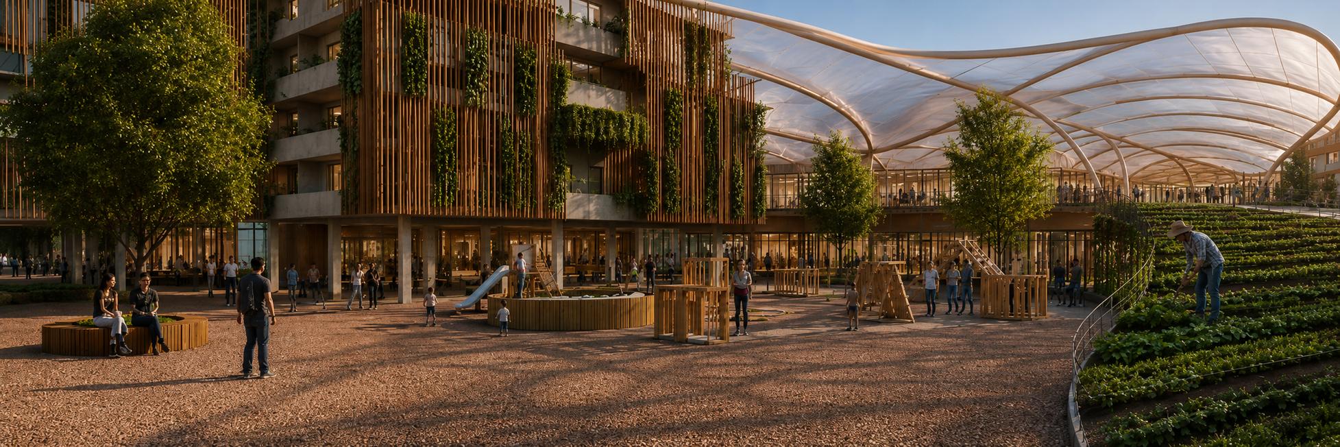
Image developed by the authors with AI-assisted visualization
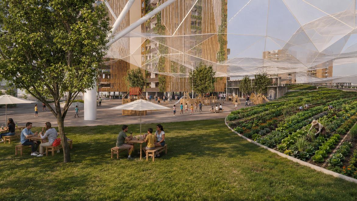
Root District integrates housing, commerce, learning spaces, urban agriculture and public life into a single mixed-use ecosystem. The project organizes these programs around shared open spaces, creating a district where daily activities, environmental awareness and community interaction happen simultaneously. Through active ground floors, productive gardens and shaded public areas, the proposal transforms the site into a resilient and socially connected urban environment.
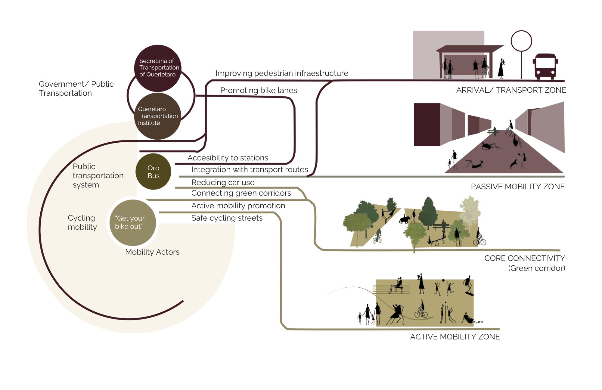
The proposal is structured through a network of mobility actors, including government institutions, public transportation systems, and cycling initiatives, which collectively promote alternative and active modes of transportation.
The strategy focuses on improving pedestrian infrastructure, integrating bike lanes, and enhancing accessibility to transportation stations in order to reduce car dependency and encourage healthier urban mobility patterns. Through the connection of green corridors and safe cycling streets, the project establishes a continuous mobility network that links key urban zones.
These connections generate three main spatial experiences: the arrival and transport zone, which concentrates public transportation access; the passive mobility zone, designed for slower and contemplative movement within green spaces; and the active mobility zone, which supports dynamic activities such as walking, cycling, and recreation. Together, these systems reinforce the concept of core connectivity, where mobility, landscape, and public life merge into a cohesive urban framework.
Source: Authors’ own elaboration
This strategy is developed through the collaboration of multiple actors involved in water management, environmental infrastructure, and urban sustainability. Government institutions, private developers, ecological organizations, and infrastructure systems work together to create a more resilient relationship between the city and its natural resources. Through the integration of water treatment processes, collection systems, and ecological corridors, the proposal promotes a more responsible and efficient urban water cycle.
The project focuses on improving water accessibility, filtration, and reuse through sustainable strategies such as rainwater harvesting, permeable surfaces, and green infrastructure. These systems help reduce environmental impact while strengthening the ecological performance of the site and supporting long-term urban resilience. Vegetated areas and public green spaces also contribute to water absorption, thermal regulation, and the improvement of environmental quality within the district.
These interventions create different layers of environmental interaction, ranging from technical infrastructure and water treatment systems to recreational and ecological public spaces. Together, they establish a connected urban ecosystem where sustainability, landscape, and resource management become essential components of everyday urban life.
Water management and
Research infiltration
regulation Canal restoration
Ecological regeneration
Canal governance and restoration
Academic & research
Research infiltration
Governance & restoration
Environmental NGOs focused on water restoration
Environmental education
Water treatment systems
Algae bio ltration
Sustainable urban infraestructure
Public space integration
Ecological education groups
Canal access points
Source: Authors’ own elaboration


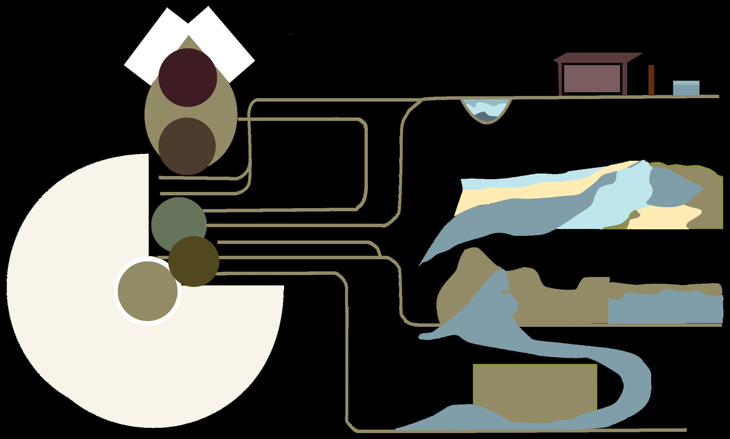
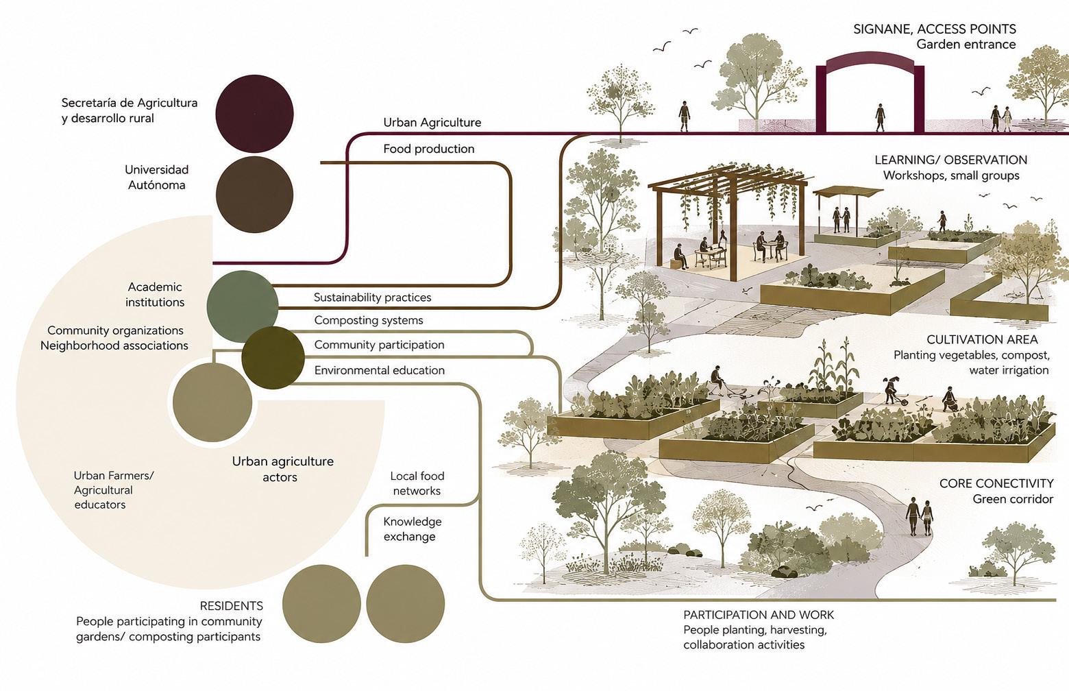
The project is supported by a collaborative network of actors related to urban agriculture, sustainability, and community participation, where food production and environmental awareness become integrated into everyday urban life. Government institutions, academic organizations, neighborhood associations, community groups, urban farmers, and residents work together to promote sustainable cultivation practices and strengthen the connection between people, landscape, and the city.
Through community gardens, composting systems, and educational spaces, the proposal encourages participation, knowledge exchange, and collective responsibility toward the environment. Academic institutions and agricultural educators contribute through research and environmental education, while neighborhood associations and local communities help activate the spaces through workshops, planting activities, and collaborative initiatives that reinforce social interaction and community engagement.
By integrating cultivation areas, green corridors, and participatory public spaces, the project transforms vegetation into an active urban system that supports biodiversity, sustainability, and local food networks, creating a healthier and more resilient urban ecosystem for the community.
Source: Authors’ own elaboration
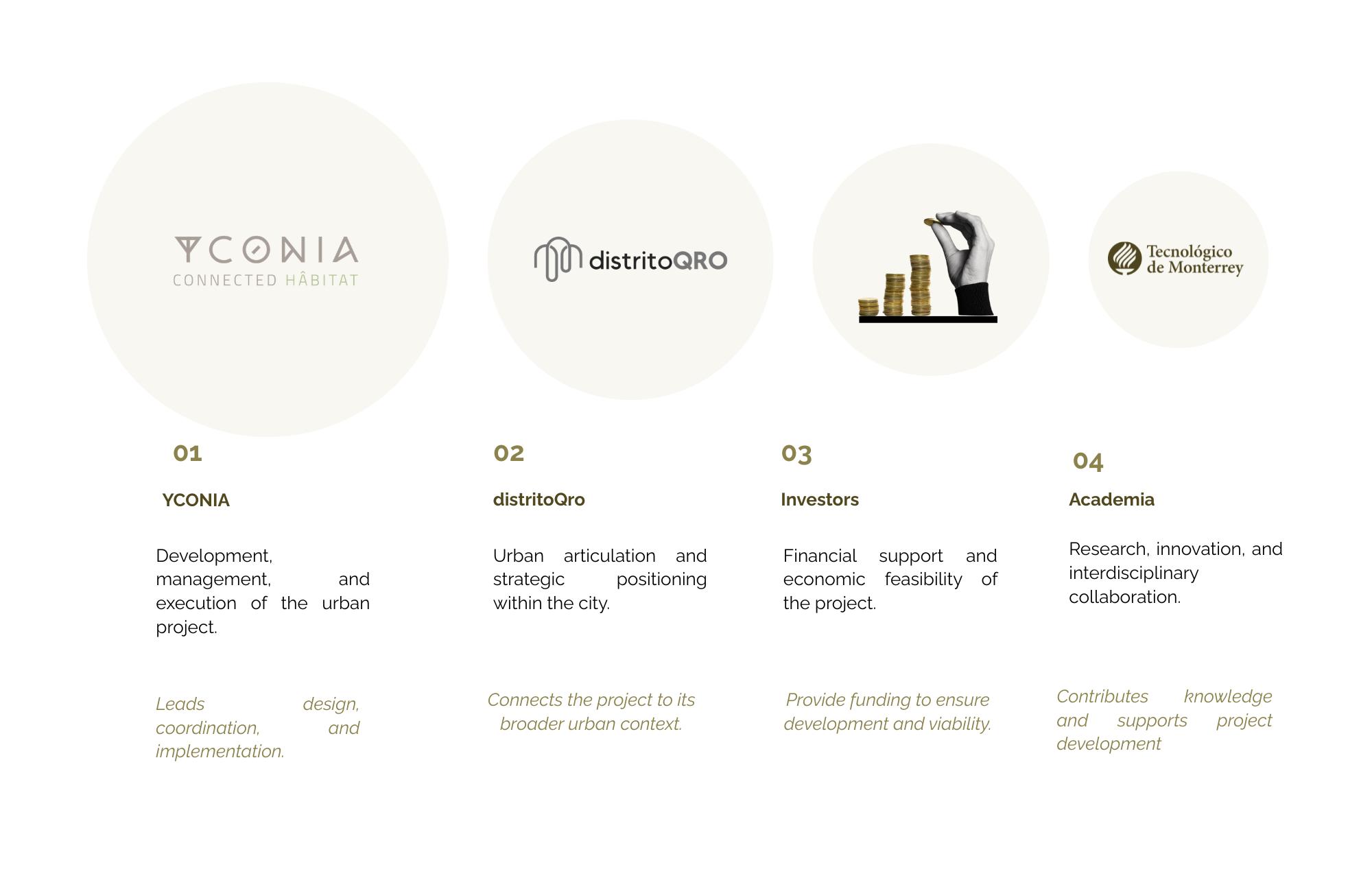
The project is supported through a collaborative structure that combines urban development, strategic planning, financial investment, and academic research. This multidisciplinary relationship allows the proposal to move beyond a conventional architectural intervention by integrating economic, social, and urban perspectives into its development process.
YCONIA is responsible for the management, coordination, and execution of the project, ensuring that the vision is translated into a cohesive urban proposal. distritoQRO strengthens the project’s connection to the city by positioning it within a broader network of urban growth and innovation. Financial investors contribute to the economic feasibility of the proposal, enabling its implementation, long-term sustainability, and future expansion opportunities. At the same time, academia plays a key role by contributing research, innovation, and interdisciplinary collaboration, generating new ideas and analytical approaches that enrich the project’s development.
Together, these actors create a balanced ecosystem where design, urban strategy, economic viability, and knowledge production work simultaneously to support a more integrated and forward-thinking urban model.
Source: Authors’ own

“Growing connections beyond infrastructure.”
Main Urban Corridors
Project Access Flows
Running track
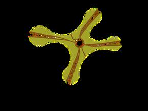
A central hub that organizes traffic flows and connects the park to its surroundings
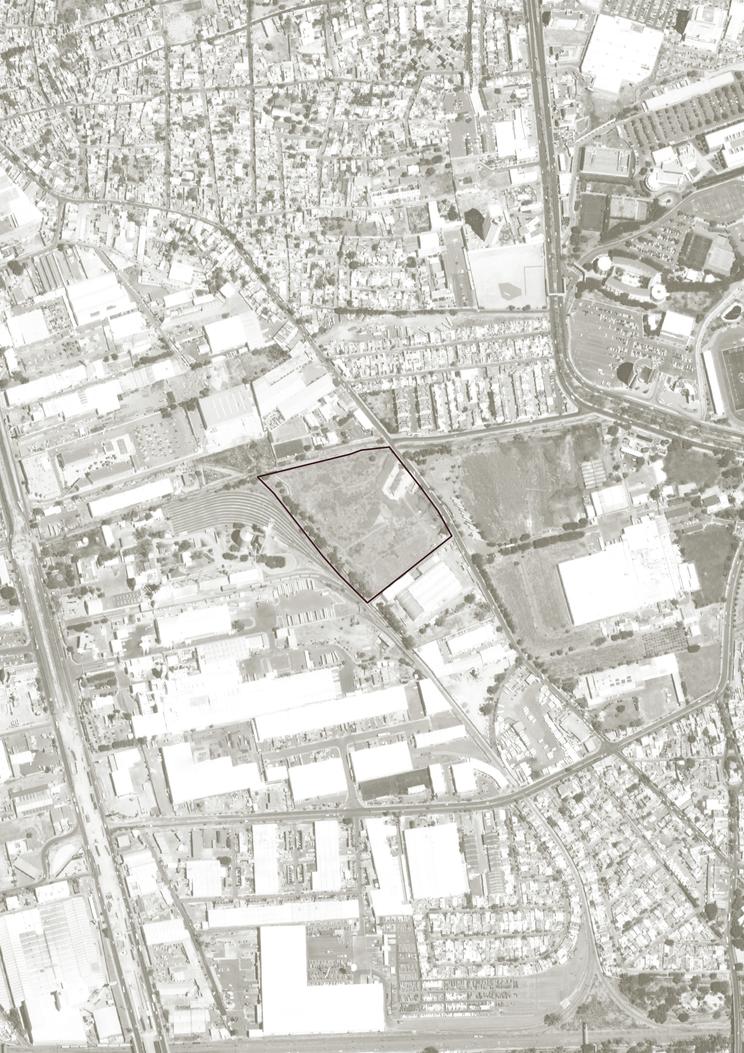
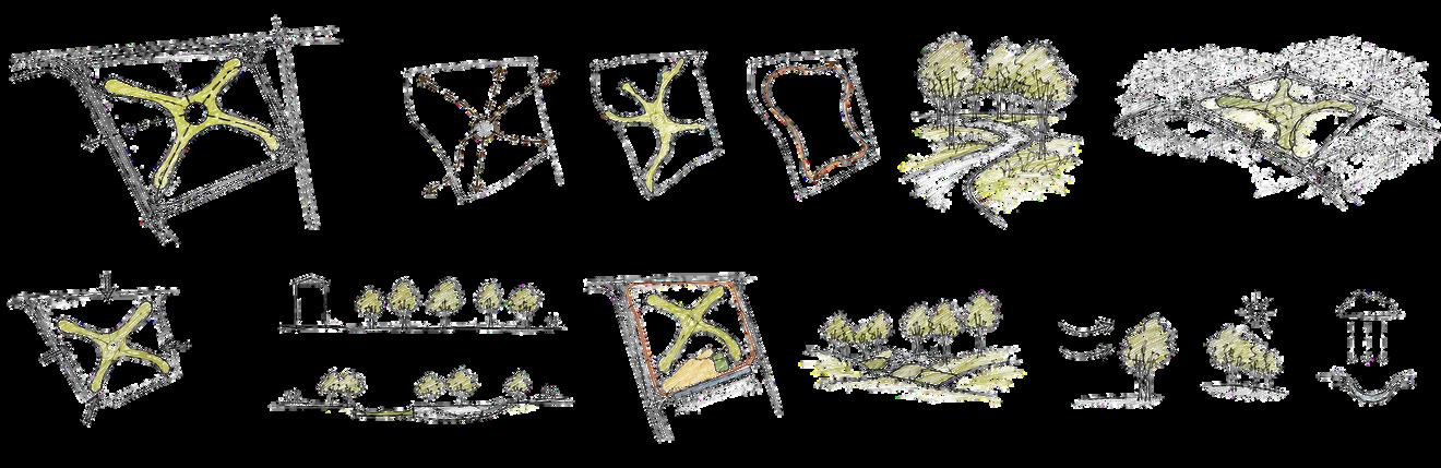
Located at a point of convergence between several urban corridors that connect residential areas, facilities, and productive zones. These corridors generate continuous user flows across the area. The project takes advantage of this strategic condition to capture and redistribute these movements, integrating pedestrian access points and public spaces that connect the site with its immediate surroundings.
Main paths leading to entries and context
Side paths that wind through the parks Perimeter path connecting the entire edge
Source: Authors’ own elaboration
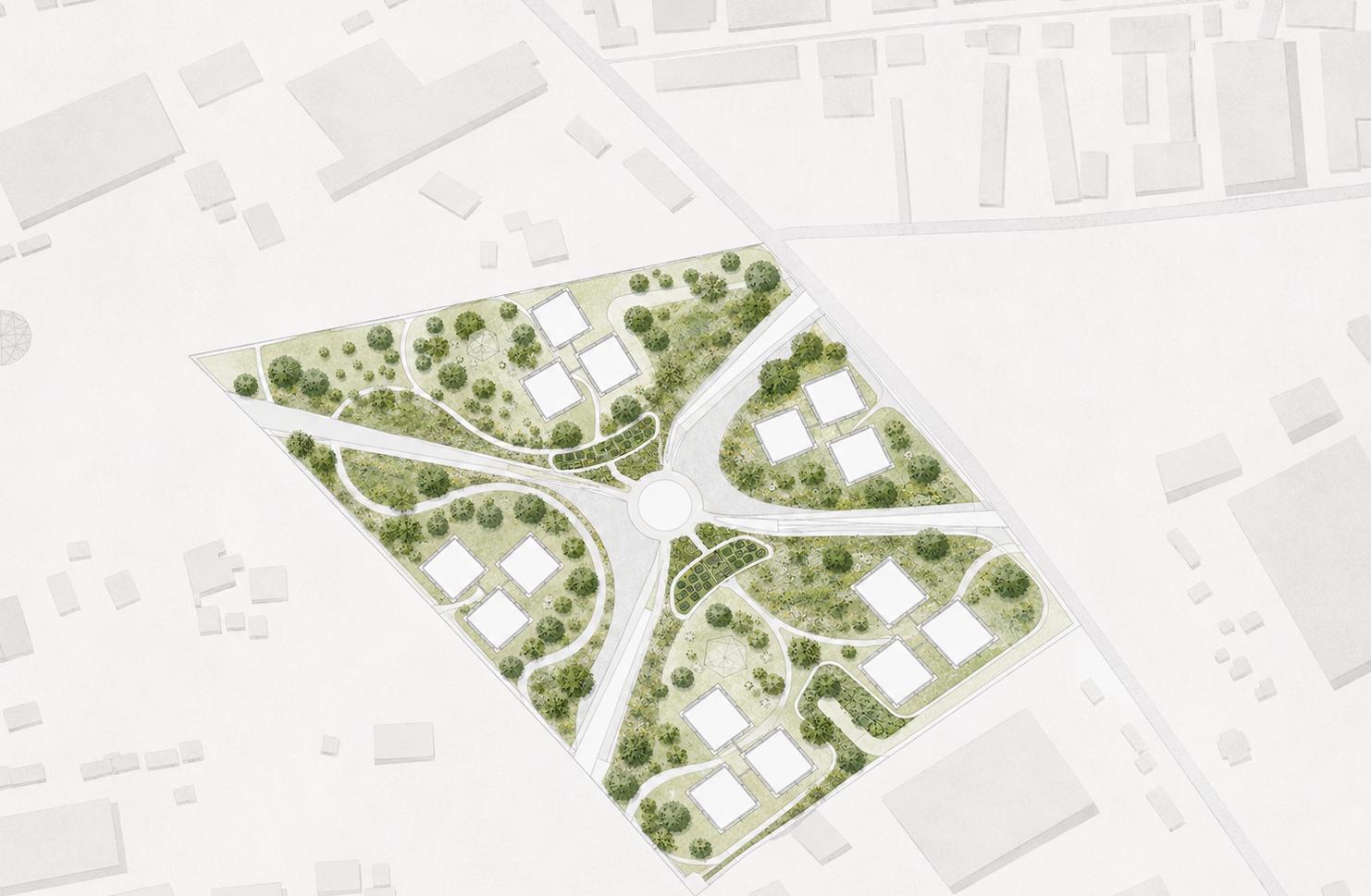

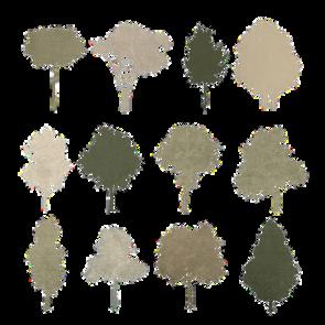
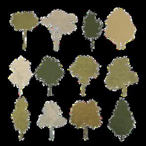
The vegetative masterplan of Root District is conceived as a living ecological infrastructure that integrates productive landscapes, public space, environmental mitigation, and community interaction into a single regenerative urban system. Rather than treating vegetation as a decorative layer, the proposal positions landscape as an active architectural and urban element capable of improving microclimatic conditions, fostering biodiversity, strengthening social cohesion, and supporting local food production.
The planting strategy is organized through a network of interconnected green systems distributed across the site, including productive orchards, urban agriculture plots, community gardens, shaded public plazas, permeable bioswales, and ecological corridors. Together, these components establish a continuous environmental framework that softens the urban condition while promoting healthier and more resilient spatial experiences.
At the core of the proposal, productive agricultural zones operate as both ecological and educational spaces. These orchards and cultivation areas are designed to support seasonal crops, local food production, and community participation through collective planting and harvesting activities. Beyond their productive function, the agricultural landscapes reinforce the identity of the district by reconnecting urban life with cultivation processes traditionally disconnected from contemporary cities.
Complementing these productive systems, native and adaptive vegetation is strategically distributed throughout pedestrian pathways, gathering spaces, and transitional zones to enhance thermal comfort and reduce heat island effects. Tree canopies provide shaded circulation routes, while layered vegetation improves air quality, increases water retention, and contributes to the overall environmental performance of the site.
Community gardens are integrated as social condensers that encourage interaction between residents, visitors, and local producers. These spaces promote collective stewardship, environmental awareness, and a stronger relationship between users and the landscape itself. Through this approach, vegetation becomes not only an environmental resource, but also a catalyst for education, recreation, and community engagement.
The landscape strategy also incorporates permeable surfaces and rainwater-sensitive systems that support natural infiltration and sustainable water management. Bioswales, vegetated buffers, and planted retention areas contribute to stormwater control while reinforcing the ecological continuity of the masterplan.
Overall, the vegetative system of Root District establishes a regenerative urban ecosystem where architecture, landscape, production, and public life coexist in balance. The proposal transforms vegetation into an operative framework capable of generating environmental resilience, productive capacity, and meaningful collective experiences within the contemporary city.
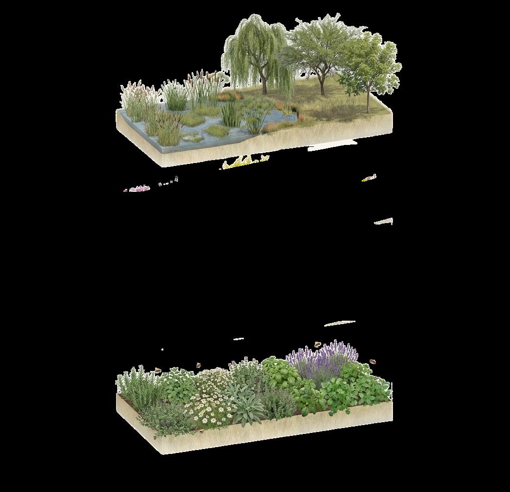
WATER TREATMENT / CANAL VEGETATION
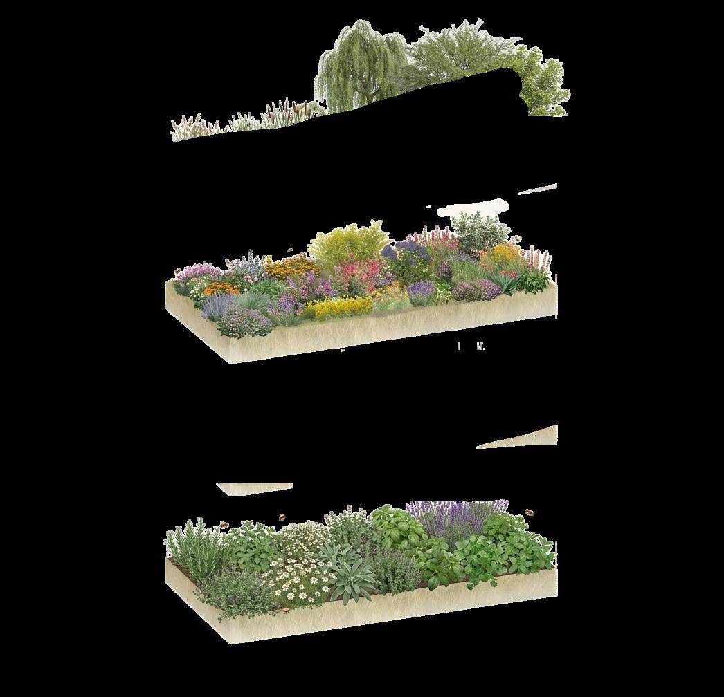
SEASONAL / PUBLIC LANDSCAPE VEGETATION
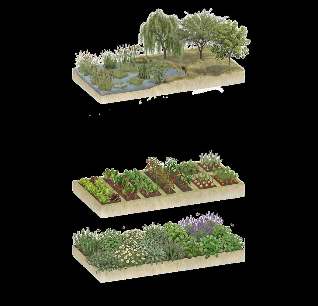
FOOD PRODUCTION LAYER
MEDICINAL & CULINARY PLANTS
Source: Authors’ own elaboration
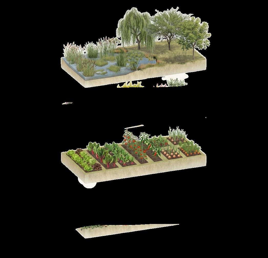
Phytoremediation vegetation composed of wetland species such as Phragmites australis (common reed), Juncus effusus (rushes), Typha domingensis (cattail), and Cyperus papyrus (papyrus) These plants absorb pollutants, oxygenate the water, reduce odors, and support microorganisms that break down contaminants Riparian trees including weeping willow, mesquite, and Mexican ash stabilize canal edges, provide shade, and improve the microclimate.
Edible planting beds with short-cycle vegetables such as lettuce, Swiss chard, spinach, and radish, combined with common crops including tomato, jalapeño and serrano peppers, onion, and carrot. These species require moderate water and allow for continuous harvesting, supporting local food production and community engagement.
A diverse mix of seasonal and flowering species such as lavender, salvia (Salvia greggii), gaura, cosmos, zinnia, and dahlias, combined with pollinator-friendly plants like echinacea, penstemon, and agastache. Ornamental grasses including Muhlenbergia capillaris, pennisetum, and stipa introduce movement and texture, while groundcovers such as lantana and portulaca provide continuity. Selected for their low water demand and adaptability to semi-arid climates, enhances biodiversity, attracts pollinators, and creates dynamic public landscapes that change throughout the year.
Aromatic and functional species including rosemary, oregano, chamomile, sage, thyme, basil, lavender, cilantro, and spearmint. These plants require less water, attract pollinators, and enhance biodiversity while providing medicinal and culinary uses that strengthen the relationship between users and the landscape.
Source: Authors’ own elaboration
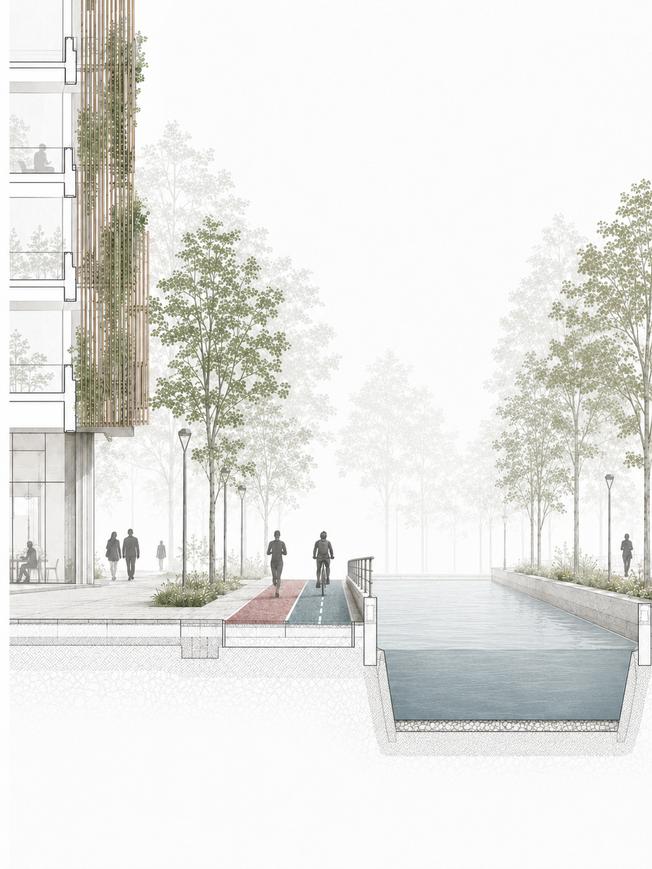
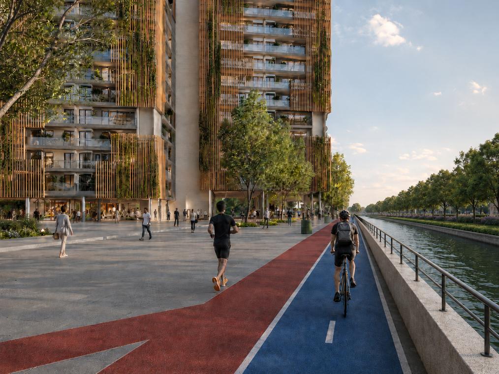
The existing canal is reinterpreted as an active urban edge rather than a residual boundary. Through the addition of pedestrian corridors, a cycling path, a running track, and continuous tree lines, the project transforms this infrastructural condition into a comfortable and dynamic public route. The intervention enhances the canal’s presence within the site, promoting sustainable mobility, everyday activity, and a stronger connection between landscape, water, and the built environment. By framing the canal as part of the public experience, the proposal turns an existing condition into a spatial opportunity for movement, comfort, and urban life.
The existing canal is reinterpreted as an active urban edge rather than a residual boundary. Through the addition of pedestrian corridors, a cycling path, a running track, and continuous tree lines, the project transforms this infrastructural condition into a comfortable and dynamic public route. The intervention enhances the canal’s presence within the site, promoting sustainable mobility, everyday activity, and a stronger connection between landscape, water, and the built environment. By framing the canal as part of the public experience, the proposal turns an existing condition into a spatial opportunity for movement, comfort, and urban life.
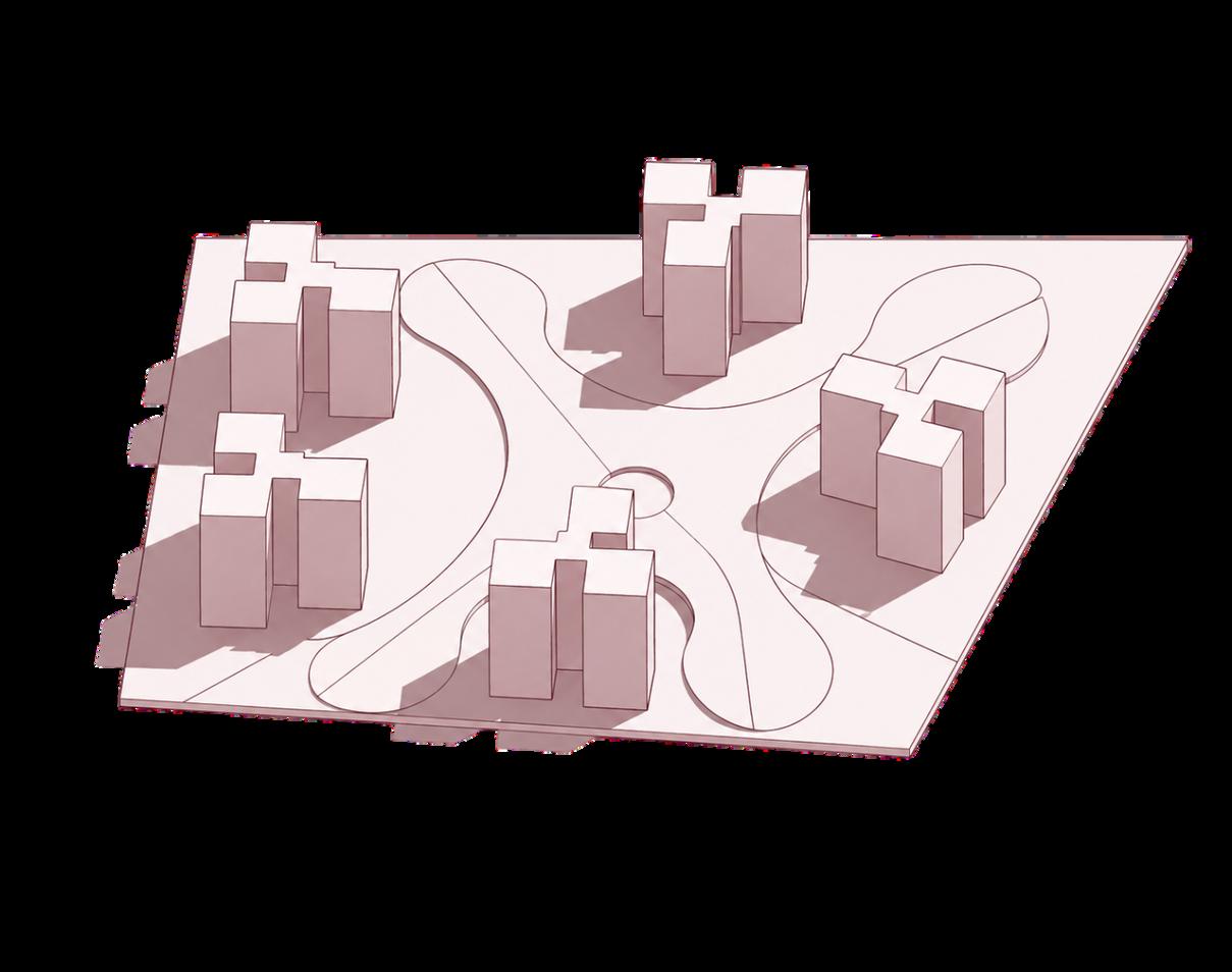
— June 21, 3:00 PM
During the Summer Solstice, the Yconia towers generate shorter and more concentrated shadows due to the higher solar angle. This condition allows greater sunlight penetration into the central public areas while maintaining shaded edges that improve pedestrian comfort. The balance between direct light and protected outdoor space enhances the usability of the plaza throughout the afternoon, creating an active and climatically responsive environment.
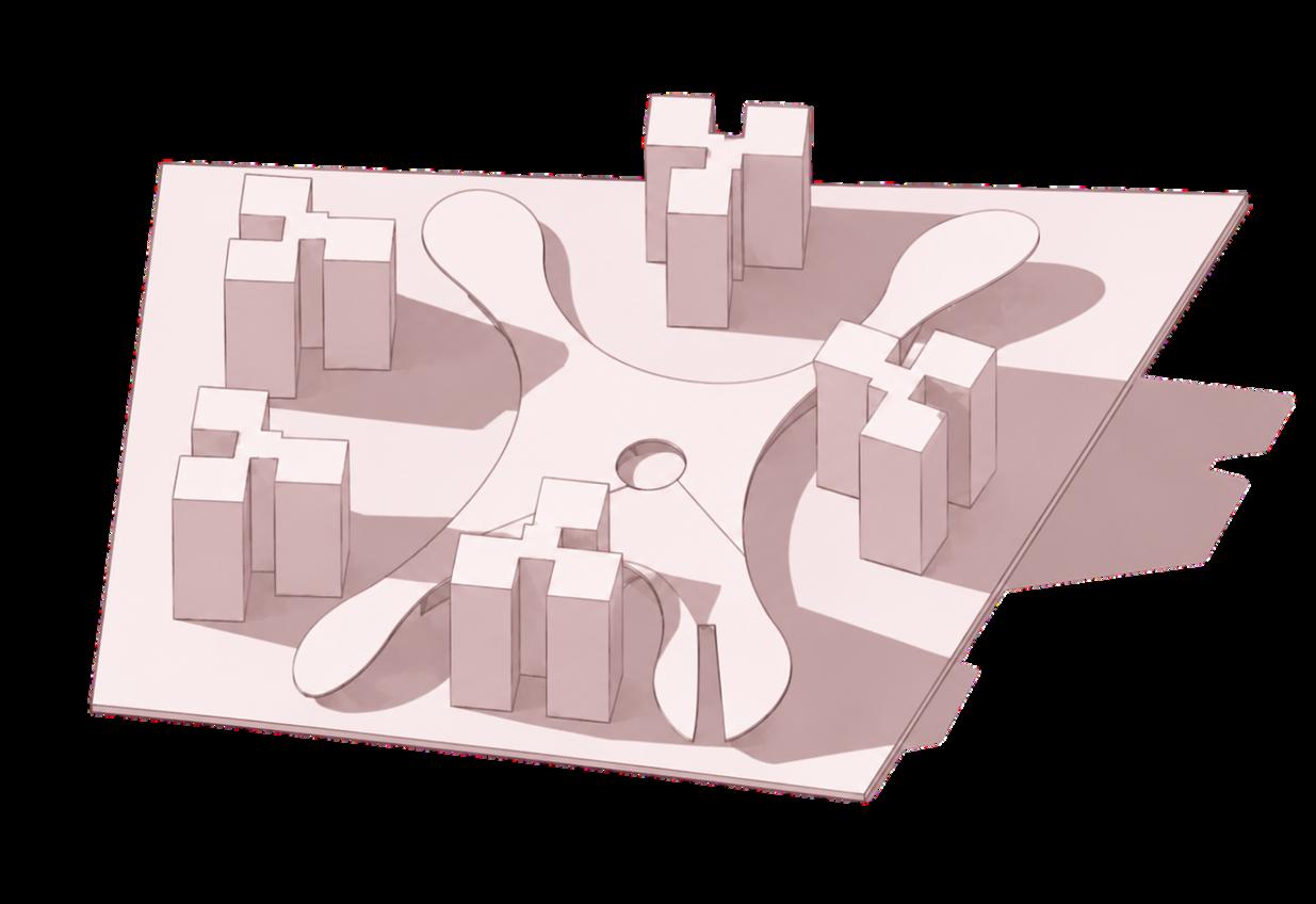
At midday during the Winter Solstice, the lower solar position produces elongated shadows that extend across the site and redefine the perception of open space. The volumetric arrangement of the towers creates moments of contrast between light and shadow, emphasizing spatial depth and orientation. This seasonal condition reveals how the project responds to changing environmental dynamics while preserving solar access within key communal areas.
Winter Solstice December 21, 9:00 AM
Source: Authors’ own elaboration
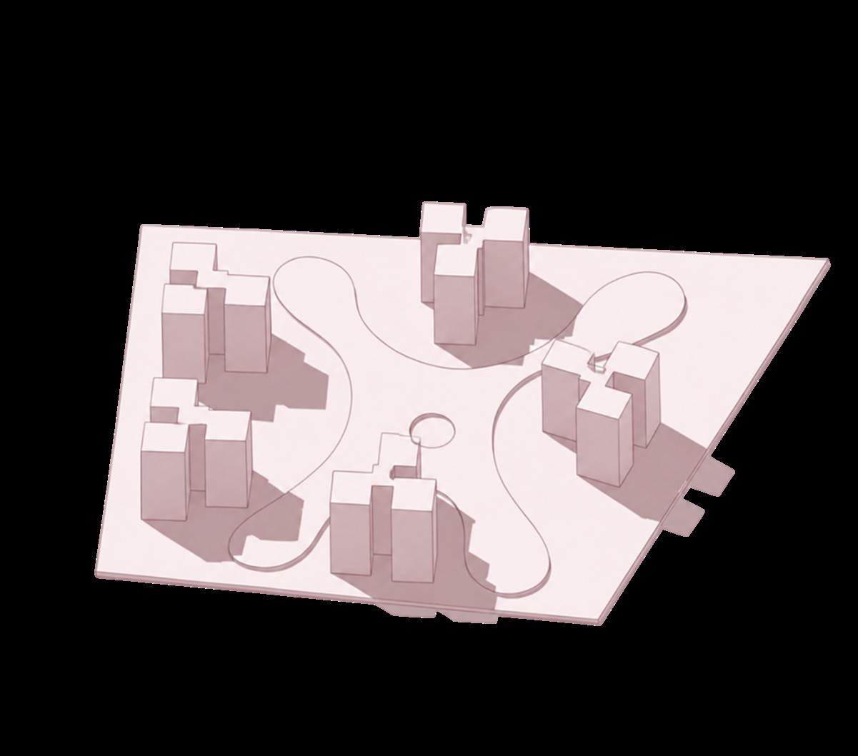
Winter Solstice — December 21, 9:00 AM
In the early morning hours of the Winter Solstice, shadows become more directional and dramatic, reinforcing the relationship between tower orientation and the surrounding public realm. The low-angle sunlight accentuates the verticality of the buildings and creates a constantly evolving spatial atmosphere across the ground plane. These conditions highlight the importance of solar studies in shaping pedestrian experience, thermal comfort, and the environmental performance of the project throughout the year.
The solar analysis explores how the Yconia towers interact with light and shadow throughout different moments of the year, revealing how seasonal conditions influence the environmental and spatial qualities of the project. By studying the Summer and Winter Solstices, the diagrams demonstrate how the volumetric arrangement of the towers shapes the experience of the public realm through changing patterns of sunlight, shade, and exposure.
During the Summer Solstice, the higher solar angle produces shorter and more controlled shadows, allowing greater light penetration into central public spaces while maintaining shaded pedestrian areas that improve outdoor comfort. In contrast, the Winter Solstice generates longer and more dramatic shadows that emphasize the verticality of the towers and reinforce the relationship between height, orientation, and open space. These changing conditions create different spatial atmospheres throughout the day and throughout the year.
Beyond measuring solar exposure, the studies highlight how the towers function collectively as environmental elements that regulate comfort, frame public space, and contribute to the overall urban experience. The analysis demonstrates how light and shadow become active components of the project, shaping movement, perception, and the interaction between architecture and climate.
BASIC DATA
Climate: temperate semi-arid
Average annual temperature: 18–22°C
HIGH SOLAR RADIATION
Annual precipitation: ~550–600 mm
Prevailing winds: northeast → southwest
HIGH WESTERN SUN EXPOSURE
Located in a temperate semi-arid climate typical of the city of Querétaro, Root District is designed to address high solar radiation, low-precipitation seasons, and average temperatures between 18 and 22°C. Based on this climate analysis, the project incorporates bioclimatic strategies aimed at improving environmental comfort and reducing the district’s energy impact.
The permeable urban layout, the fragmentation of building volumes, and the incorporation of open courtyards promote crossventilation and reduce heat buildup in public spaces and buildings. Similarly, green corridors, native vegetation, and shaded areas help mitigate direct solar exposure and reduce the urban heat island effect. The project also prioritizes natural lighting, permeable paving, and ecological integration as tools for building a more resilient, efficient, and adaptable urban ecosystem that responds to the site’s environmental conditions.
a. Bioclimatic strategies
Cross Ventilation
Open courtyards allow natural airflow through the district.
WPC Screen + Green Façade
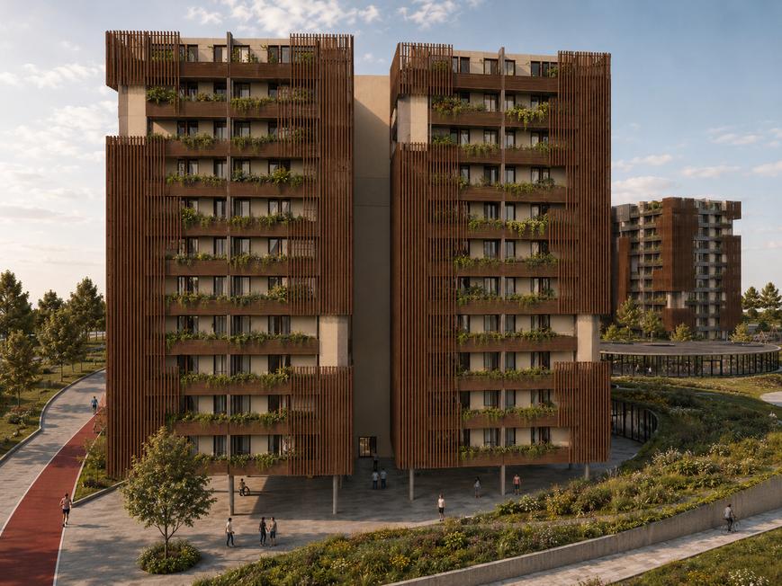
Wooden louvers filter sunlight and support vertical gardens.
Green Corridors
Vegetation connects spaces and improves the microclimate.
Permeable Paving
Porous surfaces reduce runoff and allow water infiltration.
Shaded Public Space
Canopies and greenery create cooler outdoor areas.
Native Vegetation
Low-water plants adapt to Querétaro’s semi-arid climate.
Rainwater Collection
Rooftop water is reused for irrigation.
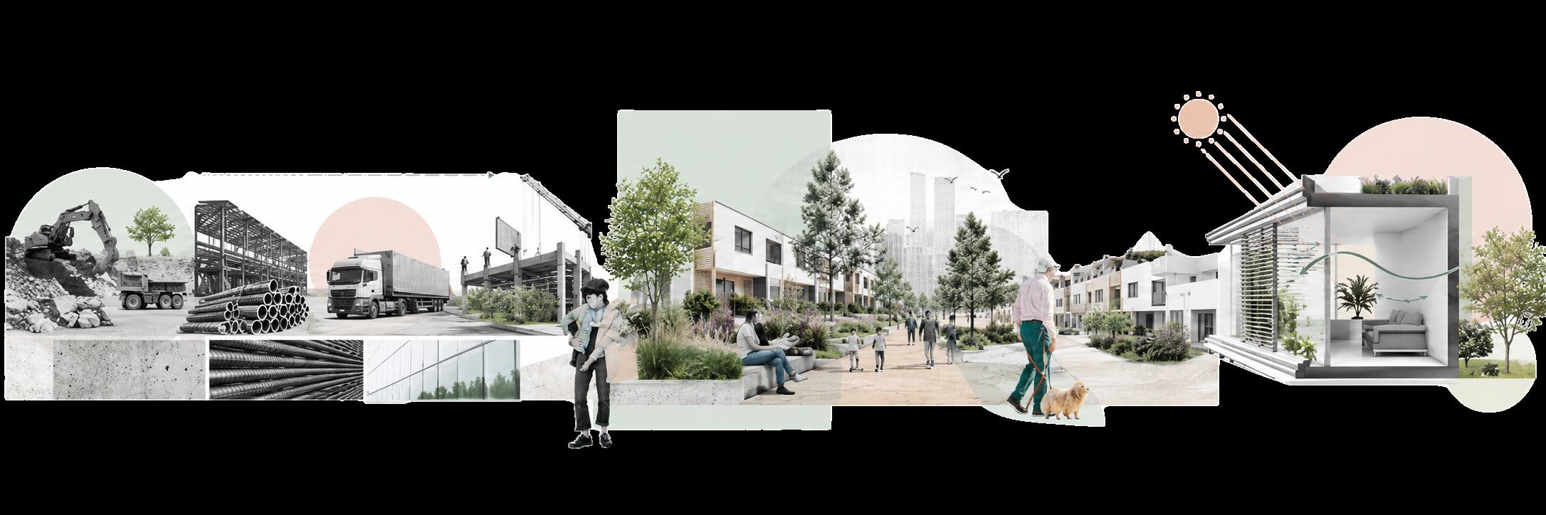
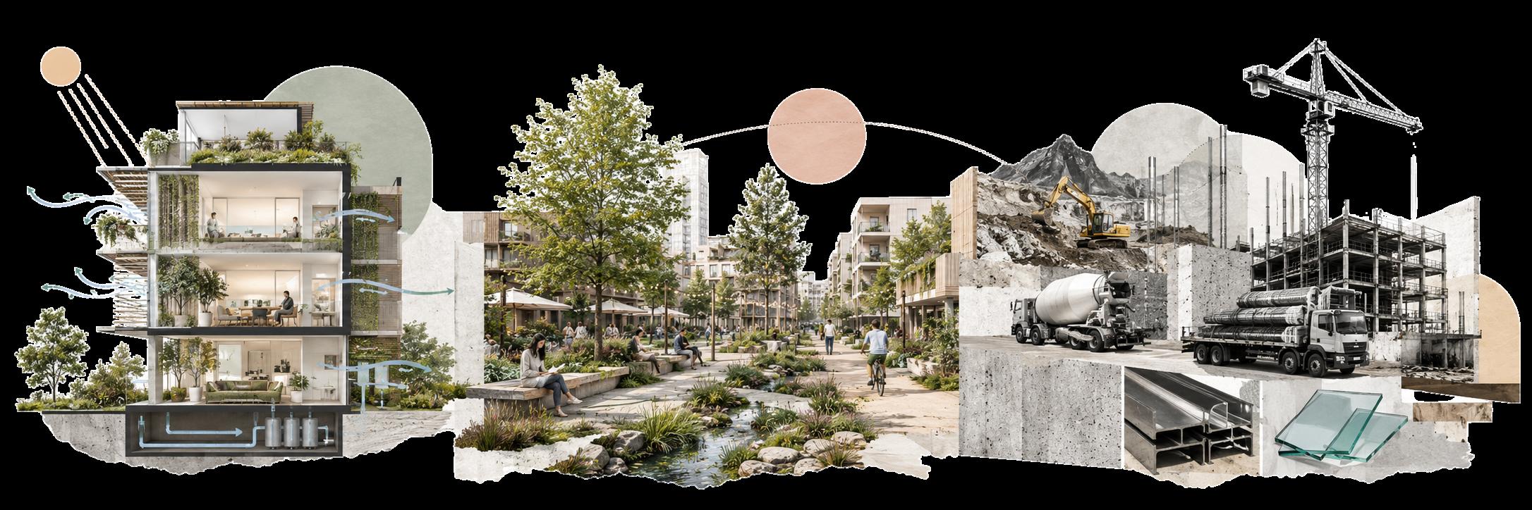
The embodied energy reflects the environmental impact generated during the extraction, manufacturing, transportation, and construction of the materials used in the district. Root District seeks to reduce this impact through efficient material strategies, the incorporation of passive systems, and structural optimization.
Although the project uses highly durable materials such as concrete, steel, and glass, the proposal partially offsets its impact through urban vegetation, permeable environmental regeneration strategies.
Estimated total project cost
Source: Authors’ own elaboration
Operational energy refers to the annual energy consumption resulting from the operation of buildings and urban spaces. Root District reduces this consumption through bioclimatic strategies such as natural ventilation, passive lighting, solar shading, and integrated vegetation.
Operational energy refers to the annual energy consumption resulting from the operation of buildings and urban spaces. Root District reduces this consumption through bioclimatic strategies such as natural ventilation, passive lighting, solar shading, and integrated vegetation.
These measures reduce reliance on mechanical HVAC systems and optimize the district’s long-term energy performance
These measures reduce reliance on mechanical HVAC systems and optimize the district’s long-term energy performance
Indicator Estimated value
Window-to-Wall Ratio (WWR) 38%
Opaque surface 62%
Estimated natural lighting 4% Daylight Factor
Estimated reduction in heat gain 20–30%
Complementary strategies Passive shading, vegetation, cross-ventilation
Source: Authors’ own elaboration
Root District achieves an estimated Window-to-Wall Ratio (WWR) of 38%, balancing natural daylight and thermal performance according to Querétaro’s climatic conditions. The façade composition integrates 62% opaque surfaces and controlled glazed openings to reduce solar heat gain while maintaining visual comfort and natural illumination. Through passive shading and cross ventilation strategies, the project reaches an estimated 4% daylight factor and reduces thermal gain by approximately 20–30%.
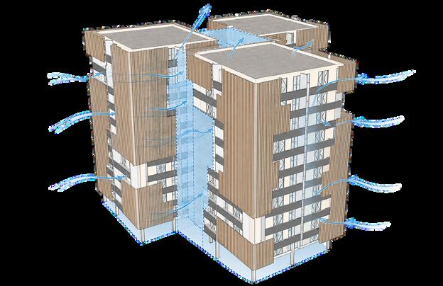
Open courtyards and permeable circulation paths allow natural airflow to move continuously through Root District, reducing heat accumulation and improving thermal comfort through passive ventilation strategies.
Open courtyards and permeable circulation paths allow natural airflow to move continuously through Root District, reducing heat accumulation and improving thermal comfort through passive ventilation strategies.

Source: Authors’ own elaboration
Cross ventilation in Root District is achieved through open courtyards, permeable pathways and strategically placed openings that allow air to move naturally across the buildings. Around 72% of the spaces receive constant natural airflow, helping reduce heat buildup and improving thermal comfort throughout the district. By relying on passive airflow instead of fully mechanical cooling systems, the project lowers energy consumption while creating healthier and more comfortable interior environments.
Cross ventilation in Root District is achieved through open courtyards, permeable pathways and strategically placed openings that allow air to move naturally across the buildings. Around 72% of the spaces receive constant natural airflow, helping reduce heat buildup and improving thermal comfort throughout the district. By relying on passive airflow instead of fully mechanical cooling systems, the project lowers energy consumption while creating healthier and more comfortable interior environments.
Root District integrates green infrastructure as a tool for ecological regeneration and environmental mitigation. The incorporation of green corridors, urban gardens, native vegetation, and permeable areas contributes to carbon sequestration and improves the district’s environmental quality.
These strategies help partially offset the emissions generated by urban development and foster a more resilient and sustainable urban ecosystem.
Vegetation Layer Function CO₂ Capture
Water Treatment Vegetation Phytoremediation + cooling
Public Landscape
Vegetation Biodiversity + shading
Medicinal & Culinary
Together, these environmental systems establish a regenerative urban framework where landscape infrastructure operates as an active component of the district rather than a purely aesthetic intervention. Vegetation, water management and productive landscapes work collectively to improve environmental performance while strengthening the relationship between users and the public realm.
The integration of ecological strategies throughout Root District contributes to carbon reduction, biodiversity enhancement and climate adaptation at multiple scales. By combining natural systems with public space and urban activity, the project promotes healthier living conditions and a more resilient urban environment capable of responding to future environmental challenges. More than isolated sustainability features, these systems form part of an interconnected ecological network that supports long-term environmental balance while enriching the everyday experience of the community.
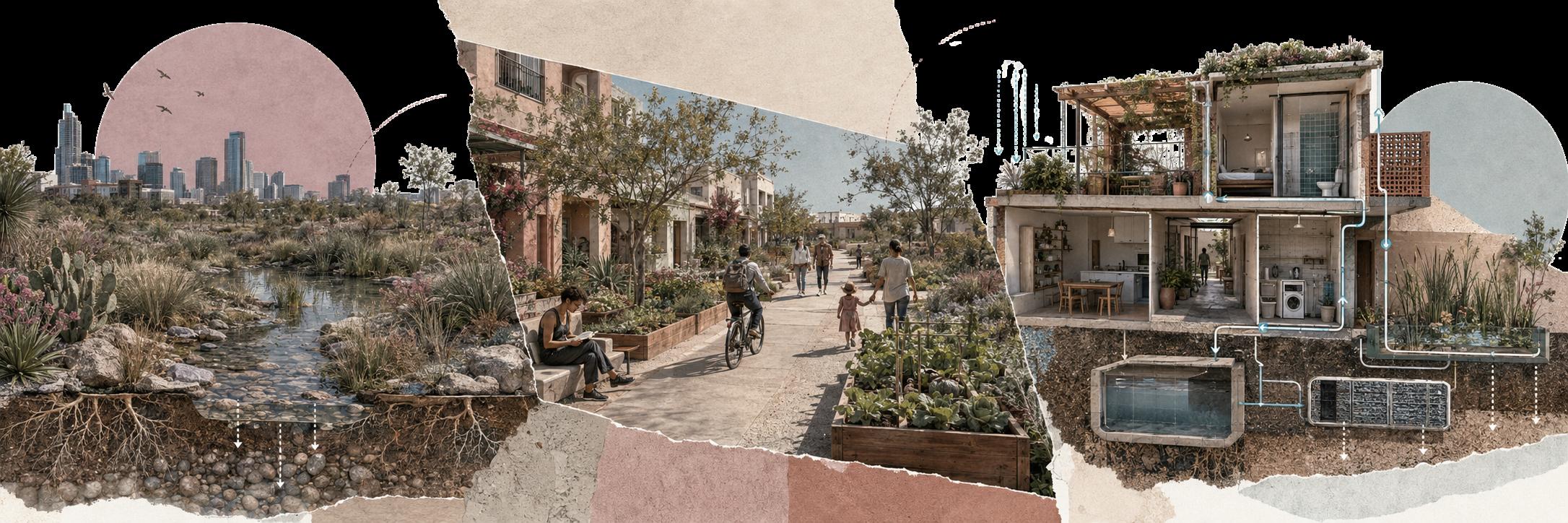
The district incorporates rainwater harvesting systems, graywater reuse, and permeable paving to reduce potable water consumption and improve water management onsite.
The integration of xerophytic landscaping and low-wateruse vegetation optimizes irrigation and reduces water waste, adapting to the climatic conditions of Querétaro.
Strategy
Estimated impact
Rainwater harvesting
Partial annual recovery
Greywater reuse Reduction in consumption
Estimated total savings 30–40%
Estimated reclaimed water 1.5 million liters per year
Source: Authors’ own
Filtration module
Underground cistern
Pump room
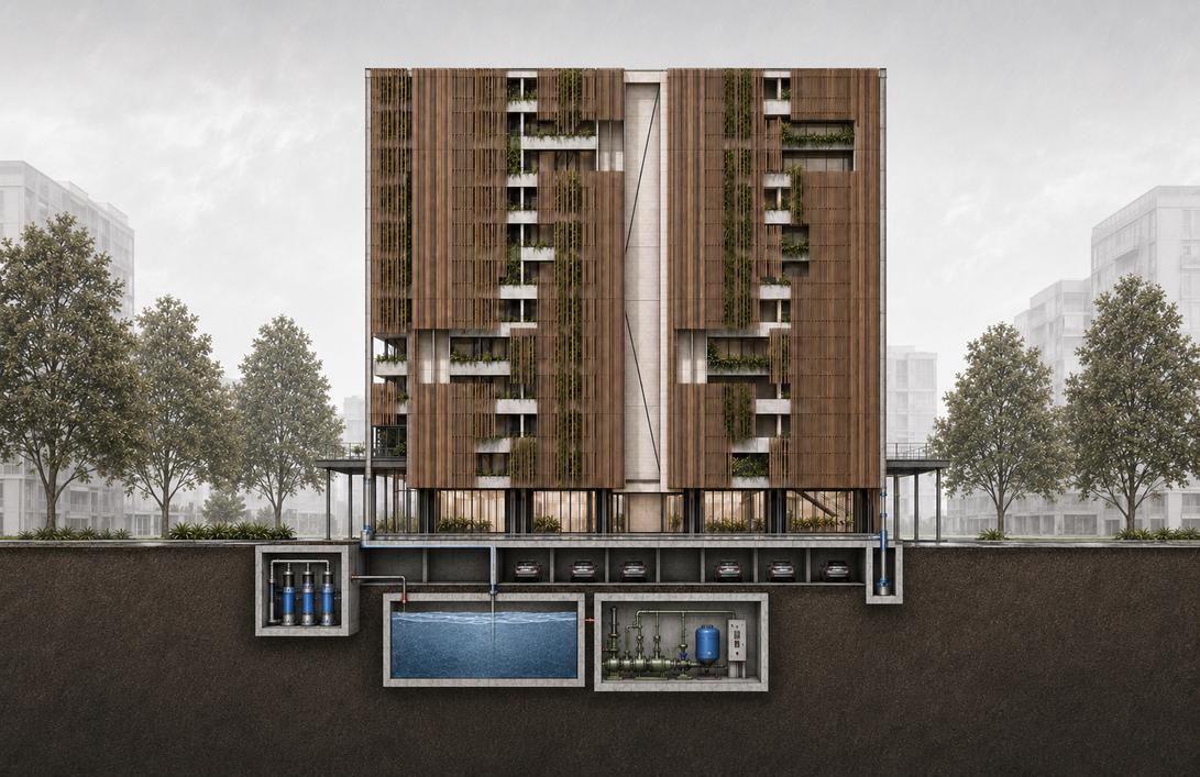
The pluvial water management system is designed to collect, filter, store, and redistribute rainwater throughout the project in order to reduce potable water consumption and create a more sustainable water cycle within the building. Rainwater will be captured directly from the rooftop surfaces through a network of collection pipes integrated into the façade and structural system. Once collected, the water will flow vertically through the blue piping system toward the underground filtration modules located beneath the building. After passing through the filtration process, the water will be stored inside an underground cistern, where it will remain protected and ready for redistribution. From this storage tank, the pump room system will regulate water pressure and distribute the treated rainwater through the green piping network across the building. The recovered water will primarily be redirected toward irrigation systems integrated into the project’s green infrastructure. This includes rooftop vegetation, façade planters, vertical gardens, and common landscaped areas, ensuring that all green spaces remain hydrated through recycled water rather than potable water sources. In addition, part of the treated water may also support secondary non-potable uses such as maintenance and service systems within the building. By implementing this closed-loop water strategy, the project minimizes runoff waste, improves environmental performance, and reinforces the relationship between architecture, sustainability, and urban ecological resilience
Uses a more conventional residential layout with separated towers and centralized public space.
Uses a more conventional residential layout with separated towers and centralized public space.
Circulation is more rigid and functional, focusing mainly on efficiency.
Circulation is more rigid and functional, focusing mainly on efficiency.
Green areas work mostly as landscape elements around the buildings.
Green areas work mostly as landscape elements around the buildings.
The project prioritizes density and organization over spatial flexibility and interaction.
The project prioritizes density and organization over spatial flexibility and interaction.
DISTRICT
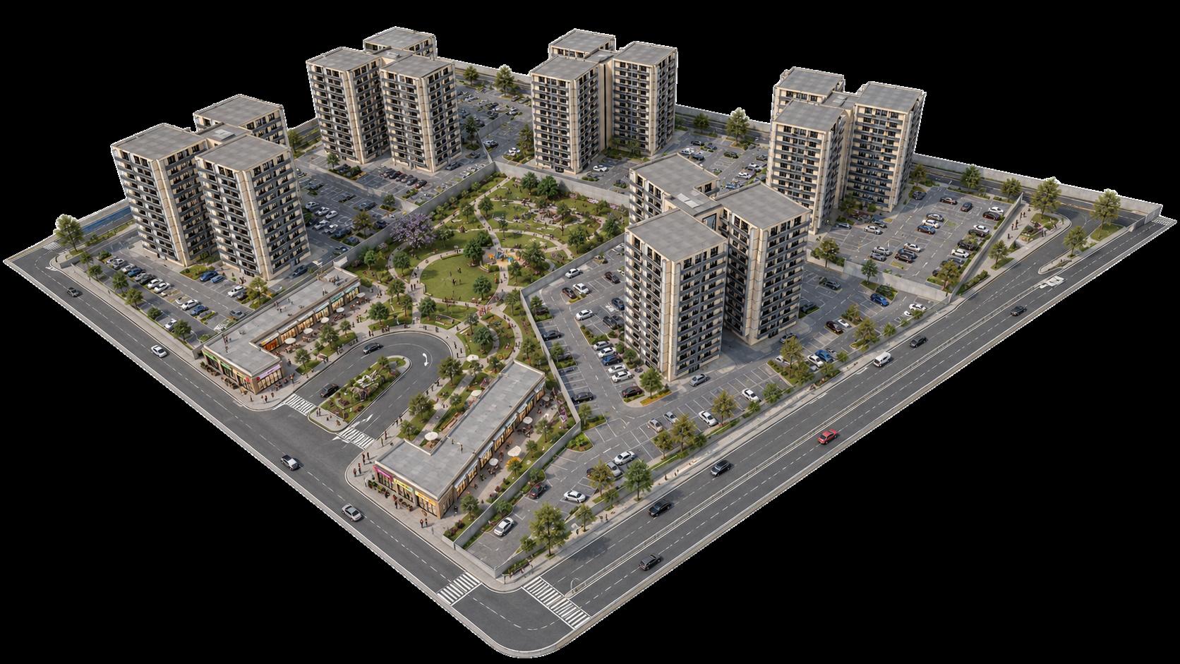
Image developed by the authors with AI-assisted visualization
Image developed by the authors with AI-assisted visualization
Proposes a more holistic and human-centered urban strategy, where architecture, landscape, and circulation work as one interconnected system.
Proposes a more holistic and human-centered urban strategy, where architecture, landscape, and circulation work as one interconnected system.
Public space extends throughout the entire district, generating continuous interaction, movement, and social activation at multiple scales.
Public space extends throughout the entire district, generating continuous interaction, movement, and social activation at multiple scales.
Introduces fluid pathways, elevated connections, and layered programs that create a more dynamic and immersive spatial experience.
Introduces fluid pathways, elevated connections, and layered programs that create a more dynamic and immersive spatial experience.
Green infrastructure is fully integrated into the architecture, strengthening the relationship between nature, wellness, and everyday urban life.
Green infrastructure is fully integrated into the architecture, strengthening the relationship between nature, wellness, and everyday urban life.
The project is designed to be more adaptable and future-oriented, allowing spaces to evolve according to changing community needs.
The project is designed to be more adaptable and future-oriented, allowing spaces to evolve according to changing community needs.
Rather than functioning only as a residential development, Root District creates a vibrant mixeduse environment that encourages inclusivity, flexibility, and long-term urban resilience.
Rather than functioning only as a residential development, Root District creates a vibrant mixeduse environment that encourages inclusivity, flexibility, and long-term urban resilience.
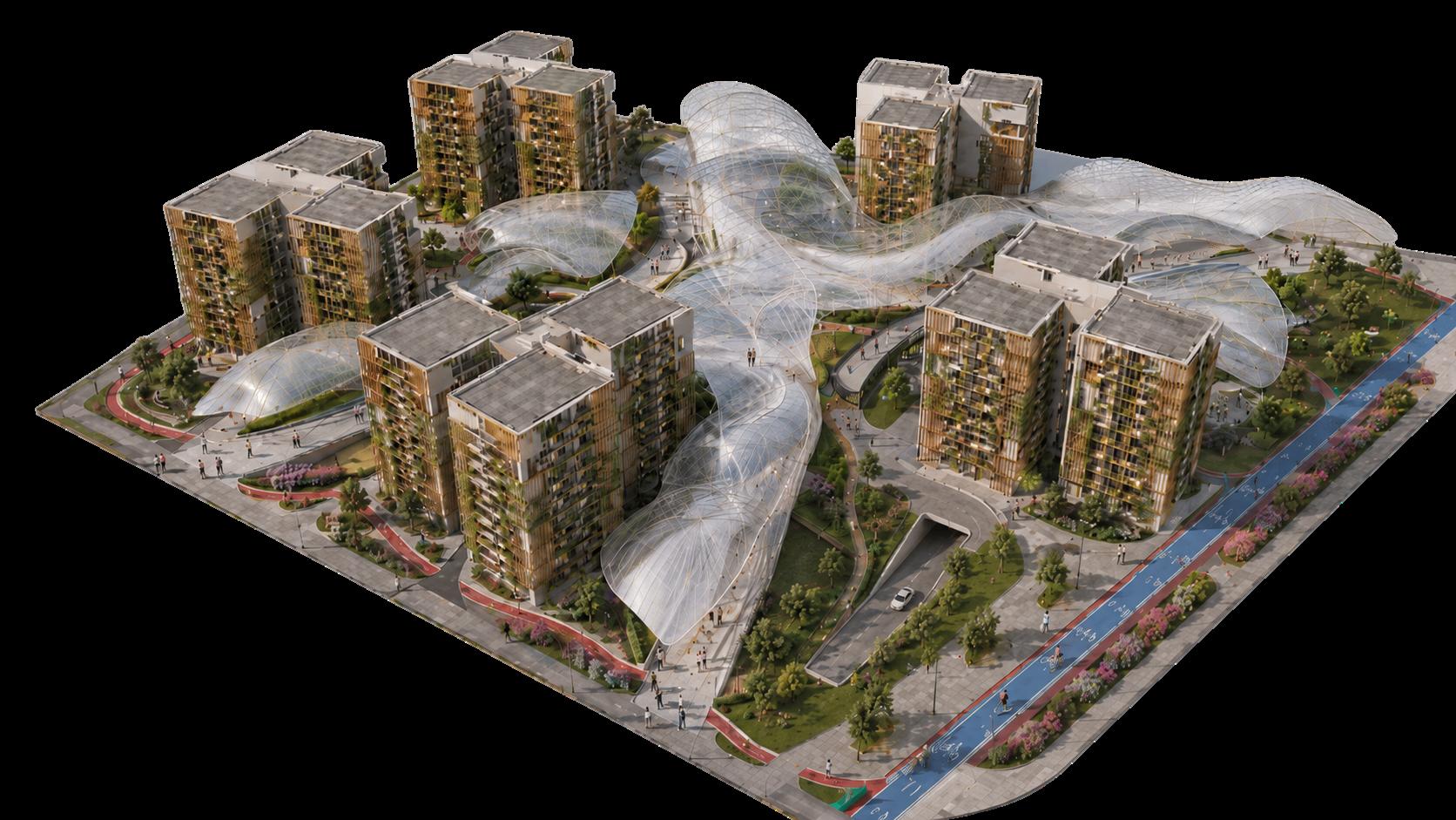
developed by the authors with AI-assisted visualization
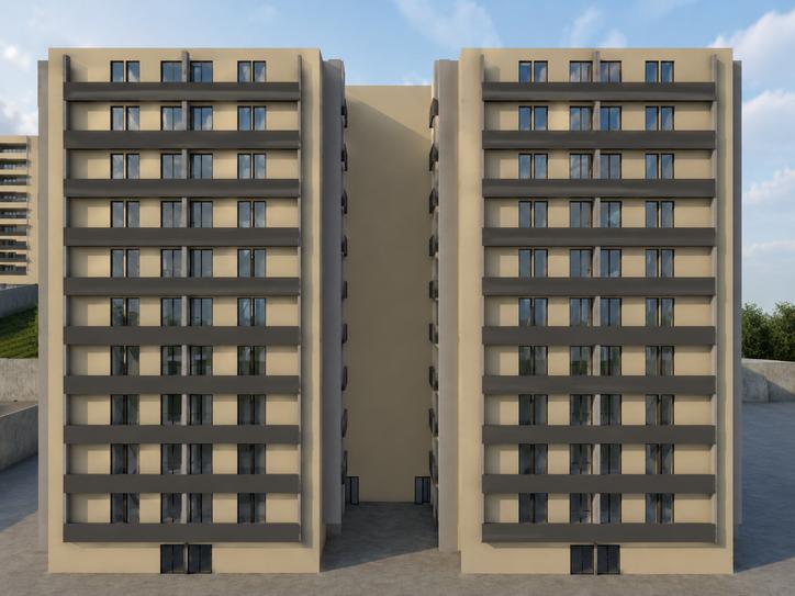
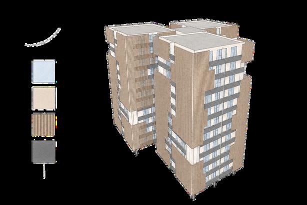
The original façades rely on repetitive horizontal elements and a monochromatic material palette that limits the visual identity of the towers. While functional, the design lacks environmental responsiveness and creates a heavier architectural appearance with minimal interaction between the buildings and the surrounding public space. In addition, the absence of integrated shading strategies reduces thermal efficiency and results in less comfortable façade conditions throughout the year.
The façades were enhanced through the implementation of WPC louvers, creating a more cohesive and environmentally responsive architectural language across the district. This strategy was developed through the solar analysis studies, which identified the areas with the highest sun exposure throughout the year. Based on these findings, the louvers help reduce direct heat gain, improve thermal comfort, and provide solar protection while still allowing natural light and ventilation. In addition, their warm materiality strengthens the relationship between architecture and landscape, giving the project a more sustainable and human-centered identity.