From: Diego Mendoza, Zara García & Elena Lara Cruzaley
To: distritoQRO
Rodrigo Pantoja.
Diana García.
Pedro Mendoza.
Yetzi Tafoya.
Andrea Parga.
Viviana Barquero.
Santiago Luján.
Carlos González.
Udo Muchow.
Escuela de Arquitectura, Arte y Diseño Tecnológico de Monterrey, Campus Qro JUNE 2026
Dedicated to:
To our parents, for teaching us to believe in our ideas even when they were just sketches; for their patience, support, and unconditional love through every sleepless night, every moment of dedication, and every moment of doubt.
To our teachers and mentors, for guiding us, challenging us, and helping us transform our vision into something greater than a project: a proposal with purpose, community, and a future.
To the architects, collaborators, and everyone involved in this process, thank you for sharing your experience, time, and knowledge with us. Every conversation, critique, and piece of advice left its mark on this journey.
To our friends and everyone who supported us behind the scenes, thank you for holding us up during the long days, celebrating our progress, and reminding us to enjoy the process.
And finally, to the community and inspiration that brought this project to life: thank you for reminding us that architecture not only builds spaces, but also connections, opportunities, and a sense of belonging.
With gratitude,
Diego, Zara, and Elena
“Where paths converge, life takes root. A system of soil, coffee, and community.”
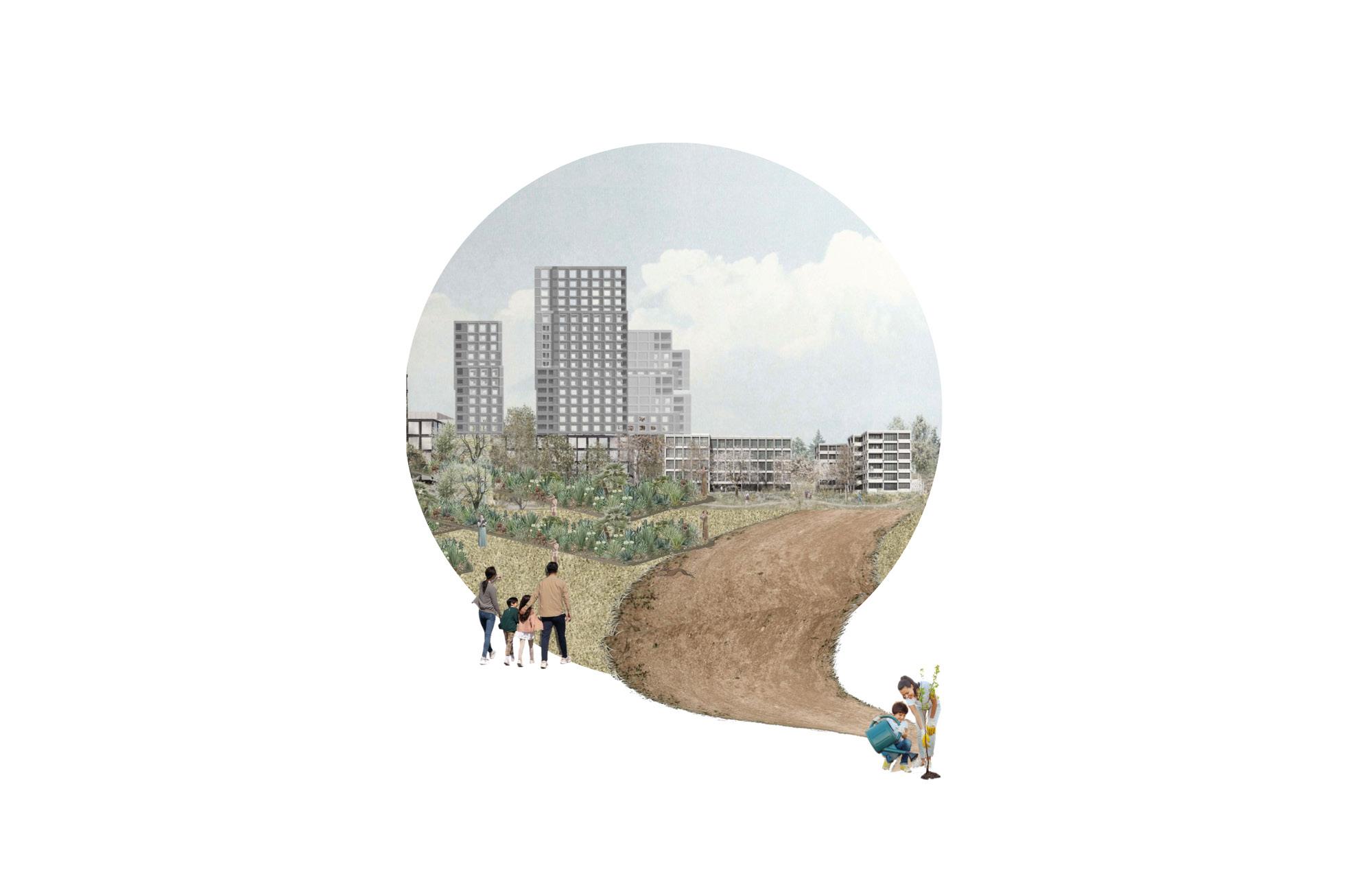
ROOT DISTRICT is conceived as a point of convergence within distritoQRO, where architecture operates as a living system rather than a collection of objects.
Through the integration of urban agriculture, coffee production, public space, and housing, the project establishes a network of relationships between land, people, and activity.
More than a fixed form, it proposes a framework for growth—an environment where social, ecological, and productive processes can take root and evolve over time.
ORIGINS
MANIFESTO
PROJECT STATEMENT
OBJECTIVES
DESIGN APPROACH
SITE & URBAN CONTEXT
distritoQRO CONTEXT
SITE ANALYSIS
URBAN CONDITIONS 3. CONCEPT
CONCEPT & SYSTEM
MASTERPLAN & URBAN STRATEGY
MASTERPLAN
CIRCULATION & FLOWS
PRODUCTIVE LANDSCAPE
ENVIRONMENTAL RESPONSE
CONVENTIONAL DEVELOPMENT VS ROOT DISTRICT
ARCHITECTURAL PROGRAM
COFFEE
STRATEGIES
PROJECT REPRESENTATION AND EXPERIENCE
ORIGINS
Root District is conceived as an urban regeneration strategy within Distrito Qro, an area defined by the coexistence of housing, education, commerce, and productive activities. Despite its potential, the district reflects common urban challenges: fragmented public space, car dependency, limited green areas, and a weak connection between daily life and the urban environment.
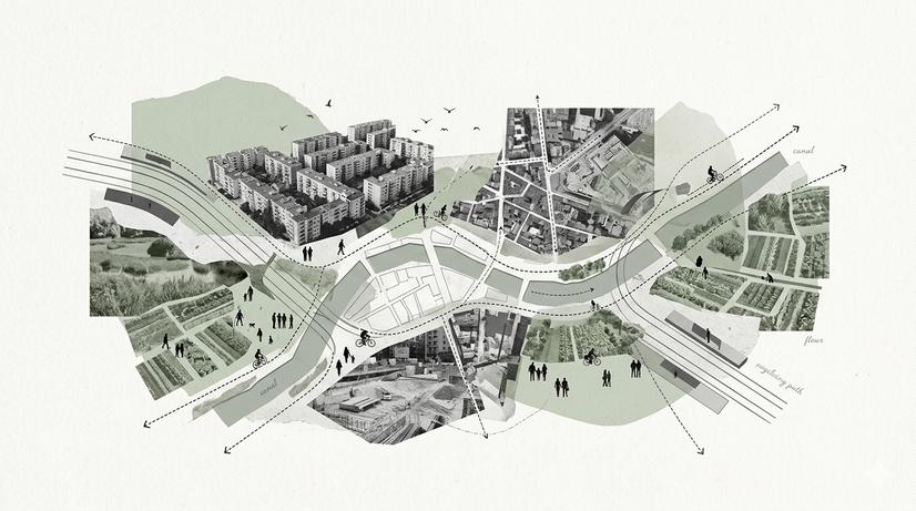
In response, the project redefines the block as an active unit of transformation. Rather than a fixed boundary, it operates as a system where public space, mobility, landscape, and social infrastructure are integrated.
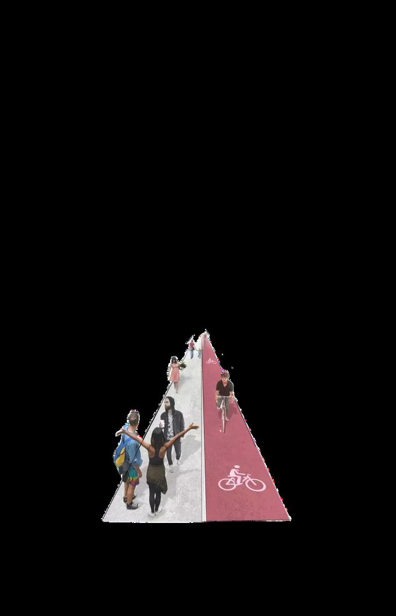
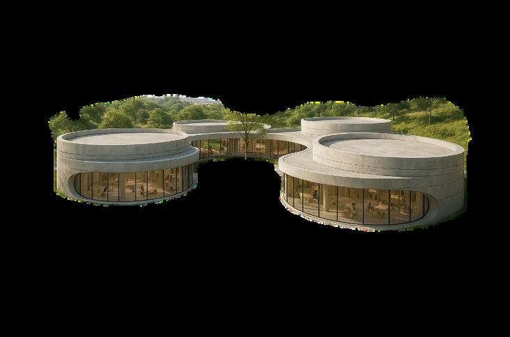
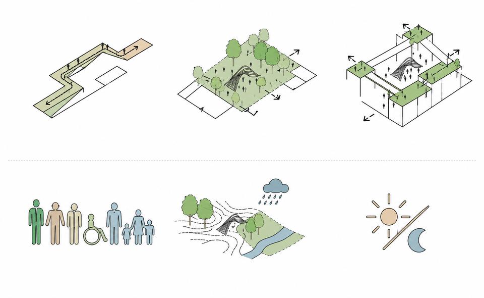
The proposal is structured through a circular system that prioritizes pedestrian and bicycle movement, incorporating green areas, permeable surfaces, and environmental strategies. Complementing this, a mixed-use building acts as an urban hub, bringing together community, educational, and productive programs that extend into public space and foster social interaction.
Root District ultimately proposes a shift from isolated interventions toward a connected urban ecosystem, where infrastructure supports not only function, but the relationship between people, the city, and its natural resources.
Source: Authors own elaboration
THE PROBLEM
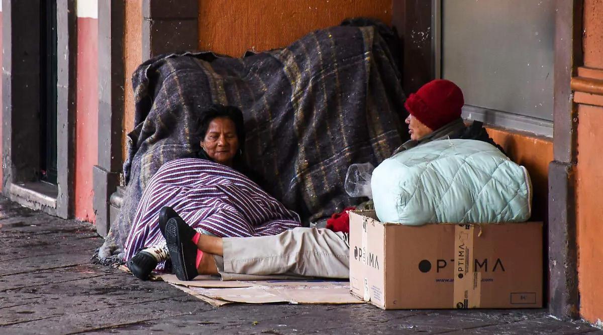
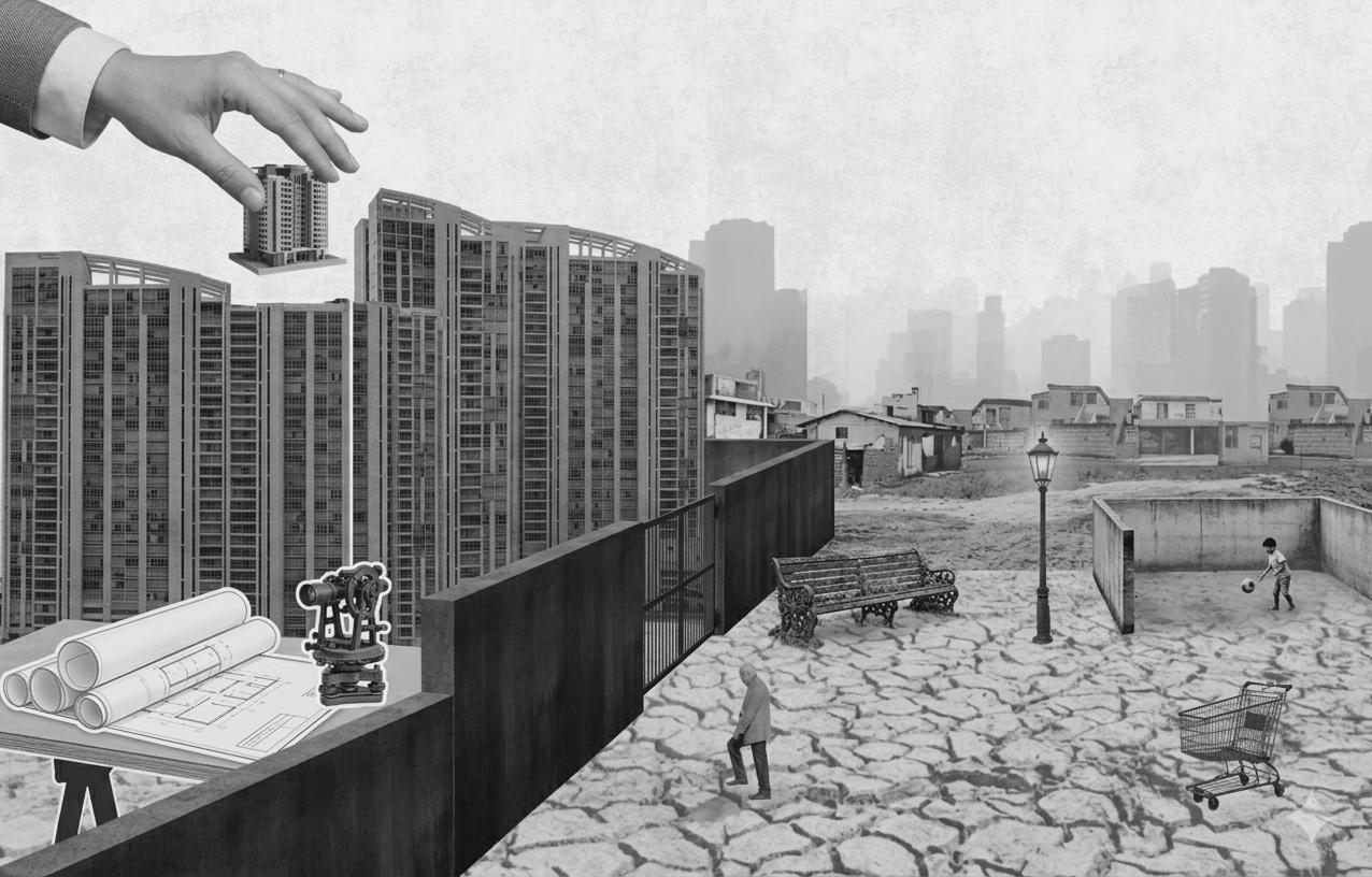
In Querétaro, urban inequity is reflected in the uneven distribution of access to public space, mobility, and environmental quality. While some areas benefit from consolidated infrastructure and services, others depend heavily on private transportation, have limited green space, and offer fewer opportunities for everyday interaction and community life.
This condition produces a fragmented urban experience, where distance, accessibility, and spatial quality define how people move, gather, and participate in the city.
Within distritoQro, these conditions manifest through a disconnection between programs and public space. Although the area concentrates housing, education, commerce, and productiveactivities, they operate as isolated elements rather than an integrated system.
Public space is often residual and lacks continuity, mobility is largely oriented toward the car, and green areas are scarce or disconnected. As a result, everyday activities remain fragmented, limiting interaction, accessibility, and the potential for collective urban life.
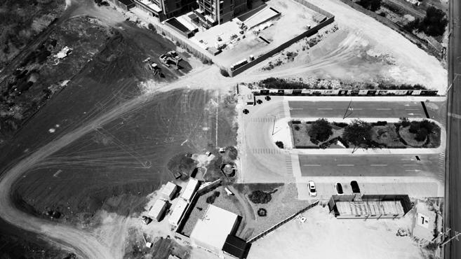
Photograph sourced from the internet
MANIFESTO
Source: Authors’ own elaboration
01. The Right to Be Seen
02. Territorial Agency
03. Pedagogy of the City
04. City Within Reach
Design active facades, strategic lighting, and transparent ground floors that foster safety through presence, not surveillance. Defend public space as a place of coexistence, dignity, and collective visibility.
Advocate for participatory budgets and neighborhood governance that ensure urban transformations reflect the needs and desires of their inhabitants. Defend participation as the foundation of spatial justice.
Transform streets, water systems, and public spaces into learning environments that cultivate environmental awareness and collective responsibility. Empower citizens to understand and shape their territory.
Reject zoning that fragments everyday life. Consolidate proximity as an urban principle by integrating housing, commerce, culture, and services within walking distance. Design districts that prioritize accessibility, inclusion, and resilience.
05. Mobility as a Scale to Freedom
Reject car dependency as the default condition. Prioritize walkability, universal accessibility, and safe crossings to guarantee autonomy at every age. Connect pedestrian networks across scales without sacrificing human centrality.
06. Homes in Motion
Advocate for the revaluation of existing housing, the use of low-impact materials, and modular flexibility that allows the home to grow and adapt to the cultural and economic identity of its inhabitants. Reintegrate housing into the social and productive fabric of the city.
07. Bring Nature Back
Restore native vegetation and ecological corridors as public health infrastructure that mitigates pollution and rebuilds biodiversity. Reintegrate nature as a structural component of the urban fabric.
08. A City That Filters
Replace asphalt with permeable systems that allow infiltration and reduce heat and flooding. Design the ground as a living system that collaborates with climate resilience.
12. Industry with Purpose
Promote industries that generate employment while regenerating environmental and social systems. Align economic growth with long-term urban sustainability.
10. Second Life Protocol
Establish neighborhood systems for composting, repair, and material recovery that transform waste into resource. Close urban cycles through shared environmental responsibility.
11.
Heritage of the Used
Revalue existing industrial and commercial structures through adaptive reuse. Strengthen collective memory while preventing displacement and generating new opportunity.
09. Reclaiming the Rain
Implement rainwater harvesting and biofiltration systems in housing and public space. Return permeability to the soil and recognize water as a shared right.
13. Innovation that Cares
Develop technologies that prioritize collective well-being, decent employment, and environmental repair. Transform productivity into an inclusive and regenerative force.
14. Edible District
Transform vacant lots into community gardens and micro-parks that shorten distribution networks and strengthen food sovereignty. Integrate food production into the urban fabric as ecological, social, and economic infrastructure.
. “ ”
A
district defined not by form, but by the connections it enables; Where infrastructure, ecology, and community grow together
PROJECT STATEMENT
Source: Authors’ own elaboration
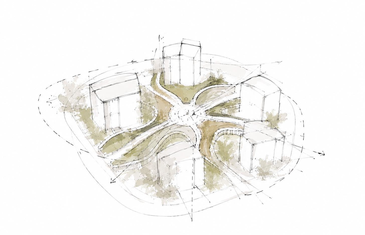
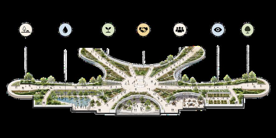
ROOT DISTRICT emerges as a regenerative urban ecosystem where landscape, community, and infrastructure merge into a single living network. Inspired by the logic of root systems, the project branches organically across the site, creating interconnected spaces for cultivation, gathering, learning, and exchange. Rather than functioning as a conventional architectural object, the proposal behaves as an evolving social landscape that adapts to public life and ecological processes.
Through layered productive terraces, water-sensitive systems, urban farming platforms, and open communal nodes, the project redefines the relationship between people and the city. Circulation becomes experience: pathways expand into markets, gardens transform into educational spaces, and ecological corridors become social connectors. Every branch of the intervention supports interaction between nature, food production, and collective activity.
ROOT DISTRICT proposes a future where architecture is no longer separated from ecology, but instead operates as a shared public organism; Cultivating resilience, accessibility, and community through a continuously connected urban environment.
OBJECTIVES
OBJECTIVES
CONNECT PEOPLE AND PLACES
Create intuitive connections across the district that make it easy and enjoyable for people to move, gather, and explore.
ENHANCE WELL-BEING
Design spaces that promote mental and physical well-being through access to nature, movement, social interaction, and moments of rest.
PROMOTE FLEXIBILITY AND ADAPTABILITY
Develop a district that can evolve with the needs of the community, allowing spaces to transform and serve multiple uses over time.
The objectives of Root District focus on creating a connected, inclusive, and adaptable urban environment that responds to both people and nature. Through integrated circulation systems, layered public spaces, and flexible programming, the project encourages movement, interaction, and accessibility across the district. The design promotes social engagement while supporting diverse activities that evolve throughout the day and over time.
Source: Authors’ own elaboration
Root District aims to enhance quality of life by integrating green infrastructure, public gathering spaces, and human-centered design strategies. The project prioritizes well-being, sustainability, and community identity by creating environments that are comfortable, resilient, and active at multiple scales. By balancing ecological systems with urban activity, the district becomes a dynamic space that supports everyday life and long-term environmental responsibility.
FOSTER COMMUNITY AND
INCLUSIVITY
CSUPPORT SUSTAINABILITY
SUPPORT SUSTAINABILITY
ACTIVATE DAY AND NIGHT
INCLUSIVITY
Create a welcoming environment for people of all ages, backgrounds, and abilities, encouraging interaction, belonging, and a strong sense of community.
backgrounds, and abilities, encouraging interaction, belonging, and a strong sense of community.
Create a welcoming environment for people of all ages, backgrounds, and abilities, encouraging interaction, belonging, and a strong sense of community.
Integrate green infrastructure, natural systems, and responsible design strategies that reduce environmental impact and build climate resilience.
Integrate green infrastructure, natural systems, and responsible design strategies that reduce environmental impact and build climate resilience
Design spaces that are safe, comfortable, and inviting at all hours, with lighting, programming, and uses that bring the district to life from morning to night.
environmental impact and build climate resilience. that bring the district to life from morning to night.
Design spaces that are safe, comfortable, and inviting at all hours, with lighting, programming, and uses that bring the district to life from morning to night
Source: Authors’ own elaboration
DESIGN APPROACH
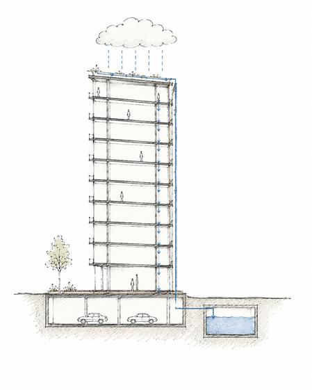
Rainwater Harvesting System:
Rainwater is collected from the roof and guided through the building into an underground cistern. This system supports water reuse and connects the tower with the landscape through a simple sustainable strategy.
Source: Authors’ own elaboration
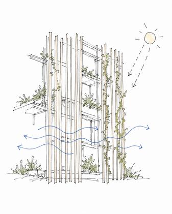
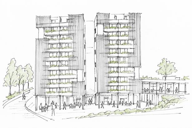
Bioclimatic Double Skin:
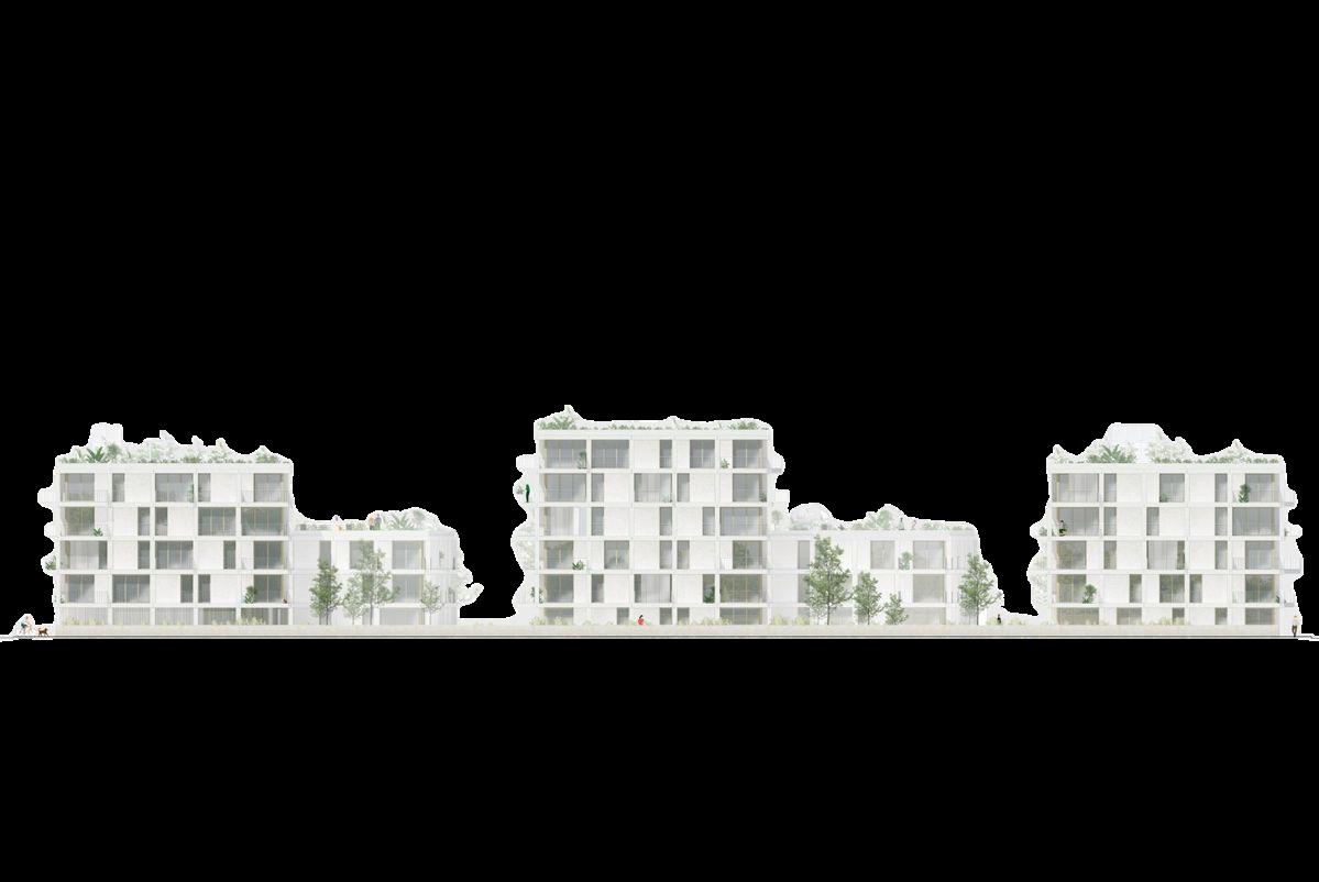
A permeable WPC louver system filters direct sunlight while allowing natural ventilation. Vertical vegetation softens the facade, improves thermal comfort, and creates a more livable environment.
Source: Authors’ own elaboration
Active Ground Floor + Urban Connection:
The towers open at ground level to create a more public and connected urban experience. Commercial spaces, pedestrian flows, vegetation, and community activity transform the base into an active social platform.
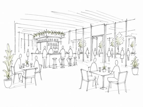
Active Interior Ground Floor:
The ground floor becomes a social interior space where people gather, eat, work, and interact. Open views, vegetation, and flexible seating activate the building throughout the day.
SITE & URBAN CONTEXT
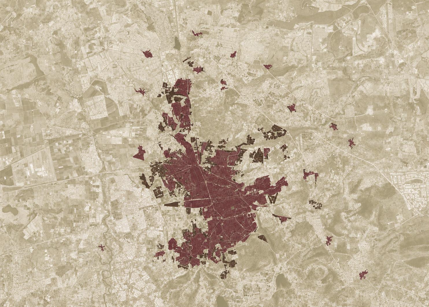
Scale: 1:350,000
Source: Authors’ own elaboration
A 1:350,000-scale block map showing the urban layout of Querétaro and the location of DistritoQRO within the city’s structure, allowing for the identification of the organization and dimensions of the blocks surrounding the site.
Analysis of the block map reveals differences in urban configuration between established areas of Querétaro and new development zones such as DistritoQRO. A key finding is the presence of a larger-scale urban layout and greater fragmentation in the area surrounding the site, characterized by wide blocks and heavy vehicular traffic. This condition highlights opportunities to improve pedestrian connectivity, activate public space, and foster a more balanced integration of mobility, human scale, and urban growth.
Scale: 1:350,000
Source: Authors’ own elaboration
Source: Authors’ own elaboration
A transportation map at a scale of 1:350,000 that analyzes the main roads, connections, and traffic flows around the site in DistritoQRO, providing insight into its accessibility and relationship with the city.
An analysis of the transportation map reveals that the site is located at a strategic connectivity hub in DistritoQRO, with nearby access to major roads and urban corridors that connect different parts of the city. The main finding is a strong reliance on cars and an infrastructure focused on vehicular mobility, resulting in fast but poorly integrated routes for pedestrians. Furthermore, the site’s proximity to high-traffic roads positions it as a node with excellent accessibility and connection potential, allowing us to understand how current mobility dynamics directly influence urban development and the project’s opportunities for intervention.
MAIN ROADS IN QUERETARO
Scale: 1:350,000
Source: Authors’ own elaboration
Source: Authors’ own elaboration
A 1:350,000-scale urban growth map that analyzes the expansion of the city of Querétaro and the consolidation of new development zones such as DistritoQRO, providing insight into the transformation and progressive occupation of the territory.
An analysis of the urban growth map reveals how Querétaro has experienced rapid expansion toward its outskirts, driven by new residential, industrial, and corporate developments. A key finding is that DistritoQRO is identified as one of the areas with the highest growth potential, due to its connectivity, infrastructure, and proximity to the city’s strategic corridors. This expansion has generated new urban dynamics, but also contrasts between established areas and sectors that remain fragmented, highlighting opportunities to create projects that integrate community, mobility, and public space into the area’s future development.
Scale: 1:350,000
Source: Authors’ own elaboration
A 1:350,000-scale industrial map showing the location of the property in DistritoQRO in relation to the area’s major industrial corridors and growth trends.
The industrial map analyzes the relationship between the site and the productive and industrial context of DistritoQRO, identifying the economic, logistical, and development dynamics that currently define the area where Yconia is located. This analysis reveals how industrial growth has shaped the territory, generating opportunities, flows, and new urban needs. The map allows us to visualize the connection between the project and its immediate surroundings, highlighting the site’s strategic importance within a corridor of innovation, employment, and urban expansion.
Scale: 1:350,000
Source: Authors’ own elaboration
Source: Authors’ own elaboration
A density map at a scale of 1:350,000 that analyzes urban concentration and land use in DistritoQRO, allowing for the identification of areas with the highest intensity of development and growth around the property.
Analysis of the density map reveals how DistritoQRO exhibits varying intensities of land use and urban development, creating contrasts between established areas and zones still undergoing expansion. A key finding is the identification of a higher concentration of activity along strategic corridors and major thoroughfares, while other sectors remain underdeveloped or less integrated. The property’s location within this context highlights its potential to serve as a hub connecting new urban dynamics, connectivity, and growth in the area.
Scale: 1:350,000
Source: Authors’ own elaboration
Source: Authors’ own elaboration
A 1:350,000-scale service map that identifies the relationship between the property in DistritoQRO and nearby commercial, corporate, educational, and recreational facilities, providing insight into the area’s coverage and urban dynamics.
Analysis of the services map reveals a concentration of activities and facilities along DistritoQRO’s main urban corridors, creating areas of greater activity and connectivity within the sector. A key finding is that the area’s growth has spurred new corporate and commercial services, although urban voids and spaces with limited pedestrian integration still exist. The site’s strategic location allows us to understand its potential to integrate into these dynamics and strengthen the relationship between community, mobility, and urban space.
Source: Authors’ own elaboration
“Urban growth is constantly transforming the relationship between people and their surroundings, redefining the way we live, connect, and build community. Beyond the physical expansion of the city, it brings about new social, economic, and spatial dynamics that shape the future of the urban environment.”
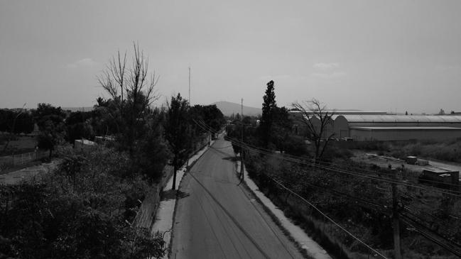
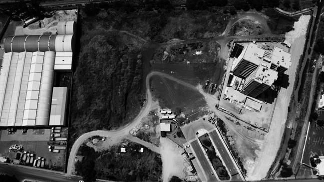
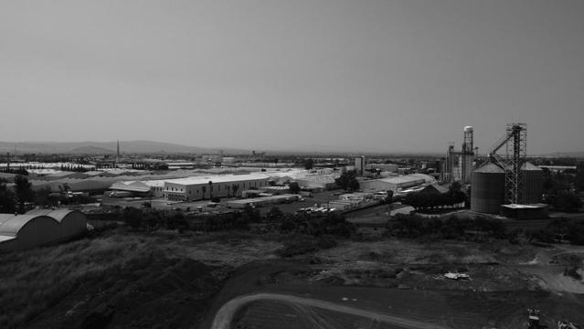
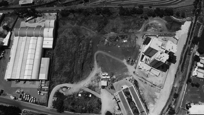
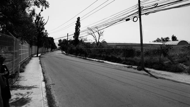
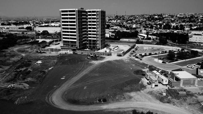
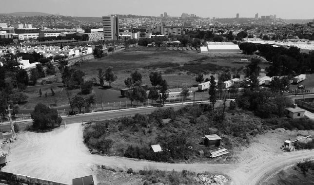
The site is located within a rapidly transforming sector of DistritoQRO, an area currently defined by accelerated urban growth, new private investments, expanding infrastructure, and large parcels of land that remain vacant or only partially integrated into the surrounding city fabric. This condition places the project within a context of transition, where emerging developments coexist with fragmented urban conditions and unresolved public spaces. The existing environment reflects both the ambitions and the challenges of contemporary urban expansion in Querétaro.
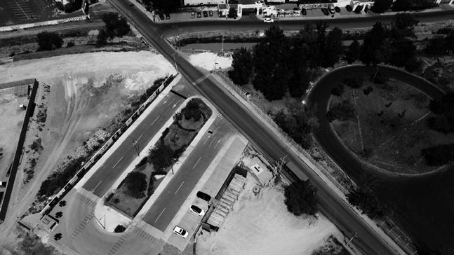
The current character of the site is strongly influenced by large-scale infrastructure and mobility systems. Major vehicular roads structure the area, connecting the property to important strategic points within the city while simultaneously reinforcing a predominantly car-oriented experience. Corporate buildings, commercial developments, and new residential projects have begun to redefine the district’s identity, creating an environment associated with economic growth and modernization. However, despite this rapid development, many spaces surrounding the site still lack cohesion, pedestrian connectivity, and a clear relationship with the human scale.
Through the analysis of streets, boundaries, circulation patterns, and existing urban conditions, several important relationships between the property and its immediate context become evident. The site acts as a point of convergence between consolidated developments and areas that are still under construction or awaiting future intervention. This contrast generates a fragmented urban landscape where moments of activity and density coexist with residual spaces, underutilized land, and disconnected edges. These conditions reveal not only the physical limitations of the area, but also significant opportunities for urban regeneration and social integration.
Existing visual records and site observations further reinforce the idea of a district that is still in the process of building its identity. Wide streets, extensive paved surfaces, and isolated developments emphasize the scale of ongoing urbanization, while the absence of active public spaces and environmental continuity exposes the need for more integrated and people-oriented interventions. At the same time, the openness of the site and its strategic location within DistritoQRO provide strong potential for the introduction of new urban dynamics capable of reconnecting fragmented spaces and fostering community interaction.
Beyond its current physical conditions, the site presents an opportunity to become a catalyst within the evolving urban fabric of DistritoQRO. Rather than functioning as an isolated development, the project seeks to establish meaningful connections between mobility, landscape, public activity, and the surrounding built environment. The proposal responds to the existing context while simultaneously envisioning a more integrated, accessible, and environmentally responsive future for the area. Through this approach, the site has the potential to transform from a transitional fragment of the city into an active urban node that contributes to the collective identity and long-term development of DistritoQRO.
SITE ANALYSIS
Summer solstice
21 JUNE
12:00
Winter solstice
21 DEC
12:00
Bus stop Bus route
Pedestrian path
Canal
Schools
Industry zone
Dominant wind
Frequency: 30%
Avg. wind speed: 3.4 m/s
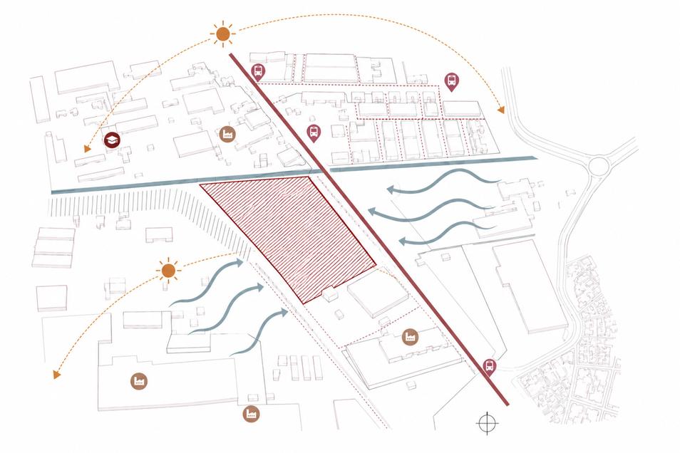
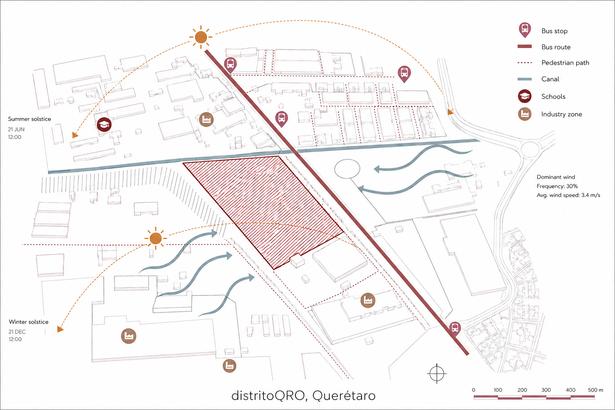
The study identifies and maps a series of urban, environmental, and infrastructural dynamics that directly influence the site and its future development potential. Through the analysis of prevailing wind directions, solar orientation during both summer and winter solstices, pedestrian movement patterns, public transportation routes, and the proximity of educational and industrial zones, the diagram provides a comprehensive understanding of the conditions shaping the project’s context. These layers of information reveal how the site operates not as an isolated parcel, but as part of a larger and constantly evolving urban system.
The analysis highlights the strategic position of the property within the expanding urban fabric of DistritoQRO, where new developments, infrastructure investments, and mobility networks continue to redefine the area’s dynamics. Its location allows for strong accessibility from major vehicular corridors while also maintaining connections to surrounding neighborhoods, commercial developments, and institutional areas. The visibility of the site within these circulation systems reinforces its potential to function as an important urban node capable of attracting activity and generating new relationships between different sectors of the city.
Environmental conditions played a fundamental role in understanding the opportunities and limitations of the site. The study of prevailing winds reveals natural ventilation patterns that can be integrated into future architectural strategies to improve thermal comfort and reduce dependence on mechanical systems. Likewise, the analysis of solar exposure during seasonal solstices provides insight into the behavior of light and heat throughout the year, informing decisions related to orientation, shading systems, vegetation, and materiality. These considerations establish the basis for a more environmentally responsive and sustainable design approach that prioritizes both comfort and energy efficiency.
In addition to climatic factors, the diagram examines the relationship between mobility infrastructure and public activity. Existing pedestrian paths and transportation routes expose areas of connectivity as well as moments where circulation becomes fragmented or dominated by vehicular movement. Understanding these conditions allows the project to identify opportunities for strengthening walkability, improving accessibility, and encouraging greater interaction between public space and the surrounding urban environment. The proximity to educational institutions, industrial areas, and emerging commercial developments further reinforces the site’s capacity to support diverse social and programmatic activities throughout the day.
Through a layered graphic representation, the study synthesizes the interaction between environmental systems, mobility networks, and urban growth patterns into a cohesive visual analysis. Rather than functioning solely as a technical diagram, the representation becomes a tool for understanding the complexity of the site and the multiple forces acting upon it. This approach establishes a strong foundation for the project’s future spatial, architectural, and landscape strategies, ensuring that design decisions respond directly to the climatic, social, and urban realities of the context while contributing positively to the continued transformation of DistritoQRO.
Type:
Site defined by absence: no users, no activity, and no identity highlighting its potential for transformation into an active, community-driven environment.
ISSUES
1. Lack of urban spaces that promote environmental learning and awareness
Many areas of the city do not offer places where people can learn about sustainability in their daily lives. This limits the relationship between community, nature, and food production.
2. Dependence on cars and low priority given to active mobility
Much of the city’s transportation depends on cars, which reduces accessibility and limits freedom of movement for pedestrians and cyclists.
3. Services and daily activities scattered throughout the city
Housing, commerce, productive spaces, and recreational areas are often separated, forcing people to travel greater distances to carry out daily activities.
4. Public spaces that are inactive or have low social appropriation
Although there are open areas, many are not designed to generate coexistence, learning, or permanence in the urban space.