4 minute read
Storrington Walk


New Year, new location, new walk, same old writer… Robert Veitch travelled to Storrington and uncovered a gem that gets 2022 off to a fabulous start!
From North Street car park exit, turn left and walk towards Storrington High Street. At the T-junction, turn right and then turn left immediately after, into Church Street.
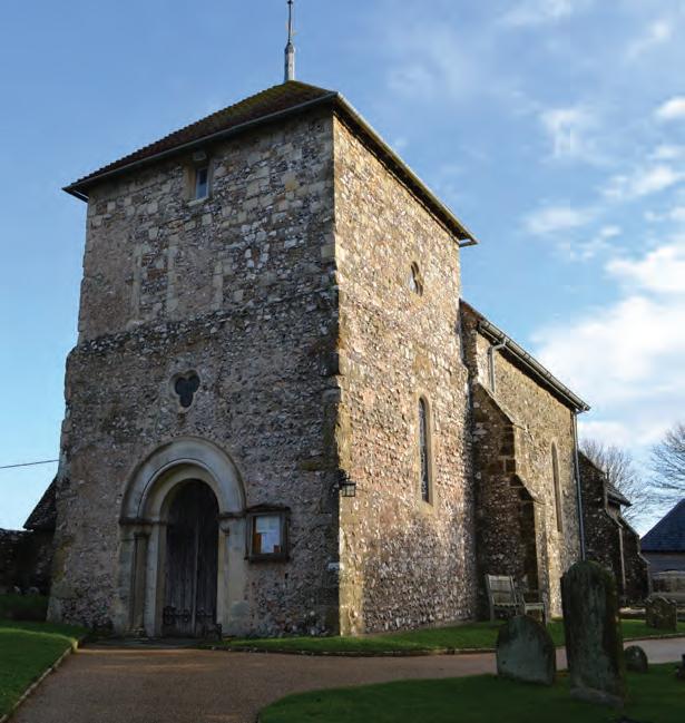
Look up to the heights of the horizon from where the distant line of leafless trees begins to beckon. Continue past the Parish Church of St Mary Storrington, which has its foundations in the 11th century. Beyond the traffic island Church Street evolves into Greyfriars Lane and the initial, gentle ascent of the Downs commences.
As the road starts to narrow, keep right at the first fork, then right again at the second fork, slightly further on. The gradient increases just a twinkle as the road degrades to a track, eventually arriving at a T-junction by a 3-way fingerpost adorned with a hydrant sign.
Turn left onto the footpath and the scarp slope proper. After 200m, bear right at the solitary fingerpost and then turn left immediately, passing the leaning tree on the way up the staircase of tree roots.
As the gradient ramps up, working the legs, lungs and heart rate, those memories of Christmas parties, dinners,
Parish Church of St Mary, Storrington presents, and celebrations will be left behind and seem ever so distant as you ascend the first Sussex Living climb of the year.
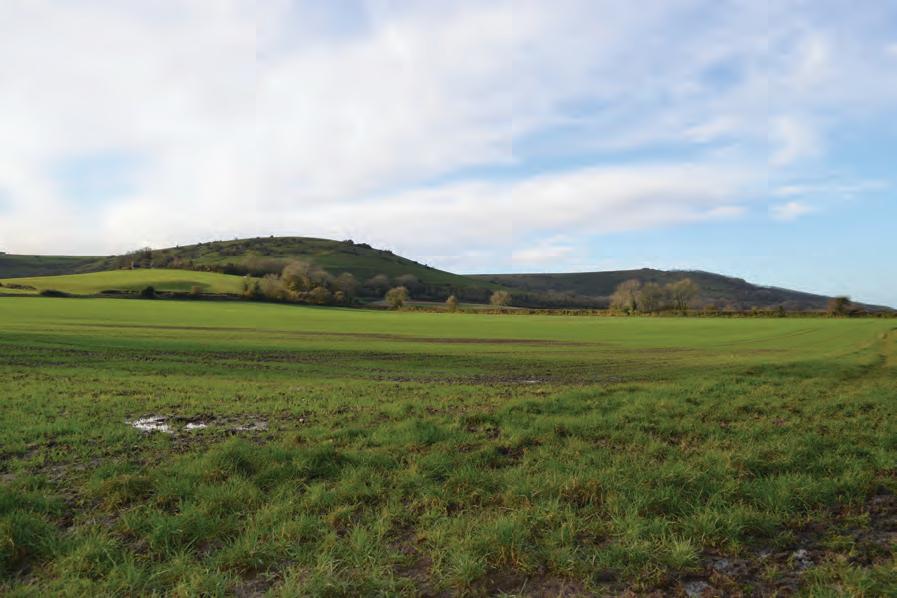
Beyond the pair of fallen tree trunks, the gradient eases and the landscape opens up. Arriving at the 4-way fingerpost you will have climbed 122m (400ft) in half a mile at an average of 15% or 1:7 in old money – the toughest part of the walk is done, so pause and enjoy the view west beyond Amberley and Duncton towards Petersfield.
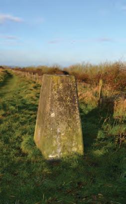
Turn left, and the slope becomes progressively easier on the way to the trig point that marks the summit of Kithurst Hill, which at 213m (699 feet) is the high point of the day. If the weather is generous, the panorama to the south encompasses a glorious array from Worthing to Littlehampton and Selsey Bill.

Continue for another 100m to the 3-way fingerpost, before turning right and downhill to the junction with the South Downs Way.
Turn left and continue through the car park, passing the Chantry Post along the way to a metal barrier and a wooden 5-bar gate. Follow the lines in the grass over the brow, but not

the summit, of Sullington Hill, then down the other side towards the barn.
Take the gate beside the cattle grid, then the gate beyond the barn. Keep to the left in the field, along the barbed wire boundary, respecting any livestock that may be present. It’s almost ½ a mile up to the summit of Barnsfarm Hill by the gate at 205m (673 feet). Once through the gate, walk a further 250m to the 3-way fingerpost, where the summit of Chanctonbury Ring across the valley to the east seems within touching distance.
Turn left and north to begin the return journey. Storrington is nearby to the northwest, while the North Downs might also be visible, over 25 miles away. Walk between the lines of stock-proof fencing, then along the chalk pathway as the altitude slips away bit by bit. Bear left at the 2-way fingerpost, then soon after, follow the tarmac between the trees of Rowdell Holt East and West to the bottom of the hill, by the farm.
Just after the telegraph pole on the right and laurel on the left, turn left at the 3-way fingerpost, and follow the bridleway, westwards. Though a little squelchy in places, it’s mostly level walking alongside open fields with the Downs providing a picturesque backdrop.
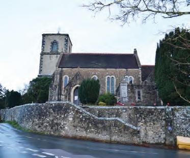
After ½ a mile there is a 5-bar gate, beyond which are buildings and a beech hedge. Once around the 90° right hand bend there’s a 3-way fingerpost. Turn left and continue between the parallel lines of trees to the gate. Cross the training gallops with care and continue along the path all the way to the farm buildings and church at Sullington.
St. Mary’s Church has stood for almost a millennia. The yew in the churchyard dates from the 7th century, under which there is a seat to pause upon and contemplate the scenery. Bear left at the church and continue in the same westerly direction for almost ½ a mile, before the path snaps left and dips downhill past two gates to the junction with Chantry Lane and the sound of falling water.
Turn right and follow the tarmac for ¾ mile to the junction with the A283. At the main road, cross with

St. Mary’s Church, Sullington