SQUIRREL HILL HISTORY
URBAN RENEWAL
in Squirrel Hill By Helen Wilson, Vice-President Squirrel Hill Historical Society
WHEN COMBINED WITH THE WORD URBAN, renewal takes on a specific and loaded meaning. After Pittsburgh’s boom years of the first half of the 1900s, the city’s population went into a steep decline, and “urban blight” was seen as a worrisome problem. The city’s Planning Department needed a way to assess the needs of individual neighborhoods, so it used census tract data to determine what those needs were. Census tracts are areas of relatively homogeneous populations varying in size from 1,200 to 8,000 people. Until the early 1970s, wards were the major political entities in the city, so exact neighborhood boundaries weren’t deemed important. When census tracts began to be used to assess the condition and needs of each neighborhood, boundaries needed to be drawn. A raging battle ensued about who lived where and what that place was called. Drafts of neighborhood maps were created by several competing groups, most importantly, the City of Pittsburgh Planning Department and the Pittsburgh Neighborhood Atlas (PNA), a consortium of neighborhood leaders. The differences between the maps sparked arguments and protests. A major point of contention was that the Planning Department’s map respected ward boundaries, while the PNA’s map focused more on community perceptions of neighborhood areas. The PNA’s map drew neighborhood lines based on the consortium’s survey that asked people where they thought they lived.
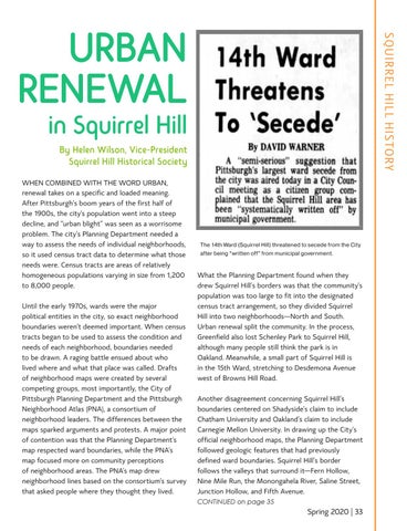
The 14th Ward (Squirrel Hill) threatened to secede from the City after being “written off” from municipal government.
What the Planning Department found when they drew Squirrel Hill’s borders was that the community’s population was too large to fit into the designated census tract arrangement, so they divided Squirrel Hill into two neighborhoods—North and South. Urban renewal split the community. In the process, Greenfield also lost Schenley Park to Squirrel Hill, although many people still think the park is in Oakland. Meanwhile, a small part of Squirrel Hill is in the 15th Ward, stretching to Desdemona Avenue west of Browns Hill Road. Another disagreement concerning Squirrel Hill’s boundaries centered on Shadyside’s claim to include Chatham University and Oakland’s claim to include Carnegie Mellon University. In drawing up the City’s official neighborhood maps, the Planning Department followed geologic features that had previously defined ward boundaries. Squirrel Hill’s border follows the valleys that surround it—Fern Hollow, Nine Mile Run, the Monongahela River, Saline Street, Junction Hollow, and Fifth Avenue. CONTINUED on page 35
Spring 2020 | 33