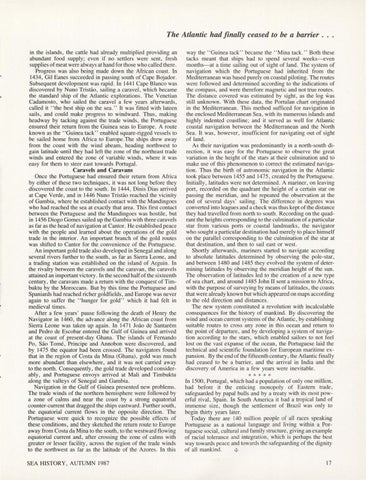
The Atlantic had finally ceased to be a barrier . . . in the islands, the cattle had already multiplied providing an abundant food supply; even if no settlers were sent, fresh supplies of meat were always at hand for those who called there. Progress was also being made down the African coast. In 1434, Gil Eanes succeeded in passing south of Cape Bojador. Subsequent development was rapid. In 1441 Cape Blanco was discovered by Nuno Tristao, sai ling a caravel, which became the standard ship of the Atlantic explorations. The Venetian Cadamosto, who sailed the caravel a few years afterwards, called -it '' the best ship on the sea.'' It was fitted with lateen sai ls, and could make progress to windward. Thus, making headway by tacking against the trade winds, the Portuguese ensured their return from the Guinea seas to Europe . A route known as the "Guinea tack" enabled square-rigged vessels to be sai led home from Africa to Europe. The ships drew away from the coast with the wind abeam, heading northwest to gain latitude until they had left the zone of the northeast trade winds and entered the zone of variable winds, where it was easy for them to steer east towards Portugal. Caravels and Caravans Once the Portuguese had ensured their return from Africa by either of these two techniques, it was not long before they discovered the coast to the south. In 1444, Dinis Dias arrived at Cape Verde, and in 1446 Nuno Tristiio reached the vicinity of Gambia, where he established contact with the Mandingoes who had reached the sea at exactly that area. This first contact between the Portuguese and the Mandingoes was hostile, but in 1456 Diogo Gomes sailed up the Gambia with three caravels as far as the head of navigation at Cantor. He established peace with the people and learned about the operations of the gold trade in the interior. An important branch of the gold routes was shifted to Cantor for the convenience of the Portuguese. An important gold trade also developed in Senegal and along several rivers further to the south , as far as Sierra Leone, and a trading station was established on the island of Arguin . In the rivalry between the caravels and the caravan , the caravels attained an important victory. In the second half of the sixteenth century, the caravans made a return with the conquest of Timbuktu by the Moroccans. But by this time the Portuguese and Spaniards had reached richer goldfields, and Europe was never again to suffer the "hunger for gold" which it had felt in medieval times . After a few years ' pause following the death of Henry the Navigator in 1460, the advance along the African coast from Sierra Leone was taken up again. In 1471 Joiio de Santarem and Pedro de Escobar entered the Gulf of Guinea and arrived at the coast of present-day Ghana. The islands of Fernando Po , Sao Tome, Principe and Annobon were discovered, and by 1475 the equator had been crossed. The navigators found that in the region of Costa da Mina (Ghana), gold was much more abundant than elsewhere, and it was not carried away to the north . Consequently, the gold trade developed considerably, and Portuguese envoys arrived at Mali and Timbuktu along the valleys of Senegal and Gambia. Navigation in the Gulf of Guinea presented new problems. The trade winds of the northern hemisphere were followed by a zone of calms and near the coast by a strong equatorial counter-current that dragged the ships eastward. Further.south , the equatorial current flows in the opposite direction. The Portuguese_were quick to recognize the possible effects of these conditions, and they sketched the return route to Europe away from Costa da Mina to the south, to the westward flowing equatorial current and, after crossing the zone of calms with greater or lesser facility, across the region of the trade winds to the northwest as far as the latitude of the Azores. In this SEA HISTORY , AUTUMN 1987
way the " Guinea tack " became the "Mina tack. " Both these tacks meant that ships had to spend several weeks-even months-at a time sailing out of sight of land. The system of navigation which the Portuguese had inherited from the Mediterranean was based purely on coastal piloting. The routes were followed and determined according to the indications of the compass , and were therefore magnetic and not true routes . The distance covered was estimated by sjght , as the log was still unknown . With these data, the Portulan chart originated in the Mediterranean . This method sufficed for navigation in the enclosed Mediterranean Sea, with its numerous islands and highly indented coastline; and it served as well for Atlantic coastal navigation between the Mediterranean and the North Sea. It was, however, insufficient for navigating out of sight of land . As their navigation was predominantly in a north-south direction , it was easy for the Po1tuguese to observe the great variation in the height of the stars at their culmination and to make use of this phenomenon to correct the estimated navigation . Thus the birth of astronomic navigation in the Atlantic took place between 1455 and 1475 , created by the Portuguese. Initially , latitudes were not determined . A mariner, on leaving port, recorded on the quadrant the height of a certain star on passing the meridian , and he repeated the observation at the end of several days ' sailing. The difference in degrees was converted into leagues and a check was thus kept of the distance they had travelled from north to south. Recording on the quadrant the heights corresponding to the culmination of a particular star from various ports or coastal landmarks, the navigator who sought a particular destination had merely to place himself on the parallel corresponding to the culmination of the star at that destination , and then to sail east or west. Shortly afterwards , mariners started to navigate according to absolute latitudes determined by observing the pole-star, and between 1480 and 1485 they evolved the system of determining latitudes by observing the meridian height of the sun. The observation of latitudes led to the creation of a new type of sea chart, and around 1485 John II sent a mission to Africa, with the purpose of surveying by means of latitudes, the coasts that were already known but which appeared on maps according to the old direction and distances. The new system constituted a revolution with incalculable consequences for the history of mankind. By discovering the wind and ocean current systems of the Atlantic, by establishing suitable routes to cross any zone in this ocean and return to the point of departure, and by developing a system of navigation according to the stars , which enabled sailors to not feel lost on the vast expanse of the ocean, the Portuguese laid the technical and scientific foundation for European maritime expansion. By the end of the fifteenth century, the Atlantic finally had ceased to be a barrier, and the arrival in India and the discovery of America in a few years were inevitable.
*****
In 1500, Portugal, which had a population of only one million , had before it the enticing monopoly of Eastern trade, safeguarded by papal bulls and by a treaty with its most powerfu l rival, Spain. In South America it had a tropical land of immense size , though the settlement of Brazil was only to begin thirty years later. Today there are 140 million people of all races speakin.g Portuguese as a national language and living within a Portuguese social, cultural and family structure, giving an example of racial tolerance and integration, which is perhaps the best way towards peace and towards the safeguarding of the dignity of all mankind . .i, 17