Big Tan Oak
Doublehead
LOCATION
LOCATION
Visit world’s largest Tan Oak near the national scenic Trinity River
This route begins about 45 miles west of Weaverville off Highway 299.
DIFFICULTY
This route is on paved and gravel roads. A Forest Service map, map skills, and a good sense of direction are helpful.
TIME AND DISTANCE
Allow 1.25 hours round trip. This route is approximately 20 miles.
High desert terrain, wild mustangs, visit a fire lookout
This route begins northwest of Alturas, near Clear Lake Reservoir in the Modoc National Forest.
DIFFICULTY
This route is along gravel and paved Forest Service and county roads. A Forest Service map, map skills, and a good sense of direction are helpful.
TIME AND DISTANCE
Allow 4 hours to complete this drive. It is approximately 75 miles.
THE DRIVE
This route is a forest lover’s paradise. The world’s largest Tan Oak tree is the focal point of this short and simple route in the Six Rivers National Forest. When driving this route, you’ll be following along Hennessy Ridge Road. This road parallels a ridge-top pack trail from the 1880s. It was used by miners working claims along the South Fork of the Trinity River, and connected the small community of Salyer to Hyampom. Hennessy Ridge is also the watershed divide between the South Fork of the Trinity, and Trinity Rivers. You reach the Tan Oak tree 10 miles into the route. Of the 100 to 300 species of Lithocarpus, the Tan Oak is the lone North American species and is native from Southwest Oregon to California. It can tolerate winter frost as well as summer heat and dryness. The bark was highly valued for tanning leather, but the wood was little used, so in the late 1800s and early 1900s most of the trees were cut down. Opposite the tree, you will see a view of the main stem of the Trinity River Canyon. Near the end on the left there are views into the South Fork of the Trinity River. You will see old growth Douglas Fir forests that are mixed with oak, madrone, and Big Leaf Maple trees. For a complete description, driving directions, and map for this route visit
www.backcountryroads.com
Petroglyphs, an old gravestone, and the Applegate Wagon Trail are just a few relics from the past that exist along this route through a section of the Modoc National Forest. You start your journey north of Canby along Highway 139, paralleling the Old Southern Pacific Railroad Line for several miles. North on Forest Road 136 takes you by Clear Lake Reservoir and Clear Lake National Wildlife Refuge. You’ll continue driving through the Doublehead Forest District and over the Devil’s Garden Plateau. Devil’s Garden is an expansive prehistoric lava flow, with sparse vegetation, rough broken lava rock, juniper trees, sage brush flats, in a semi-arid region covering about half a million acres. It remains dry most of the year but in spring time it looks like the “land of lakes” as all of the water holes fill. Halfway along the route you can stop and see the views from the top of the Blue Mountain Fire Lookout. Jane’s Reservoir is a dry reservoir and is a great opportunity for diverse bird watching. You’ll also have the opportunity to visit Big Sage Reservoir. Big Sage Reservoir was constructed in the early 1900s to provide irrigation water to Warm Springs Valley between Alturas and Canby. This route ends in the city of Alturas on State Highway 299. For a complete description, driving directions, and map for this route visit
www.backcountryroads.com
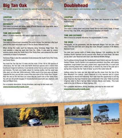
Big Tan Oak Drive
4
THE DRIVE
Boles Creek
Blue Mountain Lookout
5