


2024 DIGITAL FIELD GUIDE southcarolina7.com
SOUTH CAROLINA


SOUTH CAROLINA SC7 is a partnership between two South Carolina based non-profit organizations, Global Eco Adventures and the South Carolina National Heritage Corridor. The mission of SC7 is to get people in the outdoors so they gain an appreciation for the outdoors, and therefore begin to actively do their part to protect the outdoors.


April/May 2024 is our 5th annual SC7 Expedition. Our goal with each expedition is to promote the amazing natural wonders and outdoor recreation opportunities in our beautiful state and to raise awareness of the work happening almost daily to make our state more resilient. Our team is dedicated to being the change we wish to see in our world by living the message we preach.
During April and May we will be hiking from the mountains to the sea. But that’s just the tip of the iceberg. During the rest of the year we work with remarkable partners to pick up litter, clean our waterways, plant 3.4 million trees, build artificial reefs off the coast, provide environmental education programs, and more.
We invite you to join us on the trail on our public participation days. Virtually follow us daily on Facebook and Instagram. Together we will BE THE CHANGE!!
Tom Mullikin


Utilizing the 350-mile Palmetto Trail as the guiding pathway, the SC7 Expedition is a 30-day adventure across the state of South Carolina. The purpose of the SC7 Expedition is to highlight the amazing natural resources in our state AND to build awareness of the tremendous work that is being done to protect these resources.
SC has experienced a severe weather event each year since 2015, costing our state billions of dollars. The SC7 Team is dedicated to not simply talking about strategies to build resiliency, we are actually doing something. From picking up 3.5 tons of litter annually and planting over 3 million trees to cleaning waterways and building artificial reefs along our coast we are committed to BE THE CHANGE!

invite you to join us!


YOU CAN FOLLOW ALONG VIRTUALLY THROUGH OUR DAILY INSTAGRAM and FACEBOOK VIDEOS
Public Participation Days
PublicParticipationDays–thepubliciswelcomedtoparticipateonmanyofthedaysalongsidetheexpeditionteam. However, wehaveidentifiedPublicParticipationDaysforyourconvenience. Pleasereadtheparticipationguidelinesbelow.
YOU CAN JOIN US ON THE TRAIL ON OUR PUBLIC PARTICIPATION DAYS BY FOLLOWING THESE GUIDELINES:
Your participation is at your own risk. Please print, complete, sign, and present the Consent Form found on the SC7 website.
Your participation gives us permission to use your photograph in all SC7 marketing platforms.
You are responsible for your own hiking gear, water, and food.
You are responsible for your own transportation from the end of each hike back to your vehicle. If this is not possible, we will make an announcement each day when we reach the halfway point. At this time, you can turn around and hike back to your vehicle.
The itinerary will indicate when there is a fee to participate. Those fees are the responsibility of each individual.
The itinerary will indicate days that are not open for participation (for example, rafting the Chattooga River). On these days, suggestions will be offered for alternative activities.
Each day within this guide contains clickable links to maps and more detailed location information.

Dr. Tom Mullikin
“SC7 is an expedition across one of the most beautiful places on earth - the Palmetto State. An expedition from the Mountains to the Sea designed to introduce mountains, rivers, waterfalls, trails and a beautiful coastline and encourage meaningful conversation about conservation of these beautiful areas.”

Expedition Member and Marketing Rockstar
“The SC7 Expedition provides a unique opportunity to uncover everything that South Carolina has to offer. Our goal is to showcase our beautiful state and encourage others to explore it and protect it. From the Upstate to the Lowcountry, the Expedition provides something for everyone to enjoy.”


“SC7 is a first-of-its-kind expedition to involve thousands of people in one spectacular event. I love being a part of this effort that highlights the work of our residents, communities, and corporations to not only provide outdoor recreation, but also to protect our resources for future generations.”

DR. SUSAN JOHNSON
“It’s such an honor to be a part of the SC7 Expedition team, representing MUSC as the title sponsor and walking the walk to promote the health benefits of nature. Being in and caring for the natural environment is health promoting for people and the planet and being a part of SC7 is a great way for me to help to raise awareness toward the common goal of creating a healthy, thriving state for generations to come.
Exercise Enthusiast and Team Science Nerd
“Our passion is to highlight all of the great natural wonders and communities our unique state has to offer. From kayaking in mountain rivers, to exploring the ACE Basin, South Carolina has something to offer everyone, and we are here to encourage you to experience each one firsthand.”

Expedition Member and Team Packhorse
“SC7 was designed to showcase the many natural wonders that we have right here in South Carolina and the daily activities allows anyone to be a part of the expedition. Come out and join us!”
 MICHELLE MCCOLLUM
ABBEY CROCKER
RACHEL SIMPKINS
THOMAS MULLIKIN, JR.
MICHELLE MCCOLLUM
ABBEY CROCKER
RACHEL SIMPKINS
THOMAS MULLIKIN, JR.


“Being a part of the SC7 Expedition Team has been a great experience. And, it gets better every year. It is a humbling experience to meet so many great folks across our state who are doing so many great things for our environment.”
“SC7 is a very organized way for people to experience the 7 wonders of South Carolina. It’s very comforting for me to see that South Carolina can compete with any other destination around the world with its beautiful mountains and seas.”
“To highlight and protect the abundant outdoor activities that are right here in our own back yard in the great state of South Carolina. Together we can create healthy minds and bodies while preserving a healthy environment to live in.”

“Being on the SC7 Team has been life-changing for me. I’ve always been health conscious, but this project has opened my eyes to how the health and wellness of people and places go hand-in-hand.”

My hope is that our message will reach every man, woman, and child not only in SC - but beyond our borders. And the message is clear - you don’t have to be a tree huger to want to preserve the natural resources, beauty, and ecosystem. Get out, and educate yourself on how you can do your part, and show up. It’s that simple.”


 CONGAREE NATIONAL PARK


Public Participation Days – the public is welcomed to participate in any day of the expedition unless otherwise indicated on the daily information (some days will be project days for the team). On days closed to the public, this guide will make suggestions for alternative activities. The SC7 Team has also identified several key events designed with public participation in mind. These are listed here, with more detailed information listed on the specific day’s itinerary.
22, 2024)
Join Lt. Governor Pamela Evette, the South Carolina 7, and PalmettoPride in a statewide litter cleanup on Earth Day 2024. The county that picks up the most litter by weight will earn the South Carolina Environmental Stewardship Award.
Contact Abbey Crocker / abbey@scnhc.com for more information on how to get involved.
27, 2024)
The public is invited to join the team explore the Pickens Doodle Trail, a 7.5 mile rails-to-trails partnership between the City of Pickens and City of Easley. Participants are asked to start at the Pickens trailhead and can walk, run, or bike their desired length.
4, 2024)
Join the team to hike the Enoree Passage of The Palmetto Trail which winds 4 miles through pine ridges and hardwood bottomlands, and crosses Gilders Creek and Indian Creek before joining Buncombe Horse Trail.
11, 2024)
Join the team as we hike a 4 mile out and back hike along the coast from Myrtle Beach State Park to Sunset Beach and back.
18, 2024)
Hike the Cooper River Bridge with Will Haynie, Mayor of Mt. Pleasant. Participants choosing to walk from the Charleston side can meet the team in the middle for a group photo opp.


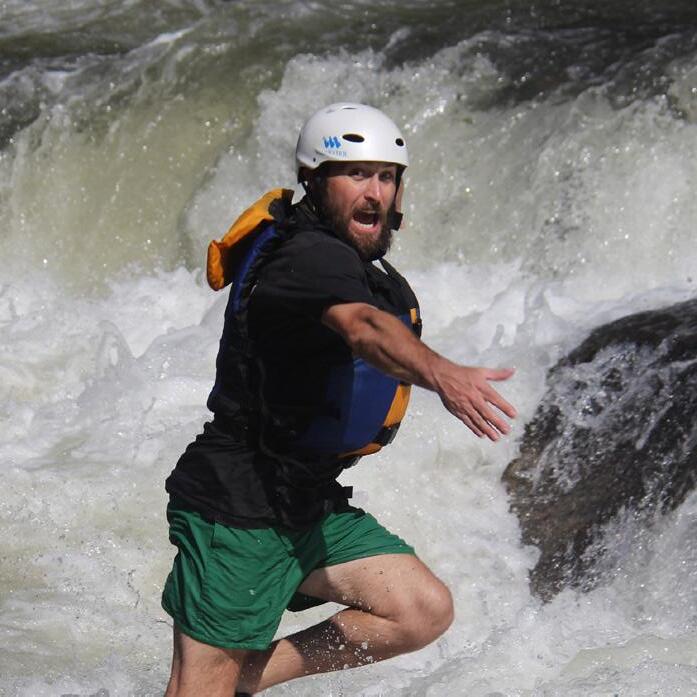
Day 3 - Wednesday, April 24th


Overview:
Famed as the location of the movie Deliverance, the Chattooga River is the crown jewel of southeastern rafting in a truly natural undeveloped setting offering the best and most challenging white water in the Blue Ridge and Smoky Mountain region. The Chattooga was named a National Wild and Scenic River on May 10, 1974 - just 6 years after the Wild and Scenic Rivers Act was established on October 2, 1968.
Mission:
Raft the Chattooga River / Afternoon trail hike with US Forestry Service.
YOUR ATTENTION, please... CLICK THE AD TO THE RIGHT TO TO BOOK THIS EXCURSION.
Begins: 1:30 PM
Chattooga River River


Day 4 - Thursday, April 25th

Oconee County - “Garden of the GODS”

OCONEE PASSAGE HIKE
Activities: Hiking + Biking
Overview:
Oconee Passage begins in Oconee State Park and ends at Oconee Station State Historical Site, a backcountry military garrison and trading post from the 1790s. From the park, the passage follows a scenic roadbed that pinches into a path along the mountain ridgeline. From the ridgeline into Station Cove, the passage drops about 1,000 feet for a challenging, one-way descent. Turn right where Oconee Passage intersects with Station Cove Falls Trail and walk the quarter-mile spur to the popular Station Cove Falls. One of the prettiest in the county, the waterfall is a majestic 60-foot, tiered cascade.
Mission:
Hike the Oconee Passage (4 miles) of the Palmetto Trail.

OCONEE STATE PARK
624 State Park Road / Mountain Rest, SC 29664


Day 5 - Friday, April 26th

Roof of the palmetto state (Summit Sassafras Mountain)
Overview:
Sassafras Mountain, the Roof of the Palmetto State is the highpoint of South Carolina at 3533 feet above sea level. Our hike will summit Sassafras Mountain beginning at the Chimneytop Gap Trailhead and continuing to Sassafras Mountain. (2.1 miles total) From the top you are able to view 6,000’ and other mountains in the distance.
The geology of Sassafras Mountain reflects millions of years of plate tectonics. It lies within the inner Piedmont belt and is thought to be part of a continental fragment that attached or even reattached North America during the Middle Ordovician at a time of continental collision and mountain building called the Taconic Orogeny (mountain-building episode). These geologic processes caused active stream down-cutting and the resultant modern scenic gorges and waterfalls that surround Sassafras Mountain.
Length: 2.1 miles
Activities: Hiking
Difficulty: Easy
Mission:
Hike from Chimneytop Gap Trailhead to Sassafras Mountain along the Foothills Trail. (2.1 Miles)
Suggested Lodging:
TABLE ROCK STATE PARK 158 Ellison Ln / Pickens, SC 29671


Overview:


The Doodle Trail, a 7.5 mile rails-to-trails partnership between the City of Easley and the City of Pickens opened Memorial Day Weekend 2015. The multi-use trail is open from dawn to dusk for biking, walking, running and rollerblading. Unauthorized mopeds or motorized vehicles are not permitted on the trail.
The Doodle line carries a rich history of industry and economy important to both the City of Pickens and the City of Easley. In 1890, the State of South Carolina issued a charter for the construction of a railroad between Easley and Oolenoy Gap, by way of Pickens. After eight years of construction, the 8.5-mile portion of the railway between Easley and Pickens became operational in 1898. Until 2013, the Doodle line hauled a variety of commodities to and from Pickens and Easley, including food products, textiles, and automobile parts. Local residents nicknamed the railroad the “Pickens Doodle” line, because the freight engine could not be turned around and had to run backwards from Easley to Pickens, looking like a doodlebug.
The Doodle Trail represents the opportunity to carry on the memory of this historic railroad and preserve the vital connection that was forged between Easley and Pickens over 120 years ago.


Begins: 9 AM


Day 7 - Sunday, April 28th
The Jocassee Gorges were named by National Geographic as one of the “50 of the Last Great Places.” In the uppermost reaches of South Carolina, the clear waters of Lake Jocassee splash against the base of the Blue Ridge Escarpment that represent the sharp transition between the South Carolina Mountains and the Piedmont. Here forested slopes drop in elevation by 2,000 vertical feet in a matter of one to two miles. The name “Jocassee,” according to Native American legend, means “Place of the Lost One.” The region is characterized by a high diversity of flora and fauna as a result of its location at the interface between the mountains and piedmont. Both mountain and piedmont plant communities are represented in the area creating a transitional zone from lower rolling hills to higher elevation mountains. The region has drawn the attention of scientists for centuries. It is where, in the mid-1700s, William Bartram discovered the famed azalea along with other species new to science and enjoyed “a view inexpressibly magnificent and comprehensive”.

Mission:
The core team will complete an ecological boat tour of Lake Jocassee.
Suggested Lodging:
YOUR ATTENTION, please... THIS ADVENTURE IS CLOSED TO THE PUBLIC. WE INVITE YOU TO PLAN FOR A VISIT TO DEVILS FORK STATE PARK TO ENJOY SOME AWESOME OUTDOOR ADVENTURES!


Book a private naturalist-led tour of Lake Jocassee and the Jocassee Gorges.


Eclectic Sun is the onsite boat rental company in Devils Fork State Park and is located in the day-use picnic ground. Click the logo to the left for more information on rentals.


Overview:
Continuing our exploration of the Jocassee Gorges, we will hike the Middle Saluda passage of the Palmetto Trail and explore Rainbow Falls, one of the many scenic waterfalls to be discovered in the area. Jocassee Gorges is characterized by complex relief with steep ravines and narrow valleys created by the many first order streams flowing through the area.
Mission:
Hike the Middle Saluda Passage of the Palmetto Trail from the Jones Gap Parking Area to Rainbow Falls and back.
Suggessted Lodging:
303 Jones Gap Road / Marietta, SC 29661
Courtesy of Phil Gaines


Begins: 9 AM

5. Work up a sweat as you hike the Rainbow Falls Trail and then relax in the cooling mist of the falls. Event
1. Check out the breathtaking views from the Caesars Head Overlook.
2. Come to the Hawk Watch and observe as the raptors migrate to their South American feeding grounds.
3. In the summer, take a dip in the Middle Saluda River or follow the Jones Gap Trail as you go from swimming hole to swimming hole.
4. Hike the Raven Cliff Falls Trail and check out the tallest waterfall in South Carolina.


and TEAM WORKDAY AT CONASTEE NATURE PRESERVE
Greenville’s newest park features four state-of-the-art playgrounds, including a 4,100-square-foot splash pad, two expansive green spaces, covered picnic tables and a 10,000-square-foot welcome center with restrooms, a first-aid station and flexible event space. The 60-acre park also features basketball courts and a historic baseball field located on the site of the former Mayberry Park, which was built in 1925.
Three pedestrian bridges span the Reedy River, which flows through the middle of the park. The Swamp Rabbit Trail, a popular 23-mile walking/biking trail, runs along both sides of the river and the park contains five additional looped walking trails totaling 2.5 miles. For those who prefer to pedal, there are seven bike rack stations conveniently located throughout the park.


Activities: Hiking Length: 2 miles (Out & Back)
Mission:
Difficulty: Easy
Hike from Unity Falls Park to Falls Park. The Expedition team will be joining the Bee Cause Project for an afternoon workday at Conastee Nature Preserve.
Begins: 9 AM


Day 10 - Wednesday, May 1st


Overview:
The Swamp Rabbit Trail is a 22-mile multi-use (walking and bicycling) greenway that traverses along the Reedy River, an old railroad corridor and City parks to connect Travelers Rest with the City of Greenville, South Carolina.
Hike a portion of the Swamp Rabbit Trail. HIKE THE SWAMP RABBIT TRAIL
Mission:
Suggested Lodging:


Begins: 9 AM
START: Trailblazer Park
235 Trailblazer Dr. / Travelers Rest, SC
FINISH:
Swamp Rabbit Cafe
205 Cedar Lane Road / Greenville, SC
PARTICIPANTS MUST ARRANGE THEIR OWN TRANSPORTATION BACK TO THEIR VEHICLES AT THE TRAILHEAD.


Over 4 miles of trails offer runners and naturalists a break from city traffic. It provides a place for citizens to run, walk, kayak, canoe, and to enjoy other recreational outings. This urban greenspace has many unique and outstanding features including several wetlands, open spaces, geological formations, and offer habitat for deer, wild turkey, fox, beaver, raccoon, numerous birds and reptiles, wildflowers, and trees.
Mission:
Hike the Cottonwood Trail.

Formed in 1989, SPACE is the second-oldest local land trust operating in the state of South Carolina, providing our community with access to local green spaces like the Cottonwood Trail. This 4-mile nature trail runs through the Edwin P. Griffin Nature Preserve and is used by over 60,000 people a year.
Activities: Hiking Length: 4 miles (Out & Back)
Event Details:
Difficulty: easy
Begins: 10 AM


Day 13 - Saturday, May 4th
Overview:
Enoree Passage is 36 continuous Trail miles through Sumter National Forest, linking Newberry, Laurens, and Union counties. The southern trailhead is located at the end of Forest Service Road 379 (Chandler Road) off Old Whitmire Road (SR 81). The Palmetto Trail winds 4 miles through pine ridges and hardwood bottomlands, and crosses Gilders Creek and Indian Creek before joining Buncombe Horse Trail. From the 10 miles to Brick House Campground, hikers and bicyclists share the Trail with equestrians.
Mission:
Hike the second portion of the Enoree Passage (4.5 miles).
Length: 4.5 miles


Hiking
Activities:
Difficulty: Moderate
Arrive: 8:30 AM Hike Begins: 9 AM
 Cole Stillwell alltrails.com

Click to learn more about the Enoree Passage of the Palmetto Trail.
YOUR ATTENTION, please... Shuttle service will be provided back to the parking area following the hike.


Overview:
Along the west side of Congaree River, between Gervais Street and Knox Abbott Drive, is the West Columbia Riverwalk Park and Amphitheater. This 4.5 acres of the Three Rivers Greenway has a half-mile path accommodated for all levels of physical access with plenty of picnic tables, and places to rest and enjoy the views of downtown along the way.
The Riverwalk’s groundbreaking took place in 2002 through a joint effort by the City of West Columbia and the River Alliance with the mission to protect the regions’ rivers and to provide locals and visitors alike with outdoor adventure. Stroll the halfmile path, catch a show at the amphitheater, or hit the water by canoe or kayak.
Begins: 3 PM
Mission:
Hike the Columbia Riverwalk and the West Columbia Riverfront Park.
YOUR ATTENTION, please... Shuttle will leave from Savage Craft Ale Works to the trailhead in Columbia at 3:30 PM.


Day 15 - Monday, May 6th

Overview:
Length: 2 miles
Difficulty: Easy
Activities: Hiking
We will explore the Congaree National Park which contains the largest remaining area of old growth bottomland hardwood forest in the United States. The Congaree boasts the tallest known specimens of 15 species! Emerging above the canopy layer is a loblolly pine that looks down on everything from 167 feet, just 18 feet shy of the Boogerman white pine in Great Smoky Mountains National Park, the tallest known tree in the East. Among the other first-place record holders for loftiness in the canopy are a sweetgum (157 feet), a cherrybark oak (154), an American elm (135), a swamp chestnut oak (133), an overcup oak (131), a common persimmon (127), and a laurel oak (125). The Congaree is known as the “Redwoods of the East”. The Congaree is currently home to six national- and 23 state-champion trees. For every three-square miles, there are two champion trees.
Mission:
Guided hike through the Congaree National Park.
Suggested Lodging: Primitive camping available at Congaree National Park.

Click to learn more about the Congaree National Park.
Entrance to Congaree National Park is free. The park does not charge for admission, camping or any ranger led programs.
Begins: 2 PM


16 - Tuesday, May 7th


Overview:
The Chotty Trail connecter is a 3.5-mile spur running from the east bank of the Wateree River through historic Camden, S.C
Named for the late Charles “Chotty” Mullikin, a celebrated World War II veteran and father of Dr. Tom Mullikin, a renowned global expedition leader; the Chotty Trail spur will ultimately connect Camden with the primary spine of the 500-mile Palmetto Trail which currently passes within 21 miles of the west bank of the Wateree River.
“Planning for the Chotty Trail began about a year ago as a way to encourage people to get out and explore historic Camden,” said Furman Miller, Midlands Regional Trail Coordinator for the Palmetto Trail. “We selected a route that covers nearly every historical point of interest between the river and much of historic Camden.”
According to Miller, approximately one mile of the route is wooded or open grassland with most of the remaining two-and-half-miles being urban (along the city’s sidewalks or paralleling roads).
Mission:
The team will hike (with an optional 45-pound weighted backpack) on the “Chotty Trail” and urban Palmetto Trail Connector from the Camden Riverfront Environmental Park to the new Revolutionary War Visitor Center (212 Broad Street, Camden SC).
Activities:

Begins: 11 AM
START:


Day 17 - Wednesday, May 8th
Overview:
The High Hill Creek Bike & Run Park is a four-mile park which runs along Interstate 95. The City of Florence in collaboration with the Atomic Mountain Bikers of Florence, developed and constructed the trail which is one of the many trails and waterways throughout Florence.
Mission:
Hike High Hill Creek Trail.
Suggested Lodging:
Lynches River County Park
5094 Coward Park Rd. / Coward, SC
Length:
Begins: 9 AM


Day 18 - Thursday, May 9th
Overview:
The SC Revolutionary Rivers Trail is a National Water Trail following the Lynches River from Lynches River County Park to the cypress and tupelo laden stomping grounds of Revolutionary War hero General, Francis Marion. General Francis Marion earned the name of the Swamp Fox during the Revolutionary War because he and his band of militia were able to simply disappear into the cypress swamplands.
Designated a National Recreation Trail in 2014, the 66-mile trail offers paddlers a captivating experience of floating through swampland that was once traversed by Patriots engaged in warfare against the Loyalists.
Theses stretches of river appeal to more than just history enthusiasts. Birders and ecologists appreciate the terrain’s rich biodiversity as well.
Coordinated through Florence CVB, the trail also features a series of short excursions and overnight rustic camping opportunities provided by local outfitters. Self-guided driving tours to remote Francis Marion Trail sites also are available.

Mission:
In partnership with the Florence CVB, the core team will kayak along SC’s Revolutionary Rivers.
Begins: 10 AM

If participating with the group paddle, you must bring your own kayak or click the logo to the right to book online through RiverRat’s.

While you’re here...
Located on Lynches River, the 676-acre Lynches River County Park features a river swamp with towering cypress trees as well as sand hills offering a wide variety of vegetation. The Environmental Discovery Center provides plenty of activities including geocaching, and there is a swinging boardwalk out into the tree top canopy.
During the summer, the Splash Pad is a popular place to cool off. Sports can be played on the softball field and basketball court.
Popular activities at the park include canoeing, nature trails, picnicking, and geocaching. Three cabins are available for rent. The 12,000-square-foot community building can accommodate groups of 20-400 people. In addition to the air-conditioned community building, there are picnic shelters and a playground area.


Overview:
Join the SC7 Expedition Team, Coastal Carolina, and SCDNR, as we continue to build to the Smart Reef system initiated during last years Expedition. Other Smart Reef locations include Georgetown, Charleston, and Port Royal Sound.
The Smart Reef system’s data will feed into the Coastal Carolina University’s interactive ocean-atmosphere-wave-hydrologic modeling system to help inform discussions about tropical storm impacts (e.g. flooding, and storm surge) and eventually broader pressures and threats to our coastal environmental and economies. The data also supports broad research interests related to the growing of reef system interactions with waves and currents as well as a wide range of natural resource management concerns.

YOUR ATTENTION, please... THIS EVENT IS CLOSED TO THE PUBLIC. WE ENCOURAGE YOU TO VISIT RIPLEY’S AQUARIUM OF MYRTLE BEACH.

Click to learn more about Ripley’s Aquarium at Myrtle Beach.


The mission of the Burroughs and Chapin Center for Marine and Wetland Studies is to:
•Advance the understanding of complex environmental processes within the coastal zone through applied research
•Train the next generation of coastal scientists who will apply this knowledge to predict behavior and aid in addressing environmental issues within the coastal zone.
•Communicate the best science available to help society effectively manage its critical coastal natural resources and the economies dependent upon them.


F O R M A R I N E &
Advance the understanding of complex environmental processes within the coastal zone through applied research
Train the next generation of coastal scientists who will apply this knowledge to predict behavior and aid in addressing environmental issues within the coastal zone
Communicate the best science available to help society effectively manage its critical coastal natural resources and the economies dependent upon them


Students have the opportunity to gain hands-on experience using technologies such as:
Remote Operated Vehicle (ROV)
Ping 3D Side Scan Sonar
Sofar Spotter Buoys
Photogrammetry Drone
Water Level Sensors
LiDAR
Water Quality Sondes And More!


For more information about ongoing research and technologies, please visit our linktree here:


Day 20 - Saturday, May 11th BEACH WALK
MYRTLE BEACH STATE PARK TO SUNSET BEACH
Overview:
Along the far-reaching stretch of Grand Strand coastline, Myrtle Beach State Park sits nestled among oceanfront maritime forest. A quiet, and surprisingly green, escape from the otherwise bustling beach, the park provides educational opportunities, a nature trail and some of the best surf fishing South Carolina has to offer as well as stunning ocean views and another great fishing spot on Myrtle Beach pier.
As far as Myrtle Beach campgrounds go, the parks’ is among the most popular, providing guests with Myrtle Beach pier and shoreline access as well as cozy sites tucked away under the towering trees. If the Myrtle Beach campgrounds aren’t for you, overnight guests may also stay in one of six rental cabins, built by the CCC in the 1930s.
Mission:
Join the team as we hike a 4-mile out and back hike along the coast from Myrtle Beach State Park to Sunset Beach and back.
Length: 4 miles
Difficulty: Easy
Begins: 9 am
 Hiking

Overview:
Myrtle Beach Pier (Pier 14)
In 1984, when Pier 14 was rebuilt, it was approved by the Corps of Engineers and given a 25 year life span. In September of 1989 Hurricane Hugo did its best to shorten that life span, however Pier 14 refused to buckle. Some of the damages sustained included the loss of the front ramp leading to the restaurant and the complete loss of the actual pier that extended more than 90 feet beyond the restaurant over the ocean. The restaurant portion remained intact. In fact, it was one of the only piers to survive Hugo’s force. Pier 14 was closed for 5 months due to Hugo.

2nd Avenue Pier
Length: 2 miles
Mission:
Difficulty: Easy
Located in the heart of the downtown Myrtle Beach district, Second Avenue Pier in Myrtle Beach allows visitors to venture farther out into the Atlantic Ocean than anywhere else on the Grand Strand without taking a boat or plane. This pier gives guests the rare chance to stroll 900 feet out over the ocean waves and get a spectacular view of both the sea and the city skyline back on dry land. But the scenic vistas are only part of the big picture at Second Avenue Pier.
Begins: 3 pm


Day 22 - Monday, May 13th
join lt. governor, pamela evette, palmettopride, and the sc7 team as we clean up litter in the myrtle beach area.
Details COMING SOON
Day 23 - Tuesday, May 14th


Overview:
History comes alive in South Carolina’s Third Oldest City as you take a leisurely stroll beneath canopied live oaks that majestically line Georgetown SC’s Historic District and learn about pre-Revolutionary, antebellum and 19th century structures which have made Georgetown SC one of the best kept secrets on the East Coast.
Mission:
Enjoy a historic walking tour of Georgetown.

Length: 2 miles
Difficulty: Easy
Begins: 11 am
Day 24 - Wednesday, May 15th


Overview:
The Edisto River’s name originated from the word edisto, a Native American term that means “black” and refers to the dark color of the river created from decaying leaves and other plant material.
The Edisto is considered the longest free-flowing blackwater river in the United States and one of the longest worldwide.
The Edisto supports several rare, nationally threatened, and endangered species such as the red-cockaded woodpecker, southern bald eagle, wood stork, loggerhead turtle, and shortnosed sturgeon.
Mission:
Tube the Edisto River.

Suggested Lodging:
GIVHANS FERRY STATE PARK 746 Givhans Ferry Rd / Ridgeville, SC 29472
Edisto River


Day 25 - Saturday, May 25th
WE ENCOURAGE YOU TO PLAN A VISIT TO THE CAPE ROMAIN WILDLIFE ESTUARY & THE SEWEE VISITOR AND ENVIRONMENTAL EDUCATION CENTER


7vdmcWv
CqWmbhr LWqhnm MWshnmWk Cnqdrs
HmspWanWrsWk VWsdp vWw Atkkr AWw Rdvdd Thrhsnq Bdmsdq Pdetfd GdWcptWqsdqr

Rdvdd Thrhsnq Bdmsdq Pdetfd AntmcWqx Bknrdc 5qdWr DdaqtWqx /1 Rdpsdladq /1 Dnqdrs
LWqrg
AdWbg-Ctmd Bnlpkdw Pdetfd FdWcptWqsdqr
AnWs IWmchmf
Fhihmf Hmsdqpqdshud SqWhk Vhkckhed Thdvhmf Snvdq Mhbmhb 5qdW
Pdrsqnnlr VdWsgdq Rgdksdq Kdfdmc


Day 26 - Friday, May 17th


Length: 9.8 miles
Mission:
Difficulty: Easy
Hike from the Levi Pearson Historic Homesite to Scott’s Branch High School in Summerton, South Carolina. This hike is to honor the 70th Anniversary of the Briggs vs. Elliot case that eventually led to the Brown vs. Board of Education, and the students who made this 9 mile hike to and from school each day.
Begins: 9:30 AM
START:

Day 27 - Saturday, May 18th

Overview: Activities: Hiking
Mission:
The Arthur Ravenel Jr. Bridge (also known as the Ravenel Bridge and the Cooper River Bridge) is a cable-stayed bridge over the Cooper River connecting downtown Charleston to Mount Pleasant. The bridge has a main span of 1,546 feet (471 m), the third longest among cable-stayed bridges in the Western Hemisphere. It was built using the design–build method and was designed by Parsons Brinckerhoff.
Hike the Cooper River Bridge with Will Haynie, Mayor of Mt. Pleasant Participants choosing to hike from the Charleston side can meet the team in the middle for a group photo opp.
THE CAMPGROUND AT JAMES ISLAND COUNTY PARK 871 Riverland Dr / Charleston, SC (843) 795-4386


Begins: 9 AM
CITY OF CHARLESTON
The team led by Mayor Tecklenburg will leave out from:
Meet at 1 Cooper St. / St. Julian Devine Community Center Playground (Parking is adjacent on Grace Bridge Street across from the East Bay Street pedestrian walk)
TOWN OF MOUNT PLEASANT
The team led by Mayor Haynie will leave out from:
Mount Pleasant Memorial Waterfront Park 99 Harry Hallman Blvd / Mt. Pleasant, SC


28 - Sunday, May 19th
Overview:
Deveaux Bank Seabird Sanctuary was established to protect significant nesting habitat of sea and shorebirds. Located at the mouth of the North Edisto River in Charleston County, Deveaux Bank Seabird Sanctuary encompasses approximately 215 acres. The size of this sanctuary varies, and it may sometimes disappear entirely. The location of Deveaux Bank as an estuarine island was first documented in 1921, and it was documented as a seabird rookery in the 1930s. During World War II, nesting was temporarily interrupted due to the island’s use as a bombing range. Deveaux Bank is part of a dynamic system; it completely subsided in 1980 due to erosion from Hurricane David and then slowly reemerged to provide seabird nesting habitat again in 1983.
Deveaux Bank’s maritime grassland community lives on unstable sand dunes elevated above the highest flood mark. The grassland community is dominated by Russian thistle and marsh hay, which grow along with camphorweed, beach elder, beach tea and dog fennel.


Mission:
The core team will participate in a private kayak tour of Deveaux Bank & Marsh Island.
 DeVeaux Bank & MArsh Island

YOUR ATTENTION, please... THIS EVENT IS CLOSED TO THE PUBLIC. TO BOOK YOUR OWN EXCURSION TO DEVEAUX BANK & MARSH ISLAND, VISIT COASTAL EXPEDITIONS.


JOIN US FOR THE 2024 South Carolina Resiliency Conference at beautiful Wild Dunes Resort in Charleston, S.C.
This new and ground-breaking conference is poised to break down barriers and unite diverse sectors of health and wellness, conservation, and corporate sustainability within a singular setting. Unlike conventional conferences, this event is a first-of-its-kind, offering a rare opportunity for industry titans across these sectors to converge by fostering an environment where networking, learning, and collaborative ventures can emerge. With this unique combination of expertise, this inaugural conference will pave the way for holistic discussions and pioneering solutions that will continue to place South Carolina as a leader in the global conversation on resiliency.

SC7 is is a partnership between two South Carolina based non-profit organizations, Global Eco Adventures and the South Carolina National Heritage Corridor


 PHOTO BY MARIE GOFF

