2 minute read
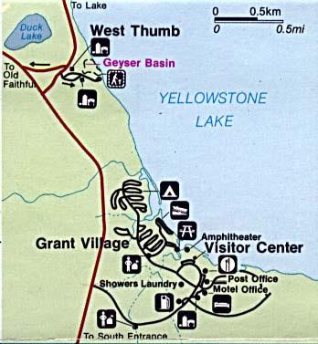
West Thumb

from 50 Iterations
by saraholick

WEST THUMB GEYSER BASIN
Advertisement
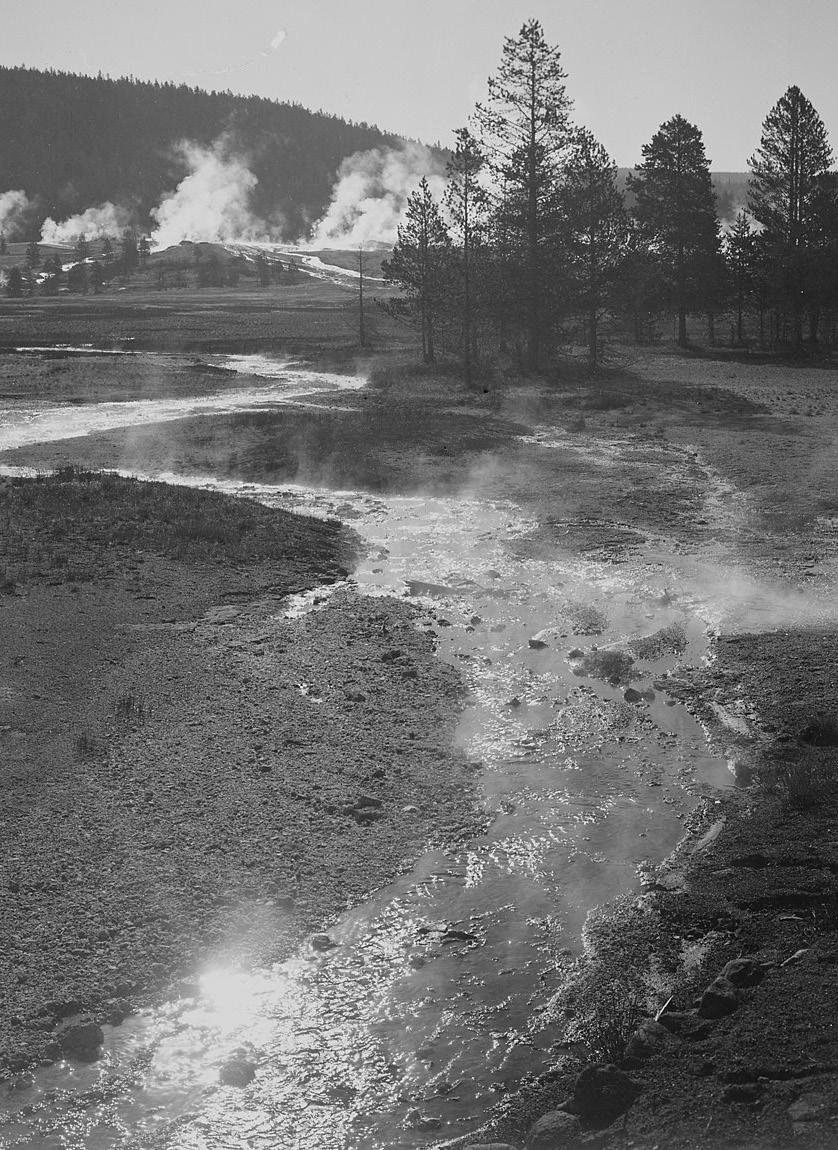
West Thumb Geyser Basin, including Potts Basin to the north, is the largest geyser basin on the shores of Yellowstone Lake. The heat source of the hydrothermal features in this location is thought to be relatively close to the surface—only 10,000 feet (3000 m) down!
The West Thumb of Yellowstone Lake was formed by a large volcanic explosion that occurred approximately 150,000 years ago (125,000–200,000). The resulting collapsed volcano later filled with water forming an extension of Yellowstone Lake. The West Thumb is about the same size as another famous volcanic caldera, Crater Lake in Oregon, but much smaller than the great Yellowstone Caldera which formed 600,000 years ago. It is interesting to note that West Thumb is a caldera within a caldera.
Ring fractures formed as the magma chamber bulged up under the surface of the earth and subsequently cracked, releasing the enclosed magma. This created the source of heat for the West Thumb Geyser Basin today.
The hydrothermal features at West Thumb are found not only on the lake shore, but extend under the surface of the lake as well. Several underwater geysers were discovered in the early 1990s and can be seen as slick spots or slight bulges in the summer. During the winter, the underwater thermal features are visible as melt holes in the icy surface of the lake. The ice averages about three feet thick during the winter.

WEST THUMB OF YELLOWSTONE LAKE
Large volcanic eruptions have occurred in Yellowstone on an approximate interval of 600,000 years. Part of this caldera is the 136-square mile (352-square km) basin of Yellowstone Lake. The original lake was 200 feet (61 m) higher than the present-day lake, extending northward across Hayden Valley to the base of Mount Washburn. Members of the 1870 Washburn party noted that Yellowstone Lake was shaped like “a human hand with the fingers extended and spread apart as much as possible,” with the large west bay representing the thumb. In 1878, however, the Hayden Survey used the name West Arm for the bay. West Bay was also used. Norris’ maps of 1880 and 1881 used West Bay or Thumb. During the 1930s, park personnel attempted to change the name back to West Arm, but West Thumb remains the accepted name.
BECHLER REGION
In the southwest part of the park, accessible via dirt roads outside of the park, is the Bechler region. This is a unique corner of the park, with the lowest visitation and a wetter environment than the rest of the park. This is an ideal location for those with an adventurous spirit and a desire to hike and backcountry camp.