
The Crown Jewel of the Metro Park system, the Big Darby Creek watershed occupies lands to the west of the cities of Hilliard, Columbus and Grove City. Adjacent townships include Brown, Prairie and Pleasant who have jurisdiction over development and the future planning efforts of the watershed. There are three main tributaries that contribute to the Darby: Clover Groff Run, Hamilton Run and Hellbranch Run. Over 200 years ago this river corridor snaked through what were thousands of acres of native Ohio Prairie Grasslands. For the past 10 years the City of Columbus Recreation and Parks Department has restored over 4 acres of the Clover Groff Run including pedestrian trails and reconstructed habitat serving as the leading edge of the City of Columbus as it meets the watershed limits. Franklin County Soil and Water District has also undertaken the Hellbranch Meadows and Stream Restoration project in an effort to bring a more naturalized stream edge to the Hellbranch. Through these public entities, a more native landscape is emerging in the watershed that is ever so threatened to be undermined by future development proposals that fail to adequately address preservationist concerns and the Big Darby Accord.
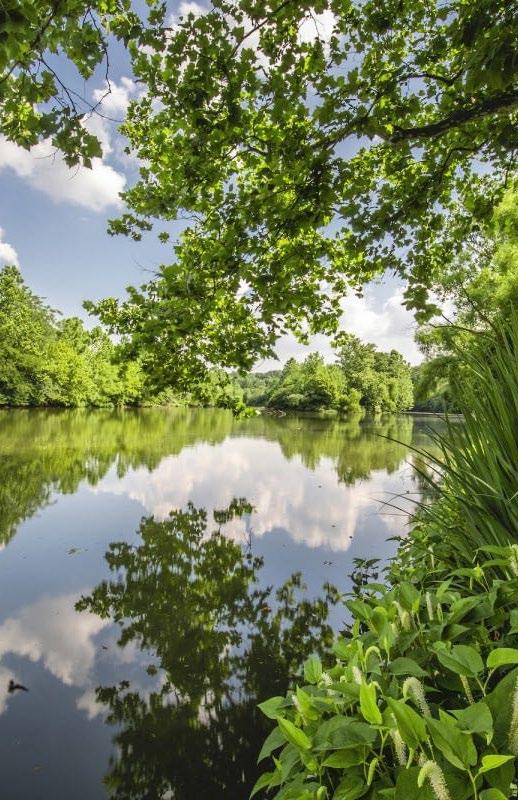
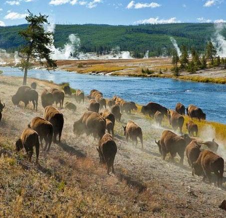
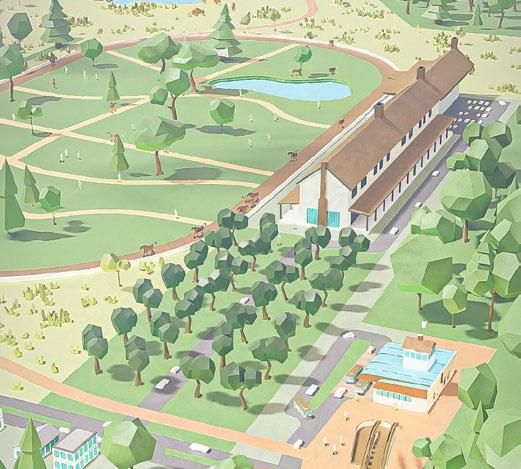
The Big Darby Creek scenic river corridor is one of America’s most endangered river corridors, home to various species of birds, fish and an endangered mussel population. For over half a century, preservationists have been working tirelessly to protect this natural resource and all of its glory for future generations. The watershed area features more than 7,000 acres of forest, prairies and wetlands and stretches along 13 miles of the Big and Little Darby Creeks, both State and National Scenic Rivers. In addition to the areas within the corridor itself, there are also over 1,600 acres of restored wetlands and native prairie grasslands. This watershed is also home to Prairie Oaks and Battelle Darby Metro Parks, seeing over 1.6 million visitors annually through their restoration efforts. Bison have been reintroduced to these lands and roam freely within two enclosed pastures in the park. With ever encroaching development proposals over the past several years, it is now our job to protect this natural wonder for our future descendants.
The Big Darby River corridor is one of the most ecologically diverse streams in the United States. With its wildlife diversity supporting diverse populations of fauna, the following are highlights of the corridor:

Birds: Over 100 species of Migratory Birds that navigate the waterways
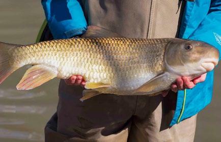
Fish: Over 50 species of native Fish, including the now believed to be extinct Scioto Madtom
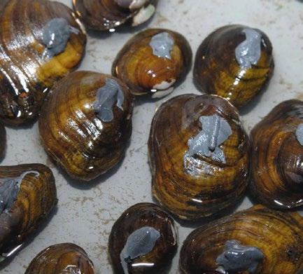
Mussels: Over 90 species of local mussels, with over 44 endangered species representing the most freshwater mussels in the USA, and more mussel species than the entirety of mainland Europe
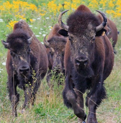
Bison: Columbus and Franklin County Metro Parks have reintroduced Bison to the Battelle Darby Park through a series of restored meadow grasslands
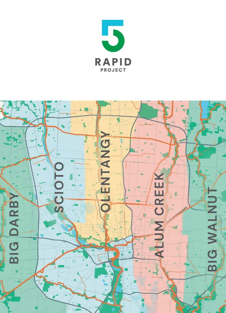
The Big Darby Corridor 3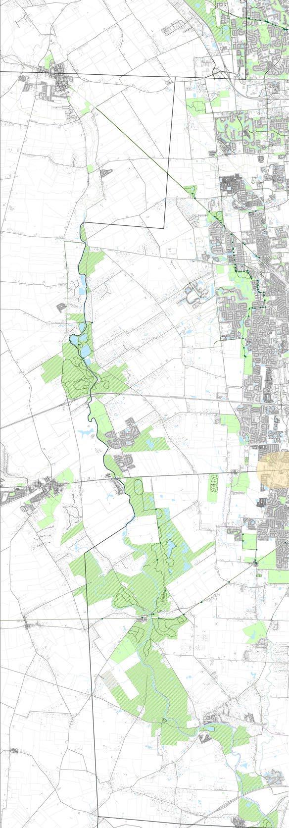
Land within the Big Darby Watershed has been largely undeveloped since the enactment of the Big Darby Accord in 2006. Through the Great Recession and now the Global Pandemic, development pressures are beginning to create concern for preservationists. Significant efforts have been made by Franklin County and the City of Columbus to restore portions of the Clover Groff Run and Hellbranch Run tributaries that both contribute to enhancing water quality making its way to the Big Darby. A few distinct challenges were the focus of this study:
UPSTREAM: Highlighted by Plain City, this area has the highest concentration of development within the corridor and is an important contributor to water quality concerns. As an upstream development zone, future plans for density should include conservation and preservation measures in line with the Darby Accord.
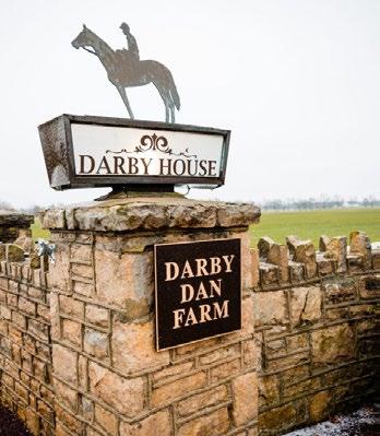
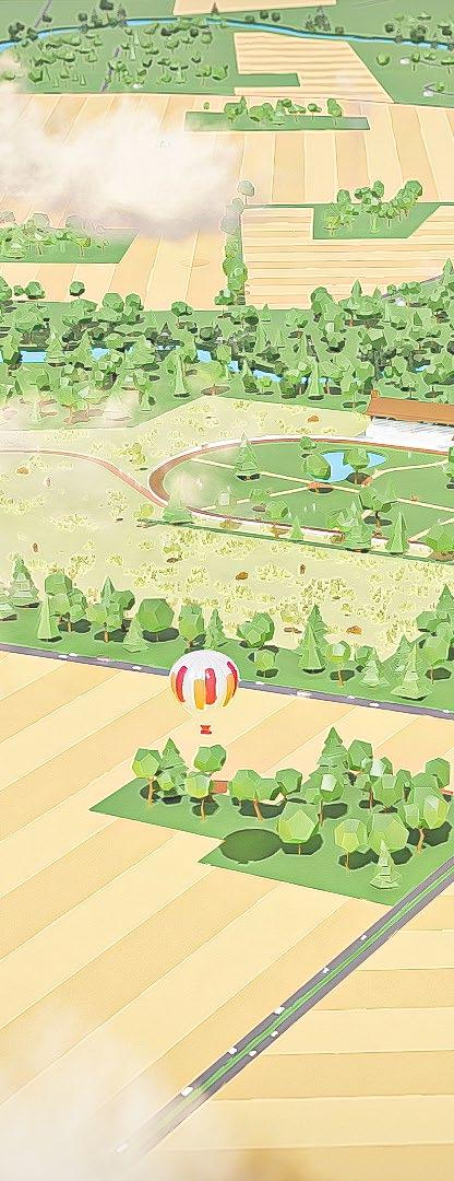
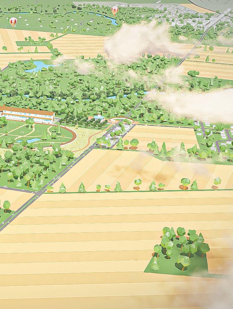
MIDLANDS: Expansive agricultural lands represent the central corridor edges along the Darby. The Darby Dan farm displays some of the greatest opportunity for commercial uses along the corridor. With the Darby House, Airfield and Horse Farms, these recreational uses enhance the rural character of the corridor but could present challenges for stormwater runoff and water quality of the streams and tributaries.
DOWNSTREAM: The town of Georgesville is indicative of the lower stream towns including Galloway, Darbydale and Harrisburg. These quiet villages allow for access to the Darby but are not utilizing the full potential of their locations.
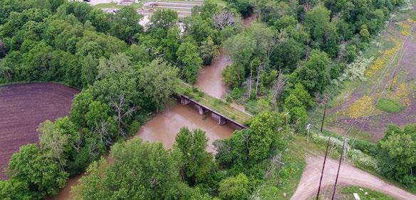
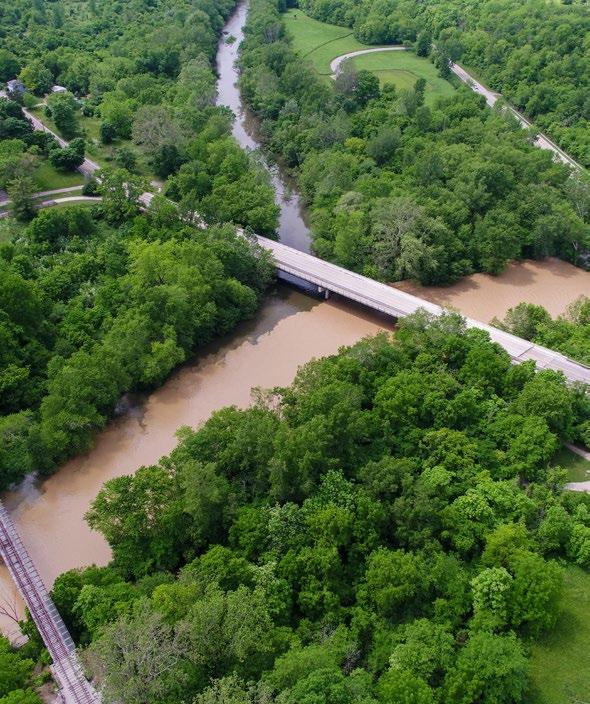 GEORGESVILLE -The confluence of the Big and Little Darby Rivers
The Central Ohio Greenways Trails present tremendous opportunity to connect people from the edges of the cities of Hilliard, Columbus and Grove City to the Big Darby Corridor. Enhanced transportation networks can further connect to villages and towns thereby strengthening their economic positions. Restoration of waterways and enhancing natural features can connect visitors to nature throughout their journey of experiences.
HIGHLIGHTS:
EXTEND HERITAGE TRAIL - Extending the trail from Hilliard to Plain City to connect to Columbus.
NEW METRO PARK - Create new Metro Park if land is acquired at the Quarry Site in Plain City.
EXTEND LINKUS - Extending the LinkUS West Broad Street Connector to Alton to meet a new trail-head of the corridor.
ENHANCE DESTINATIONS - Existing villages and towns within the corridor present opportunities for more local eateries, inns & recreational amenities.
PROTECT HABITAT - Continue to preserve and protect environmentally sensitive areas while still allowing for passive recreation activities.
DEFINE THE REGION - Currently known for the Metro Parks, there is a greater opportunity to define the entire region as a destination for Central Ohio. By introducing more visitors to the region, we can create greater awareness of the ecological value that is worth preserving.
RT. 40 (BROAD STREET)
DARBY CREEK TRAIL
“DARBY VILLAGE”
DARBY
RT. 40 (BROAD STREET)
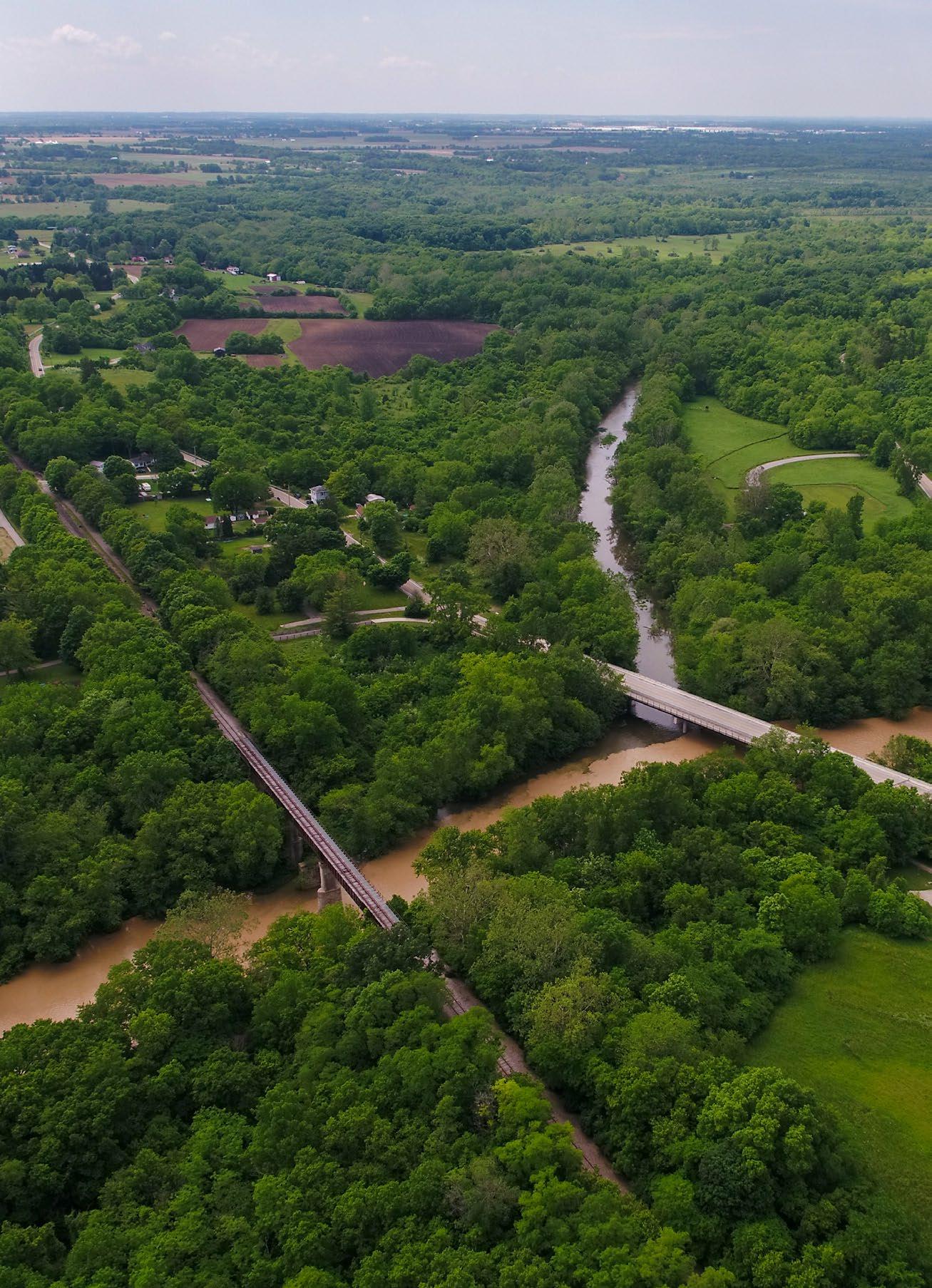
PLAIN CITY - Opportunity to extend the Heritage Trail, creating a critical link to Plain City. Additionally, there is an existing quarry that could be acquired by the Metro Parks and converted to parkland. PLAIN CITY -Potential Heritage Trail Connection through the Quarry utilizing existing Railroad Bridge. LINKUS - The opportunity to create a new east/west trail connecting residents from the LinkUs BRT to the Battelle Darby Metro Park. VILLAGE - At the center point between both Metro Parks, there is an opportunity to create a new ‘micro-village’ serving both as a destination and a critical trail link along the river at Rt. 40. The Big Darby PLAIN CITY
The Darby Creek watershed has up until this point in history been known as a scenic river corridor, home to acres of protected wildlife habitat and Prairie Oaks and Battelle Darby Metro Parks. While this has served to identify with the place, it has not helped to elevate this place in the public consciousness. Much like nature-based regions in other parts of the country, a great opportunity exists to think bigger about this natural resource on par with any iconic, sought after destination.
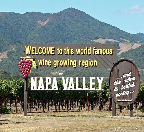
This region is well known for its rolling California hills, mild weather and fantastic wines. Over the years the experience has elevated itself with bigger and better winery tours, a wine train and balloon rides that help to define the district.
This iconic national park is emblematic of the American experience, with preserved wildlife habitat including memorable waterfalls, and the world-famous Old Faithful. Any outdoor enthusiast must travel here once in their lifetime.
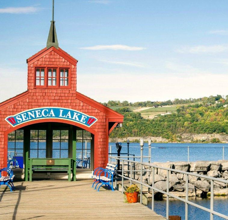
This popular tourist destination has been gaining popularity for its scenic setting and multitude of activities for all. Not to mention its quaint small towns, local eateries, and burgeoning wine scene.
The Big Darby Corridor 7
GEORGESVILLE - Shown here is a depiction of the confluence of the Big and Little Darby creeks where there is opportunity to enhance the visitor experience through greater connectivity, amenities and access to regional trails.
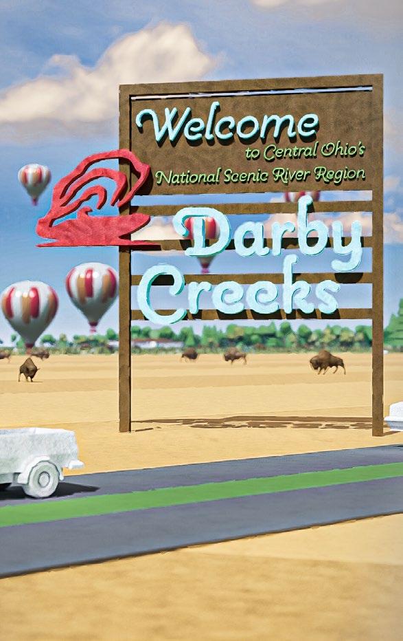
COME JOIN US FOR YOUR NEXT ADVENTURE!
A journey to the most pristine natural place in Central Ohio, the Federally and State protected scenic Darby Creeks region. The native landscape connects people to the original Ohio prairie grasslands and woodland edged streams of the Big and Little Darby watersheds. With over 80 species of riparian corridor birds, 70 species of fish and 30 species of endangered mussels, this wildlife refuge is one of the most biologically diverse aquatic systems in the United States. Whether you spend a few hours, or a few days, you will be transformed by the preserved natural character, the active and passive recreational opportunities, and accessibility to a unique collection of memorable experiences.
MEMORABLE IDENTITY - With such a vast land area it is important to create identity for the region, allowing visitors to clearly know they have arrived and are entering a special place.

The authentic Darby Creeks experience is rooted in its rich history of wildlife preservation and land management. Restored native prairies, pristine woodland edges and ecologically sensitive wildlife provide for the most unique setting in Central Ohio. The “Crown Jewel” of the Metro Parks system presents opportunities for both active and passive recreational activities taking advantage of the breathtaking setting.
THE UPLANDS: The upland prairies and meadows provide for a more active recreational experience. This zone is north of the most preserved wildlife habitat zones, which allow for recreational uses such as canoeing, kayaking and equestrian trails.
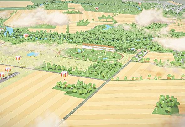
NATIONAL ROAD: The Darby Dan farmlands of the central corridor along Route 40, the historic national road, provides for an ideal location for “The Heart” of the region. The proposed “Darby Village” is an idea to create a micro-village serving as a gateway to the region and a critical trail link along the corridor.
THE WOODLANDS: The downstream Woodlands is the home to much of the protected wildlife in the corridor. This area south of the Darby Dan Farm provides for the rich habitat of birds, fish and endangered mussel populations. Opportunities for passive recreation could include yurts, camping and hiking.
CANOEING
Canoes can be rented in multiple locations providing access to the scenic river.
EATERIES
Micro-villages sprinkled throughout the corridor offer opportunities to enjoy local food and drinks.
BISON
Located at the Battelle Darby Metro Park, see these grassland animals in open pastures.
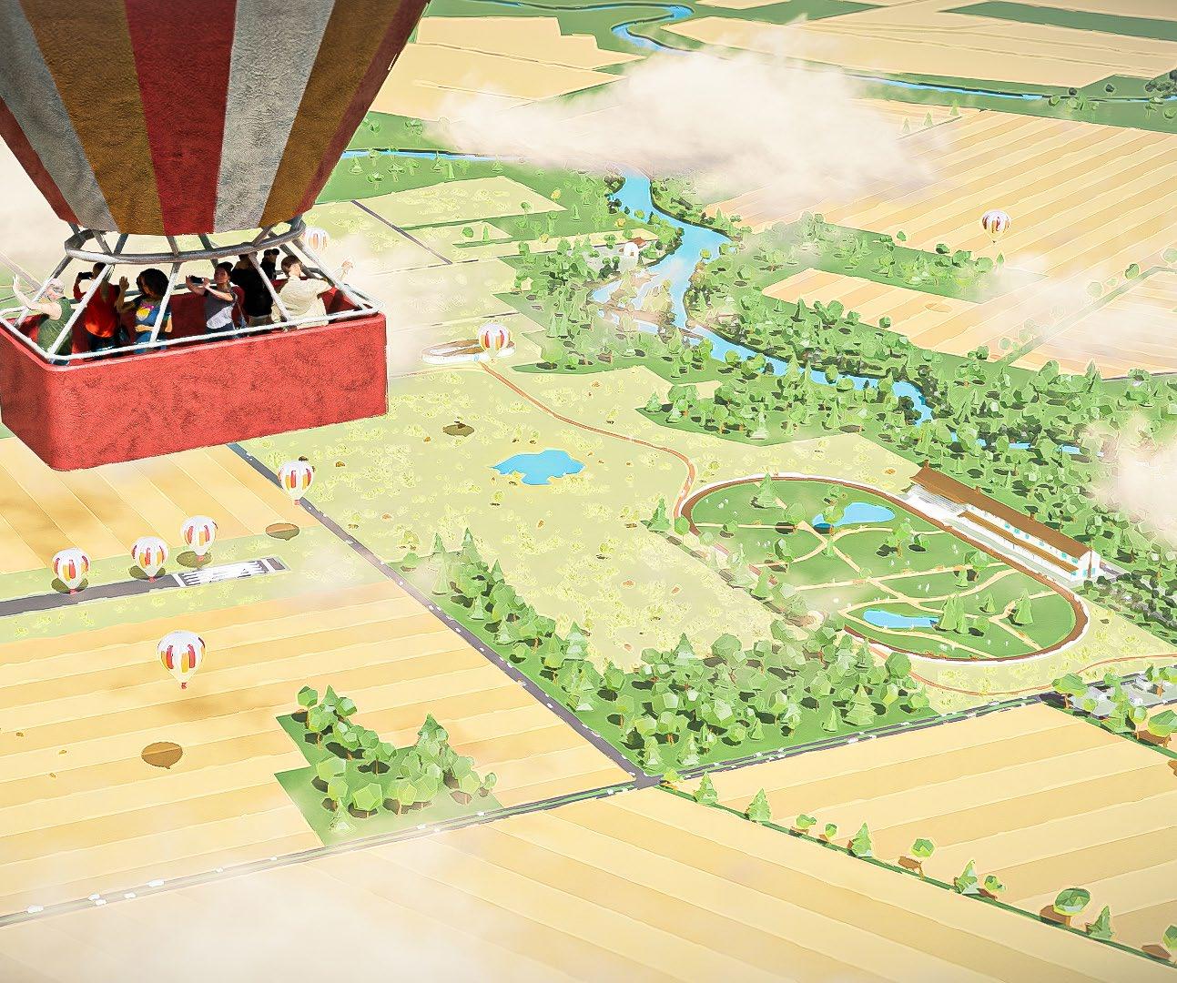
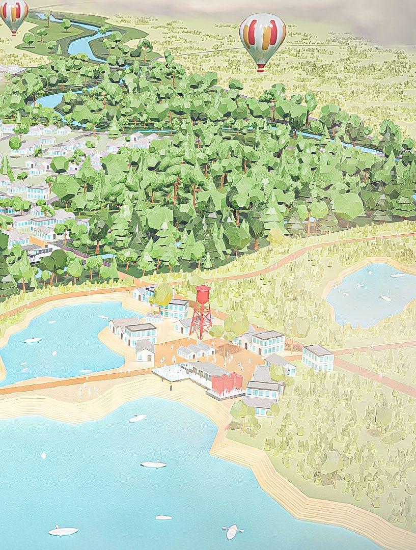
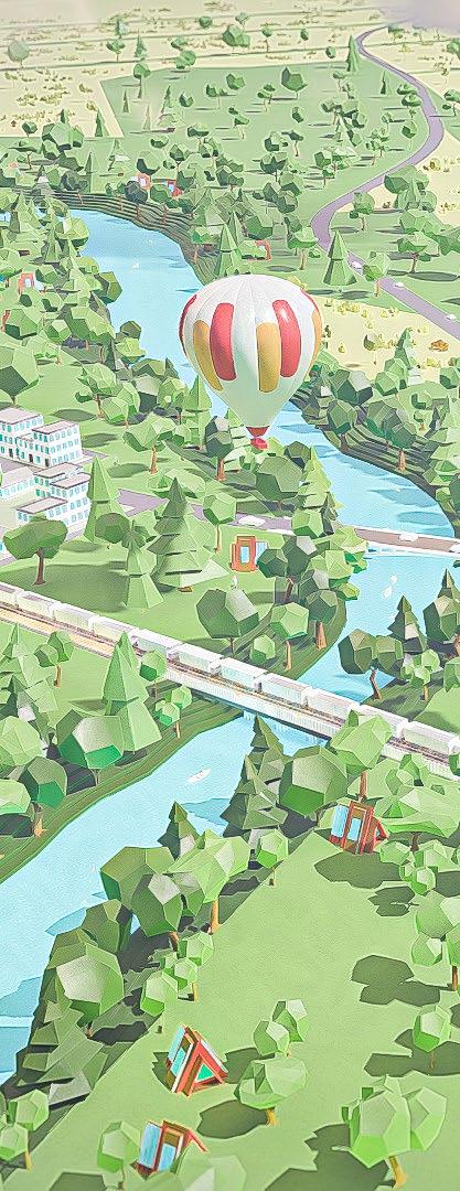
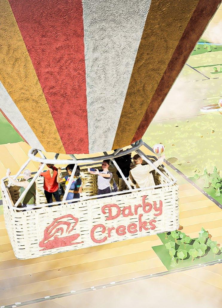
HOT AIR BALLOON
At Darby Dan Airfield, seasonal opportunities to take a majestic ride over the corridor.
WOODLANDS
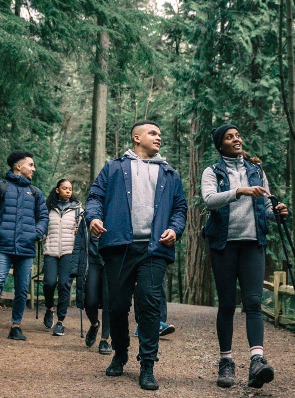
Immersive wooded areas create beautiful hiking trails throughout the region.
LODGING
A variety of lodging options are available from the new Darby Dan Inn to remote yurts that immerse you in nature.
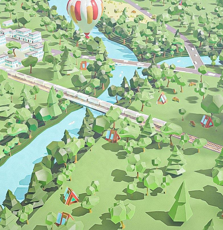
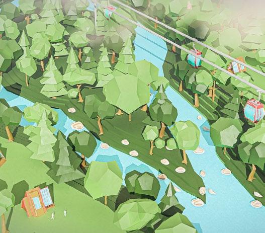
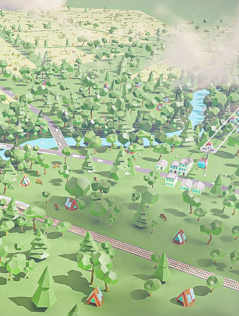
GONDOLA
Get above the river and take a quiet gondola ride between Prairie Oaks and Battelle Darby Metro Parks.
MUSEUM
See historical trophies and memorabilia from Darby Dan Farm and its equestrian heritage.
The Darby Creeks experience allows for some to relax and unplug in quaint historic villages or creates opportunities for those that love the outdoors to take advantage of the untamed river corridor.
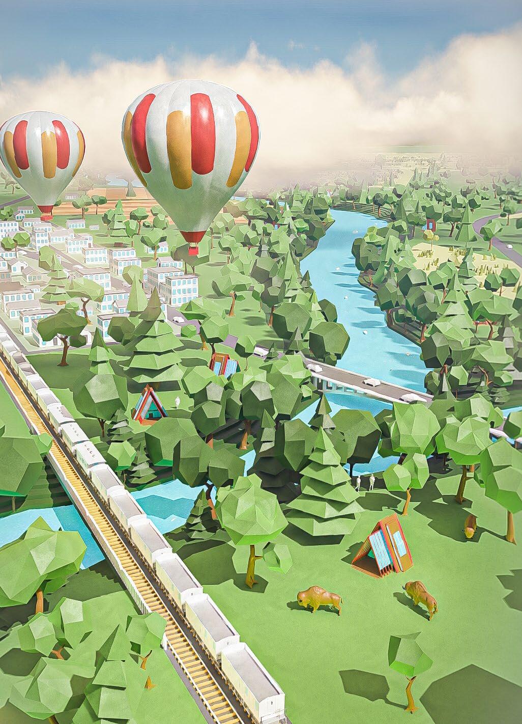
FROM THE AIR: Hot Air Balloon Rides along the Stream, Gondola Rides over the river
ON THE GROUND:
Bicycle Rides through the Prairies, Horse Trails through the Farmlands
WITHIN THE CREEKS:
Canoeing and kayaking along the river, fishing in designated areas
The Darby Creeks Tourism Board
Visit the newly formed tourism board’s website for more information on seasonal activities and events within the region.
FISHING
Enjoy designated fishing spots throughout the region.
The Upland Prairies are the most active destinations within the corridor, north of the Darby Dan Farm. A proposed connection for the Heritage Trail connects the City of Hilliard to Plain City in Union County.
Highlights: Plain City with local eateries and breweries New Quarry Lakes Metro Park with boating and bridge connecting directly into Plain City

The Downstream Woodlands are the most ecologically sensitive park spaces within the region. The local village atmosphere can be enhanced to include additional inns, eateries and shops building on existing infrastructure in Georgesville, Galloway, Darbydale and Harrisburg. Highlights:
Bison at Battelle Darby Metro Park Galloway and its local tavern serve as a gateway along the Camp Chase Trail into the region Enhanced Camp Chase Trail connects parklands to Hilltop
Gondola Cable rides over Mussel Habitat
Hellbranch Run Trail extension
Yurts along Creek Edge for Overnight Stays
Woodland Area for camping and hiking
Endangered Mussel Habitat
Osprey Lake fishing area
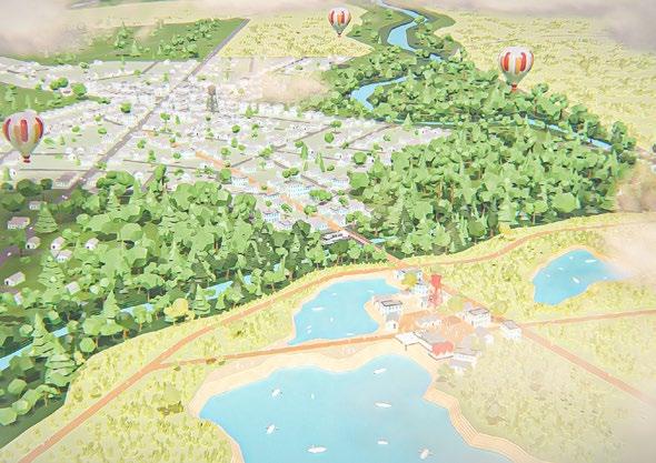
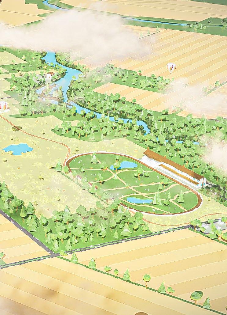
Much like the Emerald Necklace in Boston, Darby Creeks will be a region of connected parks linked by greenways and trails along waterways and tributaries. This linear system of interconnected greenways will serve as the foundation of the plan to build a new identity for the Big Darby corridor beyond the adjacent stream banks.
This public open space will be accessible to all residents of Central Ohio and beyond. Through a series of four distinct development strategies, the plan for the Darby will address these five key pillars: Health & Wellness, Social Equity, Mobility Choice, Environmental Stewardship and Economic Vitality. Through these concepts residents and visitors will be transformed through an enhanced environmental awareness and benefit from greater access to the natural world.
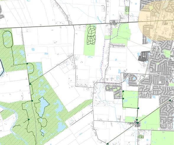
The north / south river corridor is paralleled by its main tributary to the east, the Hellbranch Run. By utilizing the Heritage and Camp Chase Trail, we create the Greenbelt.
We can celebrate connections and destinations already within the region from Plain City down to Harrisburg. New microvillages are created in strategic locations along the Greenbelt.
Through a linked set of trails and greenways, we create the Darby regional chain of parks, including 65 miles of connected trails through preserved prairie grasslands and woodland stream edges. With already 1.5 million visitors a year, this regional system of parks will connect to surrounding cities in the following ways:

CREATE THE REGIONAL TRAIL LOOP
A connected system of multiuse pathways that serve as active and passive recreational access to a connected route along the river.
CONNECT TO PUBLIC TRANSPORTATION:
The new LinkUS BRT should be extended to Alton to create a direct link to the greenbelt, providing access to the system of parks.
PLAN FOR ACCESSIBILITY:
People of all ages and abilities are invited to move along the corridor comfortably. Access to land and water designed for people of all ages and mobility levels.
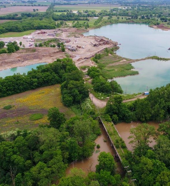
PLAIN CITY / HERITAGE TRAIL BRIDGE - (Shown in the photo above) This existing bridge and adjacent quarry to the east present a tremendous opportunity to extend the Heritage Trail to Plain City and create a new Metro Park.
NORTHERN DARBY CREEK TRAIL - Although the specific location of the northern extensions of the Darby Creeks Trail requires further study, it represents an important link to Plain City and the Heritage Trail.
SCIOTO DARBY ROAD - This roadway presents the opportunity to create a new east / west multimodal trail that would further create connectivity from neighborhoods such as Hilliard to the Big Darby.
SUGAR FARMS - This proposed development will add a significant portion of trail that will eventually connect the existing Hellbranch Trail that currently runs through Hilliard.
LINKUS / COTA CONNECTION - The western terminus of the proposed LinkUs BRT Line presents an opportunity to connect to public transit.
NEW EAST / WEST TRAIL - With a considerable amount of publicly owned land through this corridor, a new east / west trail is feasible that could connect residents from Broad Street (LinkUs BRT Line) straight down to the Battelle Darby Metro Parks.
METRO PARKS CONNECTION - Currently in planning, this critical link will connect Battelle Darby Metro Park to Prairie Oaks Metro Park. It’s current alignment is planned to go through existing neighborhoods along Hubbard Road.
HELLBRANCH RUN SOUTH - Although currently not considered as part of the Central Ohio Greenways future trail plans, a trail along this portion of Hellbranch Run will help to complete the larger greenbelt down to Harrisburg.
DARBY CREEKS TRAIL SOUTH - This future portion of the trail is part of the Central Ohio Greenways plan. It will offer access to a more remote portion of the corridor where camping & hiking could occur.
A series of existing villages and towns can serve to anchor the Greenbelt through interconnected destinations within the region. Plain City to the north where there is a greater concentration of development will include more active recreation, places to gather and transit connections. Smaller towns and villages to the south will be enhanced through shops, inns and more passive recreation for smaller groups or individuals.

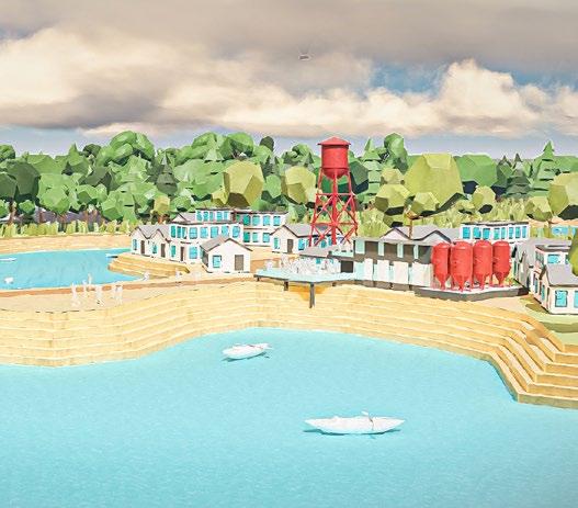
PLAIN CITY- With the Metro Parks acquisition of an old quarry site, a new destination will be born connecting the Heritage Trail from Hilliard to Plain City allowing for connections to Columbus. At this confluence, a scenic overlook and brewery could allow for the opportunity to have a drink while overlooking the river corridor.
TOWNSHIPS - By integrating the Townships we allow for smaller destinations to pop-up along the Greenbelt that would further enhance the experience throughout the Darby Creeks Region.
DARBY VILLAGE - This completely new ‘micro-village would create a critical Greenbelt connection at Darby Dan Farms and provide an iconic pedestrian bridge over Route 40 bringing together Prairie Oaks with Battelle Darby Metro Park at the central point in the Region.
LOCAL BUSINESSES - Building upon existing smaller village communities and towns, we can enhance local economies by providing tourist destinations for people to seek out along the Greenbelt trail system.
COLUMBUS NEIGHBORHOODS- By connecting Sullivant Avenue to the Camp Chase Trail with a shared use path bordered by prairie grasses we begin to pull nature into the city creating further destinations along its edges as you make the journey to the region from urban Columbus.

 The Grainery, Plain City
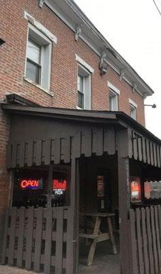
Cattleman’s Pizza, Darbydale
The Grainery, Plain City
Cattleman’s Pizza, Darbydale
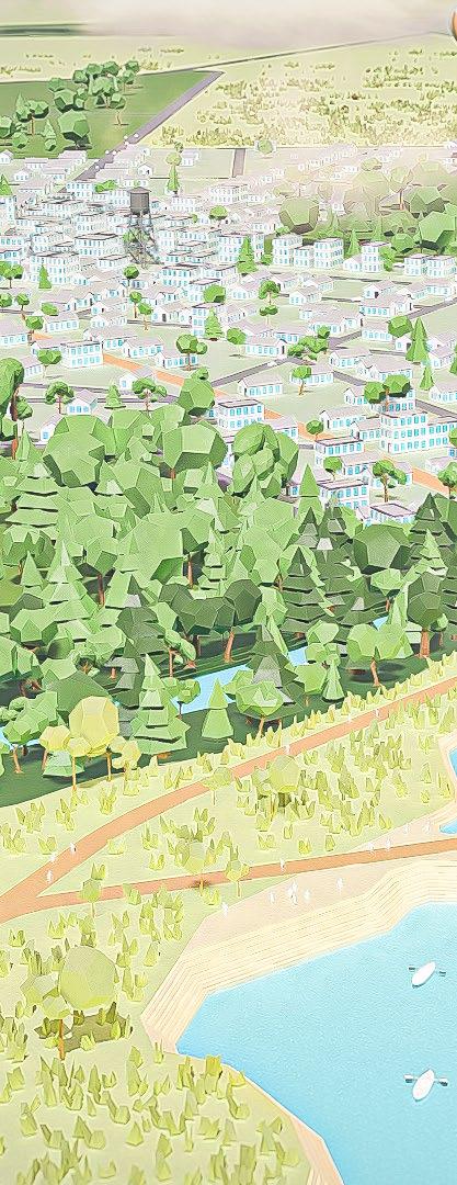
Plain City represents the northern terminus of the Greenbelt and serves as the most densely developed city in the region. The new Quarry Lakes Metro Park will allow for the connection of the Heritage trail from Hilliard and parts east to reach Plain City and the Darby Creeks region.
Plain City Brewing Co. overlooks the Darby
Restored bridge to complete the Heritage Trail into Plain City
Cultural Micro-village with brewery
Heritage Trail connects Plain City to Hilliard
Restored Prairie Grasslands
Heritage Trail extended into Plain City
a part of the BIG DARBY WATERSHED, located within the COLUMBUS, OHIO METROPOLITAN AREA
 Plain City, Ohio
Route 40, the old National Road, and the Darby Dan Farms provide for the iconic center to the region. A new ‘micro-village’ featuring an equestrian inspired museum and inn anchoring this central gateway to the broader region. A pedestrian bridge over Rt. 40 extends the Darby Creeks trail north.
West Jefferson
Pedestrian Bridge over Rt. 40 connecting
Battelle Darby and Prairie Oaks Metro Parks
Hot Air Balloon Rides from Darby Dan Airfield
Darby Dan Horse Farm & Museum
The Darby Inn
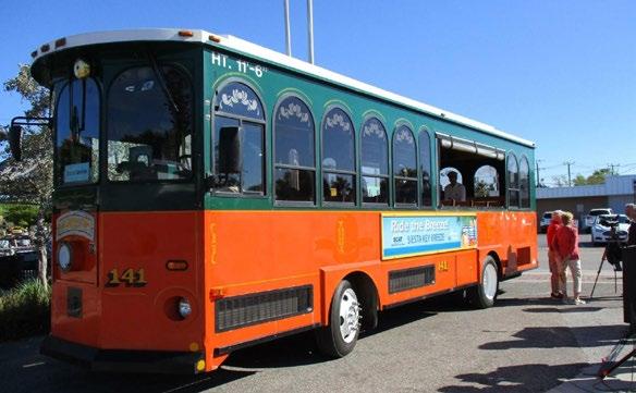
The Darby Trolley Shuttle Station
Darby Creeks Trail along Hubbard Rd.
 Prairie Township, Ohio
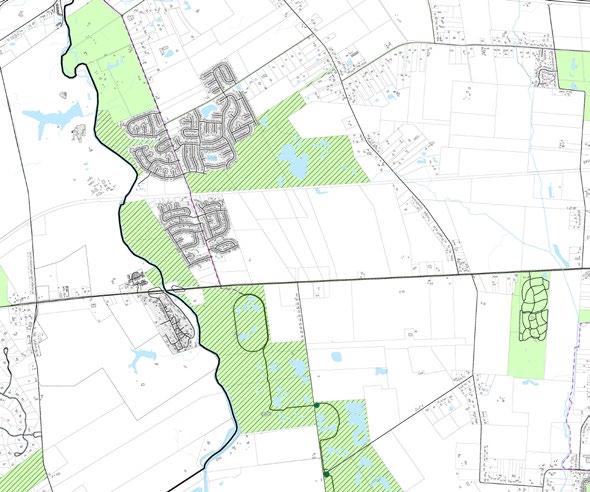
Georgesville, Darbydale and Harrisburg represent three existing villages that have premier access to the most wildlife habitat in the region. A light touch and addition of local eateries, inns and destinations will allow for exploration of the region while preserving existing natural character and respecting endangered mussel habitat.
Enhanced Camp Chase Trail connects parklands to the Hilltop Neighborhood
Gondola rides over the river corridor
Yurts along creek edge for overnight stays
Endangered mussel habitat
Georgesville, Pleasant Township
The experience of getting there is as important as what you do when you get there. Moving through the Greenbelt and its series of destinations is the journey that helps to define the region.
DARBY VILLAGE - Centralized within the region is the Darby Dan Farm that is the most connected transit experience. Once you arrive here via the LinkUS or the Darby Shuttle, you can access the Darby Inn, Darby Dan Family Museum, Horse Farms, Darby Airfield Balloon Rides and so much more!
TRANSPORTATION - The Darby Shuttle picks up visitors at the Alton Multimodal Hub where the LinkUS West Broad Street connector ends and the local transit options begin. Rent a bicycle or scooter to explore the Greenbelt or take the shuttle to Darby Village or West Jefferson for further connections to the region.
THROUGH THE AIR - At Darby Dan Airfield you can hop on a hot air balloon experience to see the entire Darby Creeks region, the most all-inclusive view of the river corridor and its attractions. If you make your way to Georgesville, you can access the gondola rides along the endangered mussel habitat area.
ON THE GROUND - Cyclists can take advantage of 65 miles of connected trails through restored prairie grasslands, stopping at quaint village destinations along the way. Micro mobility hubs provide easy transition from bus to shuttle, or rentals of bicycles and scooters.
CAMP CHASE TRAIL- With a direct connection from western neighborhoods and suburbs of Columbus, this trail also provides connections along the Ohio-Erie trail system extending from Cincinnati to Cleveland through the Darby Creeks region.


PLAIN CITY
QUARRY LAKES AMITY
PRAIRIE OAKS METRO PARK
WEST JEFFERSON
DARBY VILLAGE
BATTELLE DARBY METRO PARK
HILLIARD
Darby Creeks
GEORGESVILLE
ALTON
Access to this western Franklin County region will be accessible via the LinkUs BRT terminating at Alton.
A localized bike share system will be provided to allow visitors to move between destinations.
GALLOWAY
THE DARBY TROLLEY
This private shuttle service will move visitors between various destinations on a prescribed route allowing for hop-on / hopoff flexibility.
Seasonal hot air balloon rides from Darby Dan Airfield will provide the rare opportunity to see the entire region from above.
DARBYDALE
HARRISBURG
GONDOLA
As an eco-sensitive and experiential way to move along the river, an air gondola cable system will move visitors through the corridor.
Future regional planning considers passenger rail through the region allowing for visitors from near and far.
Through the creation of the Darby Creeks Regional Tourism District, we can create the connection between the various cities, villages, and townships to guide economic development in the region. This would include 3-pillars:
TOURISM - The tourism enhancement group would outline development incentives to connect local communities to the Greenbelt and activate destinations within the region. Tourist attractions would be in accordance with the regional green space plan and be sensitive to natural resources.
ECONOMICS - A revenue sharing agreement should be negotiated amongst the various jurisdictions that make up the corridor so that everyone can benefit from the enhancements and increased investment. Economic development would be limited to elements that would contribute to parks, greenways, and tourist attractions within the region, preserving endangered wildlife habitat and enhancing existing development.
DEVELOPMENT- A strict adherence to existing Big Darby Accord protocols should be put into place that would allow for easier transitions from active farmlands to restored natural habitats and trail connectors for regional access and connections for the Greenbelt system. Any proposed development by private entities would need to respect the development patterns of the parks and greenway systems established by the Darby Creeks Regional Tourism District.
TOURISM CAN HAVE A POSITIVE ECONOMIC IMPACT ON THE REGION STIMULATES BUSINESS INVESTMENT AND PROVIDES MORE JOBS BRINGS AWARENESS AND EDUCATION TO THE ECOLOGICAL IMPORTANCE OF THE REGION PROVIDES CULTURAL ENRICHMENT TO OUR LIVES
PIKE TWSP. MONROE TWSP. DEER CREEK TWSP.


Come to Darby Creeks, where the experience of getting there is just as memorable as being there. Follow the miles of interconnected parks and trails along native stream beds and restored prairie grasslands housing some of the most diverse wildlife in the Midwestern United States. Whether you spend a few hours or a few days, you will be forever changed by the eye-opening journey within central Ohio’s premier regional destination.