CASE STUDY:
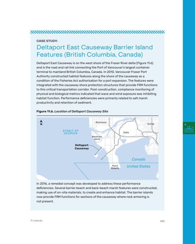
Deltaport East Causeway Barrier Island Features (British Columbia, Canada) Deltaport East Causeway is on the west shore of the Fraser River delta (Figure 11.6) and is the road and rail link connecting the Port of Vancouver’s largest container terminal to mainland British Columbia, Canada. In 2010, Vancouver Fraser Port Authority constructed habitat features along the shore of the causeway as a condition of the Fisheries Act authorization for a port expansion. The features were integrated with the causeway shore protection structures that provide FRM functions to this critical transportation corridor. Post-construction, compliance monitoring of physical and biological metrics indicated that wave and wind exposure was inhibiting habitat function. Performance deficiencies were primarily related to salt marsh productivity and retention of sediment. Figure 11.6. Location of Deltaport Causeway Site
Richmond
N
Surrey
STR A IT OF G EORG IA
Delta Westham Island
Deltaport Causeway
Canada Point Roberts
United States
In 2016, a remedial concept was developed to address these performance deficiencies. Several barrier beach and back-beach marsh features were constructed, making use of on-site materials, to create and enhance habitat. The barrier islands now provide FRM functions for sections of the causeway where rock armoring is not present.
11 | Islands
526