
1 minute read
Navigating Vancouver’s Streets


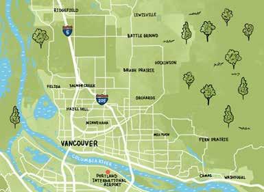
Located along the Columbia River’s northern banks, Vancouver measures 52.45 square miles and is longer in area than it is wide. Its shape resembles a “V” lying on its side or, for the more imaginative, a lazy rabbit lying on its side with ears extended.
Advertisement
The 19th-century city depended on the Columbia River for transportation, which explains why its origins are along the riverbank, before it expanded north.
The Hudson’s Bay Company (HBC) established a fur-trading post in 1825, which became known as Fort Vancouver. When the U.S. Army arrived in 1849, it built Vancouver Barracks next to the trading post and, after the HBC abandoned the fort for stations in British Columbia, it took over the facility.
Most of the early street names in this section of town pay tribute to HBC: Mill Plain, 4th Plain, and McLoughlin Blvd, for example; or the U.S. Army: Macarthur Blvd, Andresen Rd, and Grand Blvd (originally Grant Blvd after
Ulysses S. Grant). In the town’s old section, the streets sometimes run north and south and sometimes east and west. In early days, a road was called a street no matter which direction it took.
Basically, all numbered “streets,” such as 5th St, 15th St, etc., run east and west; and “named streets” and alphabet (“a, b, c …” ) streets run north and south.
In the town’s historic section, all boulevards mostly run east and west, including Evergreen Blvd, Mill Plain Blvd, McLoughlin Blvd ,and 4th Plain Blvd. The exceptions are St. John’s Blvd and Macarthur Blvd, which run north and south.
When Clark County took over the assigning of roadways, the historic streets were allowed to remain. Going forward, they followed state and federal guidelines for naming streets.
Thus if a main roadway goes east and west it is a street and if a main road goes north and south it is an avenue.


