Outside Lands
San Francisco History from Western Neighborhoods Project
Volume 19, No.2 Apr–Jun 2023
BRIDGING TIME
Outside Lands
History from Western Neighborhoods Project (Previously issued as SF West History)
Apr-Jun 2023: Volume 19, Number 2
editor: Chelsea Sellin
graphic designer: Laura Macias
contributors: Paul Judge, Nicole Meldahl, Margaret Ostermann, Andrew Roth, Irvin Roth, Arnold Woods
Board of Directors 2023
Arnold Woods, President
Eva Laflamme, Vice President
Kyrie Whitsett, Secretary
Carissa Tonner, Treasurer
Ed Anderson, Lindsey Hanson, Denise La Pointe, Nicole Smahlik, Vivian Tong
Staff: Nicole Meldahl, Chelsea Sellin
Advisory Board
Richard Brandi, Christine Huhn, Woody LaBounty, Michael Lange, John Lindsey, Alexandra Mitchell, Jamie O’Keefe, and Lorri Ungaretti
Western Neighborhoods Project
1617 Balboa Street
San Francisco, CA 94121
Tel: 415/661-1000
Email: chelsea@outsidelands.org
Website: www.outsidelands.org
facebook.com/outsidelands
twitter.com/outsidelandz instagram.com/outsidelandz
I nside
1 Executive Director’s Message
2 Where in West S.F.?
by Paul Judge and Margaret Ostermann
4 Irvin Roth Remembers
by Irvin Roth
10 Taming Ocean Beach
16 Time Frame by Arnold Woods by Nicole Meldahl
20 Inside the Outside Lands
22 Historical Happenings
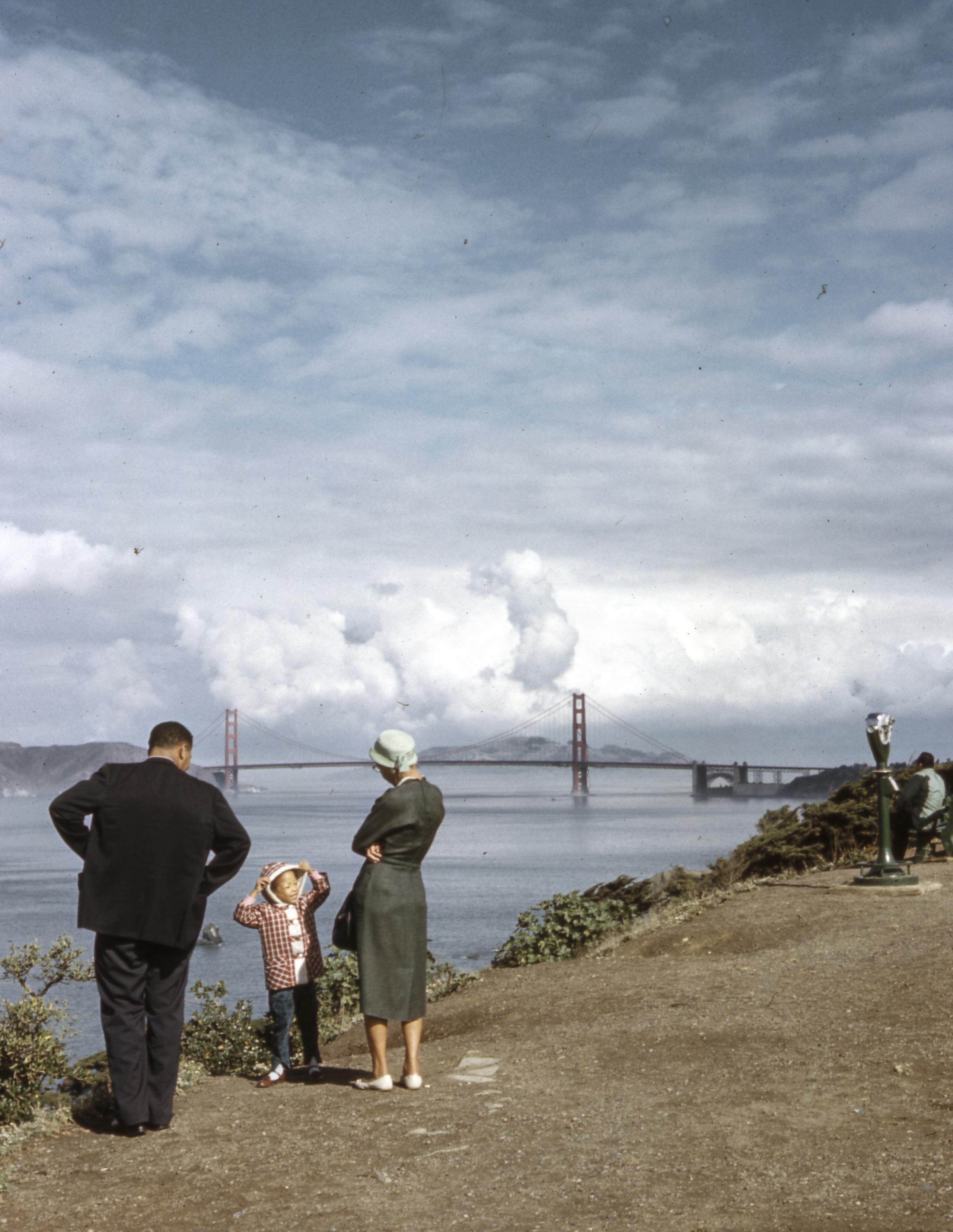
Cover: Family at Lands End, November 1960. (Courtesy of a Private Collector / wnp25.5295)
Right:
© 2023 Western Neighborhoods Project. All rights reserved.
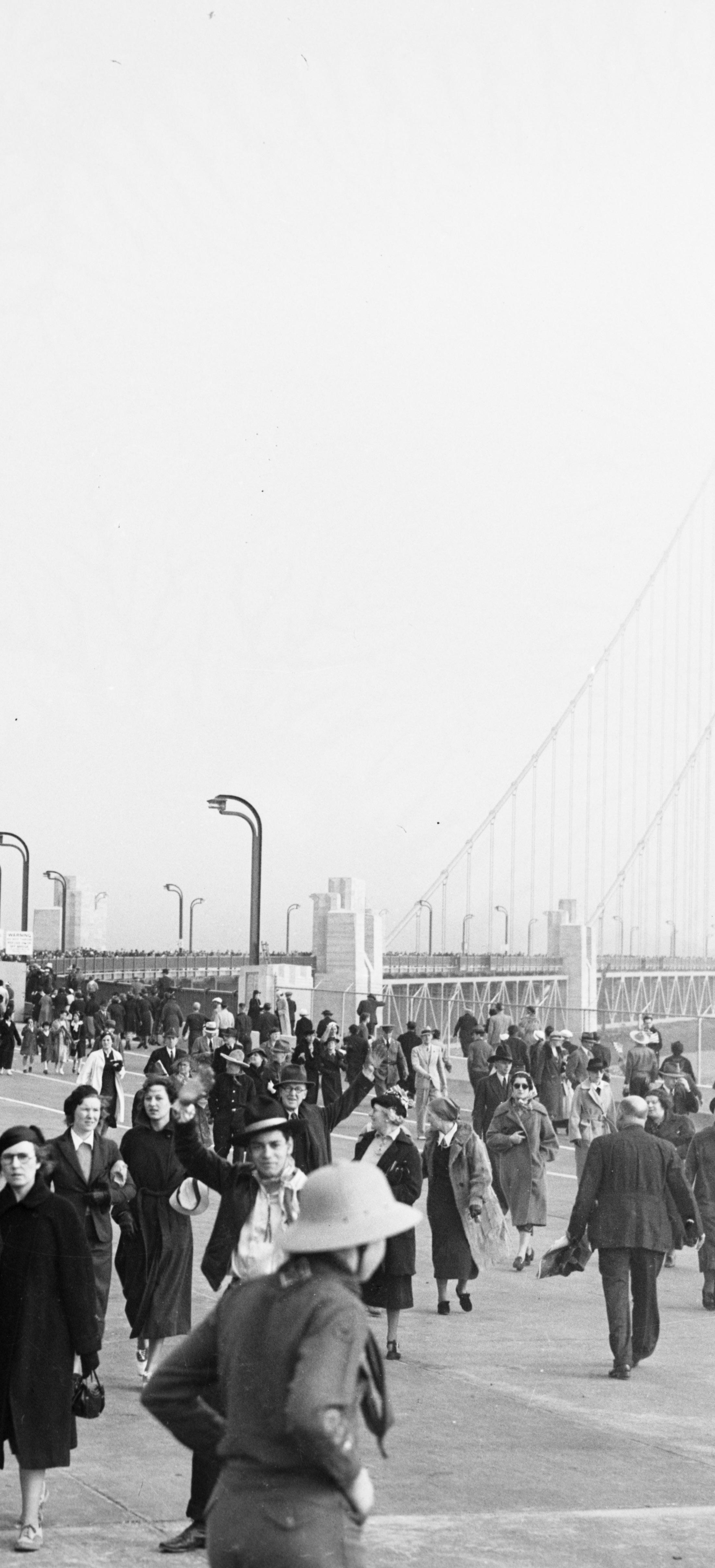
Pedestrian Day on the Golden Gate Bridge, May 27, 1937. (Courtesy of a Private Collector / wnp14.1225)
EXECUTIVE DIRECTOR’S MESSAGE

 Nicole Meldahl
Does anyone else get particularly nostalgic this time of year?
Spring always brings back a flood of memories, some soft and good and some less welcome, but all equally valuable to me. I also tend to do some deep cleaning around April and May, sorting through storage boxes and such before the summer hits, which might have something to do with the mood.
Our memories are important even if they’re painful or fleeting. They build on each other as we construct our own personal histories and they house who we are as individuals. The thing about living in a dense city like San Francisco is that all of our memories have to live together, out in the open. Which can be great – that’s how we build community – but it can also get complicated when our memories don’t precisely align. We’ve seen that a lot these days.
As a housewarming gift, our intrepid Director of Programs gave me a copy of Maurice Halbwachs’s On Collective Memory. When she handed it to me, she said, “I look forward to editing a Director’s Message that talks about this soon.” And…here we are. [Ed. note: Indeed, as I predicted.] This book blew my mind not because it taught me something new, but because it explained in better detail something I already understood: that memory is a social construct. We remember the past better, more accurately, when we talk about it with others and they fill in inevitable gaps.
With this in mind, I loved reading Where In West S.F.? this quarter because I have a long history with Parkmerced. I lived there for years while attending SF State as a young historian. Collective memory is also why I’m excited to share Andrew Roth’s family connection to the opening of the Golden Gate Bridge with you, and why we’re recording at least one oral history a month, a highlight of Inside the Outside Lands. Also in that article, I share WNP’s struggle to do right by one of our most iconic (and largest) Cliff House Collection artifacts as we look to find it a permanent, publicly accessible home in San Francisco.
Cities are sometimes better at building roadblocks than building solutions. History tells us so. Here on the west side, San Francisco has spent much of its resources building a seawall to keep our beloved sand dunes in their place. Are we winning that battle? Unclear, but the effort to do so becomes more comprehensible as Arnold Woods chronicles this saga with his article, Taming Ocean Beach.
Cities also make space for creative work in which history mixes with art and music and memory and poetry and every other divine form of human output. This is the energy I’m bringing to our archive of historical San Francisco images this year with a new rotating OpenSFHistory gallery at the WNP Clubhouse. I’m a little nervous about this leap, but also very excited to open up our history practice to broader interpretation in this way. And to share a bigger piece of who I am and what I do as a writer with my WNP family.
They say no one is an island and, similarly, I believe history can’t be fully understood on its own. So, here we go together – headfirst into another season of exciting things to come and, as always, it’s a privilege to sail these seas with you.
outside lands 1
WHERE IN WEST S.F.?
 By Paul Judge and Margaret Ostermann
A blanket of fog creeps in from the ocean, poised to soon obscure this westward view from Merced Heights in our mystery photo. Lake Merced sits idly, but no idling cars are yet backed up along 19th Avenue or Brotherhood Way. It is 1944. The distinctive towers of Parkmerced have yet to be built, but the neighborhood’s colonnaded townhomes spread out in a web-like labyrinth, ready to confuse new renters navigating the neighborhood’s many roundabouts and pieshaped lots.

David Wallace and Siobhan Ruck easily recognized the scene’s major thoroughfares, correctly placing the photographer in modern-day Brooks Park. The park’s name honors Jesse and Helen Brooks, who lived on the hill’s summit from 1936-1966 while the landscape below transformed from seemingly rural to emerging metropolis. David Volansky went one step further and cleverly narrowed the photo’s era by identifying and dating the homes in the foreground along Ralston Street: “These homes were built in 1941 while their missing adjacent neighbors were built in 1948.”
The World War II-era housing demand, and subsequent baby boom, meant that the open spaces of southwestern San Francisco were keenly eyed for development. Along the east shore of Lake Merced, the site of Ingleside Golf Course became the location of Parkmerced. Capitalizing on the steady cash flow of rental housing, the Metropolitan Life Insurance Company set out in 1941 to house over 2,500 middle-income families in two-story, single-unit attached homes with rear patios opening onto shared lawns. These common spaces offered married couples starting families with play areas for interaction with their neighbors. Paul recalls fun Sunday barbecues with his eldest sister and brother-in-law’s young family, plus their neighbors. They bundled up warm and ate dinner in the fog – not quite the same as a warmer setting in the suburbs.
The architecture and configuration of Parkmerced strongly set it apart from the familiar waffle-iron grid of the Sunset and Richmond districts. With streets radiating from roundabout intersections, instead of straight arteries, the dangers of speeding traffic were supposedly eliminated! By building on only 18% of the land, Parkmerced’s housing plan exalted all the advantages of suburbia – sunlight, playfields, and gardens – within city limits. However, restrictions on construction materials during WWII postponed full development and plagued the townhomes with issues of inferior quality.
By 1944, the year our mystery photo was taken, the first apartments on Font Boulevard were ready for renters at $52 to $84.50 per month. Four years later, Mayor Elmer Robinson drove a bulldozer to break ground on Parkmerced’s postwar expansion: 11 streamline moderne towers. Competing against flight to the suburbs, advertisements for the new 13-story towers emphasized the neighborhood’s unique combination of both city conveniences and “suburban advantages.” The peculiar “winged” tower design sought to
2 APR - JUN 2023
It was evident to Charlie why Brooks Park was once known as “Poppy Hill.” (Courtesy of Margaret Ostermann)
View west over Parkmerced from Merced Heights, 1944. (Photo by Moulin; courtesy of a Private Collector / wnp27.4985)
optimize sunlight and airflow, although any renter will attest that it simply amplifies the noise, smell, and sight of your neighbors through windows facing in on each other. The first tower units were ready in 1951, at $115 to $177 per month. While Parkmerced did not have explicit racial covenants, exclusionary rental practices kept the population overwhelmingly white. A few tenants sued Met Life over these practices – and won – in a case that reached the U.S. Supreme Court in 1972.

In marked contrast to the sweeping development 70 years ago, today Parkmerced sits stalled on their own comprehensive redevelopment plan. Approved by the Board of Supervisors in 2011, the project would replace the aged townhomes with multi-story buildings, reroute Muni’s M-line through the neighborhood, and re-align streets; all while maintaining rent protections and relocation rights for existing tenants. Perhaps a financial fantasy, the proposed start dates have come and gone while mold, leaks, and heating issues continue to blight Parkmerced.
Nevertheless, the suburban-inspired lawns of Parkmerced make it an attractive dog walking location, as frequent visitors Dorothy Fellner and her poodle Buddy can attest. Up in Brooks Park, near her home of over 40 years, Dorothy continues to enjoy the grand vistas from “this little known but expansively beautiful hilltop park.”

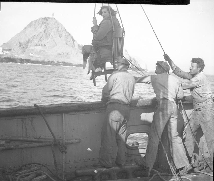
outside lands 3 Send your guesses to chelsea@outsidelands.org Where is this anxious woman being hoisted?
Parkmerced; view northwest along Font Boulevard from Chumasero Drive, circa 1958. (Courtesy of a Private Collector / wnp28.3738)
Parkmerced Ad, 1955.
 Page from Irvin Roth’s photo album, circa 1946.
(Courtesy of Andrew Roth)
Page from Irvin Roth’s photo album, circa 1946.
(Courtesy of Andrew Roth)
Irvin Roth Remembers
This article is mainly drawn from an autobiographical essay written by Irvin Roth around 2002. His son, Andrew Roth, edited the essay and added some material from Irvin’s other drafts, diaries, and interviews.
WHEN THE RICHMOND WAS YOUNG
I was raised in the Richmond district of San Francisco where from the time I was five [in 1925] until about 15 my family lived on 26th Avenue between Anza and Balboa. Our street was a steep hill bordered on each side by modest middleclass homes. On our side of the street there were the typical houses of the area, three-story buildings with large garages on the ground floor and two residences on the second and third levels. The other side of the avenue consisted of onestory bungalows. All homes were built on lots which were 25 feet wide, there was no space between the buildings. Very few were owned by the occupants; buying a home was beyond the capabilities of most families. My parents [David and Nettie Roth] paid $45 a month for a three-bedroom, one-bath flat.
Our neighborhood was mixed culturally, but all were white. There were no African Americans in my elementary or junior high school and only a very few at my high school. There were, however, many Asians, principally Chinese and Japanese, in all my schools. Most of the families on our block were Catholic, at that time the religion of a majority of San Franciscans, divided between Irish Catholics and Italian Catholics. There were, however, about ten Jewish families within two or three blocks. We mixed freely and I felt no discrimination while living in San Francisco. There was little socialization between the adults, but we children freely mixed. Our family socializing was with friends from work-connected relationships and with our family.
In 1929, we relocated across the bay to Oakland, where my parents rented a home at 7615 Holly Street for $57 a month. Here we were hit by a double blow. My father developed pleural pneumonia and was at death’s door for many months. As a result, he lost his job, used up all our savings, and was hit by health costs not covered by insurance. It was at this time that the stock market crash ushered in the Great Depression. My family was unable to recover from these events.

We moved back to San Francisco, to the same apartment building we had left just a few years before, this time renting the other unit in the duplex, 612 (rather than 610) 26th Avenue. My father became a traveling salesman for Keyston Brothers, a wholesaler in leather and shoe fittings that he sold to shoe repair shops. He worked on a small salary, augmented by commissions on successful sales. He was absent from our home from after breakfast on Monday until dinnertime on Friday. On Saturdays he worked in a retail shoe store for $5 a day.
My father was very conservative, a registered Republican and he came from a small town; a “lift yourself up by your own boot straps” kind of thing. He didn’t particularly like unions. Because most of his income was from commissions, his salary fluctuated and because of the Depression seemed always inadequate. My mother had a hard time managing the house and with raising my sister and me. Yet I felt that both of my parents loved me and both gave me emotional security. Of course, I was aware of the family’s struggle to make ends meet, but I never felt poor or deprived. I knew we could not afford many things, but I easily learned to keep my wants modest.
outside lands 5
Irvin Roth and his sister, Bernice, on the day of Irvin’s Bar Mitzvah at Sherith Israel, April 1, 1933. (Courtesy of Andrew Roth)
June 25, 1936
“On Thursday evening, June 25, while in Salinas, we received a phone call from Mother in San Francisco. She said, amidst tears, that our house burned down. So we (Dad and I) rushed back, making the trip at an average speed of 50 mph. I didn't see the house until several days later. Only the kitchen was burned completely but the whole house was smoked and smelly. The kitchen was a total wreck. All my fish were killed in the fire and someone stole my tanks while the house was being painted.”
As a result of my father’s absence, we did not share many activities. My mother was essentially a single mom and kept busy with the house and with raising two children. I do not recall ever playing board games or singing or reading together as a family.

CHILDHOOD PASTIMES
Since my parents and all our neighbors were busy with the problems of raising children during the Great Depression, the youngsters were left alone to find their own amusements and to play together with little adult supervision. My play was on the streets after school and – in the summer – after dinner. All the children played such games as “One Foot Off the Gutter” and “Kick the Can” on the avenues. Both boys and girls participated in these games. The rules for both were simple and required no special equipment.
We also used the level street on Anza between 25th and 26th
avenues as our hockey field. Wooden hockey sticks could be purchased for 25¢ and steel 4-wheel skates for about a dollar or a dollar and a half. After hockey season, we took the skates apart for the wheels with which we made racing cars by nailing the wheels to wooden apple boxes that we got from the corner grocery store. We drove our cars down the hill from Balboa to Anza, where we always posted one of us to watch for cars which, fortunately, were few and far between.
We also played baseball in the empty sand lot on our block, choosing sides and organizing ourselves with no interference from adults. We used the lot as a battlefield where we reenacted World War I by digging trenches and attacking up the hill. At no time did any parent come to see us play ball or hockey or watch us speed down the steep hills.
Even in the first grade, I walked to and from Cabrillo Elementary School, about three blocks from my home, without adult supervision. At age 10 I remember riding alone on the streetcar and paying my 5¢ fare. In elementary school, pupils served as street-crossing guards and not adults as today. I was sent regularly to the corner store to buy groceries and given the money to pay for purchases. We did not have a refrigerator until I was 14 or 15, so daily grocery shopping was necessary.
My best friend until we parted to go to different high schools was Fred Linari, who lived on 22nd Avenue. He and I spent many afternoons in Golden Gate Park, which was only three blocks south of my home. Here we visited the old de Young Museum which at that time had a large room filled with World War I weapons, uniforms, cannon, and even a small French Renault tank. Across the Band Concourse was the Steinhart Aquarium with two outdoor pools with seals and sea lions. The museums were free at that time. We also explored the park, finding wildlife such as salamanders, quail, squirrels, and, in Stow Lake, fish and ducks. We pretended to be fearless explorers.

6 APR - JUN 2023
Irvin Roth, far left, enjoying Bull Pup enchiladas with friends Jack Baraff and Lenny Richman at Ocean Beach, late 1930s. (Courtesy of Andrew Roth)
1927 Cabrillo Elementary School class photo; Irvin Roth is second from the right, bottom row. (Courtesy of Andrew Roth)
I was an avid reader and still have some of the books my parents gave me as early as 1927. The two closest public libraries, one on 10th Avenue and the other on 38th, were within walking distance and I often visited them. From my early years I walked 16 blocks to the 10th Avenue branch of the public library and the 16 blocks back. My friends as I walked equally long distances to the Alexandria and Coliseum theaters every Saturday for the movies. Later when we had bicycles, we rode longer distances. I collected stamps from an early age and feel that my interest in history and geography owes much to that hobby.
In junior high school (Presidio), I attended many parties with both boys and girls. My diary describes many such occasions and notes my joy in playing Spin the Bottle and Post Office. We considered these kissing games to be particularly daring. I was not associated with school leaders, but I was editor of the school paper in junior high and a member of the student council. I did sit right next to Judy Turner – in Hollywood she became Lana Turner – but would not dare to become a close friend.
Sometimes I went fishing off the pier at Aquatic Park with friends and more rarely with my father. We caught smelt and perch, small fishes but for youngsters, thrilling catches. When the Jewish Community Center opened in the 1930s, I joined and there went swimming and learned to play chess.
I went with friends to the Saturday matinees at local shows –the Star on Clement Street at 24th Avenue, the Alexandria on Geary and 18th Avenue, and the Coliseum on Clement and
December 15, 1937
“Yesterday, December 14 [1937], was the date upon which I was graduated from Lowell High School, having completed by compulsory education. I was one of the class of 223. We had our exercises at Mission High School as Lowell’s auditorium is too small. Everything was very nice and the day shall long live in my memory. In the evening I took Sylvia to the Senior Dance. I had my car and also took Joel Smythe and Jeanette Gorden. I bought Sylvia an orchid. She said she cried when she received it. I hope she was that happy. The dance was held at the St. Francis Hotel and was a big success. I surely had a swell time. The dance broke up at about 12:15 and we went to the Kup. And after to home. The day, all in all, was really wonderful.”
9th. Admission was 10¢ and a candy bar 5¢. The program consisted of a double-bill, that is two full-length movies, a comedy, a cartoon, and a newsreel. Another place of amusement was Playland at the Beach, now, sadly, no longer existent. Here were rides such as the Giant Dipper, Shoot the Chutes, Dodge’m, a merry-go-round, and games of chance as well as side-shows featuring scantily dressed dancing girls and freaks. One could get a big hamburger for 10¢ and the famous Bull Pup enchiladas for the same price.
ENTERING THE ADULT WORLD
My family managed the years until about 1939 when the economic situation improved. My Uncle Al and Uncle Bill, my mother’s brothers, owned the Peerless Curtain Mills at 585 Mission Street, and I know now that they helped us. They gave me a job cleaning up on Saturdays for which I was paid 50¢, a sum that covered my weekly spending for shows, streetcar fares, etc. When I graduated from high school (Lowell), I attended San Francisco State College for a semester, but having no goal and little motivation, I dropped out and went to work for my uncles at $25 a week, and I paid my mother for my board & room, I think $5. I worked as a curtain cutter, stock boy, and shipping clerk for two years, hating every minute of it.
I was always interested in politics and history and read avidly. I was concerned with social justice and became radical in thought if not in action. I subscribed to The People’s World, a daily communist paper in San Francisco – to my parents’ discomfort. My friends and I followed the European War with interest and trepidation as we all expected the U.S. to become involved. After the fall of France in June 1940, this seemed so certain that we decided to enlist in the reserves to either get our year over or to be trained. So before the Conscription Act was passed, we all went to the Navy Reserve headquarters on Market Street. Three of my friends were enlisted, but I failed my physical because of my eyesight. So I joined the California

outside lands 7
Peerless Curtain Mills building on right, 585 Mission Street, 1951. (SF Assessor's Office Negatives; WNP Collection / wnp58.157)
The opening of the Golden Gate Bridge in 1937 was a banner event in San Francisco history. On May 27, over 200,000 people walked across the new bridge. The following day, the bridge opened to traffic and Irvin was among the very first cars to cross. His diary tells the story:


Sunday May 30
Thursday the Golden Gate Bridge was open to Pedestrians. We all got girls and walked across, having lunch on the Marin side…
Since I had my car, Jo, Sid, LeRoy and I decided to stay up all night and try to be the first car across the G.G. Bridge. So we did. However we were second across. When we passed the tollgate on this side there were two trucks of photographers mostly of moving pictures, and behind this six motorcycle officers. There were three lanes of cars, we being on the extreme left. The trucks led that they might get pictures of us. The cops, with sirens wide open, led us across. What a thrill! I certainly shall never forget this. On the return trip, we were raced by a fellow whom Jo and Sid knew. (Jo was at the wheel all the time) and boy, did we hit it up! Top speed was 70 mph and that’s fast for the Plymouth.
Well, we led all the way until we came to some cops and we slowed down to State speed limit (45) and warned the other boy to do the same. But he kept on going, and the officer nabbed him. So we passed under the toll gate – first to make a round trip on the Bridge. The whole round trip only took us 13 minutes and it was the most thrilling, exciting, most colorful quarter hour of my short life. I would stay up two nights to relive those moments.
8 APR - JUN 2023
Golden Gate Bridge opening day; cars lined up at the Toll Plaza prior to the noon opening, May 28, 1937. (Courtesy of a Private Collector / wnp14.2923)
Page from Irvin Roth’s diary, May 30, 1937. (Courtesy of Andrew Roth)
OPENING OF THE GOLDEN GATE BRIDGE
February 22, 1940

“In the afternoon I went to see Bob A. at his girlfriend’s house. The neighborhood up there [North Beach] is SF’s little Bohemia and all the persons who came in are artists or models or teachers or writers. Although most of them barely scrape along as far as finances are concerned, they get far more out of life than any other group I know. They are spiritually wealthy. We drank two and a half gals. of wine. We played some of Elaine’s records—a few Dwight Fisk[e], some classics, calypsos, and that most intriguing piece, “Strange Fruit.” We talked a great deal. Another thing I like in these people is their freedom of speech. If “bastard” or “goddamn” expresses best a thought, it is said in the mixed company and nobody takes offense.”
National Guard (Company I, 159th Infantry) in September 1940 and entered active service on March 3, 1941, and was sent to Camp San Luis Obispo. I wanted to go into combat because I wanted to erase the misconception that all the Jewish men were in supply and I wanted to be sure I was in combat as an infantry officer.
At the beginning of December 1941, my regiment moved to Fort Ord, California. I welcomed this move as I was now stationed 150 miles closer to my home. On Saturday, December 6, I received a weekend pass to San Francisco. I met my mother, father, and sister, had a good home-cooked meal, and got together with some of my friends.
The next day, December 7, 1941, I drove my father’s car to see my girlfriend, Julia, at her home on Vallejo Street. In the early afternoon we heard a special newsflash on the radio reporting the Japanese attack on Hawaii and Manila. The news was followed by an announcement ordering all military personnel to report to their base immediately. “What does this mean?” asked Julia, who was an immigrant from El Salvador. “It means we are at war and that I must leave at once,” I replied.
I wanted to get back to Fort Ord as soon as possible, as I knew the longer I stayed, the more difficult the parting would be for everyone. However, I did stay for dinner with my family after which my father and mother drove me to the Greyhound Bus Depot in the Pickwick Hotel at Fifth and Mission, where buses had been commandeered by the military to transport soldiers and sailors to their stations. I was worried about my folks and Julia as the newspapers and the radio reports indicated that a Japanese fleet was steaming toward San Francisco. Although these reports proved false, there was a feeling of dread and tension among all of us.
For the next four to five weeks, we patrolled the so-called strategic areas up and down the Pacific Coast, railroad bridges, communication networks, and so forth. I remember being on guard duty down at the beach near the Cliff House and an underground cable wire that stretches all the way to Hawaii and could be reached through manhole covers. I was supposed to march up and down with my rifle acting unconcernedly so that no one would know that there was in fact a cable over there. It was rather difficult because I imagined people would look out and wonder what this soldier was doing marching up and down on the street by Sea Cliff.
Irvin was promoted to Captain and was in command of Company I, 114th Regiment of the 44th Infantry Division, when his unit landed in France in September 1944. From November 1944 to April 1945, he led his company in almost continual combat and earned a Silver Star with Oak Leaf Cluster and a Bronze Star and was awarded two Purple Hearts for wounds in action. In 2011, Irvin was made a Chevalier of the Legion of Honor by the French government in recognition of his role in liberating France. He married Maureen Aarons, whom he met while on leave in London, at the Fairmont Hotel on June 13, 1948. They raised a family in Sunnyvale, California. Irvin Roth passed away on April 19, 2016.
outside lands 9
Irvin Roth on Powell Street, late 1945. (Courtesy of Andrew Roth)
Taming Ocean Beach
By Arnold Woods
Coastal communities deal with an ageold problem: parks, residences, and infrastructures with ocean views are wonderful to have, but often difficult or treacherous to maintain. As San Franciscans increasingly came west to Ocean Beach to live or play, it did not take long for the city to see a need to protect oceanside property and the ocean road. Solving the issue would be an extended and fitful process.

10 APR - JUN 2023
There had long been a horse road extending from the north end of Ocean Beach down to today’s Sloat Boulevard. Initially known as Ocean Boulevard, it was largely a sandy road framed by the Cliff House on one end and the Oceanside House (later Tait’s at the Beach) at the other. By the mid-1890s, the city was improving the road with a foundation of rough stone all the way from the Cliff House south to Lake Merced. The road started being referred to as Great Highway, though when the name was officially changed is unclear.
With the increasing popularity of automobiles after the turn of the 20th century, San Francisco was keen to create both a better road and an attractive destination along the beach. The city wanted a beautiful esplanade that ran the full length of Ocean Beach. Such a large project would require considerable expense, and the city did not want to issue bonds for the work.
Therefore, the Board of Supervisors unanimously approved a resolution on February 15, 1915 to do the work “one section at a time.”1 This decision would have consequences as the work progressed.
On May 3, 1915, the Board of Supervisors appropriated $50,000 to begin work on the first section. City Engineer Michael O’Shaughnessy was tasked with preparing plans for a seawall that would begin at the bottom of the Sutro Heights hill, with the area behind the wall to be filled in and beautified. The choice to begin the “one section at a time” work at the northern end was not a surprise, given that the adjacent Cliff House was perhaps the most popular destination at Ocean Beach. After a hiccup with the original winning bidder for the work withdrawing, the contract was awarded to J.D. Hannah on November 19, 1915.

outside lands 11
View south from Sutro Heights showing Great Highway and Ocean Beach, circa 1895. (Courtesy of a Private Collector / wnp4/ wnpglass01.010)


12 APR - JUN 2023
Original Beach Chalet on the west side of Great Highway; recent storm damage undermined the foundation, 1914. (Courtesy of a Private Collector / wnp4/wnp4.0915)
Construction of seawall on Ocean Beach near Balboa Street, October 20, 1916. (Photo by Horace Chaffee, SF Department of Public Works; courtesy of a Private Collector / wnp36.01394)
Ocean Beach seawall and equestrian ramp near Fulton Street, May 2, 1929. (Photo by Horace Chaffee, SF Department of Public Works; courtesy of a Private Collector / wnp36.03784)
View south from foot of Point Lobos Avenue showing Great Highway and first completed section of esplanade, April 25, 1919. (Photo by Horace Chaffee, SF Department of Public Works; courtesy of a Private Collector / wnp36.02147)
O’Shaughnessy’s plans placed the seawall at 150 feet from the high tide water mark. An engineer hired by the ParkRichmond Improvement Club, however, filed a report that the seawall was too close and should be set back 300 feet. The city noted that if the beach was 300 feet wide, there would be insufficient room for the road next to it and they would have to buy beachfront properties to make up for the lost space. Beachfront property owners were not having that, so the city won that battle. Work commenced per O’Shaughnessy’s plans and continued through much of 1916. The large seawall included bleacher seats at the bottom for beach patrons to sit on.
Soon after this work began, San Franciscans petitioned to have the esplanade extended even further south. On March 18, 1916, the Recreation League asked city supervisors to extend it to at least the Beach Chalet. The Golden Gate Park Federation of Improvement Clubs then asked for $100,000 to be appropriated for the extension of the esplanade. However, the supervisors only approved an additional $25,000. The extension contract was again awarded to J.D. Hannah, even though he was not the lowest bidder. He got the contract because his company had proven to be a responsible contractor during the first part of the construction.

The completion of the first part of the esplanade work – about 1,500 feet in length – was announced by O’Shaughnessy on November 10, 1916. From there, Golden Gate Park Superintendent John McLaren took over, to do landscaping work. When McLaren was done, a large dedication ceremony
was held on April 29, 1917. With World War I raging half a world away, the speeches of Mayor James “Sunny Jim” Rolph and others at the ceremony tended toward the patriotic. Rolph urged everyone to “do our bit.”2
Mere weeks after the dedication, city budget cuts forced the Board of Supervisors’ Finance Committee to eliminate further appropriations for esplanade construction. Improvement clubs and newspapers repeatedly called for the esplanade work to continue, but the city would not budge, even when it received $392,000 from Southern Pacific Railroad as part of a land exchange. This and other cuts allowed the city to avoid reducing a payroll that some called bloated. It took two years of newspaper editorials and public calls for monies to extend the esplanade before the city finally caved in. The Board of Public Works appropriated $85,000 on March 19, 1919, but with one minor curveball. The money was not for extension of the esplanade,but for paving the entire length of Great Highway. A contract for the paving project was awarded by the end of April 1919. Work commenced, shutting down Great Highway for two months. This work was also criticized for being insufficient to bear heavy traffic.
The city signed a deal in March 1920 with contractor John Spargo to build a “public comfort station,” a.k.a. restroom, by the esplanade.3 This was completed, but money earmarked for esplanade extension and Point Lobos Avenue improvements was redirected. City supervisors voted in November 1920 to instead use that money to improve Laguna Honda Boulevard.
outside lands 13
Point Lobos Avenue construction south of Cliff House, November 4, 1921. (Photo by Horace Chaffee, SF Department of Public Works; courtesy of a Private Collector / wnp36.02636)
In March 1921, the city approved the construction of a wooden boardwalk that would extend from Sloat Boulevard north to Lincoln Way, on the beach side of the Great Highway. The contract was awarded to the Hanna Brothers, but again, the city did this on the cheap. Only $15,000 was appropriated for the work, which meant the boardwalk would only extend as far north as the money lasted. It’s unknown how much of the boardwalk was completed.

Supervisors made a bigger push forward when they set aside $150,000 in the 1921-22 budget for extension of the esplanade. Mayor Rolph signed off on this budget on June 7, 1921. The Clinton Construction Company was the lowest bidder for the work and was awarded the contract at a Board of Public Works meeting on August 19, 1921. Work on the esplanade extension began before the end of the year.
Concurrent with the extension work, San Francisco also widened and paved Point Lobos Avenue. This short stretch of road runs west from 42nd Avenue, curving to the south below Sutro Heights before uniting with Great Highway at Balboa Street. It was very popular since it provided access to the Cliff House, Sutro Baths, and other small shops and concessions. However, it was still a dirt road at the time, and particularly tricky to travel during the rainy season and occasional rock slides from Sutro Heights. Point Lobos Avenue was declared to be in “deplorable” condition with ditches, holes, and rocks that damaged automobiles.4 With reduced traffic to the Cliff House after Prohibition began, plans were made to widen and pave Point Lobos Avenue to make it safer. This included the construction of a viaduct downhill from the Cliff House, and a seawall near the bottom of the hill, where Point Lobos Avenue meets Great Highway.
When the Point Lobos Avenue makeover was done, a dedication ceremony for both that work and the further portion of the esplanade to Cabrillo Street was held on June 11, 1922. The day before, Mayor Rolph signed the budget for the 1922-23 fiscal year, which included another $150,000 for esplanade work. The contract for the next section, taking it to Fulton Street, went to the Healy-Tibbitts Company on August 23, 1922.
As esplanade construction continued, O’Shaughnessy decided he was through with the work being done piecemeal. He declared that he would not seek funds for further extension in the 1923-24 budget because the city’s “one section at a time” approach was making it more expensive than it should be, and he preferred to wait until the city could afford to make a large appropriation for the whole project. O’Shaughnessy’s recommendation remained the same the following year. So, just like seven years before, work on the Ocean Beach esplanade came to a halt. At this point, it stretched from Point Lobos Avenue to Fulton Street, near the original Beach Chalet, which was then on the west side of Great Highway.
The Beach Chalet was an impediment to further construction, as it lay in the path of the seawall. However, shifting sand dunes and tides also threatened the building, so in 1925, a new Beach Chalet was designed by famed architect Willis Polk and built directly across Great Highway from the original. It cost $75,000 and was Polk’s last project. The ground floor featured restrooms, changing rooms, and a lunch counter, while the upstairs had a 200-seat restaurant. Instead of demolishing the old structure, it was donated to the Boy Scouts. Park Commissioner Herbert Fleishhacker funded its relocation in the spring of 1925.
In the November 8, 1927 election, voters passed a $9 million boulevard bond. City supervisors decided to use $1 million from that fund to widen and beautify Great Highway. They proposed a 400-foot-wide recreation strip along the entire Sunset District shoreline that would consist of a pair of roadways with a median, and a continuously-landscaped lawn with a walkway and bridle path on the east side of the road. The lawn was broken up by planting beds for shrubs; McLaren did the landscaping.
The plan included pedestrian underpass tunnels providing beach access at Fulton, Judah, Taraval, and Wawona Streets – all intersections with a streetcar terminus nearby. Restrooms were added aboveground at Judah and Taraval and underground at Fulton. An equestrian ramp to the beach was also constructed at Fulton. A third road – today’s Lower Great Highway, east of the berm – was built and used as a service
14 APR - JUN 2023
View south from Golden Gate Park showing final phase of esplanade construction and newly-widened Great Highway, June 18, 1929. (Photo by Horace Chaffee, SF Department of Public Works; courtesy of a Private Collector / wnp36.03794)
road for the main highway, where trucks and slow-moving traffic could travel. The main roadway was lined with electric lights, and traffic signals were installed for high-use times along Lower Great Highway.
The Great Highway project also provided for a seawall along the entire highway to Sloat Boulevard, where Fleishhacker Pool and Playground had recently been completed. Although there was further seawall construction, the dream of one running the entire length of Ocean Beach never came to fruition. It never extended further south than Lincoln Way.
The entire project was completed over the course of two years. On June 10, 1929, yet another dedication ceremony was held at the end of Lincoln Way. Over 50,000 people attended. In his remarks, Mayor Rolph praised the “genius and foresight” of O’Shaughnessy and McLaren.5 The day’s events included a marathon, swimming races at Fleishhacker Pool, a parade, a horse procession, and a band comprised of over 1,000 members. California Governor C.C. Young’s 15-year-old daughter Lucy cut the ceremonial ribbon to officially open the road.
This marked the end of the 15-year stop and start project to tame the Ocean Beach waterfront. Plans to extend the seawall the entire length of the beach were abandoned, possibly due to the Great Depression. Not all of the completed work was on solid foundation though. “A full moon and freak tide” in early April 1931 washed away the sand foundation for the Taraval underpass steps.6 The steps dropped three feet, which tore a six-inch rift in the cement wing from the tunnel to the beach. Damages were estimated at $5,000 and repairs required sinking concrete cylinders into the sand as a new foundation for the steps.
Severe storms in 1939 and 1940 caused more damage to Great Highway in a large swath of area around Taraval, including the pedestrian underpass and a wooden seawall that had been built to protect the underpass. Repairs were done by C.W. Caletti, who submitted a low bid of $67,675 in February to win the contract. Over time, sand buried both the seawall at Taraval and the bleacher seats at the bottom of the seawall at the north end of the beach. All three pedestrian underpasses were eventually closed.


Despite all the efforts over the years to tame the beach, nature finds a way. Wind continuously blows sand onto the highway. Erosion at the south end of the beach repeatedly closes the southbound lanes. During the COVID-19 pandemic, without workers to clear sand, Great Highway was completely closed south of Lincoln. It was later reopened on weekdays only as a compromise. A November 2022 ballot measure that would have required the city to keep Great Highway open at all times failed. Thus, the cycle of opening and closing Great Highway marches on. Ultimately, we have fought and will continue to fight a seemingly never-ending battle against the raging surf, sand, and wind at Ocean Beach.
1. “Supervisors Favor Beach Esplanade,” San Francisco Chronicle, February 16, 1915.
2. “Beach Esplanade Is Dedicated By Patriotic Crowd,” San Francisco Chronicle, April 30, 1917.
3. “Paving in Sunset District Ordered,” San Francisco Chronicle, March 13, 1920.
4. “Bids for Repair Work on Highway Will Be Opened,” San Francisco Chronicle, September 11, 1921.
5. “Mayor Rolph Dedicates Beach Drive,” San Francisco Chronicle, June 10, 1929.
6. “Freak Tides and Full Moon Play Mean Tricks With Beach Underpass,” San Francisco Chronicle, April 4, 1931.
outside lands 15
Damage to Ocean Beach side of Taraval pedestrian tunnel, April 2, 1931. (Photo by Horace Chaffee, SF Department of Public Works; courtesy of a Private Collector / wnp36.03990)
Ti F R A M
M E
We’re excited to provide a sneak peek into a forthcoming rotating exhibition series at the WNP Clubhouse on Balboa Street that will dig deeper into our online archive, OpenSFHistory.
Every three months, we’ll slowly unveil a new arrangement of historic images in conversation with the work of a contemporary artist, based on a theme, in our brand new OpenSFHistory gallery. Although none of his photographs will appear in these shows, our first four rotations are inspired by the life and work of photographer Ansel Adams. We’re starting with Adams as our theme because he is one of the Richmond District’s own, growing up in a home on 24th Avenue that rose from sand dune wilderlands at the edge of the Presidio. When Adams married in 1928, he built a connected house next door; this was his homebase, even while he spent much of his time in Yosemite, until moving to Carmel in 1962.
The first installation, Time Frame, explores my curatorial hypothesis that Adams could not have become the landscape photographer he was without Lands End at his doorstep at a critical time in his development: the beginning. His history literally framed his art. Our featured contemporary artist for this rotation is Christine Huhn, whose work we highlighted in the third quarter 2021 issue of Outside Lands. Her series, “Can We See Time?,” explores the continual evolution of the Lands End landscape and is the living embodiment of Adams’s legacy in the western neighborhoods. The exhibition
EBy Nicole Meldahl
will start with two keystone images; building from there, we’ll regularly debut a new old image in the OpenSFHistory gallery from June through August. To commemorate its drop, each image will be accompanied by a related song and a small zine with essays connected to the images that combine history, music, poetry, and whatever else seeps in. We’ll celebrate the completed arrangement at the end of August with a closing party and then…we’ll begin again.
This is an exercise in opening up San Francisco history to let in the present and showcase photography as both art and artifact – exploring images as aesthetic things of beauty open to individual interpretation, but also as first-person accounts that document and help us examine the past. It will also mark the first time Western Neighborhoods Project is releasing limited-edition prints from the OpenSFHistory archive, produced by John Lindsey of The Great Highway gallery.
As members, you get the first look at what this experiment will bring to San Francisco this summer. So please enjoy this small selection of images and tune in to “Wilderland” by Anaïs Mitchell to set the mood.
16 APR - JUN 2023
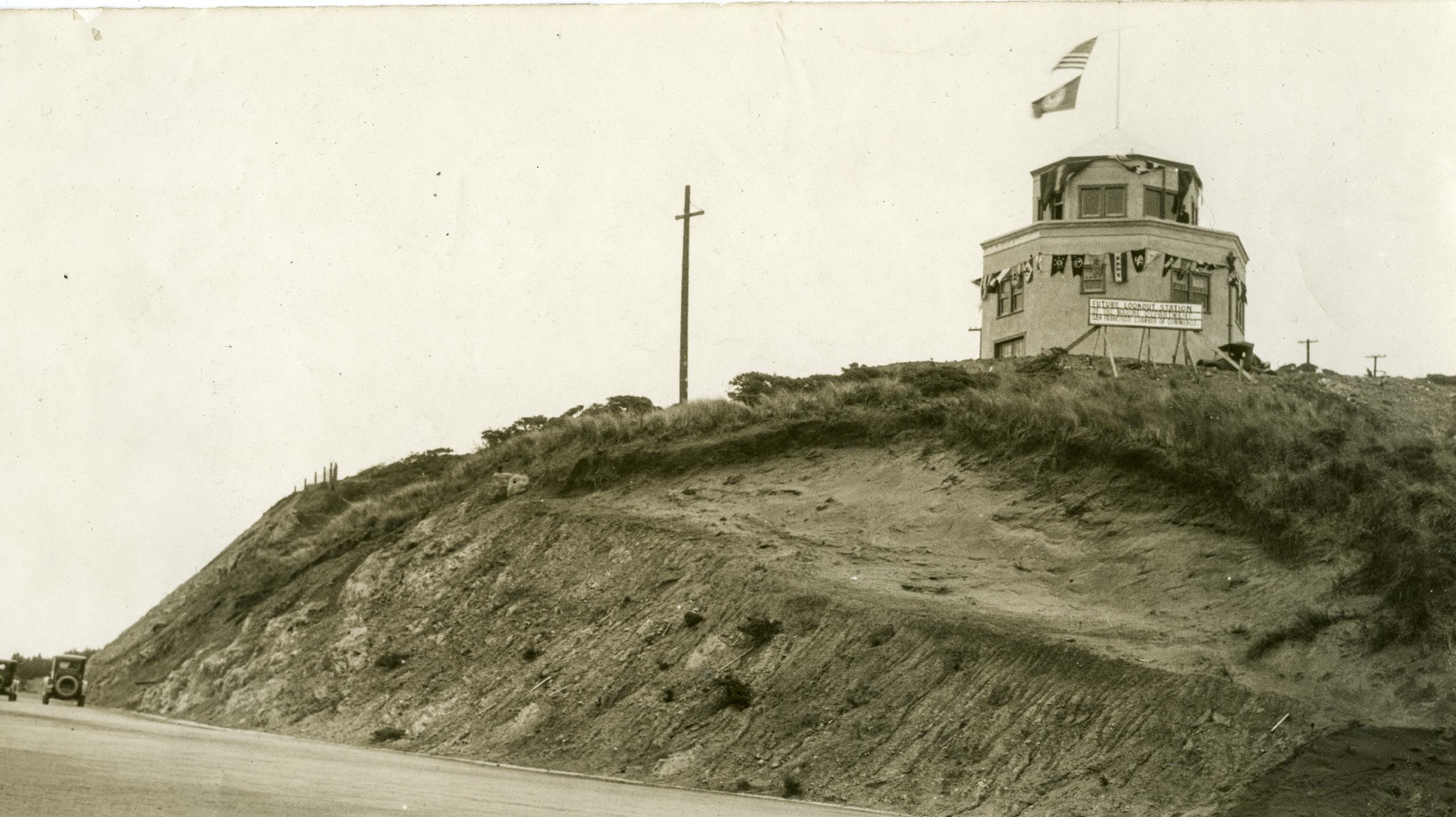
Marine Exchange Lookout building above Lands End, February 1927. (Courtesy of a Private Collector / wnp27.7895)
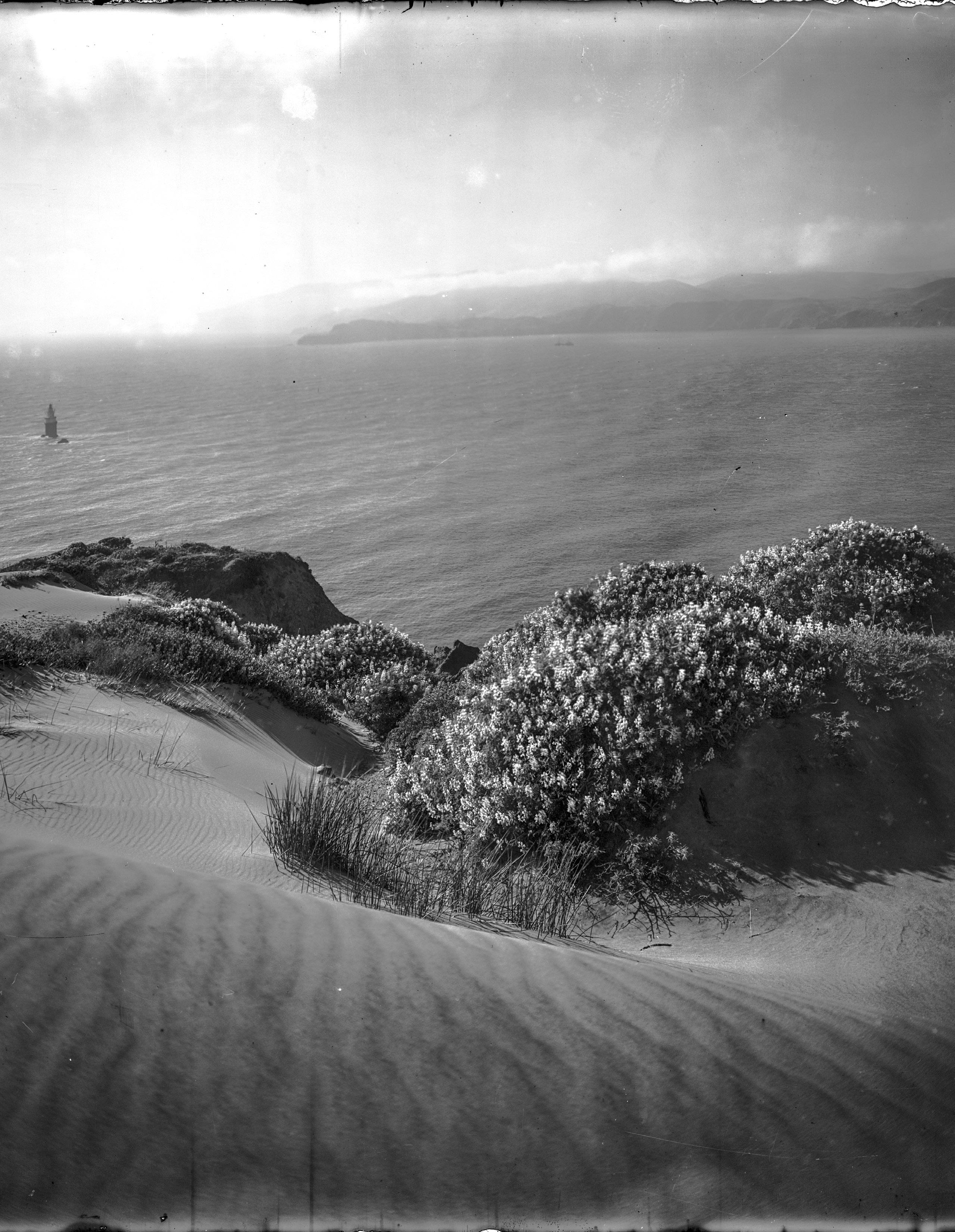 View north from Lands End, circa 1910.
(Photo by Willard Worden; courtesy of a Private Collector / wnp15.367)
View north from Lands End, circa 1910.
(Photo by Willard Worden; courtesy of a Private Collector / wnp15.367)
18 APR - JUN 2023
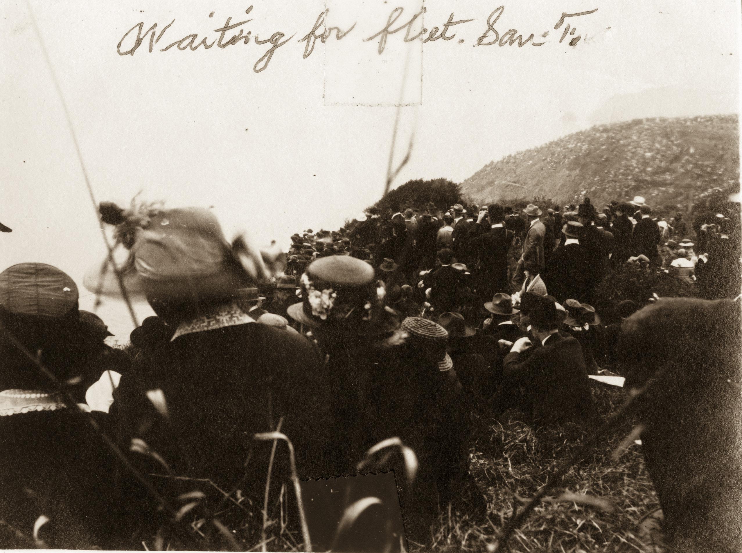
“Waiting for fleet” – spectators at Lands End watching the arrival of U.S. Navy ships, September 2, 1919. (Courtesy of a Private Collector / wnp27.1219)
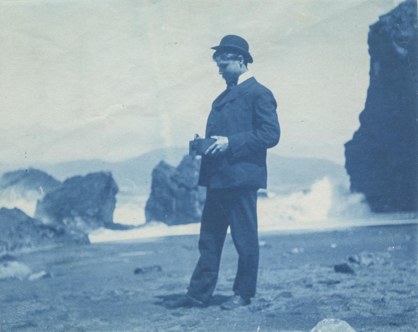
Cyanotype of a photographer at Mile Rocks Beach, circa 1900.
(Courtesy of a Private Collector / wnp27.6254)
outside lands 19
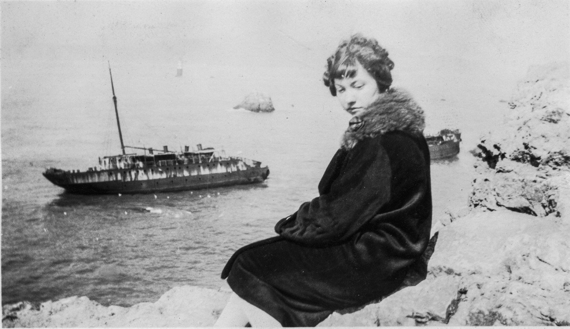
Unidentified woman and the wreck of the Lyman Stewart, circa 1927. (Courtesy of a Private Collector / wnp27.1311)
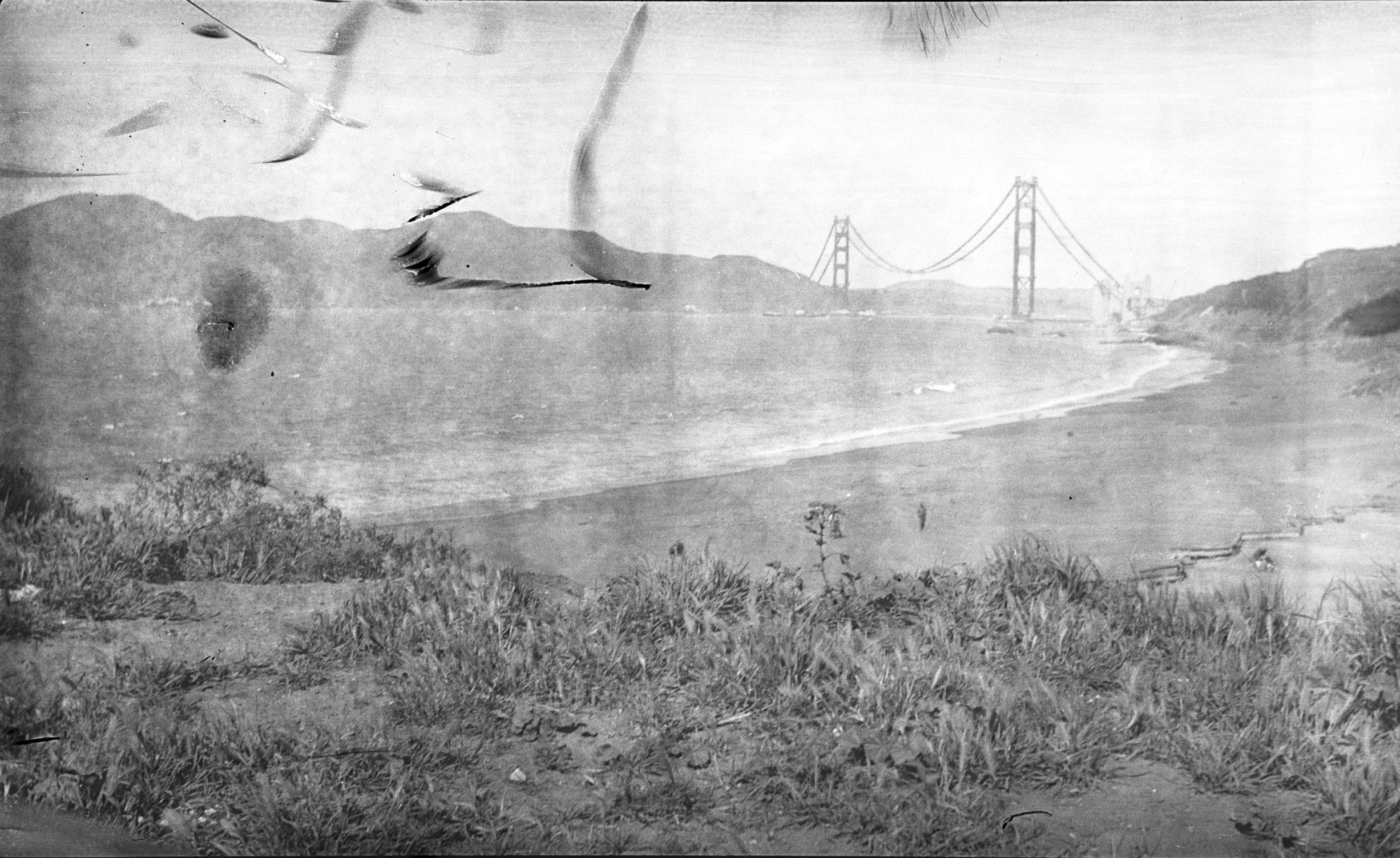
View from Baker Beach of the Golden Gate Bridge under construction, circa 1935. (Courtesy of a Private Collector / wnp14.0446)
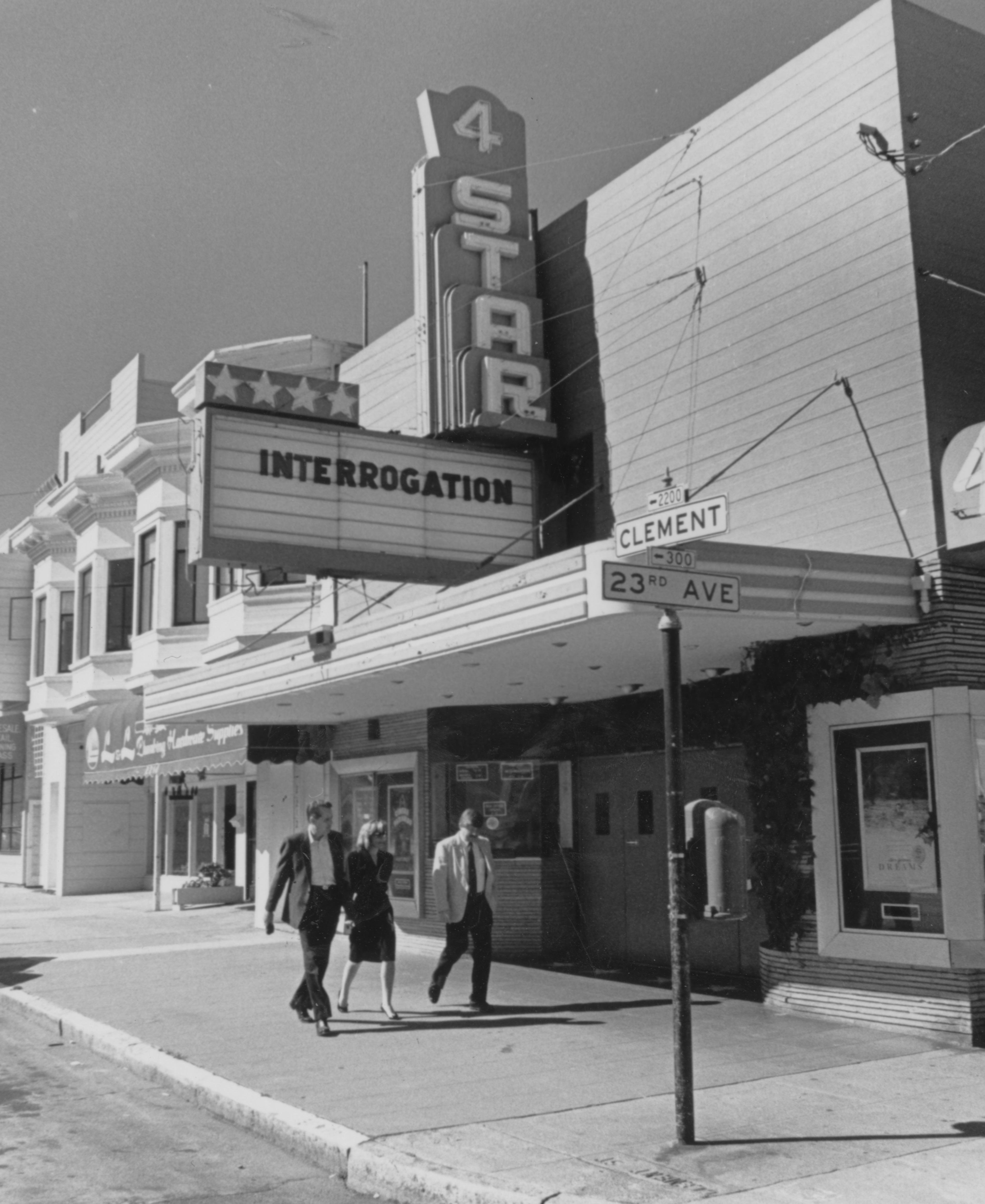
4 Star Theatre, Clement and 23rd Avenue, circa 1990. (Richmond Review Newspaper Collection;
20 APR - JUN 2023
courtesy of Paul Kozakiewicz / wnp07.00390)
Inside the Outside Lands
From where we sit, everyone is talking about the Whitney Family Totem Pole: the Cliff House’s solemn companion that we collectively purchased at auction from the Hountalases, the other family who had a major impact on the beloved and now long-shuttered restaurant. The Golden Gate National Recreation Area (GGNRA) has formally declined our offer to donate this monumental artifact to their museum collection, as did Musée Mécanique. Now that The Museum at The Cliff is closed, the GGNRA has requested the totem pole’s removal from their land with equal politeness. Understanding that this is no small feat for a nonprofit, they’re letting us work this out on a relaxed timeline, and we’re grateful that they continue to be supportive partners to us in this way.

Nonetheless, we do need to work it out; so, we’re now looking at alternatives. Ideally, we want the memory of the Whitney family and Chief Mathias Joe Capilano of the Squamish Nation in Western Canada, who carved the totem pole on commission, to remain and hold space on the west side. We want to see this piece stay alongside Great Highway in the environment it’s always known, closest to its original context. But we’re also mindful that it might make sense elsewhere. We’ve reached out to businesses along Ocean Beach, city officials, and members of the American Indian Cultural District, so that we can move forward with careful intention. We’re keeping an open mind, and all ideas are welcome as we work together to find the best permanent solution to this unique cultural heritage conundrum.
Ultimately, what matters most is that the work we do keeps these memories alive. Places change and totem poles may move, but history is constant even when bending to contemporary needs. The best way to ensure our collective memory is preserved is by recording and sharing each other’s stories. We do that weekly with our “Outside Lands San Francisco” podcast (which recently broadcast its 500th episode), and with oral histories. Thanks to the help of volunteer Sarah Wille, we’re banking one of these each month, with the likes of Thomas Beutel, Kevin Brady, Reino Niemela, Jr., Bart Schneider, and Lope Yap, Jr. Everybody's viewpoint is equally valuable in putting together the pieces of the past. Are you interested in being the subject of an oral history interview, or do you know someone who should have their story preserved? Let us know! Email Nicole Meldahl at nicole@outsidelands.org
We’re also sharing stories through exhibitions. You’re getting a sneak peek into our brand new rotating OpenSFHistory gallery in this issue, but there’s more! WNP board member Lindsey Hanson refreshed the front windows at the WNP
Clubhouse with an exhibit that takes her article from our last issue on Golden Gate Park’s windmills to the next level. You can visit it 24/7, since it’s entirely accessible from outside (and online). We’re also preparing a special program at one of our favorite neighborhood theaters to highlight Lindsey’s work and the personal histories it illuminates.
We’re grateful to host many of our programs at the 4 Star and Balboa Theaters this year. The WNP Clubhouse is filled with the Cliff House Collection and other priceless treasures, which makes it nigh impossible to hold seated lectures in the space these days. In looking for alternative west side venues, CinemaSF and the Internet Archive both answered our call. And honestly, it just makes sense to present neighborhood history to our neighbors in neighborhood locales. We look forward to seeing you over a bucket of popcorn!
outside lands 21
Whitney Family Totem Pole, 1962. (Courtesy of David Gallagher / wnp12.0106)
Western Neighborhoods Project
1617 Balboa Street
San Francisco, CA 94121 www.outsidelands.or
Historical Happenings
Thurs June 15 at 6:30pm: Restoring the Windmills
We’re celebrating Golden Gate Park’s windmills with a panel discussion and film screening. You’ll hear all about the restoration efforts that brought the windmills back to life, followed by a viewing of the Charlie Chaplin short comedy, “A Jitney Elopement,” shot on location in San Francisco in 1915. $15 for members, $25 for non-members. Location: 4 Star Theater, 2200 Clement Street.
Thurs June 22 at 6pm: A Natural History of San Francisco
Environmentalist, historian, and photographer Greg Gaar will give an illustrated presentation on the history of San Francisco’s natural features, and how they’re being preserved. This event is online only and free! Access to the Zoom meeting will be emailed to you when you register online.
Sat June 24 at 10am: Lincoln Manor History Walk
Join historian and author Richard Brandi for a history walking tour of the Lincoln Manor residence park. $10 for members, $20 for non-members; tour lasts 2 hours and the meeting location will be emailed to you when you purchase tickets.
outsidelands.org/events
Not a WNP Member?
Outside Lands magazine is just one of the benefits of giving to Western Neighborhoods Project. Members receive special publications as well as exclusive invitations to history walks, talks, and other events. Visit our website at outsidelands.org, and click on the “Become a Member” link at the top of any page.
g First Class Mail U.S. Postage San Francisco CA Permit No 925 PAID
