Cradle of rivers That the area of western Ohio between Toledo and Dayton is a source for so many rivers owes to its geological history. Two million years ago, before the start of the last ice age, the giant Teays River flowed from North Carolina toward the north and west all the way to what is now Illinois, including roughly the course that the Scioto and upper part of the Wabash take today. That one long river and its watershed drained most of the Midwest. But as the ice age dawned, glaciers smothered the Teays — the reflow created, among others, the Ohio River. “As the ice sheets were retreating, it reconfigured the surface drainage. You will see the divide between the Great Lakes drainage and the Mississippi drainage. You have a massive watershed divide,” says Wright State University Professor Stephen Jacquemin, an expert on wetlands. The glaciers also left behind rich underground water reservoirs that still bubble up to the surface, as well as a patchwork of ponds and lakes. All of those serve to birth and feed the many trickles that come together and form the cricks, streams, and, eventually, the mightiest of rivers.
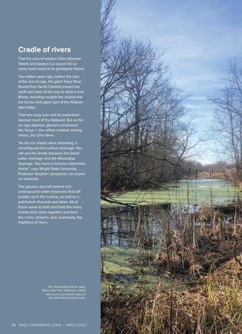
The Great Miami River lazily flows near Port Jefferson, which was once a promient stop on the Miami-Erie Canal route.
38 OHIO COOPERATIVE LIVING • MARCH 2020