Annex 8 - Detailed analysis of the at-risk territories
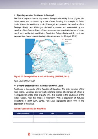
Opening on other territories in Senegal The Dakar region is not the only area in Senegal affected by floods (Figure 26). Urban areas are concerned by a risk of river flooding, for example, in SaintLouis, Matam (located in the north of Senegal, and prone to the overflow of the Senegal River), and Kedougou (located southeast and concerned by the overflow of the Gambia River). Others are more concerned with issues of urban runoff such as Kaolack and Fatick. Finally the Saloum Delta and St. Louis are exposed to a risk of coastal flooding. (Gouvernement du Sénégal, 2010)
Figure 27: Senegal cities at risk of flooding (UNISDR, 2013) Port Louis (Mauritius) General presentation of Mauritius and Port Louis Port Louis is the capital of the Republic of Mauritius. The latter consists of the main island, Mauritius, and several peripheral islands (the largest of which is Rodrigues) for a total area of 2,040 km2. It is located in the south-east of the Indian Ocean, near the Tropic of Capricorn. With a population of 135,000 inhabitants in 2014 (CIA, 2015), Port Louis represents about 10% of the population of Mauritius. Table5: General data on Mauritius Type of Information
Value
Date
Mauritius population
1.3 Million inhabitants
2014
Share of the urban population
40%
2014
Source Prevention Website Prevention Website
82 | TECHNICAL REPORT – No.35 – NOVEMBER 2017