NOVEMBER 2025
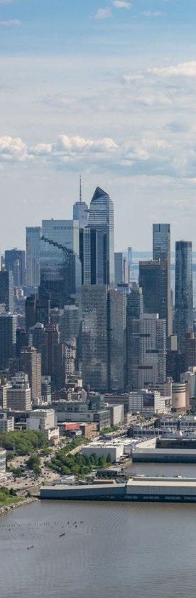
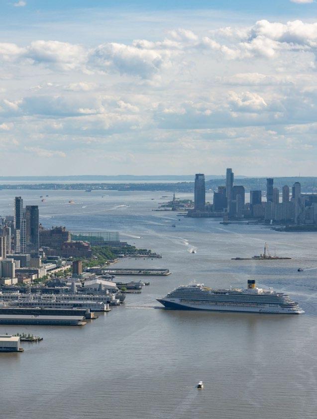
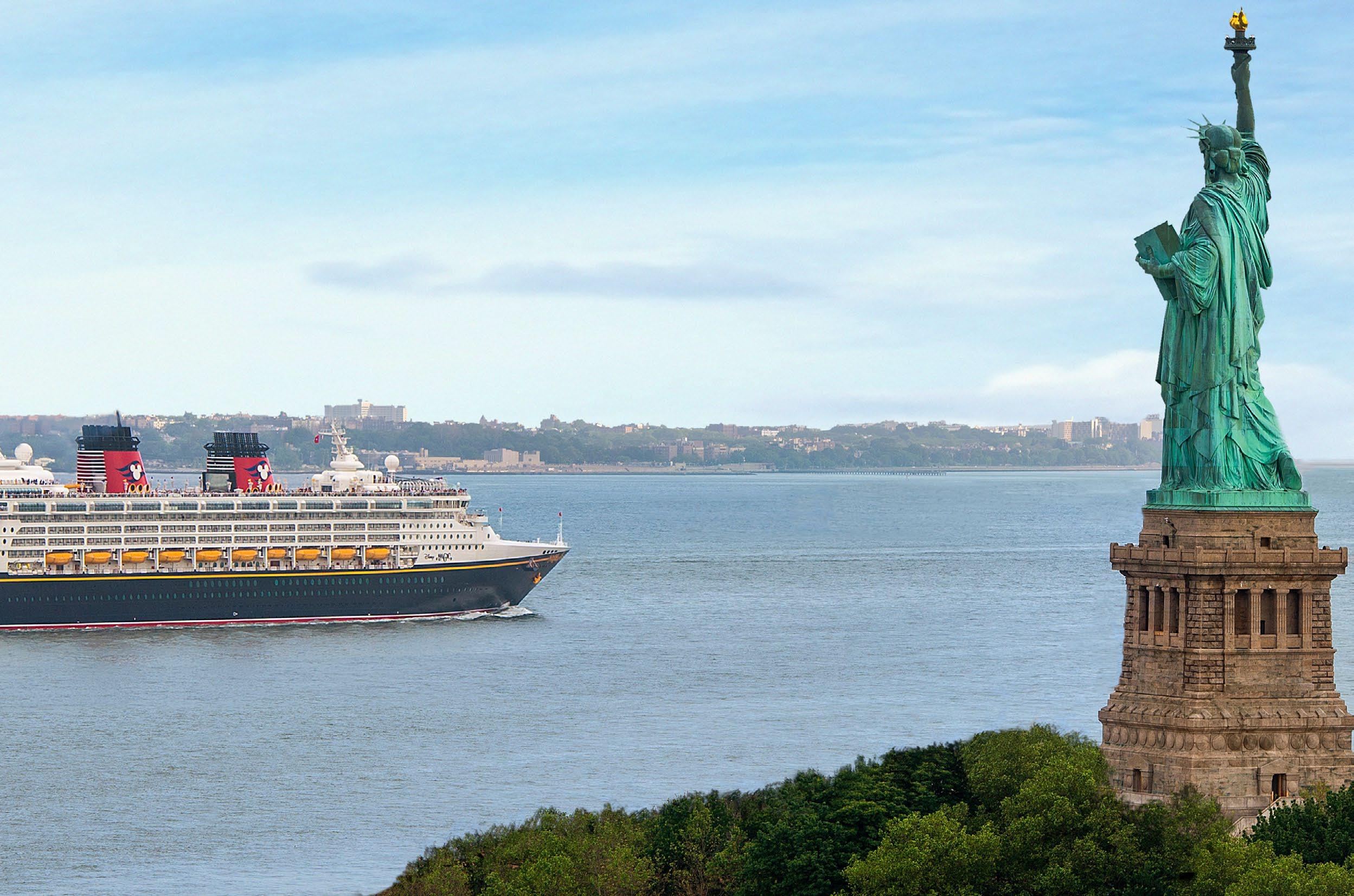
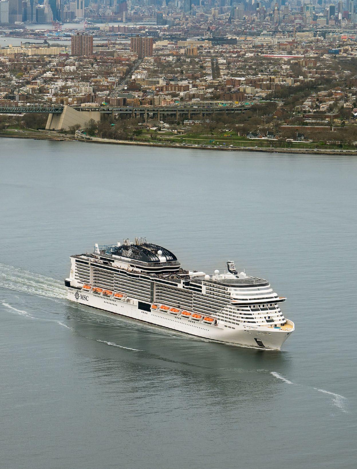
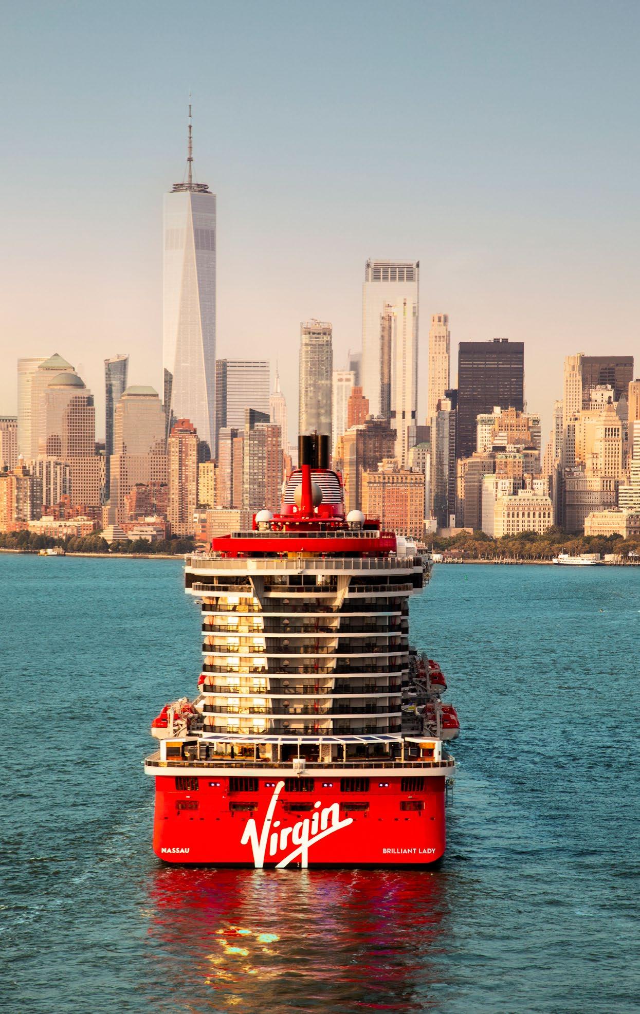
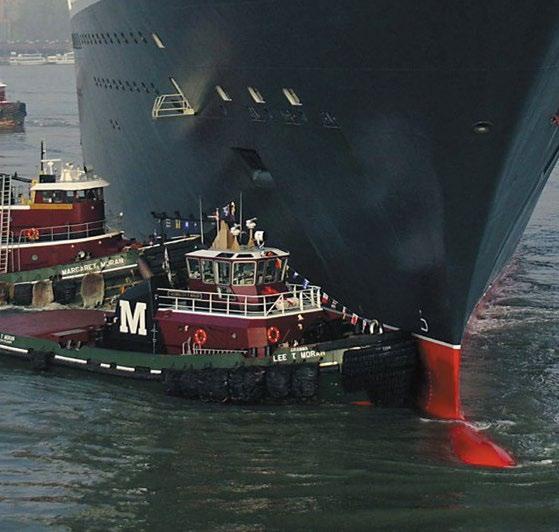
For nearly a century, the Manhattan Cruise Terminal (MCT) has stood as a vital gateway connecting the world to New York City. From the magnificent ocean liners of the past to today’s premier cruise vessels, MCT has served as the only entry point for global visitors by sea into Manhattan’s West Side, offering an indelible impression on the record number of passengers who come through each year.
The terminal has continually reinvented itself to meet the ever-evolving needs of the maritime industry and adapted in moments of economic, public health, and geopolitical crises. With each wave of change, MCT has not only endured but thrived, cementing its role as an engine of economic growth and opportunity for New York City.
Today, we face another, more critical juncture. MCT’s aging infrastructure can no longer keep pace with modern cruise ships, making efficient and sustainable operations increasingly difficult. This growing operational strain has come at the expense of our neighbors. The current facility is constrained in its ability to meet longstanding community priorities like shore power, public access, and safe urban integration. Without decisive action, we risk losing vital economic opportunities and our standing as a global maritime center, and we undermine our commitment to being a responsible neighbor to the surrounding communities.
This Master Plan is a transformative effort that marks a new chapter in New York City’s maritime legacy. As President and CEO of the New York City Economic Development Corporation (NYCEDC), I have witnessed firsthand how our city’s waterfront continues to be a driver of economic growth, resilience, and innovation. The redevelopment of MCT is not just an investment in infrastructure; it is a commitment to supporting
the future of tourism, job creation, and environmental stewardship for generations to come.
Our Master Plan sets out an ambitious vision: to replace the existing structures and rebuild MCT from the ground up to better serve the needs of the community and the industry. These infrastructure improvements will reduce emissions, meet the demands of the industry, and deliver a safer, more accessible, and welcoming waterfront for all New Yorkers. By electrifying the terminal, we will reduce vessel emissions, improve local air quality, and align with the City’s broader decarbonization and sustainability goals.
Informed by extensive community engagement, the heart of this plan lies in redeveloping the site into a truly public asset. The Plan will create a porous site that enables the public to connect with the terminal and waterfront through vibrant, accessible public spaces and improved bikeways and walkways. We are leveraging our waterways for both passenger and freight movement, and activating the waterfront with new amenities, connections, and opportunities.
The path ahead is ambitious, but achievable. Realizing the full vision of this Master Plan will require collective effort among all stakeholders to meet diverse aspirations and citywide infrastructure needs. With your support, we will create a world-class terminal that reflects the best of New York City–innovative, inclusive, and forward-thinking. Thank you for your commitment to New York City’s waterfront and for being a part of this historic transformation.
Sincerely,
Andrew Kimball President & CEO New York City Economic Development Corporation
Customer demand for cruising is at an all-time high and this sector, known for its continuous innovation, requires New York City to match its ambition. The gap between the terminal’s original, 90-year-old infrastructure and the demands of the modern maritime industry has never been wider. This presents a unique moment to revitalize this historic asset and uphold its traditional role as an engine of economic growth and opportunity for New York City.
The imperative for action is clear in two critical areas. First, the condition and layout of the terminal’s infrastructure imposes operational constraints and challenges to urban integration. Pier 92 is already inoperable, and Piers 88 and 90, supported by their original 1930s timber piles, are at serious risk of soon meeting a similar fate. The ground transport area and viaduct no longer provide adequate staging and queuing capacity, contributing to congestion and overflow that disrupts the adjacent West Side Highway. Further, the viaduct, combined with security fencing around the entire site, physically isolate the facility from the Hell’s Kitchen neighborhood. These mounting constraints create an opportunity to reimagine the terminal as a more integrated and publicly accessible urban asset.
Second, the continuous introduction of new vessels now challenges the viability of efficient, sustainable
1M PASSENGERS ANNUALLY
MCT is North America’s 5th largest homeport, with over 60M people living within 300 miles of NYC.
$500M+
ANNUAL ECONOMIC ACTIVITY FOR NYC
The cruise industry supports 3,000 local jobs and generates up to $600 per passenger in local spending.
cruise operations. The average size of cruise ships has been steadily increasing, and advancements in vessel technology, including shore power capabilities, are fundamentally reshaping operational demands. This evolution places increasing strain on the terminal’s aging infrastructure, requiring comprehensive modernization to ensure operational efficiency, environmental compliance, and futureready sustainability.
This Master Plan is a strategic vision to ensure that MCT balances being a good neighbor with remaining compliant and competitive to service existing and future fleets. Anchored by comprehensive analyses and assessments, this document details the capital projects required to deliver on the needs of the community and recapture New York City’s leadership position in the regional cruise market for the decades to come.
4.8% COMPOUND ANNUAL GROWTH RATE SINCE 2000
Global passenger volumes are hitting all-time highs post-COVID-19, showing the industry’s resilience against economic, public health, and geopolitical crises.
1935 THE TERMINAL BEGAN OPERATIONS
Originally built as the “Passenger Ship Terminal” for steampowered ocean liners, MCT has continually adapted to meet the everevolving needs of the maritime industry.
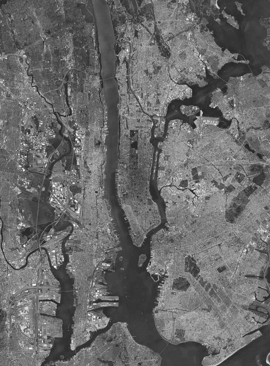
Source: Google Earth MANHATTAN CRUISE TERMINAL
92 (Inactive)

BERTH 5 (Inactive)
BERTH 3 (Inactive)
BERTH 2
BERTH 1
Building off of NYCEDC’s extensive experience operating the Manhattan Cruise Terminal, and consulting with community stakeholders, cruise lines, and industry experts, NYCEDC has identified a series of key goals and objectives for the future of MCT. These goals are necessary to balance the terminal’s need to address longstanding community priorities, while simultaneously keeping up with the evolution of the cruise industry. Accordingly, the planning process involved robust public engagement to ensure the support, safety, and well-being of MCT’s neighbors, users, and maritime workers.
Accommodating modern cruise vessels is at the heart of NYCEDC’s vision for the terminal. By constructing longer piers with three wider, more navigable berths and a centralized passenger facility, the newly built terminal will be equipped to accommodate both current and future cruise ships. These specific infrastructure improvements address the industry’s evolving needs while remembering environmental effects and responsibilities.
Additionally, the Plan will finally ensure waterfront resilience by meeting FEMA flood elevation standards and enhancing protection against future sea level rise and severe weather events.
The Plan must integrate the terminal’s secure zones with the surrounding public areas, using architectural and landscape elements to enhance both accessibility and visual appeal. Different modes of transportation will be effectively separated by widening the Route 9A Bikeway/ Walkway, segregating pedestrians and cyclists, and implementing grade separation between the West Side Highway and the terminal.
Complementing these public access improvements, the Plan must also focus on elevating the passenger experience. By offering a comfortable, reliable, and engaging environment, the terminal will create a welcoming atmosphere for visitors that encourages repeat visits.
3 4 5
A critical component of the industry’s decarbonization efforts, and a cornerstone of this Master Plan, is the implementation of shore power availability for all vessels calling MCT. This will allow vessels to connect directly to the onshore New York City electric grid and turn off their auxiliary engines while berthed.
The terminal will also strive to achieve industry-leading sustainability by incorporating on-site power generation and full electrification of the terminal building. Finally, the site is envisioned for multiple waterdependent uses to maximize its economic and community value, driving local job creation and sustained economic activity.
The Plan must preserve and expand jobs tied to a thriving, working waterfront. This will require strategic investment in infrastructure and a diversification of operations to ensure longterm employment for maritime workers and support for the broader ecosystem of waterfront trades. Crucially, the Plan must transform the terminal, beyond traditional cruise operations, into a dynamic multi-modal hub that fully leverages New York City’s waterways. The development of a dedicated Blue Highways site will establish a critical entry point to enable waterborne delivery of goods to Manhattan’s West Side (including cruise provisioning), reducing truck emissions and congestion while strengthening supply chain resilience.
While detailed facility design will occur in a future stage of the project, the terminal’s unique location on Manhattan’s West Side necessitates thoughtful, context-sensitive design. The facility is strategically located between significant civic anchors, including the Intrepid Sea, Air & Space Museum and Hudson River Park. The design must strengthen the terminal’s relationship with its neighbors through wellplanned approaches: integrating with the north-south Route 9A Bikeway/Walkway to ensure safe movement along the waterfront, and maintaining east-west view corridors along W 49th and W 51st Streets to reinforce visual and physical connections between the city and the waterfront.
The Manhattan Cruise Terminal stands as a testament to the relentless spirit of innovation and transformation that defines New York City.
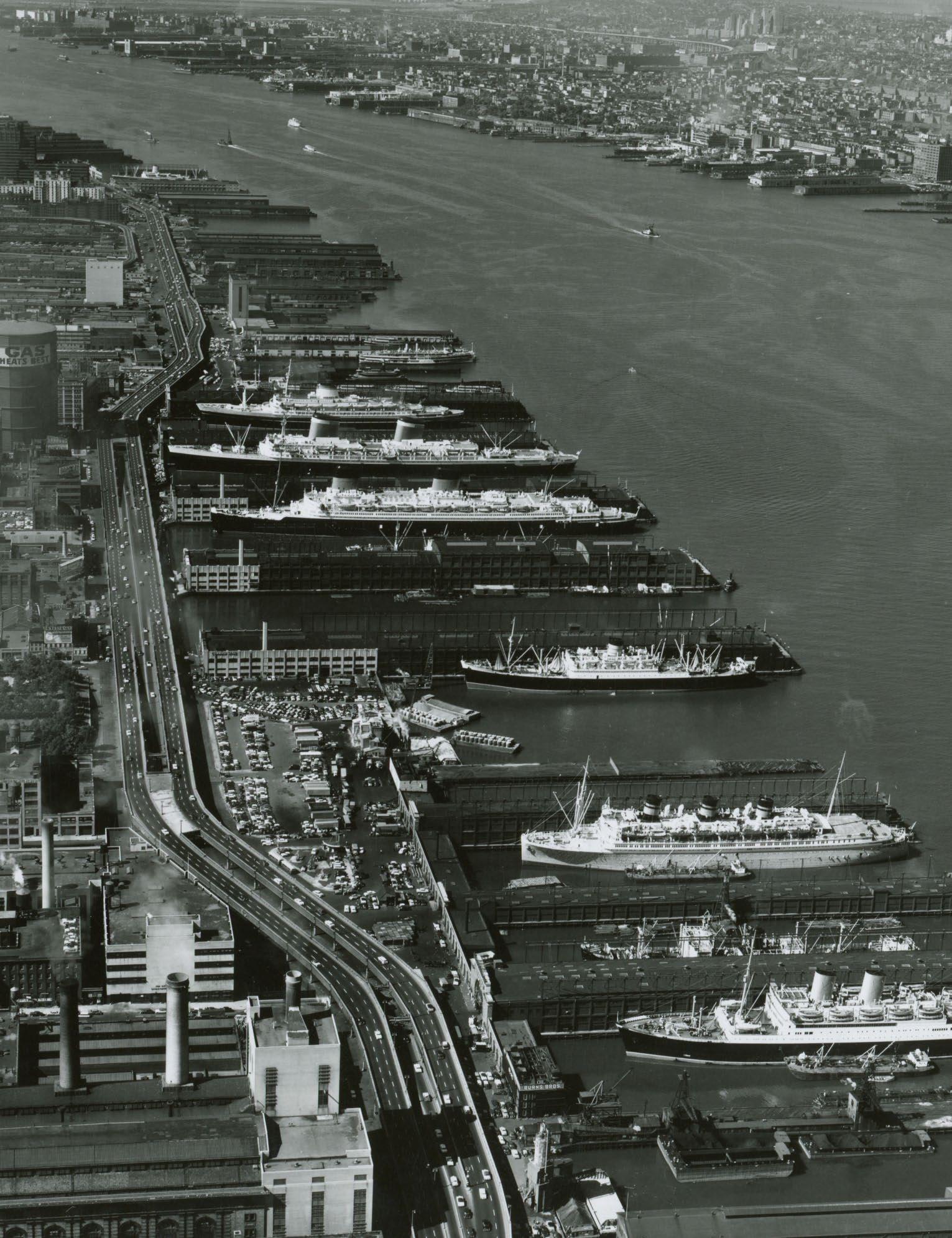
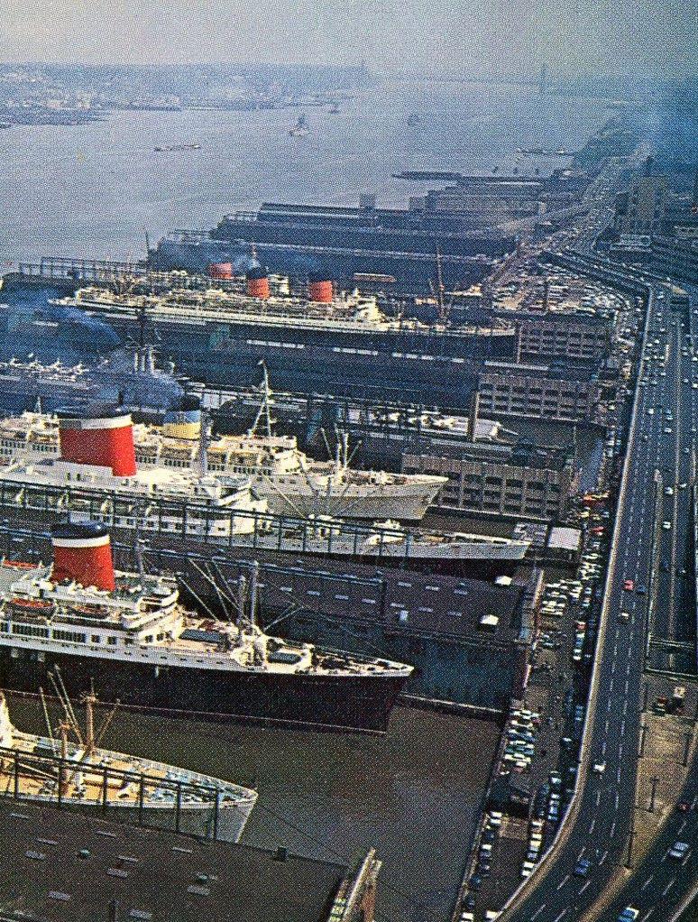
From its origins, ninety years ago, the iconic terminal has continually reinvented itself to meet the everevolving needs of the maritime industry and the City. With each wave of change, the terminal has not only endured, but thrived, becoming an indispensable asset to the region. As a vibrant hub of activity and opportunity, the terminal has welcomed passengers from all over the world, enhancing the diversity and strength of the regional economy.
Construction of the original terminal began in 1932, with Piers 88, 90, and 92 opening between 1935 and 1936. Mayor Fiorello La Guardia spearheaded the project as part of a larger citywide infrastructure development plan. The facility, known then as the Passenger Ship Terminal, was constructed to serve the world’s largest ocean liners at the time, including the Normandie and Queen Elizabeth. To accommodate these vessels within the US Pierhead Line, the bulkhead was pushed eastward, with Manhattan bedrock being excavated to allow for adequate berthing space.
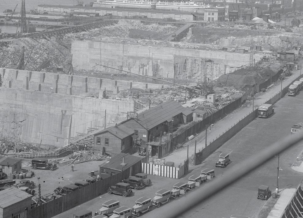
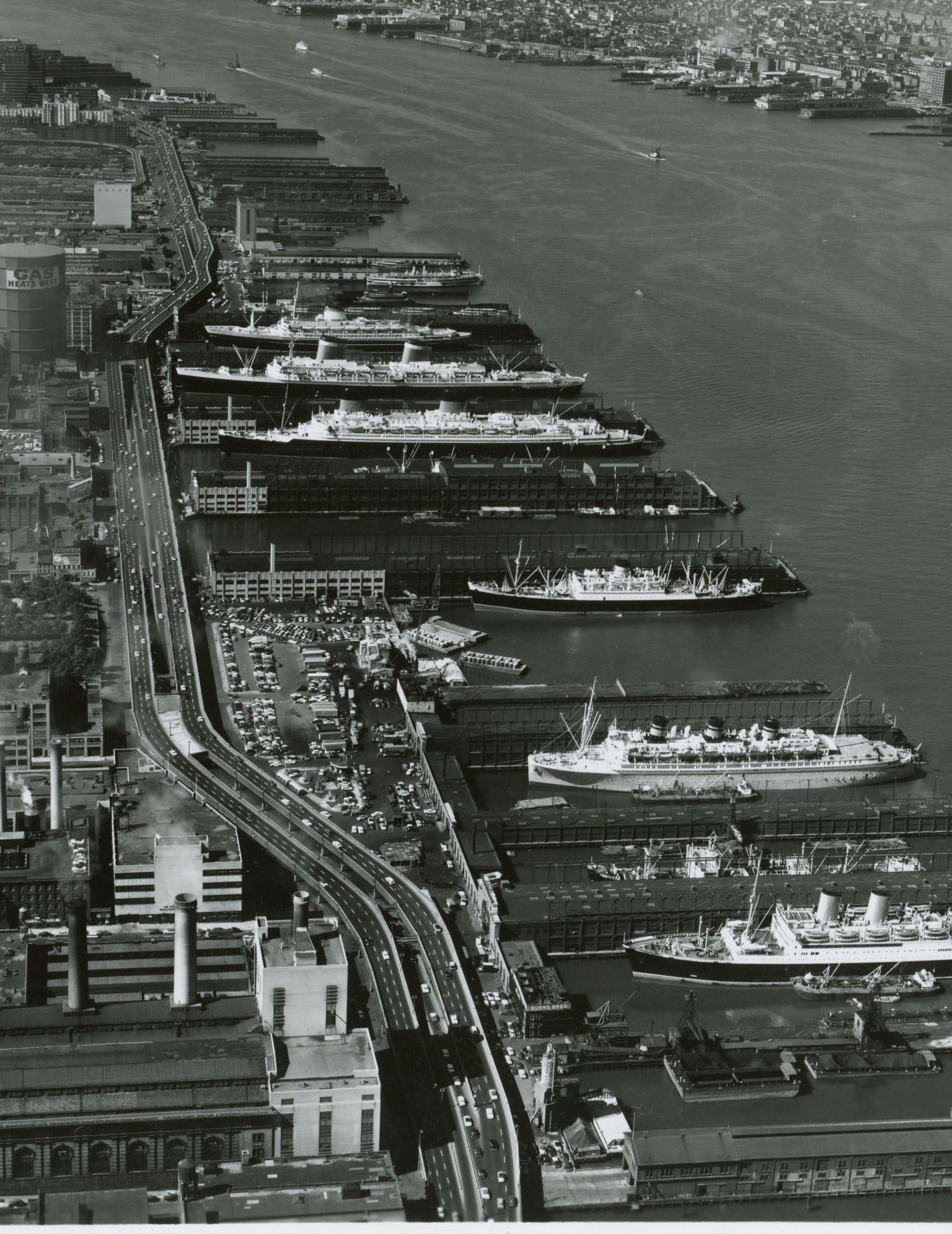
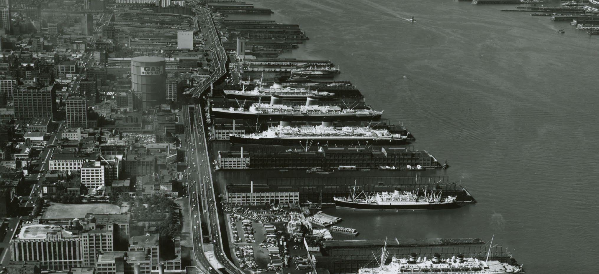
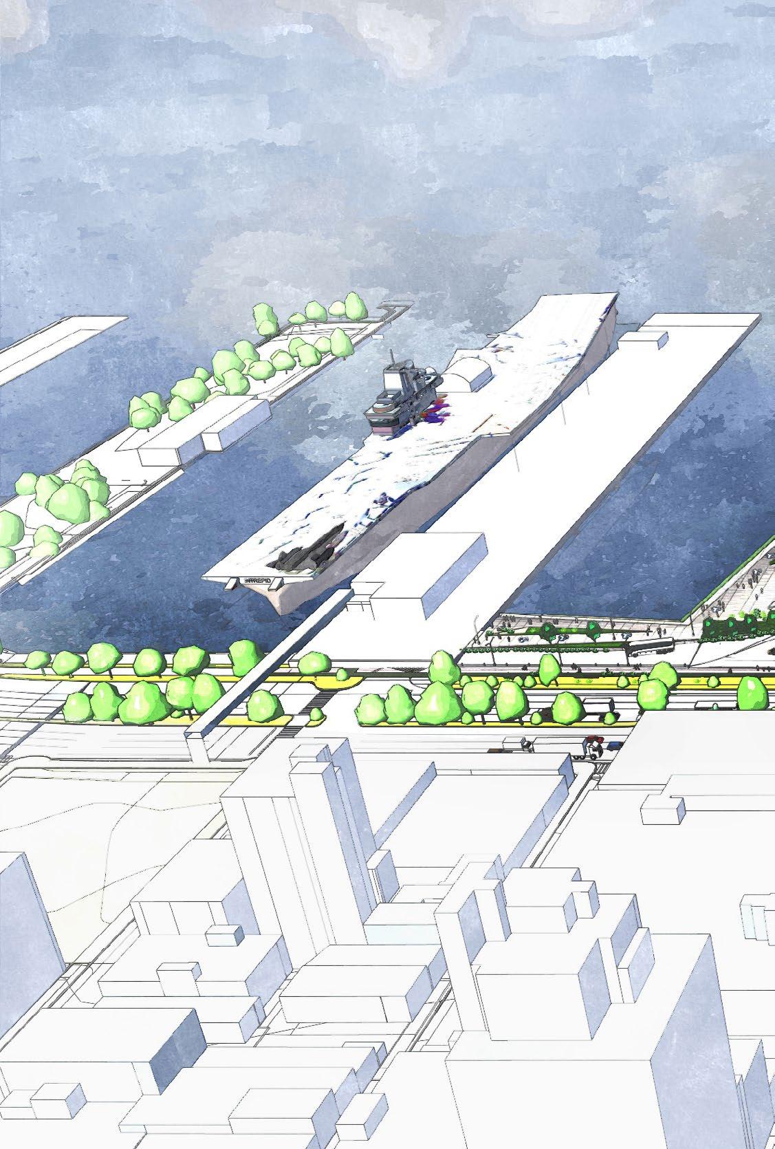
Background Image: In the 1950s, the terminal still operated all original piers and berths, handling transatlantic liners, leisure ships, and naval warships like the aircraft carrier at Pier 90. (Source: South Street Seaport Museum)
TIMELINE
1930s 1940s 1950s-60s
TRANSATLANTIC GATEWAY
JET AGE DECLINE
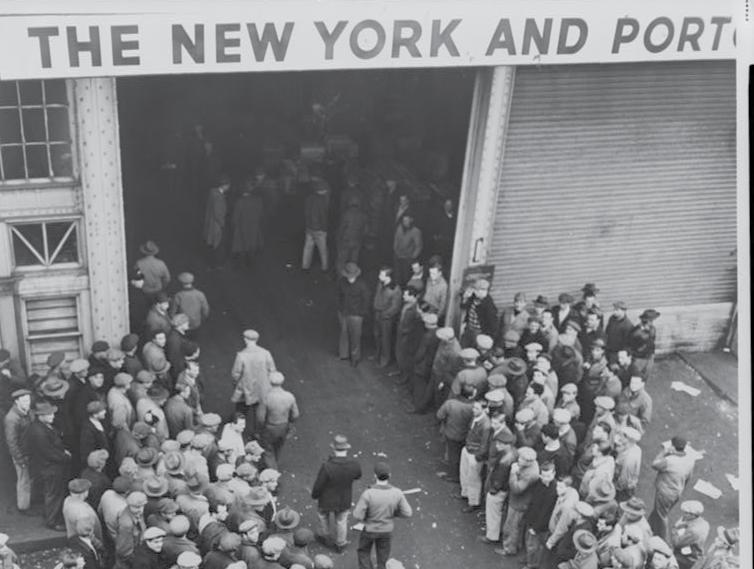
World War II brought the terminal’s early success to a halt, with the outbreak of war in Europe ceasing nearly all civilian transoceanic voyages. Despite this, the terminal remained an essential piece of infrastructure, transiting American soldiers to and from Europe.
In the years following the war, the terminal went through a difficult period of transition. The advent of jet travel in the 1950s and 1960s, led to a sharp decline in transoceanic transport, with steam-powered vessels struggling to compete with the new, faster aircraft.
In the 1960s, to avoid industrywide collapse, many steamship lines repurposed their fleets to serve leisure cruise passengers instead. In response to this growing market, the City and the Port Authority of New York & New Jersey (PANYNJ) began a redevelopment process to accommodate the new cruise vessels and their passengers at MCT. This included renovations for an inshore platform between piers and a new viaduct for vehicular access. Financial challenges led to the project taking more than a decade to complete, with the new terminal facilities finally opening in 1974.
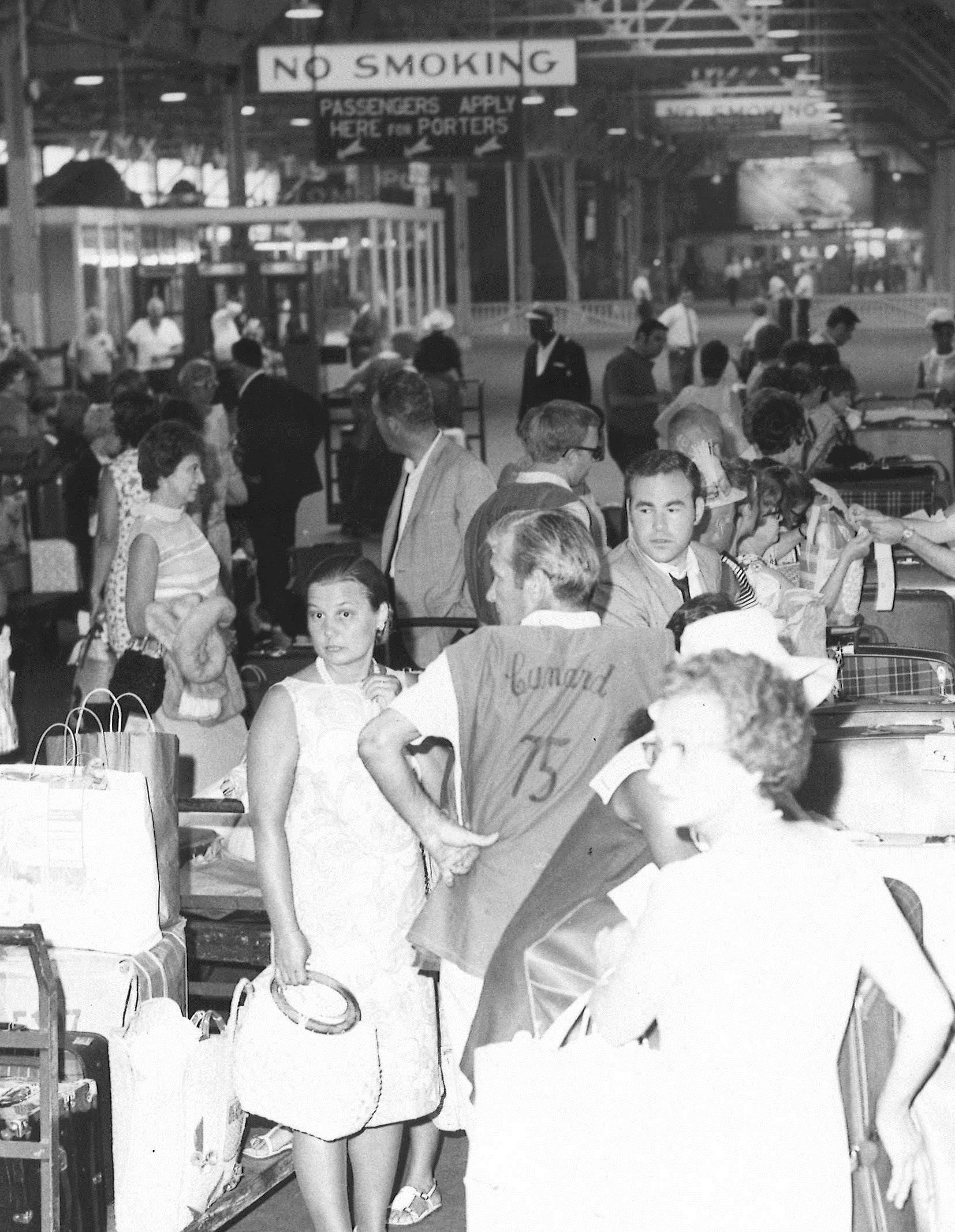
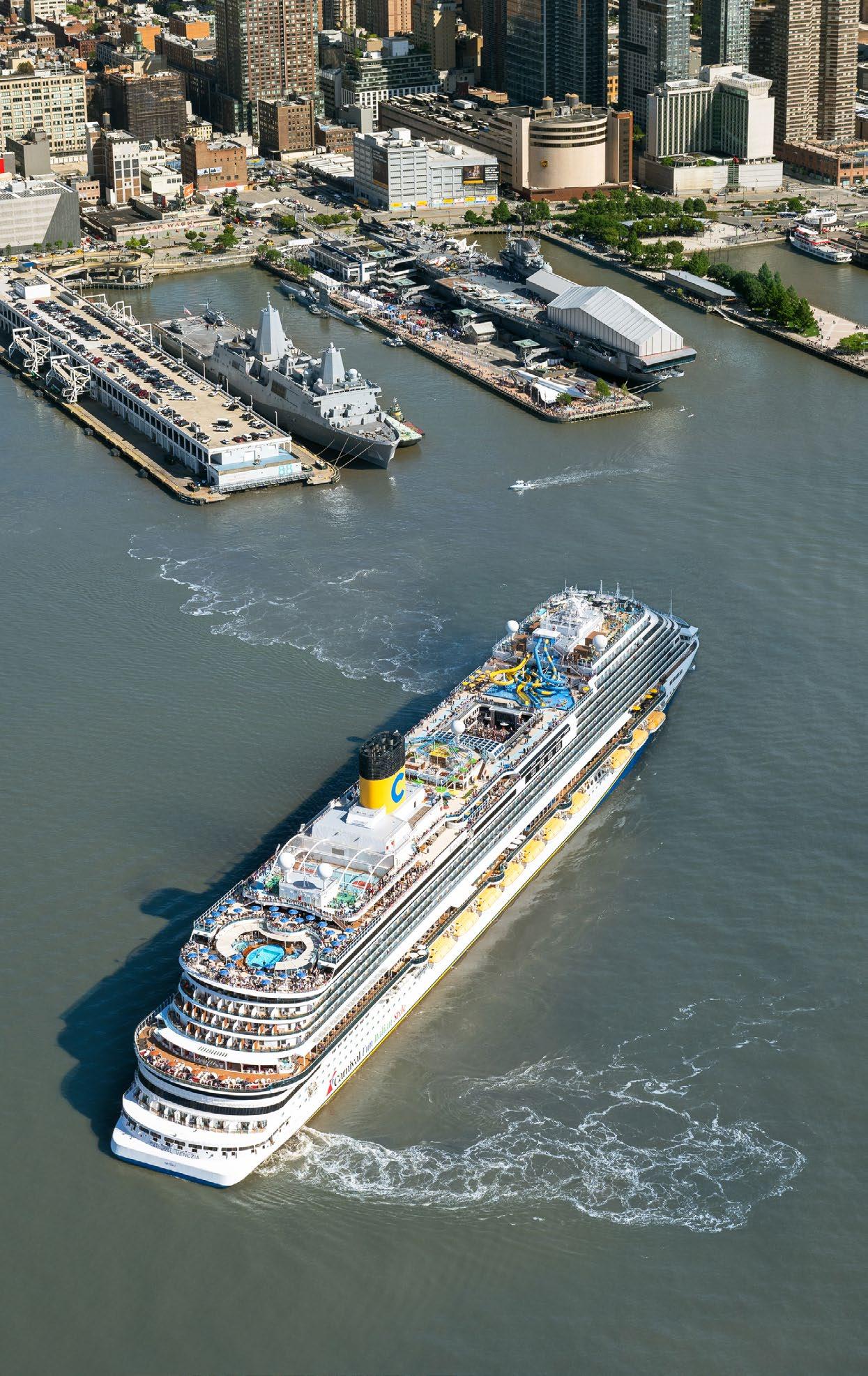
Through the rest of the 20th century, the terminal enjoyed a period of growth and heavy utilization. New markets contributed to this growth, with the Caribbean and Bermuda becoming popular and affordable destinations. Since 1988, the terminal has also proudly hosted Fleet Week—a citywide celebration honoring the Sailors, Marines, and Coast Guardsmen who serve in the US sea services. Nearly every year since, vessels from the US Navy, Marine Corps, and Coast Guard have docked at MCT, welcoming the public aboard for tours and community events.
The 2000s were another period of transition for the terminal. Due to lack of investment in the preceding years, cruise business shifted away from MCT, drawn by the newer infrastructure and expanded operational capabilities across the river in New Jersey. In 2003, operations of the terminal
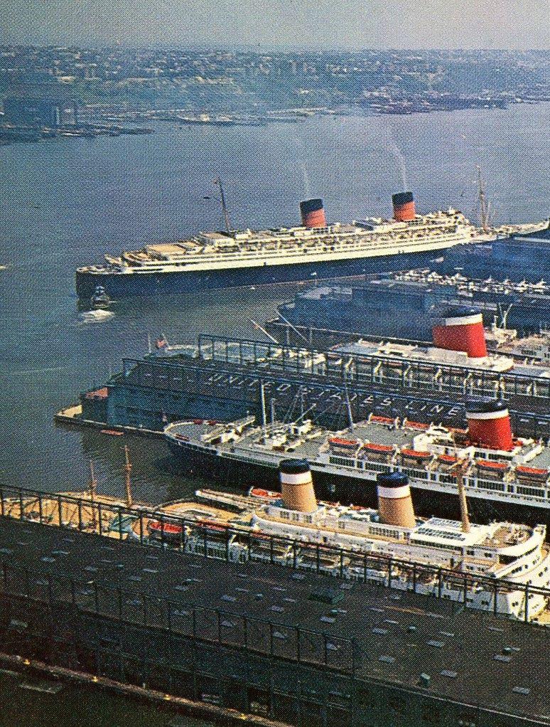
were transferred from PANYNJ to the City of New York, with its administration assigned to NYCEDC. Over the following decade, NYCEDC, through the City, invested $200 million to renovate and modernize Piers 88 and 90. Alongside upgrades at MCT, the City expanded its cruise infrastructure with the opening of a second terminal in Brooklyn in 2006. This strategic investment ensured berth availability during MCT’s renovation and allowed the port to accommodate larger vessels, such as Cunard’s Queen Mary 2.
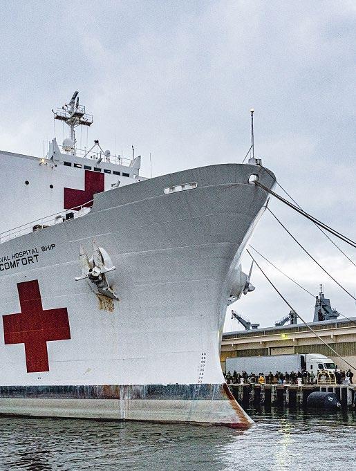
In 2020, the COVID-19 pandemic brought cruise operations at the terminal to a halt, with the federal government suspending all cruise activity in the US. Despite the 19-month No Sail Order, the terminal played a critical role in the government’s pandemic response. Just as it had in World War II, MCT served as a strategic
point of service, marked by the redeployment of the US medical vessel USNS Comfort at the terminal, which provided support to the larger New York City and New Jersey medical systems. The pandemic was immediately followed by a travel boom in 2022, leading to near-record passenger throughput at the terminal.
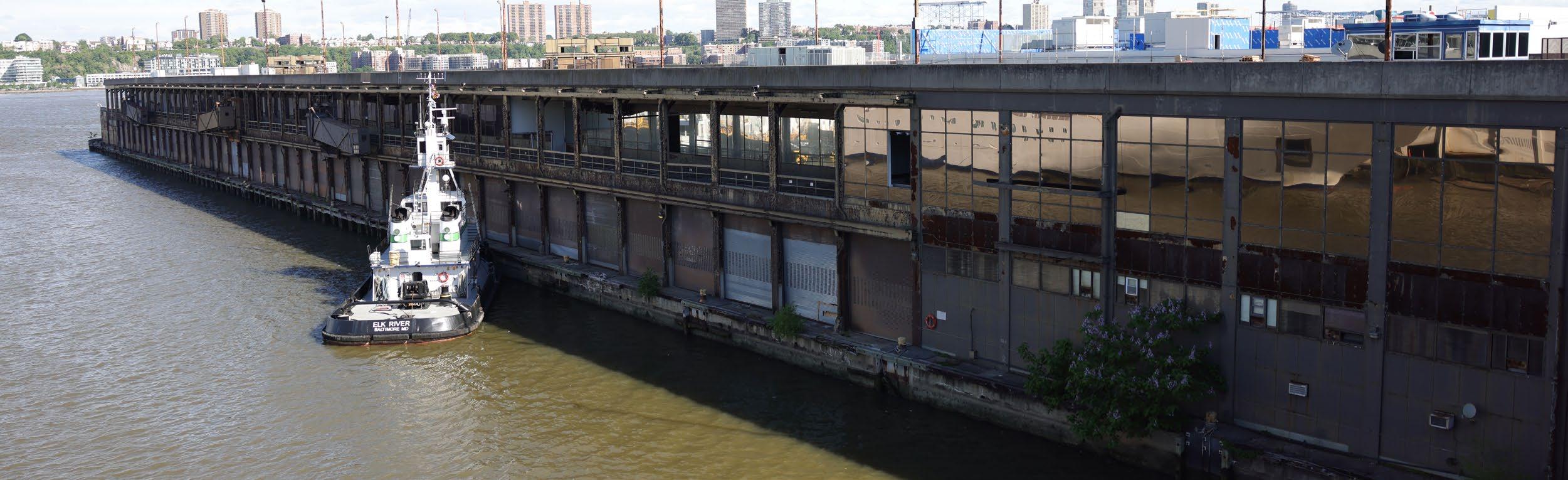
The terminal’s illustrious 90-year history demonstrates its resilience, adaptation, and unwavering significance. From the grandeur of luxury liners to its pivotal roles in times of crisis, the terminal has been a steadfast pillar in New York City’s maritime landscape. Today, the terminal stands at another critical juncture. Its aging infrastructure has reached the end of its useful life and is severely strained by the demands of the modern maritime industry, leaving the City with limited options for its future.
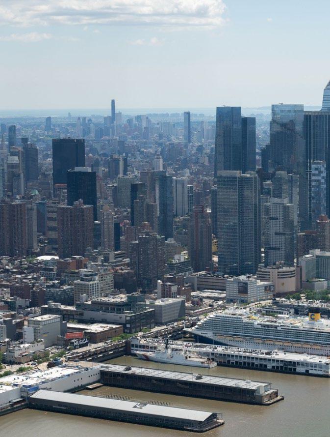
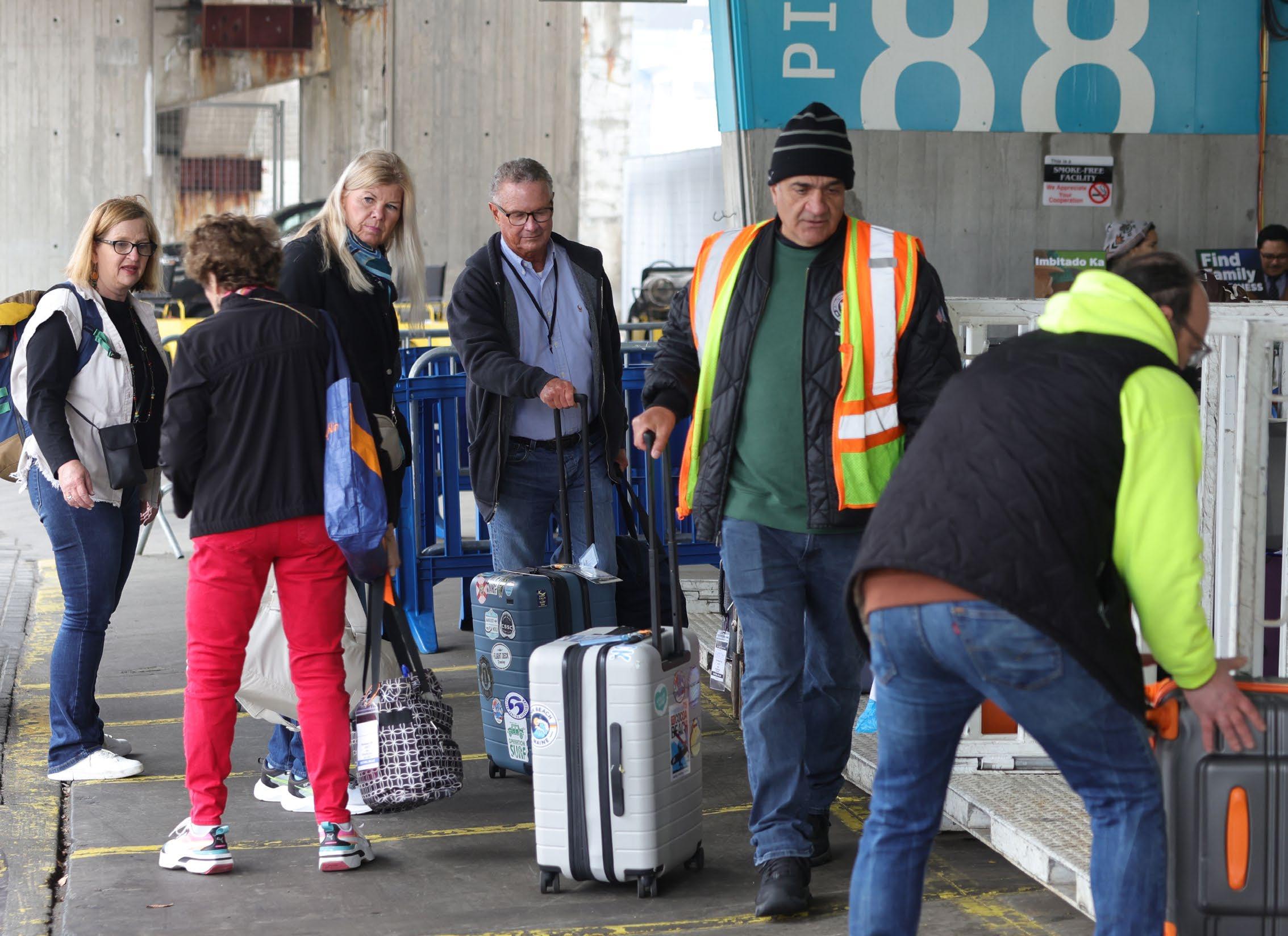
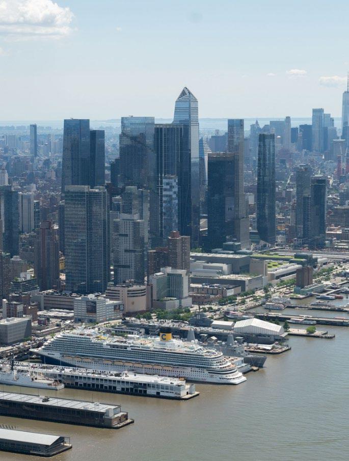
The Manhattan Cruise Terminal is a vital maritime hub, facilitating the travel of one million passengers annually from New York City to destinations across the world.
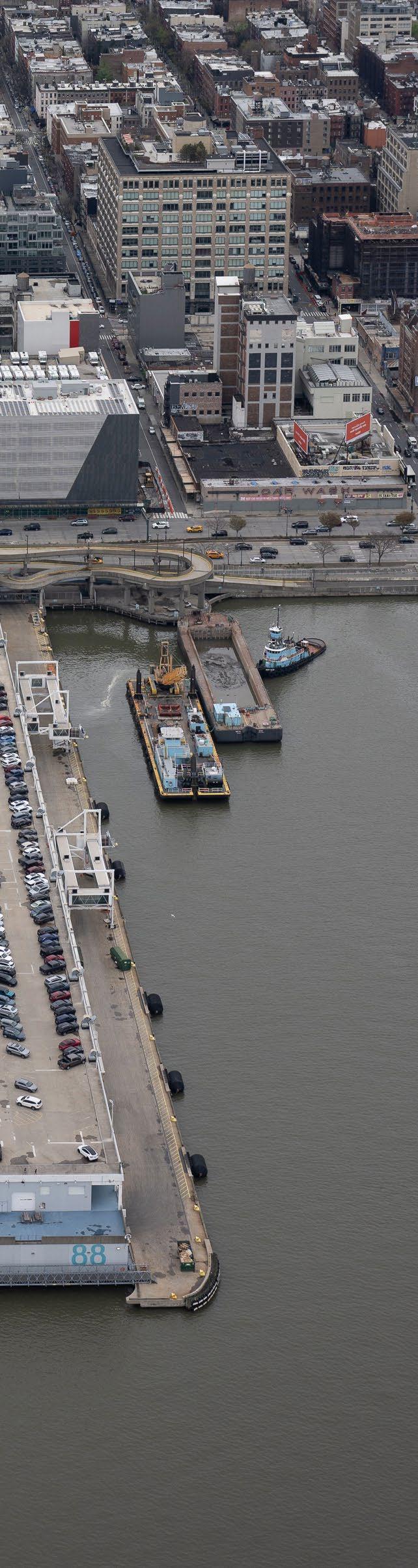
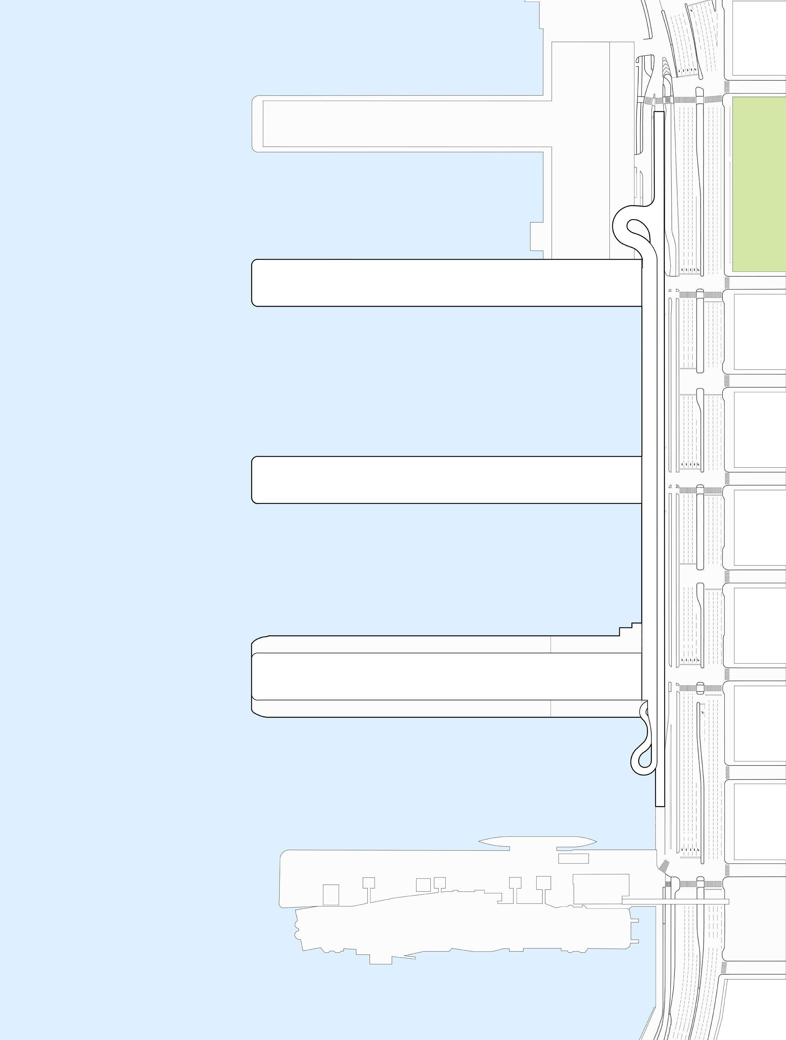
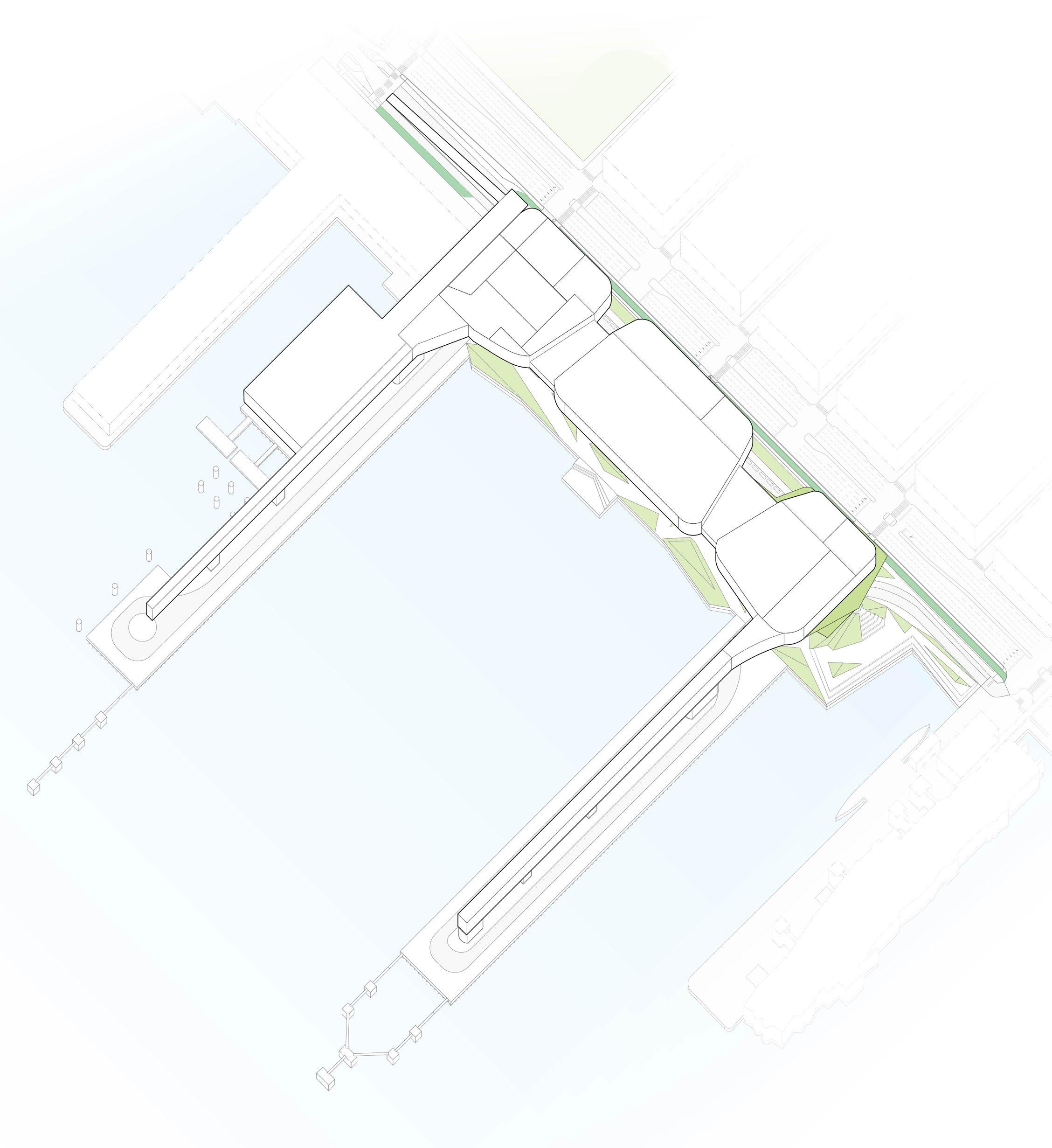
Located on Manhattan’s Hudson River waterfront, the terminal spans over fourteen acres and includes Piers 88, 90, and 92. The piers abut the West Side Highway between W 48th and W 52nd Streets and service five berths, only three of which are presently usable for cruise operations: Berths 1, 2, and 4.
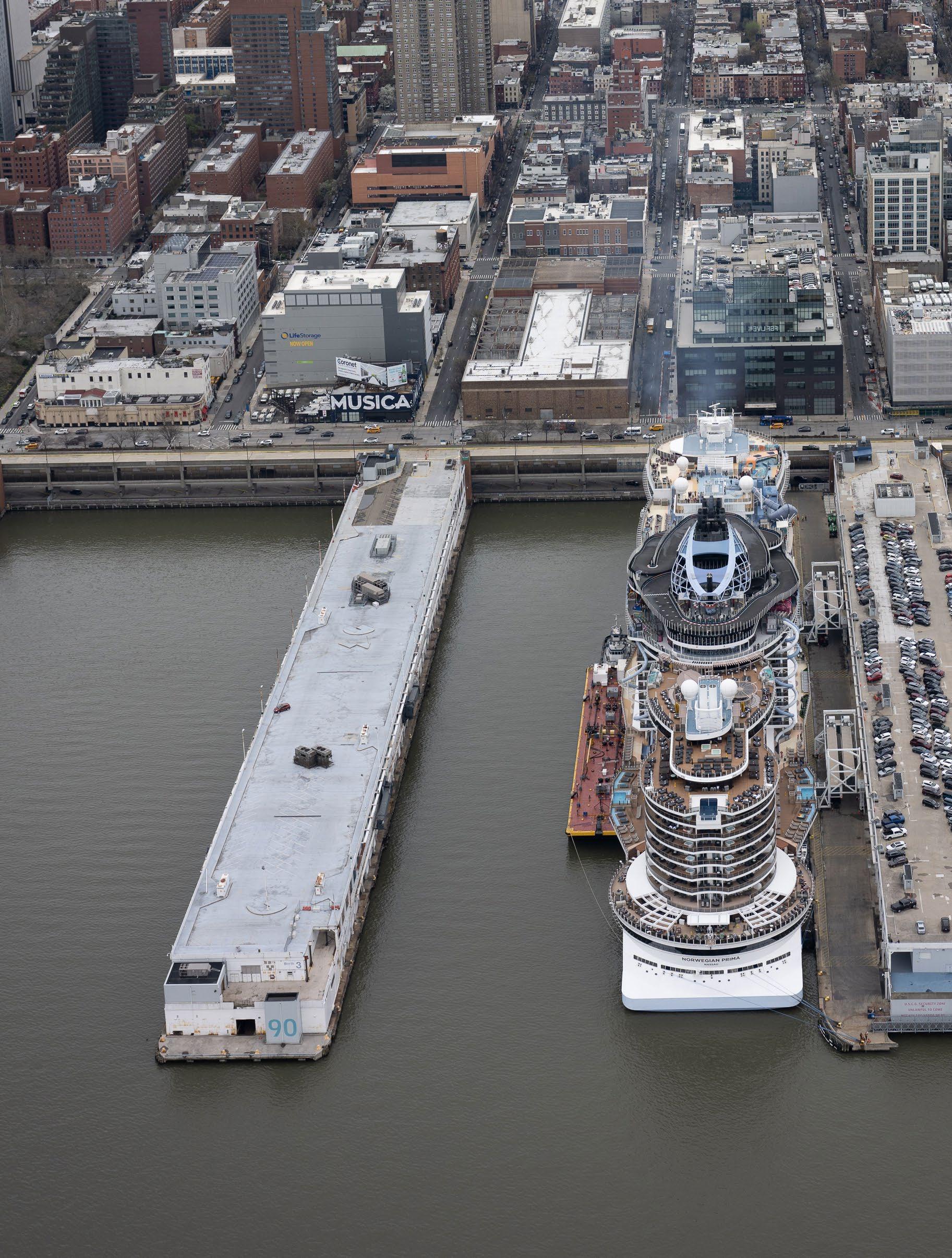
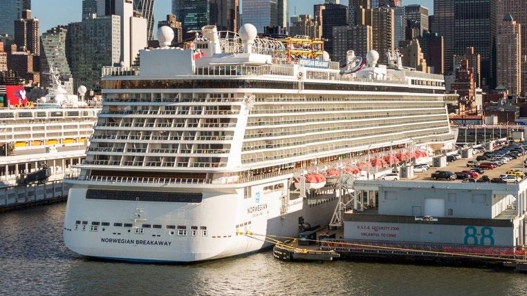
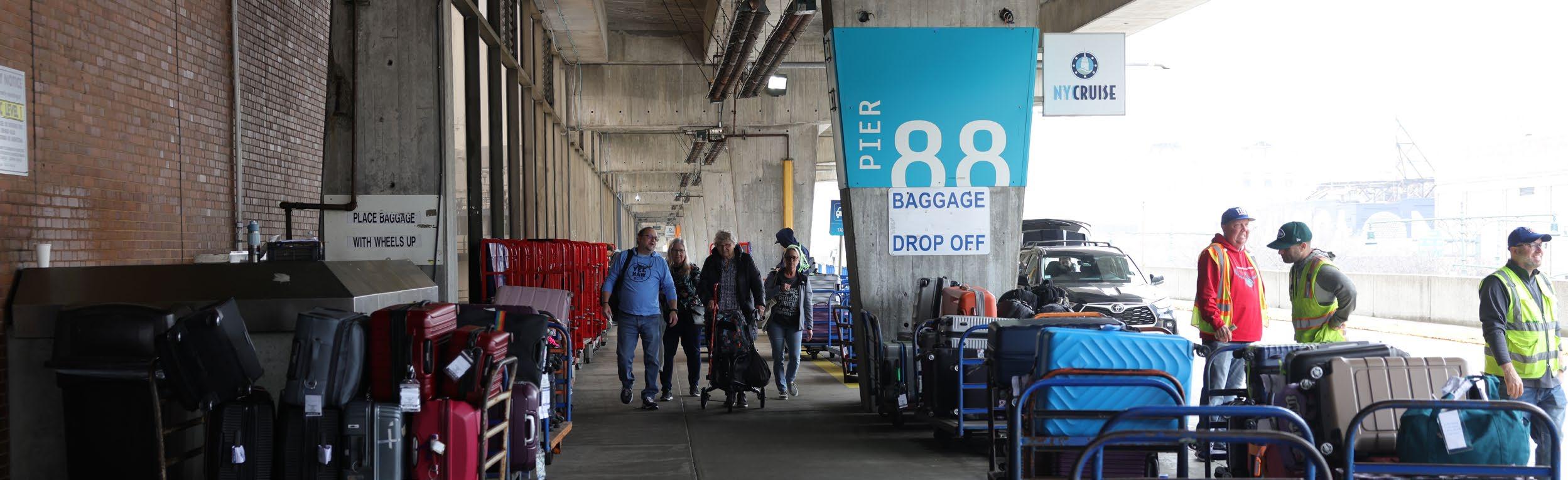
Pier 88 is MCT’s largest and most advanced facility, a status achieved largely through the renovation and modernization efforts undertaken in the early 2000s. These efforts included an apron expansion, which, along with other upgrades, have made it capable of hosting 4,000-passenger vessels and simultaneous operations at Berths 1 and 2. Its larger customs processing and luggage laydown areas make it the preferred destination for

full-foreign arrival vessels. Berth 2 is particularly busy, as its more flexible gangway system can accommodate vessels with outboard lifeboats. The ground level of Pier 88 is dedicated to disembarkation processes, including baggage pick-up and customs, as well as other back-of-house functions, such as baggage screening. Trucks navigate the northern and southern aprons to deliver provisions, which are then loaded onto vessels. The second level is reserved for embarkation processes, including baggage drop-off, security screening, and ticketing. During the 1970s, the rooftops of Piers 88 and 90 were converted into parking lots for passengers and staff. Today, the roof of Pier 88 can accommodate up to 320 vehicles.
Pier 90 typically berths only one ship at a time at Berth 4. This operational limitation is caused by Pier 88’s expanded apron, which narrows the water space between the two piers and makes it unsafe for two ships to berth side-by-side (at Berths 2 and 3). Although Pier 90 does have a narrow apron, it has not received the
STUDIOS
River PIER 94
92 PIER 90
BERTH 5 (Inactive)
BERTH 4
BERTH 3 (Inactive)
BERTH 2
PIER 88
PIER 86
BERTH 1
expansion that Pier 88 did during modernization. Consequently, the ground level of Pier 90 is largely dedicated to freight and back-ofhouse functions, while the second level manages both embarkation and debarkation processes. The size of the customs processing and luggage laydown areas restricts the use of the pier to vessels with a capacity of no more than 3,500 passengers. Additionally, its outdated gangway configuration prevents accommodation of larger vessels. On the roof level, the parking lot can handle approximately 330 vehicles.
Due to structural concerns identified at Pier 92, the City placed a Vacate Order on the building in 2019, and it is therefore no longer able to host any operations. When in service, Pier 92 could only accommodate domestic arrivals or port-of-call operations and was limited to vessels with a capacity under 2,500 passengers. The rooftop of Pier 92 could accommodate 300 vehicles, but is no longer operational.
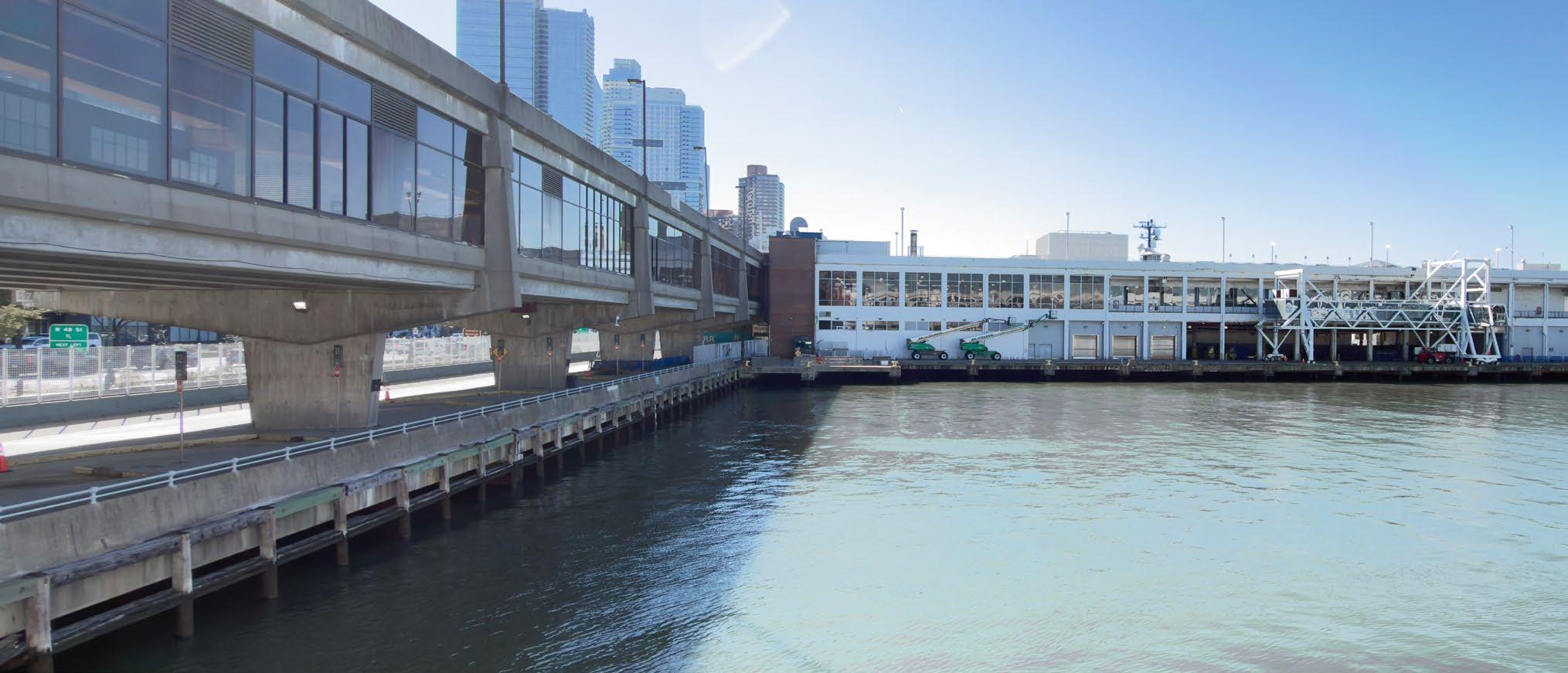
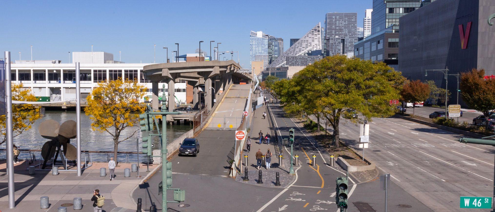
The viaduct is a two-story concrete roadway paralleling the waterfront between W 46th and W 54th Streets. Constructed in 1974, this elevated structure enables vehicular access to the terminal buildings’ second floors for passenger drop-off at Pier 88, and both pick-up and drop-off at Pier 90. The viaduct also provides cruise travelers with drive-up access to the rooftop parking areas.
Despite its critical role as a New York City transportation hub, MCT faces significant infrastructure challenges that reflect its long history. These challenges stem from the terminal’s aging structures, especially the original pier piles and viaduct, combined with the constraints imposed by modern, larger cruise ships and the resulting traffic congestion.
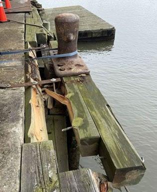
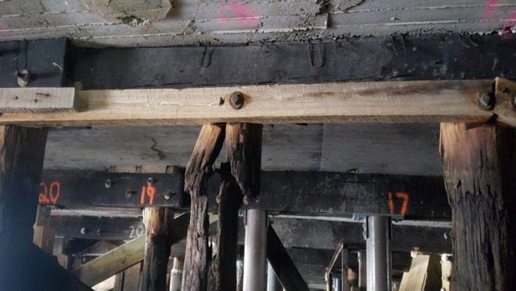
The terminal’s age is evident across its core structures. Piers 88 and 90, which were originally constructed in the 1930s, are primarily supported by their original timber piles, many of which are now over 90
years old. Even with significant maintenance and repair, these piers are reaching the end of their useful life. Similarly, the terminal buildings and ground transport infrastructure, though renovated in the 1970s and early 2000s, are showing material signs of deterioration. The ground transport pick-up and drop-off area, the viaduct, and the rooftop parking spaces all require a high level of preventative maintenance just to remain operational.
These challenges are exacerbated by the changing needs of the cruise industry. The piers, originally designed for the sleek, grand ocean liners of the past, now struggle to accommodate modern cruise vessels due to insufficient berth length and width. These constraints, which are compounded by strong cross currents in the river, severely limit the size of vessels capable of berthing at the terminal. A 2023 feasibility study explored building a new apron on the north side of Pier 90 to improve operational flexibility. Unfortunately, detailed navigation simulations revealed that the proposed apron would not meet the required safety standards for berthing modern vessels.
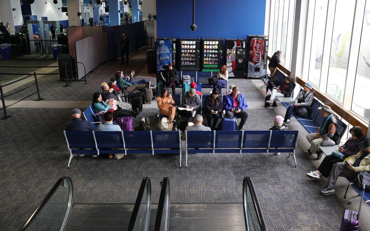
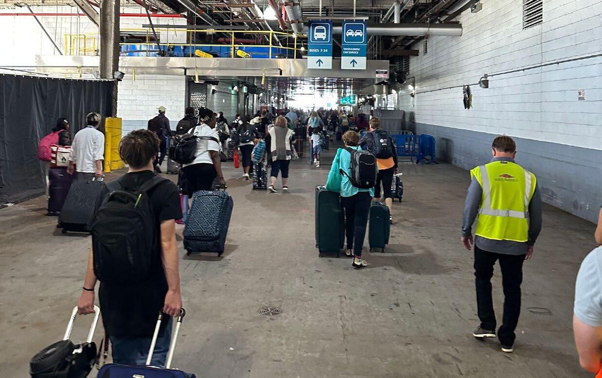
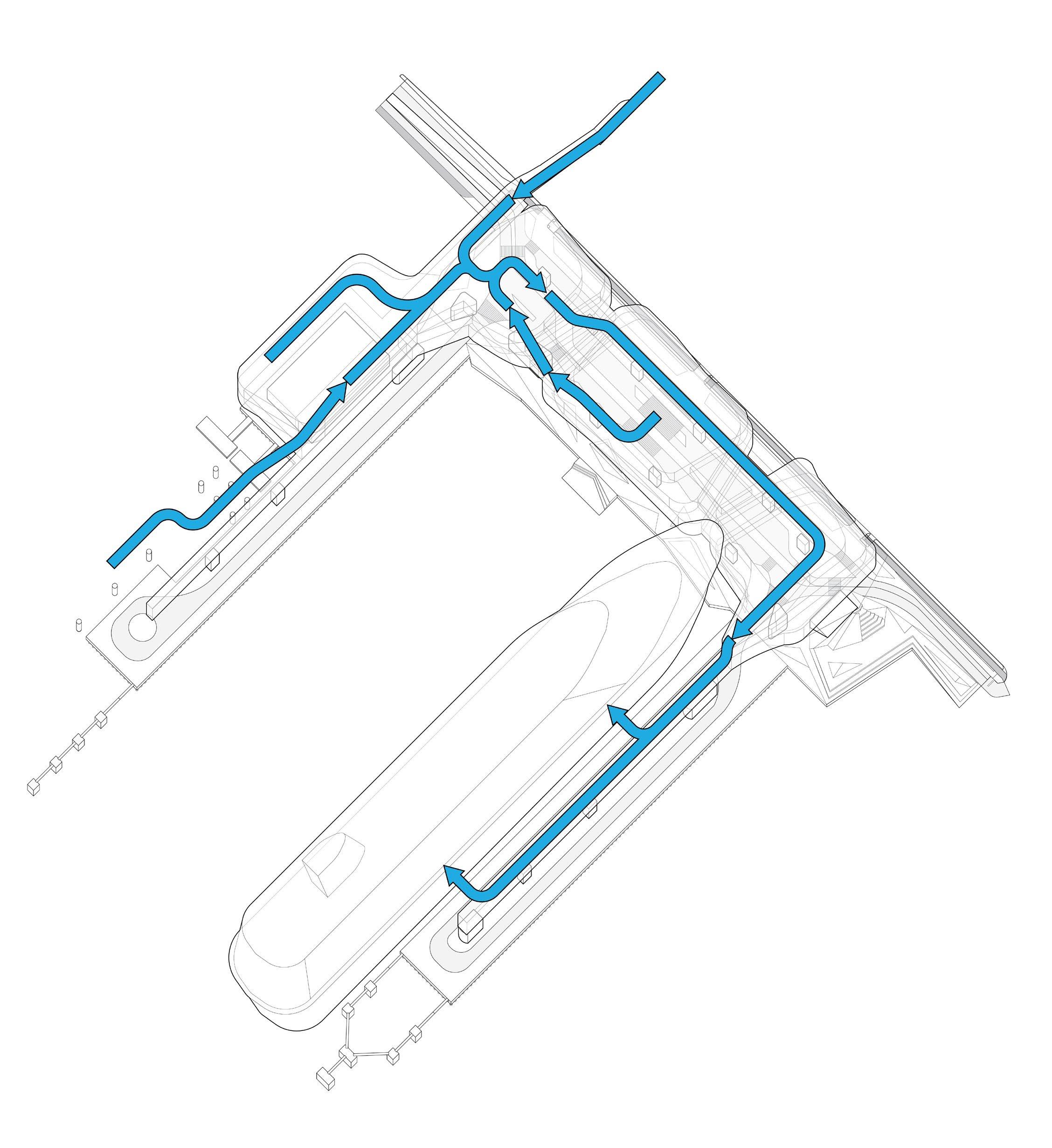
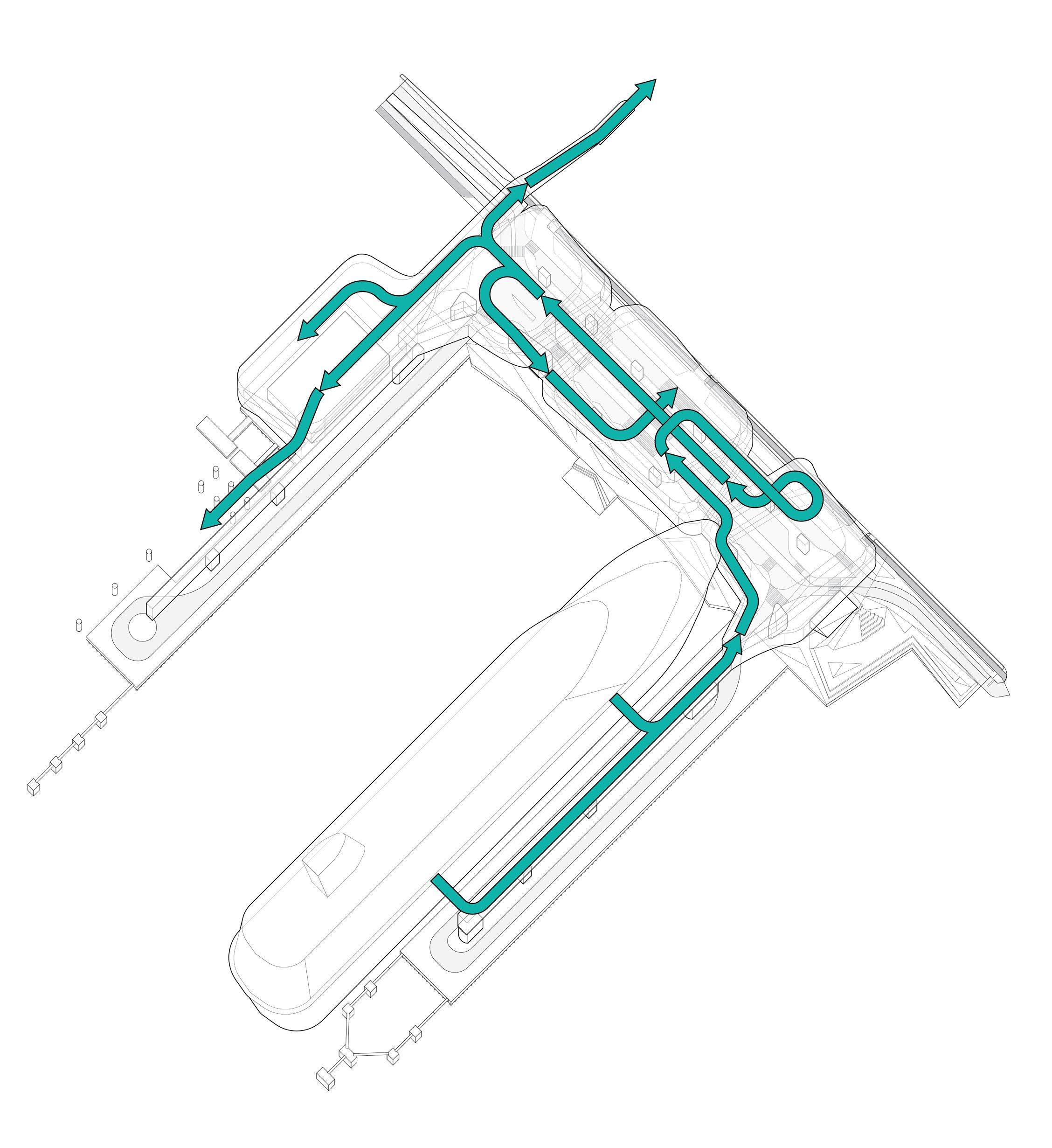
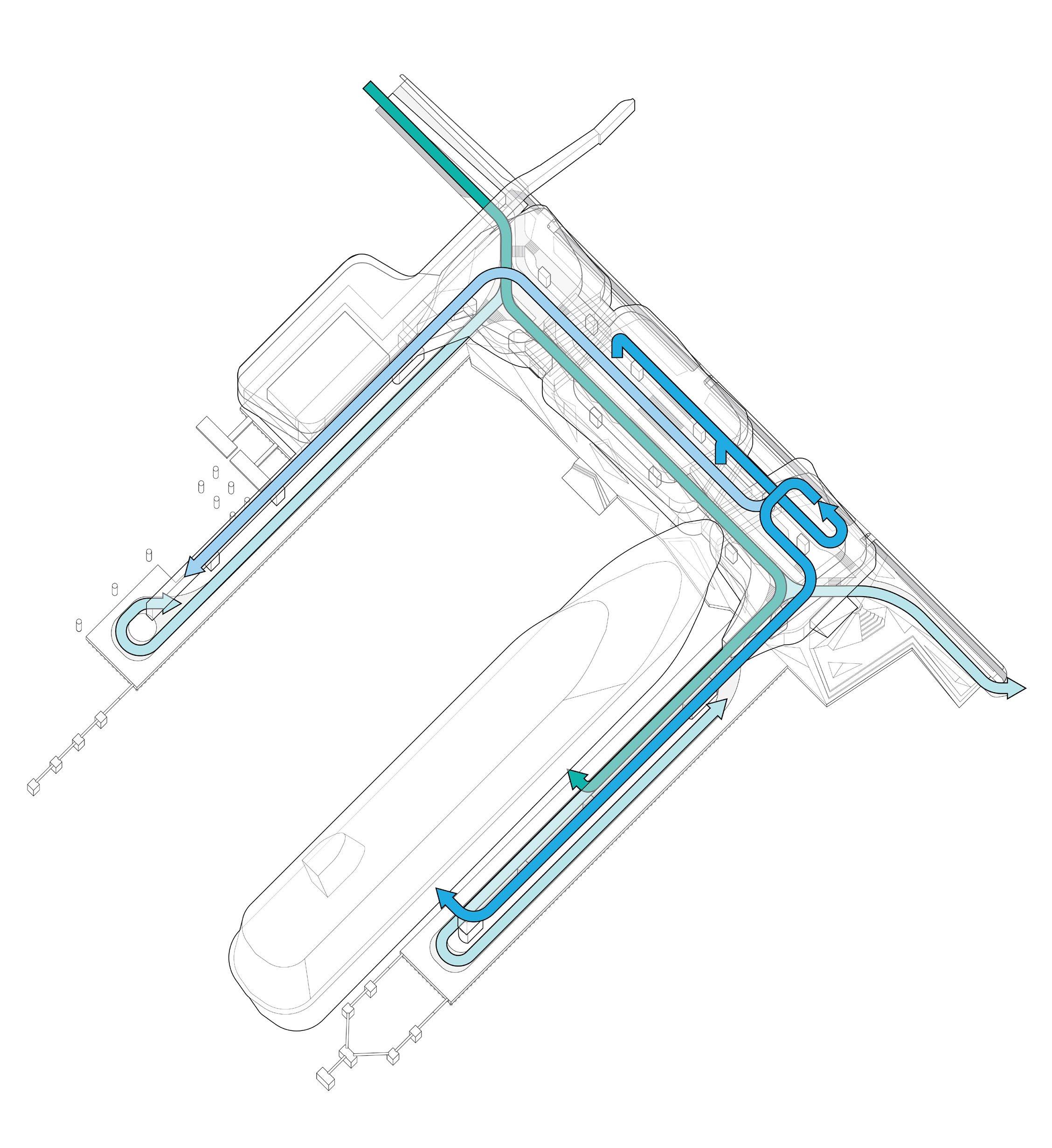
Furthermore, while the terminal’s ground transport infrastructure was designed primarily for vehicular circulation, it faces significant challenges from the current high volume of use. The roadways in and around the terminal often experience higher levels of passenger vehicle and provisioning truck traffic on vessel call days, exceeding what the terminal was originally built to accommodate. This congestion contributes to local emissions and impacts vehicular, pedestrian, and bike access around the terminal. This situation is worsened by bottlenecks at the terminal buildings’ single points of egress, security barriers surrounding the site, and narrow bikeway and walkways. Passengers exiting the terminal on foot frequently saturate the surrounding terminal areas, highlighting the urgent need for a right-sized ground transportation area.
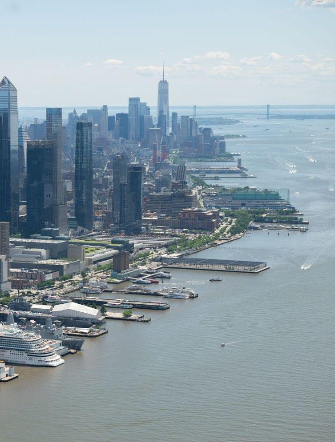
Despite these challenges, MCT has served nearly 20 million passengers over the last two decades. Its prime location offers the potential to tap into New York’s significant and potential cruise market. The region boasts over 60 million people living within 300 miles of the city, and in 2024 alone, 2.2 million passengers sailed from New York and New Jersey docks. Beyond market strength, MCT’s location is wellsuited to evolve into a world-class, dynamic cruise facility. With unobstructed views of the Hudson River to the west and the iconic Manhattan skyline to the east, the terminal offers cruise passengers unmatched access to New York City. Its direct connections to the West Side Highway, major transit hubs like Grand Central Terminal and Penn Station, and close proximity to the city’s commercial and entertainment core make it an ideal gateway to the best that New York City has to offer.
NYCEDC’s Master Plan seeks to leverage that success through a comprehensive redevelopment and modernization process, addressing infrastructure limitations to ensure the terminal upholds its role as an engine of economic growth and opportunity for New York City.
The Master Plan offers a bold vision to transform a vital City asset into a resilient, dynamic, and future-ready gateway that not only meets, but exceeds the expectations of the community and the cruise industry. By transforming MCT, NYCEDC is investing in the future of New York City, ensuring that the terminal remains a premier destination for travelers and residents alike. This ambitious vision will create new jobs, stimulate local businesses, and reinforce New York City’s status as a hub of commerce and culture.
The development of the MCT Master Plan was a comprehensive and dynamic process, driven by invaluable feedback from the local community and industry experts.
NYCEDC collaborated closely with local residents, cruise lines, and relevant market stakeholders to ensure that the Plan addresses the needs and impacts of the site. The process was anchored in rigorous research, including a detailed market study and extensive discussions with cruise experts, ensuring that every aspect of the Plan was informed by the best available knowledge and practices. This approach was crucial in shaping a vision that reflects the community’s aspirations, while meeting the needs of the industry.
Building off years of community engagement, the master planning process for the terminal was designed to be inclusive and responsive to the needs of MCT’s neighbors.
It featured various public touchpoints to gather on-the-ground perspectives and transform hyperlocal knowledge into effective recommendations. By actively engaging with residents, businesses, and other stakeholders through community meetings, workshops, and surveys, the Plan aims to effectively address the priorities of the community.
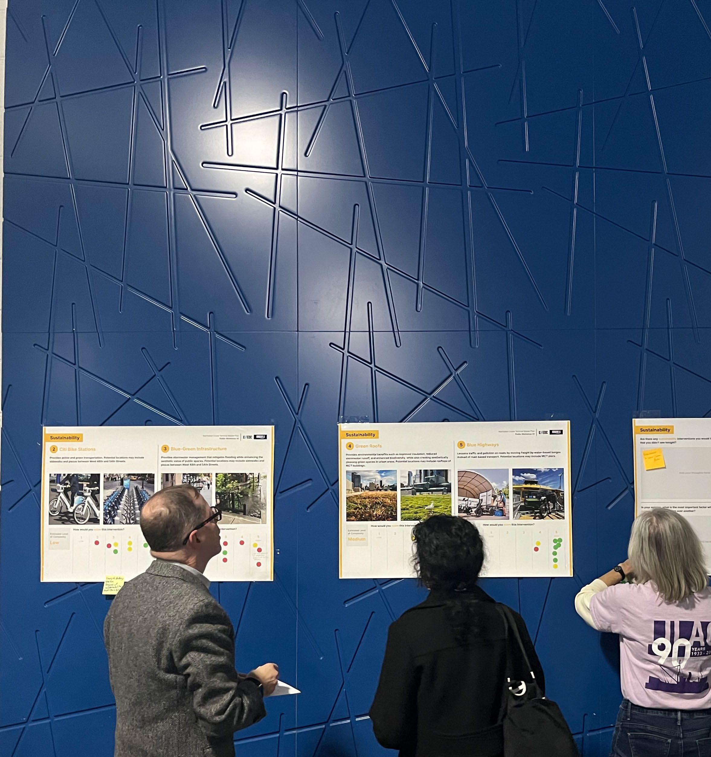
NYCEDC hosted two, in-person public workshops in 2024 and 2025 at the cruise terminal. These sessions were held to gather input on the site’s perceived challenges and opportunities, as well as the community’s aspirations and priorities for its development. The workshops aimed to foster an open dialogue and support an environment of collaboration.
NYCEDC conducted a variety of stakeholder interviews with community organizations and elected officials. The interviews were designed to inform stakeholders of the Plan’s objectives and process, solicit targeted feedback on solutions for public realm improvements, and highlight potential future collaborations.
With local community members and users of nearby public spaces in mind, an online survey was released to capture community sentiments regarding MCT from a wide range of respondents. Open from November 2024 through February 2025, the survey collected feedback from over 150 community members, detailing some of their current challenges with the facility and their ideas for the future terminal.
In addition to engaging with the Hell’s Kitchen community, the planning process included outreach to more than 25 organizations that regularly navigate the Hudson River. These included federal partners like the US Army Corps of Engineers and the US Coast Guard; City agencies, particularly those with harbor and marine units; commercial operators; and recreational groups. These sessions focused on identifying potential navigational impacts from the redevelopment and developing appropriate mitigation strategies.
The master planning process was designed to be inclusive and responsive to the needs of the community.
The first Public Workshop, along with an accompanying online survey, invited participants to share their thoughts on the current terminal’s challenges and their priorities for future development. Survey respondents identified their top three priorities, with a strong emphasis on expanding and enhancing public access.
“Lots of potential there for a truly amazing community space!”
“There should be a place for the public to appreciate the cruise terminal activities.“
“Cruising out of NYC used to be a ‘big thing.’ It attracts so much tourism and income for the city and surrounding businesses.”
“Ships should be required to use shore power in such a highly residential area.”
“We live locally and want the space to serve locals.”
“You should really consider a pedestrian bridge so the neighborhood can enjoy the new waterfront.”
“Make it safe for pedestrians and bikes to transit northsouth in front of MCT.”
”This is our home. The waterfront often feels like an afterthought and not a space for us.”
“I cannot underline how important the area is as a gateway to Hudson River Park for all of Hell’s Kitchen.”
During the second Public Workshop, participants honed in on a series of proposed interventions across four key priority areas: Sustainability, Traffic & Congestion, Activations & Retail, and Streetscape.
For each category, participants evaluated the importance of each intervention on a scale from 1 to 5, where 1 meant Not Important and 5 meant Very Important. These scores were then compiled and averaged to identify the community’s top priorities. Below are the average scores for the top three interventions in each category.
*Shore power was not specifically scored, as it was a requirement of any future development scenario.
The global cruise industry has shown robust growth over the past two decades. With a compound annual growth rate (CAGR) of 4.8% since 2000, the industry has demonstrated resilience against economic and public health crises, political instability, and other challenges that typically impact the wider tourism market. The industry is experiencing continuous growth, with expanded destinations, new brands, and a unique value proposition providing a solid foundation for long-term expansion. After unprecedented challenges during the COVID-19 pandemic, customer demand for cruise is stronger than ever, with global passenger volumes hitting all-time highs year-after-year.
North America, recognized as the most established cruise source market globally, supplies an impressive 58 percent of cruise
guests. Remarkably, however, only five percent of the North American population has taken a cruise. This market penetration is anticipated to grow steadily, driven by both repeat clientele and new-to-cruise customers. Notably, new-to-cruise customers, who represent over a quarter of annual passengers, have shown robust growth in recent years. This expanding base, coupled with the expansive tourism sector and overall industry demand, presents a compelling opportunity for sustained growth.
To take advantage of this increasing demand, cruise lines are making significant investments in their fleets, with vessel orders extending further into the future than ever before. There are currently 75 new cruise ships on order, representing nearly a 25 percent expansion in passenger capacity. The steady delivery
schedule of new vessels means average cruise ship passenger capacity has grown consistently over the past two decades.
New ships on order will be able to accommodate up to 8,000 guests, a marked increase compared to the largest ships in the year 2000, which carried 4,300 passengers. While the trend towards larger vessels has a clear impact on industry growth, it also necessitates advancements in marine, upland, and tourism infrastructure. This requires ports worldwide to continue expanding and upgrading their terminals with more efficient homeport facilities and improved berths to manage the considerable growth, while also balancing the needs of the surrounding communities.
Source: Bermello Ajamil & Partners. *Service beginning next year. Note: Figure assumes lower berths and embark and debark for each terminal in 2023.
Source: Cruise Industry News 2025 Annual Report
New York City is the oldest metropolitan cruise port in the US and a marquee destination in the cruise industry. Its location offers easy access for tens of millions of people across the Northeast US and Canada, providing a robust customer base supported by excellent local attractions and accommodations. As a global gateway, it offers local residents a wide array of easily-accessible vacation options to destinations around the world.
The NYC market is served by two major facilities: the Manhattan Cruise Terminal and the Brooklyn Cruise Terminal (BCT), which is located within the larger Brooklyn Marine Terminal (BMT) site in Red Hook. Strategically positioned
on the East Coast, these two terminals facilitate travel to four major destinations: Canada/ New England, the Caribbean and Bahamas, Bermuda, and Europe. Combined, these markets have seen nearly 50 percent growth in the last decade. The strength of this regional demand is underscored by the fact that MCT’s average vessel size is double that of the global fleet average, indicating that cruise lines are deploying some of their largest ships to service the New York market.
This market demand drives the initiative to maintain two distinct, world-class cruise facilities. The strategic importance of BCT is reinforced in the BMT Vision
Plan, a stakeholder-led effort to transform the site into a modern, fully electrified maritime port with a purpose-built cruise terminal.
MCT, however, currently faces limitations that restrict the size of visiting vessels. As cruise ships continue their trend of growing in size, these infrastructure challenges are increasingly critical. To fully capitalize on this industry demand and ensure New York City retains its status as a leading global cruise port, it is crucial that MCT makes the necessary enhancements to safely accommodate the larger modern ships and manage the corresponding increase in passenger volumes. Past
SS Normandie (1935)
Gross Registered Tonnage (GRT): 79,280
Breakaway, Vista, Prima, & Meraviglia Class GRT: 140,000 - 170,000
Source: Bermello Ajamil & Partners.
Note:
Passengers

The cruise industry is vital to New York City’s economy, generating thousands of jobs and fueling the tourism and hospitality sectors. For the vast majority of cruises at MCT, guests begin and end their journeys in New York City. This provides ample opportunity for passengers to explore the city’s many attractions, like catching a Broadway show, visiting iconic landmarks, and enjoying diverse dining options. Moreover, previous surveys indicate that up to 50 percent of passengers extend their vacations by staying in New York a few nights before or after their cruise, further boosting local businesses.
A 2018 study by Business Research and Economic Advisors estimated that each passenger arriving at the terminal spends nearly $300 in the city, with this figure increasing to $600 for those with overnight stays. In 2024, the cruise industry contributed an estimated $509M in local economic impact, while cruise passenger and crew spending supported over 2,900 jobs across New York City. It is estimated that approximately 2,000 of these jobs represent tourism-adjacent industries including hotels, food and beverage, shopping, transit, and entertainment.
The cruise industry has grown significantly over the past decades, bringing with it various challenges, particularly environmental impacts from vessel operations. Addressing these issues requires substantial efforts not only from cruise lines, which have made significant investments in reducing fossil fuel consumption, adopting new energy sources, and implementing advanced on-board waste treatment and management systems, but also from port facilities.
The Cruise Lines International Association, the world’s largest cruise industry trade association, has committed to net-zero carbon emissions by 2050. Its specific targets for shore power readiness are driving innovation in three key areas, two of which require substantial investment from ports.
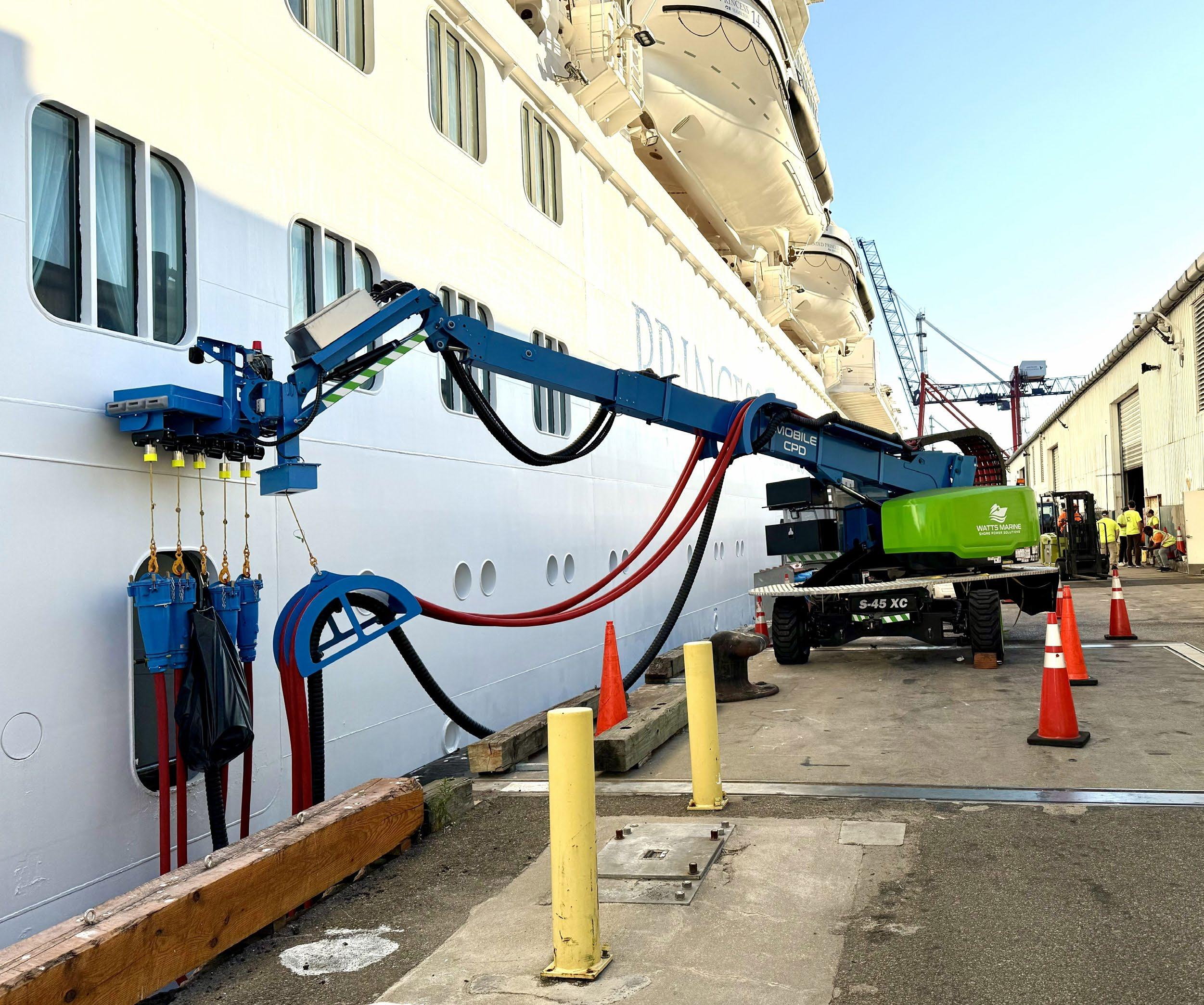
At most cruise ports, vessels run their auxiliary engines to produce electric power for essential onboard services while docked, just as they do at sea, producing emissions that contribute to local pollution. To address this issue, the industry is beginning to implement Onshore Power Supply, or “shore power,” allowing vessels to connect to the local electrical grid.
The industry has made a strong commitment: 98 percent of new cruise ships on order will be equipped for shore power, and the goal is for all ships calling at equipped ports to be ready to plug in by 2035. This commitment necessitates reciprocal investment from ports in dedicated onsite generation and charging infrastructure. While only three percent of cruise ports globally have shore power installed, this number is anticipated to rise rapidly as ports invest in the necessary infrastructure to meet the industry’s readiness.
For the existing fleet, biofuels offer a promising solution to replace fossil fuels. These can be used in current engines and turbines, typically blended with diesel or gasoline, without requiring major vessel reconfiguration.
For future vessels, liquified natural gas (LNG) is expected to become a key alternative fuel. While still a fossil fuel, LNG produces a significantly lower volume of emissions compared to typical marine fuels. Nineteen LNG cruise ships are already in operation, with several active on the US East Coast. Other energy sources, such as hydrogen fuel cells, methanol, and batteries are being developed and implemented within the global cruise fleet, but have seen lower adoption so far. Ports should be ready to facilitate the bunkering, storage, and charging required for these new energy sources, necessitating significant terminal upgrades to support the next generation of cleaner vessels.
While evaluating new eco-friendly fuels, the cruise industry is also finding ways to reduce overall consumption. Some strategies have focused on electrification to enhance engine efficiency through electric turbine-powered propulsion. Electronic fuel management systems are also being implemented to gather data on vessel fuel consumption, enabling improvements in efficiency through operational and navigational adjustments. Many vessels have installed scrubber systems, which sit in the exhaust stacks of ships and use seawater to scrub pollutants from the engine’s exhaust.
New York City is a leader on climate action and has set ambitious decarbonization goals, with a particular focus on cruise operations. The terminal reconfiguration proposed under the Master Plan will introduce comprehensive shore power capabilities at MCT for the first time. The system will be designed to satisfy the anticipated electrical needs at every berth and align the terminal with the City’s mandate for emissions reductions, including those outlined in Local Laws 54 and 97. Paired with the cruise industry’s adoption of cleaner fuels and improved vessel efficiency, shore power at MCT will enhance air quality and promote a more sustainable future for the terminal.
The future MCT will be a beacon of innovation and a cornerstone of New York City’s waterfront network, capturing the dynamic growth of the cruise industry while providing the surrounding neighborhood with the world-class facility it has long requested and deserved.
Building upon New York City’s longstanding tradition of creating world-renowned transportation hubs, the new terminal will honor and celebrate its historic role as a gateway for millions of passengers arriving in New York City. It will be a symbol of the City’s commitment to innovation, sustainability, and community, setting a new standard for cruise terminals worldwide.
The site will achieve full electrification by implementing shore power, electrifying equipment, and maximizing on-site renewable energy generation. The terminal will once again lead the industry by delivering best-inclass features, including world-leading environmental stewardship capabilities, to foster a cleaner, healthier environment for the surrounding area. The terminal will be equipped to handle a greater number of passengers and vessel calls, thanks to state-of-the-art passenger services and expanded transportation infrastructure. Additionally, new facilities for marine freight, transit, and public space will ensure the terminal serves as a transformative asset for all New Yorkers.
Grounded in NYCEDC’s mission to leverage the City’s economic vibrancy for positive outcomes, the future MCT will serve as an iconic hub of transportation and industry, embodying the innovative, resilient, and determined spirit of New York City and its residents.
All graphics are for illustrative purposes and are subject to change and refinement.
The planning team conducted thorough research and analysis throughout the Master Plan’s development.
This included research into best practices and precedent projects, detailed evaluations of the cruise market, and investigations of vehicle traffic around the terminal.
NYCEDC undertook rigorous analyses of long-term trends in the cruise industry, at both the global and regional scale, with a particular focus on regions affecting New York City, such as the Caribbean, Bermuda, and Canada/New England. With the knowledge of this market assessment, trends in ship construction, and specific deployment patterns in the region, NYCEDC was able to identify the facility capabilities needed at MCT to accommodate the ‘Design Vessel’ of the future. While ships of this scale are currently deployed in the largest markets, like Florida, they do not yet call on New York. However, as newer vessels enter service in those primary markets, existing ships of the Design Vessel class are expected to shift to New York, making MCT’s readiness essential for capturing future demand.
To complement the cruise market study, in-depth interviews were conducted with key players in New York City’s cruise industry. These discussions offered valuable insights into the specific needs of each cruise line and their collective vision for the future of the industry. By engaging directly with the major cruise lines, NYCEDC was able to ensure that the new terminal’s operational requirements and strategic goals aligned with the industry’s evolving landscape.
Ground transportation at MCT is one of the facility’s primary challenges. The full turn of a vessel at the terminal creates adverse impacts for bike and pedestrian traffic on the Route 9A Bikeway/Walkway and vehicular traffic on the West Side Highway. As part of the master planning process, NYCEDC completed an assessment of existing vehicle and pedestrian traffic anchored by detailed, on-site data collection efforts. This effort unlocked a deeper understanding of current traffic circulation, critical intersections, and site access issues, allowing NYCEDC to develop an array of near- and longterm interventions.
A cruise ship passenger survey was developed and deployed in 2024 to understand passengers’ mode of travel to and from the terminal, their associated vehicle occupancy, and their origin and destination. This helped to ensure the new terminal ground transportation area was rightsized and effective for all modes of transportation.
NYCEDC also engaged in discussions with a variety of logistics companies and freight micromobility operators to understand the driving factors for microhub site selection. Through these discussions, NYCEDC assessed the market potential for the site as a Blue Highways microhub in the lessthan-truckload delivery market and identified specific facility and infrastructure needs.
The Master Plan incorporates City and State initiatives to ensure its modernization supports broader regional goals:
• Climate and sustainability: NYS Climate Leadership and Community Protection Act, Local Law 97, Local Law 54, Green Economy Action Plan, NYC Waterfront Revitalization Program
• Port and economic strategy: Harbor of the Future Vision, BMT Vision Plan, Blue Highways Action Plan
• Waterfront and public realm access: NYC Comprehensive Waterfront Plan, Greater Greenways Initiative
• Regional transportation and safety: Vision Zero, NYSDOT Route 9A Mobility and Safety Enhancements Study
These integrated efforts ensure the terminal not only meets cruise demand but also advances the City’s commitment to safety, sustainability, and quality of life for all New Yorkers.
Harbor vessel and Blue Highways berth areas are separated from cruise operations by the North Pier
The plan’s development process integrated the vision and goals for MCT, essential infrastructure and design elements, and valuable input from the community to create a competitive and efficient terminal.
Key planning considerations included the evolving nature of the cruise industry, the constraints of terminal construction methods, environmental impacts, and the urban context of the site.
To ensure the new terminal is vibrant, sustainable, and prosperous, each aspect of the plan was evaluated using a series of environmental, social, economic, and placemaking criteria. This holistic approach aimed to balance the aspirations of the local community with the needs of the cruise industry to develop a terminal that truly enhances the urban fabric of New York City.
The development process was iterative and inclusive, incorporating feedback from various stakeholder groups through public touchpoints and rigorous research. By aligning NYCEDC’s strategic goals with community priorities and industry requirements, the Master Plan sets a clear vision for the future of the cruise terminal, ensuring it serves as an active and integral part of the City’s waterfront.
Habor vessel charging
New pile-supported pier decks extend approximately 1,125 ft from the edge of the terminal building footprint
Mooring dolphins extend an additional ~340 ft from the end of each pier deck
BLUE HIGHWAYS & FERRY LANDING
Bunkering vessel
BERTH C
PARKING STRUCTURE & BLUE HIGHWAYS SITE
PEDESTRIAN BRIDGE
NORTH TERMINAL BUILDING
Indicative scale of Design Vessel
Existing Pier 90 Footprint
CENTRAL TERMINAL BUILDING
BERTH B
SOUTH TERMINAL BUILDING
BERTH A
Breakaway Plus Class Vessel
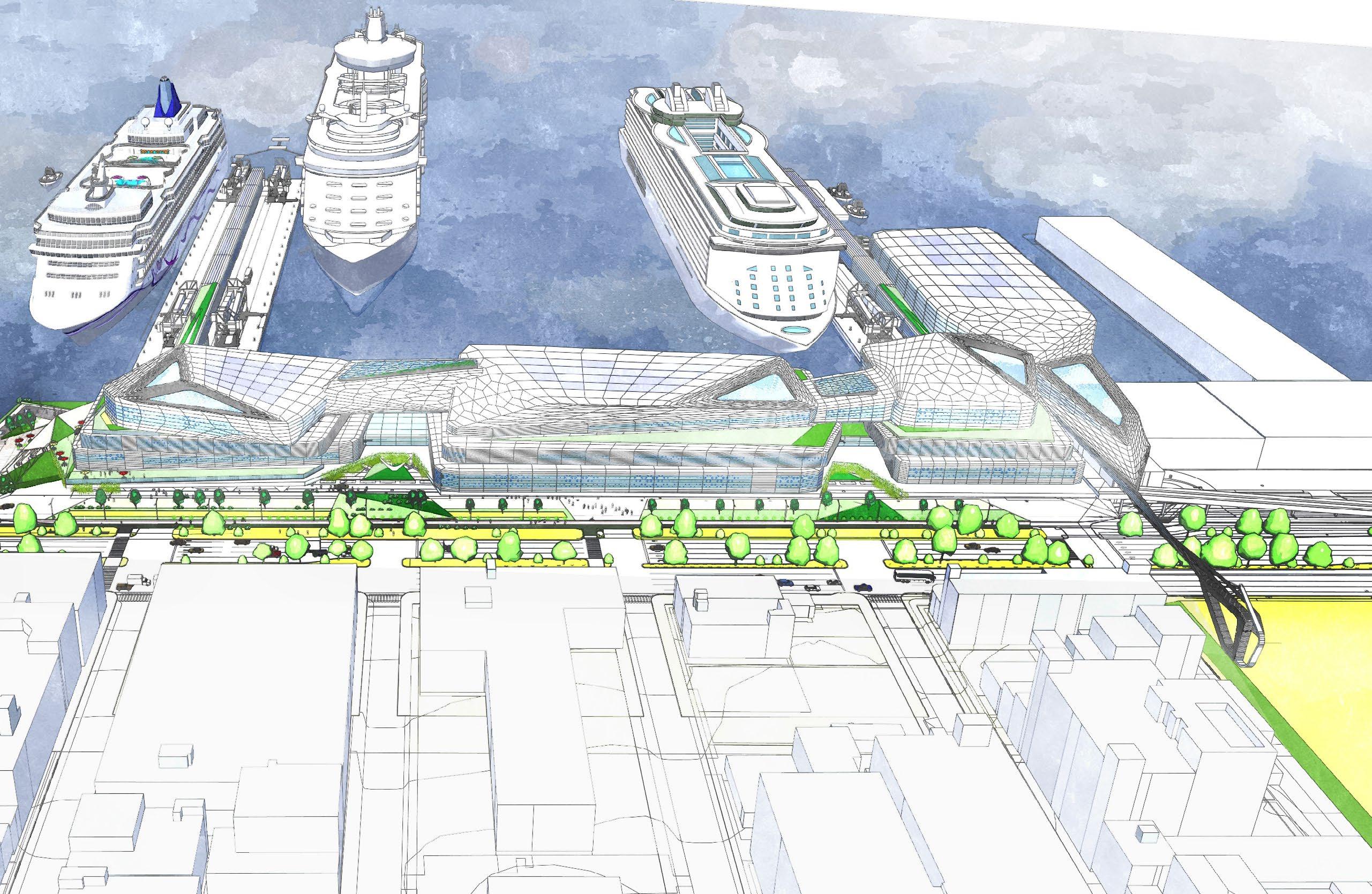
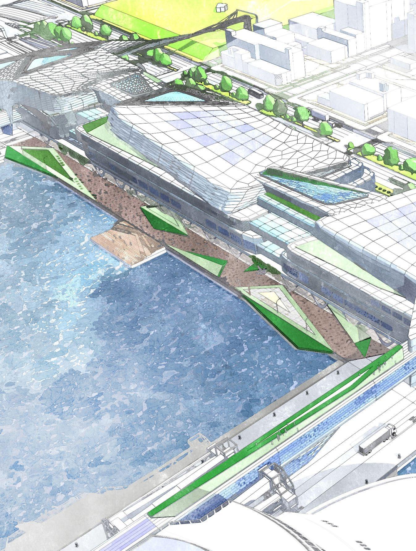
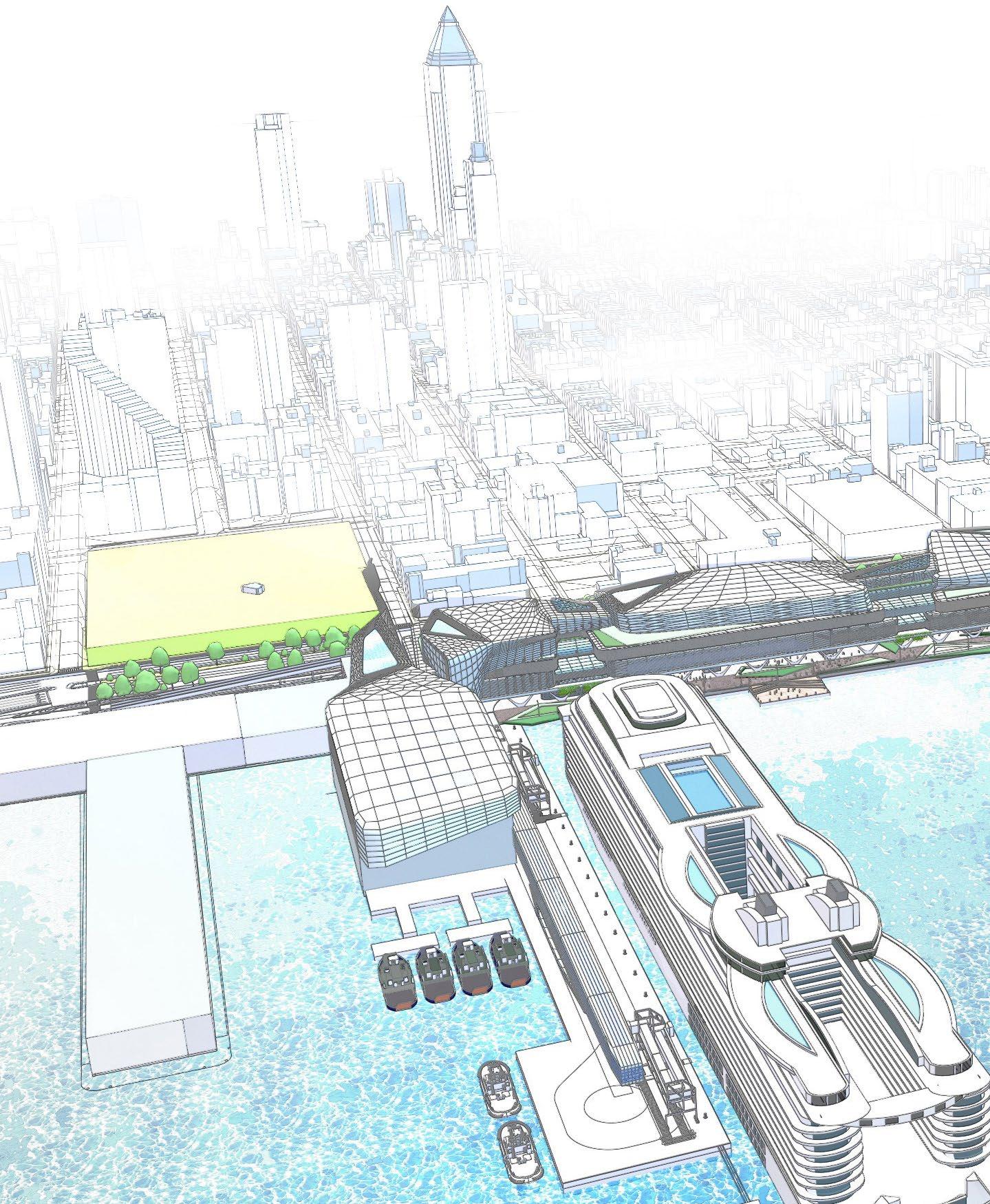
The future of the Manhattan Cruise Terminal is anchored in the removal of the existing cruise terminal and the construction of new piers and expanded facilities that will redefine the waterfront experience. These enhancements unlock new opportunities for multimodal transportation, vibrant public spaces, and sustainable energy integration, positioning MCT as a next-generation transportation hub.
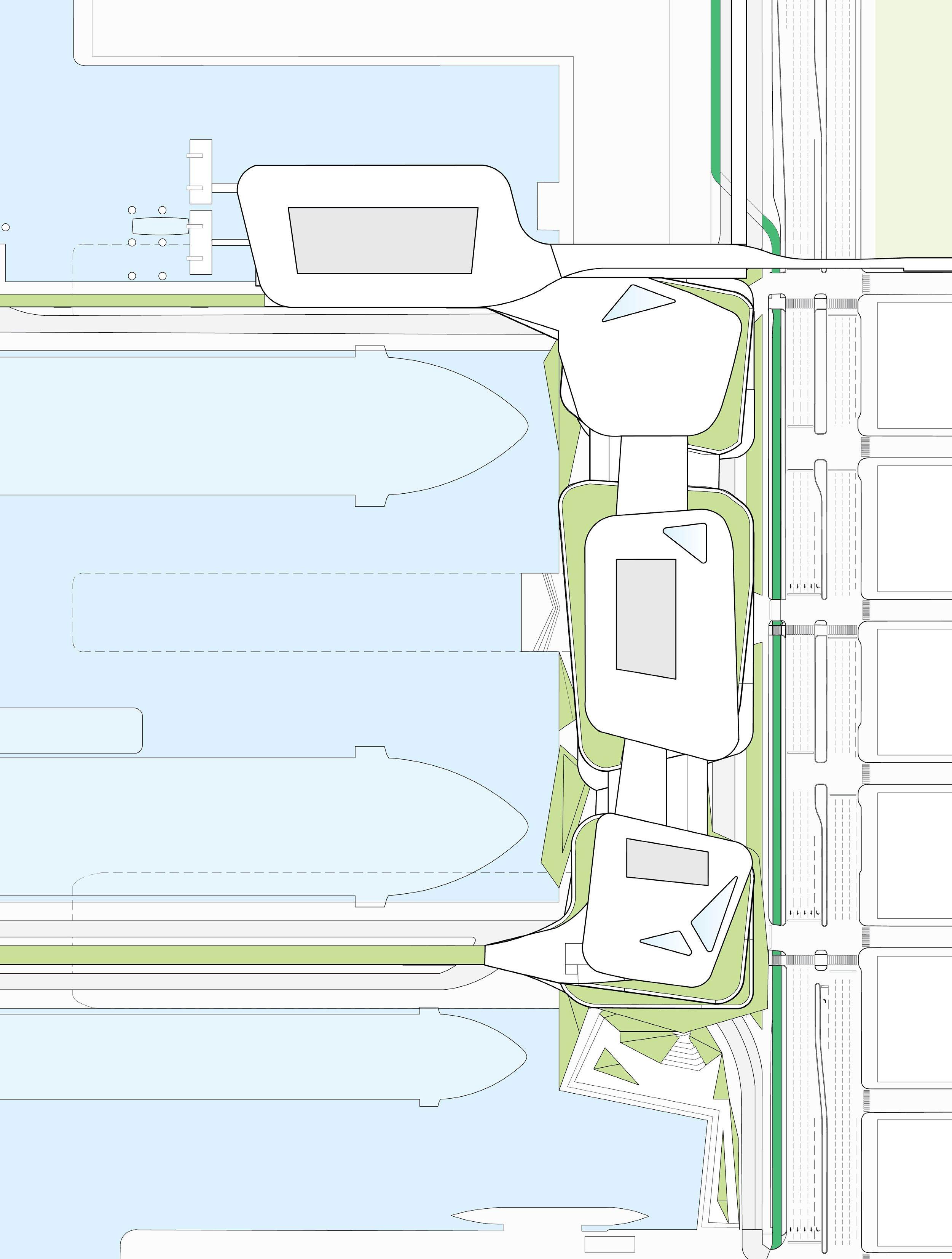
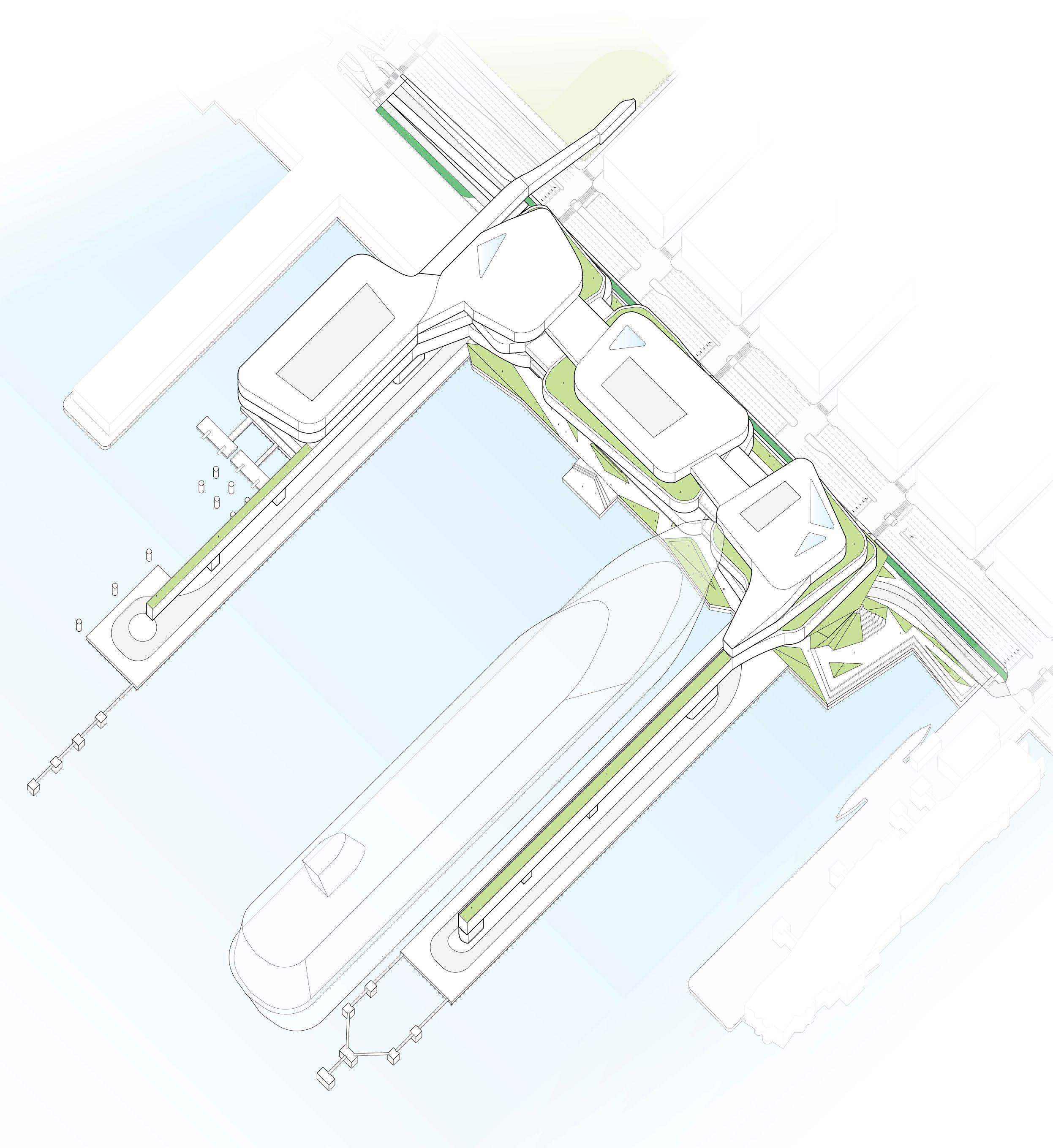
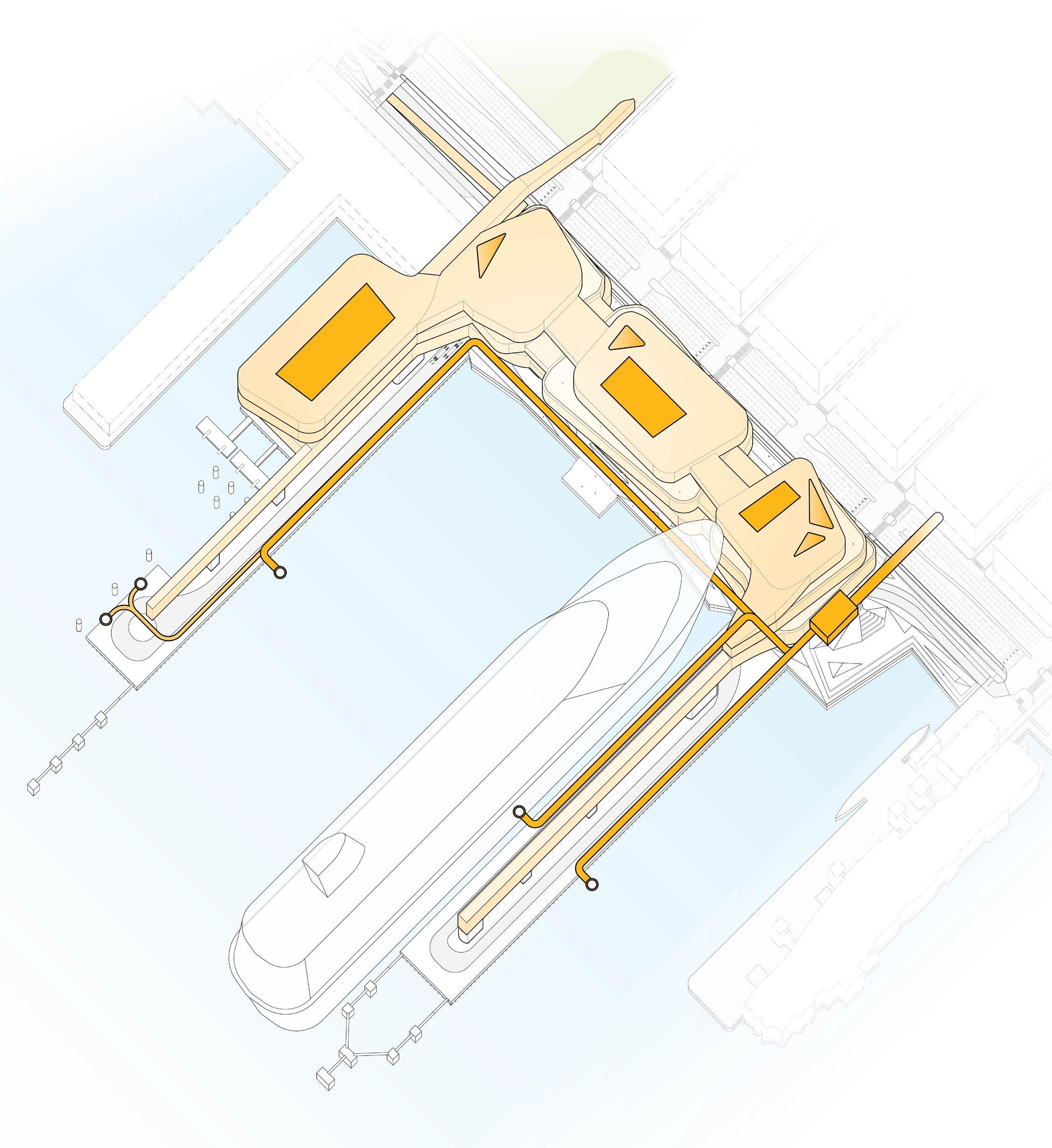
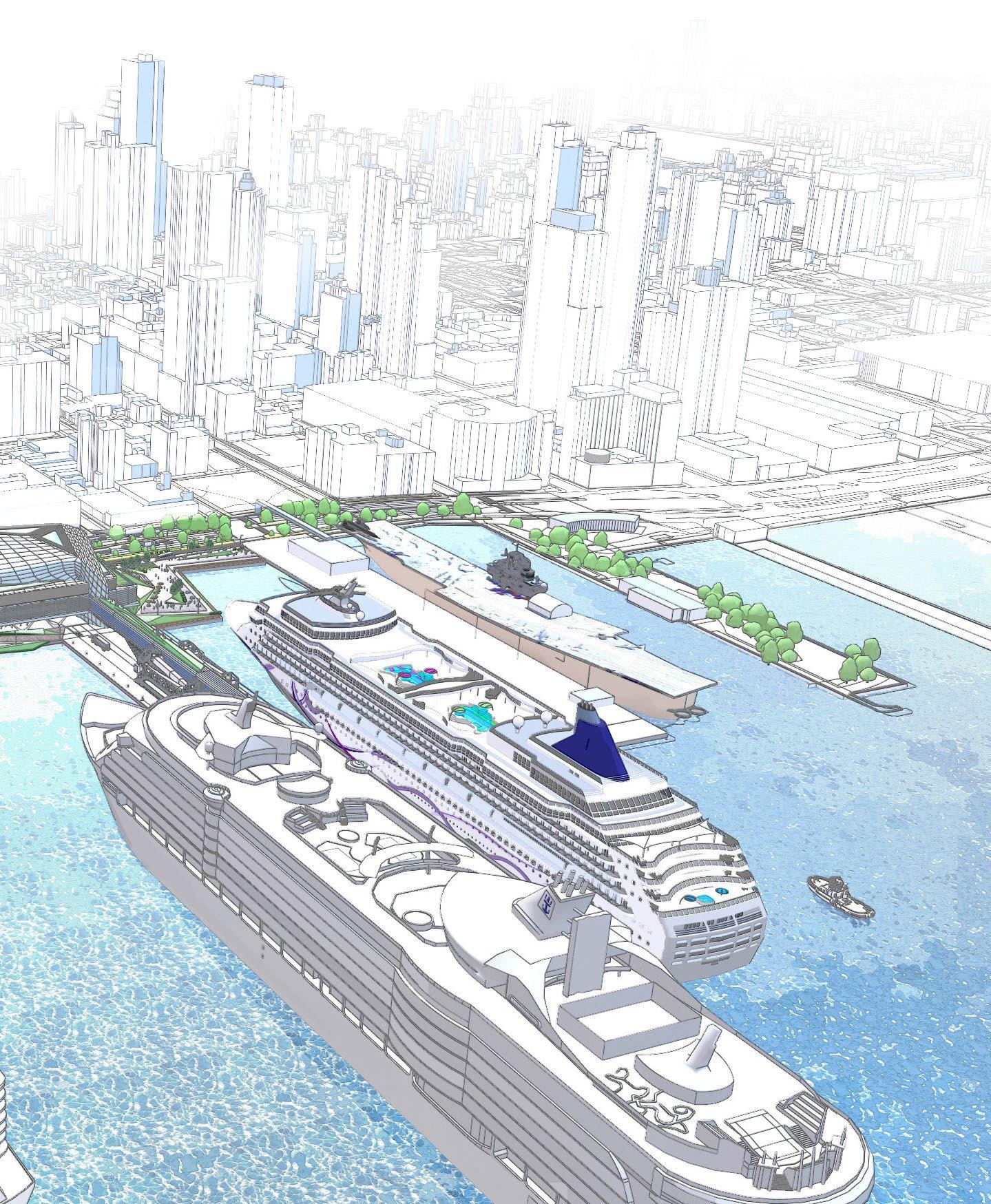
The reimagined MCT features four interconnected terminal buildings, which are strategically relocated from the existing piers to the landside. With two new piers, three berths, and an expanded operational area, the terminal will be able to simultaneously support two 8,000-passenger vessels and one 6,000-passenger vessel. This is achieved through advanced terminal systems, including centralized baggage handling, ensuring operational efficiency and an exceptional passenger experience.
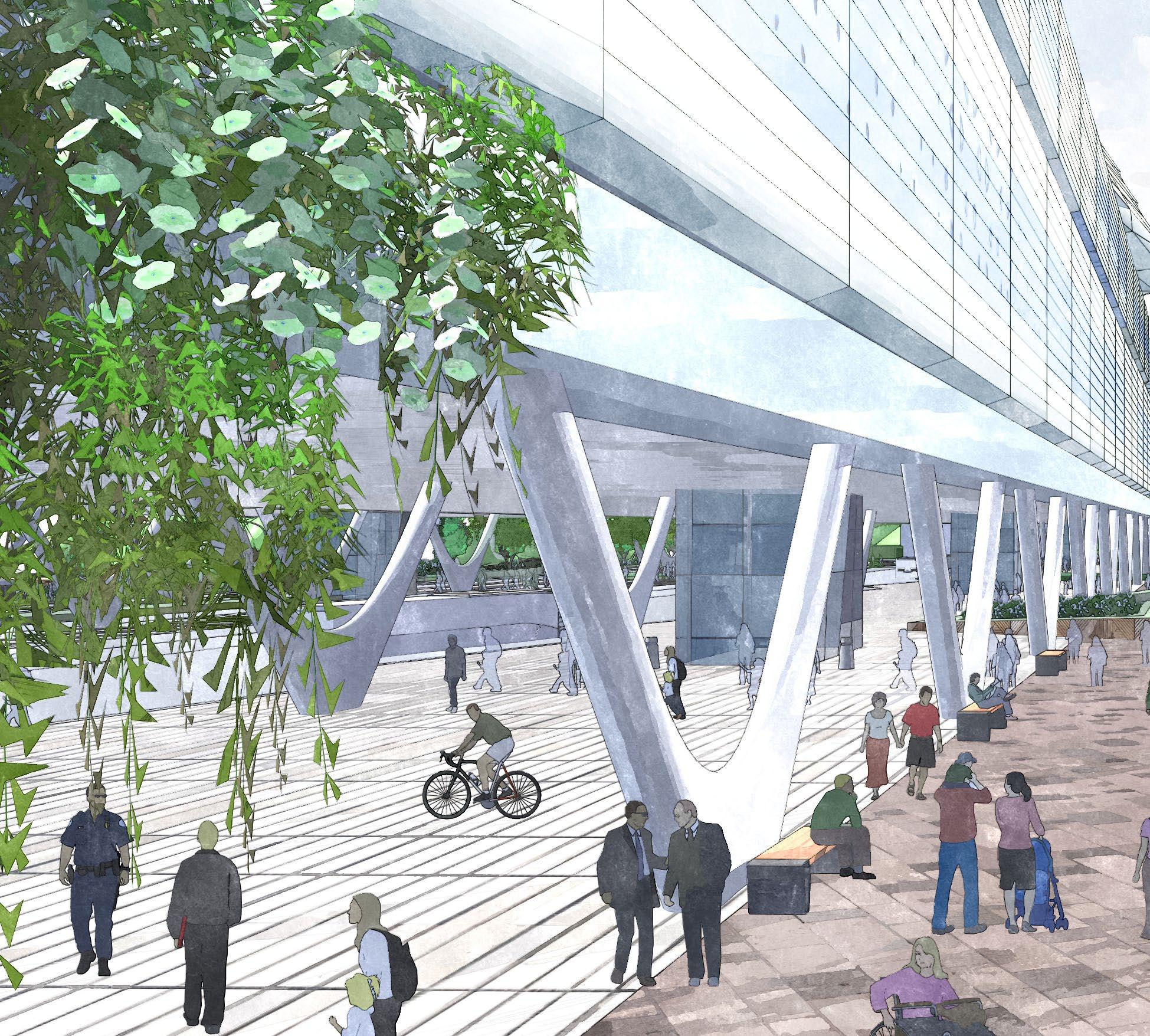
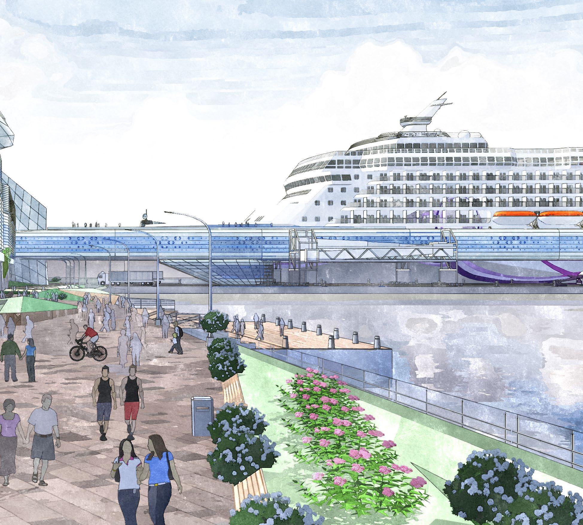
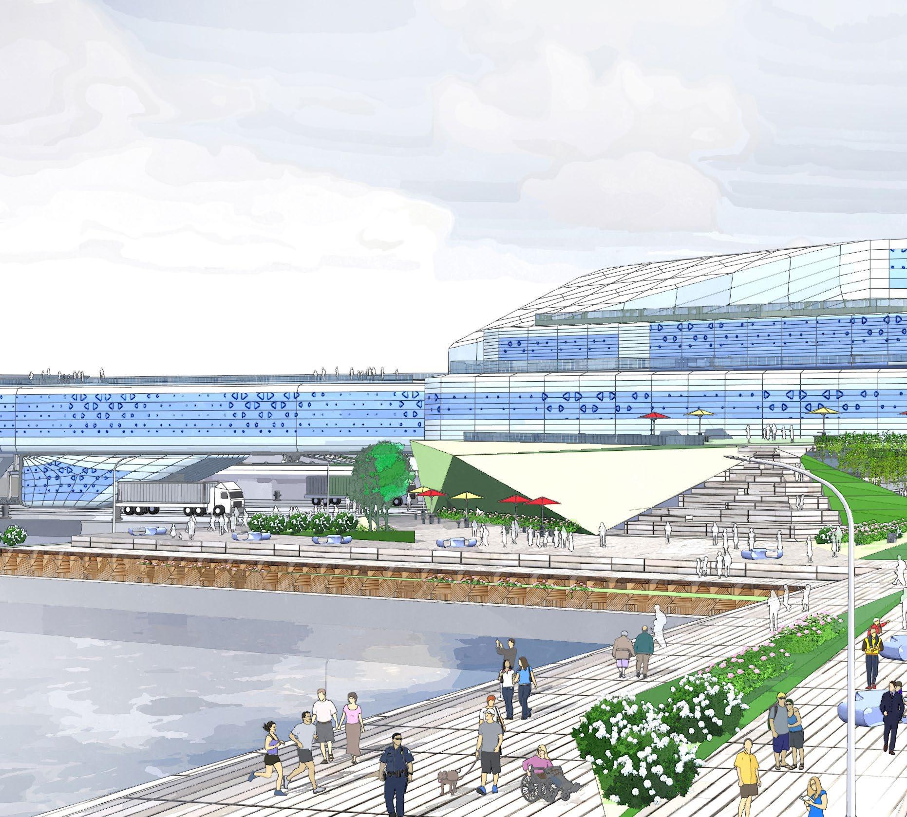
Public access is woven into the site’s design through a network of inviting, accessible spaces. From waterside promenades and stepped plazas to elevated terraces and landscaped greenways, the site offers a seamless connection between the city and the river. These spaces welcome nearby residents, visitors, and cruise passengers alike to engage with the terminal, observe maritime activity, and enjoy panoramic views of the Hudson River and Manhattan skyline.
Strategically located and thoughtfully designed, the terminal supports a range of multimodal uses. A new Blue Highways facility establishes a hub for marine freight distribution. The infrastructure also unlocks the integration of a ferry terminal on the site, enabling Hudson River ferry service for travelers and expanding non-vehicular access to the facility. Together, these elements create a dynamic, flexible waterfront that supports both passenger and freight mobility in a sustainable and futureready manner.
Sustainability is a cornerstone of the terminal’s design. Shore power infrastructure enables cruise ships to shut down their auxiliary engines while docked thereby reducing emissions. Rooftop solar arrays help offset the terminal’s energy demands, while other innovative technologies like geothermal exchange may be implemented to optimize building performance and reduce strain on the local grid. These integrated systems reflect NYCEDC’s commitment to environmental stewardship and align with citywide goals for decarbonization and improved energy efficiency.
BERTHC
SOUTHPIER
W52ndSt. W51stSt. W50thSt. W49thSt. W48thSt.
WestSideHighway
The terminal is comprised of four elevated buildings connected by skybridges that facilitate passenger flow, while enhancing view corridors along the waterfront. These structures house public amenities, passenger services, and operational functions, forming a cohesive development that responds to its urban context. Further integrating the terminal with its surroundings, a new pedestrian bridge will link the northern portion of the terminal with neighboring DeWitt Clinton Park across the West Side Highway. Strategic setbacks and massing shifts create terraces and gathering spaces, offering elevated viewing areas of the city and river while enhancing the pedestrian experience at the ground level.
Two newly constructed finger piers extend into the Hudson River, supporting provisioning, baggage handling, and shore power connections. Elevated concourses atop the piers directly link to the terminal’s third level, streamlining passenger embarkation and disembarkation. The North Pier also houses a Blue Highways site, parking structure, ferry landing, and slips for electric harbor craft to support a multifunctional waterfront.
For the first time ever, all ground transportation functions will be consolidated directly on-terminal, marking a major leap forward in passenger convenience and operational efficiency. Located beneath the elevated terminal buildings, the dedicated GTA is designed to accommodate shuttle buses, taxis, rideshare services, and private vehicles within clearly defined, purpose-built zones. This centralized approach streamlines arrivals and departures, while high-visibility crosswalks and intuitive circulation patterns ensure safe pedestrian movement. An adjacent parking facility on the North Pier provides direct access for personal vehicles, and a spacious ground-level entrance supports smooth passenger flow, even on the busiest cruise days.
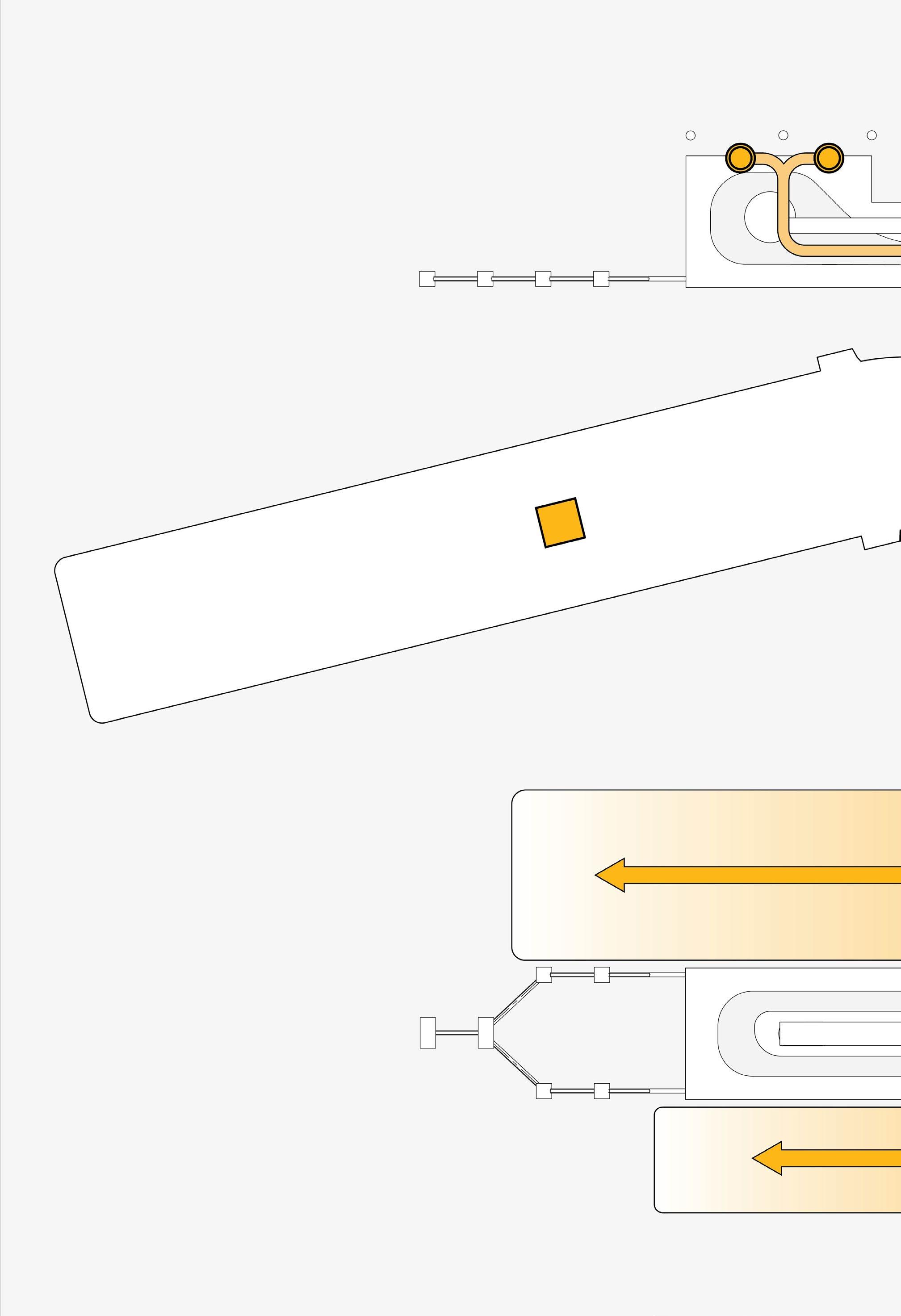
Shore power is available at all three berths, enabling vessels to connect to the City’s electrical grid and shut down their auxiliary engines while docked. The system is designed to support three cruise ships simultaneously, significantly reducing emissions and improving air quality. A dedicated on-site substation and robust electrical infrastructure ensure reliable power delivery.
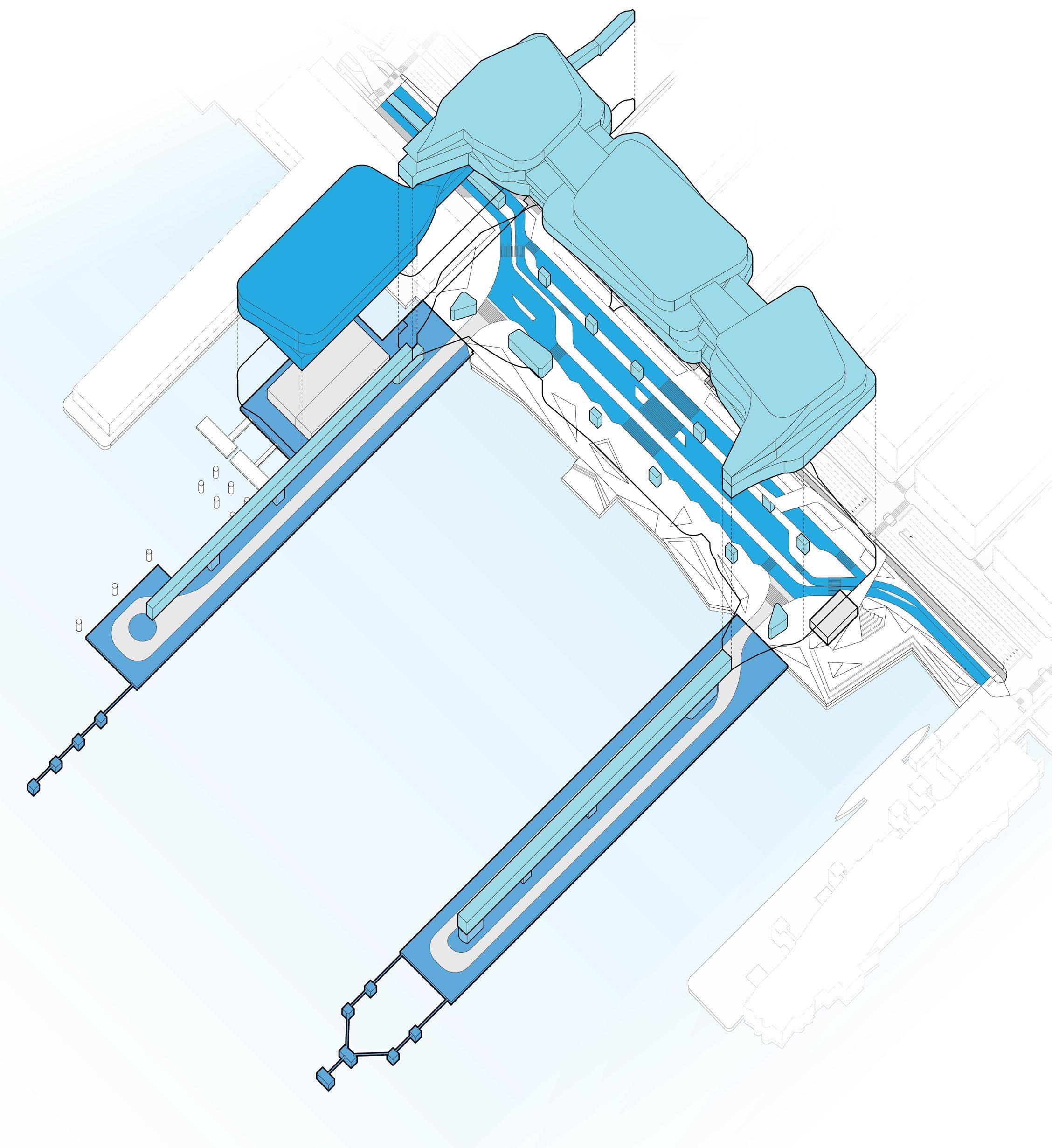
The ground level serves as the terminal’s primary gateway, featuring the GTA, direct pier access for cruise ship provisioning, public community spaces, and a Blue Highways site. This level is designed for efficient circulation and seamless integration of passenger, freight, and pedestrian activity.
The GTA accommodates a range of transportation modes, including shuttle buses, coaches, taxis, rideshare services, privately owned vehicles (POV), and ferries. Each mode has dedicated points of ingress and egress, with pedestrian routes safely crossing the West Side Highway to connect the terminal to the surrounding neighborhood.
BUSES & SHUTTLES Enter
PICK-UP
Level 2 houses the Arrival Hall, spacious baggage claim areas, and special services for disembarking passengers. Terminal administration offices are also located on this level. The Public Lobby serves as an entry point to access the elevated terraces.
At the north end of Level 3, embarking passengers undergo security screening in the Departure Hall, while in the central building, disembarking passengers are processed through primary immigration services. Level 3 also supports back-of-house functions for immigration and baggage screening. Level 4 features expansive passenger lounges and waiting areas which create a memorable start to every journey.
Passenger embarkation begins at the terminal’s northernmost building, accessible via the GTA, pedestrian bridge, or parking structure. Upon arrival, passengers proceed through security screening. After clearing security, guests ascend to the fourth-floor lounges, where optional in-person check-in is available. From there, they continue to the concourse for seamless boarding.
Passengers on-foot can access the terminal safely via the pedestrian bridge
Passengers arriving via personal car access the terminal through the parking structure
Passengers arriving via ferry access the terminal through the ferry landing and parking structure
Passengers arrive at the terminal via taxi, rideshare, bus, or shuttle
Passengers must undergo security screening in the Departure Hall before accessing the terminal lounges and in-person check-in services
Passengers who have not completed online check-in prior to arrival may do so at designated points within the lounge area
Passengers can relax and take in city views from lounges on the top floor of the terminal
VESSEL EMBARK
Passengers board cruise vessels via concourses and ramps positioned on each pier
Passengers disembark via elevated concourses and proceed through immigration. Baggage claim follows, with efficient retrieval supported by the terminal’s baggage handling system. Exiting through the lobby, passengers reconnect with the GTA, parking, or pedestrian pathways for a smooth transition back into the City.
All disembarking passengers can connect to their departure mode of transport through the second floor Arrival Hall
Passengers departing via personal car leave the terminal through the parking structure
Passengers departing via ferry leave the terminal through the parking structure and ferry landing
Passengers on foot can leave the terminal safely via the pedestrian bridge
Passengers depart the terminal via taxi, rideshare, bus, shuttle, or on-foot through the GTA
Disembarking passengers are screened and processed through immigration
3 1 BAGGAGE CLAIM
Passengers can pickup their luggage at one of the terminal’s three baggage claims
Passengers leave the vessel via the concourse, which separates them from passengers embarking or disembarking other vessels
The terminal’s new pile-supported piers extend 1,125 feet into the Hudson River. To accommodate the full length of Design Vessels, the overall pier structures, including mooring dolphins at the western ends, extend approximately 650 feet beyond the existing infrastructure. These enhancements significantly expand the terminal’s capabilities, improving berthing efficiency and safety in the dynamic river environment.
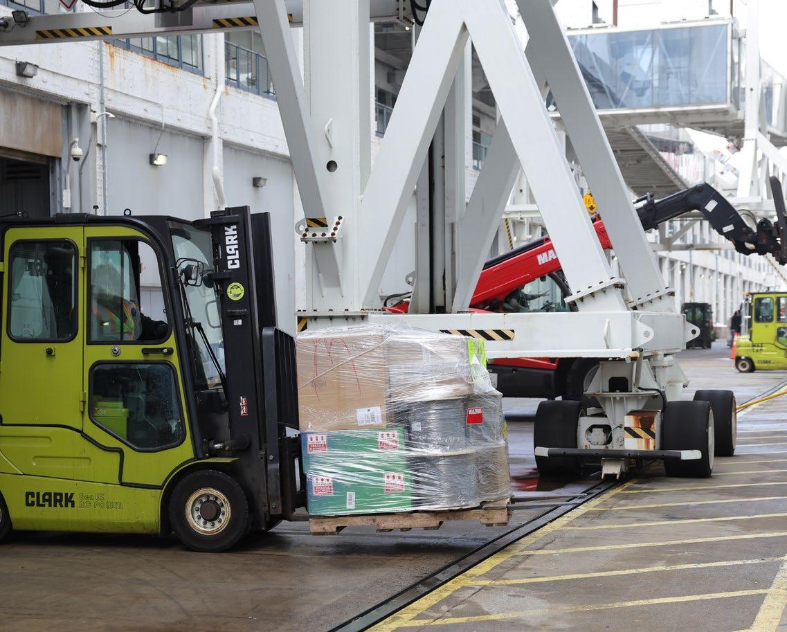
Cruise provisioning is the process by which food, beverages, and other essentials are brought to the cruise terminal and transferred to a cruise ship. This is managed through a coordinated system of freight deliveries and pier-based loading operations. On cruise days, the pier decks are dedicated to provisioning, allowing for efficient transfer of goods from trucks to vessels. Accessed via the GTA, the provisioning area includes designated queuing zones for delivery vehicles, minimizing congestion in the surrounding area. The pier deck will also include access to a power supply for refrigerated vehicles, allowing compatible trucks to turn off their engines while awaiting vessels arrivals. Looking ahead, the terminal may explore barge-based provisioning, enabling direct deliveries from marine hubs throughout the city, such as the Hunts Point Marine Terminal, offering an alternative to truck-based logistics.
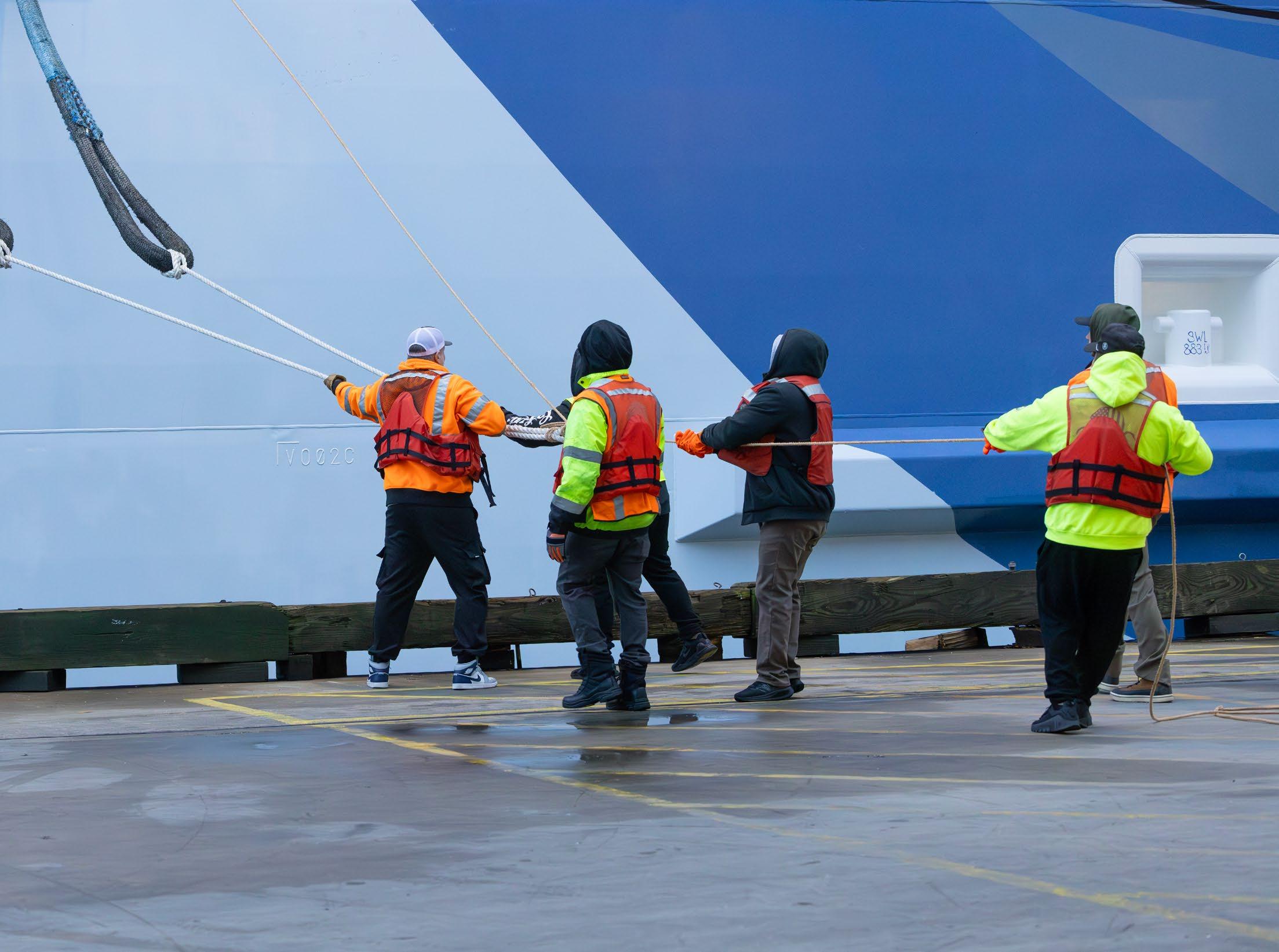
The terminal’s three berths, two flanking the South Pier and one along the North Pier, are designed to accommodate the length, width, and draft of modern cruise vessels. Their generous size allows for safe berthing despite strong tidal currents. NYCEDC will also continue existing dredging operations at the terminal to ensure sufficient depth for safe navigation.
A centralized baggage handling system serves all three berths, streamlining the flow of luggage for both embarkation and disembarkation. This system will consolidate baggage into secure, transportable units, enhancing throughput, reducing delays, and maintaining high security standards. This modern baggage handling system is integral to support high passenger throughput while improving the overall travel experience.
1 ENTRY
Provisioning trucks access the terminal from the north
Baggage conveyors are located within pier concourses
Piers are equipped with looped roadways to ensure efficient truck movement
Provisioning trucks share GTA roadways with buses and shuttles
A BAGGAGE DROP-OFF
Passengers can drop-off large bags at portals located at multiple points in the GTA
Bags are scanned and processed before being sent to the cruise vessel
4 EXIT
Provisioning trucks leave the terminal to the south
BAGGAGE LOADING
Bags are loaded directly on to vessels via conveyor systems built into the concourse
3 PROVISIONING VESSELS
Occurs on the pier deck with loaders moving goods between trucks and cruise ships
2 PIER ACCESS
Trucks access piers through secure gates located at the end of each pier
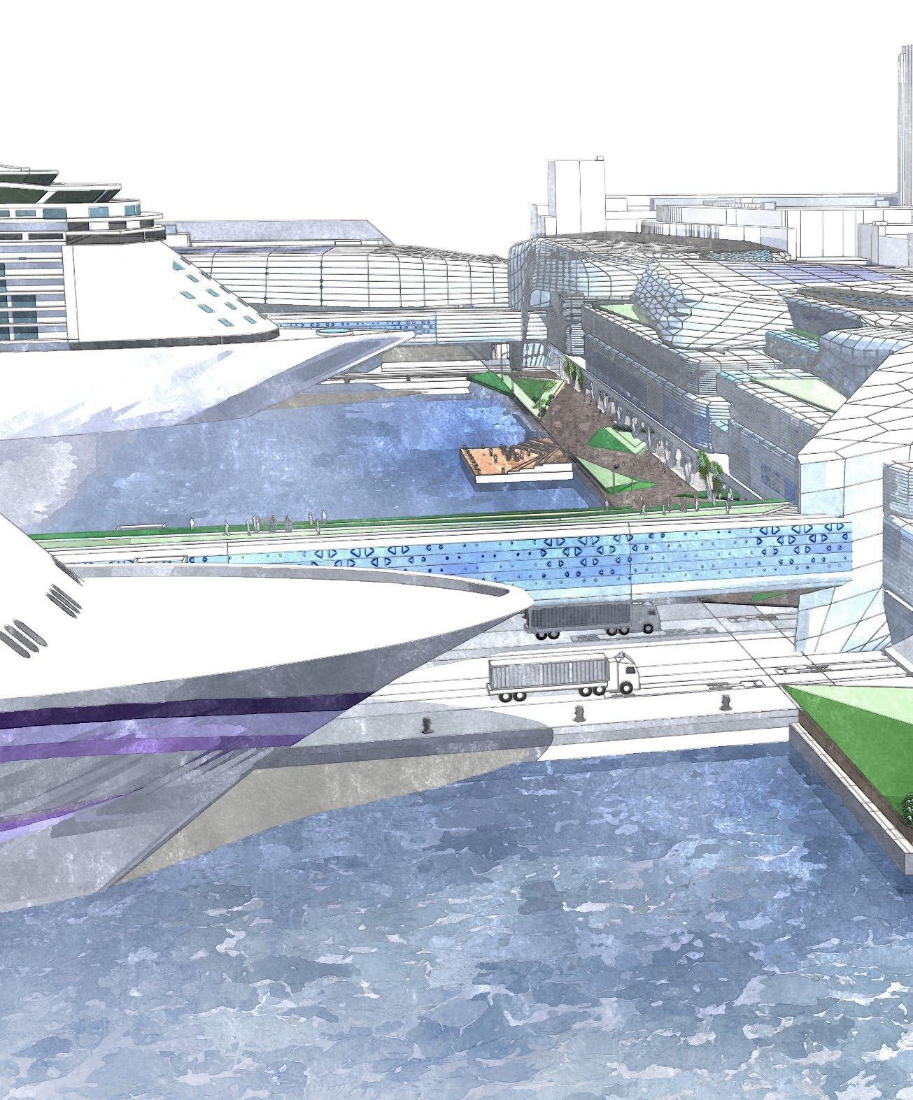
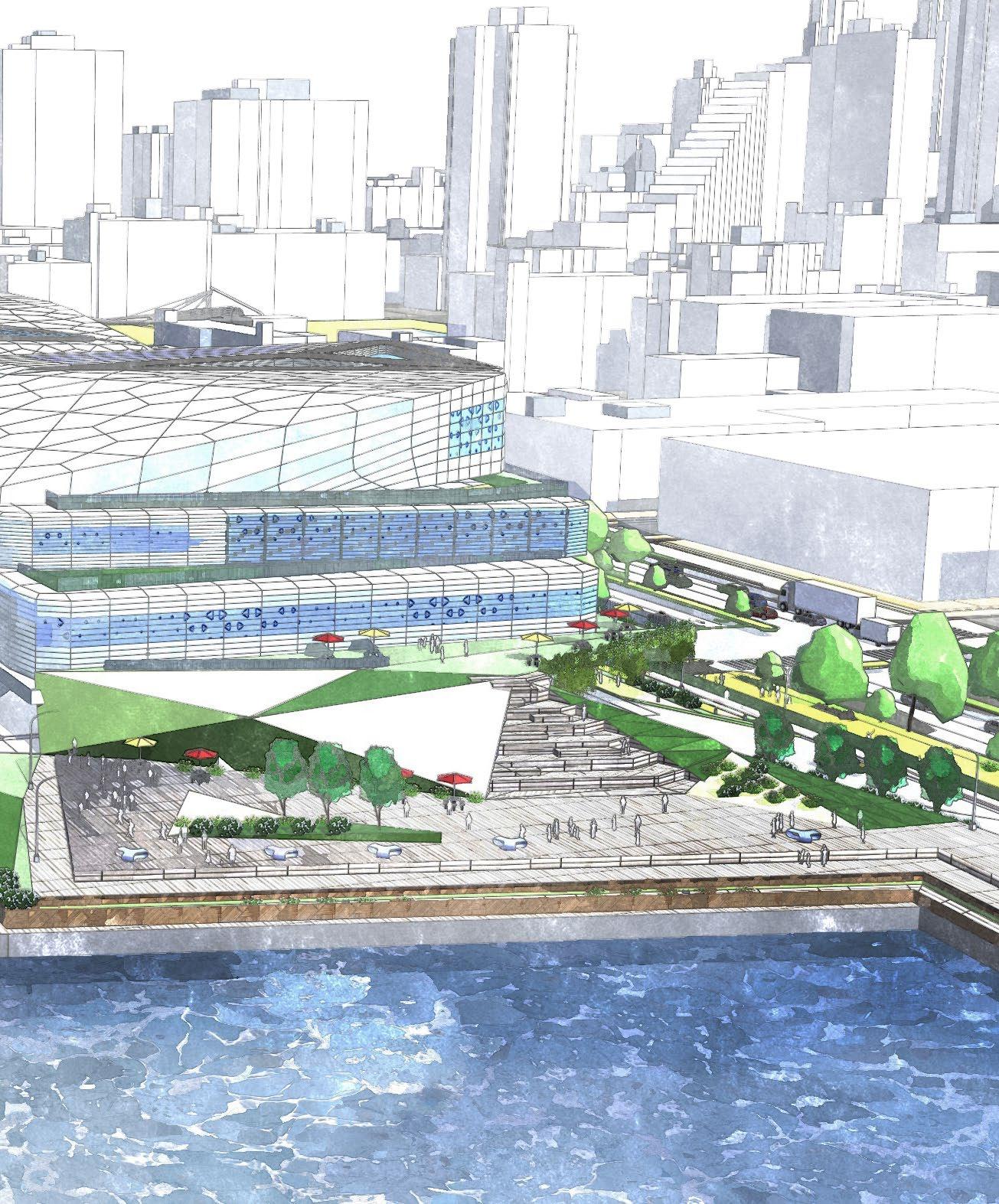
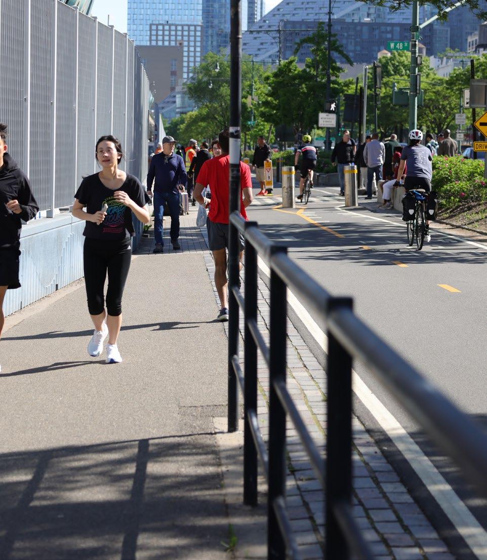
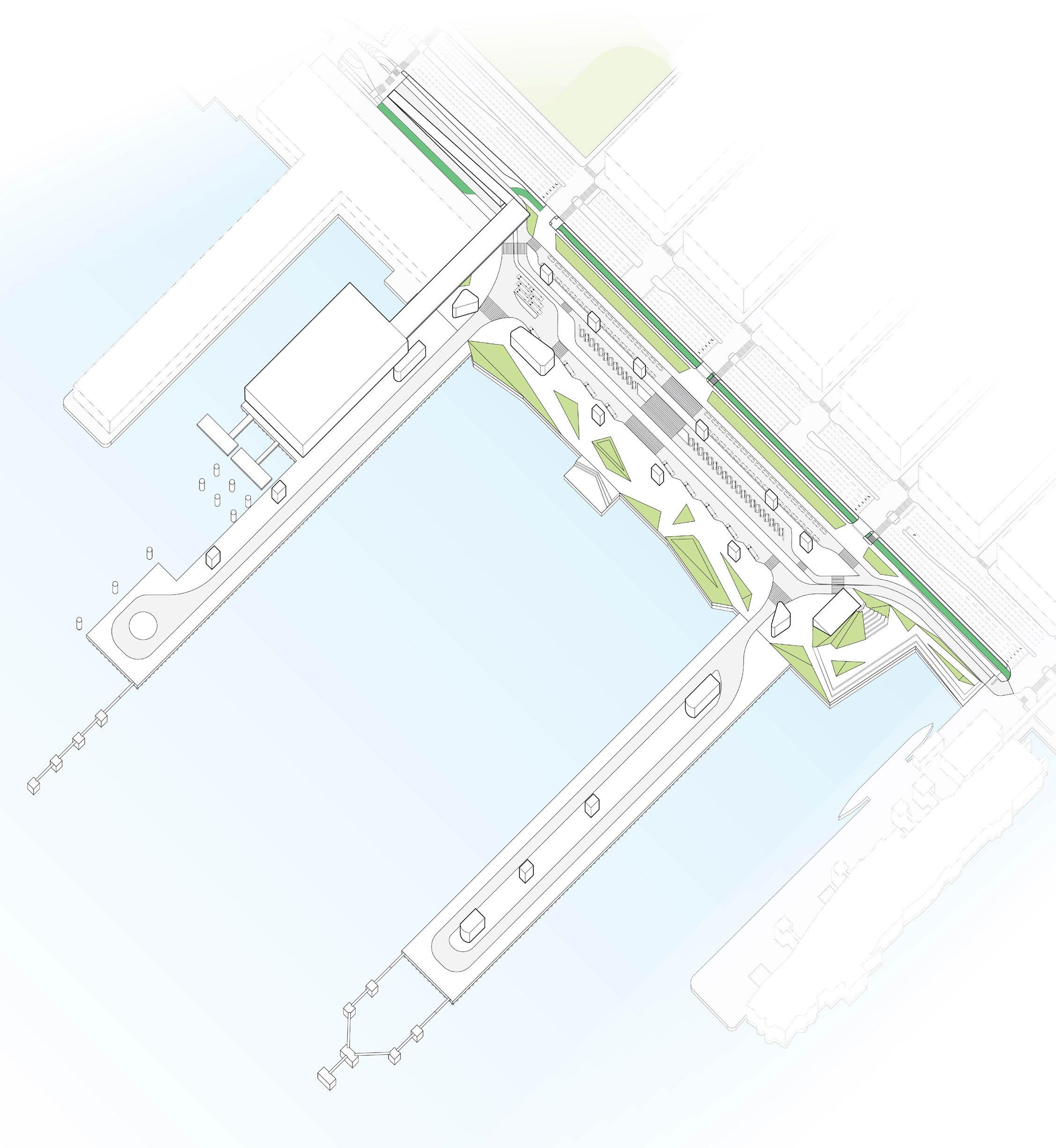
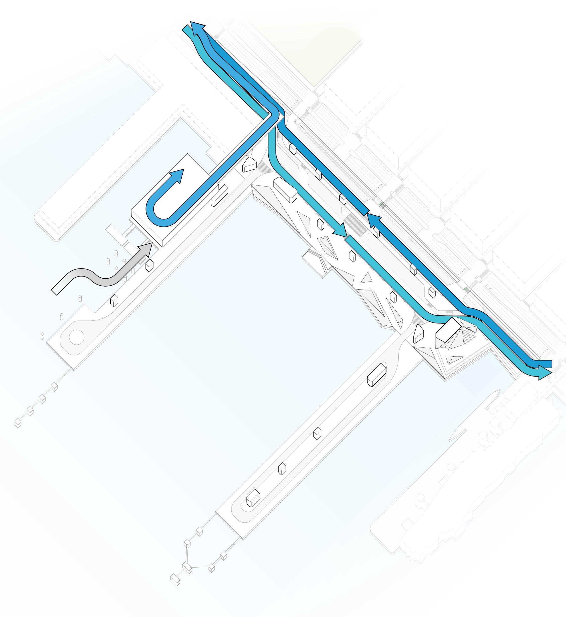
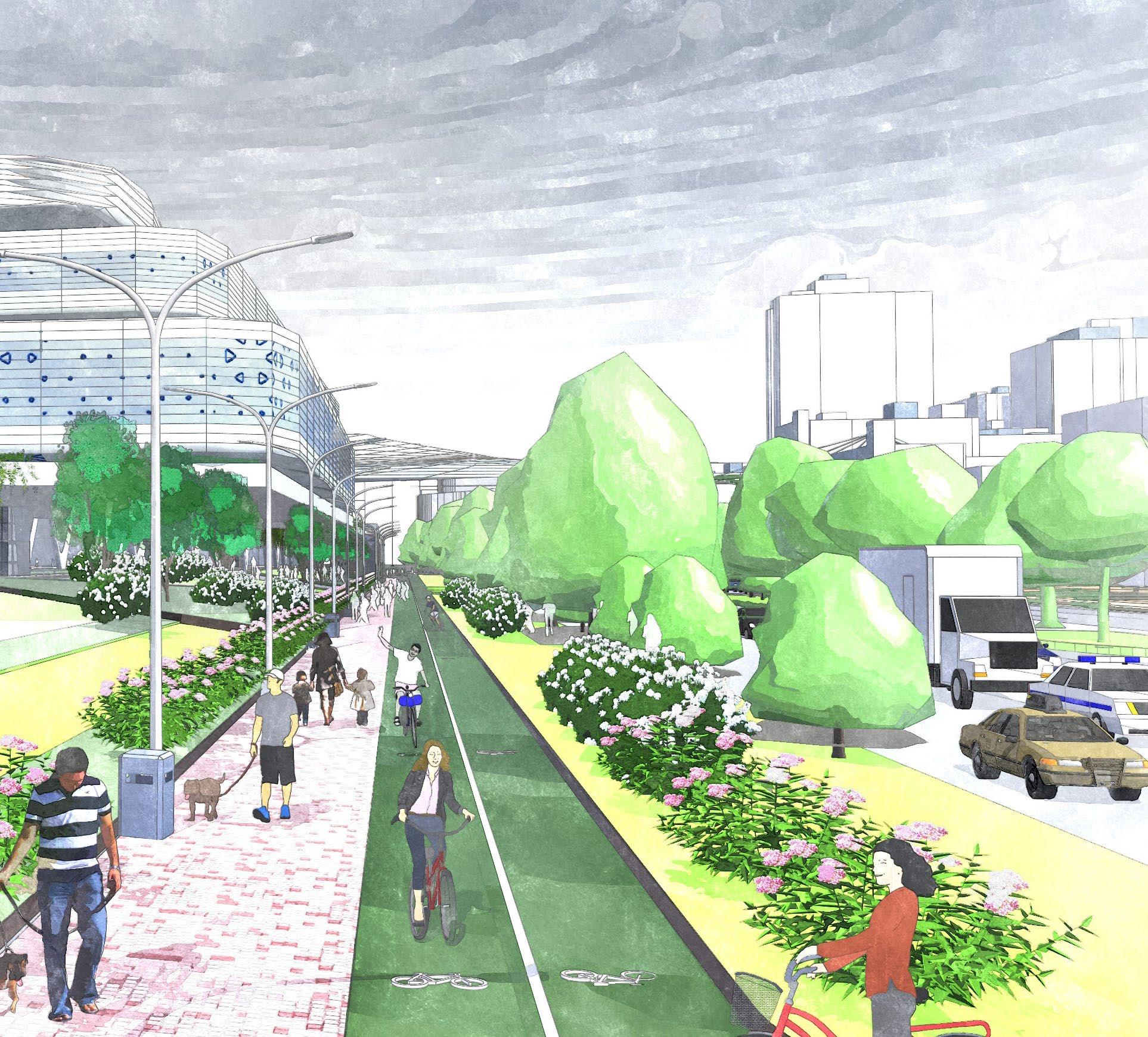
The terminal’s design prioritizes public access to the waterfront, using terraced forms and elevated pathways to create inviting spaces. These areas offer unique perspectives of maritime activity and the city skyline, encouraging community engagement and transforming the terminal into a vibrant destination.
Located along the Route 9A Bikeway/Walkway, the terminal acts as a connective node between northern and southern parklands. Expanded pathways and integrated public spaces enhance the continuity of the bikeway/walkway, drawing pedestrians and cyclists into the site and reinforcing its role as a key link in Manhattan’s waterfront network.
To ensure safe coordination among cruise operations and other Hudson River users, the terminal will implement waterside improvements that enhance visibility, communication, and operational awareness. Real-time current and temperature meters will be installed along the pier structures, with publicly accessible data portals to support informed navigation. NYCEDC will also engage an independent maritime coordination entity to oversee vessel traffic management in the area, acting as a neutral facilitator to ensure clear communication among cruise lines, ferries, recreational boaters, and commercial operators. These measures will foster a safer, more collaborative waterfront environment, reinforcing the terminal’s role as a shared civic and maritime asset.
The terminal features a portfolio of diverse, engaging, and welcoming spaces that draw the public in.
Promenades
Waterfront walkways that engage terminal visitors with the water and cruise ships.
Plazas
Places for gathering that allow for flexible programming and connection with the site.
Terraces
Elevated areas that scale the terminal buildings, providing unique views and vantage points.
Piers
Large, flexible gathering and leisure areas for public use on non-cruise days.
Expanded Bikeway / Walkway
Widened pathways for walking and biking with improved signalization and wayfinding to enhance safe movement along this north-south corridor.
Pedestrian Bridge
Connects the terminal to the surrounding neighborhood, bypassing the West Side Highway.
Concourse Rooftops
Elevated areas where visitors can get an up-close look at cruise ships and wave goodbye to departing friends or family.
Running parallel to the Hudson River, the promenade is a signature feature of the terminal’s public realm. With wide walkways, landscaped green space, and scenic overlooks, it offers a front-row seat to maritime activity.
On non-cruise days, the terminal’s piers transform into public spaces. By opening access to the community, the piers will become a new destination for leisure activities year-round.
The pedestrian bridge offers a vital and dynamic link connecting the terminal to DeWitt Clinton Park, offering safe, elevated access over the West Side Highway for both cruise passengers and the local community. By seamlessly tying the terminal into its urban surroundings, the bridge enhances connectivity, encourages public use of waterfront spaces, and transforms the terminal into a gateway to the city.
Positioned at the southern end of the site, the plaza provides layered views of the Hudson River and the Intrepid Sea, Air & Space Museum at Pier 86. The space activates an area created by the terminal’s substation, with its sloped design allowing for connection to the building’s terraces. Its multi-tiered design provides space for seating, resting, and fitness activities.
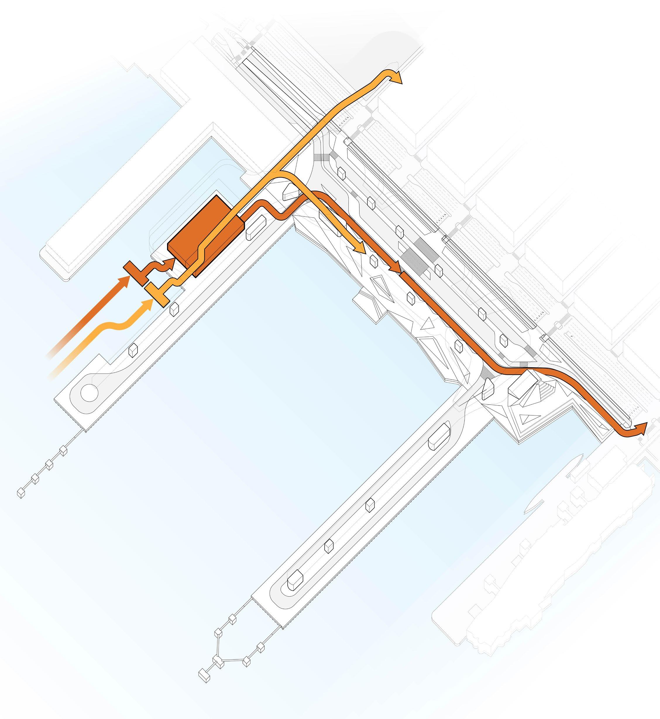
BLUE HIGHWAYS SITE
FERRY PASSENGER ACCESS TO THE TERMINAL AND NEIGHBORHOOD
CONNECTION TO GTA
FERRY & BARGE LANDING
To meet the energy demands of berthed vessels, the terminal is equipped with a shore power system serving all three berths. Connected to the electrical grid via a new on-site 70MVA substation, the system eliminates the need for ships to run auxiliary engines while docked, largely eliminating local pollutants and greatly reducing emissions.
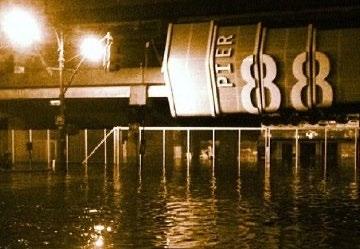
In response to environmental threats, like the impacts of Hurricane Sandy which extensively flooded the site in 2012, the proposed development incorporates a comprehensive set of climate adaptation strategies. Central to the plan is the elevation of the piers to meet or exceed FEMA flood standards, reducing exposure to future storm surges. Beyond compliance, the design responds to long-term sea level rise by integrating adaptive infrastructure and materials that can accommodate changing conditions over time.
The terminal’s expansive rooftops and predominantly daytime passenger activity make it an ideal candidate for solar energy generation. Rooftop solar arrays will help offset the terminal’s daytime energy consumption, particularly during summer months when cooling demands are highest. Pairing this with on-site battery storage would enable the terminal to store excess solar energy for use during peak demand periods or overnight, further enhancing energy resilience.
To meet the terminal’s energy demands sustainably, the development may incorporate a river water heat exchange system that leverages the natural cooling capacity of the Hudson River. By reducing the need for fossil fuel or grid-powered cooling, this system would enhance building efficiency and support the terminal’s commitment to low-emission operations.
Other solutions may include passive design, which reduces energy use through improved thermal performance of building spaces; application of external and internal vegetation, which help to regulate temperatures and improve spatial experience; and automated efficiency systems, such as window blinds, revolving doorways, and dynamic temperature control.
HABOR VESSEL CHARGING
WestSideHighway W51stSt.
W49thSt. W50thSt.
W47thSt. PIER94
BERTHC
NORTHPIER PIER86
SOUTHPIER
BERTHB BERTHA
W48thSt.
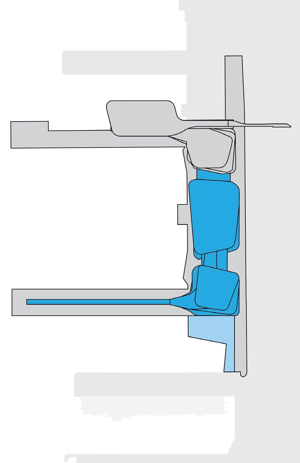
The terminal’s shore power system is supported by a network of high-capacity electrical infrastructure. This system, which encompasses the city grid connection, a new on-site substation, step down transformers, and the ship-to-shore connection equipment, is critical for the electrification of current and future operations.
Power is delivered from the grid to the substation at the southern end of the site, capable of supporting three vessels simultaneously. From there, electricity is routed to step-down transformers on each pier, which supply power to ships via mobile cable management systems. This system ensures uninterrupted service from arrival to departure, enabling full electrification of docked vessels.
The introduction of shore power and the associated infrastructure upgrade are a key priority for NYCEDC and the City. NYCEDC is actively pursuing the ability to implement shore power, starting with the upland connection to the City grid.
These upgrades at the southern end of the site are being pursued to optimize long-term shore power operation and efficiency. This strategic placement concurrently creates an opportunity for the future redevelopment of the north end of the site (discussed in the next section), thereby unlocking the site’s full potential for modernization and operational flexibility.
The complete electrification of the site is projected to require a total electrical demand of 70 MVA, a capacity that Consolidated Edison has indicated can be available. NYCEDC is currently securing this capacity and plans to begin implementation to deliver benefits to MCT operations and the community.
NORTH
ON-PIER CONNECTION
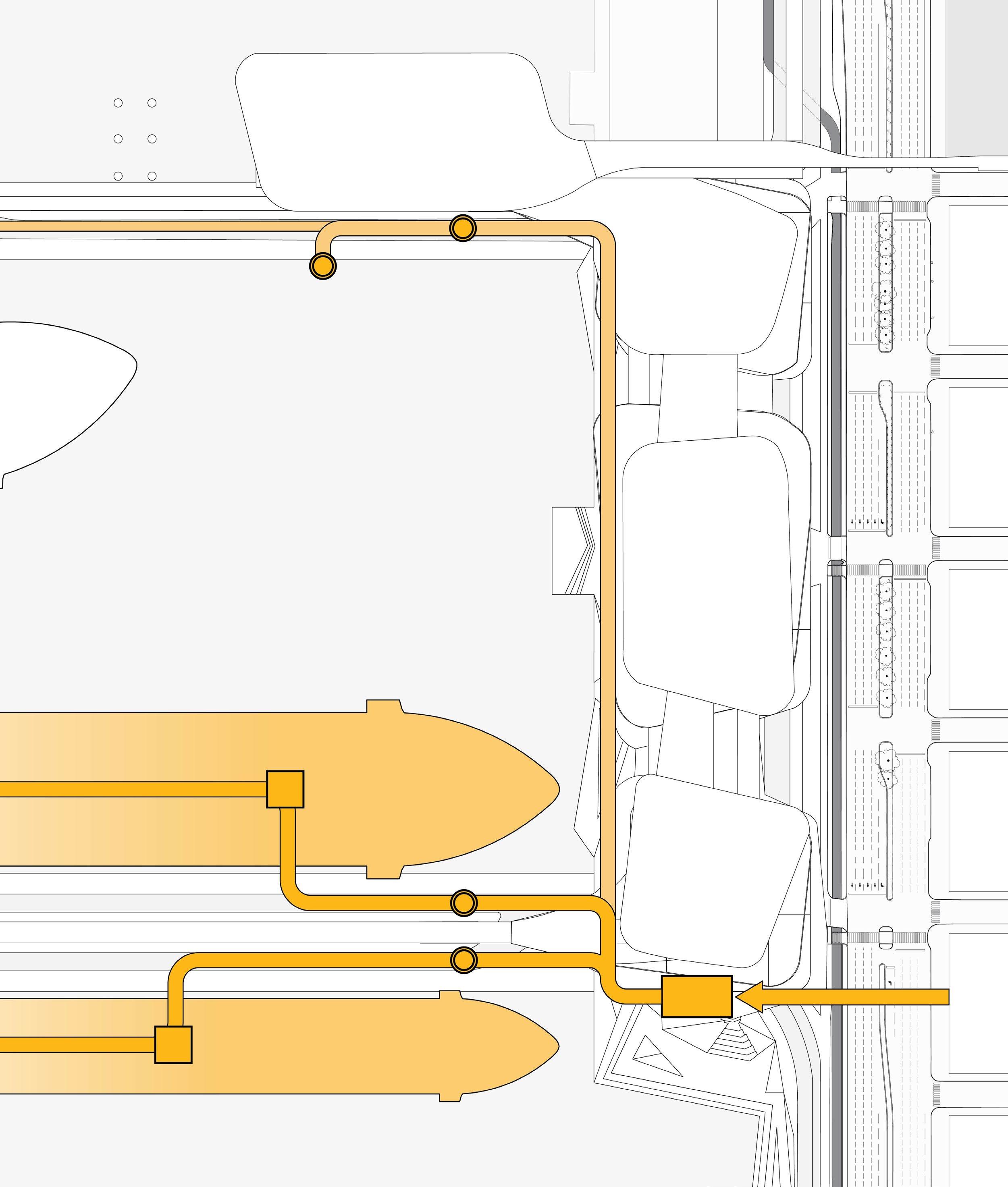
ON-BOARD POWER SYSTEM
STEP-DOWN TRANSFORMER
TERMINAL SUBSTATION
CITY GRID CONNECTION
Phase 3 is focused on preparing the site for the construction of the remaining sections of the terminal. This involves moving all cruise operations from Pier 88 to the new North Pier and terminal structures, after which the old pier can be demolished. The terminal’s existing elevated viaduct system will also be demolished, with vehicles using the new parking and GTA facilities exclusively.
The existing viaduct system is composed of two elevated levels. The first is used for passenger pick-up and drop-off, while the second is used to access rooftop parking. Removing this structure will be a carefully coordinated process, which will involve each element being removed in progressive demolition stages.

Phase 4 includes the construction of the South Pier and the completion of site-wide land creation and grade elevation, setting the stage for the final terminal buildings and the full network of integrated public spaces. During this phase, all cruise operations will be temporarily concentrated on the North Pier. To support this shift and to establish a lasting connection between the terminal and the surrounding neighborhood, a new pedestrian bridge will be constructed across the West Side Highway. This bridge will not only facilitate cruise operations during construction, but also serve as a permanent, transformative link between the terminal and DeWitt Clinton Park.
The new pedestrian bridge is a critical component of the improvements being made to pedestrian access and safety at the terminal. The bridge will connect the east side of the West Side Highway at W 52nd Street to the terminal’s second floor, providing both passengers and visitors safe and easy access to the site. The bridge will further extend the reach of the pedestrian pathways that run along the Hudson River, integrating green spaces and public space programs in the area.
Phases 3 and 4 will see terminal operations limited to a single pier and a single berth–Berth C.
Phase 5, the final stage of the terminal’s redevelopment, will see the completion and activation of all new structures and facilities. These will include the central and southern terminal structures, a concourse on the South Pier, the permanent GTA, activation of the Blue Highways hub on the North Pier, and the site’s numerous green and public spaces. Once operable, the terminal will be capable of supporting three cruise vessels simultaneously, across its three berths.
Implementing the new GTA will require significant roadway and curbside improvements. Through these improvements, the terminal will be capable of handling multiple passenger transport modes, in addition to provisioning vehicles and the micromobility vehicles supporting Blue Highways services.
To activate the site’s new public spaces, a stepped plaza, located above the relocated terminal substation, will be constructed at the southern end of the site. This plaza connects both ground level and elevated public spaces, functioning as a nexus for gathering.
As part of this Master Plan, the City is committing $20 million in critical seed funding to accelerate the development of the off-site grid connection needed for shore power, thereby bringing the necessary power delivery point to the MCT property line. This initial investment is the first step to achieve “shore power site readiness” ahead of the Plan’s first phase. By advancing this work now, the City is decisively shifting shore power from a long-standing aspiration to a tangible step forward to site readiness that reflects community urgency and directly advances the City’s climate goals.
To ensure this vision of the Master Plan is fully realized and sustainably financed, the project will focus on engaging private partners and cruise industry stakeholders. This approach will involve strategically aligning their financial incentives with the project’s long-term operational and environmental goals. Securing investment and expertise from the private sector is essential for unlocking the necessary capital funds to complete the large-scale infrastructure and upland development outlined in the Master Plan.
To realize the full vision of the Master Plan, the new piers must extend further into the Hudson River. Because the extended piers fall within the Federally Authorized Navigation Channel, the impacted area must be deauthorized through a federal process called the Water Resources Development Act (WRDA), next scheduled for 2026. To support this, NYCEDC is leading a Navigation Safety Risk Assessment, evaluating impacts to vessel operations through detailed traffic analyses, simulation modeling, and direct engagement with commercial pilots and recreational users. With WRDA approaching, this effort is a time-critical step toward unlocking the full Master Plan and ensuring the terminal’s redevelopment is aligned with its waterfront context.
Public engagement is an important throughline of the project, extending from the Master Plan stage through design, entitlement, and construction. Building upon recent dialogue with local elected leaders, community stakeholders, industry leaders, and agencies, NYCEDC will continue to coordinate with the local community to solicit input and integrate community priorities into future phases. NYCEDC will also continue to coordinate with government agencies and regulators to meet all regulatory and planning standards.
Successful implementation mandates an integrated strategy that balances the terminal’s core function with the mitigation of community and environmental impacts. To this end, further program validation during schematic design will require a multidisciplinary approach. The eventual architectural and engineering team will include specialized transportation and ecology subconsultants to ensure design advancements prioritize safety and efficiency from the landside and waterside, ultimately ensuring the design is environmentally and operationally responsible.
5
Environmental Review and Approvals
6
DETAILED DESIGN
Further Program Validation, Architecture and Engineering
7
PHASES 1-2
Removal of Piers 90 and 92, North Pier Buildout
8
Pier 88 & Viaduct Removal, South Pier Buildout, Full Terminal Activation
The Manhattan Cruise Terminal Master Plan is the result of collaboration with community and elected leaders, industry experts, and public participants to establish a bold vision for redevelopment of MCT into a future-ready gateway that serves both the local community and the cruise industry. This Plan is a framework to help guide the future phases of the project alongside continued community engagement and public participation.
• American Waterways Operators
• Carnival Corporation
• Consolidated Edison
• DonJon Marine Corporation
• Downtown Boathouse, Inc.
• Harbor Safety, Navigation, and Operations Committee
• Hornblower Corporation
• Hudson River Community Sailing
• Hughes Marine
• International Longshoremen’s Association
• Manhattan Kayak Co
• Maritime Association of the Port of NY & NJ
• McAllister Towing
• Metro Pilots
• Miller’s Launch
• Moran Towing Corporation
• MSC Cruises
• New York City Water Trail Association
• New York Cruise Lines
• New York Outrigger
• NY Waterway
• Norwegian Cruise Line
• Ports America
• PowerCon
• Reicon
• Royal Caribbean Group
• Shipping Association of NY & NJ
• United NY and NJ Sandy Hook Pilots’ Association
• Vane Brothers
• Viking Cruise Lines
• Watts Marine
• Hudson River Park Foundation, NY-NJ Harbor & Estuary Program
• Hudson River Park Trust
• Hudson Yards Hell’s Kitchen Alliance
• Intrepid Sea, Air & Space Museum
• Javits Center
• Manhattan Borough President Mark Levine
• Manhattan Chamber of Commerce
• Manhattan Community Board 4
• NYC Council Member Erik Bottcher
• NYS Assembly Member Linda B. Rosenthal
• NYS Senator Brad Hoylman-Sigal
• Office of Congressman Jerry Nadler
• Office of U.S. Senator Chuck Schumer
• Office of U.S. Senator Kirsten Gillibrand
• Riverkeeper
• Times Square Alliance
• Vornado Realty Trust
• Waterfront Alliance
• FDNY Marine Division
• New York Police Department Harbor Unit
• NYC Department of Sanitation
• NYC Parks Marine Division
• NYC Soil and Water Conservation District
• NYC Department of City Planning
• NYS Board of Commissioners of Pilots
• NYS Department of Environmental Conservation
• Port Authority of New York & New Jersey
• US Army Corps of Engineers New York District
• US Coast Guard Sector New York
Unless otherwise cited, all images and graphics included in this document are the property of the New York City Economic Development Corporation. Special thanks to the Library of Congress, NYC Department of Records, and South Street Seaport Museum for permission to use select imagery from their respective archives.
BCT Brooklyn Cruise Terminal
BMT Brooklyn Marine Terminal
CNE Canada / New England
GTA Ground Transport Area
LNG Liquefied Natural Gas
MCT Manhattan Cruise Terminal
MVA Mega-Volt-Amperes
NYCEDC New York City Economic Development Corporation
PANYNJ Port Authority of New York & New Jersey
POV Privately Owned Vehicle
PROJECT PRINCIPAL | Port Master Planning
TEAMING PARTNERS
Bermello Ajamil & Partners, a Woolpert Company | Cruise Terminal Planning & Design
Greenman-Pedersen, Inc. | Transportation
Karp Strategies | Community Engagement
Woolpert, Inc. | Planning