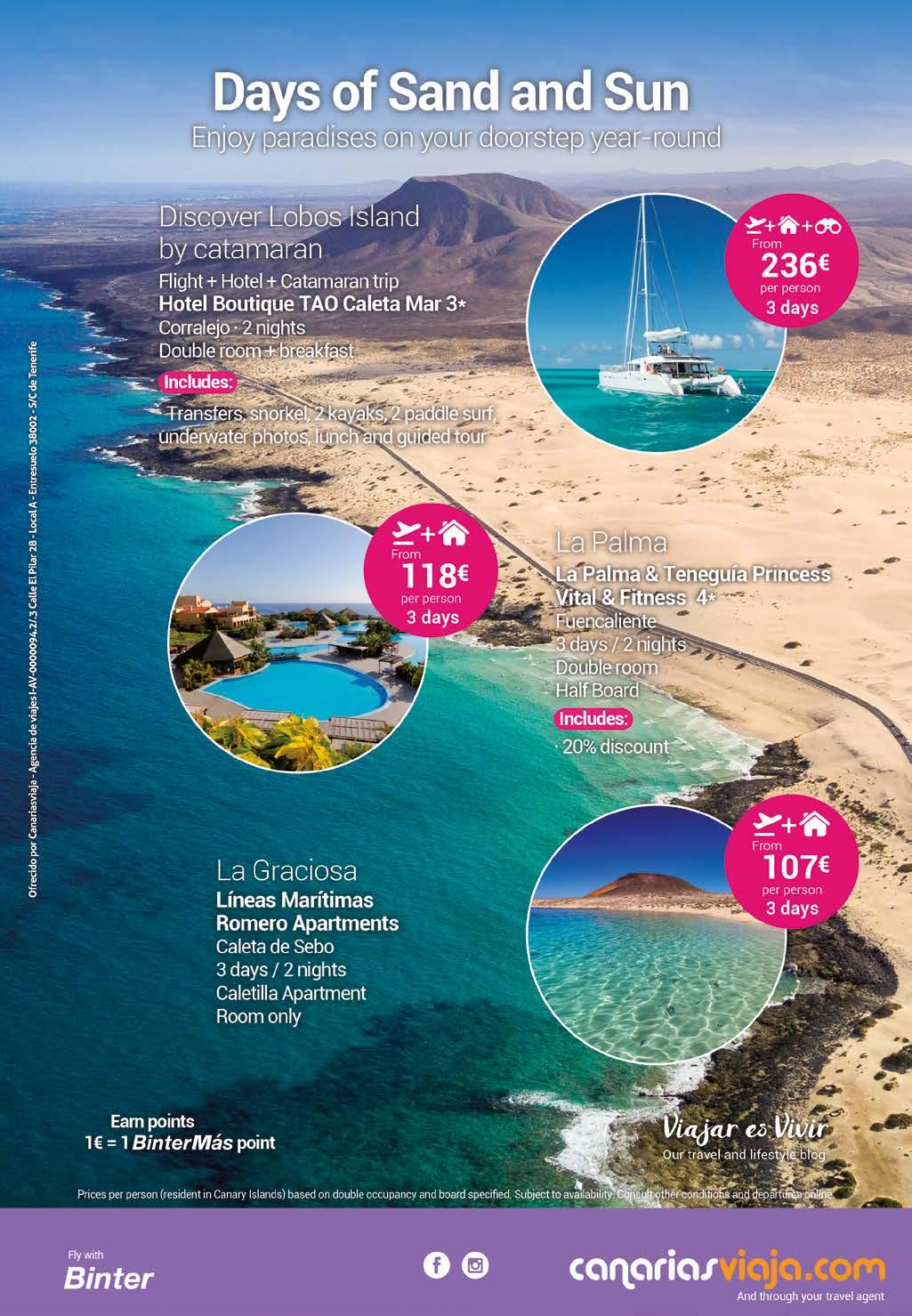
2 minute read
BACK TO ORIGINS


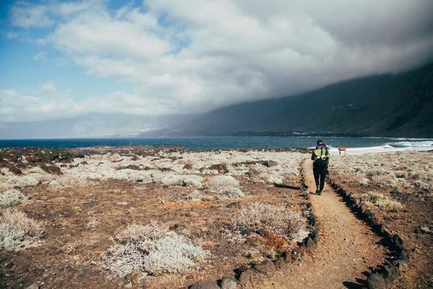
The westernmost and smallest of the Canary Islands is home to some magical spots. Our walk today is short but beautiful and is ideally suited for families. To do it, we head up to the north-western tip of El Hierro.
Arco de la Tosca
Advertisement
Punta de la Sal
Los Pesqueros de Gutiérrez
Guillén de Febles la Grande
Los Andenitos
Estacionamiento Arenas Blancas
Positive elevation: 100 metres uphill.
Negative elevation: 100 metres downhill.
Length: 5 km.
Highest point: 25 metres m.a.s.l.
Lowest point : 8 m.a.s.l.
Nearby places of interest : Verodal Beach, situated a few minutes by car from the car park at Arenas Blancas, is one of the most beautiful and stunning natural spots on El Hierro, its reddish sands standing in marked contrast to the blue of the sea. The volcanic landscape of these western parts of El Hierro does the rest.
Notes: appropriate footwear is needed to walk through the arid malpaís badlands. You will also need plenty of water, especially if walking with the family, and protection against the sun.
Did you know ? El Hierro is the youngest of the Canary Islands.

We leave the car in the car park at Arenas Blancas, from where the small path leading to the beach of the same name commences. It is easy to find the clearly marked trail, which takes us west, next to the breaking sea and along craggy bare rocks that caress the lava with arms of foam. We encounter headlands such as Arenas Blancas, rocks such as Juan Espinosa, and magma rocks like Tío Félix, which we can view from the Los Andenitos outcrop. Vegetation is conspicuous by its absence. There is just rock, sea and salt: elements that, with the combined force of the waves and our own imagination, take us back to when the Canary Islands were formed. Before plant life initiated its unstoppable colonisation from north Africa.
We continue onwards and are greeted by the two tips known as Guillén de Febles: the smaller one first, then the bigger one. A string of magma rocks, like a small archipelago of tiny islands, decorate a landscape that, on clear days, includes the island of La Palma to the north. Do not be fooled by the desolate appearance of the scenery: even these barren surroundings have produced useful resources for the people of El Hierro, as is evident from the names given to locations such as the Pascual and Gutiérrez pesqueros (fisheries), the source no doubt of wonderful parrot fish, grey mullets and salema porgy. Also, Punta de la Sal (Salty Head), which – in the days before fridges – provided the solution to ensure that meat and fish did not go off before time.
-
There is just rock, sea and salt: elements that, with the combined force of the waves and our own imagination, take us back to when the Canary Islands were first formed.


-
Soon after crossing the ravine, we reach the westernmost point of our walk: La Tosca Arch, also known locally as The Bridge. A magnificent rock arch standing at over ten metres above the water and joining two tips of land (Juan Hernández and el Cabo) that lean into the sea like the bows of a ship. After contemplating this wonderful feat of engineering by mother nature, we begin the walk back to our starting point along the way we came.