Map 5. Beech Road Inspection Sectors
Study Process
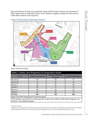
physical character of study area properties, along with the nature of many area businesses.27 Map 5 depicts the six inspection sectors. Sector numbers roughly correspond to the order in which these subareas were inspected.
Source: M-NCPPC GIS data
Table 2. Study Area Properties by Inspection Sector Sector Sector 1A Sector 1B Sector 2 Sector 3 Sector 4 Sector 5 TOTAL
Number of Properties 24 34 20 25 20 31 154*
Number of Buildings Inspected 30 27 25 11 18 48 159
Number of Businesses 57 46 167 35 65 79 449
Source: M-NCPPC GIS data and CTI inspection reports
*This total does not include 27 vacant properties located in the southern portion of the study area. See Footnote 27 for additional details.
A group of 27 properties in the southern part of the study area was omitted. All of these properties are undeveloped, and the majority of them are owned by the State of Maryland as part of the Capital Beltway right-of-way.
27
st. barnabas–beech road industrial study and action plan
27