7 minute read
NEIGHBOURHOOD PLAN

from W19P323
by PDF Uploads

2. REVIEW OF THE 2015 NEIGHBOURHOOD PLAN
2.1 STRENGHTS & WEAKNESSES
2.2 OPPORTUNITIES
2.3 THREATS
2.4 THE AREA BOUNDARY
2.5 CHALLENGES
This section highlights the key points of the analysis of the 2015 NDP in Stage 1. These key points result in several challenges for the Area which will form the base of this Plan’s objectives.
2.1 STRENGTHS & WEAKNESSES
Structure of document:
- The structure had a lack of clarity and consistency.
Consultation Process:
+ The consultation process was deemed acceptable by Camden Council, it held numerous public engagement events over 4 years.
+ All homes in the area were leafleted.
+ Engagement with different stakeholder groups.
Very low levels of engagement from the public with 14% turn out at referendum and 273 responses to 11,000 leaflets.
Did not engage with different stakeholders enough, evident in topic of policies.
The process mainly concentrated on the issue of character, which could be a reason for the lack of engagement; the questions addressed a one-sided public.
Vision and Objectives:
+ The vision and objectives were clear and reflected the findings of the consultation statement and secondary data.
The objectives covered all aspects which resulted in a lack of deliverability.
BASE CHARACTERISTICS
Green Space
Neighbourhood Centres Transport Links
Community Infrastructure Conservation Areas
Identifying qualities and issues of the Area:
+ The qualities that make Fortune Green and
West Hampstead unique were identified as well as the key issues facing the Area using the consultation statement and secondary data, e.g. census.
Policies:
- The policies which followed on from this failed to propose any actual change and instead only repeated existing higher policy or set out weak attempts at guidance. As a result, the 2015 NDP did not achieve much in terms of influencing development.
2.2 MISSED OPPORTUNITIES
Growth Area: The provision of guidance on the remaining sites, outline the desired growth spatially and socially.
Green spaces: The improvement of quality of existing green space through increasing accessibility, encouraging a variety of activities and connecting green spaces to form a ‘network’, whilst demanding new green spaces from new developments. The abundance of trees in several existing streets is encouraging and examplary.
Transport: The creation of a sustainable movement network which promotes cycling, walking and public transport whilst addressing car congestion and air pollution. The 2015 NDP missed this opportunity and focused solely on the West Hampstead Interchange pressure. Improving the streetscape is both a transport and green space issue involving, for example, underused street corners and new cycling lanes.
Housing/Other sites: The allocation of all housing sites in order to influence the types of housing needed to meet present and future needs, and prevent housing to be allocated by higher level authorities.
Character & Design: Missed opportunity of properly defining the character of the area in designating several character areas and forming a design guide to control future development.
MISSED OPPORTUNITIES
Growth Area
Green Spaces Abundance of Trees

Possible Site for Development Undervalued Grey Spaces
Streetscape
2.3 ONGOING THREATS
Transport: The residents of the Area rely heavily on cars (dominance of parked cars in the streets) and together with through traffic, West End Lane shows congestion from cars causing air pollution and worsening the pedestrian experience. This problem peaks at the West Hampstead transport interchange, creating a negative impact on the local economy and the character of the Area.
Character & Design: No design guidance means the neighbourhood’s unique character will continue to be eroded, a new identity will form that is not part of the existing one. Also, the 2015 NDP tends to focus on a couple of architectural styles (Victorian terraces, West End Lane, Mill Lane) and ignores other architectural styles and estates, such as the Dresden Close housing.
Housing: Allocate all housing sites in order to influence the type of housing to meet the needs of the Area and London more broadly, and prevent housing to be allocated by higher level. Not allocating sites means that there is no control over the type of housing, design and location of it, resulting in the worsening of housing problems, i.e. the increase of private tenancy, lack of affordable and lack of family sized dwellings.
Growth Area: The main purpose of the 2015 NDP was to address the threat of the Growth Area, but with a lack of effective tools in the plan, the threat continues to exist. The development of
ONGOING THREATS
Growth Area

West Hampstead Interchange
the Growth Area could result in more development that is harmful to the character of the Area, failing to meet needs of community and failing to take opportunities.
Grey Spaces: Near the railway infrastructure and crossings, narrow alleyways and caged paths are
Unsafe Alleyways
Traffic Dominated Streets Development raising concern
still problematic. Also, streets and squares of the Area are car-dominated, pedestrian experience and public realm quality should be a key priority.
2.4 THE AREA BOUNDARY: PROPOSAL FOR COLLABORATION WITH NEIGHBOURING NDF
As mentioned in 1. Introduction, this Plan works with the 2015 NDP Area boundary. However, this Plan aims to formulate policies on the improvement of Finchley Road which forms the eastern boundary of the Neighbourhood Area and borders the Redington & Frognal Neighbourhood Area. Therefore, this Plan aims to collaborate with the neighbouring Forum and formulate a similar ambition for Finchley Road.
The Redington and Frognal Neighbourhood Plan (RF NDP) is currently in Pre Submission Stage but draft versions show a similar ambition for Finchley Road. Where the 2015 NDP only notes the importance of Finchley Road in ‘Additional Info’ on its closing pages, the RF NDP puts ‘The enhancement of the Environment of Finchley Road’ as their third of six objectives.
Policy FR1 in the draft version of the RF NDP:
» “Wide and high-quality footways, compatible with a Conservation Area, and in accordance with
Section 7 of TfL’s Streetscape Guidance, are supported.” » “Where possible, pavement width is to be maximised to enable trees and other planting, along with the provision of seating and resting facilities.”
The passage in ‘Additional Info’ of the 2015
NDP: “During consultations, the NDF found a number of things which could be improved in this area, including traffic signals, pedestrian crossings and the development of shops and businesses. During work 1

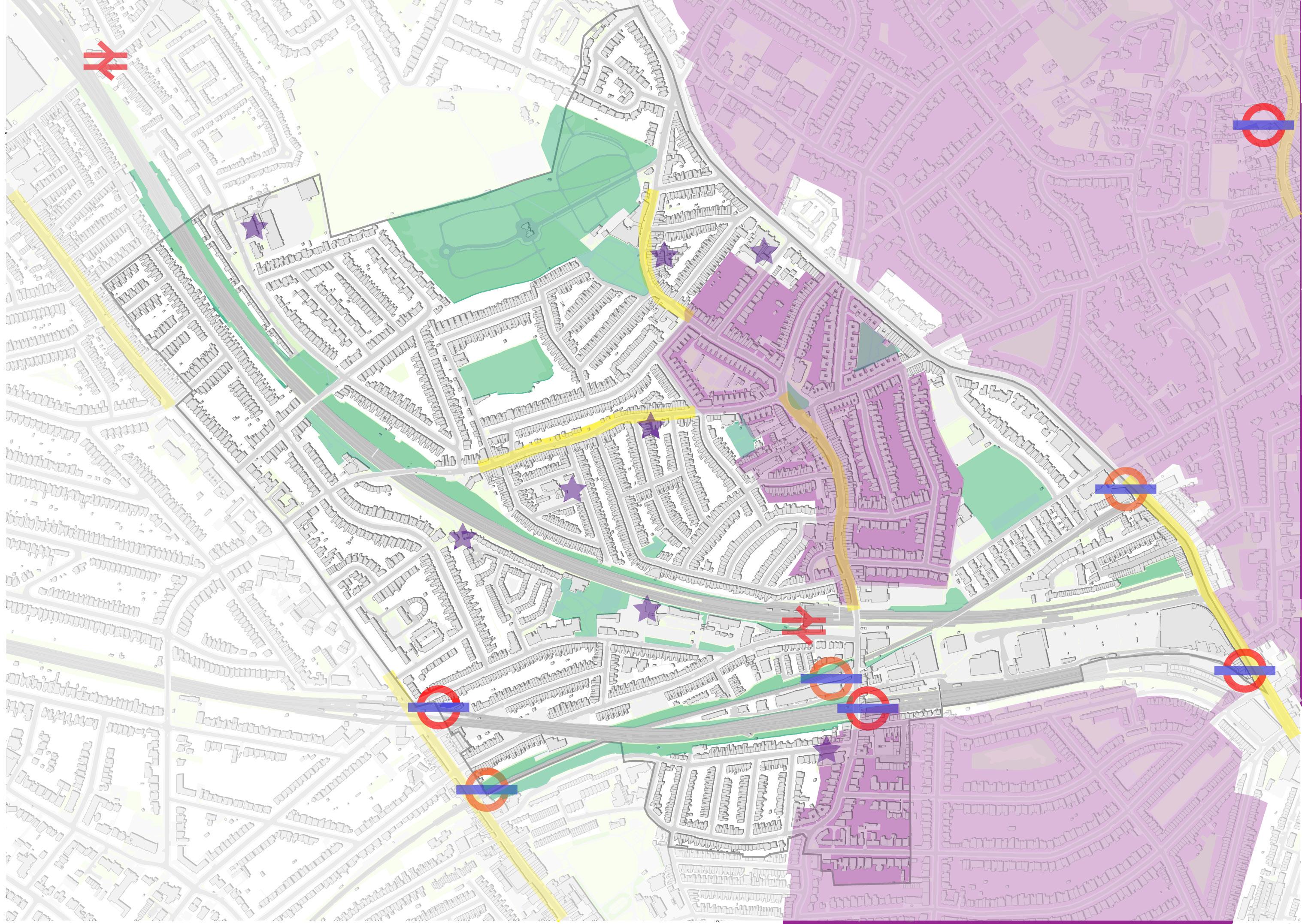
5 4 2
3
Area boundaries of Neighbourhood Plans, the colours indicate different stages of development: - ‘made’ in green: 1. Fortune Green and West Hampstead Neighbourhood Area and 2. Hampstead Neighbourhood Area. - ‘developing draft’ in orange: 3. Kilburn Neighbourhood Area and 4. Church Row & Perrins Walk Neighbourhood Area. - ‘pre-submission consultation’ in purple: 5. Redington & Frognal Neighbourhood Area.
on the final draft of this Plan, the Neighbourhood Forums covering Finchley Road began efforts to lobby Camden Council and TfL to bring forward improvements to the Road and the Town Centre. These efforts - including a much improved street environment; measures to address air pollution; tree planting; measures to make the Road safer for pedestrians and cyclists; and measures to boost the economy of the Town Centre - are strongly supported by this Plan.” However, none of these efforts can be traced online nor has a “much improved street environment” been realised between 2015 and 2020.
A precedent case of collaborating neighbourhood plans does not exist yet. However, it is clear that NDP’s boundaries could divide key areas such as major traffic arteries and high streets, which limits the making of comprehensive policies and strategies.
2.5 CHALLENGES
‘Challenges’ summarises the strengths, weaknesses, opportunities and threats into key points on which the vision and objectives will be based.
Consultation: A Plan representative of the community.
Transport: Addressing the Interchange pressure as well as encouraging sustainable movement.
Open spaces: Improving both green and grey spaces.
Character & Design: A detailed guiding approach rather than a romanticised view on the Area’s village character and red brick buildings.
Housing: Addressing the existing unaffordable housing by facilitating the necessary increase of housing.
Economy: Protecting and enhancing the Neighbourhood’s successful high streets by improving open spaces, protecting character and enhancing pedestrian experience.
Growth Area: Concentrates spatially the previous challenges whilst incorporating community infrastructure and a sustainable ambition. Also, the scale of the development raises site-specific goals including improved connections and appropriate massing, which will be discussed in Section 10.
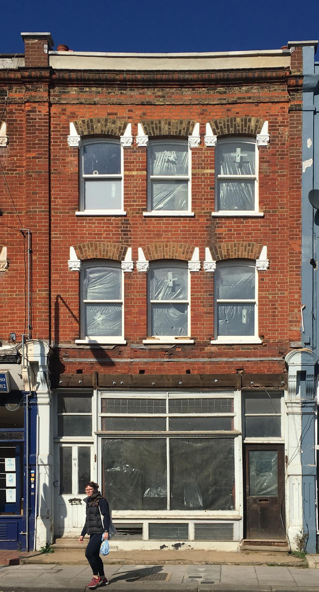
Abandoned building on Mill Lane with ground floor employment space, its architecture is examplary of the character of Mill Lane.