

The information provided in this document is intended to be used for informational purposes only. No expressed or implied warranties are made by Metroplan, Crafton Tull, or Toole Design concerning the accuracy, completeness, reliability, and usability of this information. Further investigation such as field verification, site condition assessments, engineering analysis, and design are necessary prior to implementing any of the guidance contained herein.
This report was funded in part through grant(s) from the Federal Highway Administration and Federal Transit Administration, U.S. Department of Transportation. The views and opinions of the authors expressed herein do not necessarily state or reflect those of the U.S. Department of Transportation.
Metroplan complies with all civil rights provisions of the federal statutes and related authorities that prohibit discrimination in programs and activities receiving federal financial assistance. Therefore, Metroplan does not discriminate on the basis of race, sex, color, age, national origin, religion, disability, or income status, in admission or access to and treatment in Metroplan’s programs and activities, as well as Metroplan’s hiring or employment practices. Complaints of alleged discrimination and inquiries regarding Metroplan’s nondiscrimination policies may be addressed to Hans Haustein, Title VI/ADA/504 Coordinator, 501 West Markham Street, Suite B, Little Rock, AR 72201, (501) 372-3300, or the following e-mail address: hhaustein@metroplan.org. (Hearing and speech impaired may dial 711.)
This notice is available upon request from the Title VI/ADA/504 Coordinator in large print, audiotape or braille.
Adopted by the Metroplan Board of Directors
Date: May 24, 2023
Resolution: 23-07
Metroplan is a voluntary association of local governments that has operated by interlocal agreement since 1955. It is the designated metropolitan planning organization under Title 23 of the United States Code. Metroplan has members in five Central Arkansas counties: Faulkner, Grant, Lonoke, Pulaski, and Saline. The organization acts as a unified voice to serve local governments, convening stakeholders, and providing information and data to address transportation, land use, and environmental issues affecting the region. We would like to thank the many stakeholders and local agency staff who contributed their time, perspective, ideas, and expertise to the development of the Central Arkansas Regional Greenways Plan.
Judge Barry Hyde - Pulaski County
Jon Honeywell - City of Little Rock
Mayor Terry Hartwick - City of North Little Rock
Council Member Charlie Hight - City of North Little Rock
Judge Jeff Arey - Saline County
Mayor Tom Farmer - City of Benton
Mayor Ken Kincade - City of Cabot
Mayor Trae Reed - City of Lonoke
James Walden - City of Conway
Finley Vinson - City of Conway
Charles Frazier / Justin Avery - Rock Region Metro
Prepared by Crafton Tull and Toole Design Group
This page intentionally left blank
1.0
This plan fulfills Resolution 20-05 of the Metroplan Board of Directors dated February 26, 2020.
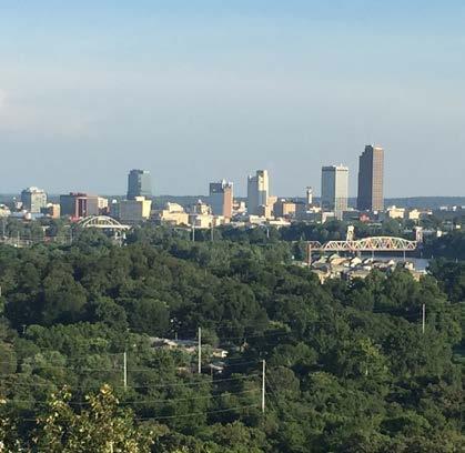
In February 2020, Metroplan, the Metropolitan Planning Organization for Central Arkansas, set a strategic target of $55 million to plan, design, and build a network of regional multi-use bicycle and pedestrian greenways throughout its four-county jurisdiction. The vote was unanimous, indicating that community leaders in Pulaski, Faulkner, Saline, and Lonoke counties understand the economic, social, and physical impact that an investment in active transportation will make on the Central Arkansas region.
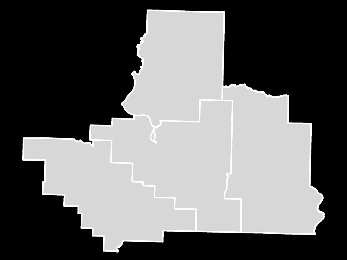
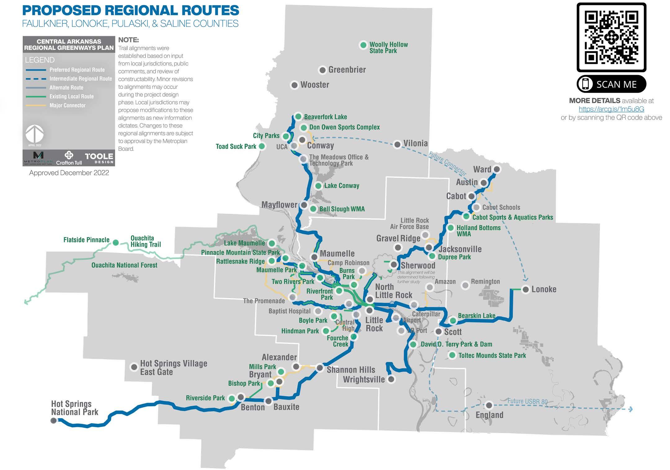
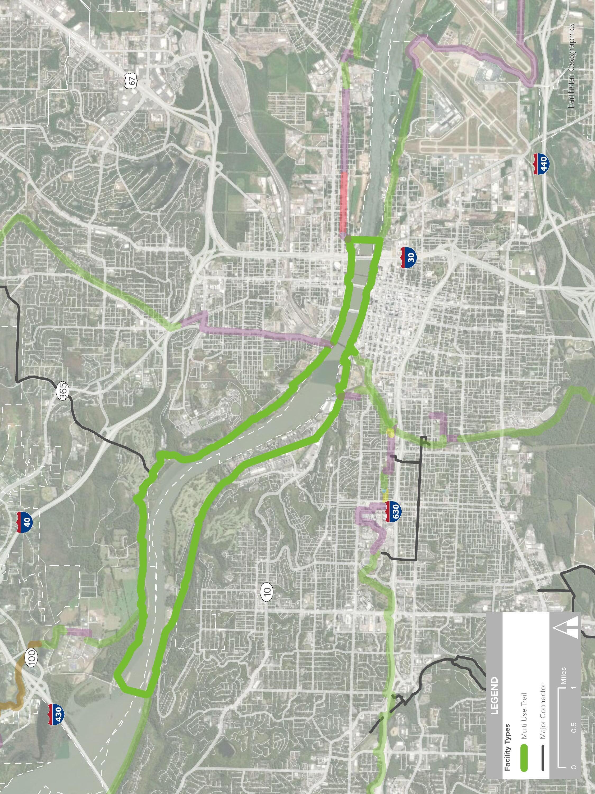
The result of extensive collaboration with nearly every community within the Central Arkansas Regional Transportation Study (CARTS) area, the Central Arkansas Regional Greenways Plan establishes active transportation, bicycling and walking, as a viable means of alternate transportation for all residents, along six corridors:
» Central Beltway Corridor: connecting east and west Little Rock
» East Corridor: from North Little Rock to Lonoke
» Northeast Corridor: from North Little Rock to Ward
» Northwest Corridor: from North Little Rock to Conway
» Southwest Corridor: from Little Rock to Hot Springs (incorporated from previous planning)
» Southeast Corridor: from Little Rock to Wrightsville
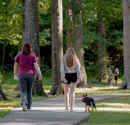
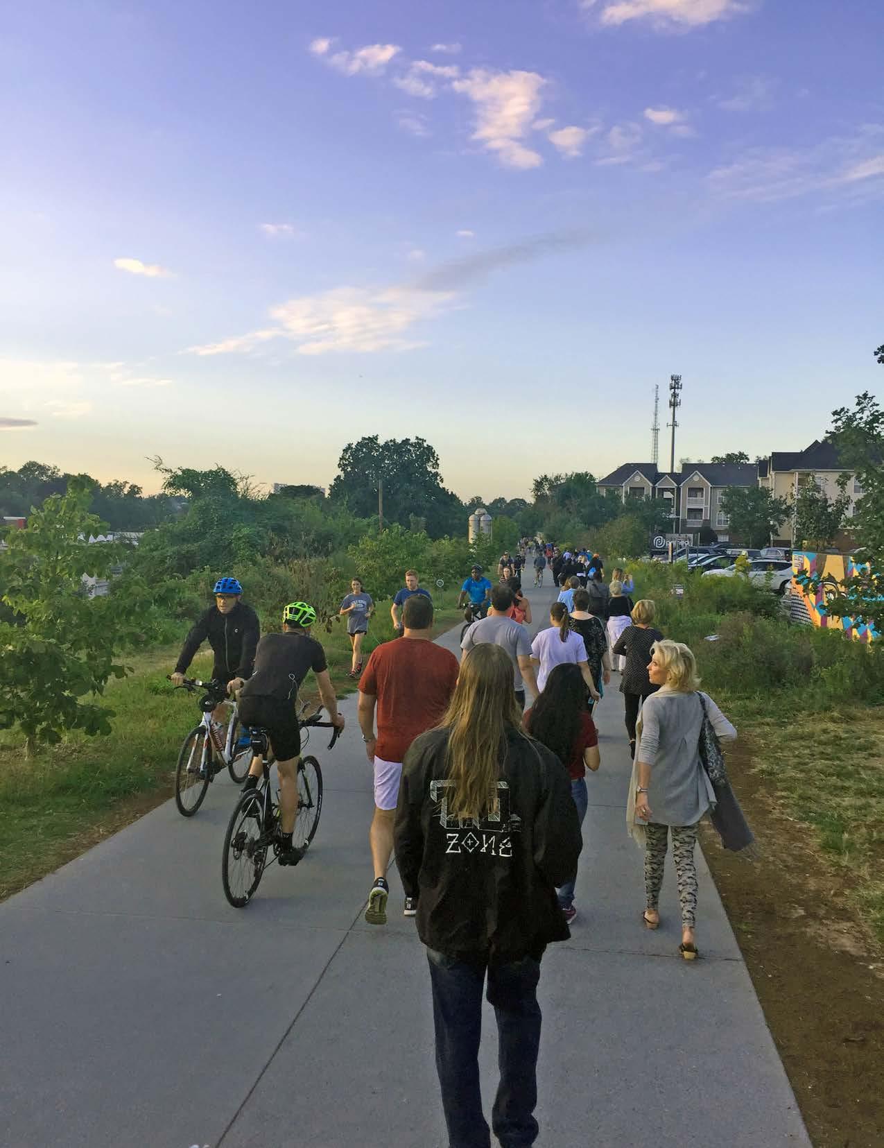
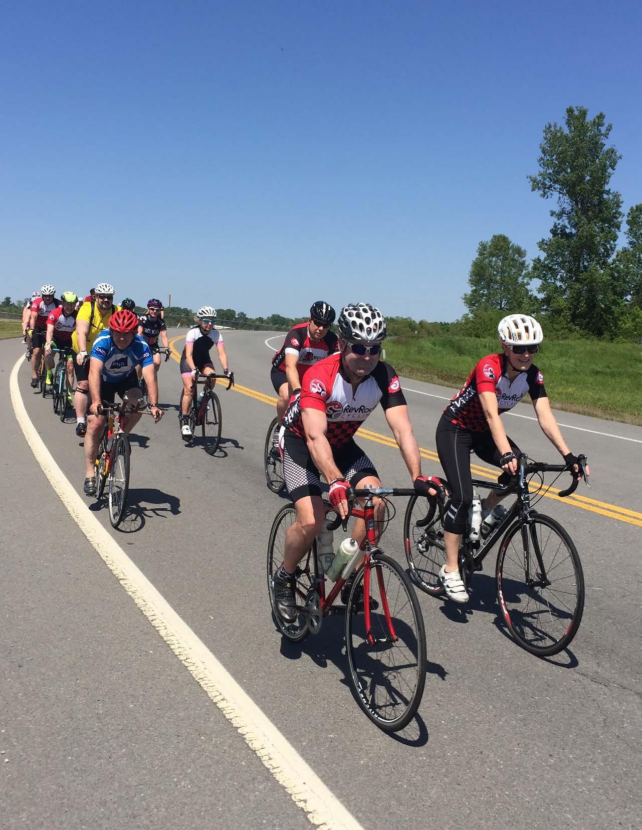
Active transportation is low-cost, sustainable, and has been proven to enhance quality of life, economic vitality, health, and equity in many cities in the U.S.
Economic benefits from this proposed bicycle and pedestrian network, one which can be safely utilized by anyone age six and up, have been observed in Northwest Arkansas. The region’s Razorback Greenway, totaling 44 miles of paved trail connecting its largest cities across two counties, is a recreational tourism magnet that supports local businesses and restaurants. The study estimates an impressive $27 million associated with bike tourism was spent at local businesses in 20171 . Even larger-scale positive impacts have been observed. Homeowners see approximately $1.1 million of increased property value per mile of trail construction, as compared to homes further than a mile from the trail.1
Economic benefits are not measured solely by increased property values. Integrating zero-emission bicycle and pedestrian network that connects with transit as well as automobile infrastructure provides an additional transportation option to a region heavily dependent on automobiles for transportation. This is where economic benefits translate to increased equity and social impact. Research has shown that individuals who rely on bicycling as their main form of transportation also live below the poverty line.2 A thorough system of trails providing
connectivity to a broad range of destinations can increase the educated population as well by allowing children to walk and bicycle to their school safely.
Perhaps the most important benefit of the Central Arkansas Regional Greenways system is the physical benefits its users will reap. Arkansas’ health rankings attest to the need for infrastructure that promotes a lifestyle of health and wellness. 37% of all adults age 18 and older are classified as obese, and the state was ranked in 2019 as the 4th most obese state in the U.S. Obesity begins young, as well, and it is estimated that one of every five children age 10 to 17 in Arkansas is obese. Obesity leads to many health issues, chief among them acute myocardial infarction (AMI, or heart attacks), which is Arkansas’ leading cause of death. 3
It is important to note that transportation and recreation can be simultaneous. Many residents of northwest Arkansas regularly drop their children off at school via bicycling, make a trip to the grocery store, or ride to visit friends and family. Commuting to work by bike is less popular in Arkansas, but is still an option in areas with safe and complete facilities for short trips. Bike trails should be constructed for transportation so that they may also function as recreation.
The COVID-19 pandemic indicated the importance of bicycling and investment in trails. In a lengthy report published in 2021 by the Outdoor Industry Association, it was reported that trails were being more heavily utilized, and that bicycling was the number one sport for youth and the third most popular sport for young adults. Grand View Research also reported in 2021 that the $54.4 billion bicycle industry is expected to grow by 7% in the next 7 years.4
1 BBC Research & Consulting (2018). Economic and Health Benefits of Bicycling in Northwest Arkansas (p. 33). Walton Family Foundation & PeopleForBikes.
2 U.S. Census Bureau, American Community Survey. “Modes Less Traveled — Bicycling and Walking to Work in the United States: 2008-2012.”
3 CDC (2020). https://www.cdc.gov/nchs/pressroom/states/arkansas/ar.htm
4 Grand View Research. https://www.grandviewresearch.com/industry-analysis/bicycle-market
NORTHWEST CORRIDOR
WEST LITTLE ROCK MAYFLOWER MAUMELLE CENTRAL BELTWAY
NORTHEAST CORRIDOR
SHANNON HILLS
BENTON BRYANT
SOUTHWEST CORRIDOR
LITTLE ROCK NORTH LITTLE ROCK
SOUTHEAST CORRIDOR EAST CORRIDOR
To make consistent routing decisions, eight desired guiding principles were defined. These principles reflect the location, purpose, physical characteristics, design intent, context, and social benefits that each route should provide to the user. In turn, each route and the network as a whole abide by the principles that were established early in the planning process.


Central Arkansas greenway routes will be viable alternate transportation options.
Central Arkansas greenway routes will be physically separated from vehicular traffic to the greatest extent possible in order to accommodate a variety of users and maintain bicycle and pedestrian comfort. INCLUSIVE

Central Arkansas greenway routes will be inclusive and equitable for a diverse range of users.

Central Arkansas greenway routes will be consistent in routing approach, priorities, assumptions, and design, creating a clear distinction from local bicycle and pedestrian paths.

Central Arkansas greenway routes will prioritize user safety by minimizing conflicts with automobiles, increasing user visibility in areas of uncertainty, and providing appropriate accommodations for emergency situations.

Central Arkansas greenway routes will be planned, designed, and constructed according to best practices considering national standards and regional influences in order to deliver a high-quality system.

Central Arkansas greenway route facility types will adjust according to the challenges of the built and natural environment.

Central Arkansas greenway routes will be well-connected to centers of population and relevant destinations, including public and private amenities and services.
Each route in the Central Arkansas Greenway system navigates complex landscapes, rising and falling among steep hills, or going out of the way to avoid difficult water crossings. Some bypass various destinations and connect others; some connect directly to residential neighborhoods while others seem to fall within a short distance. When considering the purpose of the proposed network and what route specifically to designate, many different factors were considered.
In reality, route selection is a repeated process of navigating tradeoffs, some measurable, some intuitive (see opposite page). Measurable tradeoffs are quantified by geography, estimated construction cost, number of destinations, or population served by the trail. For each of these factors, there are intuitive tradeoffs more qualitative in nature, including user comfort, experience, character, and access: perceptions about the journey along the route itself. These relationships are complex, and achieving a balance between these quantitative and qualitative tradeoffs is vital to achieving routes that are both practical as well as enjoyable.
However, the complexity of the physical terrain of the region coupled with the uneven distribution of population amid changing land uses makes achieving such a balance in every situation impossible. For instance, in established areas of midtown Little Rock, users may temporarily ride on sections of street designated with a sharrow or a converted alley due to the exorbitant cost of purchasing property or the process necessary to obtain access easements or rights of way. In this context, it is more beneficial to choose feasibility over user comfort, particularly for such a short distance. One of the flagship priorities of the network is to provide safe and inclusive connectivity, therefore such compromises are limited in occurrence.
Ideally, a route will be as direct as it is memorable. Along the Northeast Corridor between Jacksonville and Cabot, the Holland Bottoms State Wildlife Management area, operated by the Arkansas Game
and Fish Commission, permits hunting. A direct route would pass through the northeast area of this large parcel, and the presence of a project partner is even more reason to do so. However, the presence of hunting in this area necessitated either a longer route to the south and east, missing many centers of population and incurring higher cost, or a slightly longer route around the northeast corner of Holland Bottoms. The latter was ultimately chosen as the best alternative.
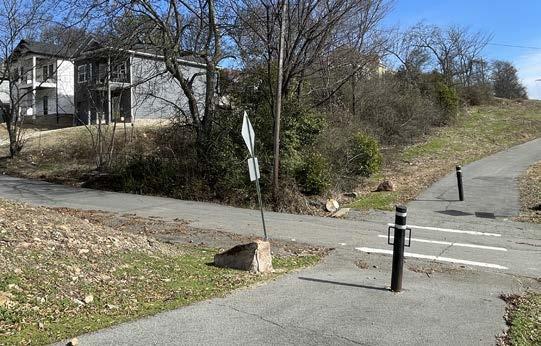
Should these greenway routes provide immediate access to users, or be located closer to users’ destinations? Ideally, both would be true. Some facilities designated in a community’s bicycle and pedestrian plan, such as sharrows and sidewalks, can provide short connections to regional routes. In some segments of the network, particularly in the Northwest Corridor, this balance is well documented. Much of the existing trail in Maumelle is along Maumelle Boulevard, which also functions as the commercial corridor of the city. This existing trail can already provide users in the southern area of the city access to grocery stores, restaurants, and parks, but the center of the city does not have the same level of access to destinations due to lack of facilities. Community leaders designated Club Manor, a local street that runs adjacent to Maumelle Boulevard, as a perfect candidate for a sidepath. It fills in gaps in the trail system and provides access to single-family homes as well as several multi-family developments and community amenities. In this case, a good balance was struck between providing immediate access for users while in a safe manner.
Additionally, this segment of the Northwest Corridor also achieves a balance in population and character. When completed, Club Manor will be attractive and useful to its residents. Located immediately east of Lake Willastein Park and directly west of the community grocery store, the corridor will soon have cars, bicycles, and pedestrians all moving to, from, and around it as they navigate their desired destinations.
Routes should be reasonably direct between jurisdictions or destinations.
Routes should be relevant, connecting people to where they need or want to travel.
Routes should serve centers of population to maximize proximity to route users.
Routes will vary in ease of implementation, dependent on ownership or jurisdiction, opportunity, constructability, and environment.
Routes should provide safety, high levels of comfort (appropriate widths and space designation), and amenities such as lighting, shade, benches, water, and restrooms.
Routes should highlight unique landscapes or cultural assets where possible and integrate public art.
Routes should have visible access via trailhead locations, wayfinding, and user orientation.
Source: Crafton Tull
Routes should provide an enjoyable user experience, sometimes a less direct alignment between two points. Topography, views, and ease of navigation should be considered.
This page intentionally left blank
2.0 NETWORK
The establishment and implementation of regional routes is the focus of the Central Arkansas Regional Greenways Plan and Metroplan. These routes will safely connect communities in Central Arkansas with scenic and direct sidepaths and trails, while adhering to the guiding principles for route selection.
These routes were developed utilizing geographic information systems (GIS) analyzing the natural and built environments, existing transportation corridors, pending active transportation projects across the region, and carefully considering the long-range goals of each community in stakeholder interviews. Field visits across all routes were conducted to verify the accuracy of digital terrain data as well as information gathered in stakeholder interviews.
These routes are the primary connections between communities throughout Central Arkansas; the spine from which local bicycle and pedestrian infrastructure should connect. They should be physically separated from other modes of transportation and abide by the Guiding Principles outlined in Chapter 1.0: Purpose. Design and materials considerations are outlined in Chapter 4.0: Design Typologies.
The Regional Routes reflected in this report were approved by leadership in each community, the steering committee, and the Metroplan Board of Directors. These routes may be amended during subsequent design phases.
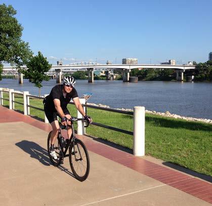
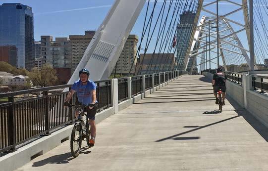
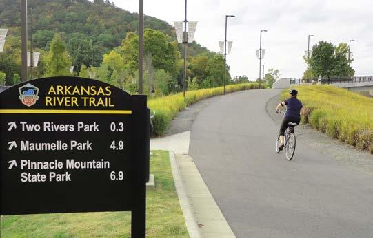
Examples of existing Regional Routes in Central Arkansas include the Arkansas River Trail.

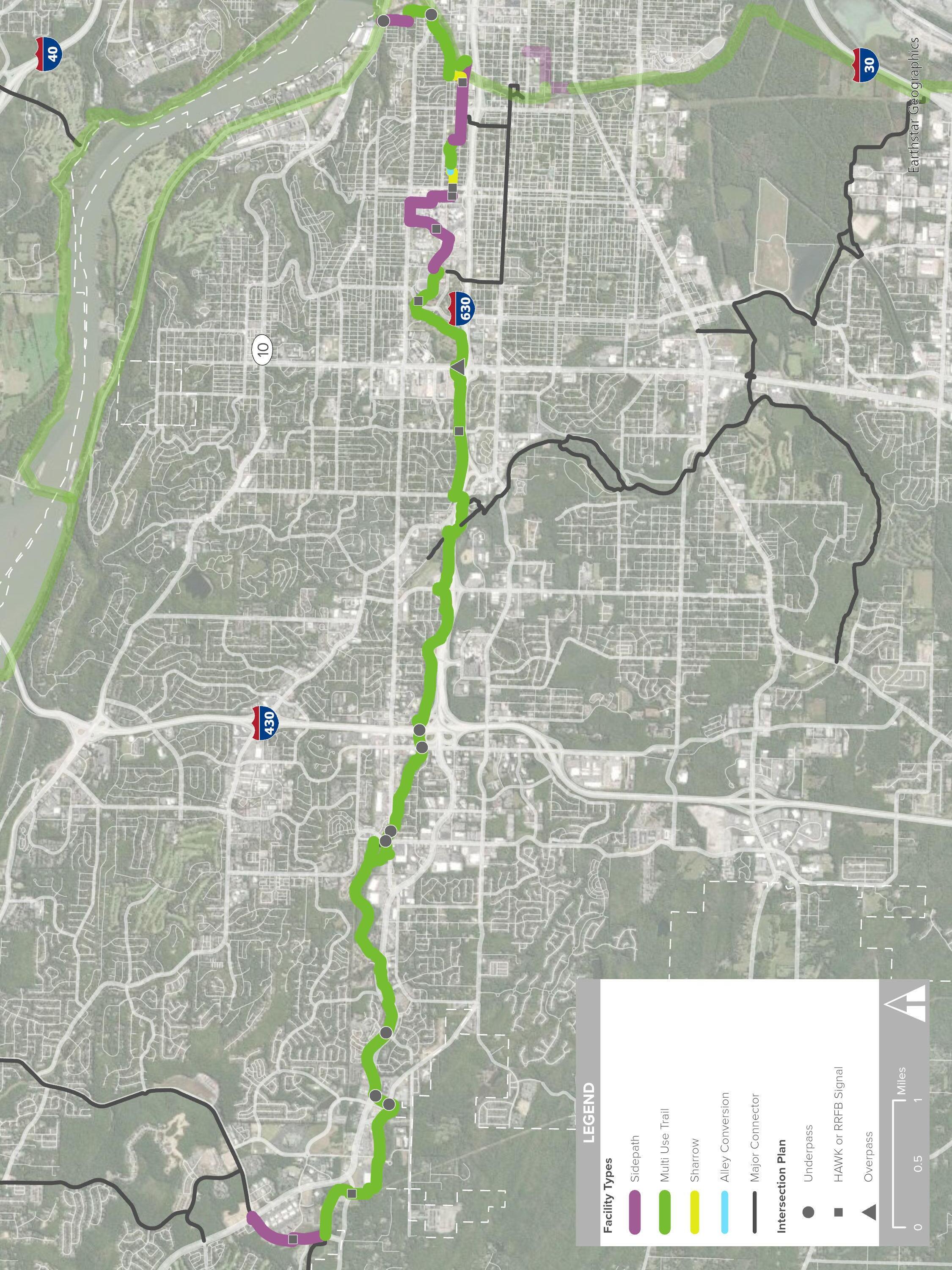
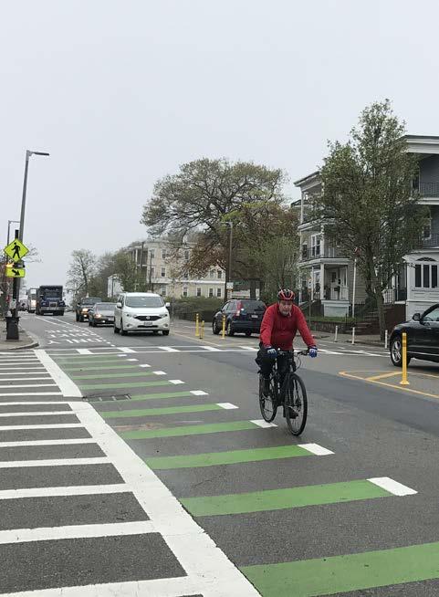
In keeping with the Guiding Principles for network development (page 12), Central Arkansas Regional Greenway routes will be physically separated and high-quality, meaning that to the greatest extent possible, the system will be comprised entirely of either trails or sidepaths. Physically separated simply means that the proposed bikeped facility is not one that places users in the same travel-way as vehicles. This provides safety, inclusivity, and comfort for all who will use the system for their daily needs. Within the entire regional network, approximately 83% is physically separated from roadway, 2% are a combination of protected bicycle facilities and sidewalks, and the remaining 15% are on-road shared bicycle facilities (the majority of which is located in the East Corridor). Major Connector Routes, described on page 21, are either local trails, pathways, or on-street protected facilities such as bike lanes.
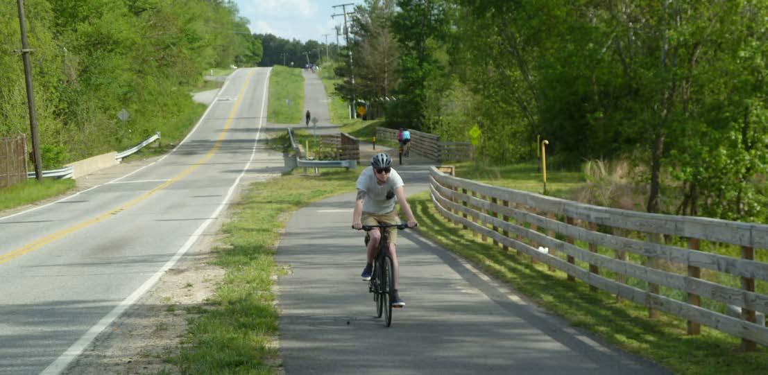
Multi-use trails are the preferred facility type, a 14’ wide paved path accommodating bicyclists and pedestrians usually following a stream or other natural easement. A sidepath retains the exact same physical design as a Multi-Use Trail, but rather follows the alignment of a roadway with a 3-10’ buffer located between the two.
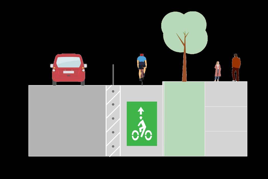
A cycle track , also known as a Two-Directional Buffered Bicycle Lane, resembles an on-street version of a sidepath but only accommodates bicyclists. Paint provides horizontal separation between users and motorists, and bollards, curbs, or other physical delineators provide vertical separation within the painted area. Since Cycle Tracks are intended for use by bicyclists, pedestrians are accommodated by an adjacent sidewalk. Less than two miles of this configuration are proposed in the network.
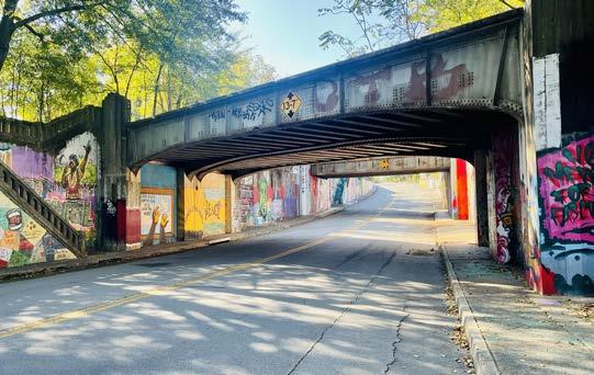
Along the Central Beltway for just over three hundred feet and in Jacksonville for just over six hundred feet, the regional route utilizes a future alley conversion. Traditional alleys are utilized by vehicles for driveways, utilities, and waste collection. Their width is typically between 10’ and 16’, and when converted to resemble a trail (but retains its low vehicular traffic volume) is safe for bicyclist and pedestrian use. These facility types are displayed on pages 22-23 and further detailed in 4.0 Design Guidelines.
In some cases, notable secondary connections exist within the network. These connections, referred to as Major Connector Routes, recognize important local initiatives that can further extend the reach of Regional Routes to local populations. While not the focus of this plan, such connections are included for context. Each jurisdiction will determine final routes and facility types for their internal connections to the regional network. While some of these connections may be separated from vehicular traffic, Major Connectors may include additional facility types that are not suitable for Regional Routes, such as the following facility types.
Protected on-street facilities like buffered bicycle lanes function like standard bicycle lanes, with one lane in each direction of vehicular flow, but feature vertical or horizontal separators, and in some cases, both. These increased safety measures allow buffered bike lanes to provide a higher degree of user comfort on busy roads.
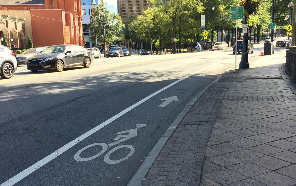
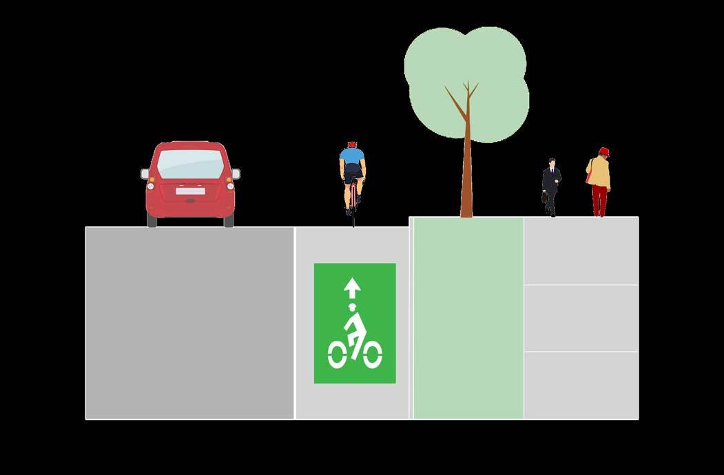
Standard bike lanes are designated by striping and bicycle symbols to indicate to motorists their intended use and are best situated on roads with lower traffic volumes and slower speeds.
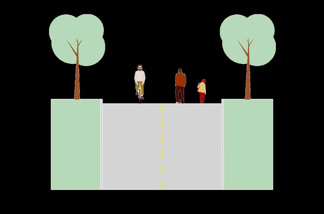
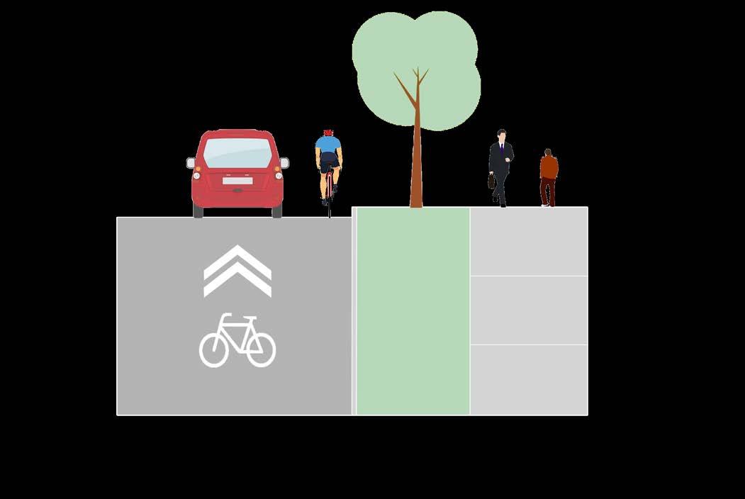
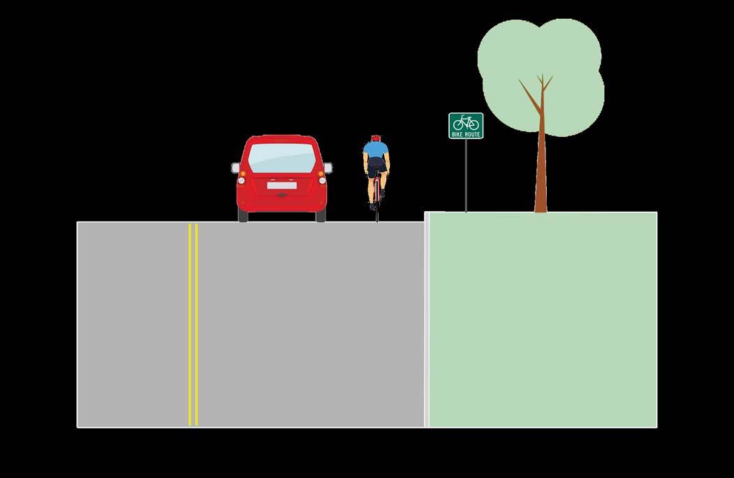
Shared-street facilities, such as “sharrows” may be utilized along quiet residential streets, or signed routes, rural recreation routes often located on appropriately-sized shoulders along state or county roads, may also be designated as Major Connectors but are not appropriate as Regional Routes.
Diagrams visualizing Regional and Major Connector Facility Types are located on pages 24-25 and are further detailed in 4.0 Design Guidelines.
Multi-Use Trail
Multi-Use Sidepath
Conversion
VEHICULAR
Signed Routes
This page intentionally left blank
This page intentionally left blank
3.0
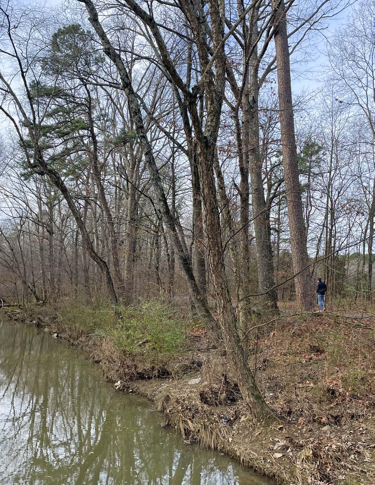
The Central Arkansas Regional Greenways network measures approximately 222 miles in total length, connecting the Capital of Arkansas to communities in the four-county area and providing active transportation opportunities for all ages and abilities. The Southwest Trail is the longest route at just over 60 miles*, followed by the Northeast Corridor. The greenways traverse the vast, unique and beautiful landscapes of the region, with views of the highest peaks and the soothing sounds of rushing water present along every corridor.
Each corridor has further unique features. The Southwest Corridor, running from Little Rock to Hot Springs, is characterized by its long stretches of forest, making the most of its solitary location and offering cyclists and long-distance runners a peaceful, scenic experience. The Central Beltway Corridor, on the other hand, is constantly navigating among the oldest blocks of the City of Little Rock to newer developments in West Little Rock. It travels along Rock Creek for the majority of its second half, and will prove to be a popular route for those running errands as well as those seeking recreation.
The Northwest Corridor features some segments as beautiful, scenic and peaceful as the Southwest Trail, and areas as dense as Little Rock when the greenway enters Conway, having traversed rural and suburban communities from North Little Rock to its south. The Northeast Corridor, planned specifically to connect as many communities and destinations as possible between North Little Rock to Cabot and Ward, will become used by many children and young people to walk to school, and in some areas, people will even be able to walk to eat with friends at restaurants.
Finally, the East and Southeast Corridors function in a similar fashion in that a notable portion of their corridors are signed routes with critical separated facilities proposed in areas of dense population. Wrightsville has a sidepath proposed on Highway 365 to connect homes to important destinations along the Southeast Corridor, similar to the proposed sidepath on Washington Avenue on the East Corridor.
* The Southwest Trail from Central High School to Hot Springs measures 58.3 miles. Extending the trail to from Central High School north to meet the Arkansas River Trail results in 60.4 miles of length. The Southwest Corridor (as defined for this study) runs from the Arkansas River Trail to the Saline/Garland County Line measures 41.2 miles.
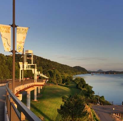
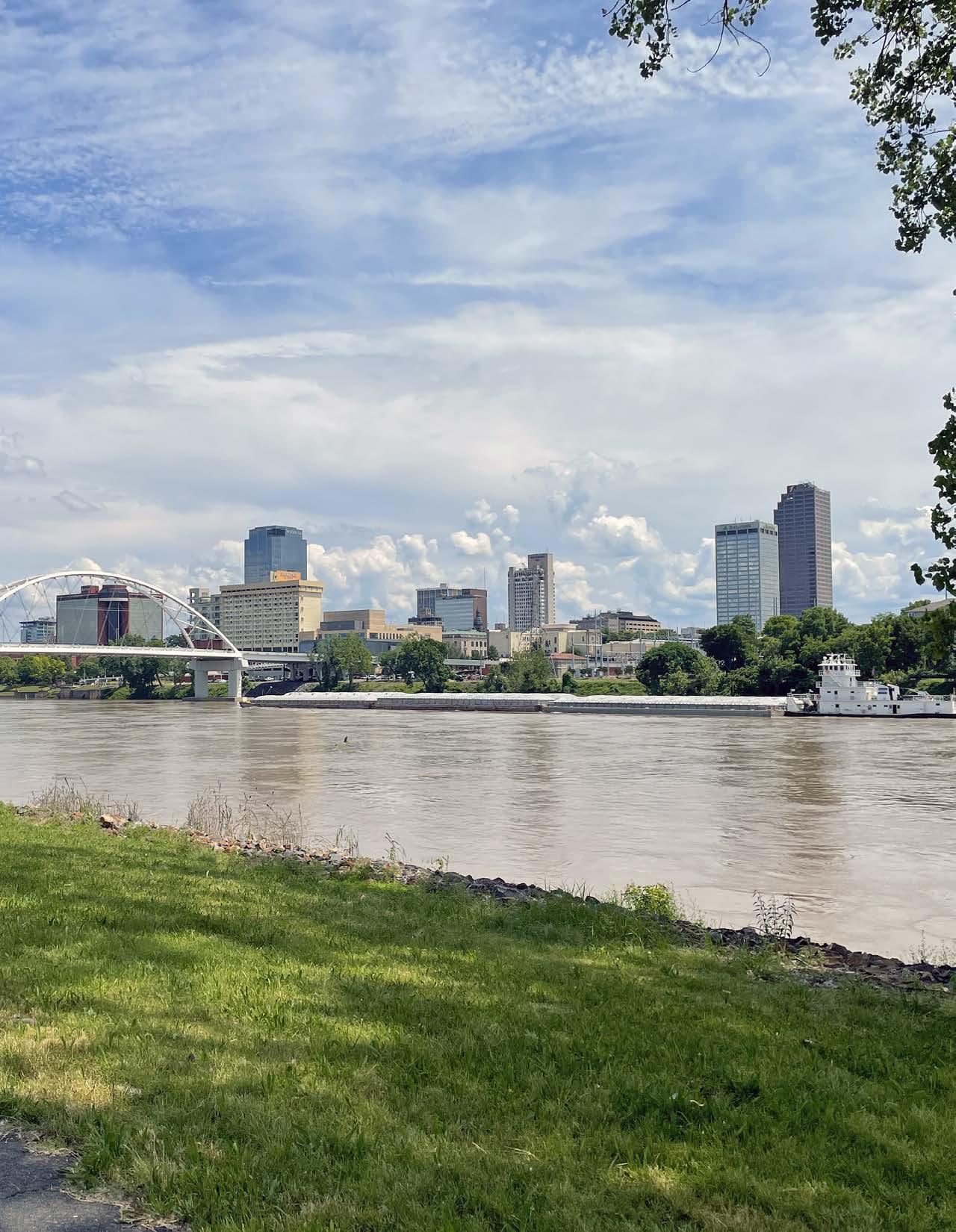
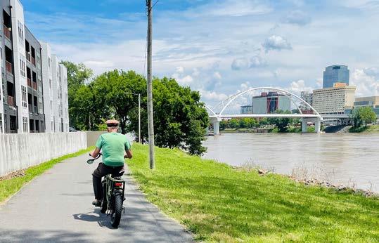
Few public investments have provided greater return on investment for tourism and culture in Central Arkansas than the River Trail. A destination for marathon runners, bicyclists in the Big Dam Bridge 100, and an amenity enjoyed by residents every single day of the week, the River Trail is the meeting place of the five corridors in the Central Arkansas Greenways network, in its own way, the very first route in the active transportation network. Plans are ongoing to “close the loop” along Cantrell Road in Little Rock.
» Big Dam Bridge
» Murray Park
» Rebsamen Park & Golf Course
» Burns Park
» Emerald Park
» Big Rock Quarry Bike Park
» Riverview Skateboard Park
» Cooks Landing Park
» Campbell Lake Park
» Rockwater Marina
» Argenta, Downtown North Little Rock
» Downtown Little Rock
» William J. Clinton Library & Museum
» Dickey Stephens Park
» Riverdale Office Park
» Miracle League Arkansas
» Episcopal Collegiate School
» Riverfront Park
» William E. Clark Presidential Wetlands
Total Length
» 15 Miles
ARKANSAS RIVER TRAIL
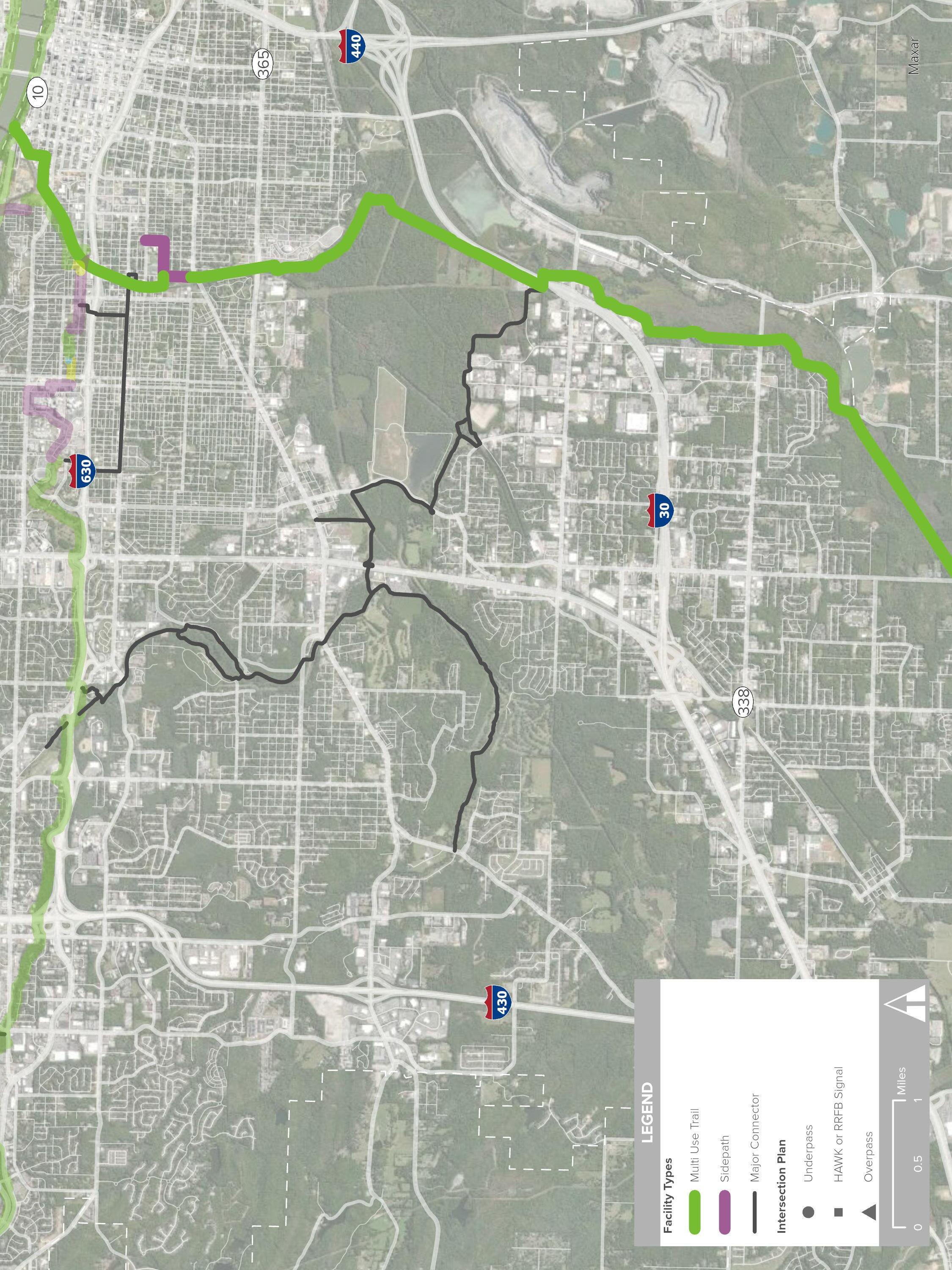
The Central Beltway Corridor connects east and west Little Rock, as its title suggests, primarily through its geographic center. In the east, the trail corridor terminates at Winston Faulkner Road near Highway 10 and the Arkansas River Trail, and terminates in the west at the Promenade on Chenal Parkway.
This route includes the extension of the Rose Creek Trail and utilizes some existing trail along Rock Creek and I-630, both of which require upgrades to become a regional trail suitable for bicycle and pedestrian use. The Central Beltway provides access to many everyday destinations.
Destinations: River Trail to Promenade
» The University of Arkansas for Medical Sciences
» The Little Rock Zoo & War Memorial Stadium
» The Promenade and The District at Midtown
» War Memorial Fitness Center
» War Memorial Park
» Kanis Park
» Birchwood Park
» Rock Creek Parkway
» Billy Mitchell Boys & Girls Club
» Lamar Porter Field & Woodruff Community Garden
» Rose Creek Trailhead
» Henderson Middle School
» (3) Grocery Stores
Total Length: River Trail to Promenade
» 14 Miles
Existing Facilities: River Trail to Promenade
» Trail: 3.5 Miles
Proposed Facility Types: River Trail to Promenade
» Trail: 7.3 Miles
» Sidepath: 2.8 Miles
» Sharrow: 0.4 Miles
» Alley Conversion: 324 Feet

The Central Beltway corridor begins at the Arkansas River Trail’s intersection with Gill Street. A short distance from Episcopal Collegiate School, this area of Little Rock features historic homes and a trail connection to the existing Rose Creek Trail located near Rice Street. Here the character of the Capital View neighborhood becomes more apparent: older homes with some scattered new construction, restaurants, the Boys and Girls Club, and the University of Arkansas for Medical Sciences (UAMS).
Between the Rose Creek trailhead and UAMS, the Central Beltway travels along 7th Street via sidepath, transitioning to trail along a creek easement until Valentine Street, where it becomes a combination of on-street bicycle facilities and proposed renovations for the 6th street alley.
At UAMS, the route becomes an urban pathway to navigate the dense development that comprises the health college campus. The route moves north to Markham Street before traveling south again along Hooper Drive and east on 7th Street to the Jim Dailey Fitness and Aquatic Center. In addition to the cityowned War Memorial Park and fitness center, the Central Beltway also passes near the Little Rock Zoo. Winding through the scenic War Memorial Park on existing and well-trodden trails, the trail passes over University Avenue, continuing along the north side of Interstate 630 to connect existing trails and Kanis Park. All of the existing trails along this route will need to be upgraded to regional trail standards.
Along Rock Creek, the trail connects to neighborhoods just north of the interstate, passing underneath Interstate 430 to connect to Birchwood Park before continuing along the creek to the Rock Creek Parkway. Utilizing the land near Rock Creek provides a true greenway for much of the Central Beltway, passing nearby destinations such as shopping, other parks, grocery stores, and neighborhoods. The greenway continues west along Rock Creek until it diverts north to intersect with Kanis Road, then utilizing a power line easement to access Rahling Road, where the route terminates at the Promenade at Chenal.
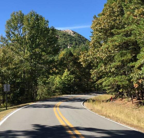
The most western segment of the Arkansas River Trail begins at Two Rivers Park Bridge, which spans the Arkansas River to the peninsula. Here among soft surface mountain bike and equestrian trails, the paved multi-use trail extends through beautiful county property northwest to Two Rivers Park, where the route to Pinnacle Mountain State Park transitions primarily to on-street bicycle lanes. Although Two Rivers Park Road (within Two Rivers Park) would require widening to accommodate bicycle lanes, bicycle lanes exist on County Farm Road, as well as portions of Pinnacle Valley Road to the entrance to the Pinnacle Mountain State Park property. The road in this area is two-lane, characterized by gently rolling hills. At the Pinnacle Mountain State Park entrance sign and property line, sidepath is proposed to provide user separation from vehicles where the route becomes more winding. The proposed sidepath continues to Highway 300, where a separated trail is proposed, turning south and encircling the titular mountain before arriving at the park’s most popular entrance. This segment measures 11 miles.
This page intentionally left blank
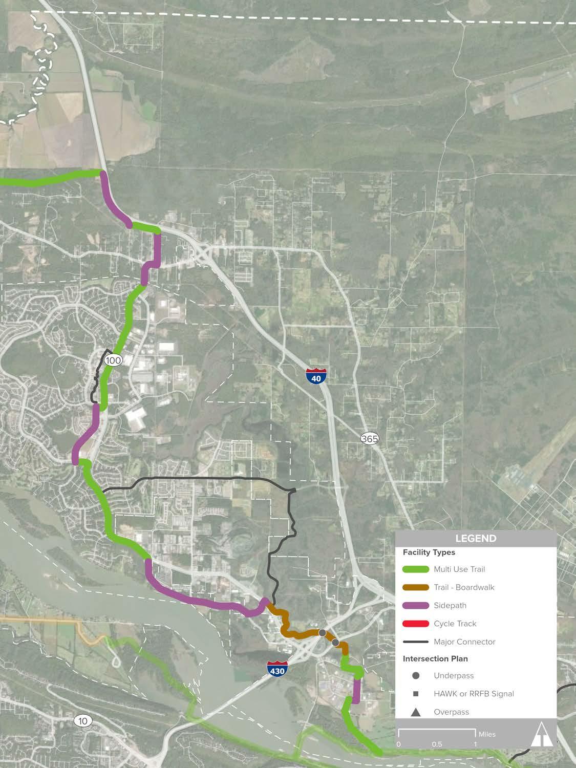
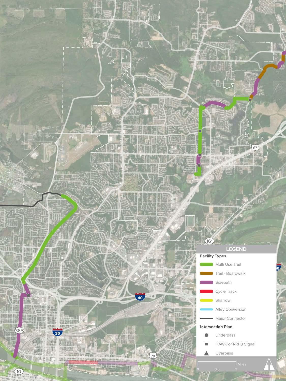
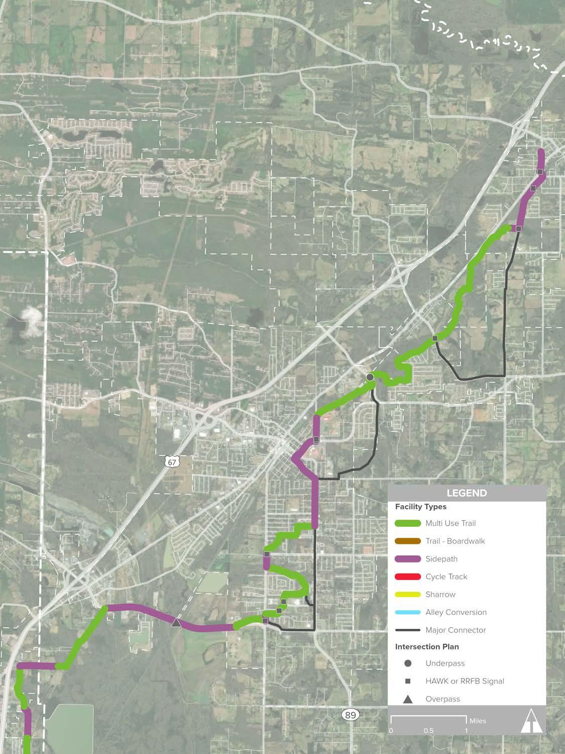
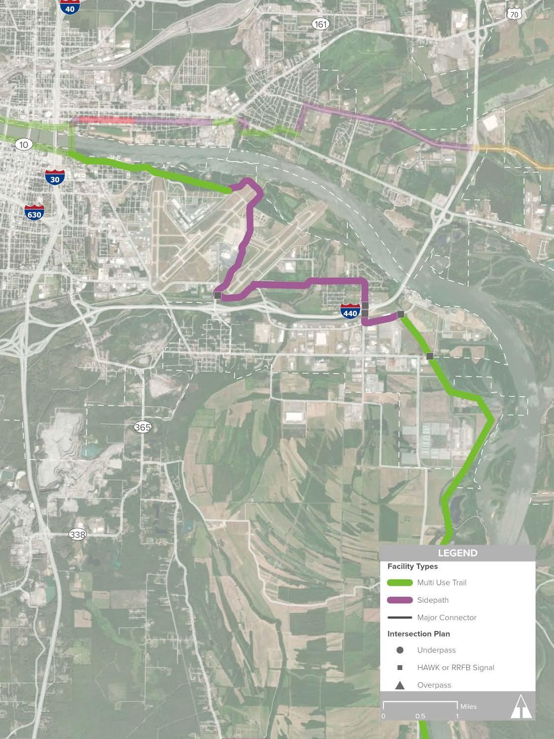
Beginning at the Arkansas River Trail south of the Northshore Business Park, the Northwest Corridor connects North Little Rock, Maumelle, Mayflower, and Conway. The second-longest route behind the Southwest Trail, the Northwest Corridor has the highest mileage of existing trail (7 miles), located in Maumelle and Conway.
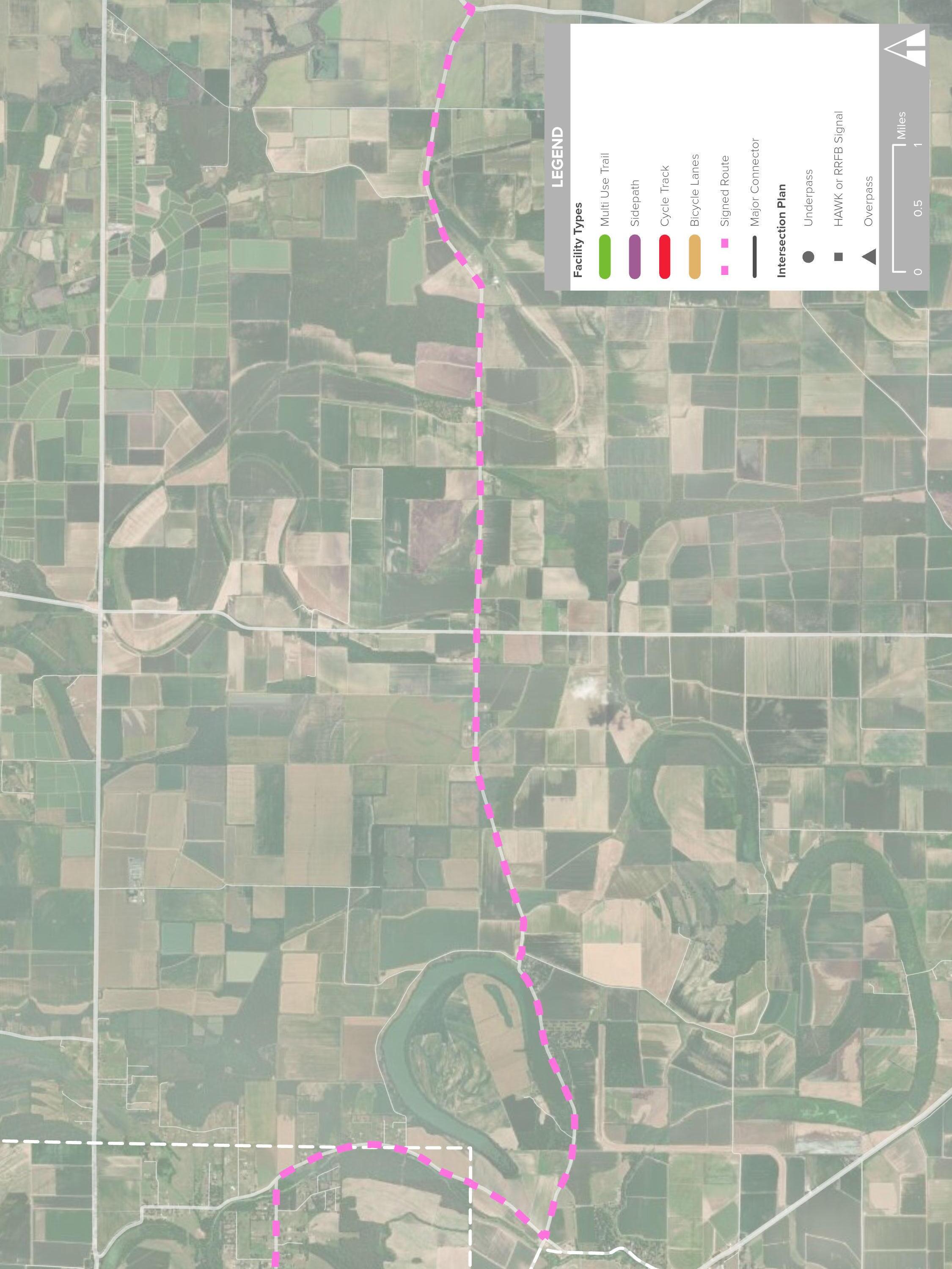
A notable physical barrier on the Northwest Corridor is the convergence of Highway 365, Union Pacific Rail Line, and Palarm Creek at the Pulaski - Faulkner County border. Special attention will be required to cross Palarm Creek and underneath Highway 365 and the Union Pacific rail line as well as thorough collaboration. This and other implementation considerations are discussed in detail on page 226.
Destinations
» Northshore Business Park
» Pine Forest Elementary School, Maumelle
» Academics Plus Charter School, Maumelle
» Mayflower Middle School
» Mayflower High School
» Central Arkansas Christian School
» Conway Technology Park
» The University of Central Arkansas
» Jewel Moore Nature Reserve
» Park on the River, Maumelle
» Lake Willastein, Maumelle
» Lake Valencia, Maumelle
» Pompe Park, Conway
» Beaverfork Lake Park, Conway
» Palarm Park, Faulkner County
» (3) Grocery Stores
Total Length
» 36 Miles
Existing Facility Types
» Trail: 6.8 Miles
Proposed Facility Types
» Trail: 9.9 Miles
» Boardwalk: 1.6 Miles
» Sidepath: 17.5 Miles
» Cycle Track: 0.22 Miles
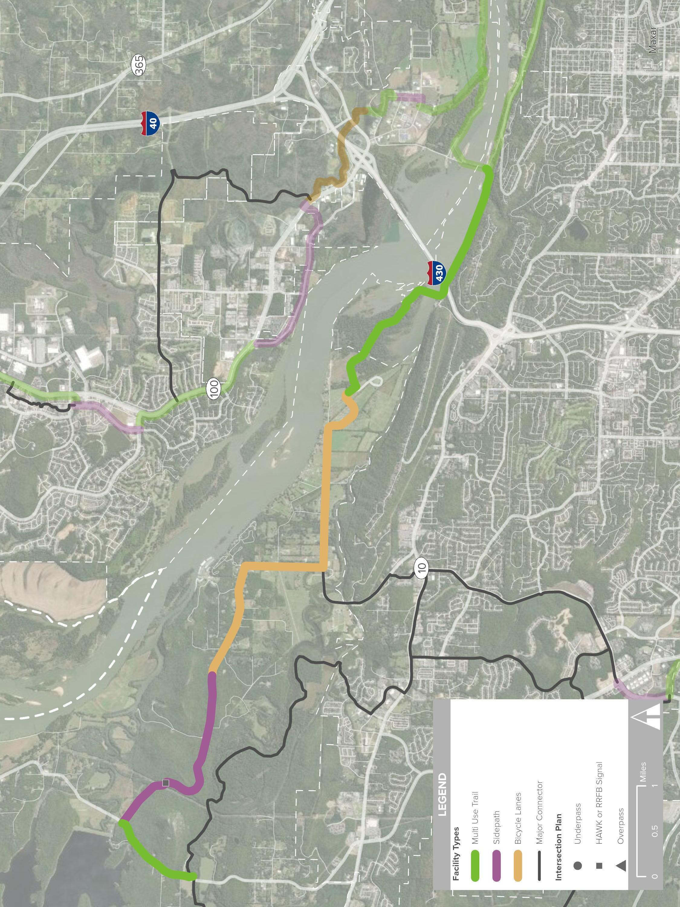
The Northwest Corridor originates where trail diverts away from the River Trail near Campbell Lake Park and enters the Northshore Business Park. The trail passes between Arkansas Surgical Hospital and the Department of Environmental Quality, transitioning to a sidepath along Northshore Drive and then north on Northshore Lane. The route becomes trail at the end of Northshore Lane, continuing until meeting White Oak Bayou, which it follows, crossing underneath Crystal Hill Road and Interstate 430. Passing by Central Arkansas Christian School, this segment will be a scenic reprieve from the nearby bustle of car traffic on the interstate and Highway 100, which the trail will cross at Corporate Drive.
Sidepath is proposed between Corporate Drive and Crystal Hill Road and the existing trail, which begins at the intersection of Crystal Hill Road and Highway 100 (Maumelle Boulevard). The existing trail enters Maumelle from the south along Maumelle Boulevard, before turning west and directing users along Odom Boulevard before continuing north along Club Manor Drive, a corridor selected for its close proximity to Lake Willastein, many commercial businesses, offices, essential services, and residential developments. At the north end of Club Manor, the route moves east through city-owned property that is currently in development as a new city food truck park. It joins the existing trail located along Maumelle Boulevard, continuing north and providing trail users connections to Pine Forest Elementary, the Maumelle Community Center,
Academics Plus Charter School, Maumelle Library, Lake Valencia, and City Hall. The trail along the boulevard is located in the center of the community, and existing local trail along Odom will provide pedestrians and bicycle riders the opportunity to reach the regional trail.
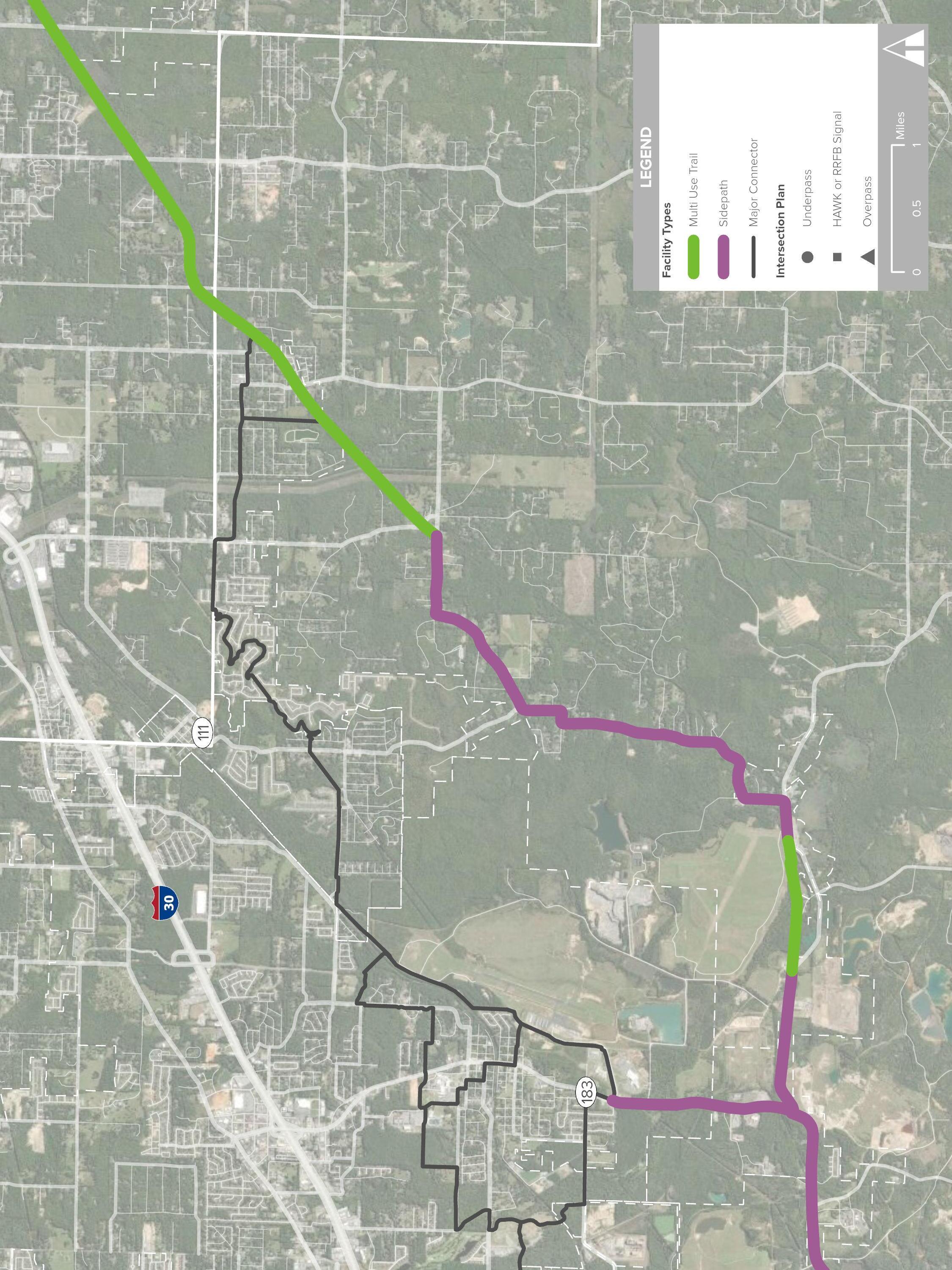
After crossing the Union Pacific railroad, the Northwest Corridor departs from Maumelle Boulevard onto Tanning Road and into Pulaski County jurisdiction. Here the difference between City and County land use development and character of homes is evident. Switching from sidepath to trail at the end of Tanning Road, the trail is directed west, meeting Ingram Road and moving north as sidepath, and at its end, switching back to trail and traversing west along the ridge dividing the undulating terrain to the south from the rice fields and marshy lowlands to the north. The segment along the ridge is just under four miles in length, and at its western ends meets the challenging Palarm Creek crossing. Right of way, environmental, jurisdictional, and individual property ownership are some of the expected challenges of this implementing a trail in this area.
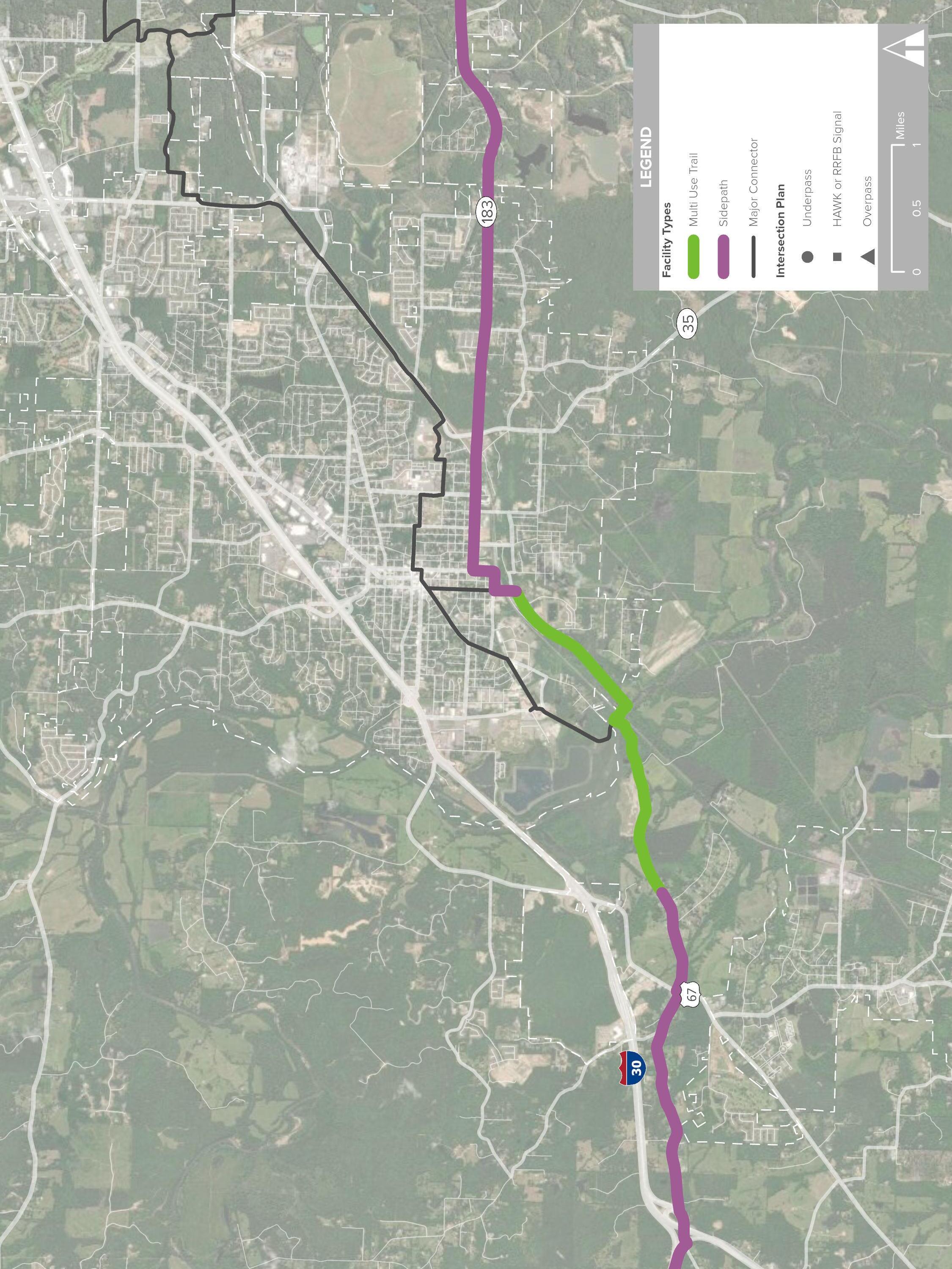
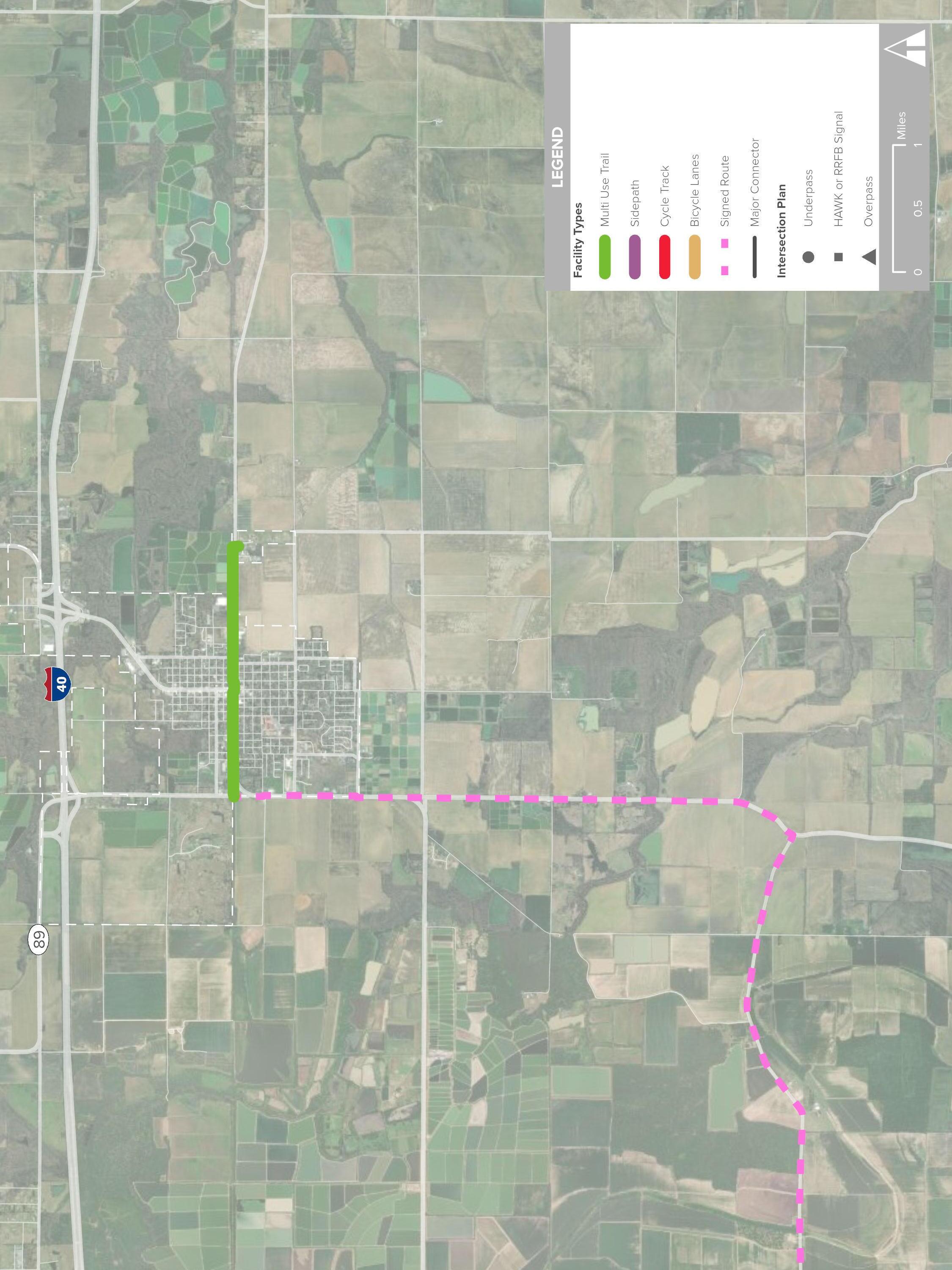
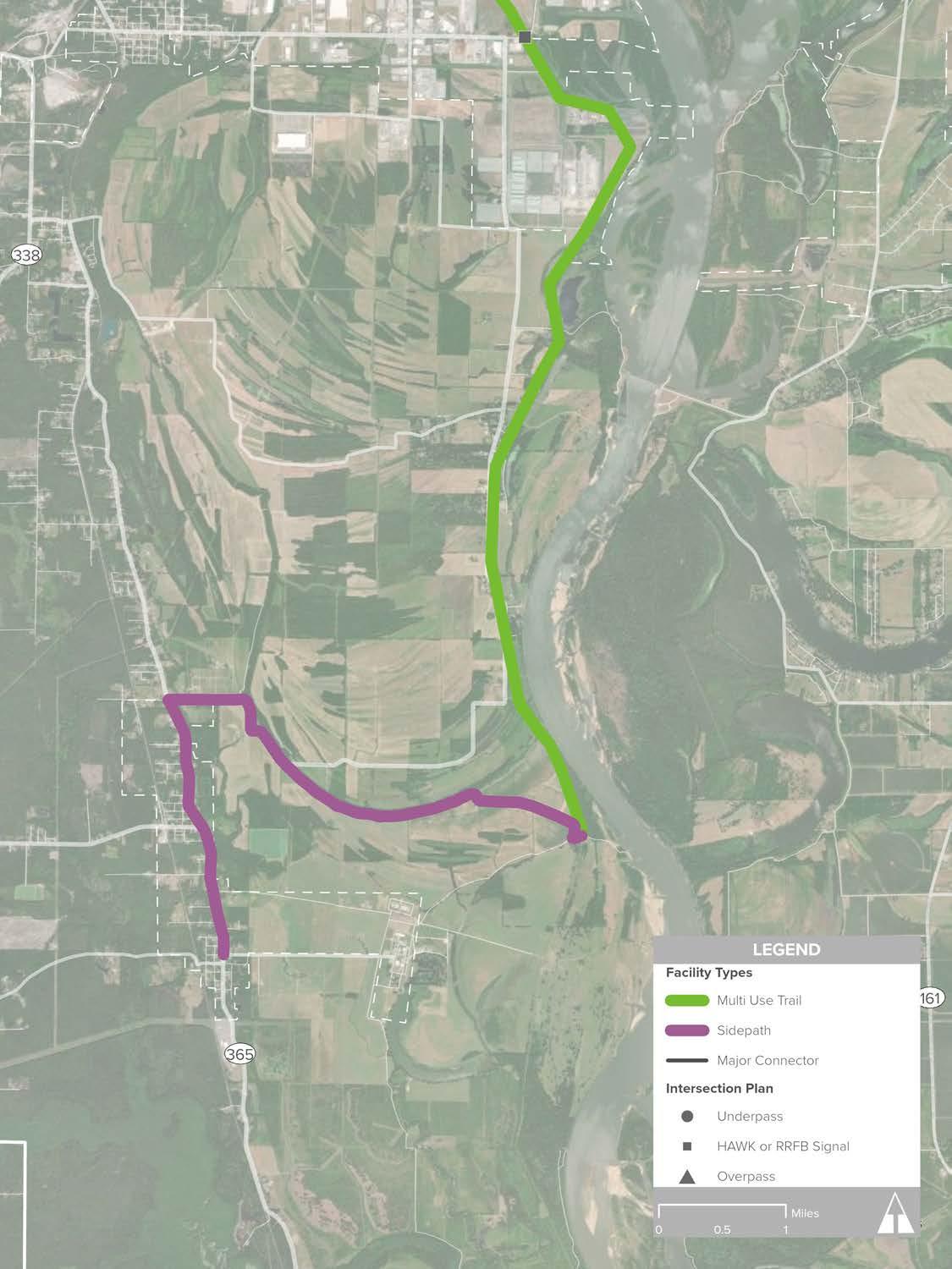
After following Highway 365 north as a sidepath for approximately one mile, the route turns onto Plantation Drive. An existing bridge over the Union Pacific Railroad provides important access for the route to safely cross the tracks, continuing north as a trail to Luker Lane and Mayflower Middle and High Schools. From there, the route follows the new Highway 89 bypass. Rural single-family housing comprises this area, with long stretches of trail surrounded by trees following a power line easement before following Sturgis Road as a sidepath into Conway.
Entering Conway from the south, the Northwest Corridor follows Gold Creek north to the Conway Technology Park from the south at Ledgelawn Drive, where the route transitions to sidepath up to Bill Bell Lane. The terrain in this area is marked by hills which ultimately point to Round Mountain, further to the south. As the trail continues west, shortly after Stanley Russ Road intersects with Bill Bell Lane, the route continues north on city property to connect to the Stone Dam Creek Trail system, currently in development. Stone Dam Creek Trail intersects South German Lane, Donaghey Avenue, and passes over Dave Ward Drive via a premiere bike and pedestrian bridge, connecting University of Central Arkansas lecture halls and housing to restaurants, eateries, and doctors’ offices.
Shortly before continuing north to the campus proper, the route winds west through the Jewel Moore Nature Reserve, a quiet open space adjacent to intramural ball fields and student parking. The trail then connects on the campus’ west side, following Farris Road north to College before meeting Kinley Trail, Conway’s first separated linear multiuse pathway system. This area contains some of the densest concentrations of destinations along the regional greenways network: the University of Central Arkansas, multi-family housing, single-family neighborhoods, grocery stores, and existing commercial that is made accessible by foot and bike. At its north end, the Kinley Trail intersects with Tyler Street, continuing as a sidepath from there to Salem Road, where the route continues for over three miles, terminating at the scenic Beaver Fork Lake. This route may eventually be expanded north to Wooster, Greenbrier, and Woolly Hollow State Park.
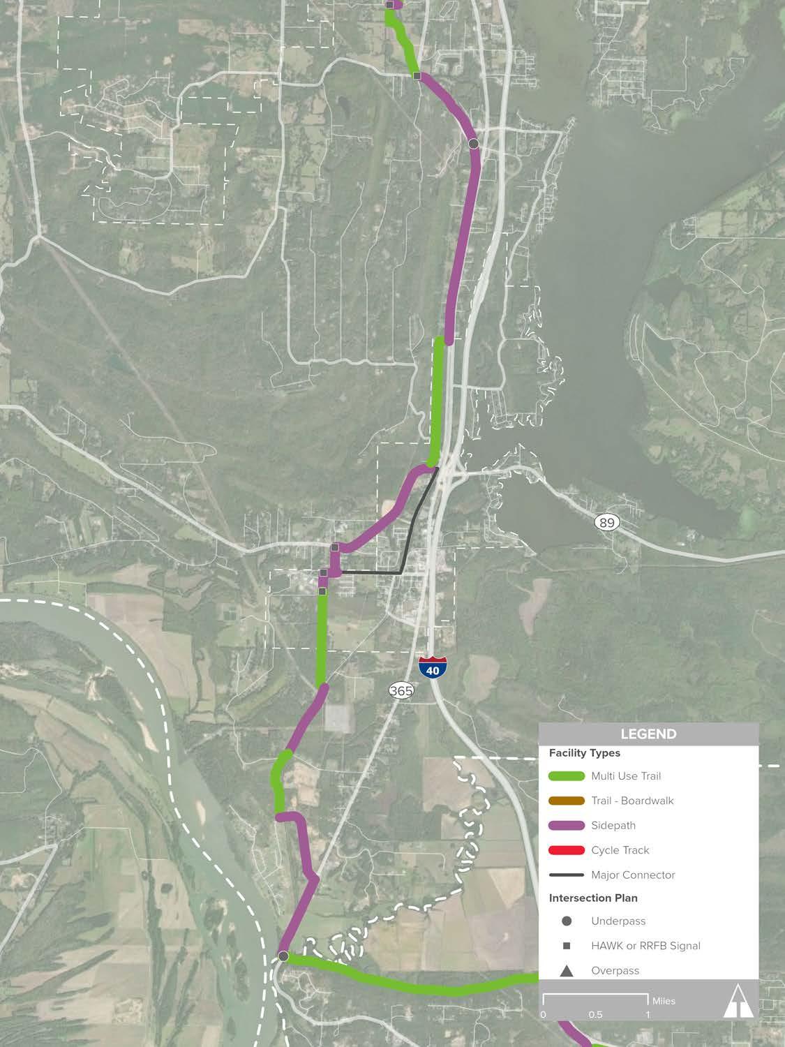
BEAVERFORK LAKE

KINLEY TRAIL
DAVE WARD FARRIS COLLEGE TYLER
UNIVERSITY OF CENTRAL ARKANSAS
DOWNTOWN CONWAY
DON OWEN SPORTS CENTER I-40
SIEBENMORGEN
CREEK
STONE DAM CREEK TRAIL
CONWAY TECHNOLOGY PARK
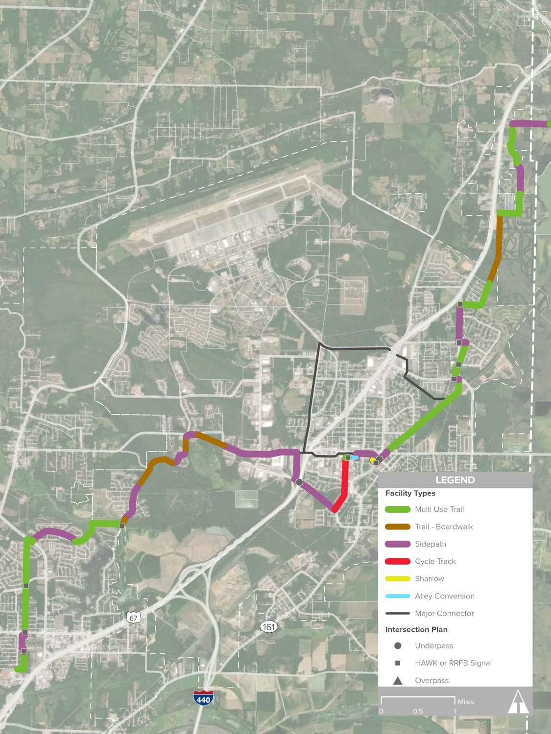
Moving north from the Arkansas River Trail at Pike Avenue, the Northeast Corridor connects North Little Rock, Sherwood, Jacksonville, Cabot, Austin, and Ward. Existing facilities include the sidepath along Pike Avenue and the Levy Trail, both of which are located in North Little Rock. This corridor traverses predominately urbanized areas and will provide alternative transportation opportunities through the heart of several communities.
» Central Arkansas Christian School
» Pathfinder Preschool, Jacksonville
» William Jefferson Clinton Elementary School, Sherwood
» Jacksonville Lighthouse Charter School
» Pinewood Elementary School, Jacksonville
» Cabot Middle School South
» Cabot Junior High School South
» Eastside Elementary School, Cabot
» Cabot High School
» Cabot Junior High School
» Cabot Freshman Academy
» Cabot Middle School North
» Ward Central Elementary School
» CHI St. Vincent Medical Center, Sherwood
» Jacksonville Library
» Lighthouse Academy High School
» Fairway Swimming Pool and Park, Sherwood
» Delmont Park, Sherwood
» Duran Community Center, Sherwood
» Austin Lakes Park, Sherwood
» Jacksonville Community Center
» Dupree Park, Jacksonville
» Jimmie White Park, Jacksonville
» Cabot Community Center
» Kerr Station Park & Cabot Community Pond
» Ward Sports Complex
» Busby Lake, Ward
Total Length
» 34.6 Miles
Existing Facility Types
» Trail: 2.9 Miles (Levy Trail)
Proposed Facility Types
» Trail: 14.7 Miles
» Boardwalk: 2.4 Miles
» Sidepath: 13.6 Miles
» Cycle Track: 0.8 Miles
» Sharrow: 353 Feet
» Alley Conversion: 611 Feet
Route Description
The intersection of Pike Avenue and the River Trail marks the beginning of the Northeast corridor. Designated as a sidepath along Pike Avenue, the route turns east on Pershing, a short distance from the North Little Rock High School and Community Center, before continuing north to meet the Levy Trail. Along Percy Machin Drive where the Levy Trail begins, the road experiences high traffic volumes, with a complicated intersection including an off-ramp from Interstate 40. Emphasizing user separation from vehicular traffic will be particularly important in this area south of Interstate 40, as well as providing upgrades to allow safe crossing by pedestrians and cyclists.
While the converted rail line provides access to recreation and transportation for many homes in the area, this segment can be improved by upgrading crosswalks at each street intersection.
A route between the end of the Levy Trail and the Power Line Trail parallel to Lantrip Road in Sherwood is still being studied and has not been finalized as of the writing of this report.
Near the William Jefferson Clinton Elementary School, the trail continues north through dense multi-family development before intersecting with the powerline easement north of Kiehl. The route in this area is oriented north-south and is characterized by gently rolling hills, low-lying areas with water features, and greenery and native tree species. Crossing Brockingon, the route utilizes existing pathways through Gap Creek and then continues along the scenic ridge between Indianhead Lake and Kellogg Creek. This setting is maintained as the sidepath continues north along Oneida Street then east along Main Street into Jacksonville.
Where the route meets Jacksonville near Redmond Road, the setting becomes much more industrial in nature. The sidepath continues along Redmond until the route transitions to cycle track moving north along James Street, passing less than a quarter mile from the Jacksonville High School. Through a combination of trail, sidepath, sharrow, and alley conversion to accommodate bike and pedestrian facilities, the route continues east through historic areas of the downtown 1st Street, passing underneath the Main Street bridge next to the railroad line. The corridor then transitions
back to trail next to Jacksonville Lighthouse Charter School, traveling north along the rail line until it reaches Northeastern Avenue. Whereas south of Main Street contains a mix of land uses including industrial, multi-family, and commercial, from this point until the corridor exits Jacksonville at Cheyenne Trail, the Northeast Corridor is characterized primarily by the single-family homes and golf courses it passes.
North of Cheyenne Trail the corridor becomes quiet, scenic and full of natural amenities. Passing by the Holland Bottoms Wildlife Management Area, trail users pass Pickthorne Lake near Coffelt Road. The route remains quiet until Highway 321, utilizing its bridge to pass over the Union Pacific Railroad line. In Cabot, the route directly connects the South Middle and South High Schools, utilizing school district property and following the creek north through Kerr Station Park before winding east to South Pine Street. Near Janice Drive, the Northeast Corridor becomes an urban sidepath, continuing north on the west side of Pine Street until Main Street, then connecting north to the Freshman Academy, North High School and Junior High School, and Cabot Community Center.
Between Cabot Freshman Academy and the Ward Sports Complex, the route briefly travels next to the Union Pacific railroad and an adjacent creek. It crosses underneath Highway 38 and over Hudson branch Creek, winding through the forest for four and a half miles before arriving at the Ward Sports Complex. Here, the route transitions to sidepath and continues north along Peyton Street, passing by Busby Lake and many neighborhoods, back over the railroad tracks, and concluding at Ward City Hall.
Old River Bridge, Saline County
Source: https://bridgehunter.com/uploads/comments/41/41960/41960-001.jpg
As previously described, the Southwest Trail was the first long-distance trail effort in Central Arkansas. The official route begins at Central High School and terminates at Hot Springs National Park, measuring 58.3 miles in length and connecting Little Rock, Shannon Hills, Alexander, Bryant, Benton, Haskell, Hot Springs, and parts of Saline and Garland counties. For purposes of this study, the Southwest Corridor begins at the Arkansas River Trail and terminates at the Saline/Garland county line, measuring 41.2 miles. As of the writing of this report, approximately 10.4 miles of trail have been funded for construction.
Destinations
» Central High School
» Arkansas State Fairgrounds
» Southside Park
» Interstate Ball Park Fields
» Southwest Christian Academy
» Pine Haven Elementary School
» Bauxite High School
» Saline Crossing Regional Park
» Hot Springs Convention Center
» Hot Springs Visitor Center
Total Length (Arkansas River Trail to the Saline/ Garland county line)
» 41.2 Miles
Proposed Facility Types (Arkansas River Trail to the Saline/Garland county line)
» Sidepath: 22 Miles
» Trail: 19.2 Miles
For purposes of this study, the Southwest Corridor begins where La Harpe Boulevard becomes Cantrell Road/Highway 10, also located near the Arkansas River Trail and continues through Pulaski and Saline counties. This extends the route northward from its official point of beginning at Central High School to connect to the Arkansas River Trail. Passing underneath Highway 10, the trail follows the Union Pacific railroad until it crosses into Interstate Park,
approximately two miles to the south. Despite its close proximity to the railroad, this segment of the Southwest Corridor is scenic, characterized by surrounding age-old trees, historic homes, and established neighborhoods amongst Capital View and around Central High School. The actual Southwest Trail, under development prior to this study, begins at Little Rock Central High School and terminates at Hot Springs National Park. The corridor included as part of this study terminates at the Saline/ Garland County line. From Central High School, the route passes directly by the Arkansas Fair grounds, and features grade separated crossings with busy streets, passing over 7th Street and underneath 3rd Street, Interstate 630, 12th Street, 13th Street, Daisy L Gatson Bates Drive, Asher Avenue, and Roosevelt Road. This is one of the most established areas of Little Rock, enhanced by the Southwest Trail.
While traversing north of Interstate Park, the trail remains east of Fourche Creek, but south of the ball fields, the Southwest Trail crosses various branches of the creek. Moving south, users will cross east on sidepath underneath Interstate 30 along a rail spur for a brief period, transitioning again to greenway trail as the corridor turns south. The next ten miles will become known as some of the most scenic and enjoyable cycling opportunities in Central Arkansas. This section of the trail navigates between the floodplain of Little Fourche Creek and adjacent industrial uses, providing users with scenic views that can only be experienced by bike or on foot. Crossings at Baseline, Hilario Springs, Geyer Springs, Chicot and Hardy will be safe, well-signed at-grade crossings and provide access for users to restrooms and other recreation routes in the area. Passing from Pulaski County into Saline County, the terrain becomes slightly steeper, but levels out as users continue south of Shannon Hills and Alexander.
The route becomes sidepath along Germania and Alexander Road, diverting away from the road right of way where Alexander meets Sardis Road before coming back to the road as sidepath. This area
is comprised mainly of large properties with long driveways, rural by nature. Continuing west, the Southwest Trail enters Bauxite along Sardis until it intersects with Highway 183, where a short segment diverts directly north to provide users access to rest and provisions in Bryant. The route follows Highway 183 until it transitions back to trail, passing behind homes as it enters the southern reaches of Benton.
Bicyclists and pedestrians in this southeastern area of the city will be able to access the trail to reach a number of destinations along Highway 35, including the high school and junior high school located less than a mile north of the route.
Where the Southwest Trail becomes sidepath along Highway 183/35, the route becomes an urban sidepath, passing through dense industrial and commercial development where the state highway becomes Edison Avenue as users travel west through the city. Restaurants, shops, and other community destinations are located along and close to this important transportation corridor. Edison Avenue intersects with East Street, and the route continues south and then west on Hazel Street before turning south again on Market Street. Just past Willow Street the route turns southwest for a mile and a half utilizing the old railroad grade to the Old River Bridge along Airline Drive and crossing over the Saline River.
As users cross from the east side of the Saline River onto its west side to reach the Saline Crossing Regional Park, the setting changes little. The route continues along the service road for over a mile and a half before transitioning to sidepath. The sidepath on River Road continues north, just outside of Haskell, until users reach Highway 67, where they will cross at-grade and continue along Pawnee Drive. The concentration of population in this area may be lower, but the character is as charming as Benton or Bryant. Pawnee Drive is designated with a sidepath from Highway 67 until it passes underneath Interstate 30, where the route then follows within the right of way of Highway 70 to the Saline/Garland county line: the terminus of focus for this study.
* Note: Intersection Treatments for the Southwest Trail are in design by others and are outside the scope of this project
COUNTY SALINE COUNTY
DR
This page intentionally left blank
Beginning in the east part of North Little Rock, the East Corridor traverses Pulaski and Lonoke counties to the City of Lonoke. The corridor is comprised primarily of on-street bicycle facilities, such as bike lanes and signed routes, rather than protected facilities such as trails or sidepaths. From the River Trail to the underpass at Interstate 440 along Faulkner Lake Road, the corridor is cycle track, sidepath, and trail, and east of I-440, the route specifically accommodates bicyclists. The signed route terminates in Lonoke at the city’s existing rail trail, which connects many residences to their downtown, ball fields, and a new career training center and health clinic.
» North Little Rock Academy
» Lonoke Middle School
» Lonoke Elementary School
» Rose City Community Center, North little Rock
» Lonoke Community Center
» Lonoke Municipal Ball Park
» Caterpillar
Total Length
» 29.8 Miles
Existing Facility Types
» Trail: 2 Miles (Lonoke)
Proposed Facility Types
» Trail: 1.1 Miles
» Sidepath: 4.3 Miles
» Cycle Track: 0.8 Miles
» Bicycle Lanes: 2 Miles
» Signed Route: 19.6 Miles
The East Corridor features user separation from vehicles from its beginning at the northeast corner of the River Trail, and bicycle-only facilities from Interstate 440 at Faulkner Lake Road until the corridor reaches the Rail Trail at Lonoke. The transition in facility types coincides with the character of the two halves of the corridor: east of Interstate 440, the corridor is lower traffic, rural, and features flat terrain, while west of the interstate is industrial, high traffic, and densely developed.
The corridor begins with sidepath along Riverfront Drive near the intersection with Cedar Street and Dorothy Rodham Way, switching to cycle track traveling east on Washington Avenue for nearly a mile, then sidepath beginning at Buckeye and continuing on Washington. The wide road is ideal for implementing a cycle track, and due to the heavy car traffic and the heavy truck traffic on the corridor accompanying the industrial land use, user separation in this area is particularly pressing. The route diverts behind buildings fronting Washington at Lincoln, traveling east between the back of shops and the Saint Louis Southwestern Railroad.
At the intersection of the railroad and Baucum Pike, the character of the area becomes more welcoming
to users. From the proposed sidepath at Justin Avenue, the trail continues along small water bodies before crossing Baucum Pike and the railroad again, connecting homes on Coral Street and Water Street to the Rose City Community Center on Rose Lane. North of Baucum Pike to Rose Lane is the most concentrated population along the East Corridor, save for the central location of the Rail Trail in Lonoke. The two-mile segment of sidepath on Faulkner Lake Road from Rose Lane to Interstate 440 marks the final bikeped facility in the East Corridor.
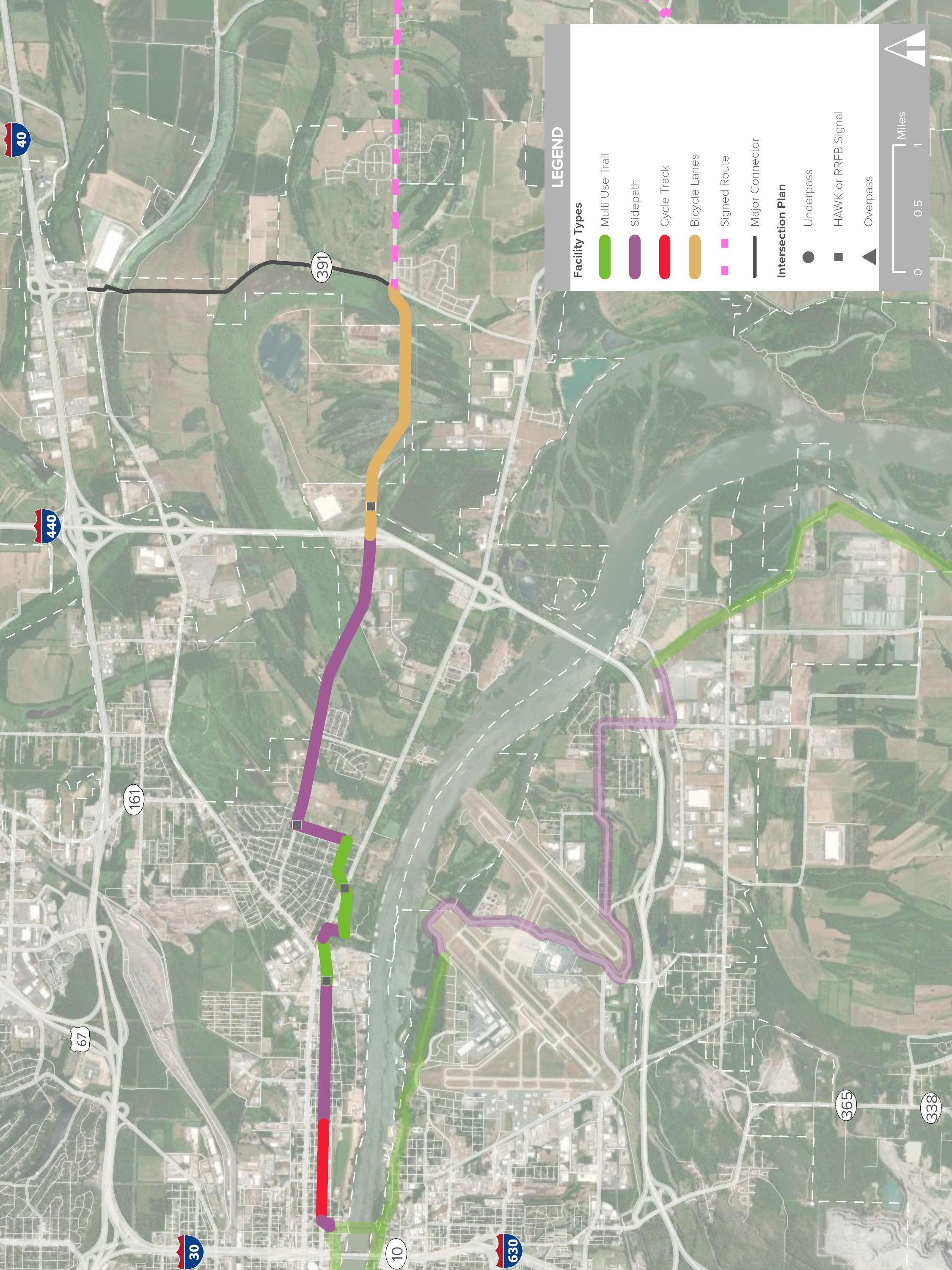
The first U.S. Bicycle Route designation in Arkansas, U.S. Bike Route 80, is located on Faulkner Lake Road from Interstate 440 to Highway 161, and bicycle lanes are proposed on Faulkner Lake Road until Highway 391. From here, the East Corridor will continue as an on-road bicycle-only facility on Faulkner Lake Road to Highway 161 where the route travels south to Bearskin Lake Road, passing the oxbow lake and the historic Marlsgate Plantation. At Highway 15, the corridor continues as Bearskin Lake Road changes to Bevis, continuing east past fish farms and rice and barley fields before meeting Highway 31 and traveling north to its intersection with Highway 70, and ending at Lonoke’s local rail-trail that continues east across town and terminating at the Lonoke Municipal Ball Park.
3.16 East Corridor: East
The Southeast Trail is comprised of off-street trails and sidepaths, with significant portions paralleling the Arkansas River. Extending from the Arkansas River Trail in Little Rock, the southern terminus of the Southeast Trail is Wrightsville, and other significant destinations include the Port of Little Rock and the Little Rock National Airport.
» 40+ major employers including Amazon, DP&L, and Hormel Foods
» Bill and Hillary Clinton National Airport
» Dassault Falcon Jet
» David D Terry Park
» 21.5 Miles
» Trail: 10.1 Miles
» Sidepath: 11.4 Miles
The Southeast Trail originates at the southeast corner of the Arkansas River Trail and leads to Wrightsville. From the River Trail the route continues east as a greenway, transitioning to sidepath at the Bill and Hillary Clinton national Airport. The sidepath continues around the airport and south until it meets with Roosevelt Road, continuing to Fourche Dam Pike and passing underneath Interstate 440 to enter the Port of Little Rock. The route turns east on Lindsey Road, then south as a greenway, following the levee for nearly eight miles. This stretch also connects directly to Damsite Road, which leads to David D Terry Park, allowing users the opportunity to take in the scenic landscapes of the lowlands south and west of the Arkansas River. At the greenway’s intersection with Highway 87, the Southeast Trail transitions to sidepath, winding its way west and slightly north until it meets Asher Road and then Highway 365, connecting homes to commercial businesses and community facilities before terminating at Highway 386.

9TH
DOWNTOWN LITTLE ROCK
EAST CORRIDOR
BILL AND HILLARY CLINTON NATIONAL AIRPORT
COLLEGE STATION
COLLEGE
365
3.18 Southeast Corridor: South
HWY 87 HWY 83
This page intentionally left blank
The regional greenways network will include a variety of different trail typologies based on geography, land use, and the phased nature of building out a regional system. The following sections detail where each of these trail types is best suited and opportunities to flexibly implement each type while upholding best-practice design standards. While a shared use path through a natural corridor may look very different from an on-street local facility, safety and comfort for all ages and abilities are the common foundations for all typologies.
This section, combined with guidance on priority trail crossings and wayfinding, will lead to a seamless regional trail network.
Context refers to where a facility is most appropriate within the regional network. Context incorporates geography, land use, traffic speed and volume, and user expectations.
The design guidance section provides specific implementation details for each facility. Guidance covers best practices for width and materials as well as considerations for signage, striping, and maintenance.
Implementing a regional trail network requires a realistic blending of contextspecific needs and high-quality design. Each section includes information on interim steps, flexible phasing, and adjustments that can be made in constrained environments.
» Multi-use trails
Wide paved trail through a non-roadway, natural corridor
» Sidepaths
Paved trail adjacent to a higher volume roadway
» Two-way separated bike lanes (aka cycle tracks)
On-street facility for bi-directional travel with separation on one side of the street
» Directional separated bike lanes*
On-street facility for directional travel with separation on both sides of the street
» Conventional bike lanes*
Painted, designated space for cyclists on roads with low to moderate volumes
» Local facilities*
Signs, pavement markings, and traffic calming on quiet, lower-volume streets
* Included in the Bicycle Facility Design Details of the Multimodal Infrastructure Guide.
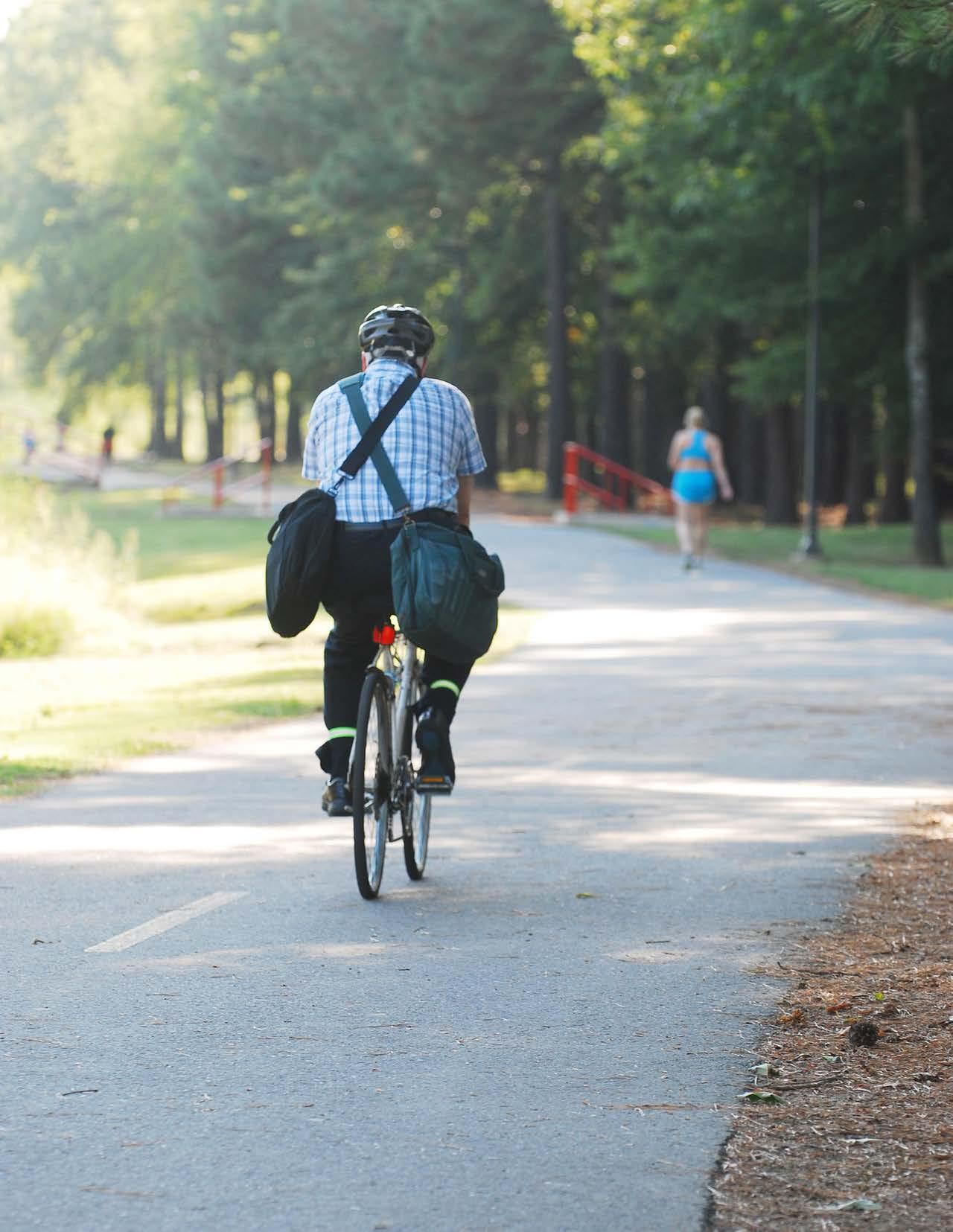
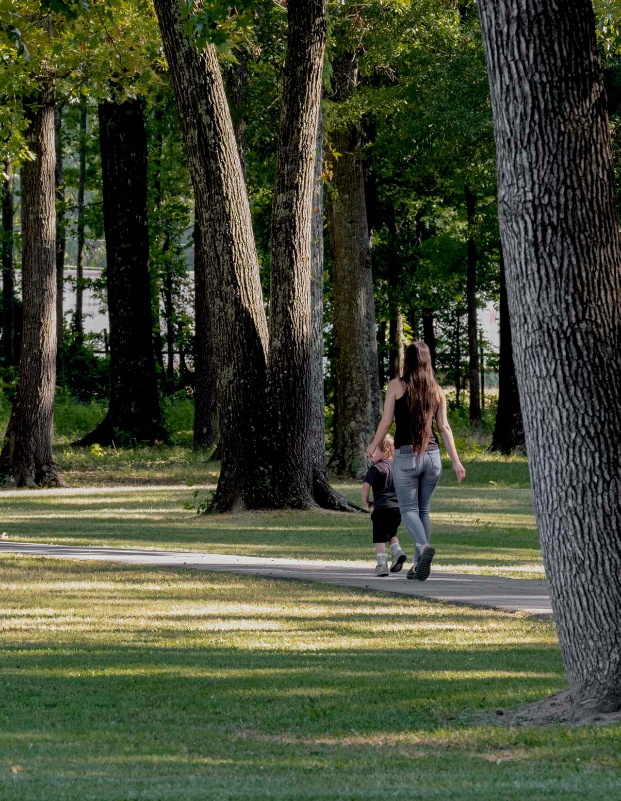
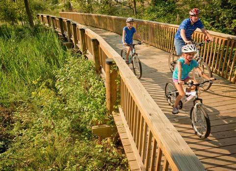
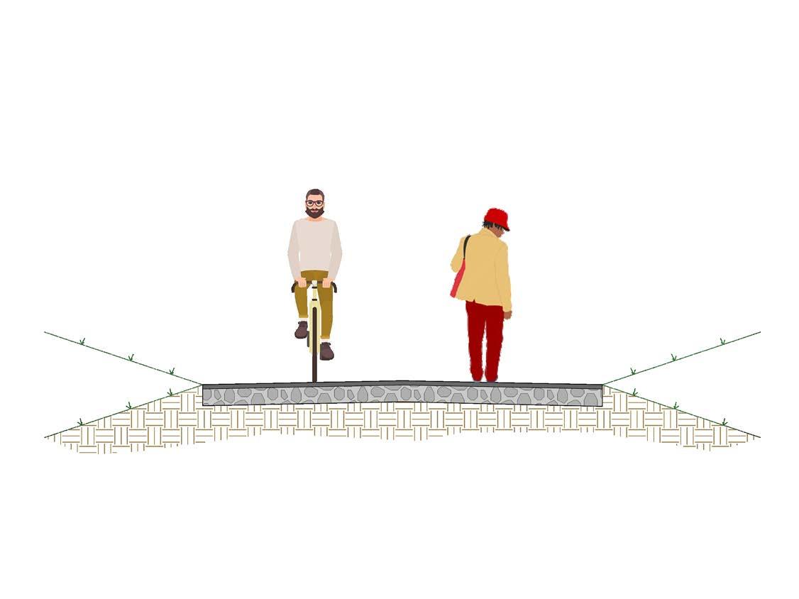
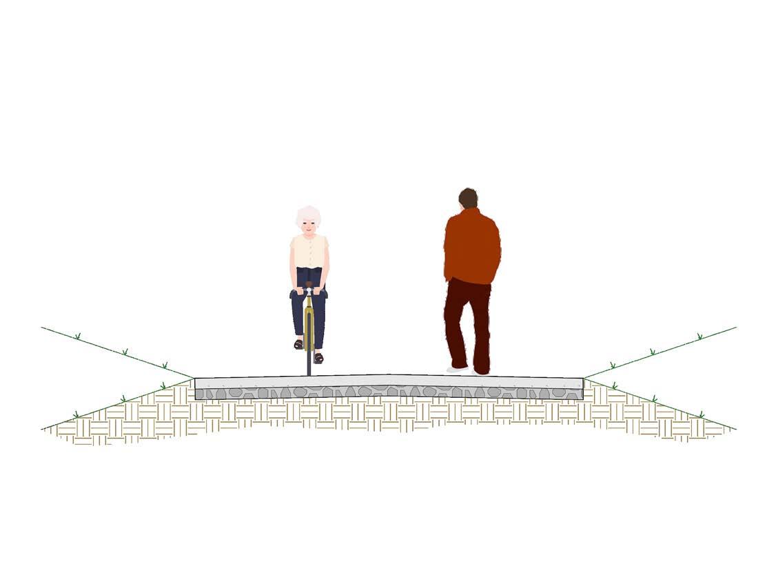
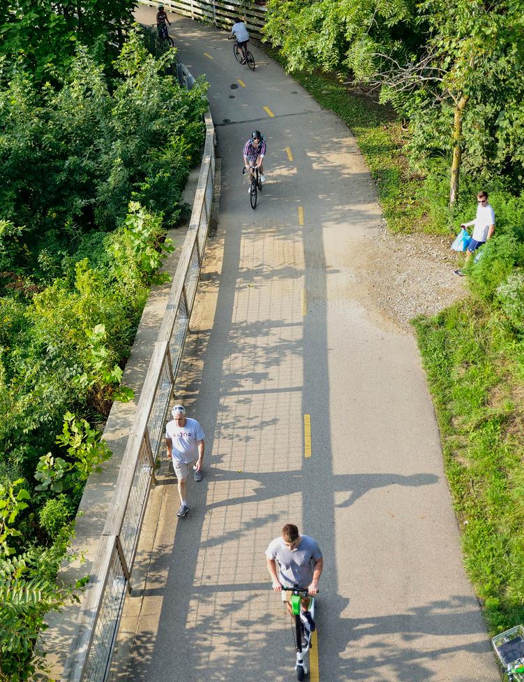
Multi-use trails represent the premier typology for the regional system. They offer a natural experience, removed from the risks and distractions of traffic and are often the most enjoyable facility for many users. Multi-use trails provide two-way travel for people walking, biking, and wheeling with ample space for traveling side by side and passing others. In a regional system, shared use paths provide the long connections between towns, regional parks, and natural areas.
Alignments for shared use paths typically follow natural, non-roadway corridors, and may vary based on more urban or rural contexts. Shared use paths often follow existing easements along corridors already set aside for utilities, waterway buffers, or former railroad lines.
URBAN MULTI-USE TRAILS
» Provide transportation and recreational connections to community destinations, and natural features.
» Alignment should take advantage of adjacencies to urban parks and open space.
RURAL MULTI-USE TRAILS
» Provide regional connections rather than access to specific attractions.
» Alignments are guided by natural corridors along utility easements, waterways, and former rail lines.
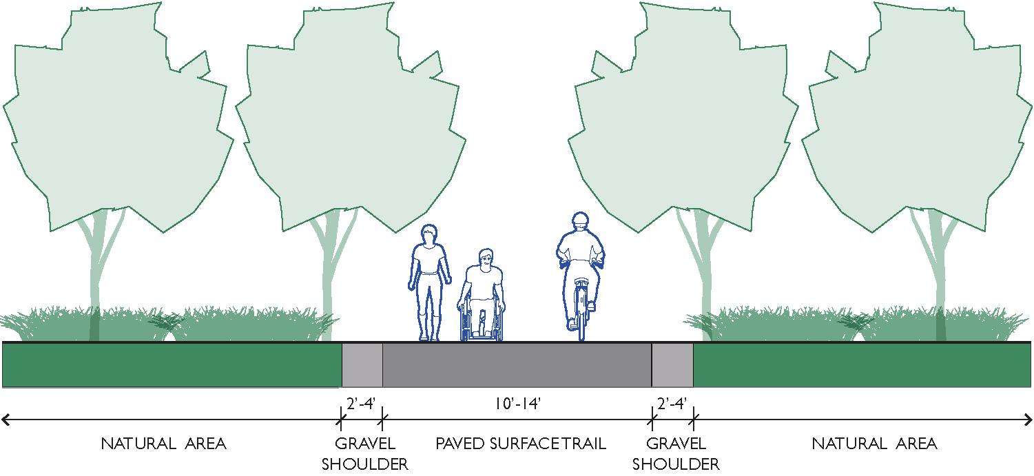
Multi-use trail widths will vary depending on context but should at minimum provide space for two cyclists to ride side by side and comfortably pass another user approaching from the opposite direction. The diagrams on page 10 highlight the space required to accommodate different users.
» Regional paths and trails should be a 14’ paved path with 2’ of gravel shoulder on either side. Local paths and trails may be 10’-14’ wide.
» Heavily used trails may require wider widths than 14’.
» Connectors or trail spurs should be a minimum of 8’ wide.
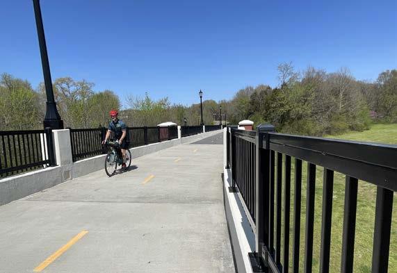
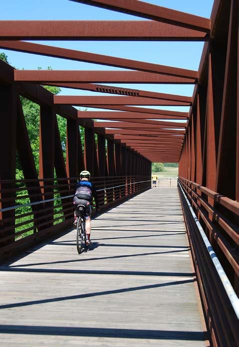
» Bridges should be a minimum of 10’ wide.
Multi-use trails require a firm, stable, slip-resistant surface typically constructed from asphalt or concrete. Long-term durability, safety, costs, and maintenance should all be considered when determining surface type.
» Gravel
» May only be used on Regional Trails to temporarily connect route segments before final buildout
» Commonly used for rural trails
» Natural aesthetic
» Softer surface for runners
» Affordable initial investment compared to asphalt and concrete
» Requires frequent maintenance especially to prevent erosion
» Difficult to maintain consistent quality and meet ADA surface standards
» Asphalt
» Smoother and sturdier than gravel while less expensive than concrete
» Prone to cracking and vegetation creep on the edges
» Require significance maintenance to fill and seal cracks
» Require complete overlay every 8-10 years
» Concrete
» Long lifespan with minimal maintenance
» Most expensive initial installation
» Joints should be designed to maximize comfort for cyclists
Best practices for multi-use trails can vary depending on specific needs and contexts. Appropriate trail widths and high quality surfaces are crucial to developing an accessible and long lasting network, but many interim steps can be taken leading to a preferred alignment or final design:
» Trail widths can vary but should not be less than 10’. Regional trails should be no less than 14’ wide.
» Gravel and asphalt can be used for temporary facilities.
» Sidepaths and other on-street facilities discussed in the Multimodal Infrastructure Guidelines can form short-term connections while a shared use path is being planned or constructed.
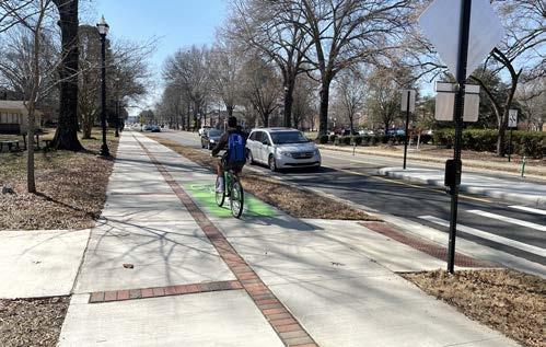
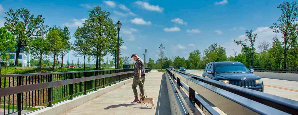
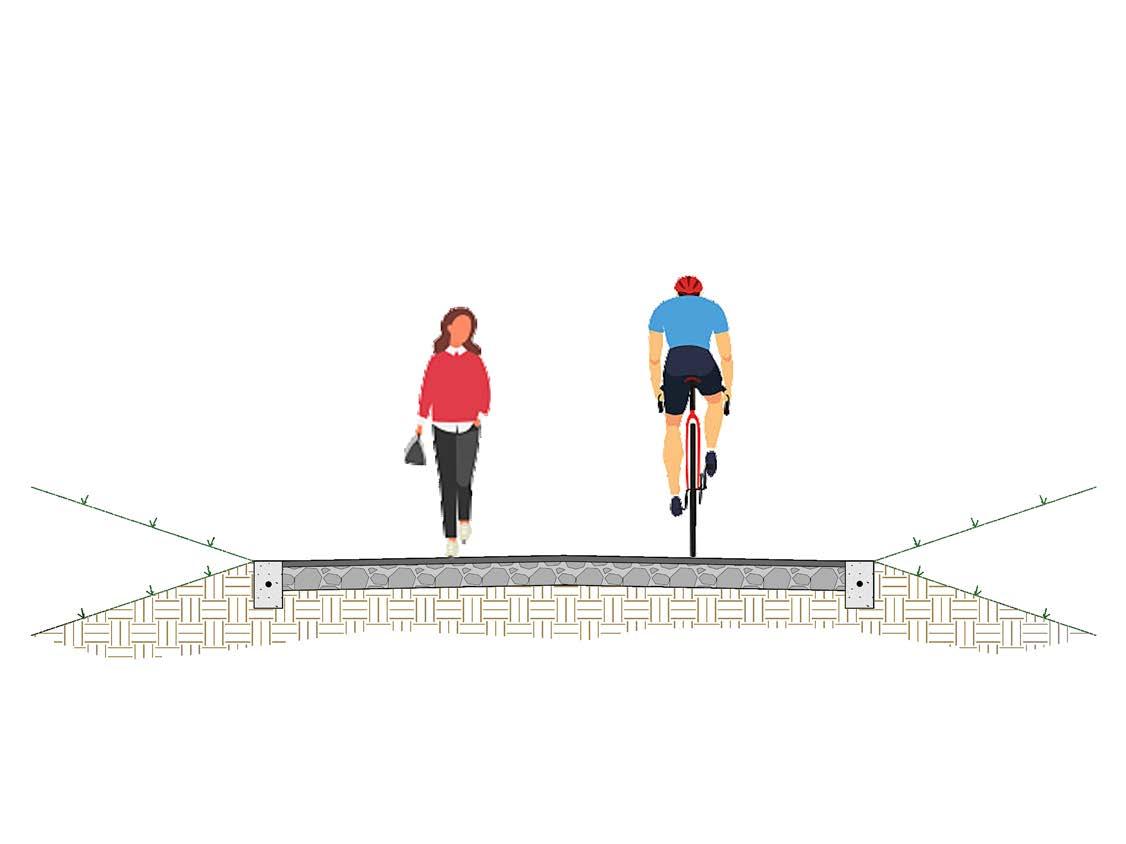
Sidepaths run parallel to existing roadways but extend the shared use path experience by maintaining separation from vehicle traffic. Despite being immediately adjacent to the roadway, sidepaths provide a highquality experience for users of all ages and abilities.
Sidepaths form key connections in the regional system. They provide a comfortable experience for bicyclists and pedestrians while capitalizing on a roadway alignment that is often already the most popular, or most direct route between destinations. Sidepaths are well suited for rural areas, especially along a two-lane road where adding an on-street facility would require widening the road, possibly impacting the area’s rural character. To avoid conflicts, sidepaths should only be constructed in areas with few roadway and driveway crossings. The landscaped buffer for sidepaths is also contingent on a wide roadside environment, which can require additional right-of-way.
14’ WIDTH FOR REGIONAL SIDEPATHS
0’-14’ WIDTH FOR LOCAL OR CONNECTOR SIDEPATHS
- 14’
While roadway corridors bring additional design considerations, sidepaths should satisfy the same design criteria as shared use paths through a natural corridor.
Like shared use paths, sidepaths must be wide enough to accommodate two-way travel for a variety of modes. Additional width may be required as the volume and mix of users increases.
» Local or connector sidepaths should be 10’-14’. Regional sidepaths should be 14’ wide.
» Short sections in constrained areas can be a minimum 8’ wide for local or connector sidepaths.
Separation should be provided between a sidepath and the adjacent roadway to demonstrate to both the bicyclist and the motorist that the path functions as an independent facility for bicyclists and other users.
» The minimum distance between sidepath and roadway is 5’.
» Where 5’ of separation is not possible a physical barrier or railing should be provided.
» Sidepaths along high-speed highways may require additional separation.
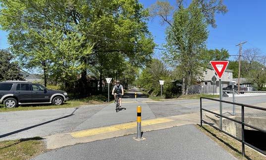
Two-way travel on sidepaths create a number of potential conflicts at driveways and road crossings:
» Motorists entering or crossing the roadway will often not notice bicyclists approaching from the right because they do not expect traffic from this direction.
» The speed of a bicyclist crossing the street may be unexpected for a driver who is anticipating a pedestrian crossing from a standard sidewalk.
» Motorists waiting to enter the roadway from a driveway or side street may block the sidepath crossing, as drivers pull forward to get an unobstructed view of traffic.
» At the beginning and end of the sidepath, bicyclists traveling in the opposite direction of traffic may continue on the wrong side of the road.
Sidepaths constructed in natural areas along roadways take on many of the characteristics of shared use paths. However, sidepaths can also be implemented directly within a street right-of-way. Street level sidepaths repurpose travel lanes, shoulders, or on-street parking, and function similarly to an on-street two-way separated bike lane. Flexible barrier materials such as flex-posts and planters can serve as temporary buffers if a full landscaped buffer is not feasible. Wide sidewalks can also serve as temporary sidepaths.
* Shy space is the operating space plus additional protective space and/or avoidance space from adjacent users
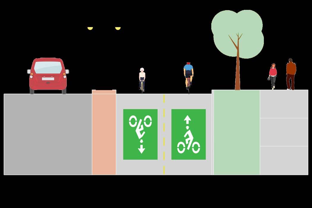
Like sidepaths, two-way separated bike lanes (aka cycle tracks) also run parallel to high volume streets and provide dedicated space for bicycle movement in both directions on one side of the street. However, unlike sidepaths, these facilities also provide separation between bicyclists and pedestrians.
Separated bikeways capitalize on the connectivity provided by an existing street network but are more comfortable to a wider range of bicyclists than conventional bike lanes. They eliminate the risk of a bicyclist being hit by an opening car door and prevent motor vehicles from driving, stopping, or waiting in the bikeway. Compared to shared use paths and sidepaths, they also provide greater comfort to pedestrians by separating pedestrians from bicyclists who are operating at higher speeds. This makes two-way separated bike lanes best suited for high-speed roadway corridors where high volumes of cyclists AND pedestrians are expected.
Two-way separated bike lanes can be at the street level using parking or another barrier as a buffer or can be raised to sidewalk level which adds additional vertical separation from traffic. Like sidepaths, two-way separated bike lanes require special attention for bicyclists traveling the opposite direction of traffic. This includes clear markings at driveways and intersections as well as at transitions to existing bicycle facilities or shared use paths.
» Two-way separated bike lanes should be a minimum of 12’ or 8’ in constrained areas. The diagrams on page 83 highlight the space required for bicyclists and pedestrians.
» The buffer between the bike lanes and travel lane should be a minimum of 3’.
» Buffer materials can range from paint and flexible vertical elements to concrete or landscaping.
» The buffer between the bikeway and the sidewalk can be a standard curb or a landscaped strip. Sidewalk level bike lanes must have at least a tactile strip to designate the edge of the sidewalk.
» A yellow dashed line should be used in the center of the bikeway to delineate travel directions.
» On-street parking should be prohibited near intersections and driveways to maintain visibility for turning vehicles.
» Used sparingly within the Regional System
» Two-way separated bike lanes have relatively low construction costs when they can repurpose existing pavement.
» Flexible barrier materials such as flex-posts and planters can serve as temporary buffers if a full landscaped buffer is not feasible.
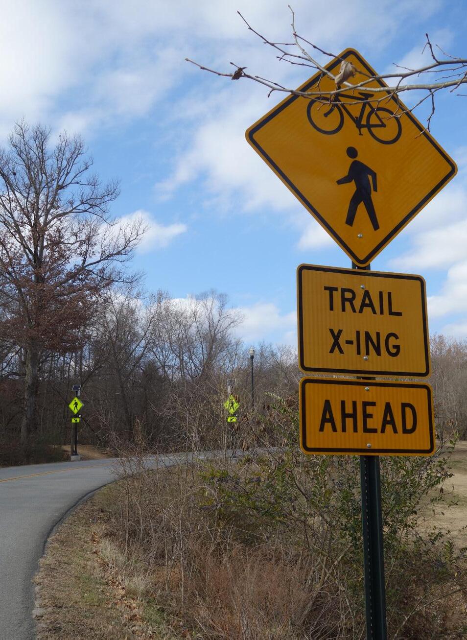
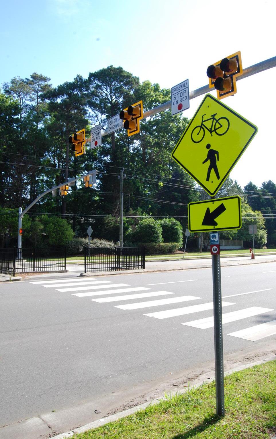
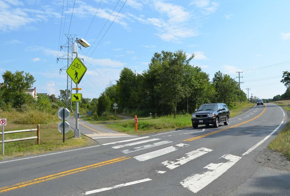
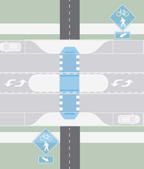
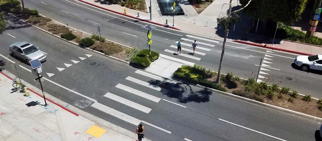
For all trail crossings a high visibility crosswalk is the minimum standard treatment. Additional treatments for both midblock and intersection crossings can generally be broken into three main categories:
Speed is the number one factor that influences fatal and severe injury crashes. Crossing treatments that slow vehicle speeds include adding stop control, signage and pavement markings, and limiting right turn on reds at intersections.
As mentioned in the trail design guidance, the speed at which a bicyclist enters a crossing, and the trail crossing itself, can be unexpected for drivers. This can be addressed through advanced signage and pavement markings, widening the queuing area for people waiting to cross, and alerting trail users as they approach the crossing.
Shortening the crossing distance for trail users makes a crossing more comfortable and limits the amount of time they are “exposed” to moving traffic. These countermeasures often modify geometry of the crossing to reduce crossing distances and add protected space for those waiting to cross. These may include curb extensions, median refuge islands, hardened centerlines, and protected intersections.
The following crossing treatments should be considered for trail crossings. Design guidance for these treatments can be found in the Intersections and Crossings chapter of the Multimodal Infrastructure Guidelines.
» Raised Crosswalks
» Curb extensions
» Median refuge islands
» Protected intersections
» Hardened Centerlines
Four additional crossing treatments, not previously discussed in the Multimodal Infrastructure Guidelines are included on the following pages.
These elements include high visibility crosswalks, advanced STOP and YIELD markings, and warnings signs and are intended to make crossings and trail users within crossings more visible.
USE
» Should be included with all other trail crossing countermeasures.
» Pavement markings should be placed between 20’ and 50’ in advance of an uncontrolled crossing. Placement distance will also depend on roadway speed and other geographic features such as blind turns and hills.
» Where possible, signage should be placed on both sides of the street.
» MUTCD trail crossing sign includes both bicyclist and pedestrian.
» Colored conflict striping indicates to drivers that the crossing is different than a standard crosswalk.
» Too much signage can lead to clutter and lack of overall emphasis.
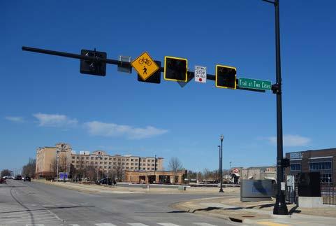
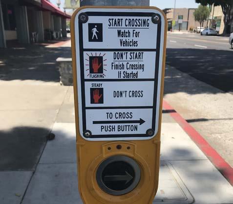
HAWK signals are user-activated via push buttons and use a sequence of flashing and solid lights to indicate when it is safe to cross and when vehicles can proceed.
USE
» Best suited for multi-lane midblock crossings or uncontrolled intersections where vehicle speeds and volumes are high.
» Help reduce delay for trail users waiting to cross.
» Phases for vehicles include a “dark” phase if no one is there to cross, a flashing yellow phase warning that a person has activated the push button, and a solid red phase to stop and allow the trail users to cross.
» Should be paired with high visibility crosswalks and stop bars.
RRFBs combine a standard trail crossing sign with user-activated flashing lights. They increase visibility at crossings and lead to high vehicle yield rates.
USE
» Best for high volume midblock crossings with low to moderate vehicle speeds.
» Should be placed on both sides of the crosswalk.
» RRFBs are also commonly used for school or standard pedestrian crossings.
» Can increase the effectiveness of other crossing treatments such as Advance Yield Markings and YIELD HERE signs.
GUIDANCE AND CONSIDERATIONS
» RRFBs are typically powered by a stand alone solar power unit but can also be wired to a traditional power source.
» Consider a HAWK signal for roadways with multiple lanes or higher speeds.
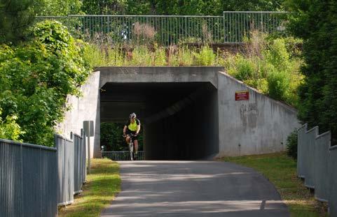
Grade separation offers an uninterrupted trail experience over or under a large barrier. However, it is the most expensive crossing treatment and should be reserved for cases where at-grade crossing options do not meet safety goals.
» Best for crossing highways, major roadways, and natural barriers such as rivers or ravines.
» Choice of bridge versus tunnel is primarily influenced by adjacent topography.
» Bridges offer security advantages as tunnels require significant lighting even during the day. Bridges also present fewer drainage problems.
» Providing accessible trail access may require significant ramping, which is costly and often a deterrent to compliant use.
» Grade separated crossings should incorporate lighting, wayfinding, and other amenities.
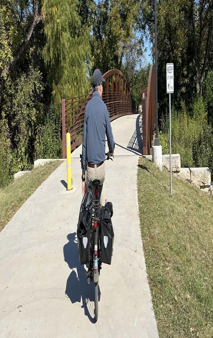
» Well-designed, visually appealing bridges provide an opportunity to draw attention to the trail network and become destinations unto themselves.
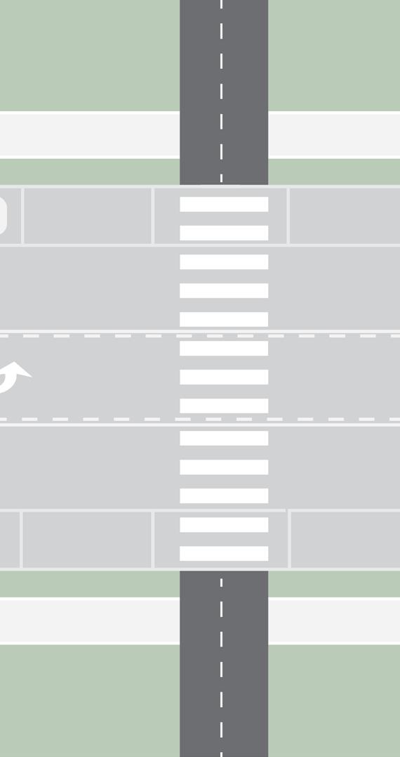
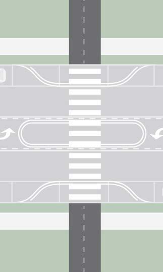
The previous sections outline best practices for designing safe, comfortable trail crossings. However, fully built-out treatments may not be feasible or necessary when a trail is initially constructed. The illustrations below demonstrate how treatments can be added and upgraded over the life of a crossing: (1) An initial phase begins with only a high visibility crosswalk at the crossing. (2) Over time, as funding is available and trail use increases, additional road space is repurposed with paint or flexible materials to designate more space for those crossing. (3) Finally, a completed crossing adds signage, updated crossing paint, and permanent curb extensions and refuge island.
1 2 3
Trail amenities provide a comfortable and fun experience for people traveling throughout the trail system. At some point, regardless of the type of trip, most trail users will desire or depend on a place to sit, drink, use the restroom, or learn about the surrounding area. Trail amenities include:
» Wayfinding includes traditional signs, or the use of colors, artwork, and paint, which are critical to ensuring that people can navigate a trail. Signage at trailheads and decision making locations increases the comfort and access of the entire trail system.
» Restrooms and drinking fountains are desirable amenities along a trial system especially near parks and other community destinations. These are especially important for people with young children, older adults, and those traveling longer distances.
» Bicycle repair stations and parking help ensure that bicyclists reach their destination safely and allow bicyclists to leave and protect their bicycle while walking or enjoying other amenities.
» Seating can enhance the user experience and attract people of all ages and abilities. Even a simple bench provides a place to rest, relax, and enjoy the trail system at one’s own pace.
» Trash receptacles help maintain cleanliness throughout the system and protect natural habitats.
» Public art creates a sense of identity and place along the trail and provides a unique user experience. Art installations can serve as landmarks through the system and can even be incorporated into the aesthetics or utility of other amenities.
Trail amenities should respond to user behavior and be placed in a way that allows for convenient maintenance in the future. Ultimately, amenities should be placed in areas where people already naturally want to pause, rest, play, eat, or plan their route.
1. STANDARD DISTANCE
Evenly space amenities across the trail system at a set distance interval.
» Sets a uniform user expectation for the entire trail system
» Requires numerous caveats where maintenance and environmental factors limit placement
» Example: Seating should be placed every half mile along the system
2. CO-LOCATE & CLUSTER
Group amenities together near destinations or other natural resting areas.
» Creates places along the trail where different types of users can rest, regroup, orient, and recharge
» May lead to long gaps between amenities were trail access is limited
» Example: Seating should be placed at all trailheads, trail intersections, and everywhere restrooms and drinking fountains are present
3. GRADIENT
Gradually space amenities further apart as you travel further from a trail entrance or access point.
» Accommodates needs of different trail users and different trip types
» Especially important for older, younger, and less experienced trail users
» Example: Seating should be placed every quarter mile within the first mile of a trail head and every half mile throughout the system.
The Central Arkansas area contains vast and unique landscapes that require specific trail construction requirements. The alluvial plain of the Mississippi River found in the East Corridor is flat and features more standing water, which would be a proper scenario for choosing concrete for trail construction rather than asphalt. The Ouachita Mountains to the southwest and the Ozark Mountains to the northwest present frequent elevation changes. In this case, the flexibility of asphalt to make switchbacks would be a cost-effective solution compared to concrete. Individual corridors may have different types of trail materials used for construction due to the unique soil types, terrain, and amount of expected water runoff.
The matrix below aids decision-making during engineering and design, addressing varying contexts for seven different environment types and four specific material types.
* May use gravel initially or during interim phases of buildout
DASH YELLOW LINE @ CENTERLINE CROWN
DASH YELLOW LINE @ CENTERLINE CROWN
12-14’ ASPHALT TRAIL OR SIDEPATH
6-7’ LANE
DASH YELLOW LINE @ CENTERLINE CROWN
6-7’ LANE
2% SLOPE
3:1 MAX. SLOPE 3:1 MAX. SLOPE -3:1 MAX. SLOPE -3:1 MAX. SLOPE
4” MIN. COMPACTED CLASS 7 AGGREGATE BASE
2% SLOPE
4” MIN. (4,000 P.S.I) CONCRETE
12-14’ CONCRETE BOARDWALK
WOOD DECKING
WIRE MESH
Boardwalk with Wood Deck
TIMBER RAILING
BEAM/PEDESTAL
12-14’ CONCRETE BOARDWALK
PRECAST TREAD
6x6 WOOD POSTS
2X6 WOOD BRACING
HELICA PIERS
Boardwalk with Concrete Deck (PermaTrak or approved equal if using a proprietary system)
TIMBER RAILING
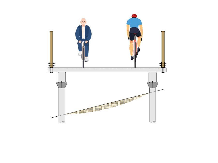
PRECAST BEAM (TYP.)
MICROPILE CAP (TYP.)
MICROPILES TO BE DESIGNED BY FOUNDATION CONTRACTOR (TYP.)
5.0
Sign systems in the United States are guided by best practices, standards, and regulations. Typically, communities must follow regulatory guidance when implementing information systems on streets or in the public right-of-way. Customized signage solutions may be used off-street on sidewalks and trails, however, a solid understanding of local, state and federal guidelines and requirements is important for the integration, legibility and safety of the traveling public. The key national documents that refer to pedestrian and bicycling wayfinding are summarized below. These documents, along with state and local guidance and regulations, should also be consulted when implementing the wayfinding system provided in this section.
The Federal Highway Administration’s MUTCD (2009 edition) holds jurisdiction over all signs on any road or bikeway open to public travel. This includes all shared use paths and separated or conventional bike lanes. The MUTCD covers:
» Sign design for bicycle guide (wayfinding) signs, bicycle routes, and auxiliary plaques, based on a smaller size of the D-series guide signs for motorists.
» Pictographs and appropriate abbreviations for destination names.
» Placement, mounting height requirements, sign size, and layout.
» Priority MUTCD sections for bicycle wayfinding are Chapter 2D and Part 9. These sections should be consulted before undertaking any wayfinding development project.
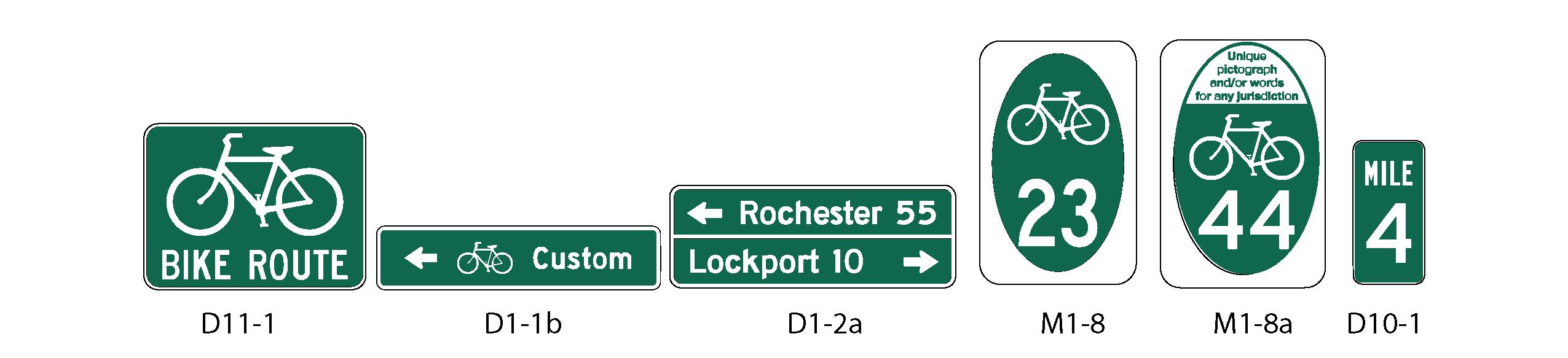
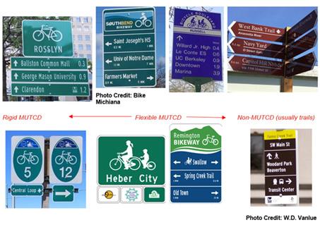
MUTCD Section 2D.50 Community Wayfinding Signs allows for customized wayfinding signs that vary from standard MUTCD D-series signs. Community wayfinding guide signs may employ unique colors, logos, and fonts as part of a coordinated and continuous system of wayfinding signs for an area.
Currently, Community Wayfinding only applies to on-street bicycle routes, but in June 2014 the National Committee on Uniform Traffic Control Devices recommended that shared use paths be incorporated under Community Wayfinding in the next update of the MUTCD. For the purposes of this project, we have interpreted Community Wayfinding as applying to both on-street bicycle routes and shared use paths.
The AASHTO Bike Guide is consistent with and provides supplemental information to the MUTCD. A forthcoming update will contain a full chapter on wayfinding, expanding on the current 2012 guide. The current guide discusses the MUTCD D Series and MUTCD national and state route (M1) signage. The update will expand on the nuances of these signs while covering the MUTCD Community Wayfinding Series. The forthcoming guide will also discuss applications, sign types, and supplemental signs such as mile markers.
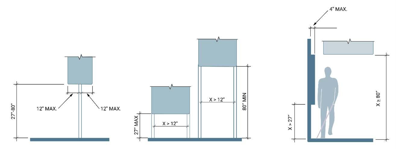
The ADA currently does not guide exterior wayfinding systems. It does provide guidance on protruding objects and clear width on accessible routes, with the guidance aimed toward pedestrians. Guidelines for shared use paths are under development and will address post mounted objects and sign legibility.
A strong wayfinding system must provide people with the tools to determine their route and learn, retrace, or reverse it. Finding one’s way in any environment is essential for daily travel and requires a wide range of cognitive abilities. Most important among these is the ability to make use of spatial cues to navigate one’s surroundings. The more intentional the wayfinding signage is along the Central Arkansas Regional Greenway, the better it will meet the needs of people walking and biking along its routes. The elements of design psychology presented below and described on the following pages are critical in developing a human-scale and effective wayfinding strategy and can be applied to all aspects of sign design and placement.
THE SIMPLER THE INFORMATION IS, THE EASIER IT WILL BE TO UNDERSTAND.
Designing for a diverse audience requires an understanding of the audience’s information needs. Using icons, symbols, and typefaces that are legible at various traveling speeds and organizing information clearly are all part of the toolkit necessary to create a simple design that speaks to the diverse needs of the Central Arkansas region’s pedestrians, bicyclists, and transit users. Whether the users are non-English speaking or have physical, visual, or mental disabilities, we must design with empathy and inclusion in mind to provide clear and legible communication for all users’ ease of access and navigation.
INTEGRATE INFORMATION ACROSS MODES AND MEDIA TO REFLECT THE REAL JOURNEYS PEOPLE MAKE.
Users must have easy access to the right information as they plan their trip and throughout their journey. Whether the information is on a computer or mobile device or in the built environment, access to accurate, easy to locate information is paramount to creating a comfortable journey. When information is integrated seamlessly across multiple modes, it facilitates travel for users who are unfamiliar with the environment and helps ensure they will return and share their positive experiences with others.
DISPLAY THE RIGHT AMOUNT OF INFORMATION AT ALL STAGES OF A JOURNEY.
Communication to bicyclists and pedestrians in the built environment requires providing the right amount of information at just the right time. Displaying too much information will cause the audience to ignore it; on the other hand, too little information will frustrate the audience. Careful study of locations, destinations, amenities, and user types in the Central Arkansas region allows the development of a wayfinding system that meets the needs of the users without over-signing or placing information where it may not be effective.
EFFECTIVE WAYFINDING SYSTEMS OFFER DIFFERENT LEVELS OF INFORMATION IN SUCCESSIVE STAGES.
In order to reduce sign clutter and support users ability to maintain motion as much as possible, effective wayfinding systems disclose the most relevant information progressively. For example, a local destination such as a library or school only appears on signs close to the destination, not miles away. Progressive disclosure of information reduces clutter, confusion, and cognitive workload by presenting the minimum information needed for the task at hand. In wayfinding systems, this often means dividing up large numbers of potential destinations into distinct zones by region, district, or neighborhood. When users arrive in a particular “zone,” they are introduced to the destinations within that zone.
INFORMATION CONSISTENCY, INTEGRITY, AND AVAILABILITY ARE CRUCIAL TO ACHIEVING PREDICTABILITY.
People navigating an unfamiliar environment require a “bread-crumb” trail to easily find their way. It’s important to provide information that is accurate, predictable, and consistent to establish trust with the users of the Central Arkansas region’s pedestrian, bicycle, and transit networks. The use of modular sign systems allows for updates to be easily made to accommodate changes and maintain accuracy of information.
ESTABLISH TRUST WITH THE USER BY PLACING THE RIGHT SIGNS IN THE RIGHT PLACE WITH CONSISTENCY TO ESTABLISH COMFORT AND LEGIBILITY.
Having information where it is needed while avoiding clutter is key to creating legible places. Some places naturally convey orientation based on the physical environment, while others require more explanation. Providing consistent sign design at welcome and decision points for pedestrians, bicyclists, and transit users in the Central Arkansas region orients users and provides information about direction and interpretation. Meeting the expectations of users at each arrival and decision point provides a level of comfort and rhythm that users grow to trust.
A RATIONALE FOR THE PLACEMENT OF DIFFERENT SIGN TYPES OPTIMIZES THE WAYFINDING SYSTEM WITHOUT ADDING CLUTTER.
Careful placement of signs in just the right location ensures an economically efficient approach to implementation and establishes a pattern that gives users confidence to explore. Signs should be located based upon the needs of specific user types rather than a one-size-fits-all approach. For example, a kiosk is appropriate at a junction where many people will congregate, but a smaller sign or ground application is a better approach at a location that will have fewer users.
UNDERSTAND PEOPLE’S STATE OF MIND AND PROVIDE INFORMATION FOR THE RIGHT TYPE OF USER.
An empathetic approach to design balances the needs of the audience with the needs of the facility in order to create seamless and quality experiences. This process brings a creative, humancentered method to design. The diagram shown on the following page illustrates four typical mindsets with which users might approach the Central Arkansas Regional Greenway: Focused, Expectant, Curious, or Hurried. Each user’s needs for the wayfinding information will vary and could be met through the right tools. Understanding the audience makes it possible to provide the right information for a diverse group of interests.
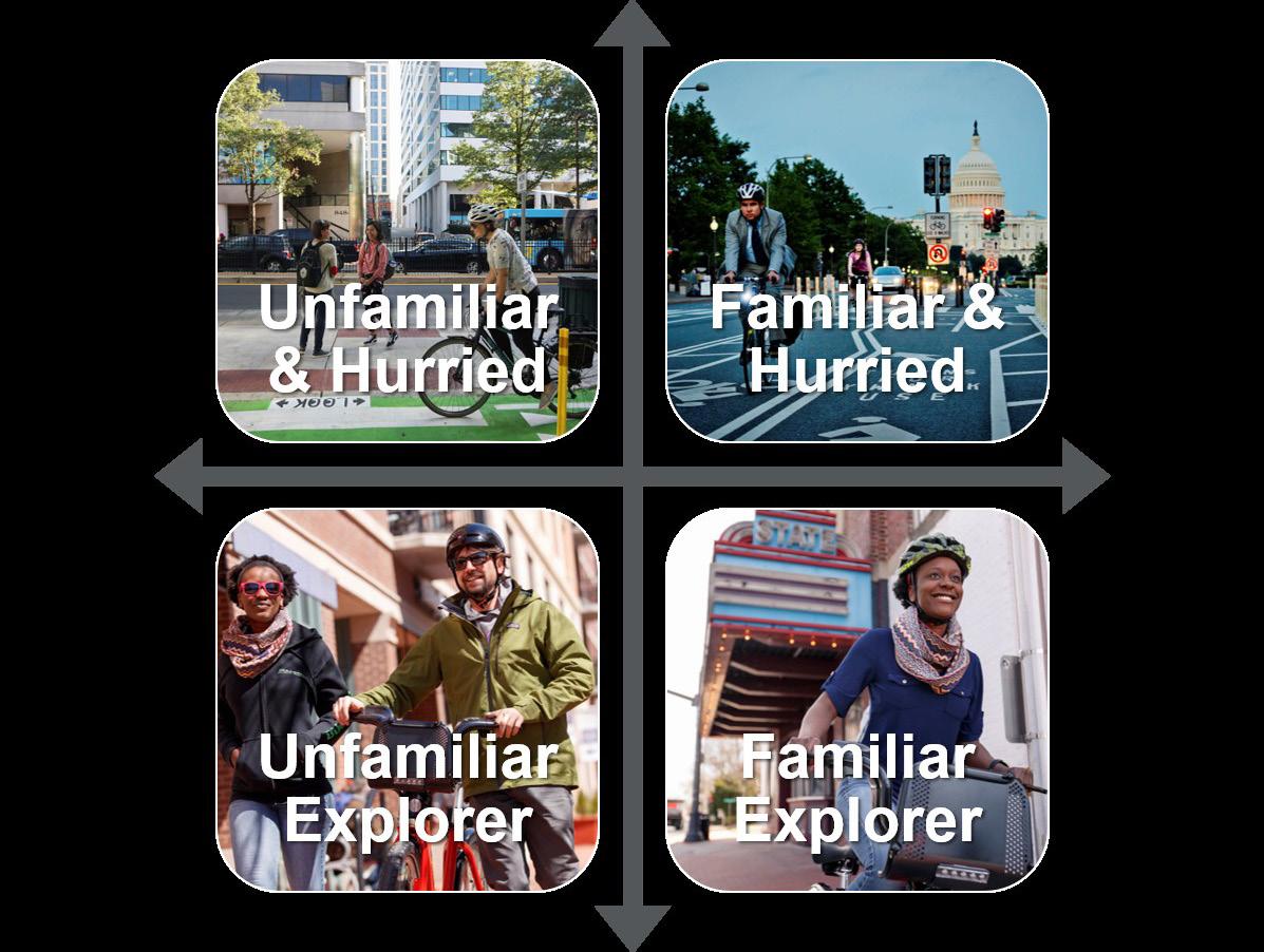
HELP PEOPLE DEVELOP A VISUAL UNDERSTANDING OF THEIR PLACE IN THE ENVIRONMENT.
Map-based information supports verbal directions and gives people an opportunity to learn about the region and individual communities in a visual way. Highlighting landmarks, districts, and destinations help people match the representation of the environment with the physical environment itself.
PEOPLE NATURALLY ORIENT THEMSELVES BASED UPON VISIBLE LANDMARKS IN THE ENVIRONMENT.
Using landmarks as part of a map-based wayfinding system makes it difficult to get lost. When landmark destinations such as statues, monuments, plazas, and architecture are provided on maps, it aids in navigation by connecting the physical surroundings to the sign or map. When a landmark is provided as part of wayfinding, it allows the user to connect the orientation provided on a sign to the visual reality of the environment. Then the user no longer has to refer back to a sign or map, but may use the landmark to navigate.
There are four sign types recommended for the Central Arkansas Regional Greenway: Turn, Decision, Confirmation, and Awareness. Each sign has a different function to aid people as they navigate a route by foot or on wheels. The following sections provide details about these functions and each sign’s specifications and considerations when developing content and determining sign placement.
DECISION SIGNS
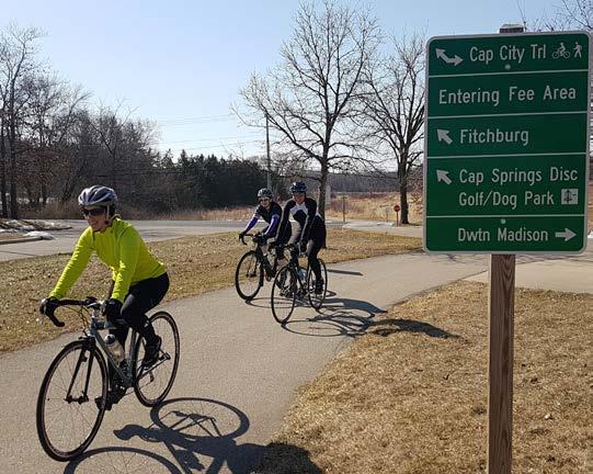
CONFIRMATION SIGNS
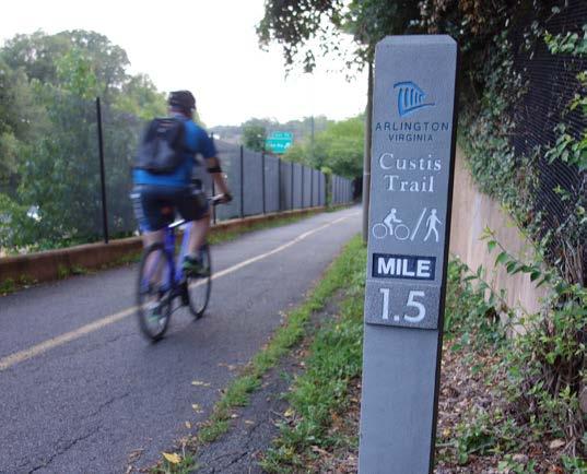
TURN SIGNS
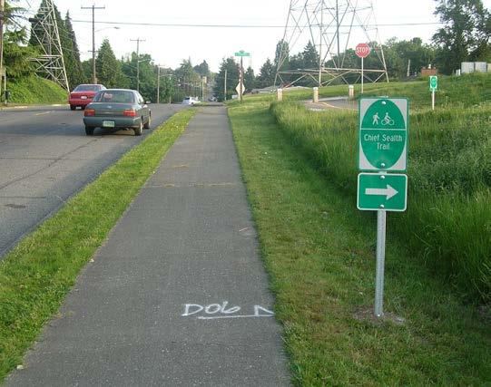
AWARENESS SIGNS
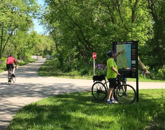
Decision signs mark the junction of multiple routes. They orient users within the local context and provide directions to one or more key destinations. These signs should be added before key decision points so there is time to make the decision of where to go next and can include turn sign elements such as accessible route directions.
» Mark the junction of two or more routes.
» Inform users of designated routes to access key destinations.
» Provide direction and distance to destinations.
» Maximum of three to four destinations. Finger signs may have three to four destinations in any one direction.
» May include travel times or distance to destinations.
» May include information about turning routes and intersecting routes.
LOCATIONS
» Place at key junctions alongside a designated route to indicate intersecting routes and nearby destinations.
» For on-street applications, place 50’-100’ prior to a decision point; for off-street: 25’-50’. These are adequate distances for pedestrians and bicyclists to see and respond to sign messaging. Exact distances will vary depending on context.
» Left turns for bicyclists require special consideration. The decision sign should be placed at a distance before the intersection based on the number of lanes the bicyclist needs to merge across to make a legal left turn:
» Zero lane merge: 50’
» One lane merge: 100’
» Two lane merge: 200’
Turn signs help people stay on their desired route. These signs should be added before key turns along a route so there is time for people to make their turn safely and smoothly. Turn signs are also important in highlighting accessible routes that are direct, well-communicated, and minimally sloped for people who use wheelchairs, push strollers, or have a difficult time using stairs and steep paths.
FUNCTION
» Clear direction for bicyclists and pedestrians to turn when a route transitions from one roadway or trail to another.
» Highlight accessible routes that are direct, well-communicated, and minimally sloped for people who use wheelchairs or need to avoid stairs and steep paths.
CONTENT
» May be a combination of a confirmation sign (MUTCD D11-1) and directional arrow (MUTCD M6-1) or a stand-alone decision plaque (MUTCD D1-1, D1-1b).
» May include travel distance to destination (MUTCD D1-1a, D1-1c).
LOCATIONS
» At intersections and at detours.
» Along accessible routes.
» Before key turning points, so that there is time to make the decision of where to go next.
» Note: In locations where there are two or more intersecting trails or bike routes, a decision sign should be used.
PLACEMENT
» In on-street applications, 50’-100’ in advance of the turn.
» In off-street applications, 25’-50’ in advance of the turn.
» Left turns for bicyclists require special consideration. The turn sign should be placed at a distance before the intersection based on the number of lanes the bicyclist needs to merge across to make a legal left turn:
» Zero lane merge: 50’
» One lane merge: 100’
» Two lane merge: 200’
» For accessible routes, place signs so they are consistently visible before and after each turn. Paths must be at least 36” wide, with turning areas at least 48” and passing areas at least 60”.
Confirmation signs are signs or markings that are not used to direct people but act to verify that the user is on the right path. To create a positive, stress-free experience, these signs provide comfort in the fact that the person is going in the right direction. Conveying the right mood is a key part of what signage can achieve when implemented correctly. Confirmation signs are often placed after key decision points to confirm a route.
FUNCTION
» Spaced periodically along a trail or bike route network to maintain a consistent level of confidence that users are still traveling along the same route.
» Do not indicate a change in direction.
CONTENT
» May include distance traveled (e.g., mile marker), name of the route, or one directional destination.
» May have informational or branding content such as the name of the route.
LOCATIONS
» After decision signs, turn signs, and decision points.
» At an intersection, along a route, at a detour.
» Placed after access points along a trail or bike route network.
PLACEMENT
» Locations where a designated route is not linear and after complex intersections (e.g., intersections with more than four approaches, roundabouts, or indirect routing).
» In off-street applications, approximately every ¼ to ½ mile unless another type of wayfinding sign or pavement marking is present within the interval.
» In on-street applications, within 50’-100’ immediately following turns to confirm designated route.
» If the signed route is approaching a turn, turn signs or decision signs should be used instead of confirmation signs.
Awareness signs provide information about nearby routes and destinations and encourage new users to walk or ride to explore destinations using the wayfinding system. These signs can include a map for people to orient themselves with key routes, landmarks, trailheads, and amenities such as bathrooms and water fountains.
FUNCTION
» Build awareness of the low-stress priority network.
» Inform users of designated routes to access key destinations.
» Provide direction and distance to destinations.
CONTENT
» May include travel times to destinations.
» May include a network map with landmark building footprints, amenities, restroom, food, accessible routes, and street crossings.
» Include information about accessible routes.
LOCATIONS
» Trailheads.
» Transit stops located near other destinations and/or trailheads.
» Near key destinations in the region.
» At key junctions along a designated route to indicate nearby destinations.
PLACEMENT
» For on-street and off-street applications, place awareness signs 3’ (minimum of 2’) off the path.
» Position wide kiosks perpendicular or parallel to the route. Place along wide paths or in plazas that provide space for people to gather without blocking the path.
» Position narrow kiosks perpendicular to the route.
Razorback Regional Greenway
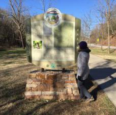
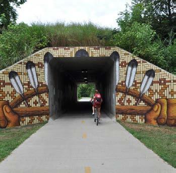
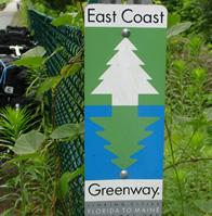
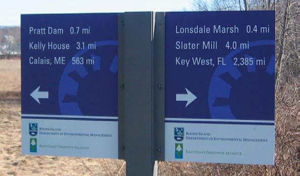
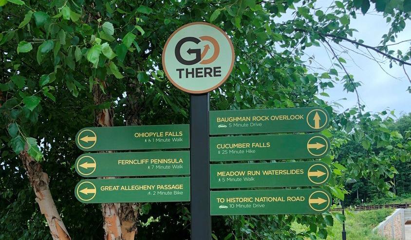
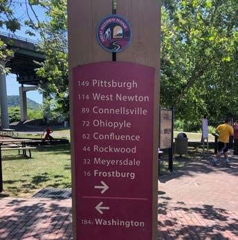
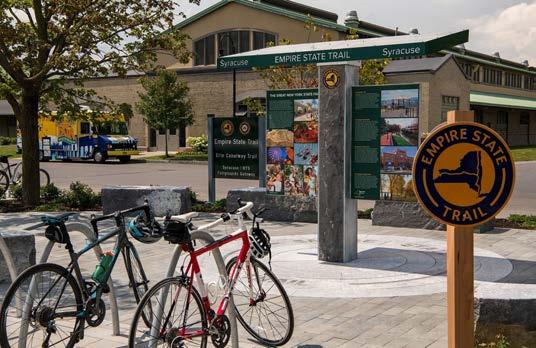
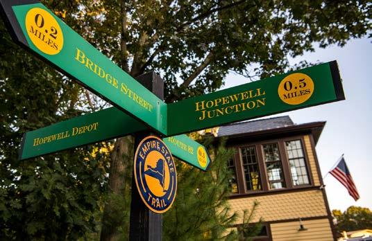
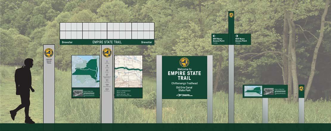
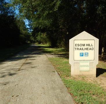
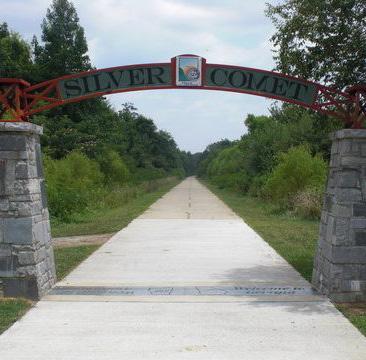
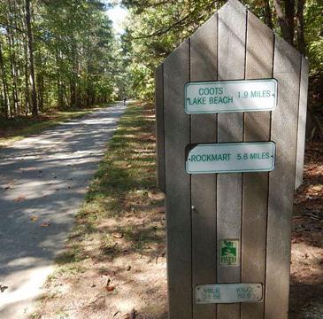
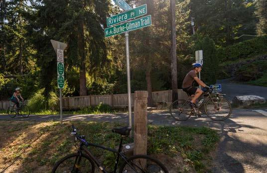
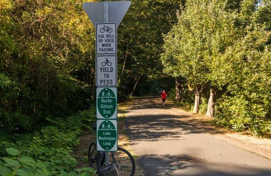
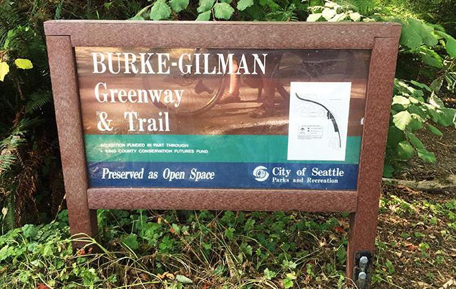
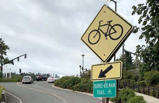
A consistent, eye-catching symbol is important to ensure wayfinding is effective across the regional trail network. The example symbols and colors shown below are used on the following pages demonstrate continuity across existing and new trails and trail signage throughout the Central Arkansas Regional Greenway Network.
EXAMPLE TRAIL SYMBOL EXAMPLE DESIGN FEATURE

LOGO & DIRECTIONAL ARROWS
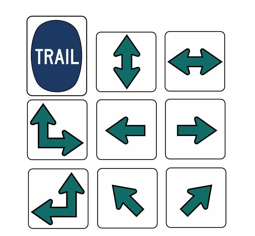
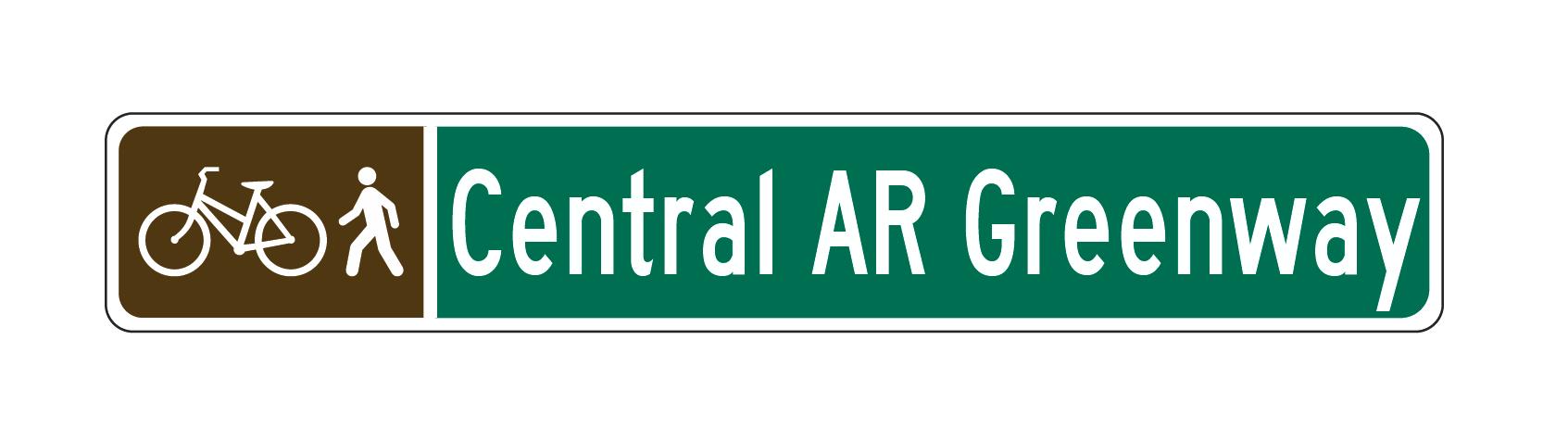
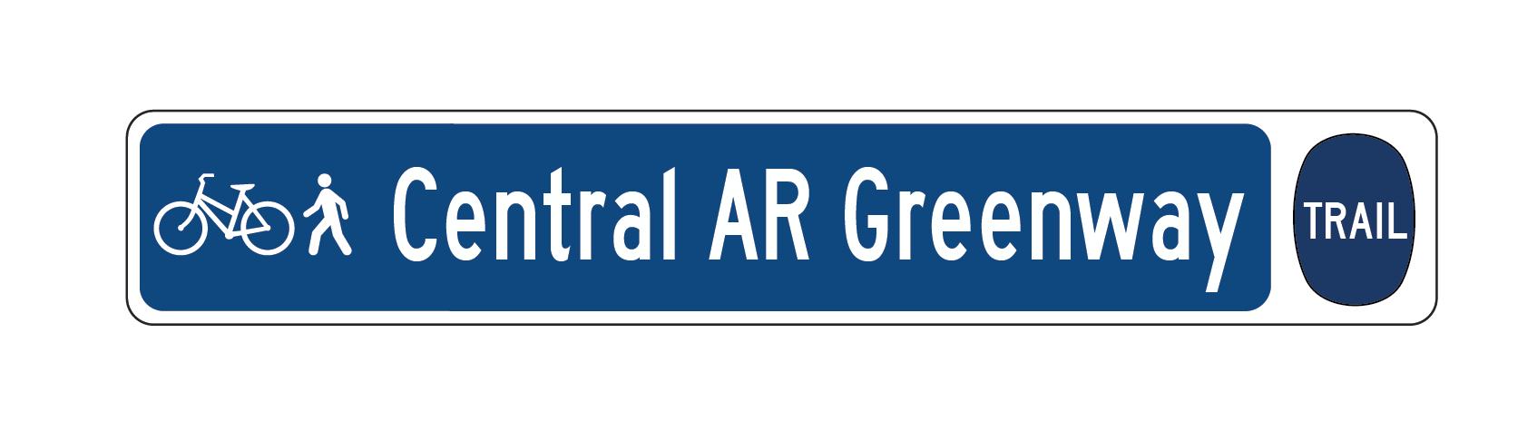
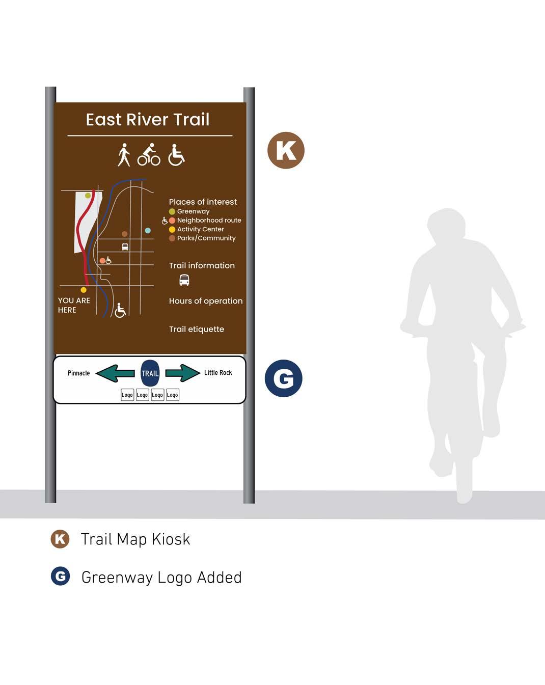
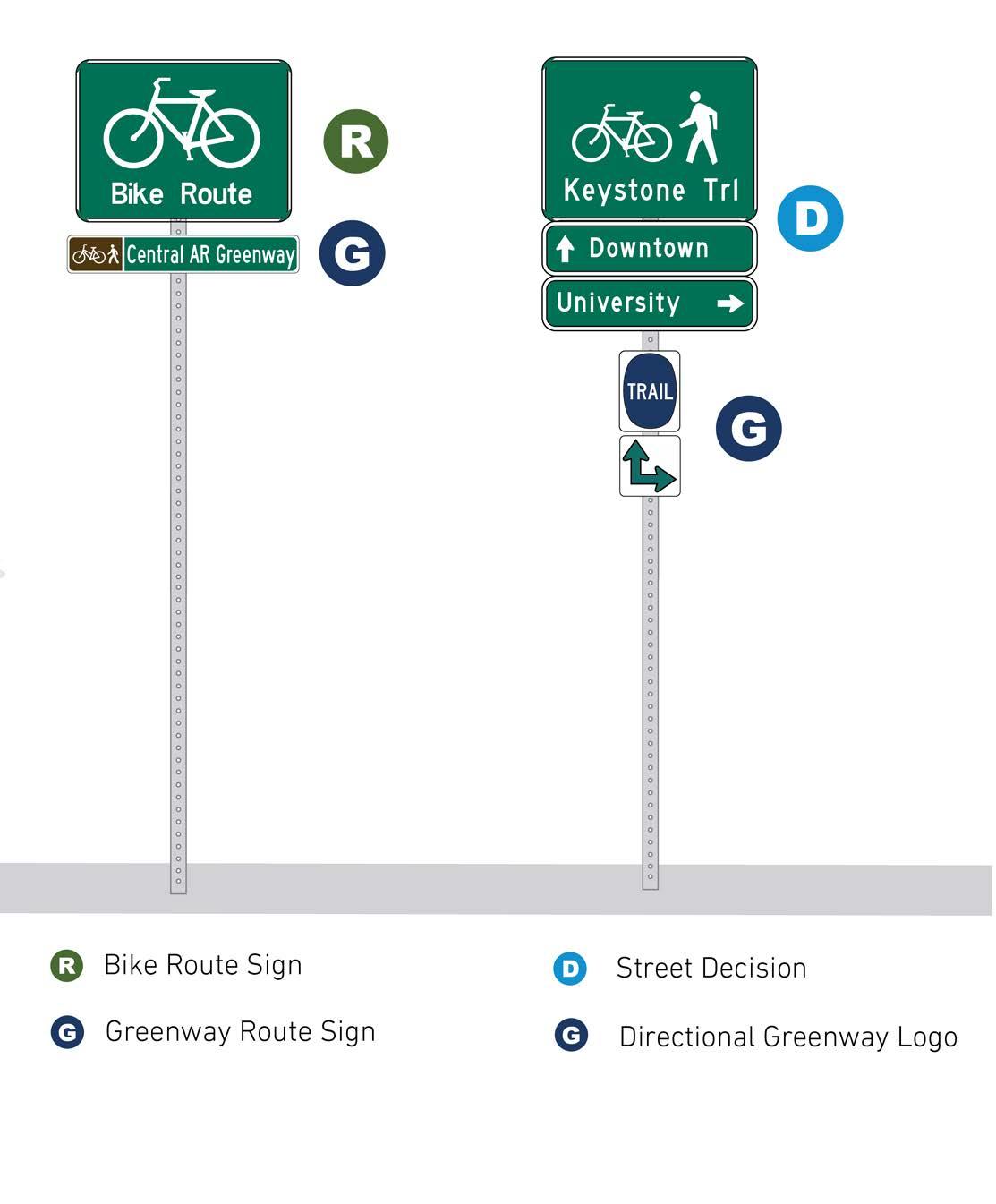
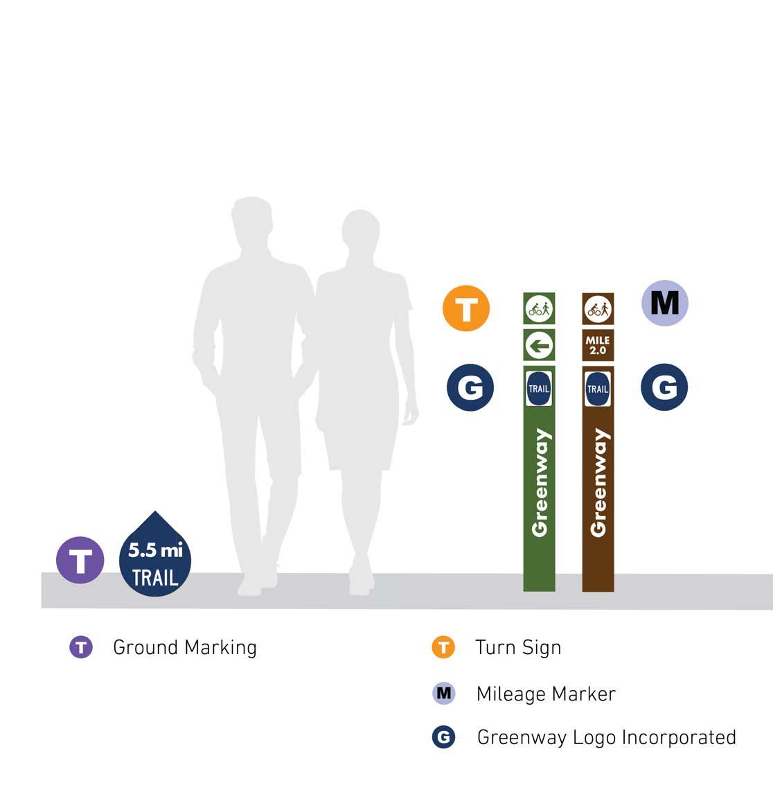
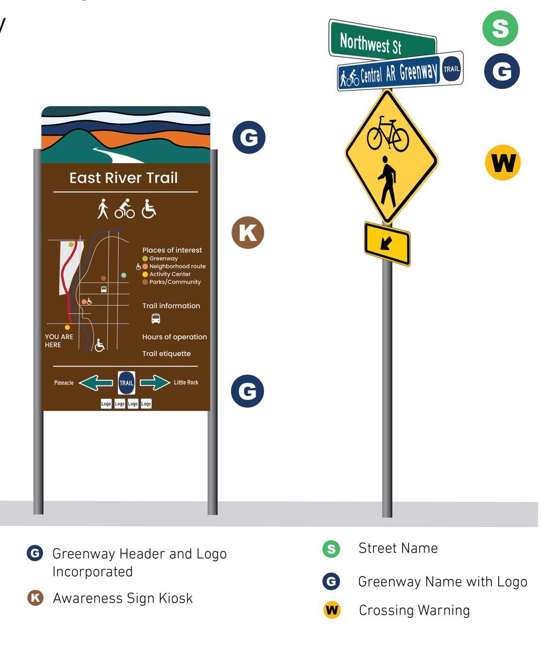
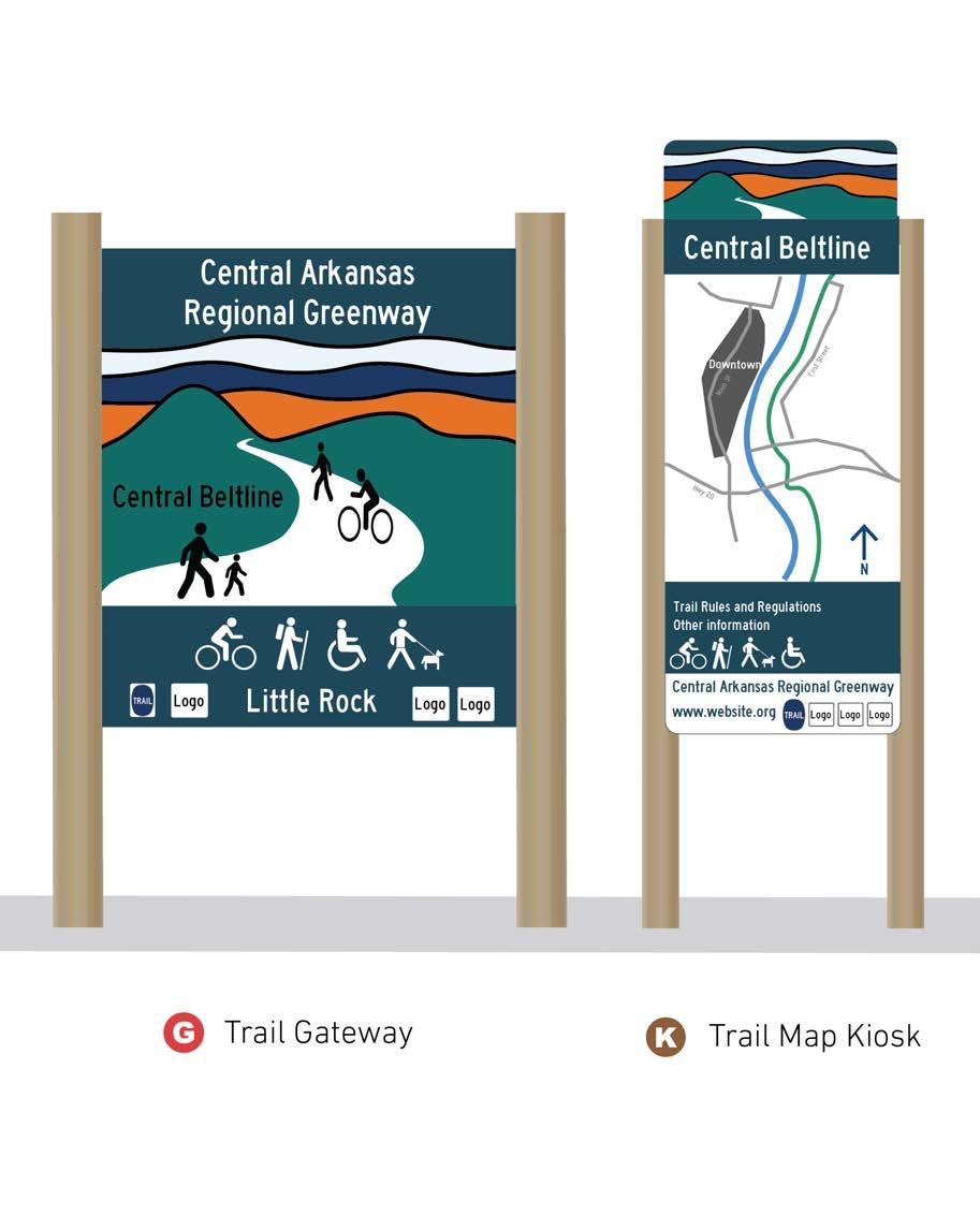
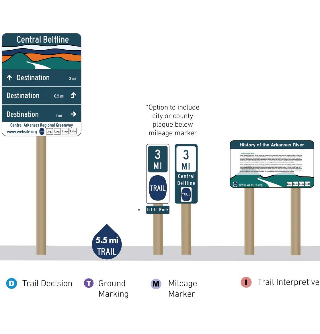
This page intentionally left blank
Constructing all regional greenway corridors at once is not feasible and strategic phases and regional partnerships will be important to the system’s success. There is a need to assign the network corridors into manageable projects that can be packaged for ease of implementation. These packages were selected by breaking the Regional Routes into packages that are of a feasible length and cost for implementation. The packages have logical termini such as major roadways, city or county limits, town centers, and key destinations.
The goal is to create packages that range from three- to six-miles in length a to align FHWA’s definition of a short trip for bicycle transportation. A few exceptions are longer than six miles to logically terminate at a destination or where creating an arbitrary split would not serve a purpose. The packages include both existing and proposed trail segments as some areas of existing trail may require improvement when it’s time to construct. Depending on jurisdictions, partnerships, topography, and several other factors, each project package may be implemented all at once or split into smaller portions.
Each of the five corridors vary in length and topography which results in variations in the number of packages. The breakdown of the number of packages by corridor are as follows:
» Arkansas River Trail Corridor: 3 packages
» Central Beltway Corridor: 5 packages
» Northwest Corridor: 6 packages
» Northeast Corridor: 8 packages. Package #2 (Kierre Drive to the Powerline Trail) has been omitted until a final alignment is determined.
» Southwest Corridor: 6 packages
» East Corridor: 1 package (the segments consisting of bicycle lanes and signed routes are not packaged)
For purposes of this section ONLY, the following designations apply :
» “On-Road” facilities indicate separated infrastructure, such as sidepaths, that occur within a road right of way.
» “Off-Road facilities indicate infrastructure located outside of a road right of way.
A map and description of each of the trail corridor’s packages follows each trail corridor map.
This page intentionally left blank
The Arkansas River Trail Corridor, fifteen miles in length, is mostly existing with small missing gaps totaling one mile in length.
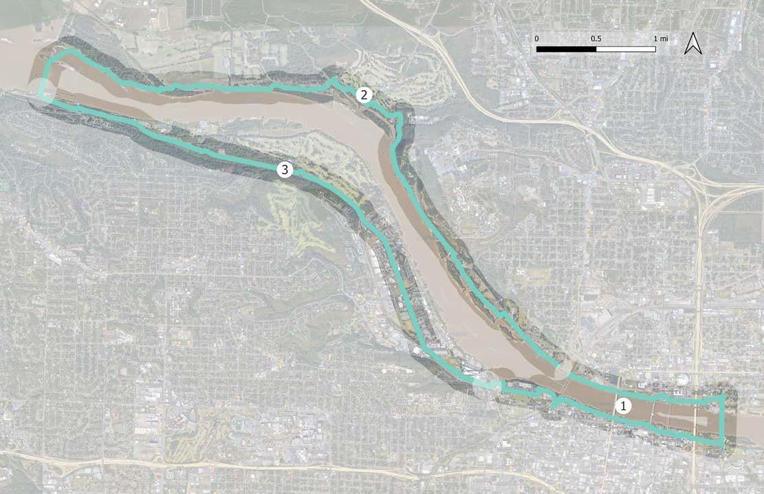
This 4.2-mile long package will fill the gap in the existing trail between Gill Street and the Arkansas Arts Council. This includes the bridge over the Baring Cross Railroad and would improve the existing sidewalk along that proposed segment. This trail segment crosses between Little Rock to North Little Rock through the Clinton Library park and across the Clinton Presidential Park Bridge. This package connects to all five regional greenways, making the infill of gaps even more important to the functioning of the overall network.
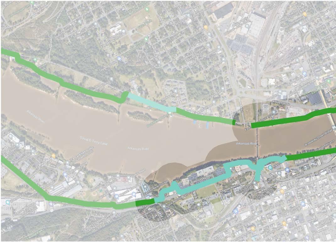
» The Central Beltway Corridor, as well as the downtown connection to the Southwest Trail, will begin near the conversion of Cantrell Road into La Harpe Boulevard, and its bridge passing over the Union Pacific rail line.
» The Northeast Corridor will connect to the Arkansas River Trail along Pike Avenue and travel north.
» The East Corridor extends from the River Trail at its most northeast corner near Dorothy Rodham way.
» The Southeast Trail starts at the southeastern-most corner of the River Trail near the Clinton Library.
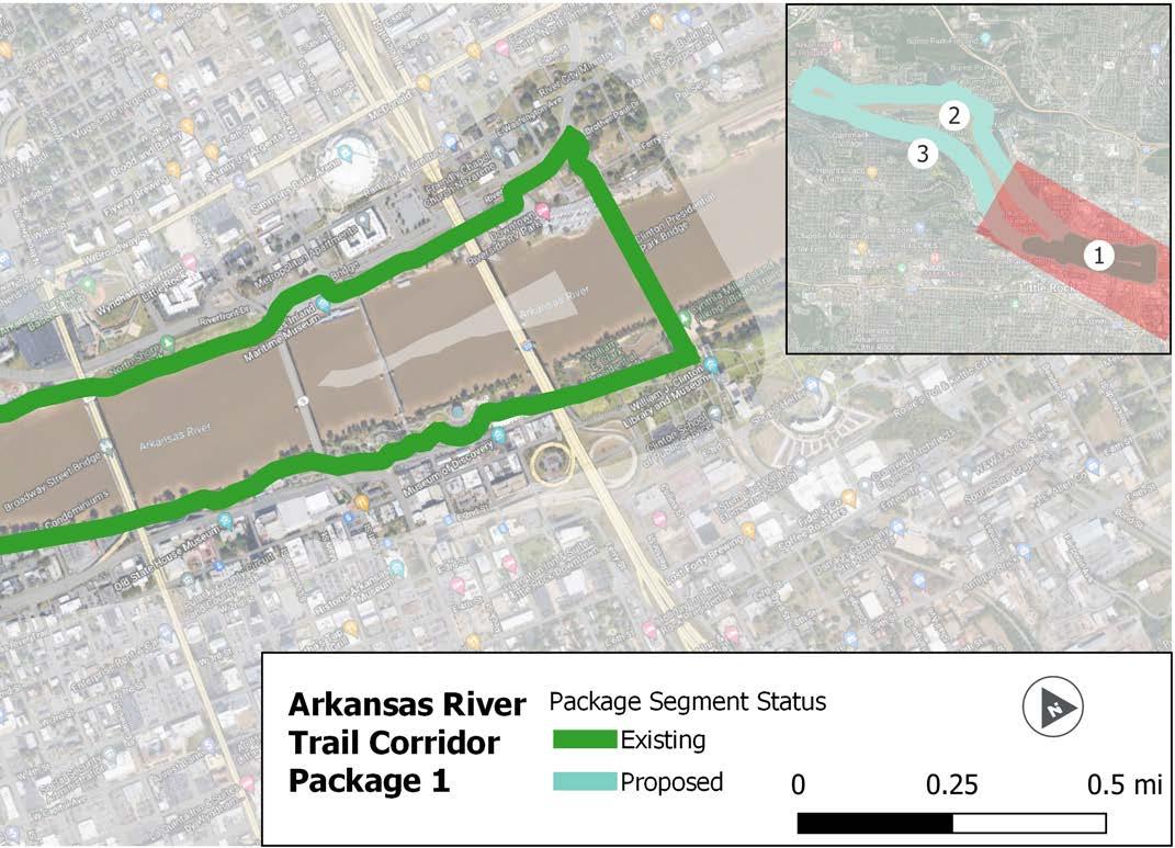
For purposes of this section ONLY, the following designations apply
» “On-Road” facilities indicate separated infrastructure, such as sidepaths, that occur within a road right of way.
» “Off-Road” facilities indicate infrastructure located outside of a road right of way.
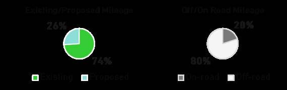
Package 2 of the Arkansas River Trail is 6.3 miles long, with a short segment of the trail (shown as “proposed” on page 129) that was completed in 2022. This package connects Riverview Park, Big Rock Quarry, Burns Park, and Campbell Lake Park, and also features the Big Dam Bridge on its western end. While this package may not contain segments for trail construction, upgrades and investments in preventative maintenance are likely.
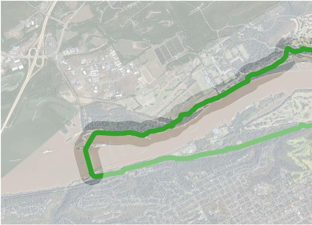
NORTHSHORE BUSINESS PARK
BURNS PARK SOCCER FIELDS
REBSAMEN PARK
BURNS PARK GOLF COURSE
PULASKI TECHNICAL COLLEGE
BIG ROCK QUARRY
REBSAMEN GOLF COURSE
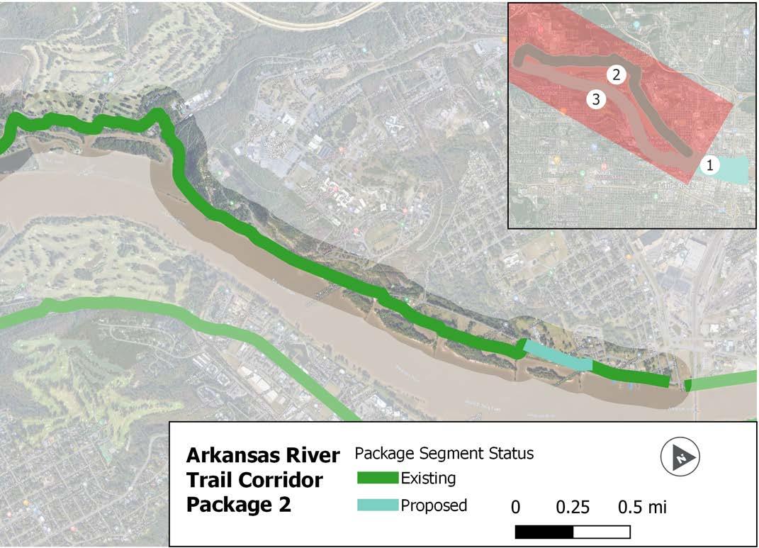
For purposes of this section ONLY, the following designations apply :
» “On-Road” facilities indicate separated infrastructure, such as sidepaths, that occur within a road right of way.
» “Off-Road” facilities indicate infrastructure located outside of a road right of way.
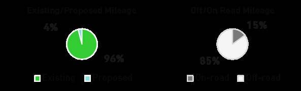
Package 3 is 4.9 miles long and consists entirely of an existing trail. Improvements would likely only involve upgrading the existing on road facility on Riverfront Drive east of Rebsamen from bike lanes to a separated facility type. It passes through Murray Park, Rebsamen Park, and connects to the Junior Deputy Baseball Park.
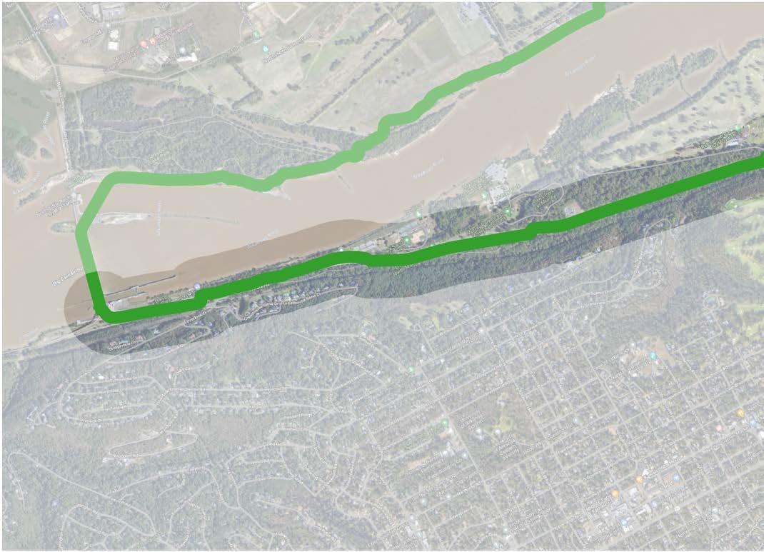
BIG ROCK QUARRY
REBSAMEN GOLF COURSE
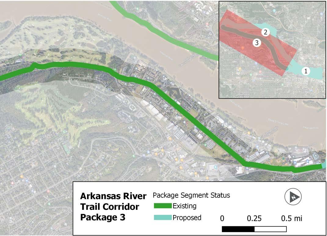
MATCHLINE A MATCHLINE B
For purposes of this section ONLY, the following designations apply :
» “On-Road” facilities indicate separated infrastructure, such as sidepaths, that occur within a road right of way.
» “Off-Road” facilities indicate infrastructure located outside of a road right of way.

This page intentionally left blank
This corridor, when combined with the Arkansas River Trail, creates an almost complete loop or beltway, the remaining gap (shown with a dashed line below) is classified for further study in the future. The 25-mile corridor contains 10 miles of existing trail spread across several of the project packages. The corridor connects to several parks, trails, and the Little Rock Zoo.
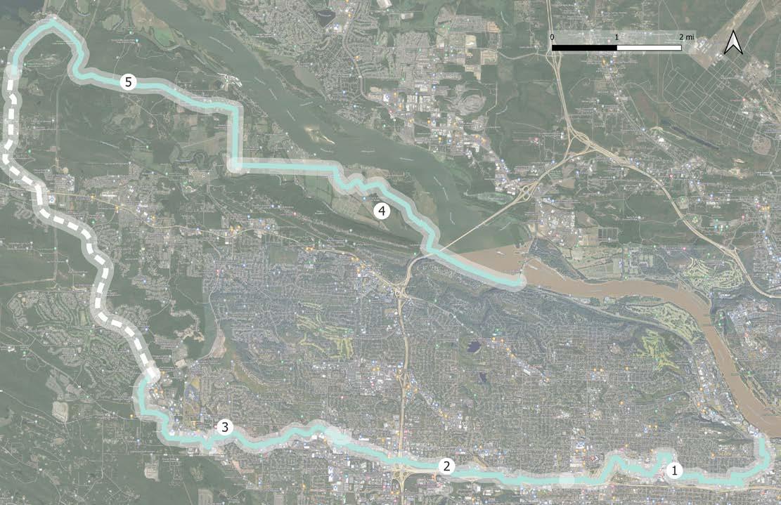
This 5-mile package connects the Arkansas River Trail to multiple key destinations: Rose Creek Park, Woodruff Community Garden/Lamar Porter Field, the University of Arkansas for Medical Sciences, Little Rock Zoo, War Memorial Park, and the future connection to the Southwest Trail near 7th Street. This package includes a future pedestrian overpass of University Avenue, noted on the map below.
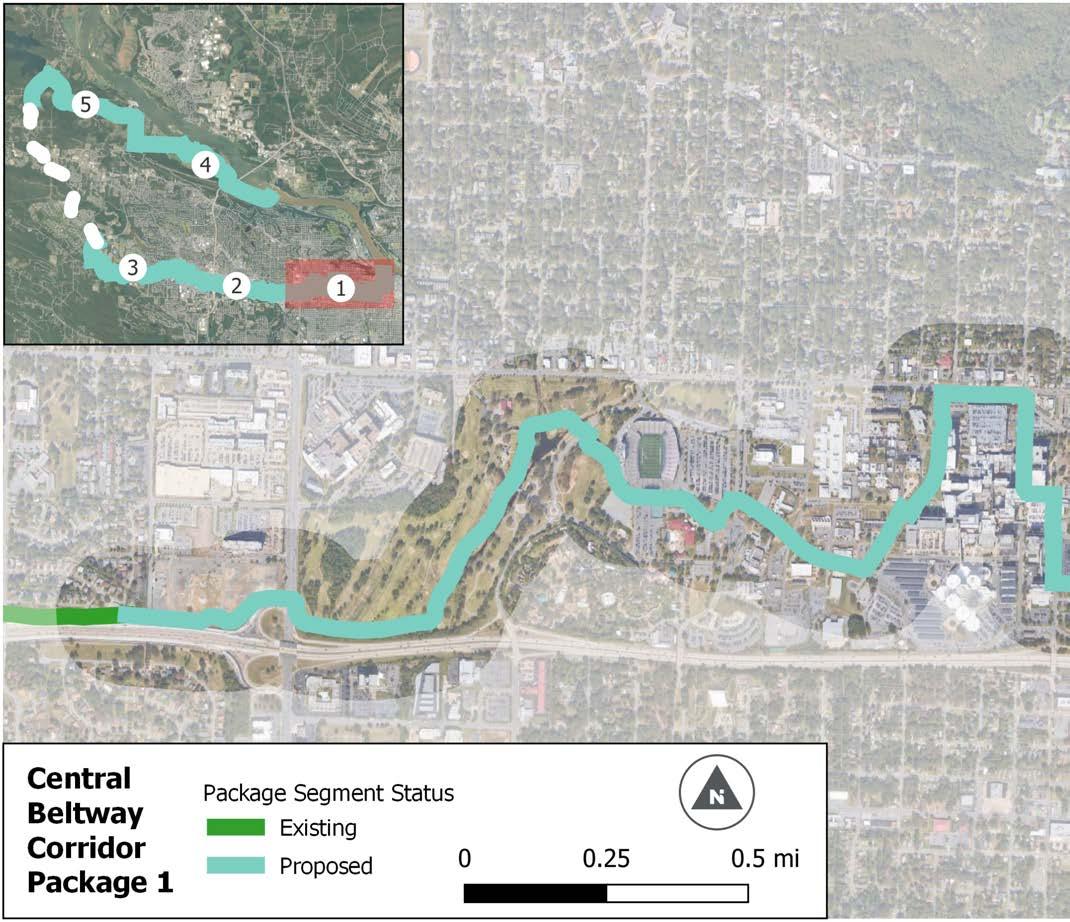
MATCHLINE
For purposes of this section ONLY, the following designations apply
» “On-Road” facilities indicate separated infrastructure, such as sidepaths, that occur within a road right of way.
» “Off-Road” facilities indicate infrastructure located outside of a road right of way.
This 4.4-mile package runs along Interstate 630 for most of its length including a segment where it connects to kanis Park to the south of the interstate. It offers a connection for an array of residential neighborhoods to War Memorial Park and Rock Creek Trail. This package includes proposed underpasses of I-430, Shackleford, and Bowman utilizing one of the existing box culverts under each road to provide a continuous connection from east to west.
Proposed Culvert Underpass
MATCHLINE A MATCHLINE B
For purposes of this section ONLY, the following designations apply :
» “On-Road” facilities indicate separated infrastructure, such as sidepaths, that occur within a road right of way.
» “Off-Road” facilities indicate infrastructure located outside of a road right of way.

This package, 4.6 miles in length, utilizes the Rock Creek Trail and the easement around Rock Creek to connect several shopping centers and with several major residential developments. For most of its length, the trail is parallel to Chenal Parkway before following Rahling Road to terminate at the Promenade at
its intersection with Chenal Parkway. This package utilizes existing bridges to cross beneath Markham, Chenal, Pride Valley, and Kanis. This package also utilizes a grade separated box culvert under Kirk Road previously designed for trail use.
Proposed Bridge Underpass
For purposes of this section ONLY, the following designations apply :
» “On-Road” facilities indicate separated infrastructure, such as sidepaths, that occur within a road right of way.
» “Off-Road” facilities indicate infrastructure located outside of a road right of way.
This 5.5-mile package uses existing trails for most of its length (Arkansas River Trail and Two Rivers Park) before proposing a bike lane along Two Rivers Park Road from the park’s trail terminus and the existing bike lanes on County Farm Road.
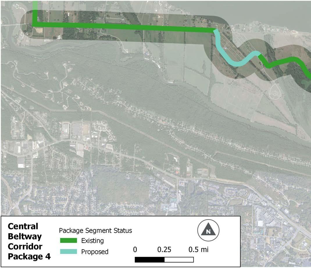
MATCHLINE A MATCHLINE B
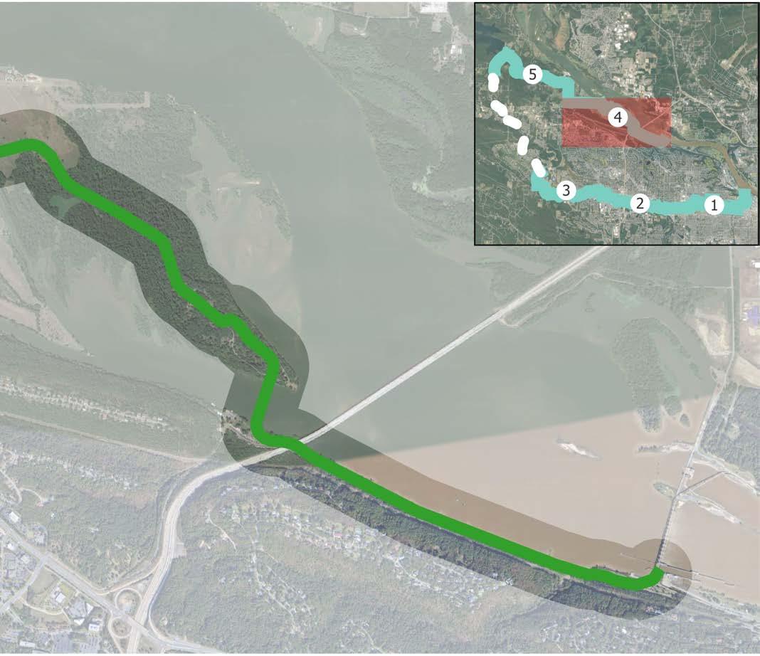
For purposes of this section ONLY, the following designations apply :
» “On-Road” facilities indicate separated infrastructure, such as sidepaths, that occur within a road right of way.
» “Off-Road” facilities indicate infrastructure located outside of a road right of way.
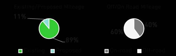
This 5.5-mile package utilizes existing bike lanes along Pinnacle Valley Road for the first third of its length and transitions to a proposed sidepath and trail once the road reaches Pinnacle Mountain State Park. The final segment is a trail that runs parallel to Highway 300 to the main entrance of the state park.
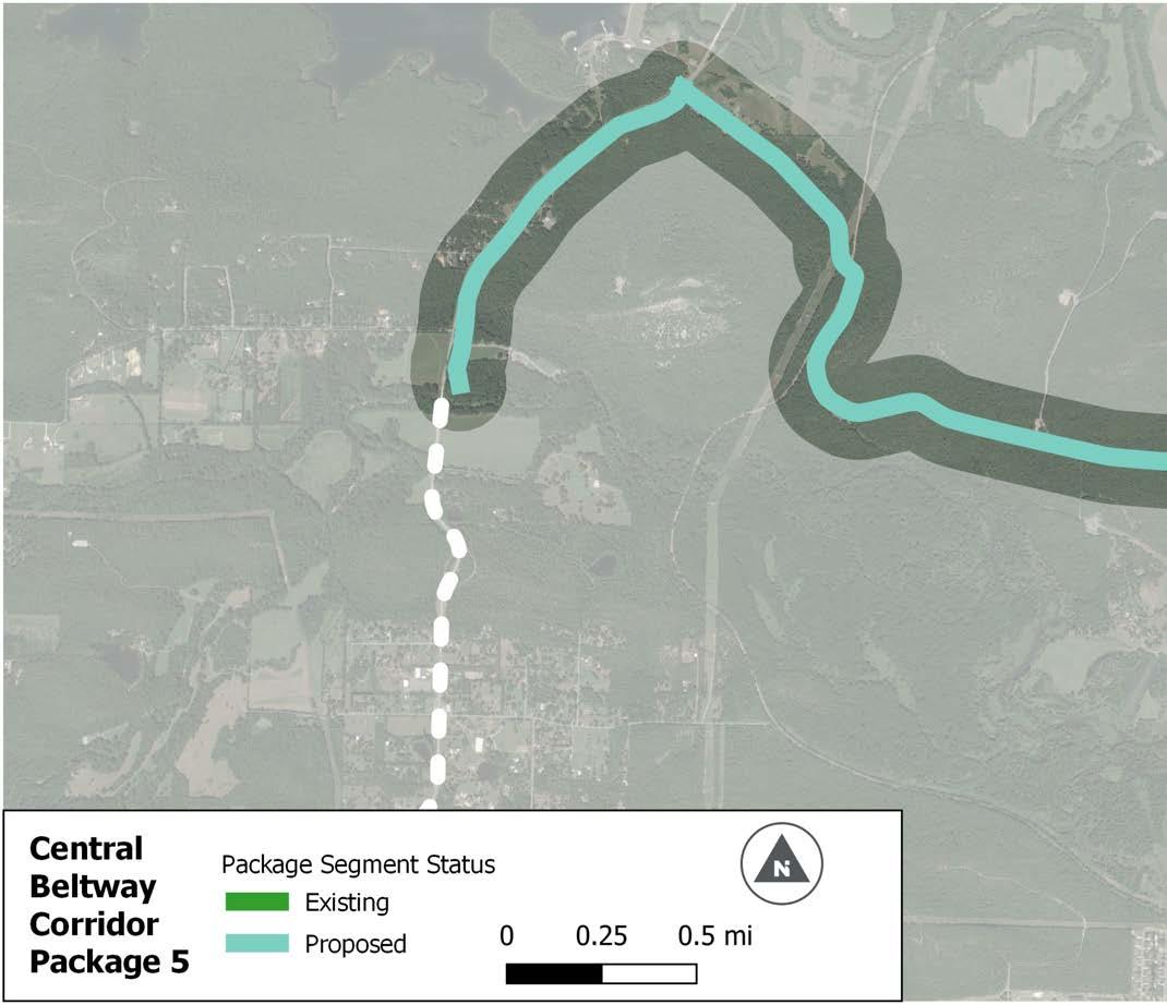
PINNACLE MOUNTAIN EAST SUMMIT TRAILHEAD
MOUNTAIN
PINNACLE MOUNTAIN WEST SUMMIT TRAILHEAD
PINNACLE MOUNTAIN STATE PARK ARBORETUM
PINNACLE MOUNTAIN STATE PARK VISITOR CENTER
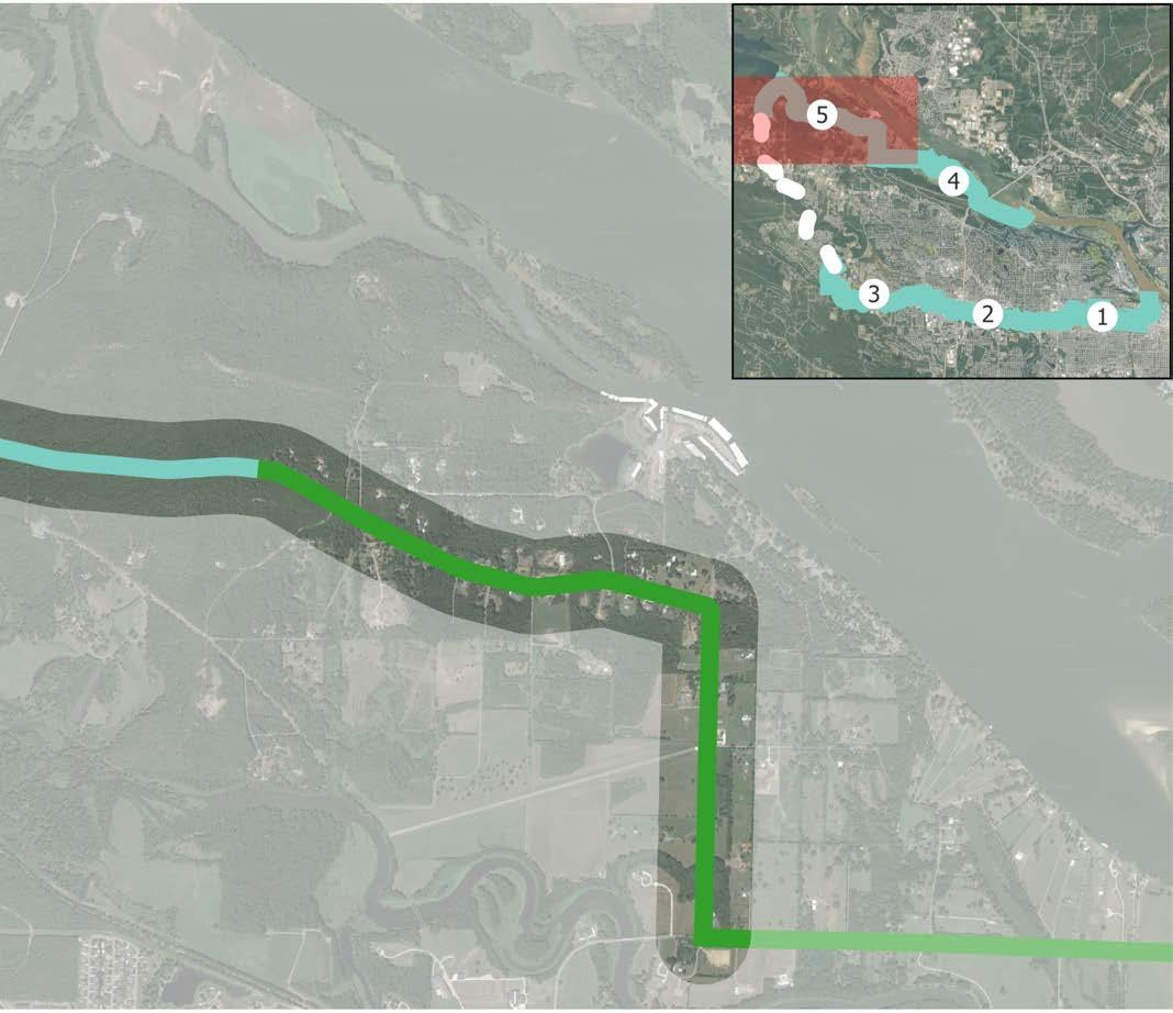
MATCHLINE A MATCHLINE B
For purposes of this section ONLY, the following designations apply :
» “On-Road” facilities indicate separated infrastructure, such as sidepaths, that occur within a road right of way.
» “Off-Road” facilities indicate infrastructure located outside of a road right of way.
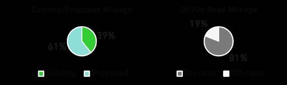
This page intentionally left blank
The Northwest Corridor is 36 miles long with 7 miles of existing trails. The corridor starts near Cook’s Landing in North Little Rock and passes through Maumelle, Mayflower, sections of Pulaski and Faulkner County, and Conway before ending at Beaver Fork Park Lake on the northern edge of Conway’s city limits The corridor is divided relatively equally between on- and off-road facilities (55% offroad facilities).
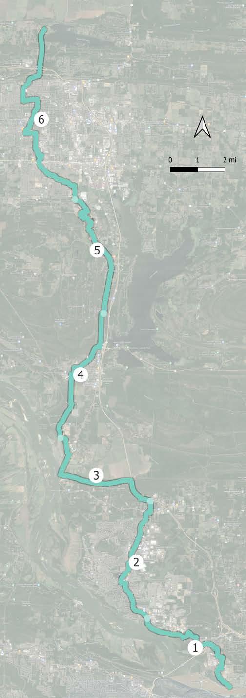
Package 1 is 5.4 miles in length and begins as the North Shore Trail from the Arkansas River Trail to Northshore Drive. Much of corridor is a proposed trail through the White Oak Bayou on the east side of Hwy 100 with slightly more on-road sidepath facilities than off-road trails. The route crosses Hwy 100 at a future traffic signal, however, a grade-separated crossing in the future might be needed. The corridor joins the existing sidepath along the west side of Maumelle Boulevard as this package terminates. It connects to several parks including Park on the River, Northshore Golf Range, and Campbell Lake Park, and includes two major bridge underpasses at Crystal Hill Road and I-430.
* Proposed Bridge Underpass
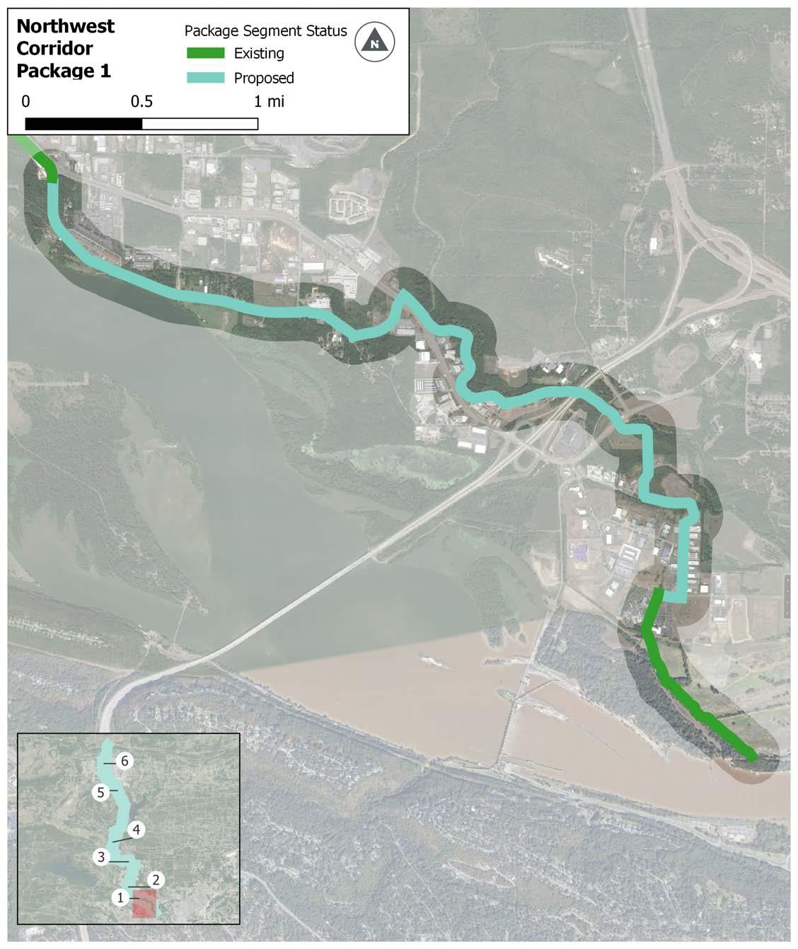
CENTRAL ARKANSAS CHRISTIAN SCHOOL
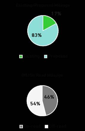
For purposes of this section ONLY, the following designations apply :
» “On-Road” facilities indicate separated infrastructure, such as sidepaths, that occur within a road right of way.
» “Off-Road” facilities indicate infrastructure located outside of a road right of way.
6.12 | Northwest Corridor Package 1
NORTHSHORE BUSINESS PARK
CRYSTAL HILL ELEMENTARY
LAKE PARK
Package 2 is 5.3 miles in length and is over two-thirds existing sidepath paralleling Maumelle Boulevard to a large degree. In addition to offering access to the residential areas along Maumelle Boulevard, the package connects to Lake Willastein Park and Maumelle’s commercial core via Club Manor Drive. Similar to Package 1, the package ends when the facility changes from sidepath to trail. Local trails provide extensive connections from the project package to points throughout the community.
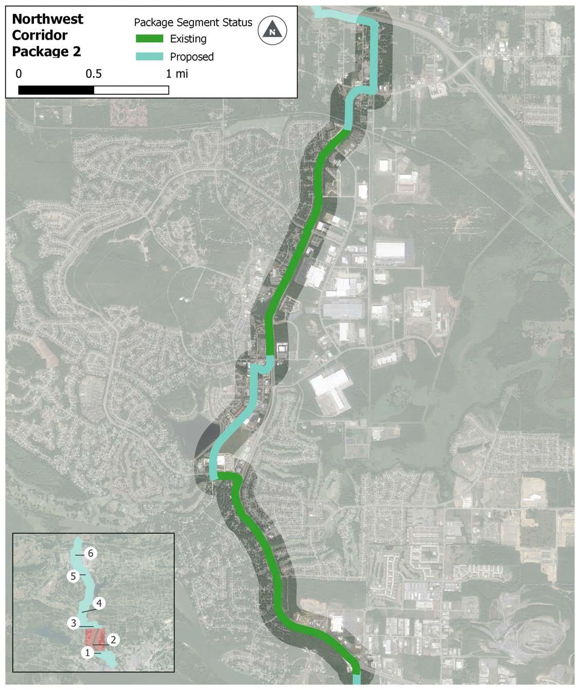
PINE FOREST ELEMENTARY MAUMELLE CHARTER ACADEMICS PLUS CHARTER
For purposes of this section ONLY, the following designations apply :
» “On-Road” facilities indicate separated infrastructure, such as sidepaths, that occur within a road right of way.
» “Off-Road” facilities indicate infrastructure located outside of a road right of way.
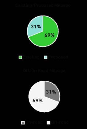
6.13 | Northwest Corridor Package 2
This mostly off-road trail package, 5.5 miles in length, runs parallel to Interstate 40 before turning west toward the Arkansas River and Highway 365. Once the package crosses under Highway 365, the facility type transitions to an on-road sidepath, which results in the package ending the next time the facility type changes. This package includes a bike-ped bridge (water crossing) over Palarm Creek east of Hwy 365, then a bridge underpass beneath the new Hwy 365 bridge crossing Palarm Creek on its north side.
* Proposed Underpass
Bridge
For purposes of this section ONLY, the following designations apply :
» “On-Road” facilities indicate separated infrastructure, such as sidepaths, that occur within a road right of way.
» “Off-Road” facilities indicate infrastructure located outside of a road right of way.
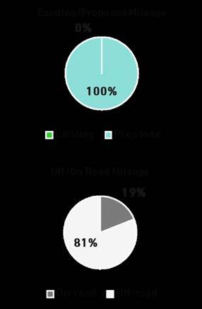
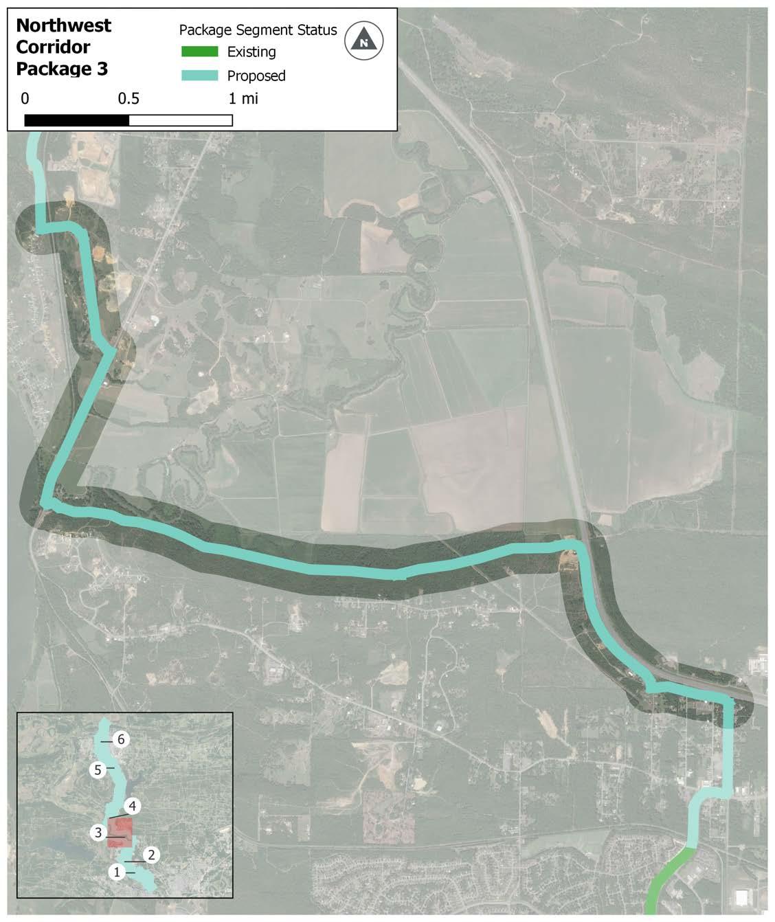
6.14 | Northwest Corridor Package 3
Package 4 is 5.5 miles long and connects from rural areas into and through Mayflower. The trail passes to the west of downtown Mayflower and connects to Mayflower Middle School, Mayflower High School, and Fletcher Bend Public Use Area. It continues around the Hwy 89 bypass then continues north toward Conway.
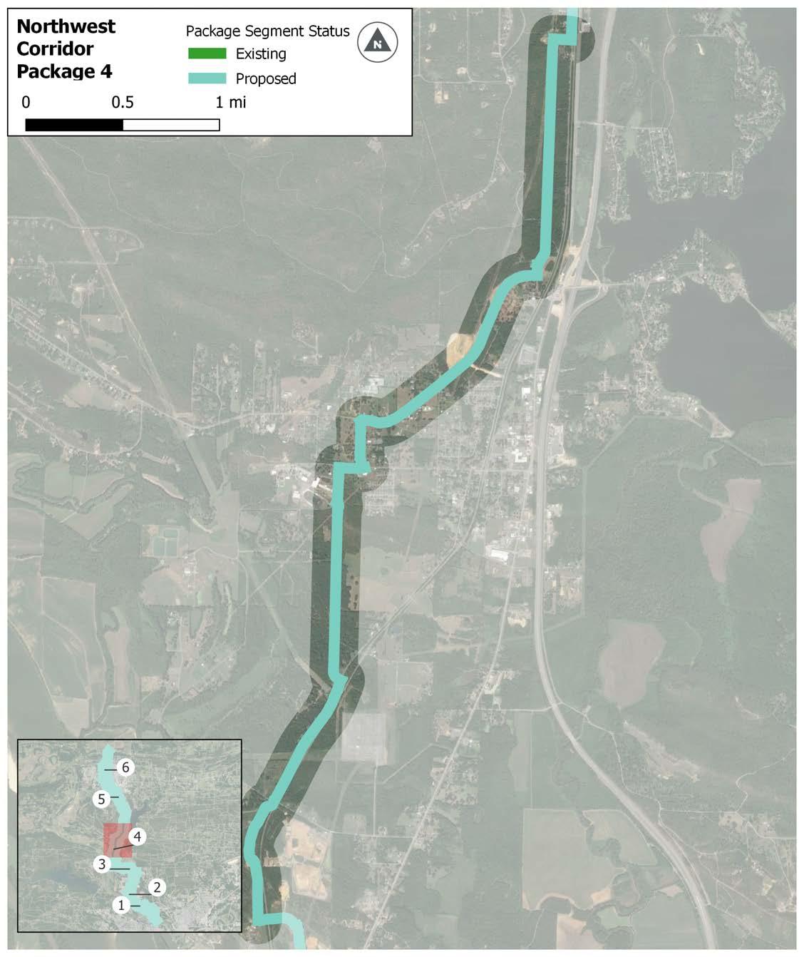
6.15 | Northwest Corridor Package 4
For purposes of this section ONLY, the following designations apply :
» “On-Road” facilities indicate separated infrastructure, such as sidepaths, that occur within a road right of way.
» “Off-Road” facilities indicate infrastructure located outside of a road right of way.
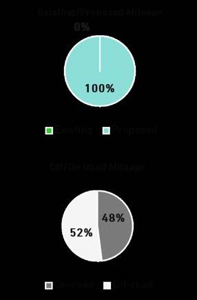
This 5.5-mile package passes through the unincorporated community of Gold Creek and ends in the City of Conway. The Conway Technology Park and several large employment centers are the main destinations in this package.
For purposes of this section ONLY, the following designations apply :
» “On-Road” facilities indicate separated infrastructure, such as sidepaths, that occur within a road right of way.
» “Off-Road” facilities indicate infrastructure located outside of a road right of way.
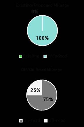
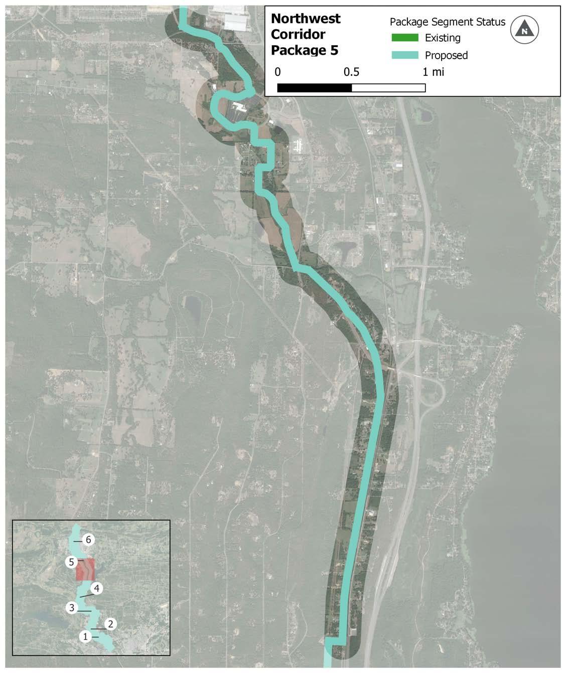
6.16 | Northwest Corridor Package 5
Package 6 exceeds 7 miles, an exception to the maximum desired package distance, with a length of 8.9 miles. The package begins from the point where Package 5’s facility type changes from sidepath to trail. It connects users with the Farris Softball Complex and utilizes Kinley Trail from College to Tyler. The package connects with many University of Central Arkansas destinations, as well as other practical destinations throughout Conway, which creates a lot of utility for potential users. The trail crosses Interstate 40 and ends at Beaverfork Lake Park at the Conway City Limits. A parallel bike ped bridge along Salem Road to cross the railroad in north Conway is proposed.
GATLIN PARK POMPE PARK
CONWAY HIGH SCHOOL PRINCE ST
LAUREL PARK
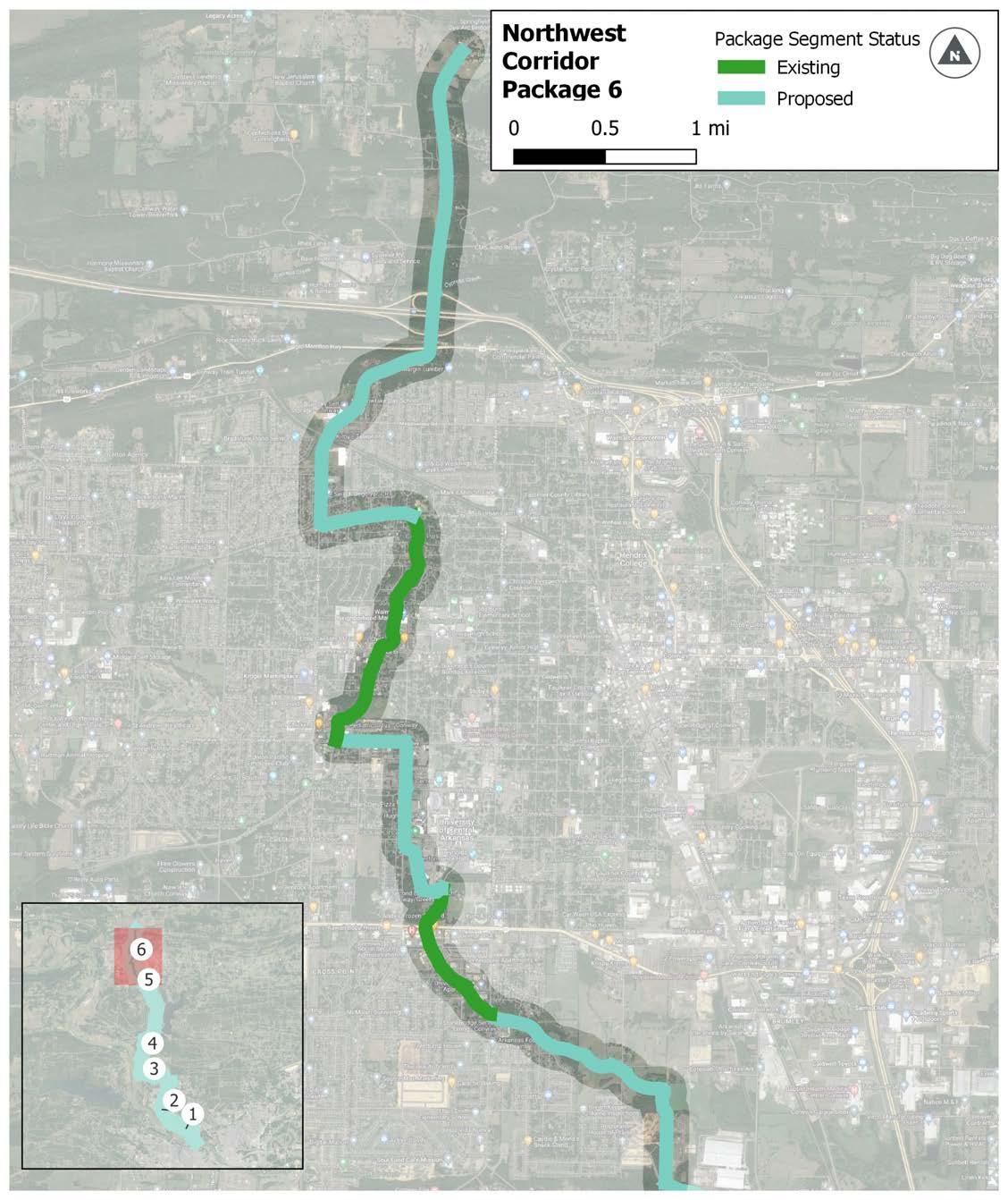
UNIVERSITY
STUART MIDDLE SCHOOL VANN ELEMENTARY
DOWNTOWN CONWAY
* Proposed Bike Ped Bridge
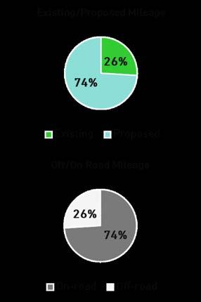
For purposes of this section ONLY, the following designations apply :
» “On-Road” facilities indicate separated infrastructure, such as sidepaths, that occur within a road right of way.
» “Off-Road” facilities indicate infrastructure located outside of a road right of way.
6.17 | Northwest Corridor Package 6
STONE DAM CREEK TRAIL
This page intentionally left blank
This corridor is 34.3 miles long with 2.8 miles of existing trail (all in Package 1) and connects the City of North Little Rock to the City of Ward. The proposed trail passes through several parks, town, and residential areas. There is a gap in the corridor which will eventually be Package 2 and the second half of Package 3. Further study will be conducted to determine the best connection between the Levy Trail in North Little Rock and Sherwood.
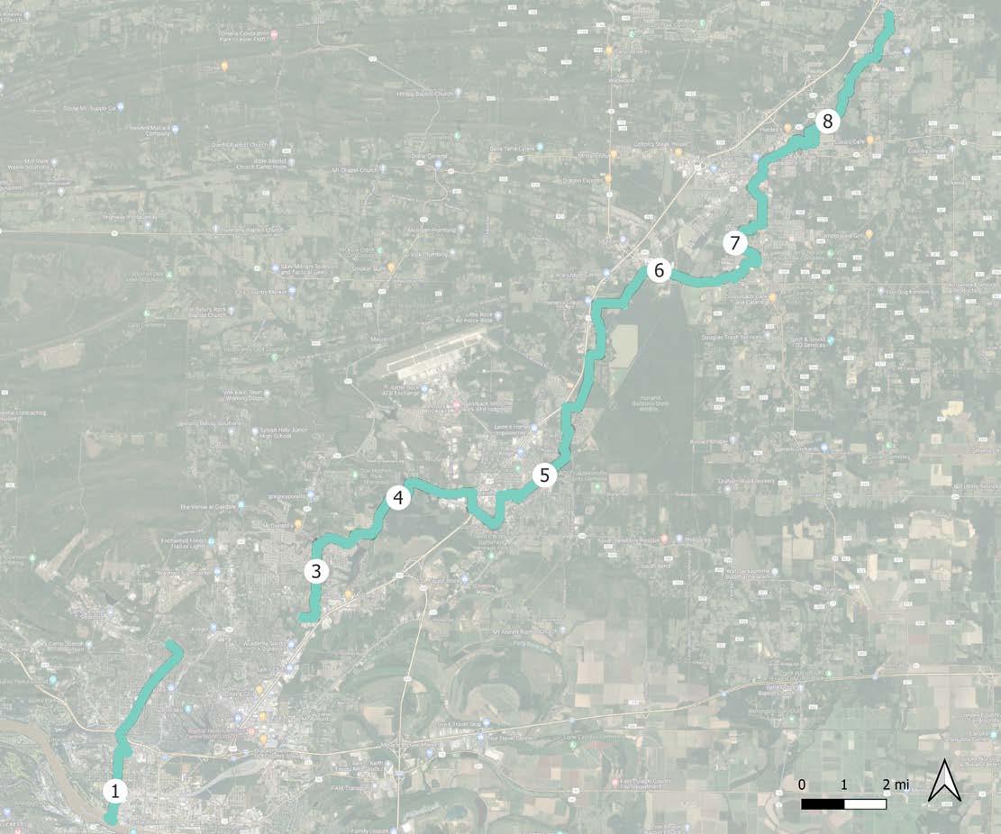
SEGMENT 2 ROUTE UNDER FURTHER STUDY
Two-thirds of this 5.1-mile package is made up of existing trail. The existing facility is a piece of the Arkansas River Trail, a new sidepath along Pike from the River Trail to 13th, and almost the entirety of the Levy Trail. By way of the Levy Trail, the package runs through a dense residential area, thus offering high ease of access. Kierre Drive serves as the termini for this project package. Further study will determine the alignment from Kierre Drive to the Powerline Trail in Sherwood. Additionally, the route’s crossing under the railroad bridge along Pershing will require further design consideration.
The package has been omitted, subject to further study.
6.19 | Northeast Corridor Package 1
* Proposed Bridge Underpass
For purposes of this section ONLY, the following designations apply :
» “On-Road” facilities indicate separated infrastructure, such as sidepaths, that occur within a road right of way.
» “Off-Road” facilities indicate infrastructure located outside of a road right of way.
This 1.64-mile segment is the Power Line Trail, currently funded and in engineering phases of development. The package is mostly an off-road trail to the west of Brockington Road. It offers a connection to William Jefferson Clinton Elementary and multiple residential neighborhoods. Stonehill Park is in close proximity to the trail. Since it is funded, Package 3 has been omitted from subsequent prioritization and tier maps.
For purposes of this section ONLY, the following designations apply :
» “On-Road” facilities indicate separated infrastructure, such as sidepaths, that occur within a road right of way.
» “Off-Road” facilities indicate infrastructure located outside of a road right of way.
This 5.2-mile package starts at the north end of the Powerline Trail in Sherwood and terminates on the edge of downtown Jacksonville at Jacksonville City Hall. The proposed alignment will run mostly alongside the roadway. The trail connects several residential neighborhoods together and would offer access to two parks (Austin Lakes Park and Northlake Park).
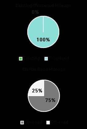
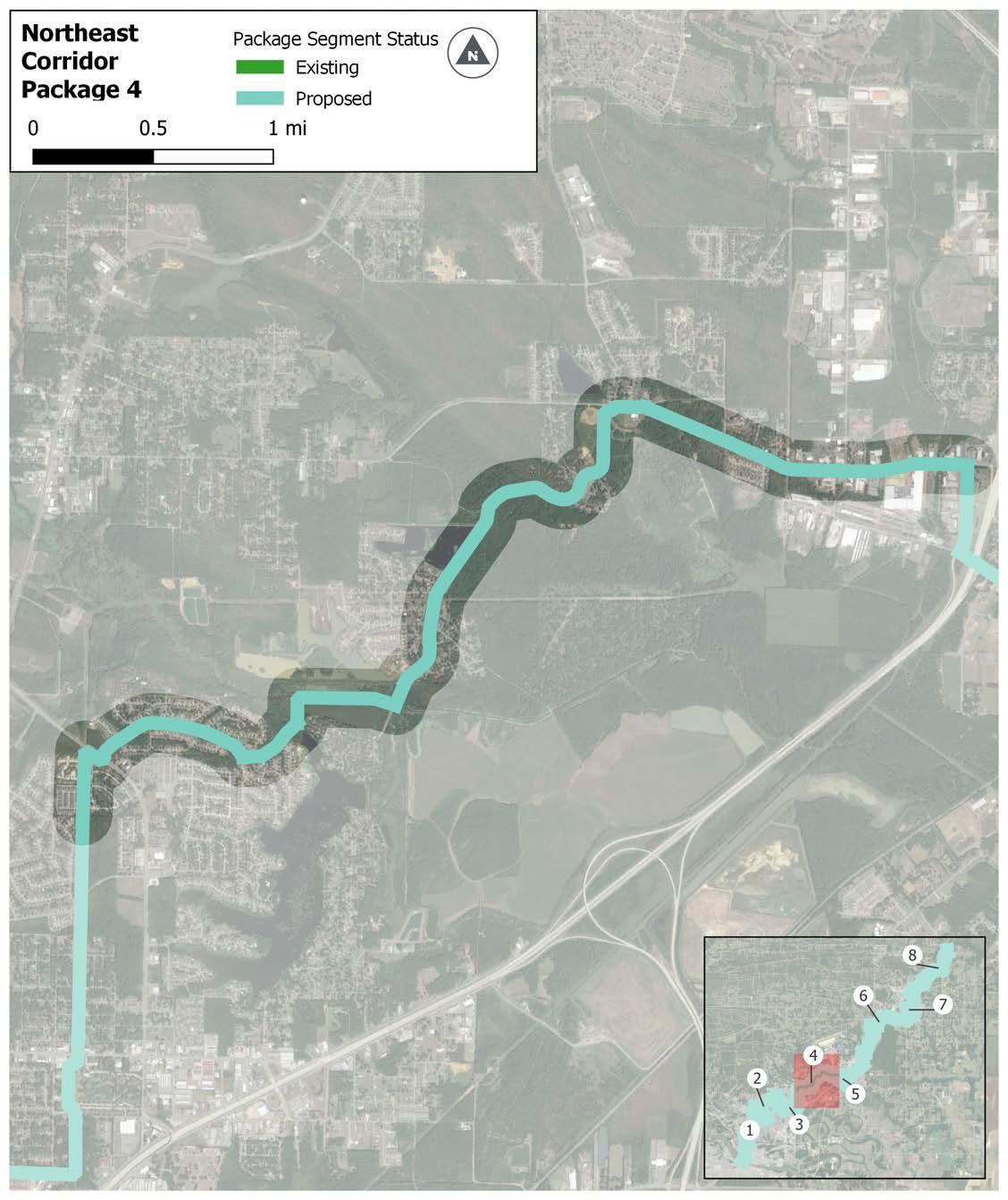
6.21 | Northeast Corridor Package 4
For purposes of this section ONLY, the following designations apply :
» “On-Road” facilities indicate separated infrastructure, such as sidepaths, that occur within a road right of way.
» “Off-Road” facilities indicate infrastructure located outside of a road right of way.
This package, 6.2 miles in length, runs through the heart of the City of Jacksonville and is almost evenly split between on-road sidepath or cycle track and off-road trail facilities. Utilizing the Hwy 67/167 underpass at Redmond Road, it connects local residential areas to a high number of destinations such as Jacksonville Community Center, Dupree Park, Jacksonville Lighthouse Charter School, Pinewood Elementary, and Jimmie White Park. Bridge underpasses along Redmond Road under Hwy 67/167 and along First Street under Main Street, both in Jacksonville, will require additional design consideration.
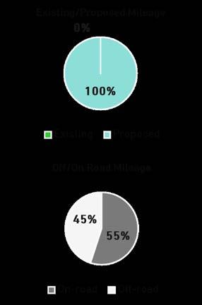
*Proposed Bridge Underpass
For purposes of this section ONLY, the following designations apply :
» “On-Road” facilities indicate separated infrastructure, such as sidepaths, that occur within a road right of way.
» “Off-Road” facilities indicate infrastructure located outside of a road right of way.
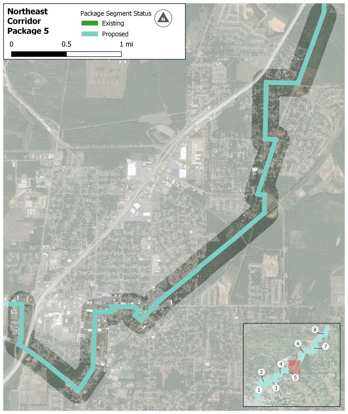
6.22 | Northeast Corridor Package 5
The 5.5-mile package runs between the edges of Jacksonville and Cabot and passes in and out of pockets of both communities. The trail heavily utilizes open space and easements which results in the project running along the edges of residential areas and directly connecting only a few destinations such as Pickthorne Lake at Holland Bottoms and Cabot Sports Complex and Aquatic Park. This segment includes the addition of a bicycle and pedestrian overpass adjacent to the Hwy 321 bridge over the rail line just west of the Cabot Aquatic Park and Sports Complex.
* Proposed Bike Ped Bridge
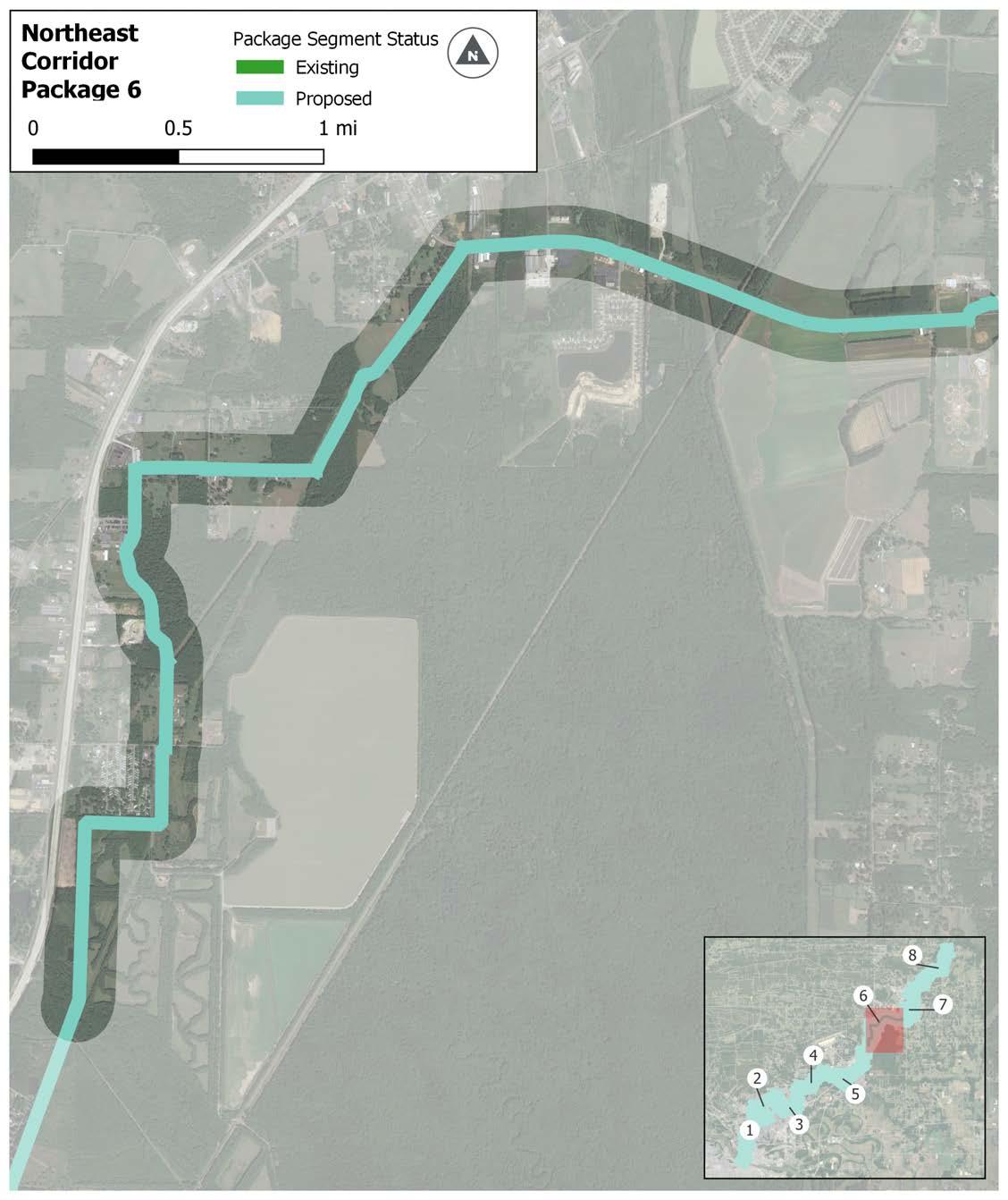
6.23 | Northeast Corridor Package 6
For purposes of this section ONLY, the following designations apply :
» “On-Road” facilities indicate separated infrastructure, such as sidepaths, that occur within a road right of way.
» “Off-Road” facilities indicate infrastructure located outside of a road right of way.
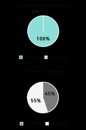
This 4.2-mile package connects densely populated residential areas to several parks and schools such as Kerr Station Park, Cabot Community Pond, Cabot Middle School and Cabot Junior High. The terminus is Cabot High School in Downtown. Construction for this package will be primarily in both forested areas and existing open space.
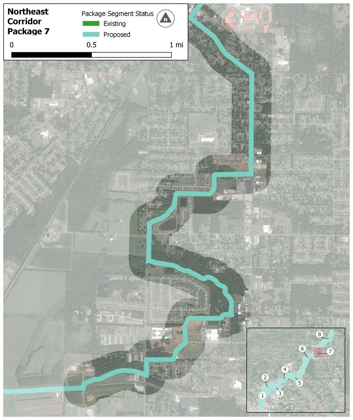
EAST SIDE ELEMENTARY
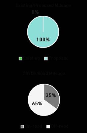
For purposes of this section ONLY, the following designations apply :
» “On-Road” facilities indicate separated infrastructure, such as sidepaths, that occur within a road right of way.
» “Off-Road” facilities indicate infrastructure located outside of a road right of way.
6.24 | Northeast Corridor Package 7
This mostly off-road package, 6.4 miles long, runs through downtown Cabot and connects the Cabot High School and Junior High campuses along with Cabot Middle School. It crosses under Hwy 38 and north of Cabot, the trail becomes an off-road trail facility running through Austin and connecting to the Ward Sports Complex. From there, it follows Peyton Street to downtown Ward passing by Busby Lake.
* Proposed Bridge Underpass
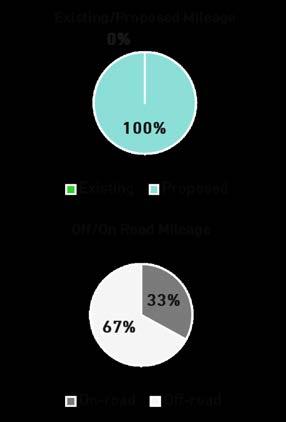
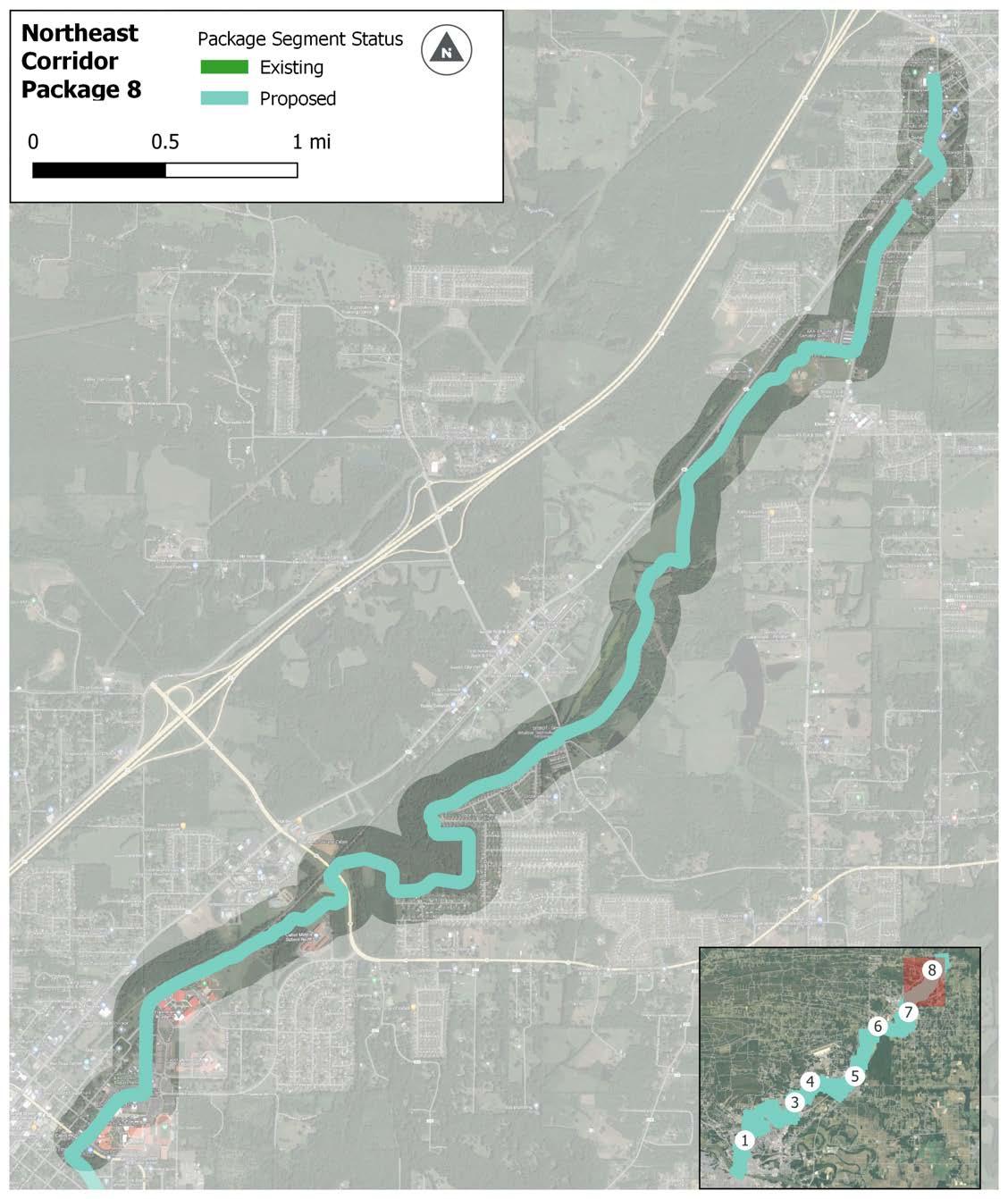
For purposes of this section ONLY, the following designations apply :
» “On-Road” facilities indicate separated infrastructure, such as sidepaths, that occur within a road right of way.
» “Off-Road” facilities indicate infrastructure located outside of a road right of way.
Figure 6.25 | Northeast Corridor Package 8
This page intentionally left blank
The unfunded sections of the Southwest Trail are 33 miles long. For purposes of this study, the corridor starts at Arkansas River Trail in Little Rock and ends at the Saline County Line. There are large gaps between the end of Package 1 and Package 2 (a funded segment spanning the Pulaski and Saline County borders) and between Package 4 and Package 5 (a funded segment through Benton). It passes through City of Little Rock, City of Bauxite, and City of Benton. 66% of the proposed corridor is follows roadways as sidepath.
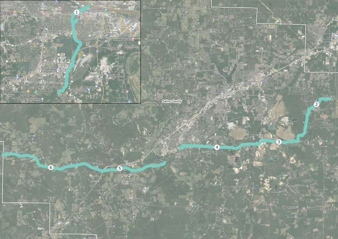
FUNDED SEGMENT
FUNDED SEGMENT
FUNDED SEGMENT
This mostly off-road/trail package, 9.2 miles in length, begins at the Arkansas River Trail running parallel to a rail line from the Trail down to Southside Park. Additionally, along this section the trail will run parallel to as well as cross the Central Beltway Corridor. Going south from that point, it crosses forest land until it runs parallel to I-30 with it crossing the highway north of 65th Street. After turning away from the Interstate, the package runs through forest land until it reaches a funded section of the trail corridor.
CENTRAL HIGH SCHOOL ROOSEVELT
65TH ARKANSAS STATE FAIRGROUNDS
I-30
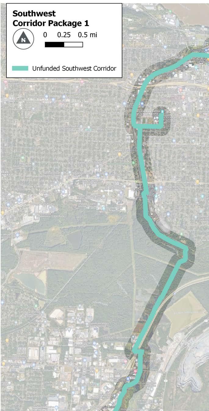
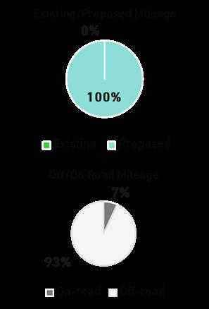
For purposes of this section ONLY, the following designations apply :
» “On-Road” facilities indicate separated infrastructure, such as sidepaths, that occur within a road right of way.
» “Off-Road” facilities indicate infrastructure located outside of a road right of way.
This 3.6-mile package is entirely on-road (sidepath) and follows Germania for the first 2 miles, with the remaining length along S Alexander Road. Package 2 ends at the Bauxite City Limits near Brooks Bethel Missionary Baptist.
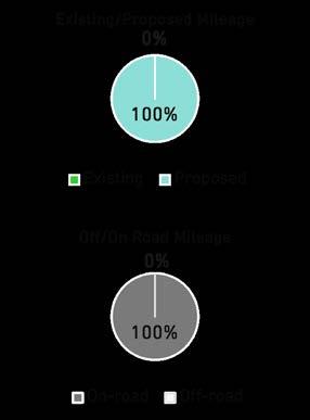
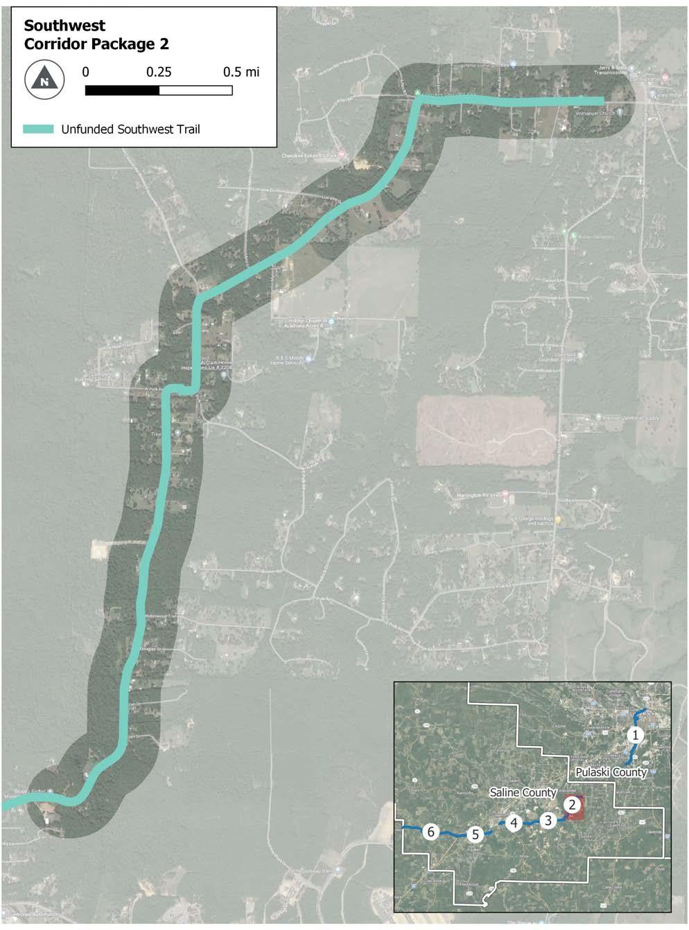
For purposes of this section ONLY, the following designations apply :
» “On-Road” facilities indicate separated infrastructure, such as sidepaths, that occur within a road right of way.
» “Off-Road” facilities indicate infrastructure located outside of a road right of way.
This mostly on-road (sidepath) package, 5 miles in length, runs parallel to S Alexander Road, W Sardis Road, and Bauxite Highway with a section is the middle where it diverges from Sardis Road and continues along the old rail corridor. The package runs along the northern side of S Sardis Road and Bauxite Highway with the end of the package coming when it crosses Bauxite Highway at Word Street.
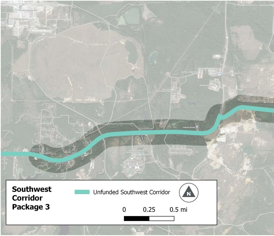
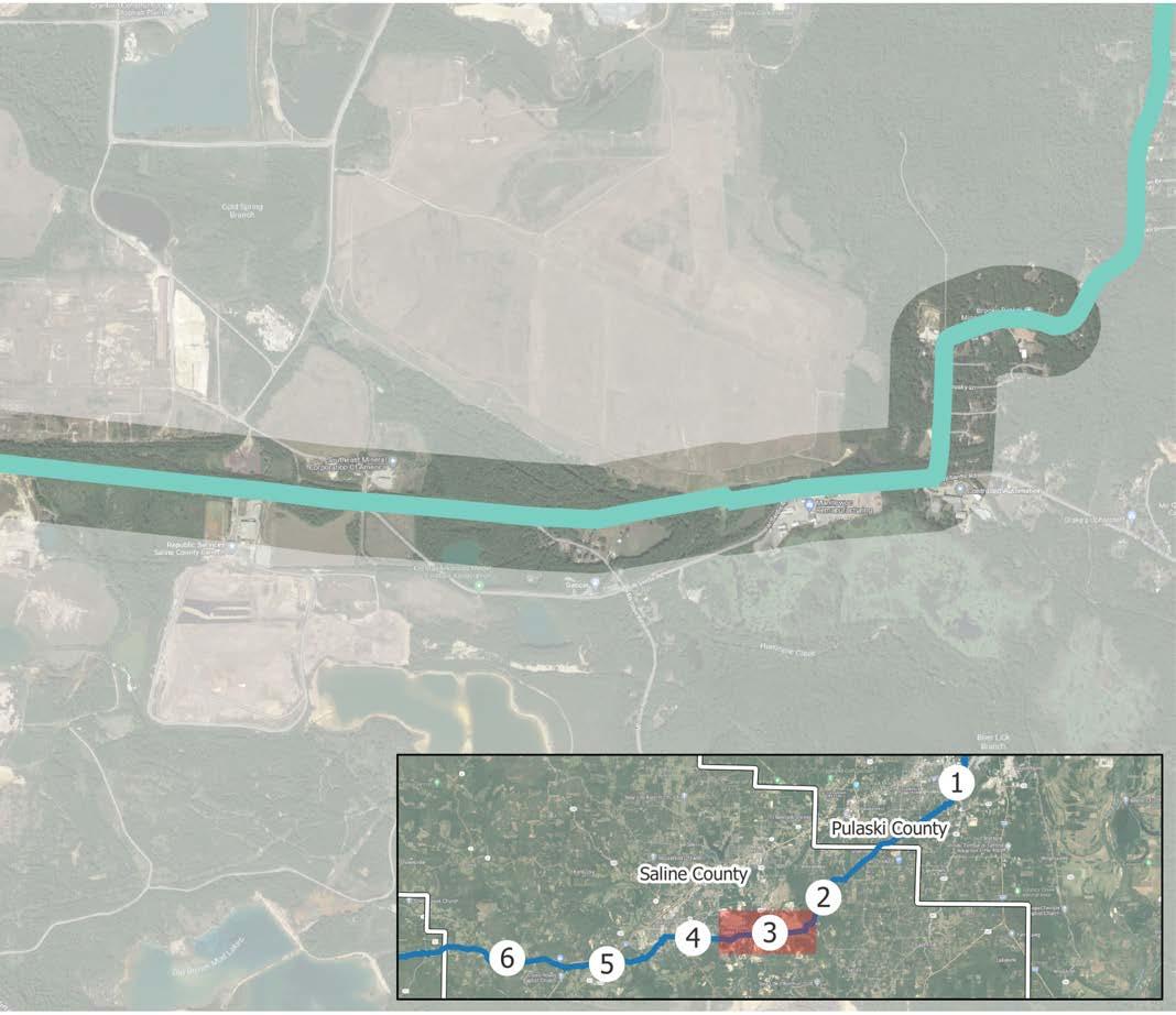
For purposes of this section ONLY, the following designations apply :
» “On-Road” facilities indicate separated infrastructure, such as sidepaths, that occur within a road right of way.
» “Off-Road” facilities indicate infrastructure located outside of a road right of way.
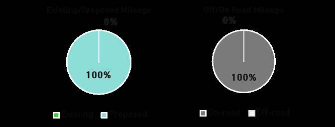
Package 4, which is 3.6 miles long, runs along Bauxite Highway/Edison Avenue for the first 3 miles of the package before turning down S East Street and Hazel Street. The package, which is entirely sidepath, ends south of downtown Benton at the next funded section of the trail.
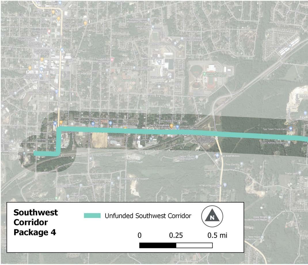
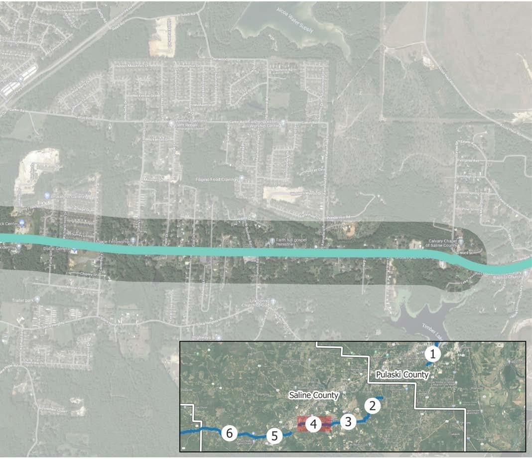
For purposes of this section ONLY, the following designations apply :
» “On-Road” facilities indicate separated infrastructure, such as sidepaths, that occur within a road right of way.
» “Off-Road” facilities indicate infrastructure located outside of a road right of way.
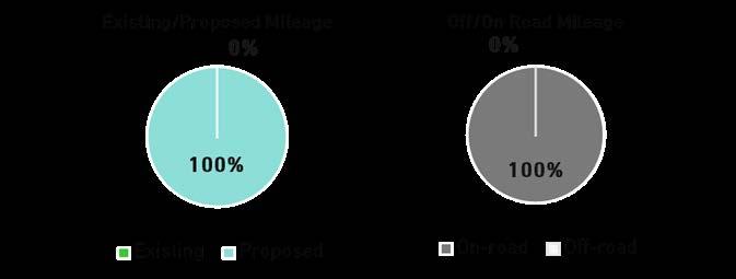
Package 5, which is 4.1 miles long, starts from the funded trail segment that ends at Saline Crossing Regional Park and travels south as a trail along the dirt road portion of River Road. Once that road becomes paved, it transitions to a sidepath until River Road ends at E Highway 67. The package crosses Highway 67 and continues along Pawnee Drive until it gets to Interstate 30.
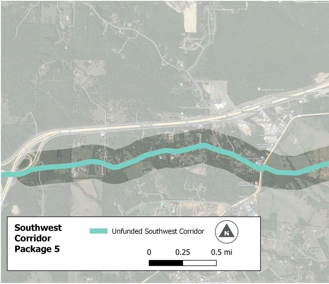
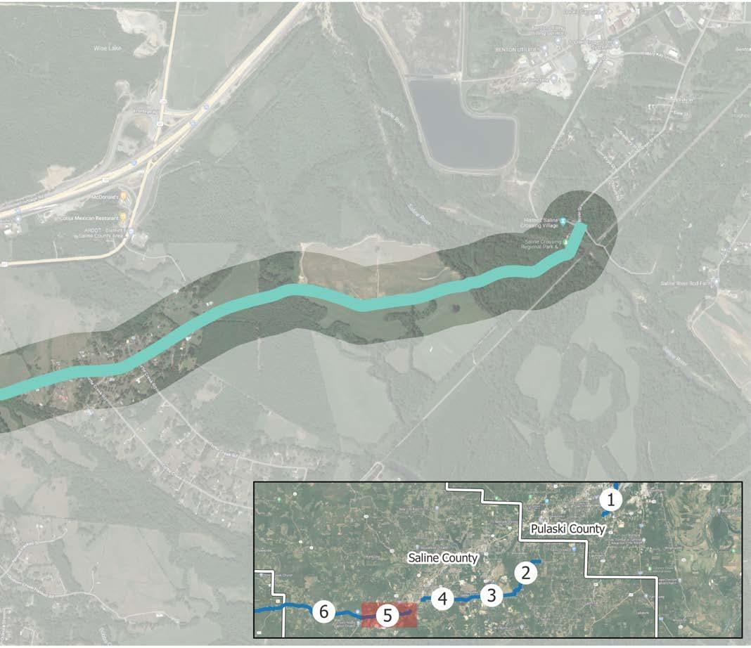
For purposes of this section ONLY, the following designations apply :
» “On-Road” facilities indicate separated infrastructure, such as sidepaths, that occur within a road right of way.
» “Off-Road” facilities indicate infrastructure located outside of a road right of way.
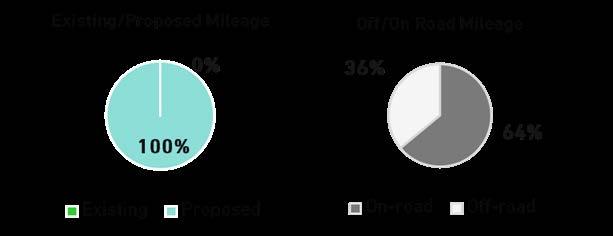
Package 6, 7.3 miles long, runs along US 70 for almost its entire length (7.1 miles) turning onto CR 88 just prior to reaching the county boundary. The trail is proposed to continue on to Hot Springs, outside the Central Arkansas Regional Trails study area.
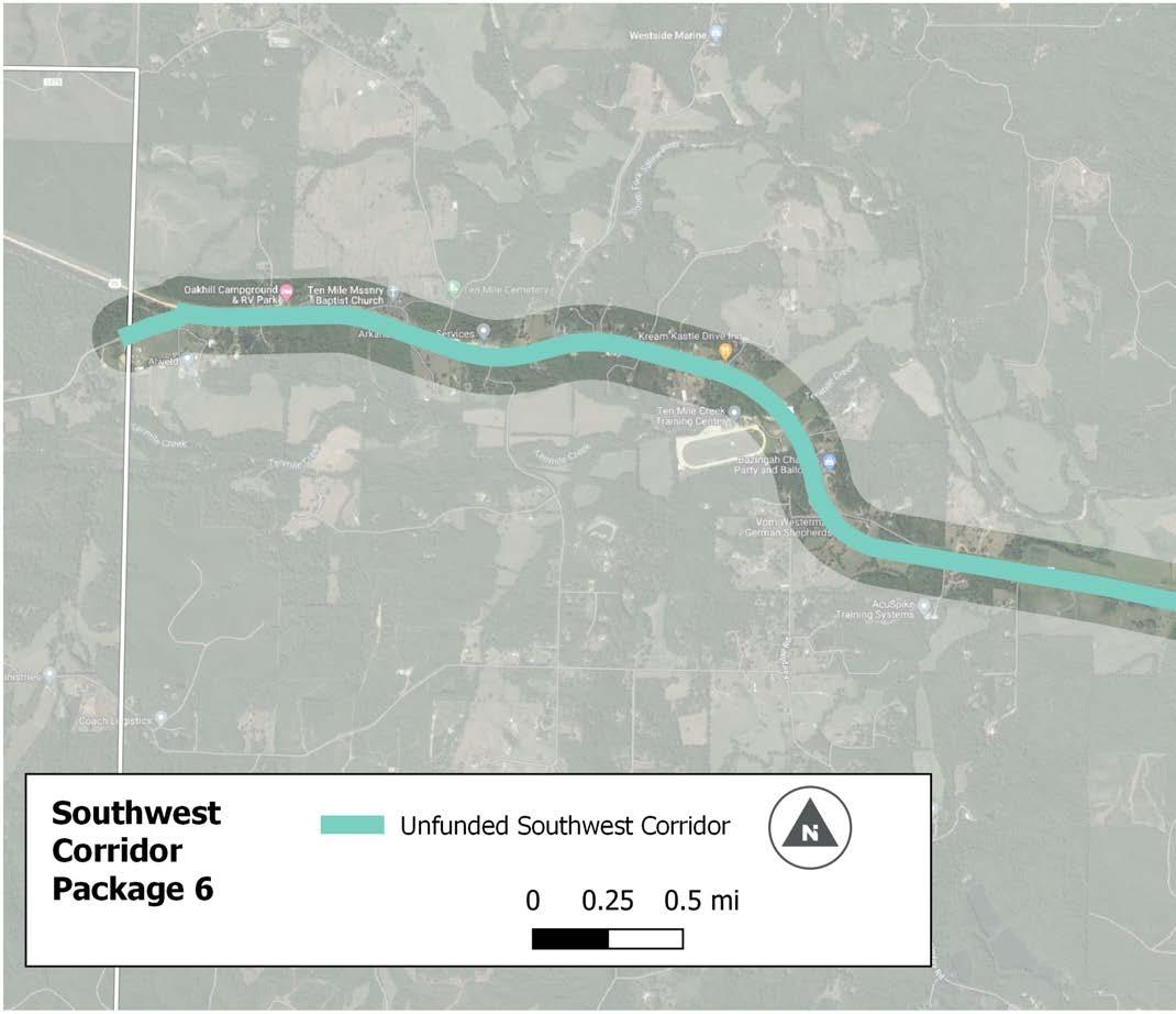
I-30
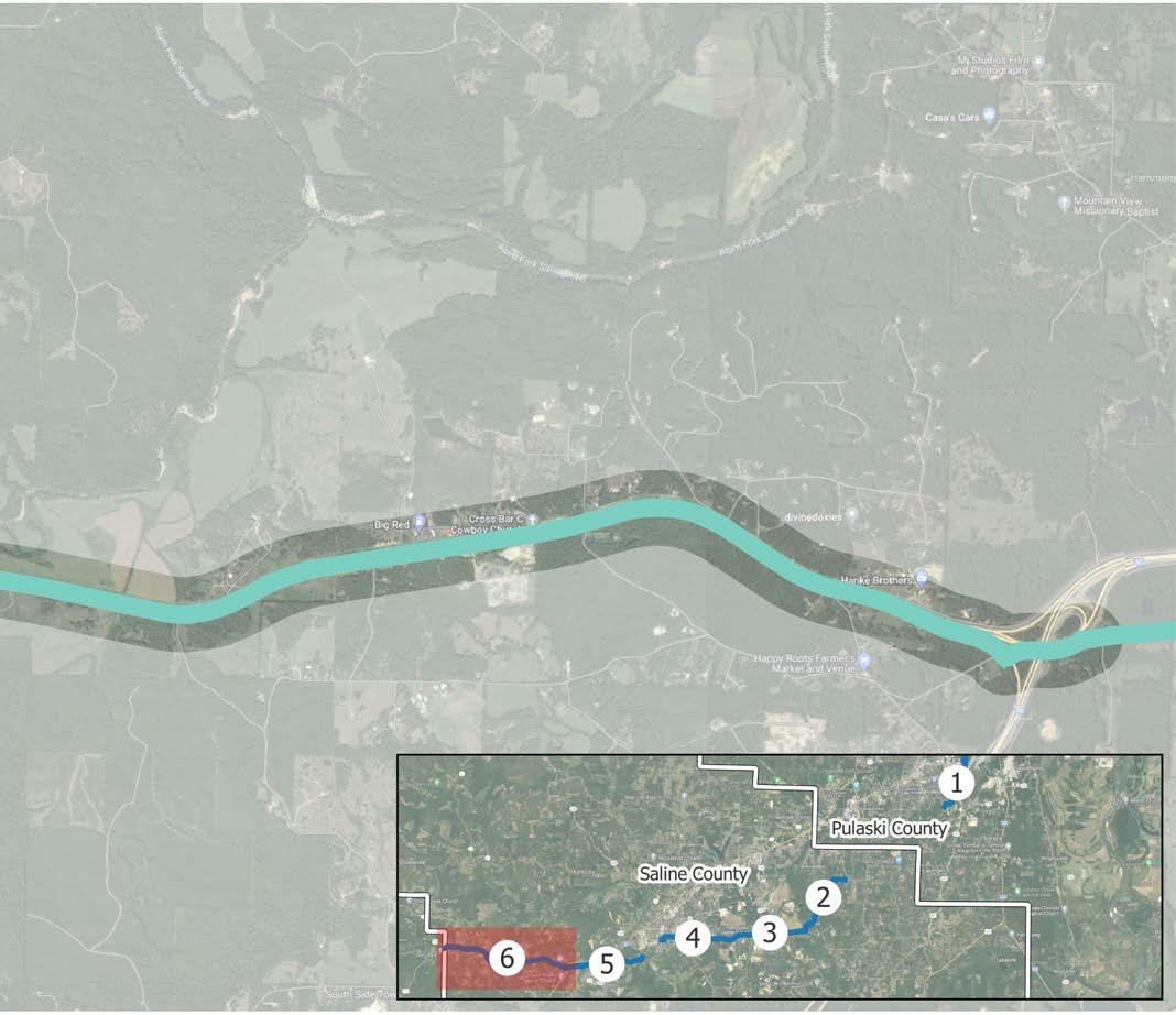
For purposes of this section ONLY, the following designations apply :
» “On-Road” facilities indicate separated infrastructure, such as sidepaths, that occur within a road right of way.
» “Off-Road” facilities indicate infrastructure located outside of a road right of way.

This page intentionally left blank
The 29-mile East Corridor begins at the northeast corner of the Arkansas River Trail, connecting North Little Rock to Lonoke’s Rail-Trail. From the River Trail to Interstate 440, the corridor is predominately comprised of sidepaths. East of I-440, Faulkner Lake Road and the route through Lonoke County are rural in nature, suitable for on-street facilities. Here, the facility type transitions to bicycle lanes, and at Baucum Road, transitions again to a signed bicycle route until the corridor reaches Lonoke. Bicycle lanes and signed routes are indicated by dashed lines on the map below and are not included in corridor segment packages.
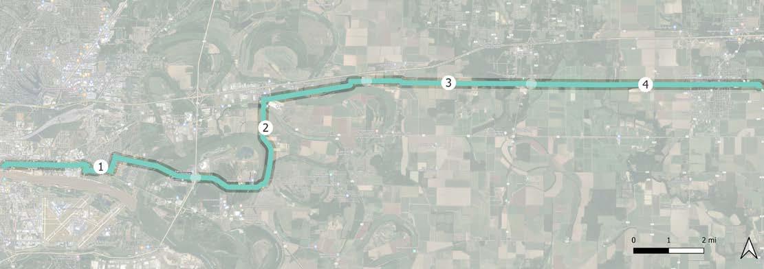
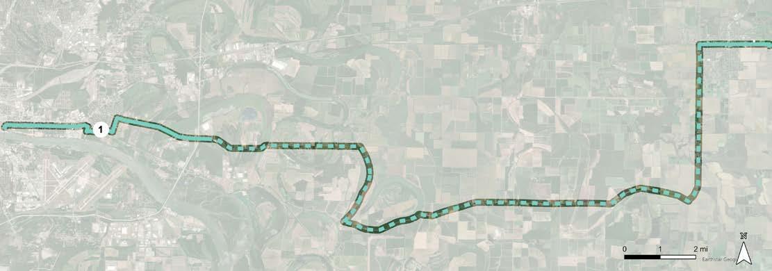
This 6.1-mile package begins at the Arkansas River Trail and terminates at Interstate 440. It is a proposed cycle track and trail corridor that connects to the Rose City Community Center and passes through several residential areas in North Little Rock.
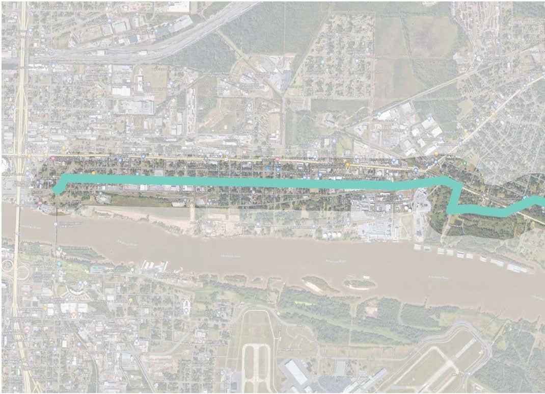
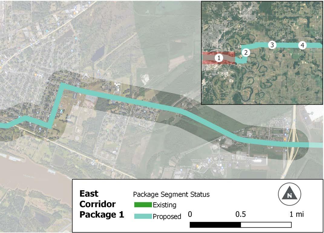
For purposes of this section ONLY, the following designations apply :
» “On-Road” facilities indicate separated infrastructure, such as sidepaths, that occur within a road right of way.
» “Off-Road” facilities indicate infrastructure located outside of a road right of way.
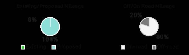
Implementing the CARTS Regional Pathways Master Plan and its recommended greenway trail network will occur over time through strategic phases. This Plan highlights the vision and significant coordination and effort by agency partners within the region. To guide phasing, the network segments were classified as projects and then combined with adjacent projects to create corridor segment packages throughout the proposed system. Segment packages were scored using criteria that address the following categories:
» Connectivity
» Destinations
» Trail Access
» Construction & Maintenance
These categories and corresponding criteria were assembled according to national best practices along with the results of polling questions asked of the Steering Committee and local staff at a workshop in April 2022. A process of identifying criteria and determining the appropriate weighting occurred with Metroplan staff and the Steering Committee in August 2022. The final weighting and criteria are described in Table 6.1.
Prioritization and resulting tiers in this plan should be used to guide planning and funding efforts and not strictly dictate phasing for the regional system. Metroplan will continue to have a consistent process for evaluating applications for funding; however, it will be important that the results of this Plan inform those decisions for greenway projects. Metroplan should develop a methodology within their scoring system that weighs Plan recommendations to allow for nuance based on a project’s designation within the tiers.
It should be noted that because of data constraints, scoring for the transit criterion was determined by the presence of a trail corridor crossing a transit route. Additionally, funded segments of the Southwest and Northeast corridors, signed route sections of the East corridor, and segments of the Southeast Corridor that are under design were not scored or prioritized.
CATEGORY CRITERIA
Destinations
Destination Density
Number of destinations per mile within a 1/2 mile of proposed trail
Connectivity
Links to Other Existing Trails/Greenways
Density of existing bicycle/trail facilities
Construction and Maintenance
Transit
Links to existing transit routes
Trail Access
Links to Significant Trails/Greenways
Density of existing bicycle/trail facilities
Constructability and Ongoing Maintenance
RATIONALE
Trails with a high number of existing destinations will have increased attraction to people walking and people on bicycles
Population Density
Population density within 1/2 mile of proposed trail
Equity
Access for vulnerable users (Low Income, People of Color, Persons with Disabilities)
0.25 to 0.5-mile buffer to reach Census block groups
Existing bicycle and pedestrian facilities attract users.
Active transportation and transit functionality go hand-in-hand; it is important that active transportation around transit stops and routes is safe and connected for users
Significant trails/greenways represent major regional assets. Connecting to this marquee trails is important to building a regional active transportation network
Ability to simplify construction and maintenance access
Ability to reduce overall cost
Enhancing infrastructure in densely populated areas impacts the most users per given area
Will this project address the priorities for underserved populations?
» Direct connection to two or more destinations = 20 points
» Direct connection to 1 destination = 15 points
» Indirect connection within 0.5 miles to 2 or more = 10 points
» Indirect connection within 0.5 miles to 1 destination = 5 points
» Indirect connection over 0.5 miles to 1 destinations = 0 points
» Direct connection to two or more trails = 20 points
» Direct connection to 1 trail = 15 points
» Indirect connection within 0.5 miles to 2 or more trails = 10 points
» Indirect connection within 0.5 miles to 1 trail = 5 points
» 1 or more transit route crossings = 10 points
» 0 transit route crossings = 0 points
» Direct connection to two or more significant trails = 20 points
» Direct connection to 1 significant trail = 15 points
» Indirect connection within 0.5 miles to 2 or more significant trails = 10 points
» Indirect connection within 0.5 miles to 1 significant trail = 5 points
Professional Discretion to create:
» High Ease of Construction/Maintenance = 20 points
» Medium Ease of Construction/Maintenance = 10 points
» Low Ease of Construction/Maintenance = 5 points
» High = 25 points
» Medium-high = 20 points
» Medium = 15 points
» Medium-low = 10 points
» Low = 5 points
» High = 25 points
» Medium-high = 20 points
» Medium = 15 points
» Medium-low = 10 points
» Low = 5 points
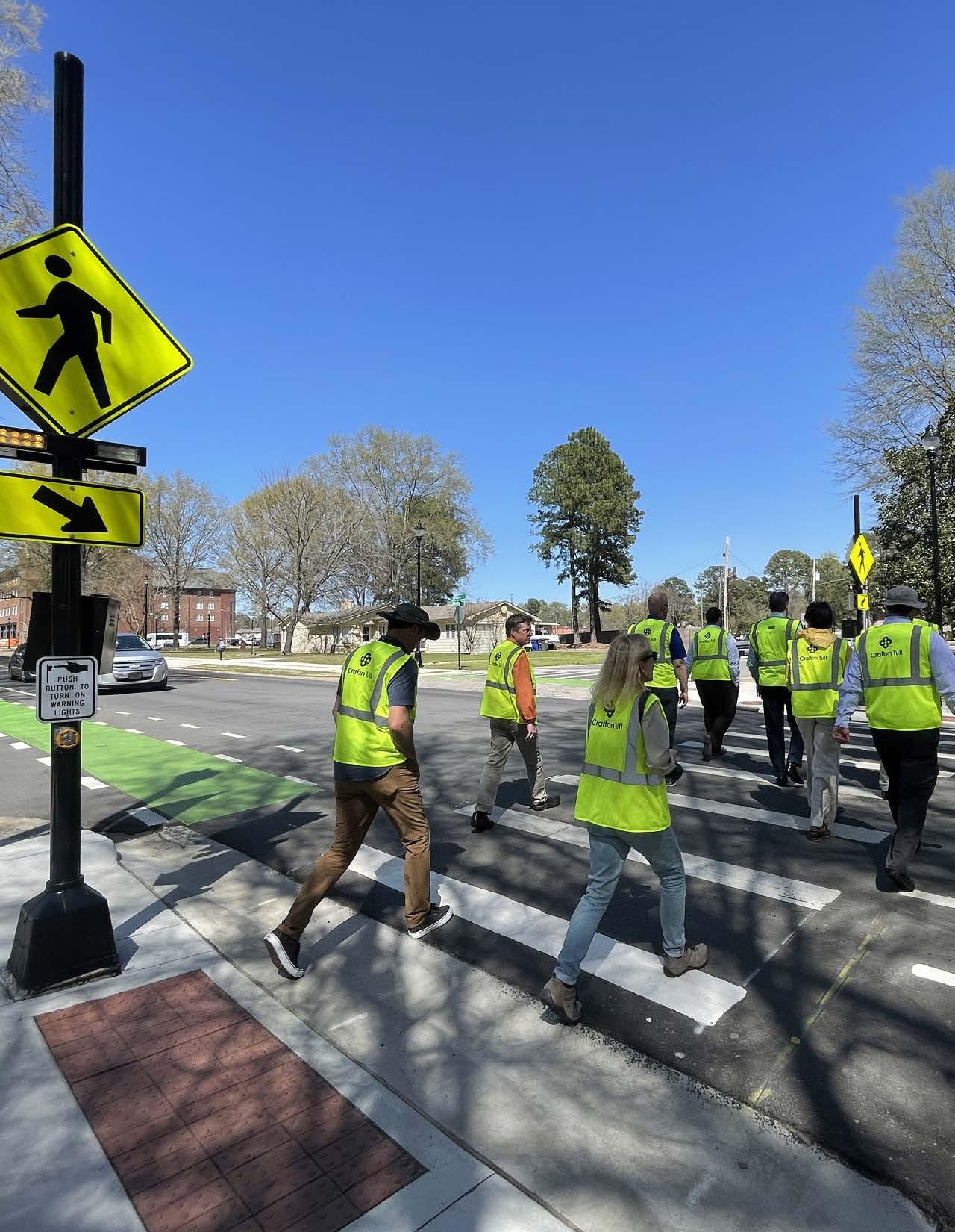
The proposed Regional Greenways System is over 222 miles and includes both proposed and existing trail facilities. The 27 segment packages were scored using the criteria described on pages 193-195. Based on prioritization scores, segment packages were placed into three tiers. While not every project can be in the highest tier, each project is a critical piece of the regional greenway network. Projects in packages that rank lower may be considered in conjunction with adjacent projects as surrounding development or other transportation investments come online. Additionally, while tiers have been established, these designations are for planning purposes and it is understood that there will be “projects of opportunity”; therefore, projects should be implemented when opportunities present themselves.
A map of the corridors and the tiers are displayed in Figure 1. The ten highest scoring project packages are included in Tier 1 (Table 6.3), the next ten project packages are in Tier 2 (Table 6.4), and the remaining seven project packages are in Tier 3 (Table 6.5).
Tier 1 includes projects that scored the highest in the prioritization process (Table 6.3). Project packages in this tier have high connectivity to other trails and destinations along with low maintenance and construction cost, relative to projects listed in the other two tiers. This includes several projects that would close existing gaps and retrofit existing segments of the Arkansas River Trail, Central Beltway, and Northwest Corridors. In most cases these projects have feasible alignments, are highly visible, can generate the most excitement, and increase the public’s support for the expansion of the system.
Tier 2 project packages continue to expand on connecting gaps and making improvements to the current system as well as strengthening the regional system by expanding the implementation of projects in the East, Southwest, and Northeast trail corridors (Table 6.4).
The remaining project packages are grouped into Tier 3 (Table 6.5). This includes implementation of projects to fill in gaps and construct new greenway trails along the Northwest, Northeast, and Southwest Corridors to complete the overall regional greenways system.
The following tables and maps show the project packages and the scores each received compared to other packages within the same trail corridor.
Package 3 (4.6 miles) Bowman Road Shopping Center to Chenal Parkway
Package 1 (5.0 miles) Cantrell Road to Blue Bird Drive
Package 2 (4.4 miles) Blue Bird Drive to Rock Creek Trail
Package 4 (5.5 miles) Big Dam Bridge to Pinnacle Valley Road
Package 5 (5.5 miles) Country Farm Road to Kingfisher Trail
6.9. Central Beltway Corridor Packages
6.10. East Corridor Map
Package 1 (6.1 miles) Arkansas River Trail to I-440
Table 6.11. East Corridor Package
Packages 2 & 3 (19.6 miles) I-440 to Lonoke Rail Trail - signed routes only; not scored
Package 1 (5.4 miles)
Arkansas River Trail to Maumelle Boulevard
Package 2 (5.3 miles)
Maumelle Boulevard to Overstreet Road
Package 3 (5.5 miles)
Overstreet Road to Plantation Drive
Package 4 (5.5 miles)
Plantation Drive to North Main Street
Package 5 (5.5 miles)
North Main Street to Bill Bell Lane
Package 6 (8.9 miles)
Bill Bell Lane to Kinley Drive
6.12. Northwest Corridor Map
Table 6.13. Northwest Corridor Packages
SEGMENT 2 ROUTE UNDER FURTHER STUDY
Package 1 (5.1 miles)
Arkansas River Trail to Kierre Drive
Package 2 (5.3 miles)
undetermined - omitted
Package 3 (5.0 miles)
Powerline Trail (funded) - omitted
Package 4 (5.2 miles)
Silverbrook Drive to Municipal Drive
Package 5 (6.2 miles)
Municipal Drive to Jacksonville City Limit
Package 6 (5.5 miles)
Jacksonville City Limit to Cabot City Limit
Package 7 (4.2 miles)
Cabot City Limit to Downtown Cabot
Package 8 (6.4 miles)
Downtown Cabot to Downtown Ward
* Package 2 has been omitted until a final alignment is determined Package 3 has been funded and therefore not scored, prioritized, or placed into a tier
Table 6.15. Northeast Corridor Packages
Package 1 (9.15 miles)
Arkansas River Trail to Little Fourche Creek
Package 2 (3.63 miles)
Germania to Bauxite City Limits
Package 3 (5.04 miles)
Bauxite City Limits to Word Street/Bauxite Hwy
Package 4 (3.64 miles)
Word Street/Bauxite Hwy to S Market Street
Package 5 (4.13 miles)
Airline Drive/Saline Crossing Regional Park to I-30
Package 6 (7.28 miles) I-30 to Saline County Boundary
Table 6.17. Southwest Corridor Packages
Planning-level cost estimates for bike and pedestrian facilities were calculated on a linear-foot basis using unit pricing and do not include right of way acquisition, substantial grading and drainage, permitting, utility relocations, amenities, or design costs. Proposed grade separated treatments were calculated according to an order of magnitude cost. While outside the scope of determining full engineering designs for each trail crossing, unit prices for crosswalks, Rectangular Rapid Flashing Beacons, and HAWK Signals were assessed. Cost estimates for the Southwest Trail were completed as part of a separate design effort and included for reference herein.
As more time passes between the development of this plan and the implementation of the recommended pathways, these cost estimates will inevitably fluctuate in both predictable and unpredictable ways.
TOTAL ESTIMATE OF PROBABLE COST PER ROUTE
Central Beltway + Big Dam Bridge to Pinnacle Mtn * $24,954,220.81
Northwest * $61,821,774.17
Northeast * $74,810,103.65
Southwest (by others) $74,181,740.22
East * $9,667,812.82
Southeast * $33,122,245.00
GRAND TOTAL $278,557,896.67
* Estimates for these corridors do not include land or right of way acquisition, substantial grading and drainage, permitting, utility relocations, lighting, amenities, or engineering fees.
Tables on the following pages further break down these costs by the overall network as well as by each corridor, within the following subcategories:
Trail Typologies
» Trail
» Boardwalk
» Sidepath
» Cycle Track
» Alley Conversion
» Bicycle Lanes
» Sharrow
» Signed Route
» Existing Trail or Sidepath
» Existing Bike Lanes
Intersection Treatments
» High Visibility Crosswalk
» Rectangular Rapid Flashing Beacon (RRFB) Signal
» HAWK Signal
» Rail Crossing (at grade)
» Box Culvert Tunnel Under Road
» Grade Separated Underpass (Road or Rail Bridge)
» Bike-Ped Bridge Over Road
» Water Crossing: Trail over Culvert
» Water Crossing: Trail over Box Culverts
» Water Crossing: Trail over Precast Span Bridge
» Water Crossing: Trail over Pre-Engineered Bridge
Southwest
Subtotal
$74,181,740.22
Implementing the Central Arkansas Regional Greenways Master Plan and its recommended trail network will not occur as a single project but rather over many years and in various stages. It will be a significant and sustained effort by local governments and agency partners within the region. While the project Steering Committee has been involved in this planning process, implementation will require working with a larger number of local and regional partners, as well as building public support for priority projects.
Key implementation strategies that should be considered moving forward are outlined below.
While Metroplan will continue to have a consistent process for evaluating the merits of projects that apply for funding, it will be important that the results of the Plan inform those decisions for greenway projects. The project tiering presented in the Plan is not a definitive priority list and should not be used as such; rather, project tiers are intended to serve as guidance as to which projects warrant greater consideration. Therefore, Metroplan should develop a methodology within their scoring system that weighs Plan recommendations to allow for nuance based on a project’s designation within the tiers.
Metroplan and member governments should regularly (i.e., at least annually) evaluate the projects included in the Plan to track which projects have been implemented, determine if new projects should be added and prioritized, and make appropriate recalibrations. Over time, ongoing transportation and land use investments may refine the priorities of local governments and the region, resulting in the need to revisit portions of the Plan. Such recalibration is healthy; just as the region is constantly evolving and changing, so should the Plan be a living document.
»
Metroplan and its member governments are leading in active transportation by dedicating funding to advancing the regional greenway network. This has not gone unnoticed in Arkansas and throughout the country. Metroplan and its partners should continue to lead in the dedication of funds to and the develop of a nationally significant regional greenway system. Such leadership will result in increased momentum, recognition, and competitiveness for future federal funding.
Public engagement should be an ongoing part of the implementation process, directed by the CARTS Regional Greenways Steering Committee. Public engagement should make use of resources to elevate the visibility of active transportation and demonstrate the region’s commitment to programmatic and infrastructure solutions. Primarily, future engagement should reflect an equitable process by prioritizing the input and participation of those least likely to be reached through traditional outreach processes and should strive for equitable outcomes by prioritizing infrastructure and programs that meet the needs of people of all ages, abilities, and backgrounds.
Metroplan has developed strong design guidance resources through this Plan and the previously commissioned Multimodal Infrastructure Guidelines. These documents should be formally established as the expected standards for the design of multimodal projects throughout the region. By doing so, the regional greenway system and all connecting multimodal transportation facilities will be implemented in a uniform, consistent manner that will result in a unified, world-class network.
As Central Arkansas moves regional greenway projects forward it will be important to measure the effectiveness of each project. Collaborative benchmarking programs should be established where data is collected and shared among local jurisdictions and regional partners. Collecting and recording bicycle and pedestrian counts along greenways is one such program. This should be done at regular intervals so that usage trends can be understood. Counts will validate the investment that has been made, identify areas of demand, and increase support for future projects. Additionally, ARDOT, Metroplan, and member governments should continue to collect and analyze pedestrian and bicycle crashes, correlating frequency, types, causes, and locations of crashes with appropriate safety countermeasures as greenway implementation continues.
Through the development of the Plan, a number of intersections and interchanges were identified that need improvement to realize the greatest impact from planned greenway improvements. Opportunities for improving these intersections and interchanges may arise outside the confines of the development of the regional greenway system. When intersections and interchanges are slated for vehicular improvements, that is an opportune time to also implement crossing improvements to benefit the future greenway network. Appropriate improvements may include but are not limited to grade separation, signal timing adjustments, pedestrian and/or bicycle signals, pedestrian and/or bicycle crossing markings and signage, ADA curb ramps, refuge islands, and turning radii reductions. The design guidance included in the Plan and the Multimodal Infrastructure Guidelines can serve as a ready reference for such projects.
Whenever possible, recommendations in the Plan should be incorporated into other capital projects to leverage available funding. By making greenway investments as part of roadway, bridge, utility, civic, and park projects, more efficient costs can be achieved through economies of scale. By considering active transportation as an essential part of the community, the decision to include greenways in larger initiatives becomes business as usual.
Metroplan should continue to review alignments as new projects are developed and brought online and as new opportunities or barriers are discovered. Alignment refinements may be necessary during the design and engineering phases for route segments indicated in this document.
While city or county government may provide funds from annual budgets or by way of grants, many partners enhance the development of the Central Arkansas Regional Greenways. Cities must coordinate their bike and pedestrian plans to connect between communities. Large-scale greenway projects stretching further than just one or two miles point inevitably to another jurisdiction, whether the county or an adjacent city. Along the way, barriers may be traversed with the help of partners. Finally, various state agencies with connections to established railroad companies, the U.S. Army Corps of Engineers, or other experts on difficult concerns throughout the greenway network are vital partners. The following regional partnerships may be advantageous to provide information, physical resources, or administrative benefits.
County government and municipalities offer staffing services such as developing grant proposals, refining routes, contracting with design firms, and remaining informed regarding funding opportunities for trail development. Since these two levels of jurisdiction are recipients of funds by which trails will be constructed, they act as the “fulcrum” to which the wheel of other partnerships connect.
The Arkansas Department of Transportation is the foremost state organization involved with the development of the Central Arkansas Greenways Plan and will remain involved as trail segments apply for and receive funding. It is important that county and municipal governments maintain communication with ArDOT to remain informed of details that affect greenway development. Other state partners offer grants or provide additional resource or partnership opportunities, such as the Arkansas Department of Parks, Heritage, and Tourism (including Arkansas State Parks and the Arkansas Natural Heritage Commission), the Arkansas Department of Health, UAMS, and the Arkansas Game & Fish Commission.
Chambers of commerce house as many as ten or more organizations under their umbrella: advertising and promotion, economic development, and engagement with the business community. Maintaining good relationships with the Chamber can assist in building consensus and support within the business community.
Utility easements are the primary resources that can be provided by these partners, whether along power, sewer, water, or natural gas lines with documented usage agreements from all parties involved.
Whether universities or early childhood, education institutions near the greenways network are invaluable resources. Establishing walking and biking early on in a child’s life creates a culture of active transportation. Providing safe facilities for everyone is at the core of this plan, and schools have tools to promote active transportation to students. School leadership should be part of every active transportation project near campuses.
» Pulaski County
» Faulkner County
» North Little Rock
» City of Maumelle
» City of Conway
» City of Mayflower
» Arkansas Department of Transportation (ArDOT)
» Conway Development Corporation & Conway Area Chamber of Commerce
» Mayflower Chamber of Commerce
» Maumelle Area Chamber of Commerce
» North Little Rock Chamber of Commerce
» Summit Utilities
» Conway Corporation
» Entergy Arkansas
» Central Arkansas Water
» Mayflower School District
» Conway School District
» Pulaski County Special School District
» University of Central Arkansas
» U.S. Army Corps of Engineers
» Pulaski County
» Saline County
» City of Alexander
» City of Bryant
» City of Benton
» City of Shannon Hills
» Garland County
» City of Hot Springs
» Arkansas Department of Transportation (ArDOT)
» Bryant Chamber of Commerce
» Benton Chamber of Commerce
» Vista Outdoor
» Summit Utilities
» Entergy Arkansas
» Central Arkansas Water
» Bryant School District
» Benton School District
» Pulaski County Special School District
» Pulaski County
» Lonoke County
» City of North Little Rock
» City of Lonoke
» Arkansas Department of Transportation (ArDOT)
» North Little Rock Chamber of Commerce
» Entergy Arkansas
» Central Arkansas Water
» Summit Utilities
» North Little Rock School District
» Pulaski County
» Lonoke County
» City of North Little Rock
» City of Sherwood
» City of Jacksonville
» City of Cabot
» City of Austin
» City of Ward
» Little Rock Air Force Base
» Arkansas Game & Fish Commission
» Arkansas Department of transportation (ArDOT)
» North Little Rock Chamber of Commerce
» Sherwood Chamber of Commerce
» Jacksonville Chamber of Commerce
» Cabot Chamber of Commerce
» Entergy Arkansas
» Central Arkansas Water
» Summit Utilities
» North Little Rock School District
» Pulaski County Special School District
» Jacksonville School District
» Cabot Public Schools
» Pulaski County
» City of Little Rock
» Arkansas Department of Transportation (ArDOT)
» Arkansas Department of Parks, Heritage & Tourism
» Little Rock Chamber of Commerce
» Little Rock Convention & Visitors Bureau
» Entergy Arkansas
» Central Arkansas Water
» Little Rock School District
» Pulaski County Special School District
» University of Arkansas for Medical Sciences (UAMS)
» Pulaski County
» City of Little Rock
» City of Wrightsville
» Little Rock Port Authority
» Arkansas Department of Transportation
» US Army Corps of Engineers
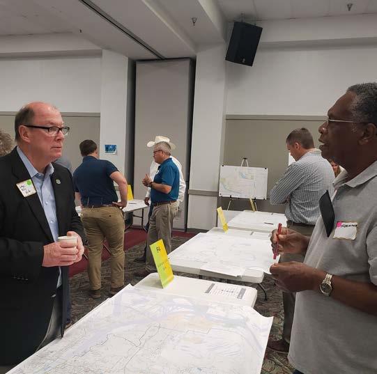
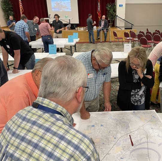
Steering Committee and Workshop Participation
Implementation considerations can generally be divided into two categories: tangible and perceptual. Physical, financial, and legal barriers are all tangible, and oftentimes are resolved through financial agreements. In some areas of the proposed greenway network, the best method of crossing a busy arterial city street is by way of a bike and pedestrian bridge or underpass. This specific crossing at University Avenue navigates the sharp drop from the city-owned property on the east to commercial area on the west side of the busy street. It will require further study, additional funding, and coordination between the City of Little Rock and ArDOT. Legal issues, such as right of way acquisition, property ownership, and liability are also specific issues that require specific solutions.
Perceptual considerations may seem less daunting, but in reality carry equal weight. Whereas tangible considerations can be solved through communication, negotiation, and additional grants and funds, perceptual considerations reside in individuals’ discernment of active transportation. Growing greater support for trails throughout the region and investing in infrastructure to protect bicyclists and pedestrians should be at the forefront of this process. These perceptual considerations can be cultural, administrative, and political in nature, and manifest in various ways.
» Lack of driver and cyclist traffic law understanding
» Hesitant public attitude toward active transportation
» Lack of an adopted bike and pedestrian plan to tie local destinations to regional routes
» Lack of local complete streets ordinances in some communities
» Public knowledge of existing trail locations
» Public understanding of different bicycle and pedestrian infrastructure types and appropriate uses
» Perception that trails promote or increase crime
» Lack of wayfinding to identify existing and potential infrastructure connections
» Identifying methods to increase ownership and support
» The ongoing maintenance of greenways at the local level
» ARDOT, county, and municipal coordination for existing road upgrades or future corridors
» Coordination between county governments, US Army Corps of Engineers, ARDOT, and Union Pacific at the Palarm Creek crossing
» Implementing rural connections between communities
» Defining the greenway connection between North Little Rock and Sherwood
» Securing funding with local government budgets
» Varied support levels from local government
» Rights-of-way and/or access easements acquisition
ARKANSAS RIVER TRAIL
» Some concerns about widening the River Trail to 14’
NORTHWEST CORRIDOR
» Passing underneath I-430 at White Oak Bayou
» Crossing Highway 100 at-grade near Corporate Drive
» Navigating intersection of Palarm Creek, Union Pacific Railroad, and Highway 365
» Navigating topography changes
SOUTHWEST CORRIDOR
» Fourche Creek is difficult to traverse
» Union Pacific Railroad near Fourche Creek complicates trail development
» Lack of railroad right of way ownership
EAST CORRIDOR
» Faulkner Lake Road drainage issues pose physical barrier to cyclists until the road is raised
» Navigating industrial land use and many curb cuts along Washington Avenue in North Little Rock
» Crossing underneath Highway 67/167 in Jacksonville along Redmond Road and rail spur
» Highway 321 crossing over railroad into Cabot will require parallel bike/ped bridge
» Navigating around Jack’s Bayou near Holland Bottoms Wildlife Management Area
» Crossing the railroad along Peyton Street in Ward
» Navigating through large wetland areas
» University Avenue bicycle and pedestrian bridge near War Memorial Golf Course
» I-430 box culvert crossings near I-430/I-630 interchange
» Crossing underneath Kanis along Rock Creek
SOUTHEAST CORRIDOR
» Gathering a match for grants in Wrightsville
» Utilizing levees along the Arkansas River
The overwhelming majority (91%) of Central Arkansas Regional Greenway survey respondents said that separation from traffic would encourage them to use the regional greenway for transportation purposes.
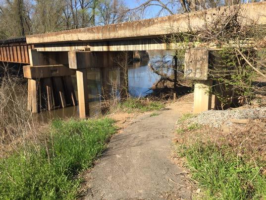
Funding for trails and greenways makes up a small fraction of the construction and maintenance of the overall transportation network. With limited dollars for transportation, a greenway system provides important connectivity for walking, biking, and transit-dependent populations. The provision of both essential and alternative transportation and the health and recreation benefits of trail systems results in a considerably positive effect on the local economies of those communities that make these investments.
Trail systems are a key component to the overall health and viability of a complete transportation network. State and federal officials have provided several funding sources that can be used to enhance and build out a viable regional trail system that can benefit the CARTS region.
Dedicated local funding can strengthen applications for federal and state funding. In addition to local funds, state funding sources can also be leveraged for implementing active transportation infrastructure. The following source is a state-level funding option in Arkansas.
» Outdoor Recreation Grant Program (ORGP)
Administered by the Arkansas Department of Parks, Heritage, and Tourism (ADPHT), the mission of the Outdoor Recreation Grants Program is to promote and improve the management, planning, and overall quality of Arkansas’ outdoor recreation resources. Two different grant programs are offered, Matching Grants and FUN (Facilities for Underdeveloped Neighborhoods) Park Grants. The ORGP has provided $47.2 million in matching grants since 1988 and approximately $11 million in FUN Park Grants since 1991. More than $3.6 million was awarded to projects within 25 counties across the state in 2022. Some of the projects included enhancements such as developing, widening, and resurfacing walking trails, installing a pedestrian bridge, and improving accessibility and lighting.
There are also a variety of federal funding programs that apply to trail projects. Federal funding sources that are pertinent to the CARTS region are summarized in the following sections.
The Bipartisan Infrastructure Law authorizes nearly 70% more money for the Transportation Alternatives Program from $850 million to an average of $1.44 billion per year. These funds include all projects and activities that were previously eligible under TAP, encompassing a variety of smaller-scale transportation projects such as pedestrian and bicycle facilities, recreational trails, safe routes to school projects, community improvements such as historic preservation and vegetation management, and environmental mitigation related to stormwater and habitat connectivity.
A federal share of 80% and a 20% match is required from the eligible project sponsor for projects funded under TAP. The Arkansas Department of Transportation’s (ARDOT) current maximum is $500,000 per award, while Metroplan’s current maximum is $200,000 per award. Costs associated with preliminary engineering, environmental documentation, right-of-way and utility adjustments, and construction inspection will be the responsibility of the eligible sponsor. At ARDOT’s discretion, non-construction phases of large, regionally significant projects may be awarded federal funds.
Administered through Metroplan, the Surface Transportation Block Grant Program (STBG) leverages federal funds to preserve and improve the conditions and performance on any federal-aid highway, bridge, and tunnel projects on any public road, pedestrian and bicycle infrastructure, transit capital projects, and public bus terminals and facilities. The current policy has a focus on projects of regional significance, defined as improvements to major routes that improve access, reduce crash rates, and/or relieve congestion. The STBG is the current, primary funding source for advancement of the Central Arkansas Regional Greenway.
The competitive RAISE program (previously known as TIGER and BUILD) invests in multimodal and multijurisdictional road, rail, transit, and port projects that are typically harder to support through traditional USDOT programs. These competitive grants are intended to make significant investments in projects that achieve national objectives. The Bipartisan Infrastructure Law includes $7.5 billion in supplemental funding over five years for RAISE. In the most recent cycle of RAISE, USDOT awarded nearly $1 billion in infrastructure grants. Projects that were primarily about trails received 19% of the overall funding, and projects that were targeted at making roads safer for vulnerable road users like bicyclists and pedestrians secured another 21% of the funding.
ARDOT administers the FHWA National Recreational Trails Program in the State of Arkansas. The Recreational Trails Program is an annual competitive cost-sharing opportunity that is funded through a portion of TAP funds set aside specifically to construct and maintain non-motorized recreation trails and trail support facilities within the state. The program provides for an 80% federal share and 20% non-federal share for each project, with maximum awards up to $500,000 for trail grants. ARDOT’s main priority in allocating funding is for the construction of new trails and for major maintenance of existing trails. FHWA approves the following as eligible activities for RTP funding:
y new construction
y relocation of existing trails
y major maintenance of existing trails
y bridge purchase and installation
y bridge construction
y interpretive brochures
y trail education materials
y lighting
y landscaping necessary to heal construction damage along paved trails
y bike racks
y trail signs and marking
y trailhead facilities
y restrooms
y bulletin boards
y all-terrain vehicle/dirt-bike loading ramps
y parking areas
y water supply
y drinking fountains
y trash receptacles
The Bipartisan Infrastructure Law established the Carbon Reduction Program. This program provides $6.4 billion through FY 2026 to states and any Metropolitan Planning Organization (MPO) to develop carbon reduction strategies designed to reduce transportation emissions and identify projects and strategies that support these efforts. While ARDOT has two years to develop their strategy, FHWA encourages state DOTs to obligate available CRP funding to projects that support the implementation of their strategies.
y CRP funds can also be used to fund projects designed to reduce carbon dioxide (CO2) emissions from on-road highway sources. Transportation Alternative-eligible projects, including the construction, planning, and design of on- and off- road trail facilities for pedestrians, bicyclists, and other nonmotorized forms of transportation are included as an eligible use of CRP funds.
A discretionary program created by the Bipartisan Infrastructure Law, the Reconnecting Communities Pilot program provides $1 billion in funding through FY 2026 to support planning, capital construction, and technical assistance to restore community connectivity equitably and safely through the removal, retrofit, mitigation, or replacement of certain transportation infrastructure that have created mobility, access, or economic development barriers.
Facilities that are eligible for this program include the removal, retrofit, mitigation, or replacement of highways, roads, streets, or parkways, as well as other transportation facilities such as railroad tracks, that have created barriers to connectivity due to high speeds, grade separations, and other design factors. Regional trail proposals to connect neighborhoods, specifically ones that were historically divided by now obsolete rail lines, could be competitive submissions for this new program.
This program focuses on reestablishing community connectivity and eliminating barriers to mobility, access, or economic development through Planning and Capital Construction grant funding opportunities – each with their own eligibility and applicant requirements – as well as providing technical assistance for eligible applicants. It is anticipated that Planning grant awards will range from $100,000 to $2 million and Capital Construction grant funding will range from $5 million to $100 million.
The Railway-Highway Crossings Program, also referred to as the Section 130 Program, provides funds for the elimination of hazards at railway-highway crossings. The Section 130 Program has been correlated with a significant decrease in fatalities at railway-highway grade crossings. From 2000 to 2019 the most recent data available shows fatalities at these crossings have decreased by 32%. The overall reductions in fatalities come despite an increase in the vehicle miles traveled on roadways and an increase in the passenger and freight traffic on the railways. The program’s annual set-aside for railway-highway crossing improvements was continued through the Infrastructure Investment and Jobs Act (IIJA). The funds are set-aside from the Highway Safety Improvement Program (HSIP) apportionment and are apportioned to states by a formula. Projects funded through this program are awarded a 90% federal share.
The Land and Water Conservation Fund is a federal program supporting the protection of federal public lands and waters. The program works in partnership with federal, state, and local efforts to protect land in national parks, national wildlife refuges, national forests, national trails, and other public lands. Securing public access, developing recreational opportunities, and maintaining ecosystem benefits for local communities are goals of the LWCF. The grant program provides matching grants to state and tribal governments for the acquisition and development of public parks and other outdoor recreation areas and facilities.
Arkansas is included within the EFL Access Program, which was established to improve transportation facilities that provide access to, are adjacent to, or are located within federal lands. The program supplements state and local resources for public roads, transit systems, and other transportation facilities, with an emphasis on high-use recreation sites and economic generators. Funding for the program is provided from the Highway Trust Fund and allocated among the states using a formula based on road mileage, number of bridges, land area, and visitation. In Arkansas, this program is administered through ARDOT. A minimum of 18.45% matching share of the project total is required for this program. With some exceptions, other federal funds may be used as a match. FY 2023-2026 projects have been awarded and the next call for projects is anticipated for Fall 2024.
This new program was authorized in the Bipartisan Infrastructure Law at $200 million annually (subject to appropriations). The program establishes competitive connectivity grants that strategically invest in projects that connect active transportation networks. The goal of the program is to accelerate local and regional plans to create safe and convenient routes to everyday destinations. Eligibility for the program include active transportation projects or a group of projects with a total cost of over $15 million, or total cost of $100,000 for planning and design grants. This program is not yet funded; advocates will be encouraged to engage in efforts to fully fund the program.
There is a wide variety of grants provided by the Centers for Disease Control and Prevention (CDC) that can be used to fund public health programs that advance the agency’s mission to keep Americans safe and healthy where they work, live, and play. In FY 2020, public health programs across the U.S. received nearly $20 billion in grant funding. Local, regional, or state public health departments could assist in navigating the grant application process.
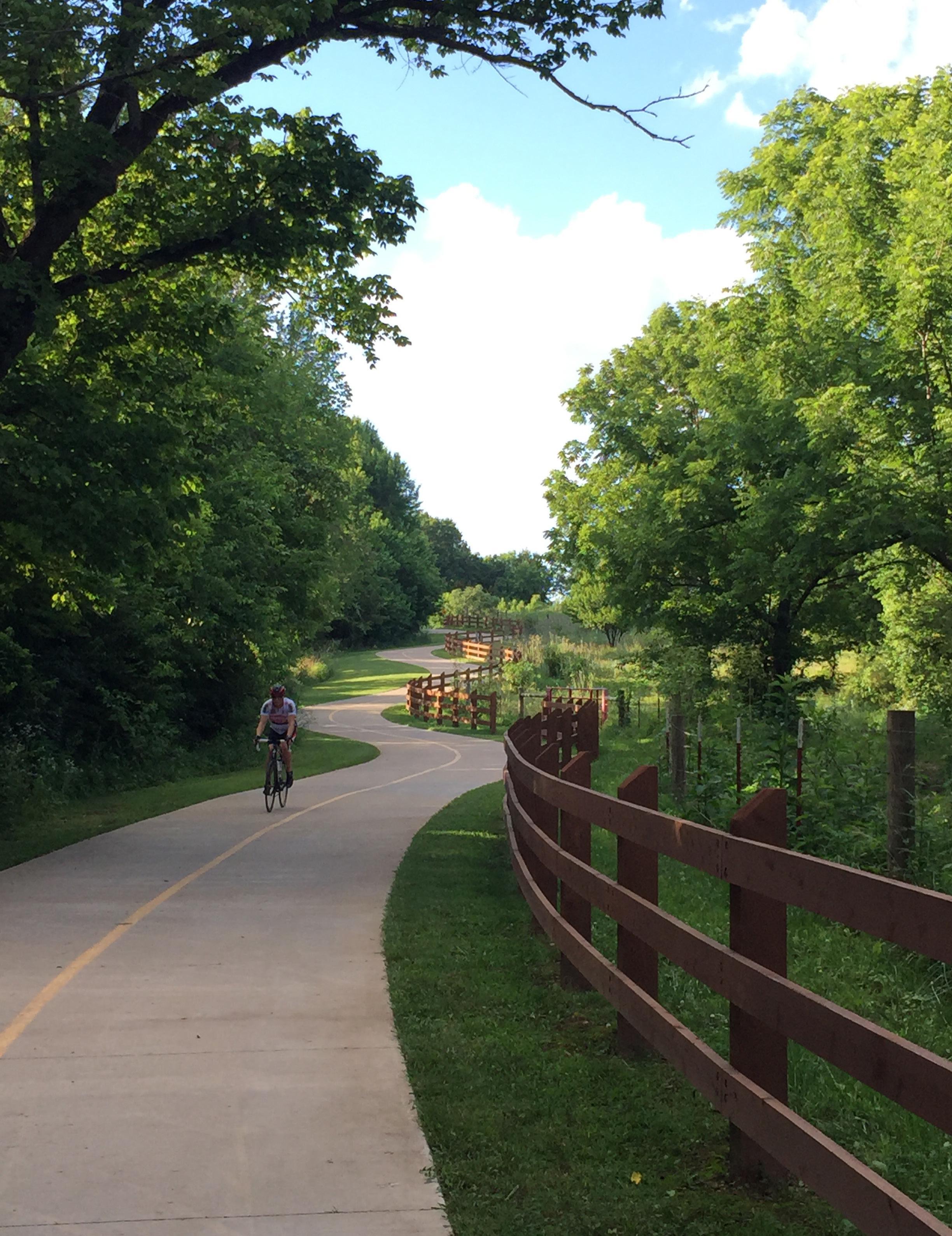
Regional greenway provide numerous benefits to people who live, work, and play in Central Arkansas. While return on investment often refers primarily to economic growth, trails provide a wide range of holistic benefits for businesses, people, and the environment. Trails provide places for physical activity, contribute to a multimodal transportation network, connect people with nature, and spur economic development. Open space corridors preserve the region’s natural environment and provide dedicated space for wildlife and vegetation.
When people and companies decide where to live and do business, they factor in a host of considerations, including health, safety, economics, equity, and the overall quality of life of a community. Conversely, if these considerations see significant decline, people and businesses may choose to relocate to communities that place a higher priority on them.
To provide an initial understanding of the potential benefits of implementing the Central Arkansas Regional Greenway, the following sections showcase why it is important to make public investment in regional trail systems. Case studies of existing trail systems are highlighted that have directly experienced the benefits from investing in regional trails.
Regional trail systems like the Central Arkansas Regional Greenway can result in a positive return on investment in a variety of areas, including:


Trails should be designed for users of all ages and abilities, people walking, bicycle riders, and micromobility users. Multimodal design elements ensure trails in Central Arkansas are easy to use, predictable from community to community, and comfortable for everyone. When planned in cooperation with residents, trail systems can be equitable by connecting communities and highlighting the culture and needs of nearby neighborhoods. No two neighborhoods are the same. By listening to people in each neighborhood, trail systems can advance equity and be a catalyst for implementing anti-displacement strategies, improving equitable transportation access, and meeting unique needs of those who live near the trail.
Milwaukee, Wisconsin’s Beerline Trail broke ground in 2002 along a former railroad right-of-way that routes through the Harambee, a historically disinvested and predominantly Black neighborhood, and Riverwest, an economically thriving neighborhood adjacent to the University of Wisconsin-Milwaukee.1 In 2019, the City of Milwaukee published an Equitable Engagement Plan to ensure that the continued development and maintenance of the trail benefits current residents who lived along the trail.2 Equity is advanced by the Beerline Trail Guiding Lens which is a resident-led group that provides programming and engagement while guiding growth and development decisions for the trail expansion. 3 The trail has since become a unifying hub for arts and culture between the two neighborhoods, as well as a space for people to safely be outside, commute to work, and stay active.4
Source: https://www.beerlinetrailmke.org/art
1 Vasquez-Noriega, C. (2018). A Pathway to Connect Communities: A Case Study of the Beerline Trail Extension in Milwaukee, Wisconsin (p. 33). Urban Institute. https://www.urban.org/sites/default/files/publication/99035/milwaukee_beerline_trail_extension.pdf
2 City of Milwaukee. (2019). The Beerline Trail: Equitable Implementation Plan – Executive Summary. https://city.milwaukee.gov/ ImageLibrary/Groups/cityDCD/planning/plans/Northeast/pdfs/2019-12-16BeerlineTrailEIP-ExecutiveSummary-Print.pdf
3 Beerline Trail. (2022). Guiding Lens | Beerline Trail | Milwaukee. Beerline Trail. https://www.beerlinetrailmke.org/guiding-lens
4 Chapter, from the A. P. A. W. (2020, November 24). Beerline Trail Equitable Implementation Plan Wins Prestigious Spark Award | LISC Milwaukee. Local Initiatives Support Corporation. https://www.lisc.org/milwaukee/regional-stories/beerline-trail-equitableimplementation-plan-wins-prestigious-spark-award-american-planners-association-wisconsin-chapter/
Beerline trail routing between Milwaukee’s Harambee and Riverwest neighborhoods.
Source: Beerline Trail https://www.beerlinetrailmke.org/
Use of creative placemaking to bridge two communities with a community trail. Equity efforts include:
» Linear park
» Connections to adjacent neighborhoods
» Community leadership and programming
» Placemaking and art
» Community-centered redevelopment projects
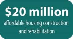
5
» Strengthening of neighborhood people power
» Bridging of communities
» Improved community safety and wellbeing along the trail and in adjacent neighborhoods
» Increased use of the trail, programming, and art activation
» New businesses and jobs near the trail
» Additional housing and development that benefits nearby residents
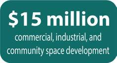
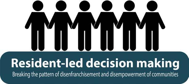

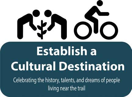
Graphic source: City of Milwaukee. (2019). The Beerline Trail: Equitable Implementation Plan – Executive Summary. https://city. milwaukee.gov/ImageLibrary/Groups/cityDCD/planning/plans/Northeast/pdfs/2019-12-16BeerlineTrailEIP-ExecutiveSummaryPrint.pdf
5 City of Milwaukee. (2019). The Beerline Trail: Equitable Implementation Plan – Executive Summary. https://city.milwaukee.gov/ ImageLibrary/Groups/cityDCD/planning/plans/Northeast/pdfs/2019-12-16BeerlineTrailEIP-ExecutiveSummary-Print.pdf

Access to trails plays an important role in improving overall health of people in Central Arkansas. The United States Centers for Disease Control and Prevention (CDC) has found that moderate physical activity can substantially improve one’s physical health, mental health, and quality of life.6 The CDC also states that efforts to promote physical activity through walking and bicycling should include access to trails.7 Trails provide inexpensive opportunities for active lifestyles by dedicating space for people to walk, wheel, jog, and bike to work, school, errands, and for recreation. These activities help improve heart health and lower levels of obesity, Type 2 diabetes, and cancer.
Trails also offer access to nature where people can relax and recharge. According to the United States Department of Health and Human Services, walking and bicycling reduces depression and anxiety and improves cognitive function and quality of sleep. 8,9
The Razorback Regional Greenway located in Northwest Arkansas connects communities through 37.5 miles of shared use trails. Planning for the greenway started in 2000 by the Northwest Arkansas Regional Planning Commission and was completed in 2015. In the 2018 BBC Report about the health benefits of bicycling in Northwest Arkansas, they found that the rate of bicycling participation is 11% higher (27%) than the national average (16%). 43% of bicyclists in the area were categorized as “enthusiasts” by riding their bikes more than 35 days of the year. With these high rates of bicycling along the greenways, the region is preventing about 10 deaths per year by protecting against deaths from heart disease and diabetes, both of which are common in sedentary living.10
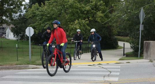
Arkansas.
Source: Toole Design Group
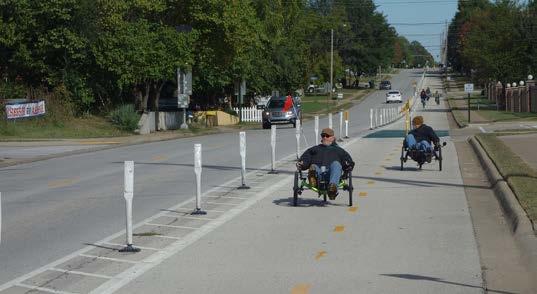
Source: Toole Design Group
6 The Centers for Disease Control and Prevention, Physical Activity and Health: A Report of the Surgeon General, (1999). https://www. cdc.gov/nccdphp/sgr/pdf/execsumm.pdf
7 Greenville Health System, Swamp Rabbit Trail: Year 2 Findings, (2014). https://www.rutherfordcountync.gov/departments/tourism_ development_authority/outdoor_recreation_-_economic_impact_analysis.php
8 Physical Activity Guidelines Advisory Committee Report, 2008, https://health.gov/sites/default/files/2019-10/CommitteeReport_7.pdf
9 American Heart Association, Recommendations for Physical Activity, https://www.heart.org/en/healthy-living/fitness/fitness-basics/ aha-recs-for-physical-activity-in-adults
10 BBC Research & Consulting. (2018). Economic and Health Benefits of Bicycling in Northwest Arkansas (p. 33). Walton Family Foundation & PeopleForBikes. https://8ce82b94a8c4fdc3ea6d-b1d233e3bc3cb10858bea65ff05e18f2.ssl.cf2.rackcdn.com/d0/97/ cf26b21948308adae6828624729a/march-2018-nw-arkansas-final-report-corrected.pdf
Increasing miles of greenways and connectivity between residences, schools, offices, basic amenities, and entertainment.
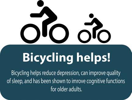
Graphic sources:
» $85 million in health benefits
» $79 million reduced mortality benefits
» $7 million estimated avoided health care costs
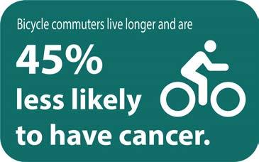
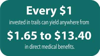
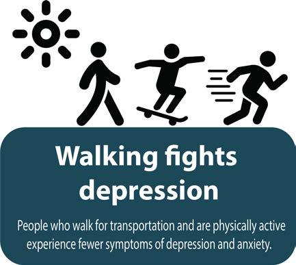
10 deaths prevented & $7Million SOURCE: BBC Research & Consulting. (2018). Economic and Health Benefits of Bicycling in Northwest Arkansas (p. 33). Walton Family Foundation & PeopleForBikes. https://8ce82b94a8c4fdc3ea6d-b1d233e3bc3cb10858bea65ff05e18f2. ssl.cf2.rackcdn.com/d0/97/cf26b21948308adae6828624729a/march-2018-nw-arkansas-final-report-corrected.pdf
Every $1 SOURCE: A Cost-Benefit Analysis of Physical Activity Using Bike/Pedestrian Trails, Health Promotion Practice, https:// conservationtools.org/library_items/1085/files/995
45% less likely SOURCE: Association between active commuting and incident cardiovascular disease, cancer, and mortality: prospective cohort study, BMJ 2017;357:j1456 https://doi.org/10.1136/bmj.j1456
Bicycling helps SOURCE: Physical Activity Guidelines Advisory Committee Report, 2008, https://health.gov/sites/default/files/2019-10/ CommitteeReport_7.pdf
Walking fights depression SOURCE: American Heart Association, Recommendations for Physical Activity, https://www.heart.org/en/ healthy-living/fitness/fitness-basics/aha-recs-for-physical-activity-in-adults
11 BBC Research & Consulting. (2018). Economic and Health Benefits of Bicycling in Northwest Arkansas (p. 33). Walton Family Foundation & PeopleForBikes. https://8ce82b94a8c4fdc3ea6d-b1d233e3bc3cb10858bea65ff05e18f2.ssl.cf2.rackcdn.com/d0/97/ cf26b21948308adae6828624729a/march-2018-nw-arkansas-final-report-corrected.pdf

As a desired community asset, trails connect people to shopping, dining, work, school, and entertainment. Communities often see an increase in property values along trail systems, which benefits property owners, developers, and local government agencies. They also attract businesses to locate near the trail access points and tourists to plan their trip along the trail, spurring economic investment and activity. Trail access near businesses has been shown to increase sales revenue as more people walk and bike along our nation’s trail systems each year. 12, 13
The Swamp Rabbit Trail is a 22-mile rail-to-trail system that connects the cities of Greenville and Travelers Rest as well as Furman University. Winding strategically through Greenville’s downtown, the trail routes people walking, bicycling, and rolling past local downtown business, art galleries, restaurants, and idyllic community parks. The trail is funded by Prisma Health and managed by Greenville CountyRec, the city’s parks, recreation, and tourism department.14 Since the trail opened in 2009, over 500,000 people have enjoyed the trail each year. The economic impact is significant; the Swamp Rabbit Trail generates about $7 million from tourism within Greenville County on a yearly basis.15 Within the first year of the Swamp Rabbit Trail opening, nearby businesses reported increases in sales and revenue ranging from 30% to 85%.16
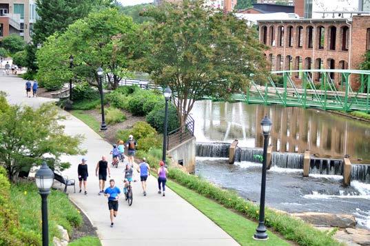
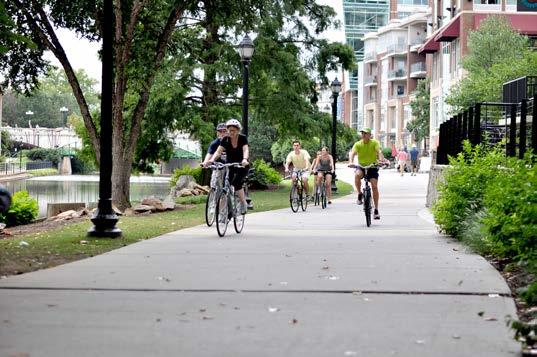
Source: Toole Design Group
Toole Design Group
12 Greenville Health System, Swamp Rabbit Trail: Year 2 Findings, (2014). https://www.rutherfordcountync.gov/departments/tourism_ development_authority/outdoor_recreation_-_economic_impact_analysis.php
13 West Virginia University Health Research Center, Business Impact of Monongalia River Trails System (West Virginia), (2017). https:// www.americantrails.org/images/documents/ BusinessImpact-MonongaliaRiverTrails.pdf
14 Prisma Health Swamp Rabbit Trail. (2022). Greenville County Parks Recreation & Tourism. https://greenvillerec.com/swamprabbit/
15 Prisma Health, Greenville County, Upstate Forever. (2022). Quick history of the GHS Swamp Rabbit Trail. https://drive.google.com/ drive/folders/0B4QPVctUt6DcRmoweFNTYXg3aFU?resourcekey=0-7NRQTGMPTC45iZ4rzd5HgA
16 Reed, J. A. (2011). Greenville Health System Swamp Rabbit Trail: Year 2 Findings. https://cms6.revize.com/revize/rutherfordnc/ document_center/Outdoor%20Recreation%20-%20Economic%20Impact%20Analysis/SRT%20Impact%20Study%20Year%202%20 Final.pdf
Promote active living and transportation to connect people to accessible open space and key destinations throughout the region.17
» Increase in revenue ranging from 30-85% for local businesses
» 5 new businesses opened in the 2nd year because of the trail
» Expect an increase in property values of $1.5 billion 18
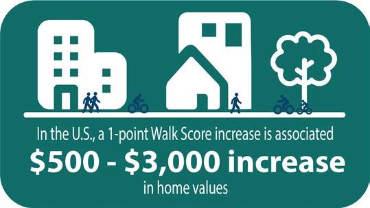
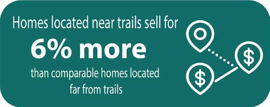
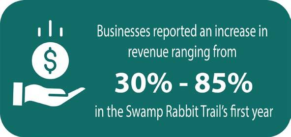
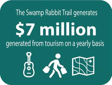
Graphics Sources:
6% more SOURCE: Our Roads Are in Bad Shape... Why Spend Money on Trails?, American Trails, https://www.americantrails.org/ resources/faq-our-roads-are-in-bad-shape-why-spend-money-on-trails
Walk Score SOURCE: Walking the Walk: How Walkability Raises Home Values in U.S. Cities, CEOs for Cities http://blog.walkscore.com/ wp-content/uploads/2009/08/WalkingTheWalk_CEOsforCities.pdf
Business Revenue & Swamp Rabbit generates SOURCE: Reed, J. A. (2011). Greenville Health System Swamp Rabbit Trail: Year 2 Findings.
https://cms6.revize.com/revize/rutherfordnc/document_center/Outdoor%20Recreation%20-%20Economic%20Impact%20Analysis/ SRT%20Impact%20Study%20Year%202%20Final.pdf
17 Reed, J. A. (2011). Greenville Health System Swamp Rabbit Trail: Year 2 Findings. https://cms6.revize.com/revize/rutherfordnc/ document_center/Outdoor%20Recreation%20-%20Economic%20Impact%20Analysis/SRT%20Impact%20Study%20Year%202%20 Final.pdf
18 Agency, C. (2020, December 18). The Swamp Rabbit Trail Extension May Increase the Value of Your Home. The Home Team. https:// hometeaminc.com/the-swamp-rabbit-trail-extension-may-increase-the-value-of-your-home/

Conserving natural resources is an important piece of the legacy that trails and greenways leave for future generations. Open space corridors preserve natural areas in the face of rapid development, protecting habitat for the many animals, insects, and plants that are important and unique to the Central Arkansas region. Open space corridors also improve water and air quality, as they mitigate stormwater runoff, encourage water table recharge, and provide space for trees that reduce carbon dioxide in the atmosphere.
Since 1991, the East Coast Greenway has connected 3,000 miles of walking and bicycling routes from Maine to Florida. The most contiguous stretch of the route is in North Carolina’s Triangle Region, connecting the cities and towns of Durham, Morrisville, Apex, Cary, Raleigh, and Clayton.19 The East Coast Greenway is integrated through the region’s parks and trail systems and, in 2021, was designated as an official North Carolina State Trail within the state parks system.20 By offering alternative active routes throughout the region, people have reduced emissions by walking and bicycling.21 This has resulted in 1.1 million pounds of emissions removed from the Triangle Region’s atmosphere each year.22
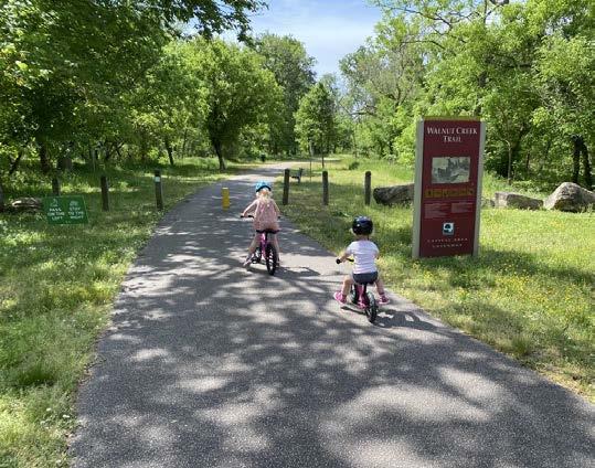
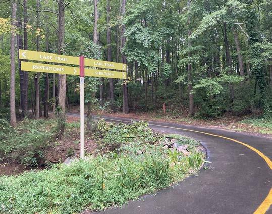
Source: Toole Design Group
Source: Toole Design Group
19 Alta Planning + Design. (2017). The Impact of Greenways in the Triangle: How the East Coast Greenway Benefits the Health and Economy of North Carolina’s Triangle Region (p. 28). East Coast Greenway Alliance. https://altago.com/wp-content/uploads/Healthand-Economic-Benefits-of-East-Coast-Greenway-to-North-Carolina%E2%80%99s-Triangle-Region.pdf
20 East Coast Greenway. (2022, December 6). East Coast Greenway—2023 is Year of the Trail in North Carolina. East Coast Greenway Stories. https://www.greenway.org/stories/2023-is-year-of-the-trail-in-north-carolina
21 Frumkin, H. and Fox, J. “Making Healthy Places: Designing and Building for Health, Well-being, and Sustainability.” New York: Island Press, 2011. Print
22 Alta Planning + Design. (2017). The Impact of Greenways in the Triangle: How the East Coast Greenway Benefits the Health and Economy of North Carolina’s Triangle Region (p. 28). East Coast Greenway Alliance. https://altago.com/wp-content/uploads/Healthand-Economic-Benefits-of-East-Coast-Greenway-to-North-Carolina%E2%80%99s-Triangle-Region.pdf
Connect people to nature through a coastal trail system to strengthen climate resilience, sustainable transportation, community engagement, and active lifestyles.
Benefits 23, 24
» Protected wildlife corridors
» Trails adopted and preserved by state parks
» Increased access to nature and opportunities for people to experience the outdoors and become stewards of the environment
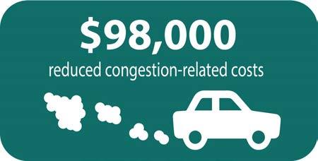
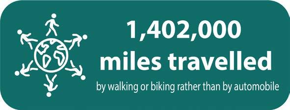
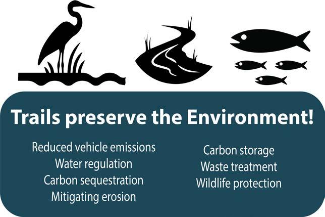
Graphics Source:
Alta Planning + Design. (2017). The Impact of Greenways in the Triangle: How the East Coast Greenway Benefits the Health and Economy of North Carolina’s Triangle Region (p. 28). East Coast Greenway Alliance. https://altago.com/wp-content/uploads/Healthand-Economic-Benefits-of-East-Coast-Greenway-to-North-Carolina%E2%80%99s-Triangle-Region.pdf
23 Alta Planning + Design. (2017). The Impact of Greenways in the Triangle: How the East Coast Greenway Benefits the Health and Economy of North Carolina’s Triangle Region (p. 28). East Coast Greenway Alliance. https://altago.com/wp-content/uploads/Healthand-Economic-Benefits-of-East-Coast-Greenway-to-North-Carolina%E2%80%99s-Triangle-Region.pdf
24 East Coast Greenway. (2022, December 6). East Coast Greenway—2023 is Year of the Trail in North Carolina. East Coast Greenway Stories. https://www.greenway.org/stories/2023-is-year-of-the-trail-in-north-carolina
This page intentionally left blank
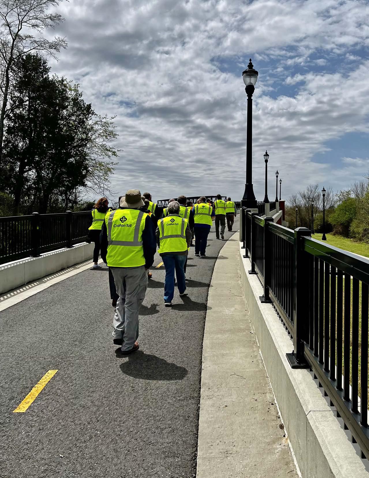
The planning process was directly guided by the steering committee across seven meetings, collectively providing expertise in the areas of planning, transportation, design, recreation, in addition to providing information regarding their respective communities. Centered around two workshops, each consisting of stakeholder and public input, community engagement was an ongoing process throughout the plan that determined the final greenways network.
Steering Committee included the following representatives:
» Judge Barry Hyde
» Jon Honeywell
» Mayor Terry Hartwick
» Charley Hight
» Judge Jeff Arey
» Mayor Tom Farmer
» Mayor Ken Kincade
» Mayor Trae Reed
» James Walden
» Finley Vinson
Pulaski County Judge
City of Little Rock Public Works Director
City of North Little Rock
City of North Little Rock Council Member
Saline County Judge
City of Benton
City of Cabot
City of Lonoke
City of Conway Planning & Development Director
City of Conway Transportation Director
» Charles Frazier / Justin Avery Rock Region Metro
Additional stakeholders from communities within the four-county area were involved in two project workshops. They included the following:
» City of Little Rock
» City of North Little Rock
» City of Maumelle
» City of Mayflower
» Mayflower Chamber of Commerce
» City of Conway
» City of Sherwood
» City of Jacksonville
» City of Cabot
» Cabot Chamber of Commerce
» City of Austin
» City of Ward
» City of Shannon Hills
» City of Haskell
» City of Bryant
» City of Benton
» City of Lonoke
» City of England
» City of Wrightsville
» City of Wooster
» City of Greenbrier
» City of Guy
» City of Vilonia
» Pulaski County
» Faulkner County
» Saline County
» Lonoke County
» Little Rock Port Authority
» Rock Region Metro
» Arkansas Department of Transportation
» Arkansas Department of Parks, Heritage, and Tourism
» Arkansas Game and Fish Commission
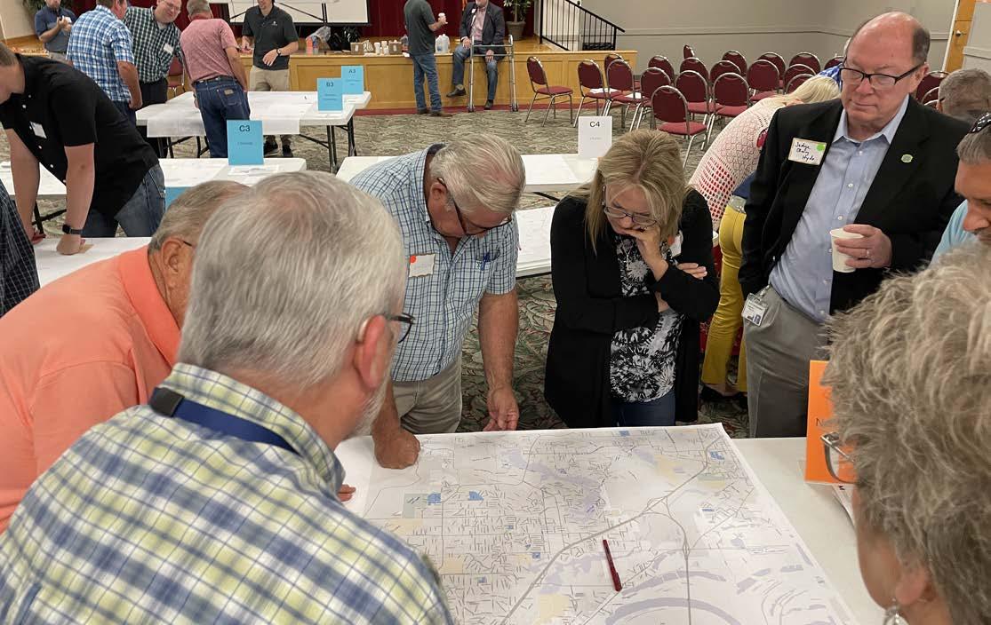
Attendees at the first Stakeholder Working Session
Workshop 1 was dedicated to establishing the vision for the greenways plan. The workshop consisted of a steering committee meeting, stakeholder interviews, and a large stakeholder working session.
The team gathered detailed information regarding local projects, priorities, and implementation considerations as well as connectivity opportunities between jurisdictions. Public sentiment was gathered as the subsequent virtual public meeting. Each type of engagement provided insight to the development of a greenways network.
Sixty-one people were interviewed representing 28 jurisdictions and agencies within the study area. These interviews were focused on understanding local issues including projects in progress, points of interest, opportunities for connectivity, and initial route opportunities. Representatives of communities outside the immediate reach of the five original corridors were also interviewed to collect information for future planning and community sentiment.
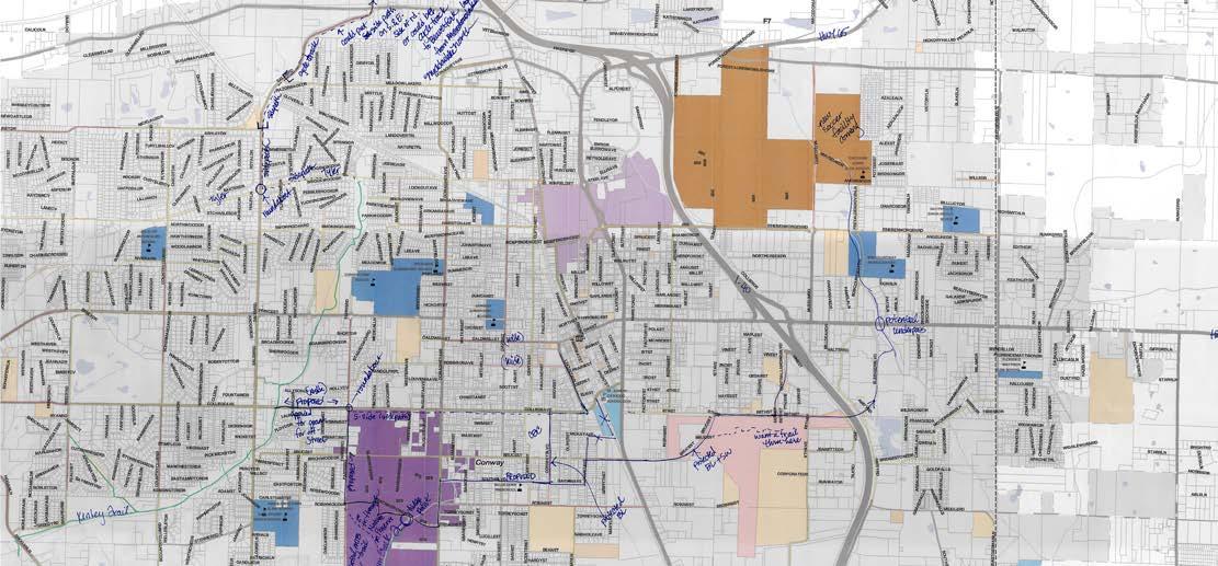
Stakeholder interview notes reflect local projects and priorities
While stakeholder interviews focused on local issues, the stakeholder working session focused on regional connectivity between communities. Five corridor breakout sessions were held simultaneously at the Jacksonville Community Center. Corridor maps were set up throughout the Jacksonville Community center to resemble the geographic layout of Central Arkansas. Attendees of the stakeholder interviews as well as stakeholders unable to attend interviews gathered to discuss opportunities for connectivity from their community to adjacent jurisdictions. 77 people attended the Stakeholder Working Session.
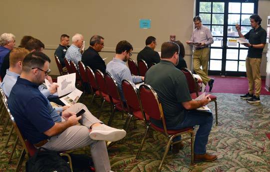
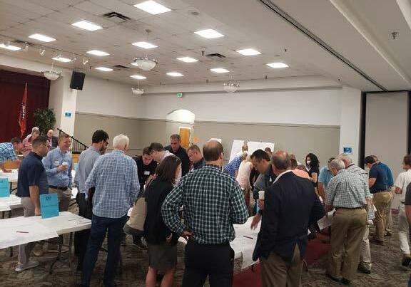
Following the first workshop, a virtual public meeting was held to gather public input on the vision for the regional greenways system.
The 55 attendees were polled on five questions, shown on the following pages. These results informed future greenway use, route selection criteria, amenity preferences (discussed in greater detail during Workshop 2), and network prioritization.
The project survey and first interactive web map were introduced to provide additional opportunities for feedback regarding destinations, route challenges, and potential trail connections. Survey results begin on page 264.
Would you use a regional pathway network for any of the following purposes?
I would not use a regional pathway network 1%
To enjoy the outdoors 20%
For tourism, sightseeing, or visiting destinations 17%
To access transit or a regional transit system 9%
For everyday trips (work, store, food and drink, etc.) 15%
For recreation (non destination-oriented) 21%
To spend time with family or friends 17%
In what activities would you participate on a regional greenway?
Bird watching or enjoying nature 10%
Sitting or people watching 11%
Traveling to work, school, services, or entertainment 14%
Skating, roller blading, or skateboarding 1%
Walking alone or with others 20%
Walking a pet 10%
Jogging or running 11%
Bicycling 23%
What are the four most important factors for determining regional routes, in your opinion? (Select 4)
Comfort: topography, safety, amenities 14%
Character: access unique natural or cultural resources 12%
Access: locate near neighborhoods 17%
Experience: views, shade, ease of navigation 19%
Directness: direct route between destinations 4%
Destinations: connect to goods, services, work, or school 20%
Population: serve populated areas 10%
Feasibility: cost, ease of implementation 4%
What regional pathway amenities are the most important to you? (Select up to 5)
What would encourage you to use regional greenways for transportation purposes? (Select up to 5)
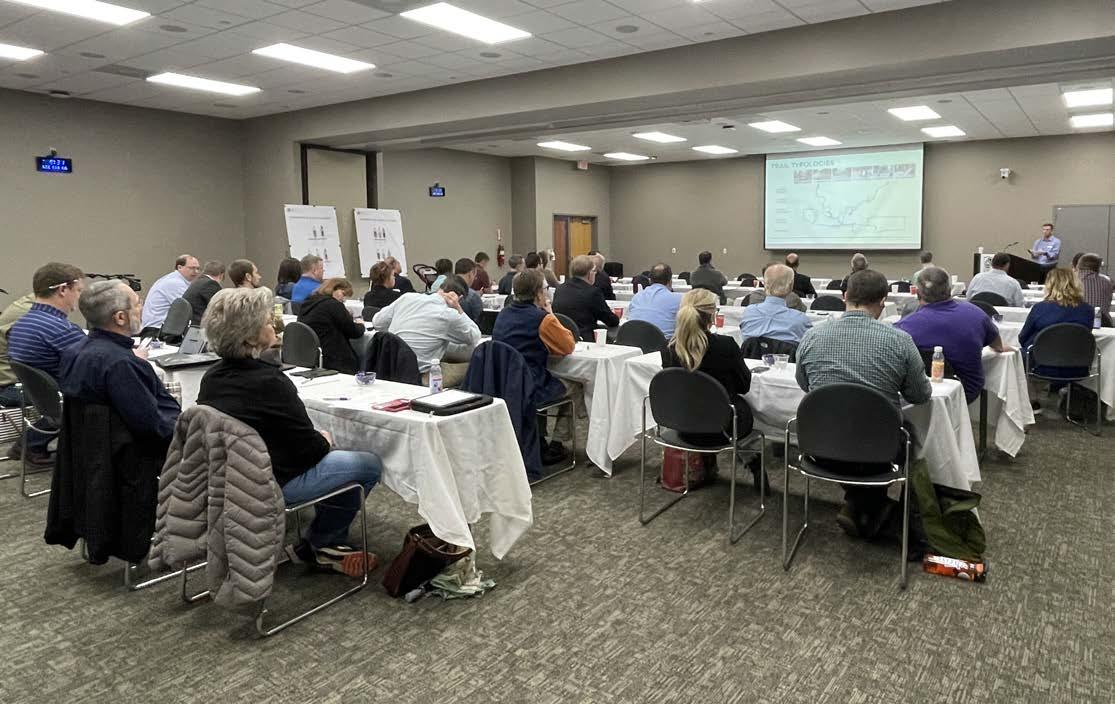
Attendees at the second Stakeholder Working Session
Purpose
Workshop 2 served as an opportunity present the original five corridor routes as well as provide an in-depth presentation on trail design, typologies, and amenities, collect stakeholder feedback, and begin prioritization efforts. The workshop was held in Conway, concluding with an excursion around the community to examine trail design typologies and intersection treatments, including grade-separated, signalized at-grade, and roundabouts.
Jurisdictions within the study area received training on trail typologies and intersections, and the consultant team received feedback on routes as well as typologies and amenities preferences, as depicted on the following pages.
Forty people attended the stakeholder working session in Conway. Following the mini typologies training session, attendees were given the opportunity to investigate spatial considerations for trail users, operating space, and facility widths and were asked to provide input for amenities and typologies preferences.
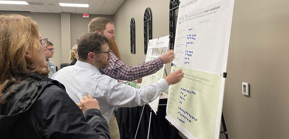
Workshop attendees were divided into two groups to attend walk audits around Conway. Attendees examined and discussed examples of a grade-separated bicycle and pedestrian bridge over a state highway, mid-block crossings, sidepaths in two urban contexts (on a college campus and in downtown), sidepath interface with a roundabout, a grade-separated box culvert underpass, a HAWK signalized trail crossing, and a grade-separated bridge underpass along a drainage corridor. Design opportunities and challenges were discussed at each location, as well as the benefits of each crossing or intersection type. Corridor facility types included trails and sidepaths.
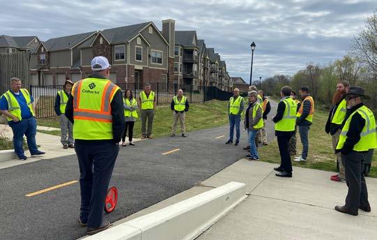
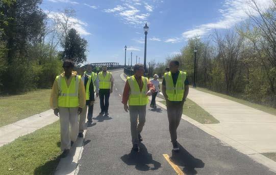
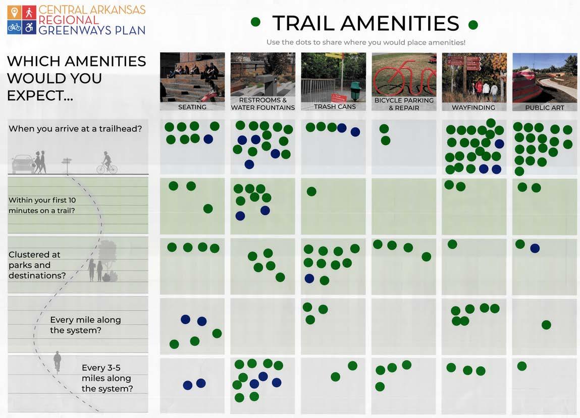
Which amenities would you expect...
When you arrive at a trailhead? Within your first 10 minutes on a trail? Clustered at parks and destinations? Every mile along the system? Every 3-5 miles along the system?
The following tables reflect attendee responses during the second stakeholder working session presentation.
Stakeholder Working Session attendee responses
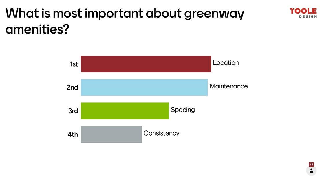
Stakeholder Working Session attendee responses
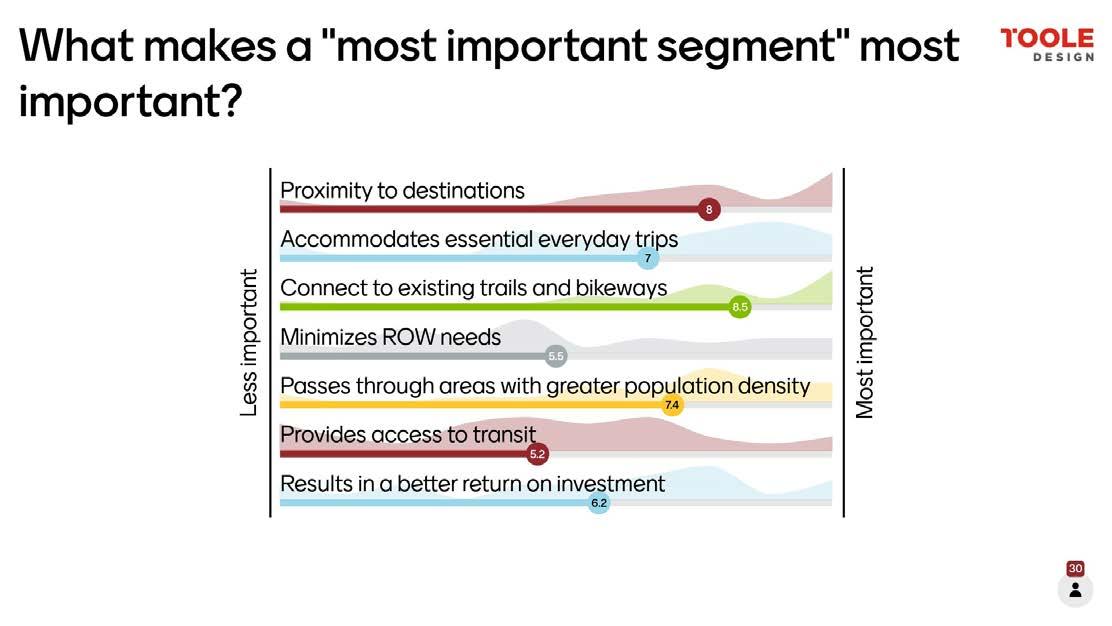
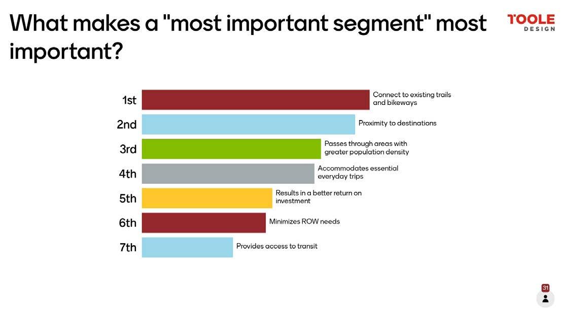
Stakeholder Working Session attendee responses
The second virtual public meeting hosted 84 participants from across the four county area. The draft network was presented, accompanied by considerations for route development, recommended pathway design, implementation strategies, and branding. An update on public input was provided, as well as the results of the 1,001 responses to the user preferences survey, which were accompanied by 818 online mapping survey responses. The second webmap, developed to receive input on the draft greenway corridors, was launched a month prior. It received 146 comments, the majority of which were devoted to the Central Beltway and the Northwest Corridor. Results from the survey begin on page 264. Polling results from the second public meeting are located on the following pages.
How far do you feel comfortable riding a bicycle in a single trip?
Would you ride a bicycle more often for trips within your town, or for trips from one town to another?
Which route would you anticipate utilizing the most?
I would frequently utilize multiple routes 5%
Central (East Little Rock to West Little Rock)
27%
East (Little Rock to Lonoke) 8%
Northeast (Little Rock to Ward) 11%
I would not utilize any of the proposed routes 5%
Southwest (Little Rock to Benton) 22%
Northwest (Little Rock to Conway) 22%
A project overview, the project schedule, and regional greenway alignment considerations and tradeoffs were presented at the first steering committee meeting. The four tradeoffs in route development include population and character, directness and experience, destination and access, and feasibility and comfort, as described on pages 14-15. Branding considerations and priorities for regional pathway design (continuity and seamless transitions at intersections, priority as a transportation mode, coherent pathways amid changing landscapes, and separation from roads) were also presented.
Meeting Outcomes
Survey results from early jurisdiction input were shared: projects in North Little Rock, Pulaski County, Saline County, Shannon Hills, Sherwood, Vilonia, Bryant, Cabot, Conway, Hot Springs Village, Jacksonville, Little Rock, the Little Rock Port Authority, Lonoke, and Maumelle all detailed current bicycle, pedestrian and multi-modal projects. Leadership with the City of Conway shared early preferences on route alignment from North Little Rock to Conway.
Following two days of stakeholder interviews with communities in the study area and the first stakeholder working session affiliated with Workshop 1, the steering committee met to discuss major findings and input gathered. Committee members reported by each of the five original corridors on said findings, providing updates on barriers as well as recommendations and directives.
Meeting Outcomes
The input gathered from Workshop 1 provided the basis for route development for the project. Information provided by representatives from each corridor was assimilated into Geographic Information Systems (GIS) and utilized for determining route alignments. Discussion on the tradeoffs discussed in the first steering committee were revisited, as guidance for route development.
Following workshop 1, route development was conducted for the remainder of 2021, including multiple meetings with each jurisdiction to review and revise proposed route alignments, including major local connectors to the original five regional routes. At the third steering committee, the project team presented the draft network, classifications of bicycle and pedestrian facilities and their appropriateness for regional routes, design typologies, and methodology for route segment prioritization.
Meeting Outcomes
Steering committee members to provided feedback on each preliminary regional route. In addition to route alignment discussion and edits, trail characteristics were also discussed. Comments included including speed limits for bicyclists, appropriateness of trail materials (asphalt vs. concrete), traffic calming techniques, and allowing room for emergency responders. Steering committee members provided prioritization input ranking “Most Important Greenway Segments,” located on the following page.
the
As compared to other segments, results in a good RETURN ON INVESTMENT 3%
Is in close PROXIMITY to a variety of DESTINATIONS
CONNECTS to existing TRAILS or BIKEWAYS
Passes through areas
Steering Committee Meeting 3 attendee responses
The steering committee met for a fourth time in April to finalize the regional routes and discuss considerations to route implementation. In addition to final route alignments, major crossings were discussed, including the I-630/I-430 interchange, White Oak Bayou, Palarm Creek, and the Holland Bottoms Wildlife Management Area.
Meeting Outcomes
Central Beltway
With comments regarding clearance at Bowman, inquiries regarding Capital Avenue and a potential route through UAMS, the Central Beltway was approved by majority vote.
Northwest Corridor
Comments for the Northwest Corridor included implementing a sidepath along Crystal Hill if possible, implementing a boardwalk around White Oak Bayou, and amending the North Little Rock Master Street Plan to include a light at Corporate Drive. The corridor was approved by majority vote.
Northeast Corridor
The Cabot to Ward connection alignment was discussed regarding potential modifications. Pulaski County representatives suggested that routes follow creek corridors in areas of heavy development. The connection between North Little Rock to Sherwood was discussed, with several comments related to directness versus experience and implementation cost. The majority vote approved the corridor, with the caveat that the preferred regional route was amended between North Little Rock and Sherwood.
While the alignment for the Southwest Trail was already underway by others and outside the scope of the project, the major local connections from the corridor into Shannon Hills, Alexander, Benton and Bryant were all discussed. Additional major connectors were proposed, and a regional route spur was proposed from the Southwest Trail to lead into Bryant along Reynolds Road. The corridor was approved by majority vote.
Technical comments included utilizing Washington for the East Corridor. Additional inquiries regarding the status of the abandoned rail right of way from North Little Rock to Lonoke and whether it exists within a rail bank. The Corridor was approved by majority vote
After the steering committee meeting, the routes were presented to the Metroplan Board of Directors for approval to release for public comment.
The steering committee met via Zoom to review and refine proposed corridor segment packages, including refining routes not yet confirmed in Cabot, Austin, and between North Little Rock and Sherwood. The team shared sentiment from the public survey that informed project packaging and prioritization. Steering committee and public input regarding prioritization criteria were presented, and weights for prioritization were determined. Commissioning a hydraulic study of the I-430 underpass through box culverts was discussed.
Meeting Outcomes
Corridor segments (aka project packages) and prioritization methodology were approved by the steering committee, excepting the package between North Little Rock and Sherwood which will be subject to further study.
Corridor segments (aka project packages) and their resulting scores were reviewed and discussed. The placement of each segment/package into Tier 1, Tier 2, or Tier 3 was based on each segment’s score. Network branding was also presented and discussed.
Meeting Outcomes
Steering committee members pointed out that Tier 3 projects could be politically harder if they are located predominantly in rural areas, indicating concerns about filling gaps in isolated areas of Tier 3 projects. Discussion of a bonus point system for projects implemented through partnerships was held with general support.
The steering committee requested time to review the information. Prioritization of the Southwest Trail was not included in this round, and it was requested that unfunded portions of the Southwest Trail within the CARTS study area be prioritized as part of the final presentation and report.
The seventh steering committee meeting detailed route updates along the East Corridor, Southwest Trail, and Southeast Trail. Design typologies as well as project packages and prioritization were reviewed again. Surface material suitability and amenity palettes were presented. Committee feedback on amenities was requested by December 2nd, 2022
Meeting Outcomes
Prioritization, routes, and packages were approved. The team was directed to finalize facility types, design typologies, and amenities, as well as to begin cost estimates.
Would you use a regional pathway network for any of the following purposes? Please select all that apply
To spend time with family or friends
A project survey was developed to gauge greenways interest, use, vision, levels of comfort, and incentives. It was promoted at workshops, virtual public meetings, on the project website (www.centralarkgreenways.com), and in promotional videos and media coverage. It was closed in October 2022 and received 1064 responses. Those responses are summarized on the following pages. For everyday trips (work, store, food and drink, etc.) For recreation (not destinationoriented)
To access transit or a regional transit system For tourism, sightseeing, or visiting destinations To enjoy the outdoors I would not use a regional pathway network
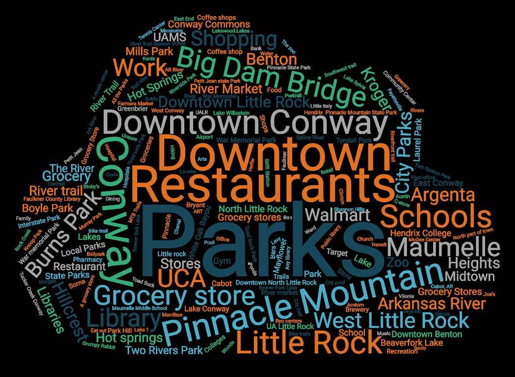
Above: What destinations in YOUR COMMUNITY would you like to access by local or regional pathway?
Below: What destinations in the CENTRAL ARKANSAS REGION would you like to access by local or regional pathway?
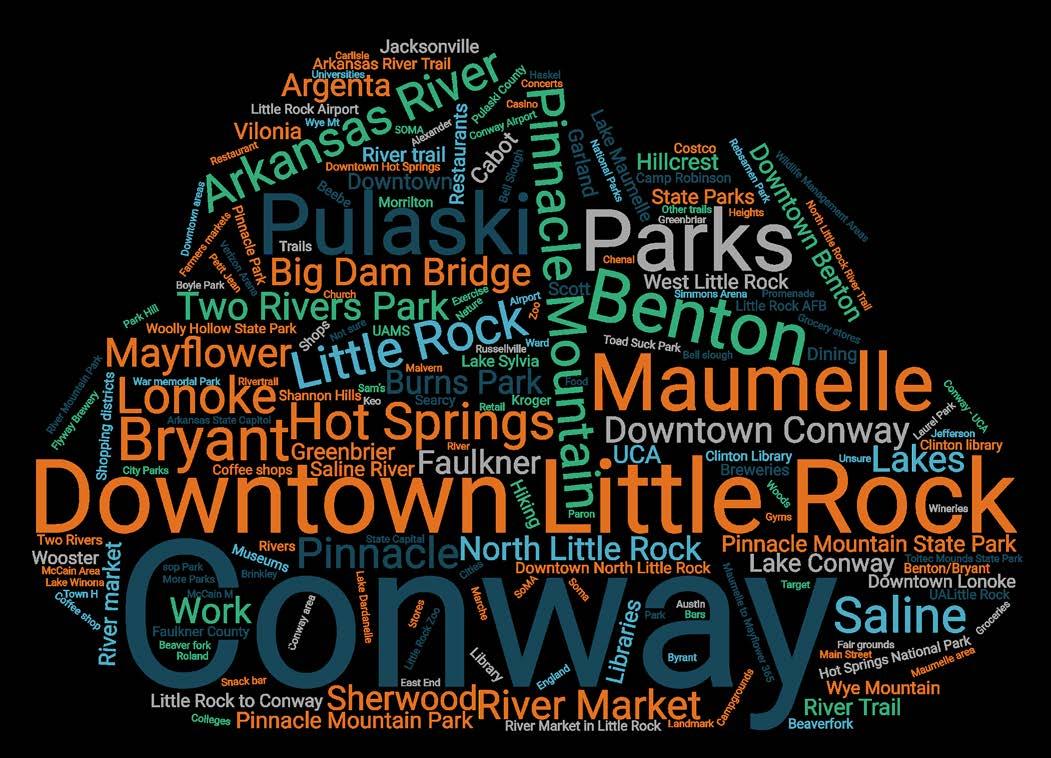
What outcomes would you like to see from a regional pathways network?
No way, no how: I am not capable of riding a bike or choose not to 5%
Interested but concerned: I prefer trails or low - traffic
Strong and fearless: I will ride with traffic and on roads without bicycle lanes 18%
Enthused and confident: I will ride on paved shoulders and in bicycle lanes 28%
More sidewalks, bike lanes, or trails in the community
Better maintenance of sidewalks, bike lanes and trails
More accessible infrastructure (curb ramps, wheelchair access, wider sidewalks, etc.)
Better lighting of sidewalks, trails, and roads
Creation of a bike share program or an affordable place to buy used bikes
More bicycle parking and repair stations
Showers and lockers at school or work
Better signs on trails and routes so I know where to go
Nothing would encourage me to walk or bike more
Other (please specify)
Inadequate lighting
Destinations are too far away
Takes too long
Lack of sidewalks, bike lanes, and trails
Dangerous intersections
Traffic is too dangerous
Weather-related concerns
Inadequate maintenance of streets (example: potholes, dirt/gravel roads etc.) Crime
Harassment
None of the above; I feel safe when biking or walking in my neighborhood
Other (please specify)
Prefer
In which Faulkner County city or town do you live?
Prepared for Metroplan
by Crafton Tull and Toole Design Group