5 minute read
PICTURE THIS: THRU-HIKING THE OREGON COAST TRAIL


by Aimee Frazier
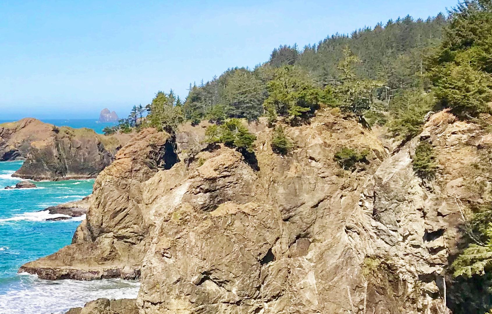
Imagine: you’re a thru-hiker on the Oregon Coast Trail. The sun is out, but the air is cool. Seagulls glide overhead, their familiar caws echoing down the beach. The rhythmic crash of ocean waves rolls in from your right, while to your left, sea grasses in hues of green and wheat dance on a sand dune. A north breeze brushes against your back, tinged with the scent of salt and sea life.
Your hiking boots are snug and laced up to your ankles, short gaiters keeping sand at bay. Your pack hugs your hips, carrying a lightweight tent, sleeping bag, water, tide table, map, and a few soon-to-be well-earned snacks. For the next month, a patchwork of coastal campgrounds and quaint inns will be your home. This is the Oregon Coast Trail (OCT)—a lesserknown gem that stretches the full length of Oregon’s rugged and scenic shoreline.
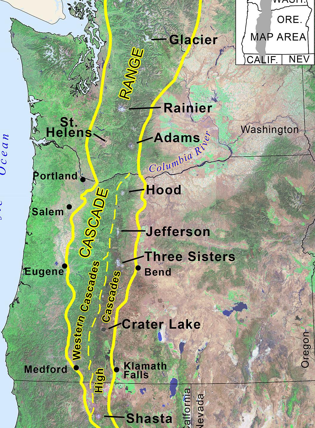
A Trail Less Known
Chances are, if you’ve ever strolled along the Oregon coast, you’ve unknowingly walked a stretch of this trail. Despite its international reputation among thru-hikers, the OCT remains a surprising discovery for many Oregonians. Spanning over 400 miles from the Columbia River to the California border, it weaves through a variety of landscapes—wide-open beaches, mist-laced cliffside forests, charming seaside towns, historic lighthouses, and stretches of highway. It’s a journey that offers the best of both worlds: solitude and civilization, wildness and comfort.
My own relationship with the trail has been forged through day hikes with my kids, backpacking trips with adventureloving friends, and solo explorations along the quieter southern sections. My longest day of backpacking on the OCT? Fifteen miles—motivated less by ambition and more by the realization while setting up camp that I’d left a box of wine in my car in the parking lot many miles back. It was worth doing the hike twice.
Insights from a Trail Expert
To better understand what it’s like to thru-hike the OCT, I sat down with Bonnie Henderson, author of Hiking the Oregon Coast Trail and the trail’s most seasoned voice. Her stories bring the trail to life—flagging down crabbing boats to ferry across bays, rising at dawn to cross rivers at the lowest tides, and even the misadventure of stepping off a boat onto what she thought was shore, only to find herself on a vanishing sandbar (spoiler: she made it out just fine thanks to a second boat rescue).
Unlike the Pacific Crest Trail, with its bustling trail communities and wellworn paths, the OCT is a quieter, more contemplative trek. The hikeable season is short, generally from mid-June through September—due to river crossings that become impassable from fall through spring. As a result, and due to its relatively low foot traffic, OCT hikers often find themselves walking alone, nestled between ocean and town, stitching together nights at public beach sites (where permitted), established campgrounds, and local inns.
Planning Is Essential
Planning ahead is crucial. “This trail is like a puzzle you have to solve,” Bonnie told me. Tides can render key stretches impassable. River mouths and headlands require perfect timing. Apps like NOAA’s tide charts or printed local tide tables are just as essential as your map. River crossings and boat ferries must be coordinated with precision—or you’ll be stuck waiting, or worse, wading (that was a joke—please don’t actually wade across dangerous waters!).
Navigation can be another challenge. Though there is marked signage, it’s easy to miss key turn-offs, especially when transitioning from beach to bluff. Bonnie recommends using the FarOut app, an interactive trail map that helps hikers to track their route. She also pointed out the neon yellow beach access signs you’ll see along the way. “These aren’t mile markers,” she explained. “They’re emergency reference points, but they can be helpful for wayfinding.”
A Choose-Your-Own-Adventure Trail
Even the trail’s mileage is flexible. Depending on whether you opt to ferry across bays or hike around them (where possible), the total distance can range from about 400–425 miles. Some hikers arrange boat rides with locals; others detour inland when needed. Every version of the trail is slightly different—just one of the ways the OCT is more of a choose-yourown-adventure than a rigid route.

And don’t forget your rain gear. “Even in the summer months, it can get soggy,” Bonnie warned. “This is a trail where you really need to do your homework. The tide, camping rules, crossings—they can all make or break your experience. It’s also crucial to walk from north to south to have the north winds at your back and keep the sand out of your eyes.”

Planning Resources & Information
■ Planning Resources
Guidebook: Hiking the Oregon Coast Trail by Bonnie Henderson. Mazama Library call #
Trailkeepers of Oregon OCT overview is the best online resource for trip planning: trailkeepersoforegon.org/oct/
FarOut Guides Interactive Map: faroutguides.com/oregon-coasttrail-map/
Oregon Coast Trail Facebook Group
■ Camping & Lodging Tips
Beach Camping: Permitted in certain areas, primarily on the southern coast. Restrictions apply near state parks, certain cities, and snowy plover nesting zones.

■ Safety & Navigation
Tide Awareness: Some trail sections are only passable at low tide. Always consult tide tables before planning your day’s hike.
Campgrounds: Numerous state parks along the trail offer hiker/ biker campsites.
Inns & Lodges: Many hikers opt for a mix of camping and stays in local accommodations. Advance reservations are recommended during peak season.
Trail Signage: While signage exists, it’s not always consistent. Utilize GPS apps and maps for accurate navigation.
Emergency Markers: Neon yellow beach access signs are used as emergency reference points but are not mile markers.