3 minute read
MAPS


Advertisement
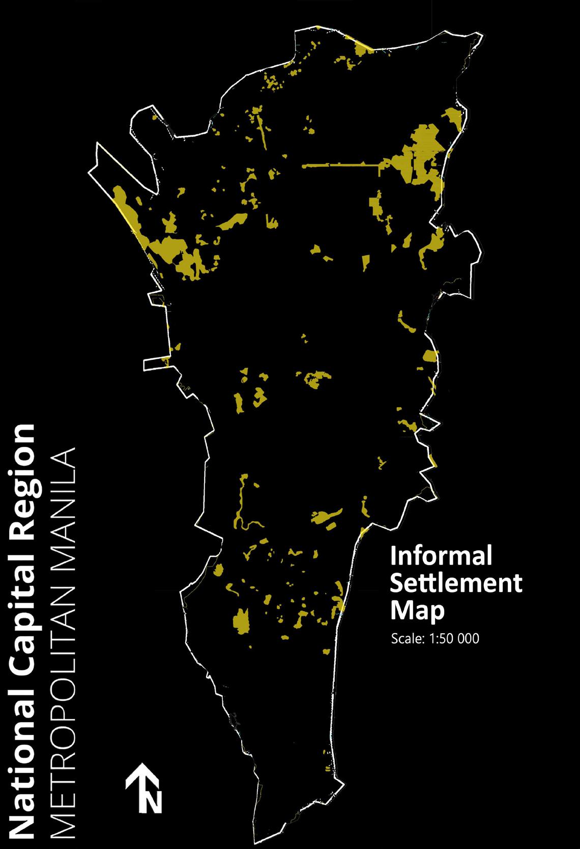
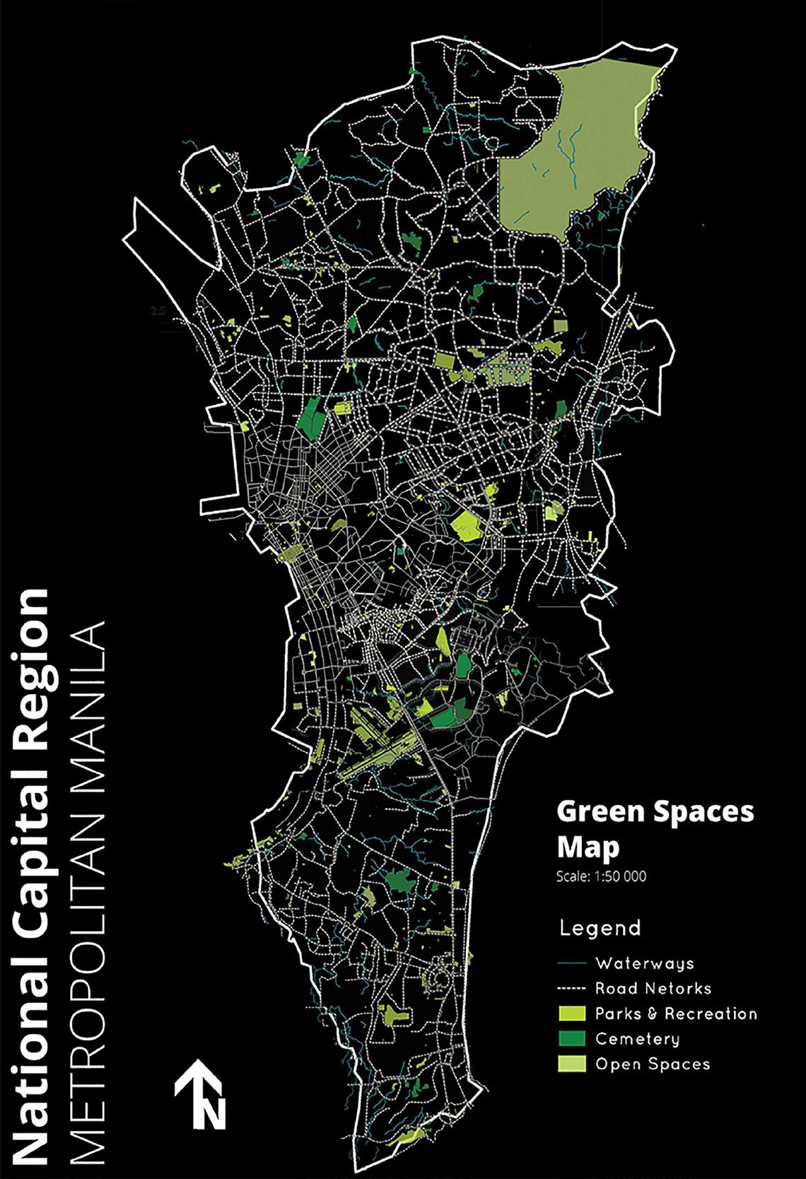
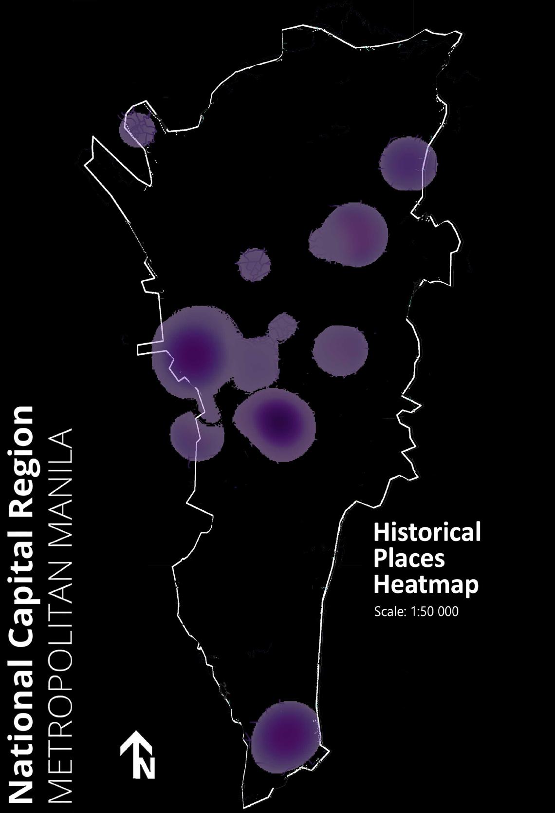
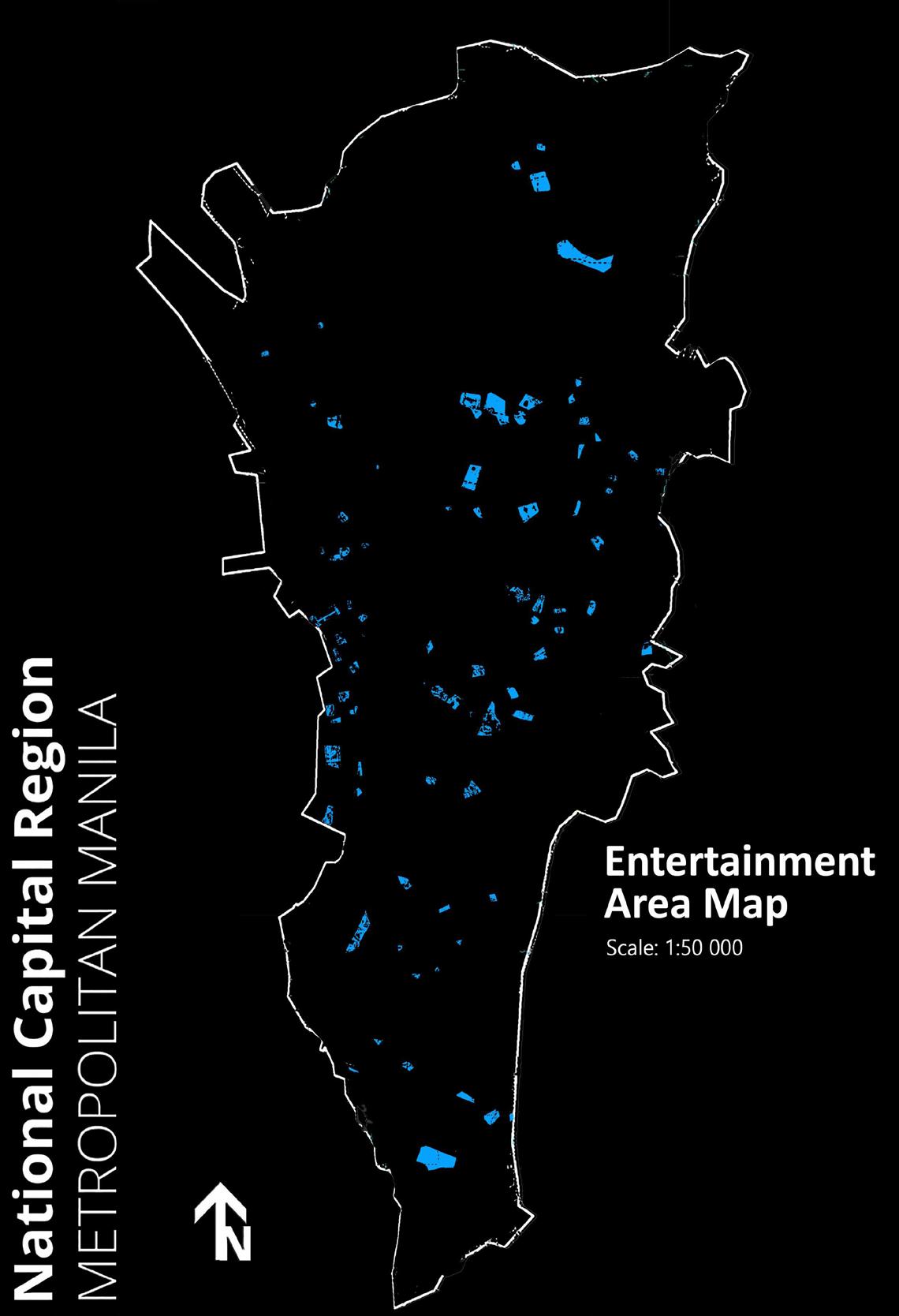
Metro Manila is an interesting megalopolis for urban study. Important data overlayed in a map can present ways for more effective urban planning.
The data used for these maps were extracted from Google Earth and OpenStreet maps. GIS data from Philippine GIS website were then used to compare the current situation of Metro Manila. These were then processed and analyzed using QGIS.
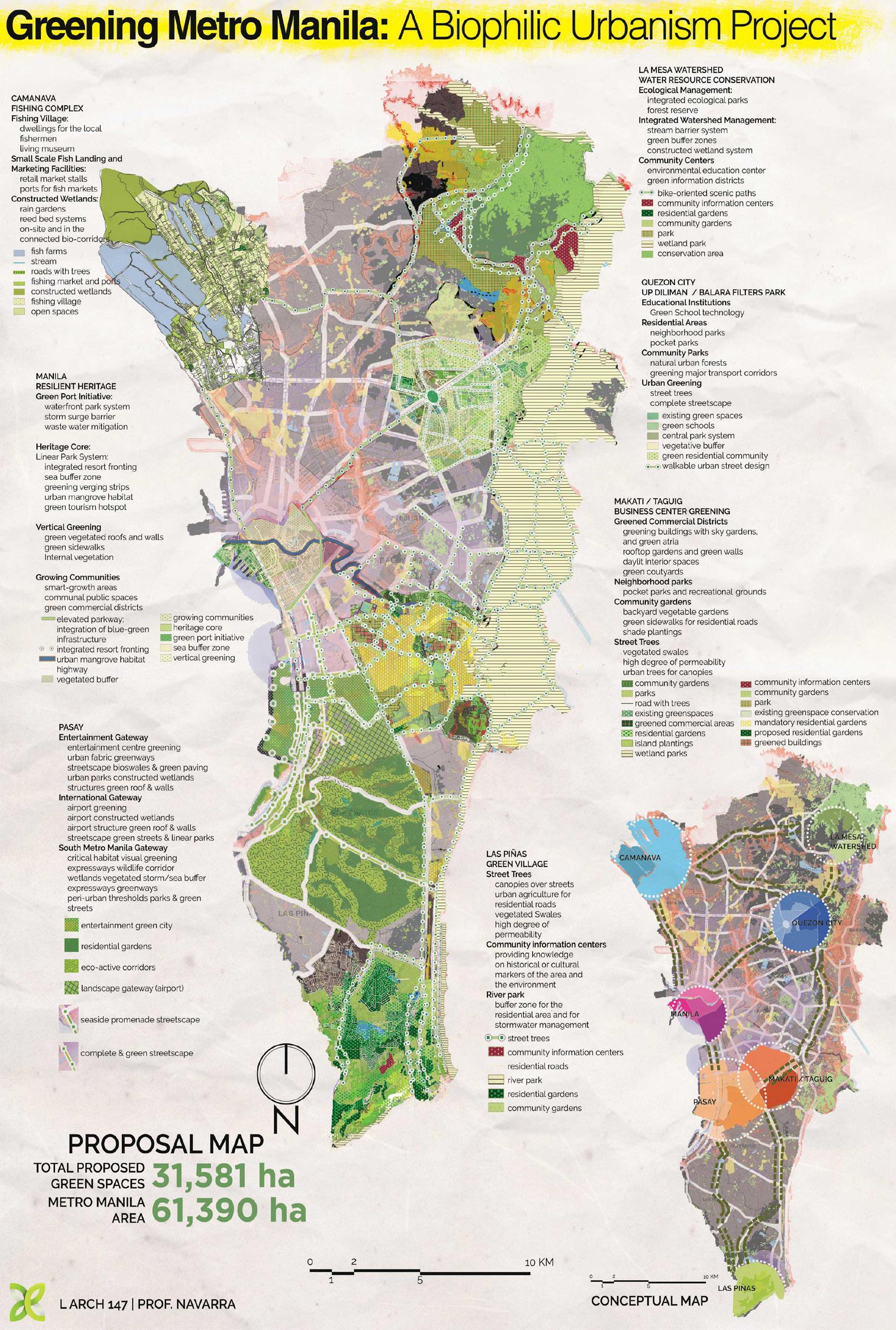
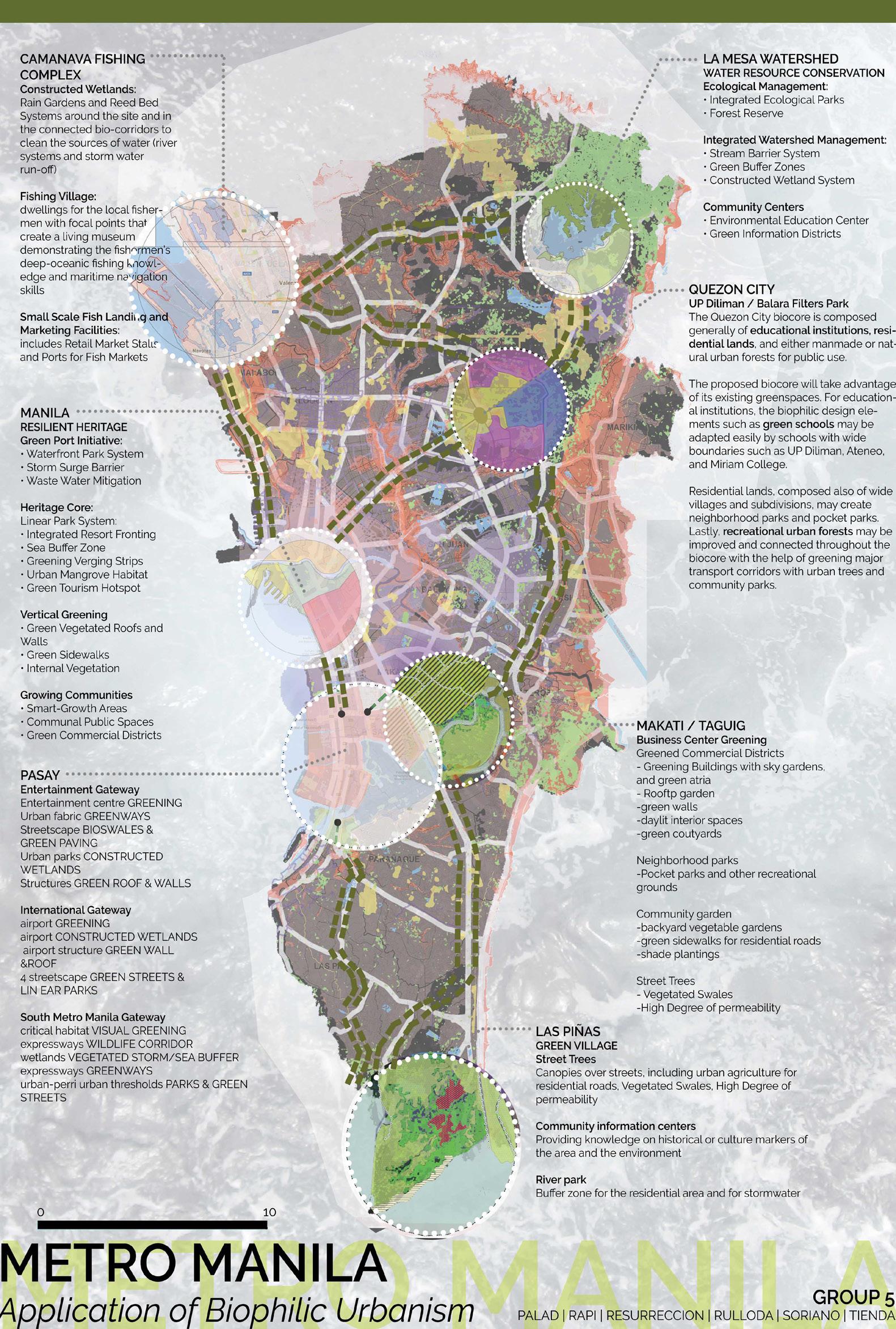
These Metro Manila maps were initially submitted as part of a class project. They were further submitted to the Metropolitan Manila Development Authority for their proposed greening project in the year 2017. The maps were also used in a research paper and co-authored with L.Archt. Nappy Navarra, which was presented in the 2017 Urban Resiliency Forum.
Greening Metro
Manila

Peri-Urban Landscape
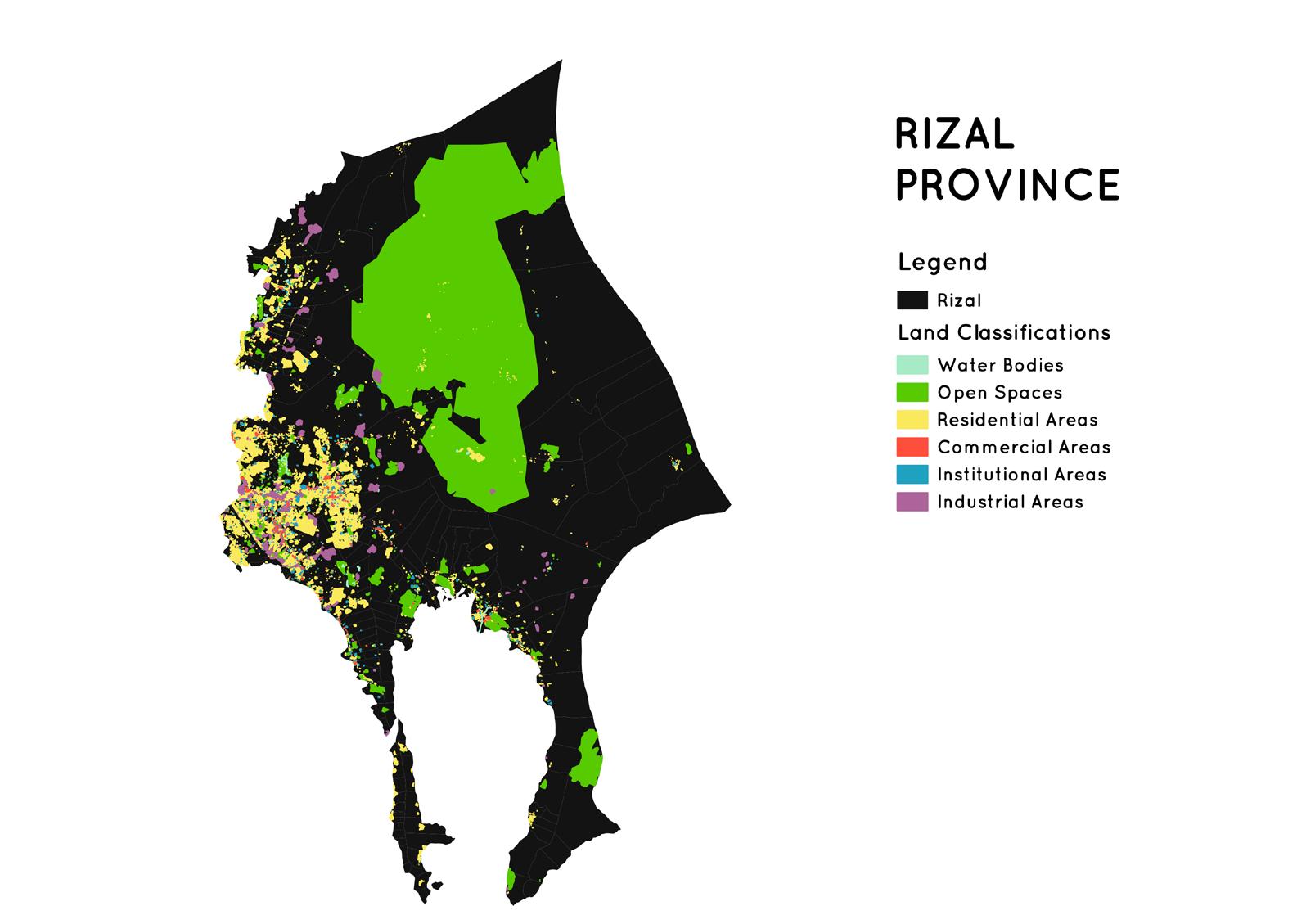
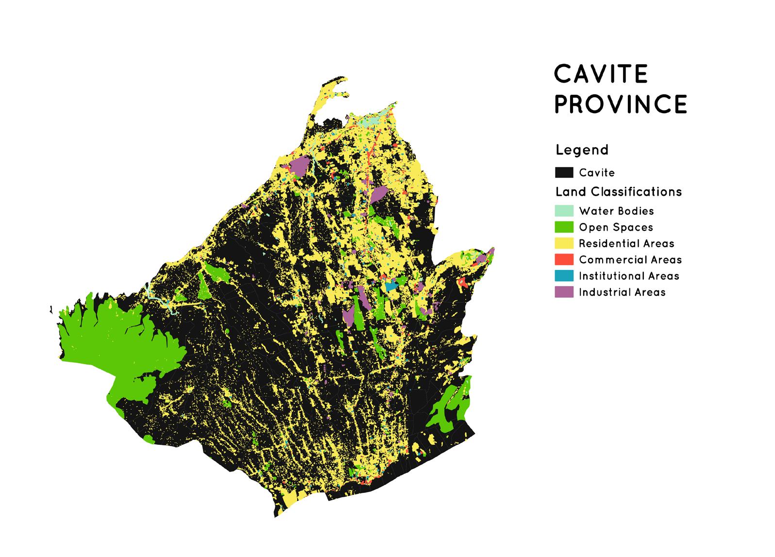
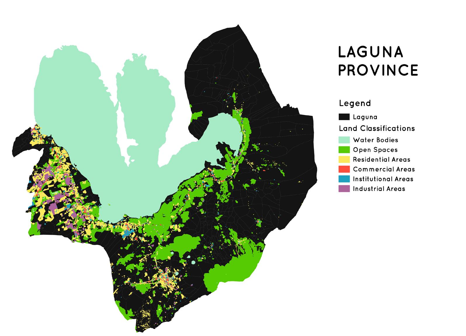
With the growing population in Metro Manila, several studies are being conducted in its adjacent provinces. These adjacent provinces fall under the Peri-Urban Landscapes studied by L.Archt. Desiree Nadal. The data from OpenStreet map and Philippine GIS database were used to create these base maps for her PhD thesis submitted to the University of Edinburgh, London.
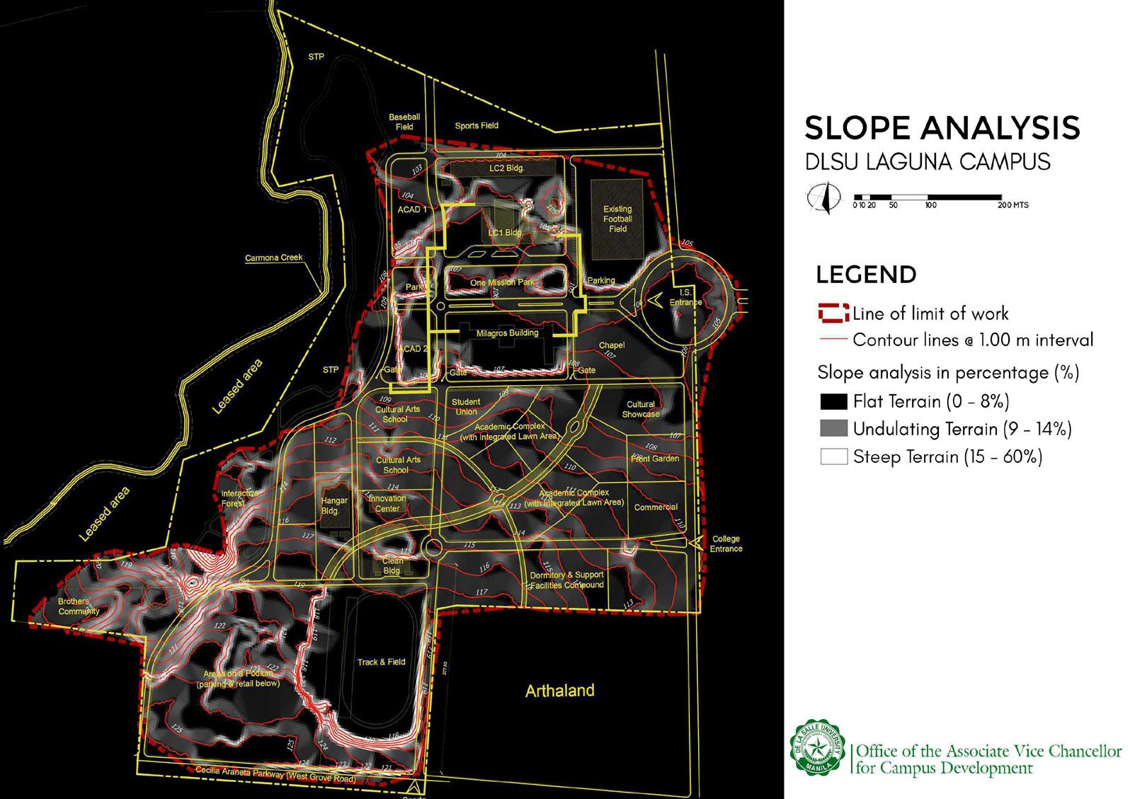
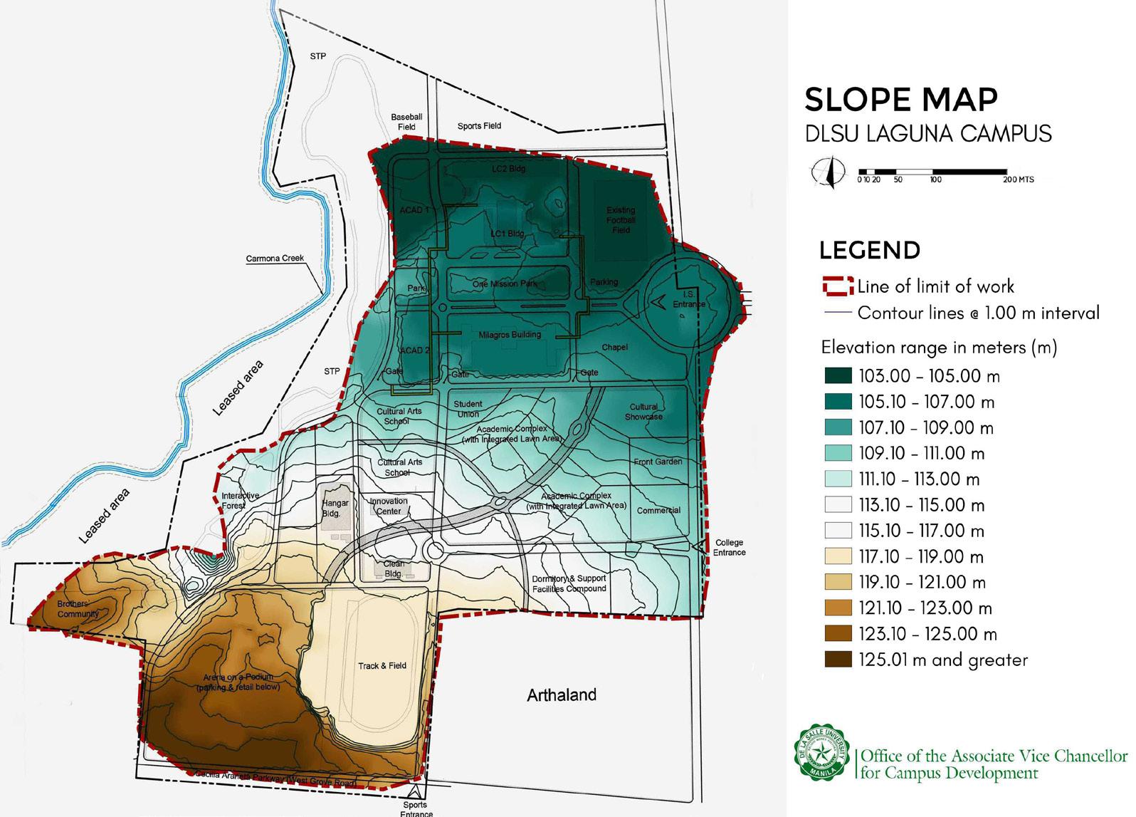
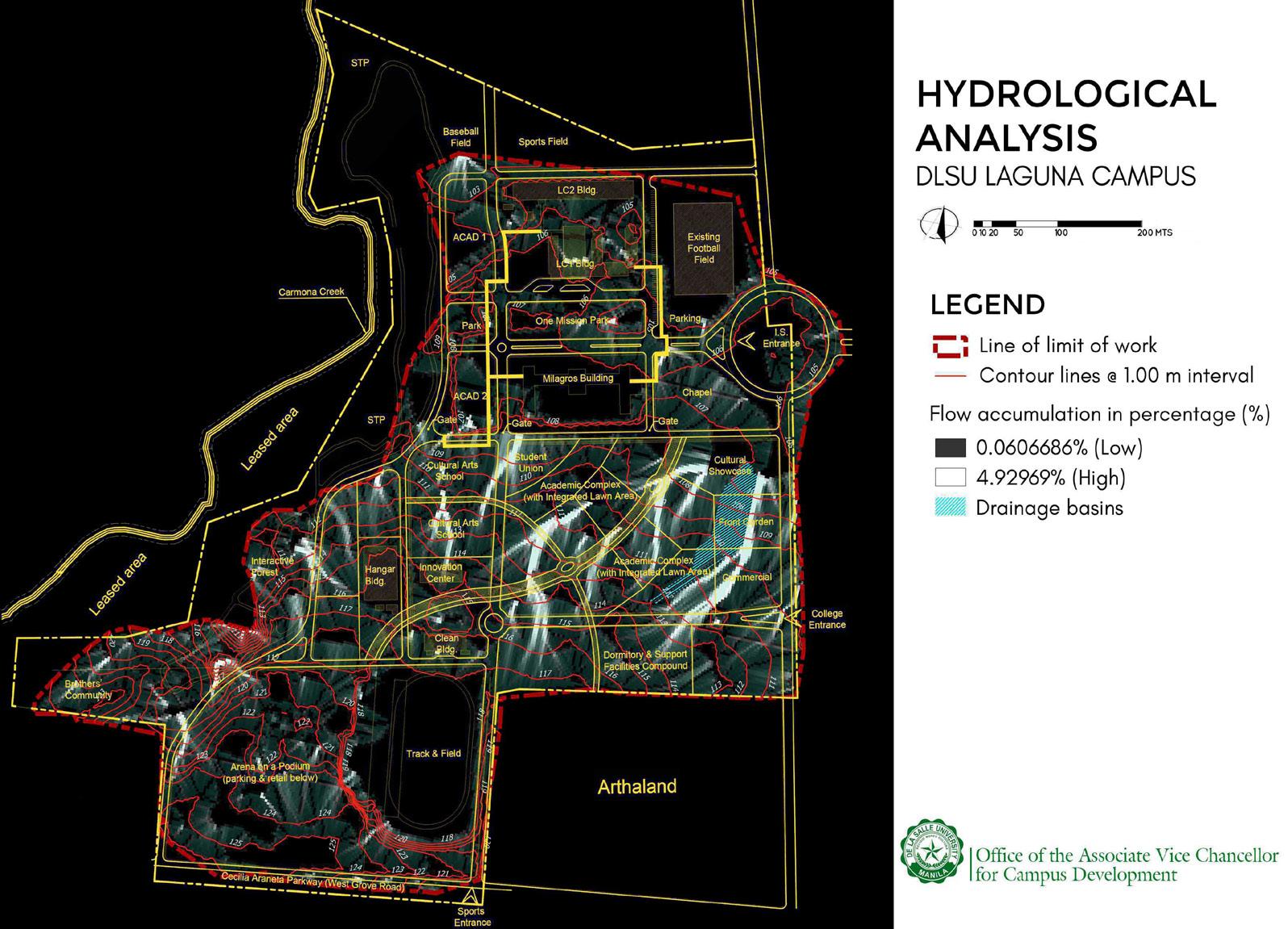
Campus Planning
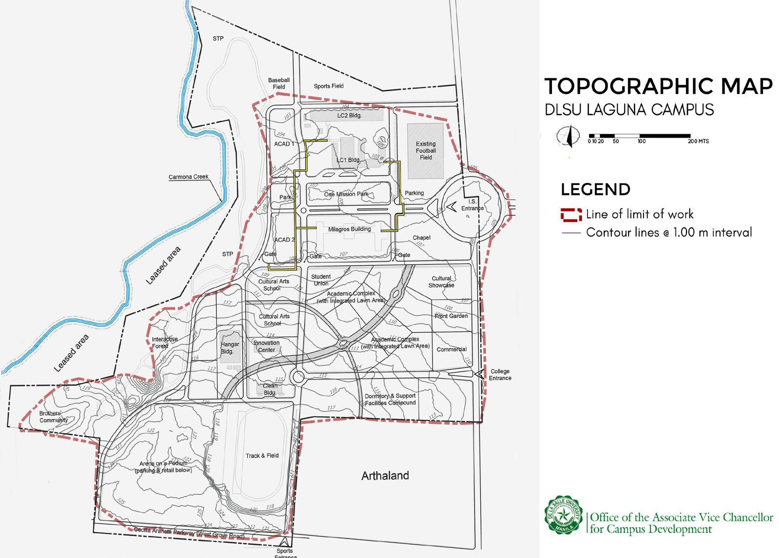
GIS data can be a vital part of a planning project. De La Salle University - Sta Rosa Campus is a new project and is envisioned to be a next-generation university in South Luzon. It is aiming to achieve a BERDE Certification thus the planning of its remaining land is vital to achieving this goal.
These maps were created from integrating CAD drawings to QGIS to come up with analysis maps. These were further used for geological studies and reference for possible build-up areas.
The hydrological analysis of the campus was taken into consideration to maximize the existing terrain. This was also used in planning where to put the botanical garden and rainwater harvesting facility.
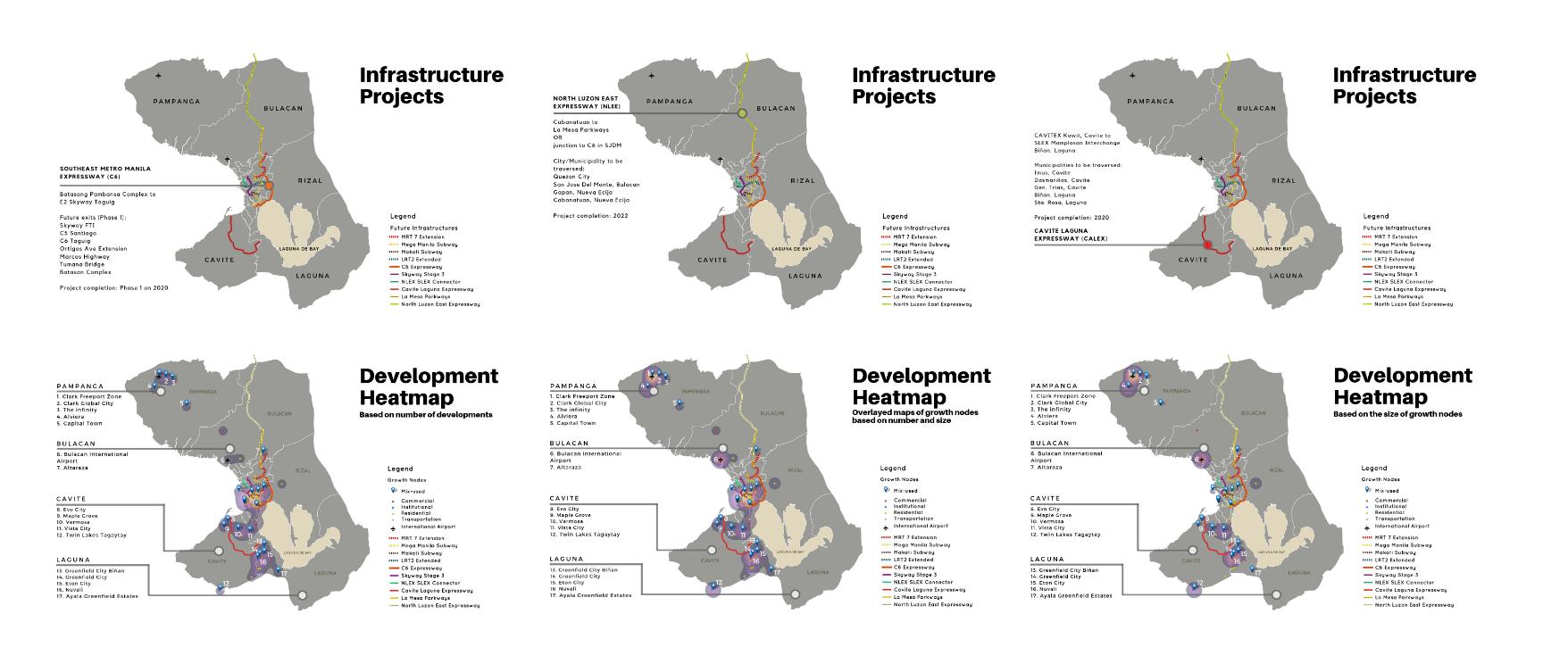
Business development
The real estate industry in the Philippines is consistently thriving through the years. The competition between developers is growing but the land suitable for development is limited.
These maps were part of the expansion strategy of one of the leading real estate developers in the Philippines, Filinvest Land. The 5-year plan will study the locations of future and ongoing infrastructure projects within Mega Manila. That includes provinces of Bulacan, Pampanga, Rizal, Laguna, and Cavite. From this study, a 100% approval rate was given to more than 20 raw land properties targeted to be acquired.

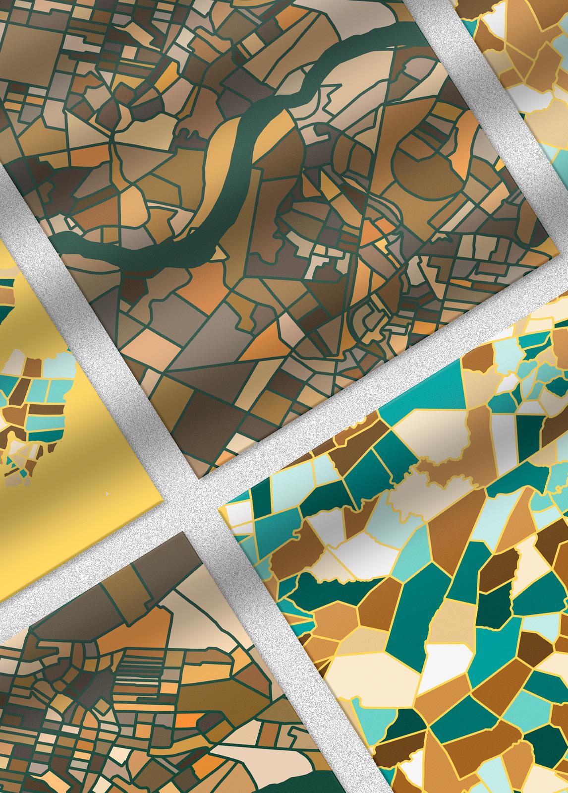
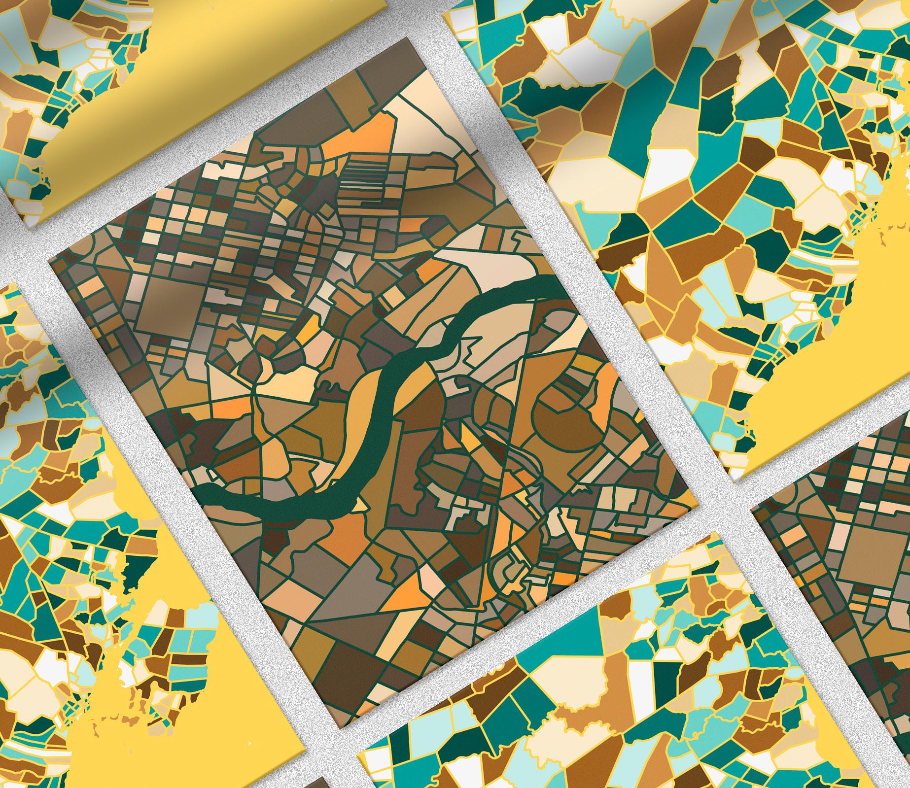
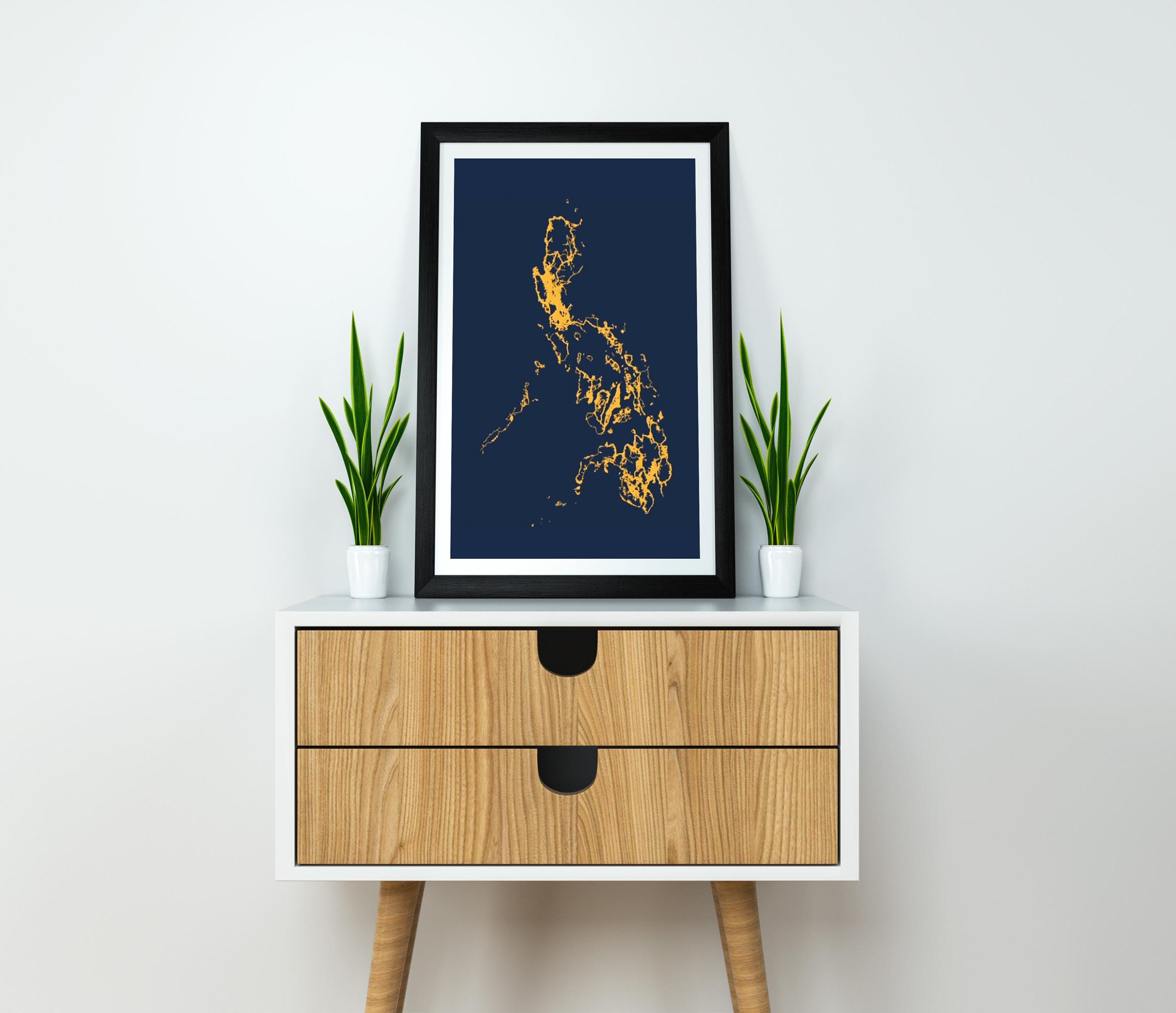
Flip.A.Map
Flip.A.Map is a mapping business wherein maps are aesthetically customized for decorative purposes. This business also caters to maps for research, clothing patterns, and other graphic designs.


LORIEJOY RAPI ljrapi@gmail.com +659 396482677 issuu.com/loriejoyrapi