Wayfinding Strategy
December 2022
This study was funded with a combination of federal planning funds made available through Genesee Transportation Council’s (GTC) Unified Planning Work Program (Task 6312- Livingston County Downtown Wayfinding Master Plan) and a contribution from Livingston County, the project sponsor. The process was guided by an active Steering Committee representing the nine Villages of Livingston County, State Parks and regional organizations. The committee provided valuable input and feedback regarding the Countywide wayfinding system.

Louise Wadsworth
Livingston County Office of Economic Development
Maureen Wheeler Livingston County Office of Economic Development
Barry Briffa Mayor, Village of Leicester
Zac Cracknell
Megan Crowe
Livingston County Highway Department
Livingston County
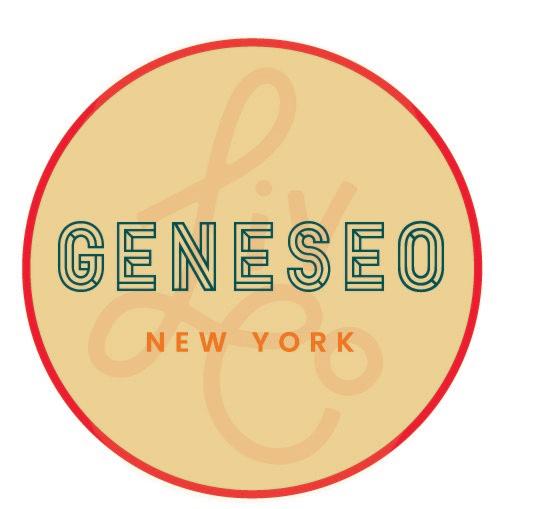
Margaret Duff Mayor, Village of Geneseo
Mike Falk Supervisor, Town of Lima
Dave Fanaro Supervisor, Town of Leicester
Tom Finch New York State Department of Transportation
Rob Hayes Village of Avon
Jason Hunt Village of Caledonia Planning Board
Laura Lane Livingston County Area Chamber of Commerce and Tourism
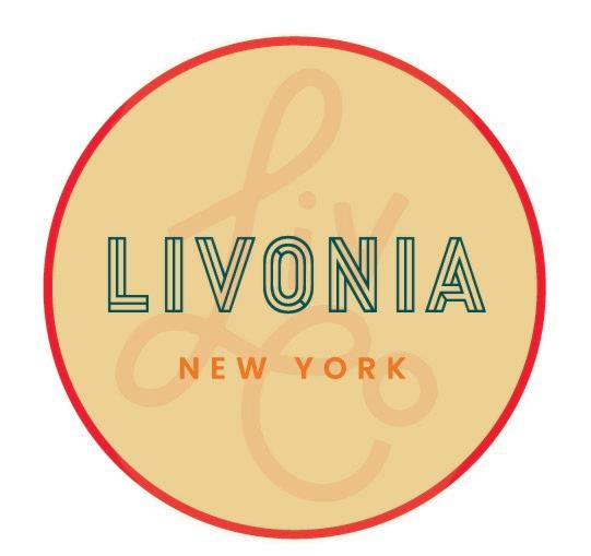
Cal Lathan Mayor, Village of Livonia
Eddie Lee Village of Geneseo
Lora Leon New York State Department of Transportation
Lori Maher Genesee Transportation Council
Nicole Manapol Letchworth Gateway Villages
Jack Morgan Mayor, Village of Nunda
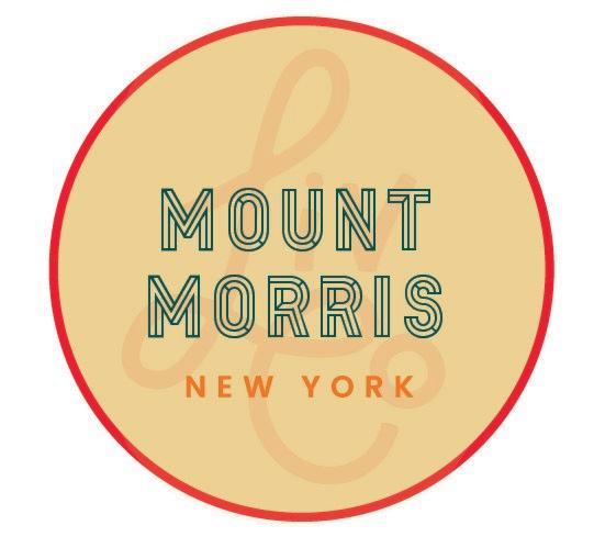
Frank Provo Mayor, Village of Mount Morris
Nina Piccini Letchworth Gateway Villages
Andrew Quinn New York State Department of Transportation
Paul Spitzer New York State Department of Transportation
Kristine Uribe Genesee Valley Greenway State Park
Peter Vogt Mayor, Village of Dansville
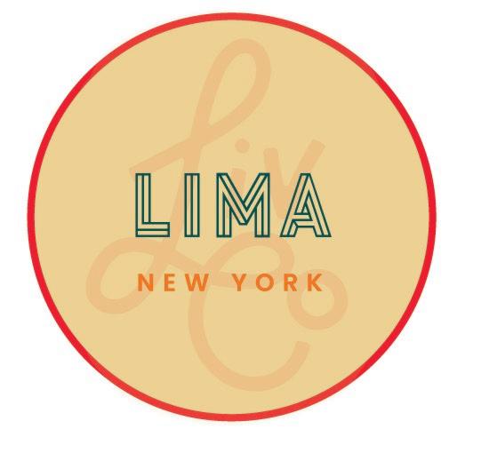
John Wadach Mayor, Village of Lima
Bill White Village of Caledonia
Roy Wood Clerk, Village of Nunda
The Genesee Transportation Council assures that no person shall, on the grounds of race, color national origin, disability, age, gender, or income status, be excluded from participation in, be denied the benefits of, or be otherwise subjected to discrimination under any program or activity. GTC further assures every effort will be made to ensure nondiscrimination in all of its program activities, whether those programs and activities are federally funded or not.
This report was prepared for Livingston County by Bergmann.

Livingston County identified the need to undertake a County-wide Wayfinding Study with the overarching goals of:
Improving navigation throughout the County. Supporting economic development within the County’s downtowns. Visually connecting downtowns and destinations through uniform and consistent signage. Promoting the County’s unique assets and destinations. The design and implementation of a wayfinding system will weave together the nine Villages of Avon, Caledonia, Dansville, Geneseo, Leicester, Lima, Livonia, Mount Morris, and Nunda through a cohesive vehicular and pedestrian signage system, guiding people to Livingston County’s unique destinations and promoting tourism, recreation and economic development.
Aided by a robust public engagement strategy, this study identifies the unique assets and destinations within Livingston County and identifies recommendations for wayfinding signage design and location. Along with the recommendations, phasing plans and cost estimates are provided to assist the County and Villages in obtaining financial resources for implementation. Streetscape recommendations and guidelines are also included with the goal of improving pedestrian safety and navigation for all modes of transportation, and to further help visually connect each Village while creating a strong identity.
Recommendations in this study take into account other regional and local initiatives in the County including the Genesee Valley Greenway State Park signage project, Genesee Valley Trail Town Initiative, Livingston County Commercial District Assessment study and Letchworth Gateway Villages programs to name a few. Synergies between these initiatives and ongoing coordination with each other will help create a robust identity for Livingston County, promoting tourism and economic development for the region.
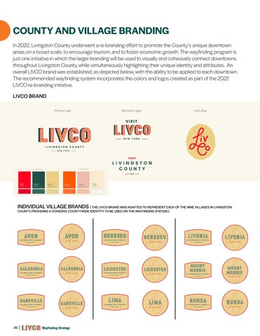
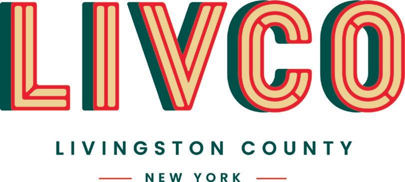
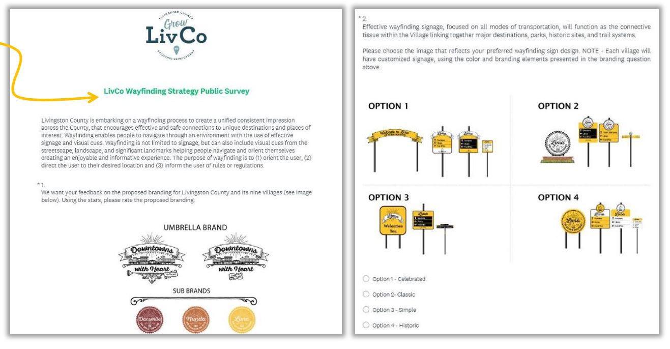
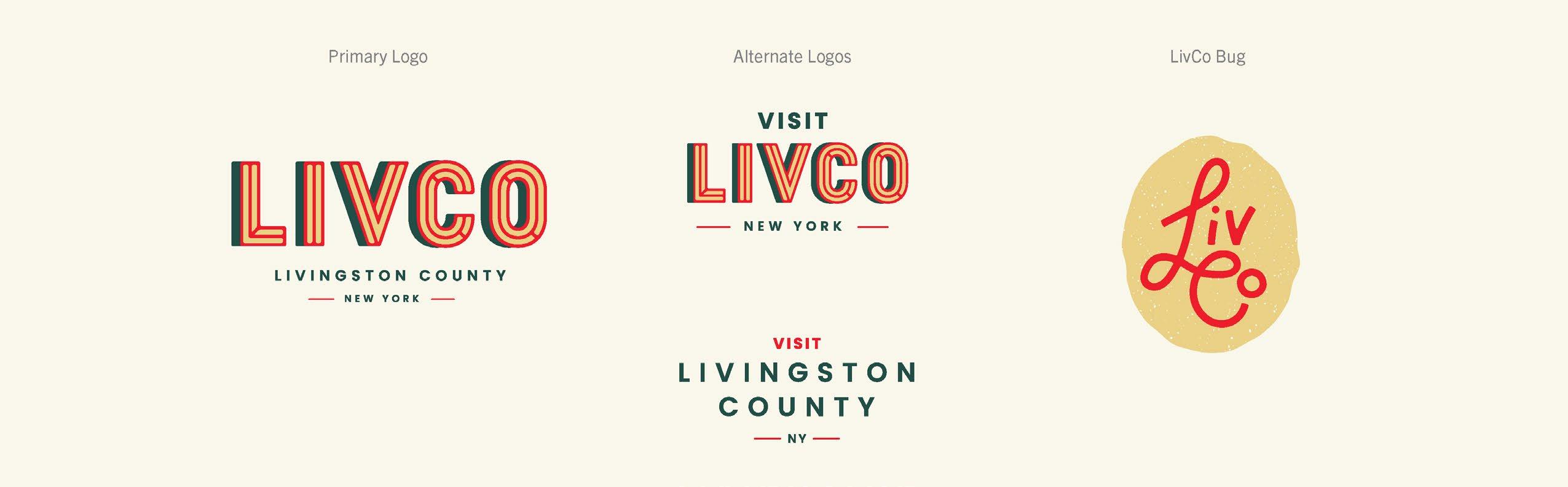
In 2022, Livingston County underwent a re-branding effort to create a series of marketing assets to better promote the County and it’s nine Villages. Sign concepts developed in this plan are reflective of the 2022 LIVCO brand.
Wayfinding is enabling people to navigate through an environment with the use of effective signage and visual cues. An effective wayfinding system, focused on all modes of transportation, can entice residents and visitors to explore beyond their traditional comfort zone. Wayfinding is not limited to signage, but can also include visual cues from the streetscape, landscape, and significant landmarks helping people navigate and orient themselves creating an enjoyable and informative experience.
The study area consists of the entirety of Livingston County, with an emphasis on the nine downtowns as a focus of regional activity. Livingston County is located in the Finger Lakes region of New York State and is approximately 640 square miles in size with a population of 65,000 people. Nature and history abound in the County with natural wonders including the Genesee River and the gorges of Letchworth State Park, and the beauty and draw of Conesus and Hemlock Lakes. The County is also home to major educational institutions including SUNY Geneseo bringing approximately 5,500 students and their families to the region. The County is served by a number of major highways including I-390 and Routes 5&20, 15, 15A, 36, and 39 which connect visitors to destinations throughout the County.
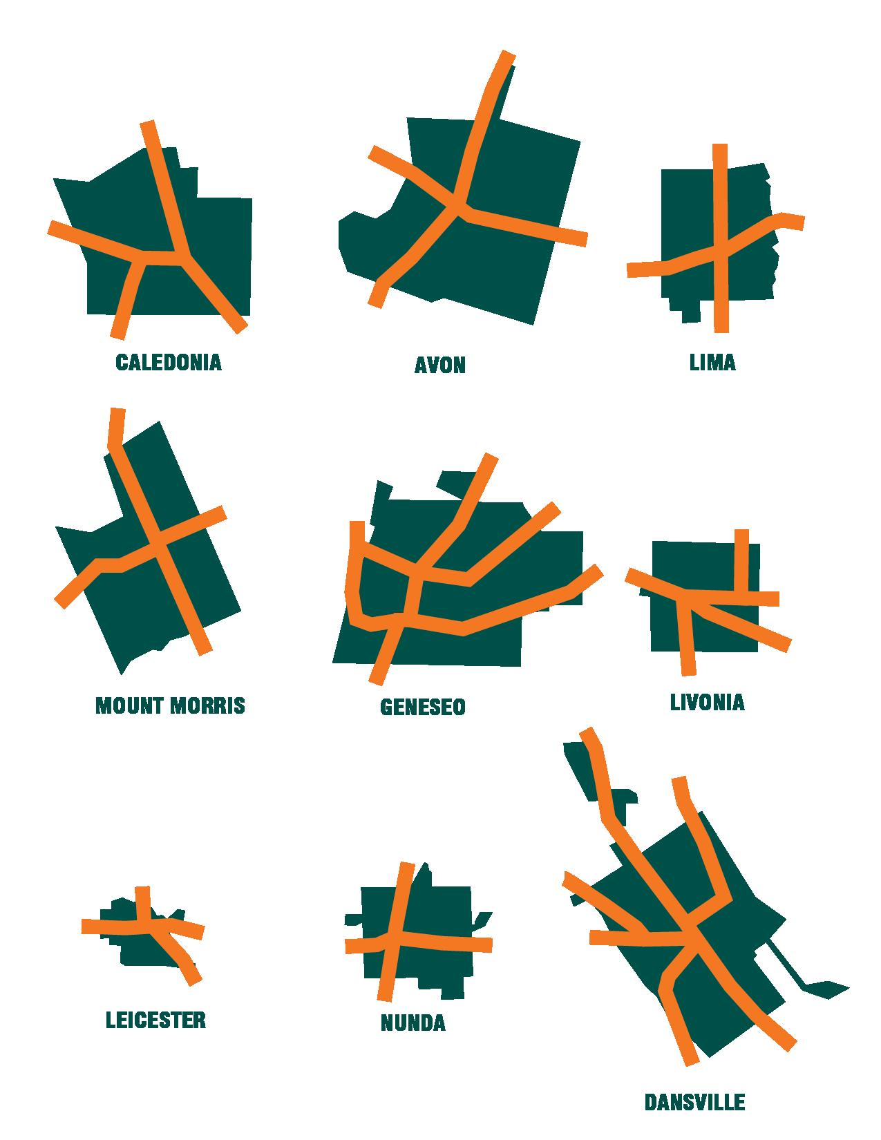
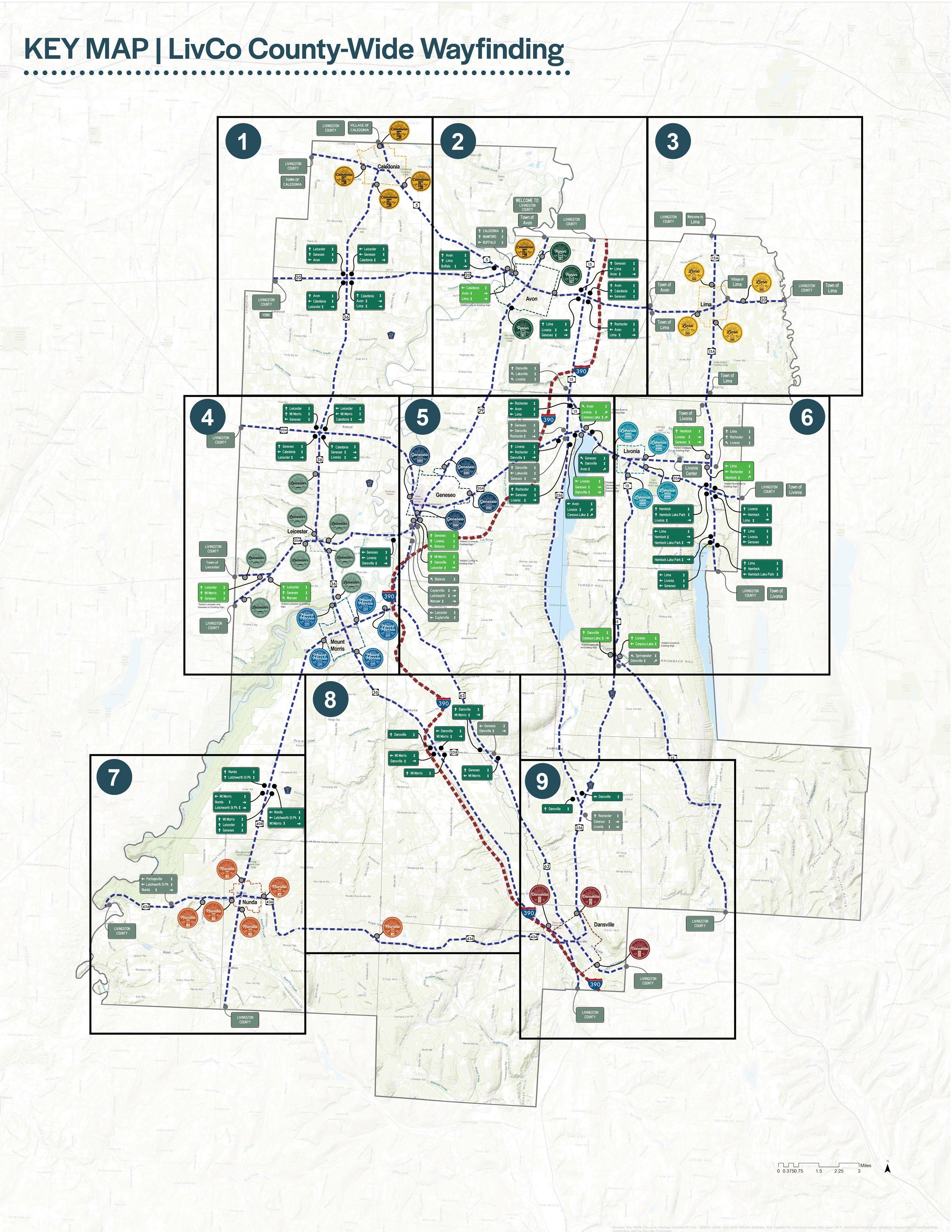
Each of the nine Villages is schematically depicted below.
Developing a wayfinding strategy for Livingston County and it’s nine Villages began with an extensive existing conditions analysis to understand the wayfinding system today, engaging community members and local stakeholders to understand what is important in each of the nine Villages, and developing a sign system that ties together the objectives of this study.
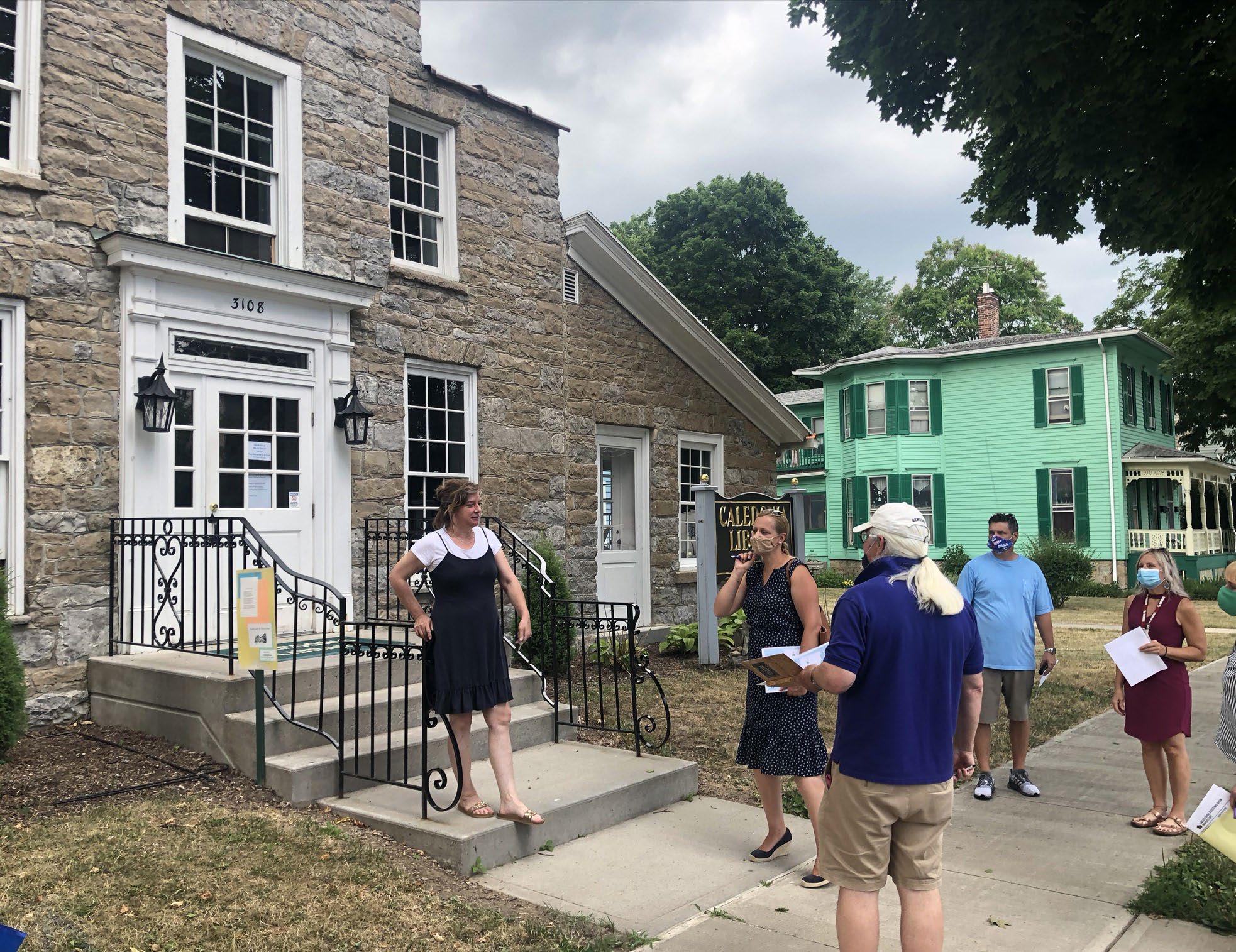
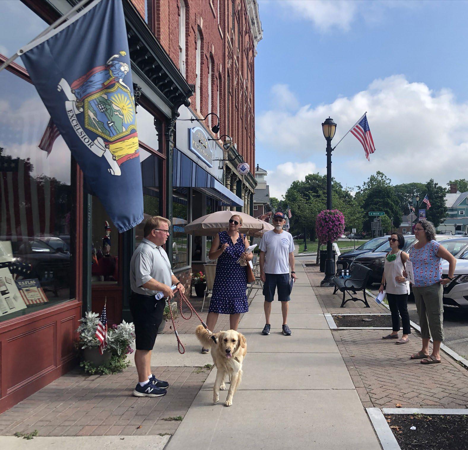
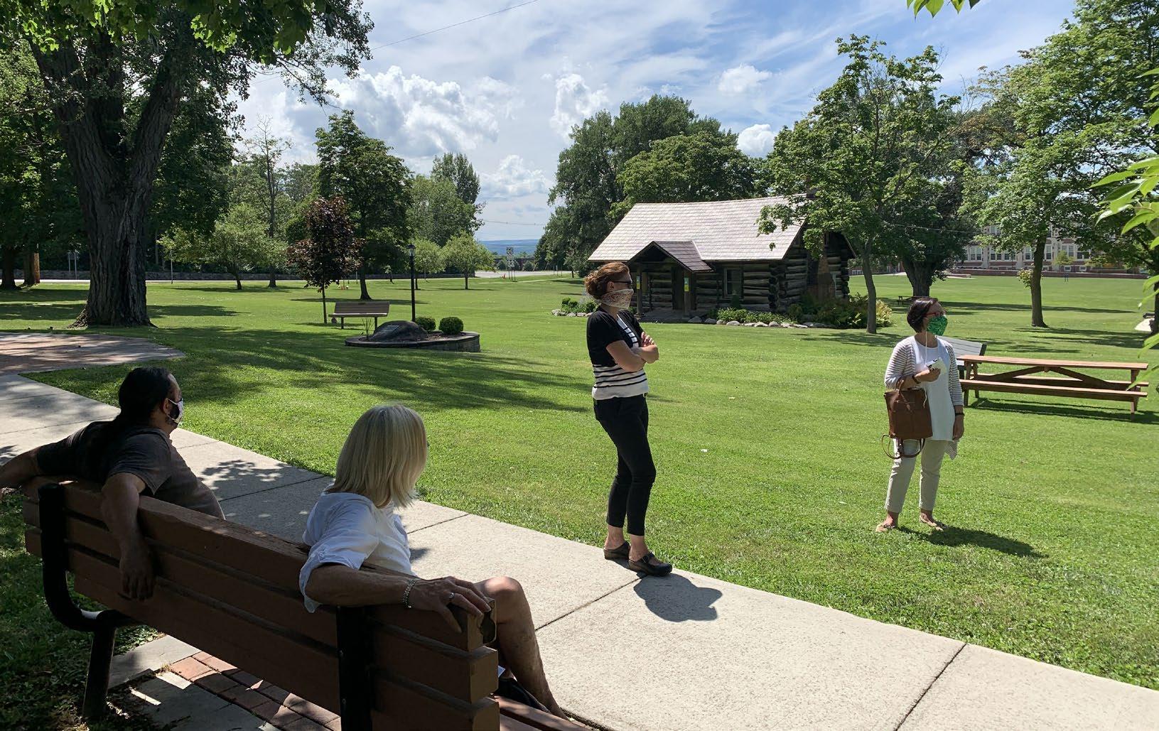
Soliciting and receiving input from the community is critical for building project support and buy-in. Throughout the study process, community and local stakeholders were engaged to understand the unique aspects of the nine Villages and to provide feedback on wayfinding design and streetscape recommendations.
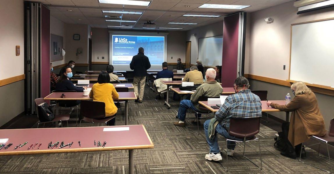
Steering Committee meetings were held at key decision making points during the project. Due to the COVID-19 pandemic, a majority of these meetings were held virtually. The committee was comprised of representatives from each of the nine Villages in Livingston County, State Parks, community organizations and the New York State Department of Transportation. The committee met to discuss project progress, review deliverables and provide guidance on recommendations.
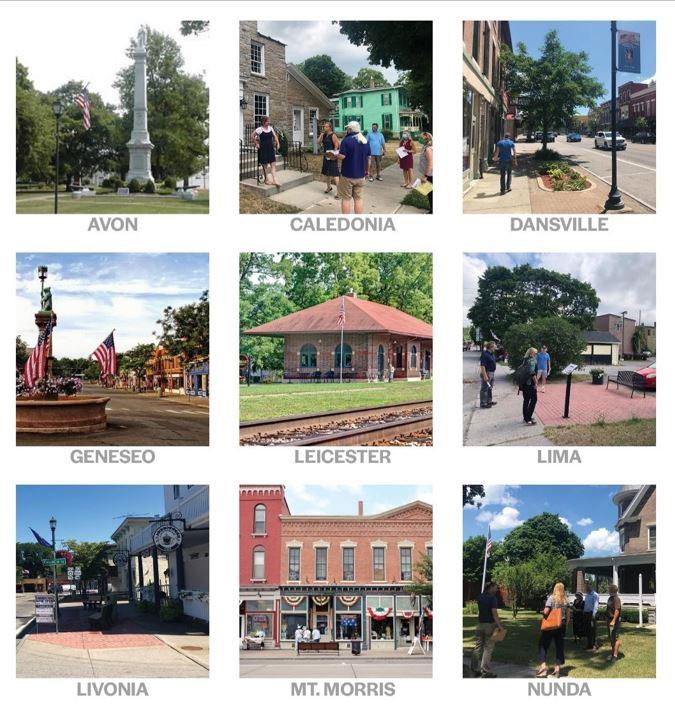
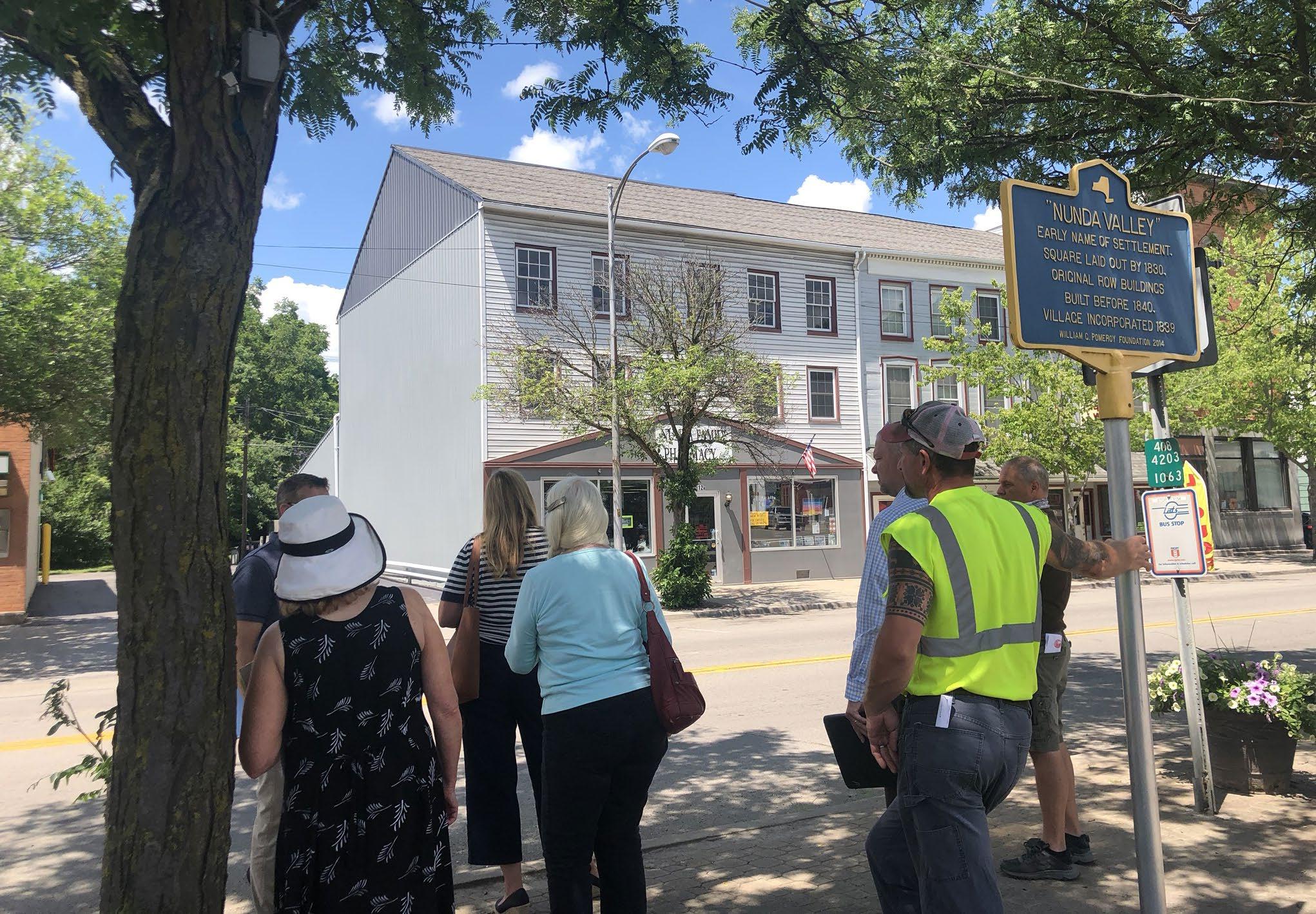
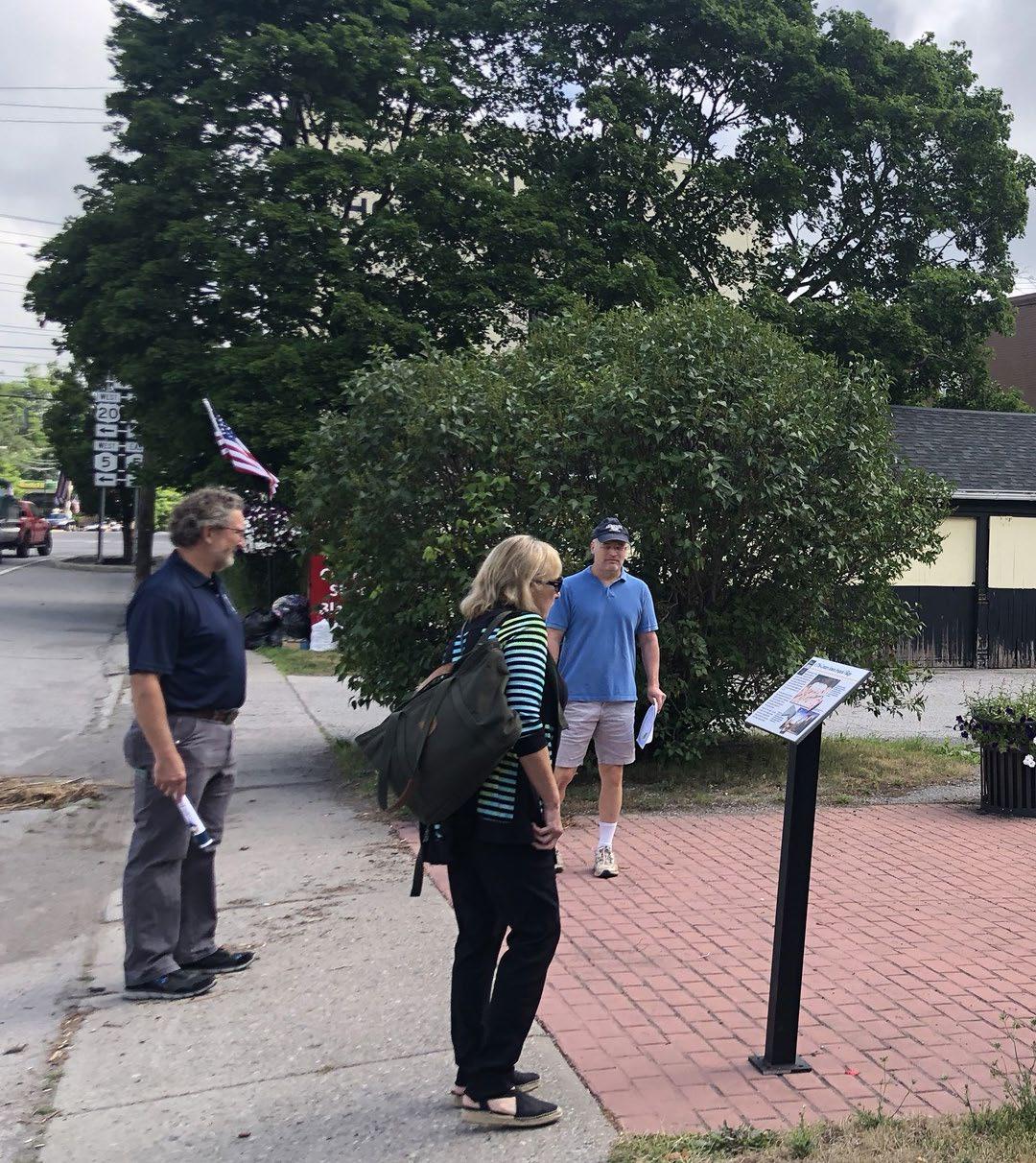
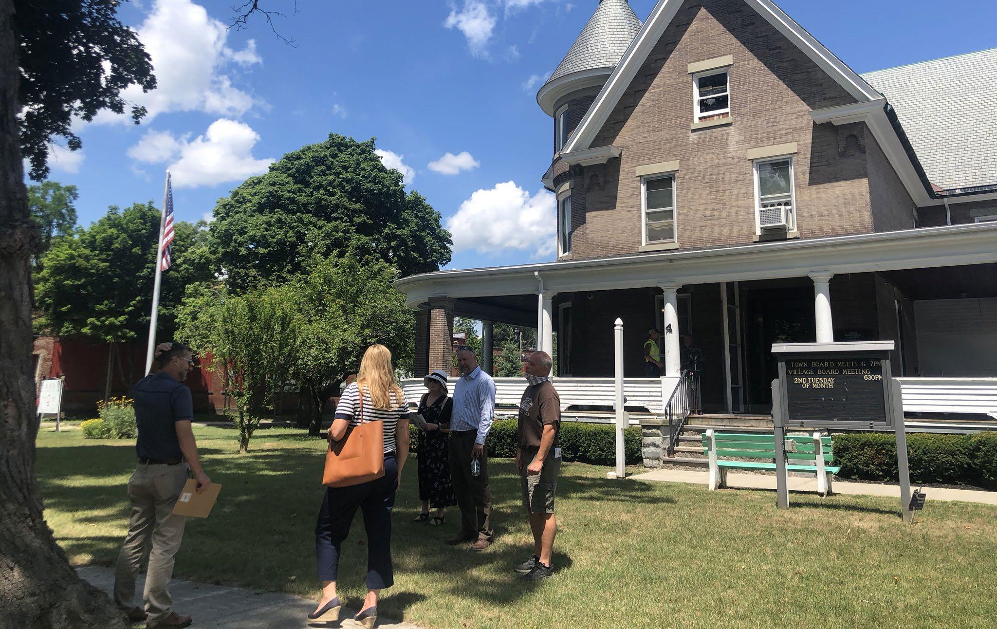
Stakeholder meetings were held in each of the nine Villages in the summer of 2020. Stakeholder groups consisted of local officials, business owners and interested community members. Meeting participants provided local insight and shared unique aspects of each Village, helping to inform wayfinding recommendations. Tours of each downtown informed streetscape recommendations and guidelines.
Two online surveys were created for the community to provide feedback on the County-wide branding and wayfinding recommendations. The results of the survey helped inform the preferred sign design and destinations to be included in the proposed system.
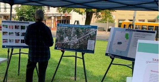
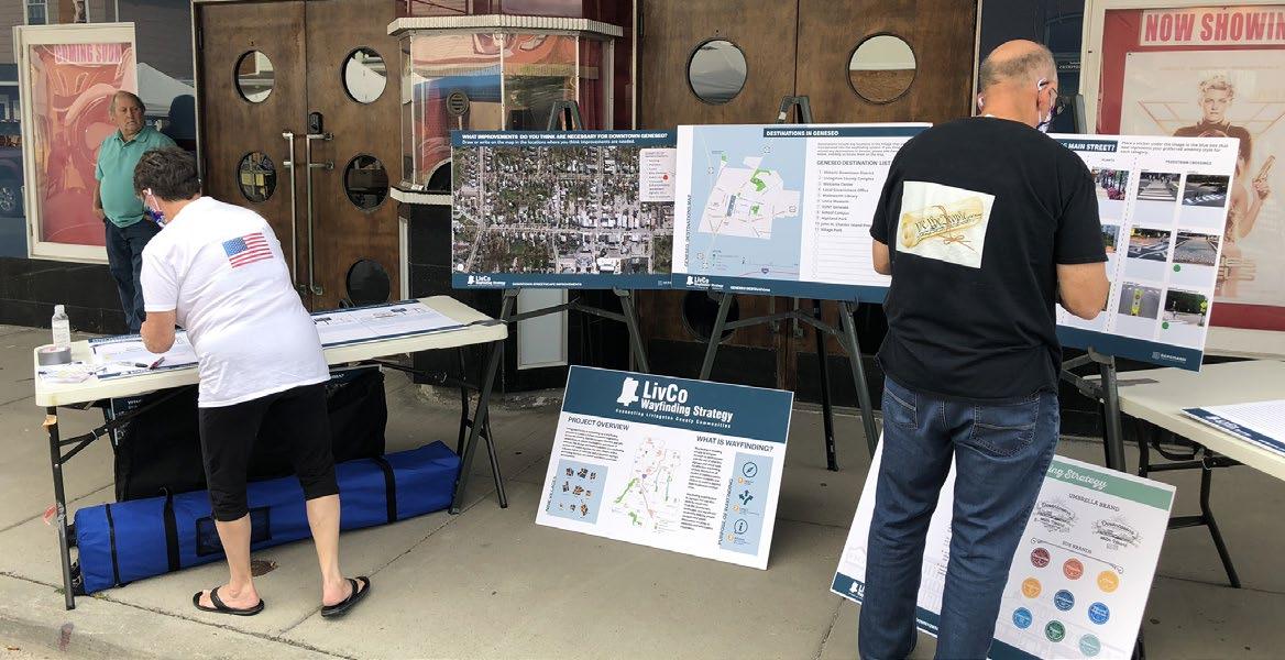
Public meetings where held during the planning process to inform and engage the community. The purpose of these meetings was to educate participants on the role and purpose of wayfinding, branding and how they relate to community development. In September 2020, the project team set up information booths at local farmer’s markets in Lima and Geneseo to share project information and solicit feedback. Information gathered helped influence the final sign design and recommended destinations.
Due to the COVID-19 pandemic, the final two public meeting were held virtually. The meetings were conducted at the end of February and beginning of March to accommodate as many participants possible. The meetings consisted of a presentation followed by a question and answer session.
A project website was created for this planning effort which allowed interested parties to stay involved and up to date on project progress. The website provided access to documents, project related surveys, and provided the opportunity for community members to share feedback with the project team.
To create a comprehensive wayfinding plan, you first need to understand what signage is already in place, who is the intended user, and what gaps or deficiencies exist in the system. An inventory of existing wayfinding signage was conducted throughout the nine Villages and along major vehicular routes in Livingston County. With the use of a GIS phone application, each sign was located and categorized according to which sign “system” it fell within, intended viewer, sign type and general condition.
For this study the following existing sign systems were inventoried:
• Community Entrance Sign
• County Entrance Sign
• Destination Sign
• Directional Sign
• Distance Sign
• Exit Sign
• Gateway Sign
Community Entrance Sign - Standard DOT signs and are located at Village and Town boundaries.
• Historical Marker
• Kiosk
• Other
• Parking Sign
• Recreational & Cultural Interest Sign
• Service Sign
• Trail Sign
County Entrance Sign - Standard DOT signs located at the Livingston County boundary announcing arrival into the County.
Destination Sign-
Located at decision making points these standard DOT signs direct users to major destinations.
Directional Sign-
Located at decision making points these standard DOT signs direct users to major destinations, Village or Town Centers.
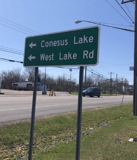
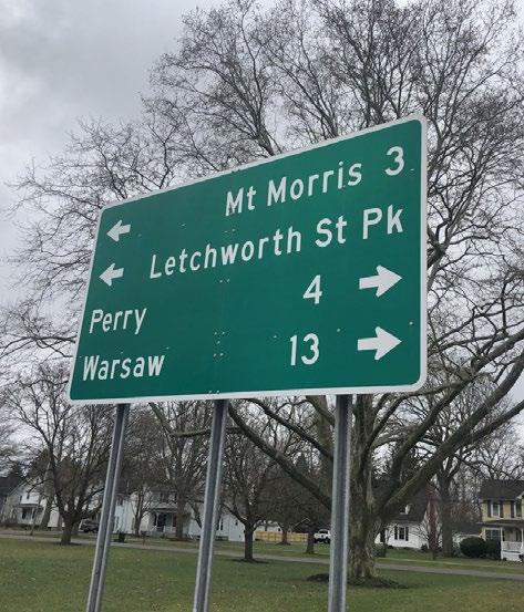
Distance Sign - Located at decision making points and along major roadways, these standard DOT signs provide direction and distances to nearby destinations, Villages and Town centers.
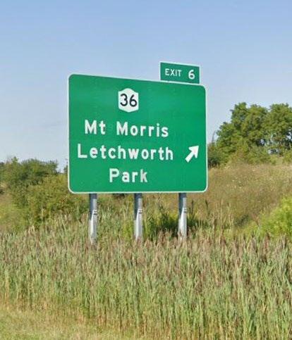
Exit Sign - Standard DOT sign located on Interstate 390, providing exit and destination information.
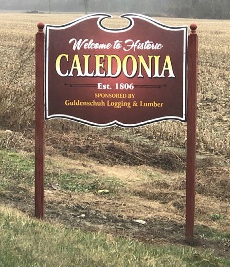
Gateway Sign - Gateway signs are found at Village and Town boundaries and announce arrival into a community. These signs are typically unique to the community they are located in.
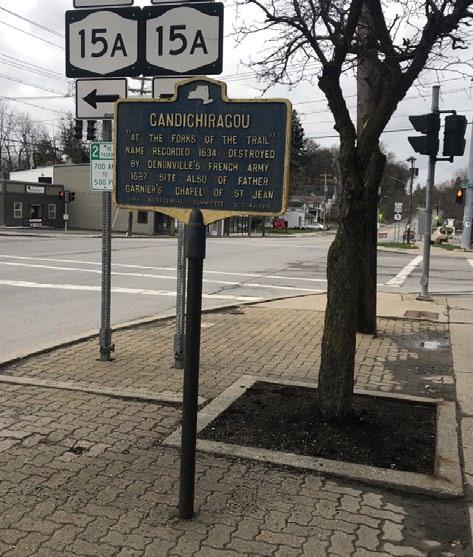
Historical MarkerLocated at points of historical significance providing information and history of a site.
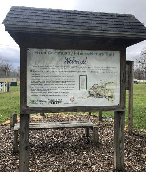
Kiosk - These signs are typically located in parks or along trails providing interpretive information or wayfinding mapping.
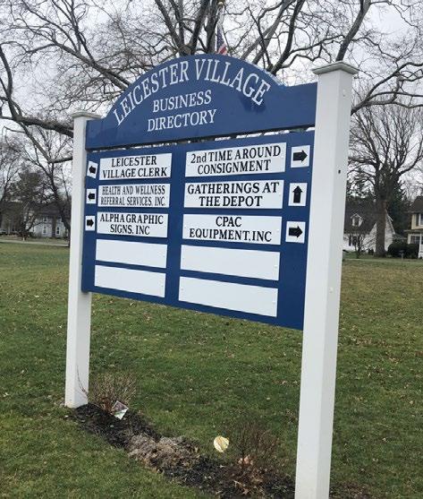
Other - Signs falling in the “other” category consist of business directory signs or community and civic organization signs, typically found at Town and Village boundaries.
Parking Sign - Located near public parking facilities direction users to available public parking.
Recreational & Cultural Interest Sign - Typically found at park entrances.
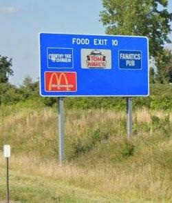
Services Sign- Found predominately on Interstate 390 informing vehicular travelers of nearby, restaurants, gas stations, hotel accommodations or other service oriented destinations.
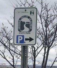
Trail Sign - These signs provide direction to nearby trail facilities and trailhead/parking accommodations.
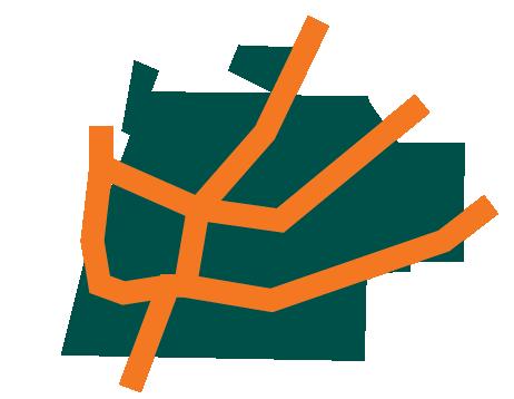
The heat map below represents the concentration of existing wayfinding signage in Livingston County. The darker the color purple the higher concentration of signage. Mount Morris and Dansville have the most signs while Nunda and Livonia have the least. The number of signs in a community may be influenced by the number of destinations and decision making points that exist. The map also illustrates signage gaps between Village centers indicating where new signage may be needed to ensure a comprehensive and cohesive wayfinding system.

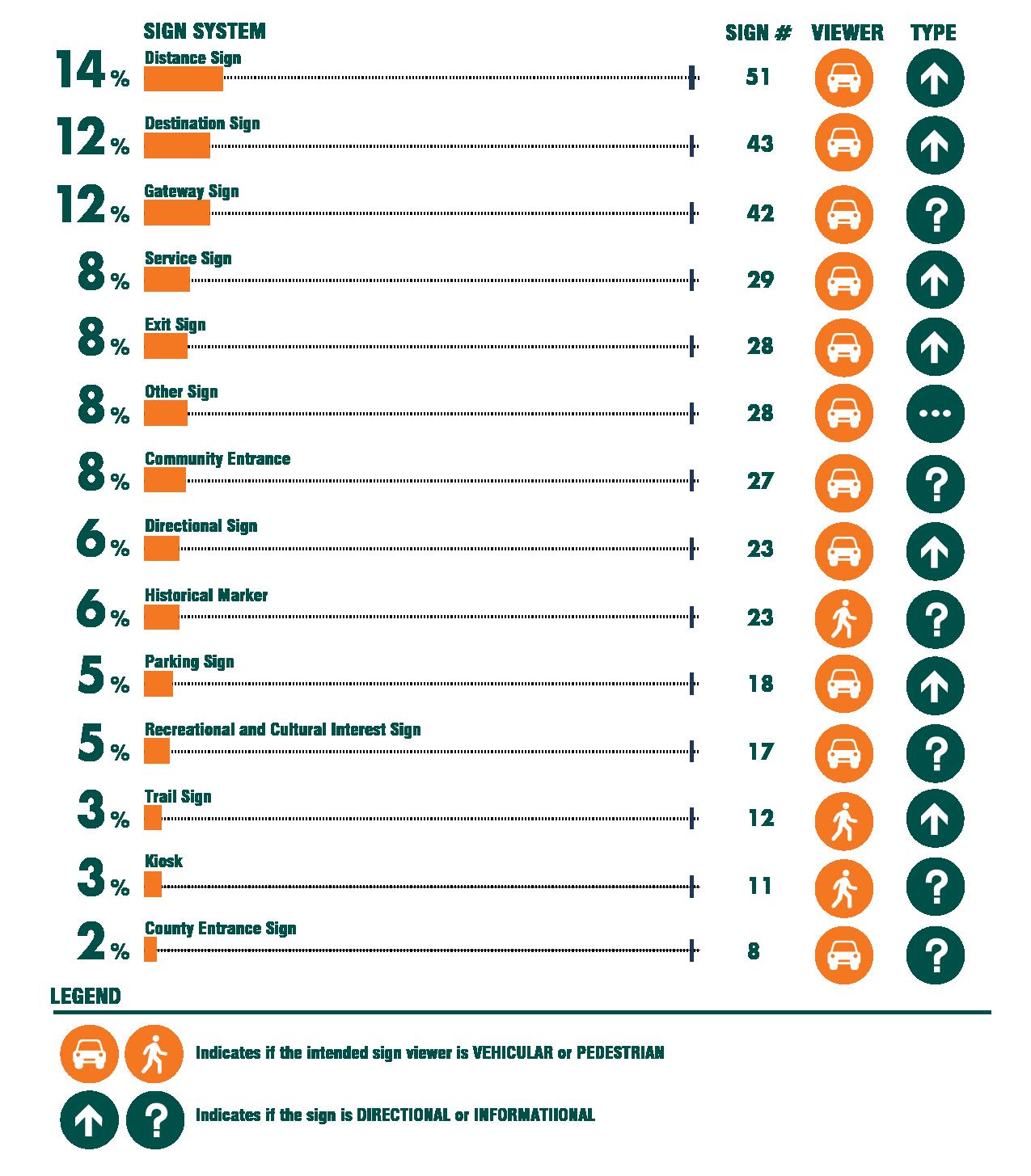
Understanding what sign systems exist, the intended viewer and sign condition is key to inform recommendations for future sign type, location and messaging. The infographics on page 11 and below provide a snapshot of the existing Livingston County wayfinding system as a whole. The following pages further break down the system providing a comprehensive summary for each of the nine individual Villages.
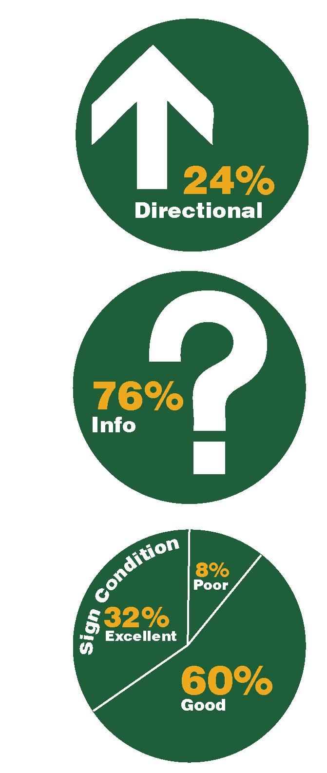
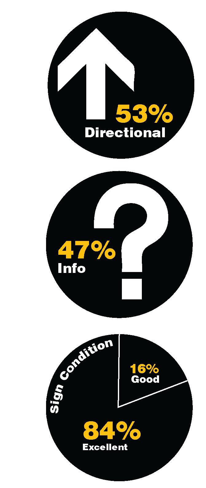
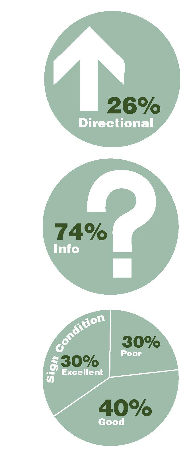
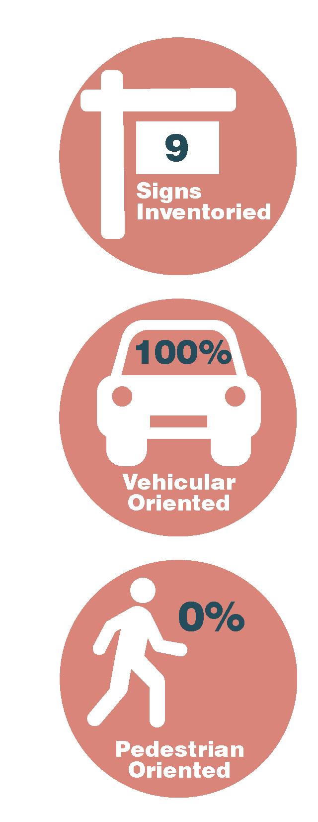
In total 360 wayfinding signs were inventoried in and between the nine Livingston County Villages.

A majority of the signage is geared toward a person in a vehicle.
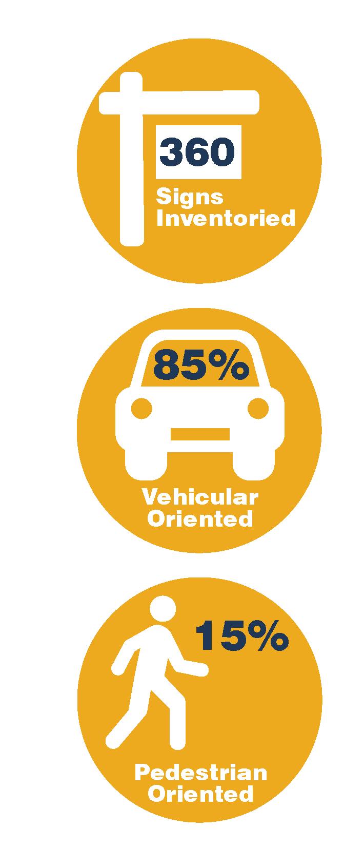
Pedestrian signs are less prevalent, a majority of them consist of Historical Markers or Trail Signage.
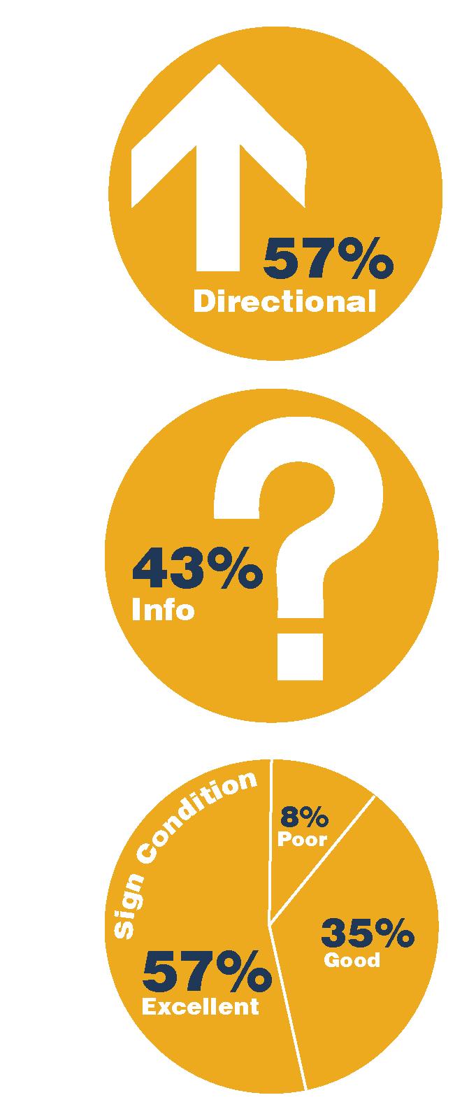
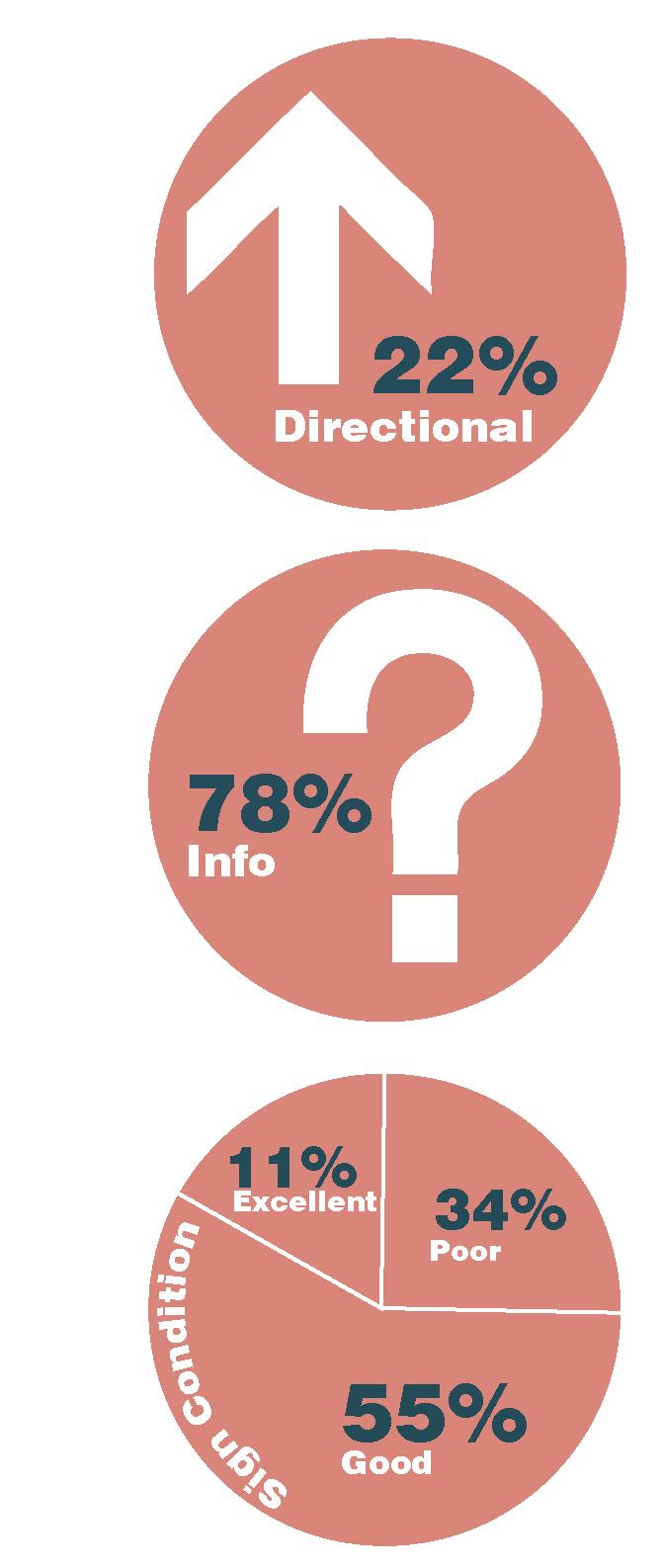
Over half the existing signage directs individuals to destinations including nearby towns and Villages, parks and educational institutions. Informational signs make up nearly half of the existing signage which includes Gateway and Cultural & Recreational signs.
A majority of the signs inventoried were identified to be in Excellent or Good conditions. A small percentage of signs are in Poor Condition, a majority of those being Historic Markers.
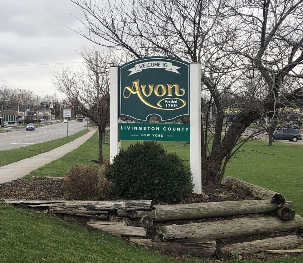
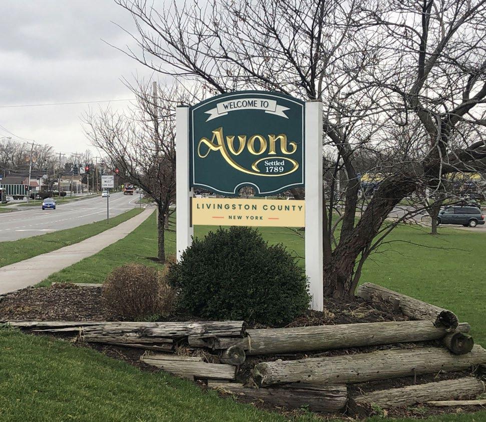
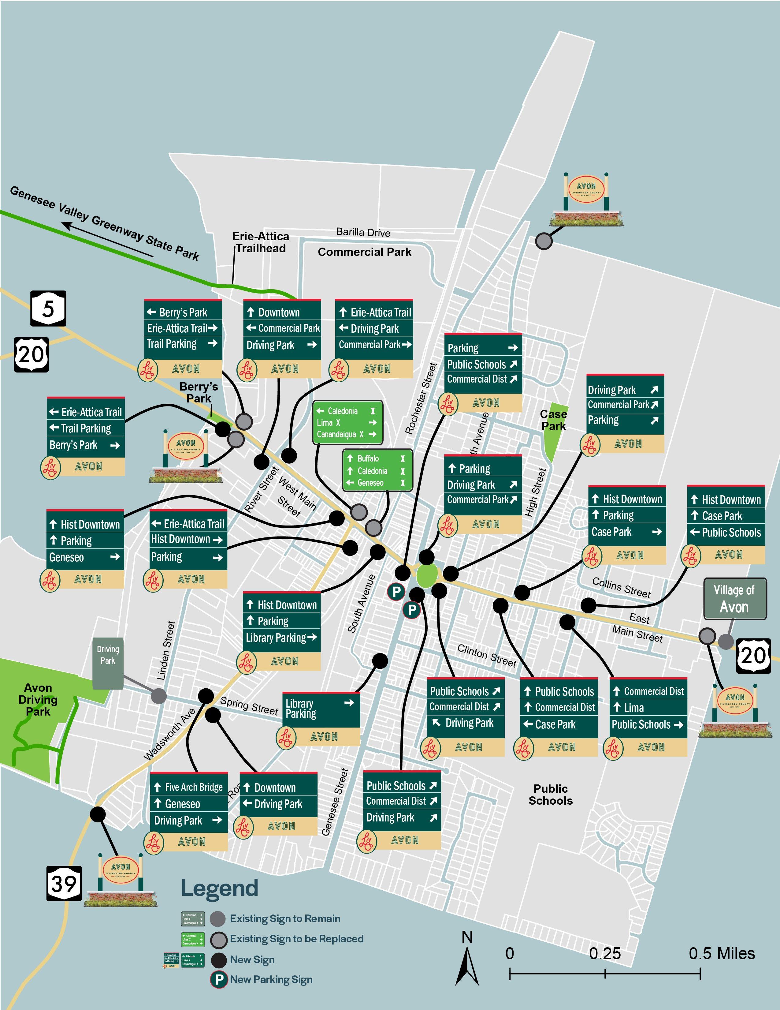
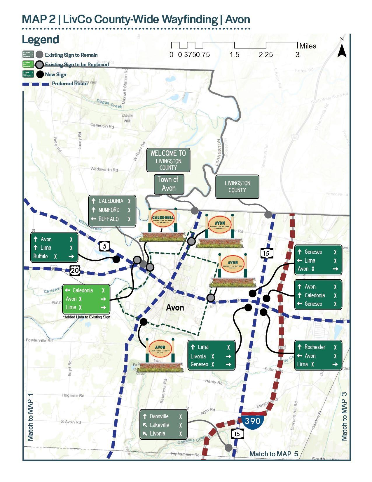
Avon is a northern gateway to Livingston County adjacent to Monroe County. Routes 5, 20 and 39 are the major roadways in and out of the Village connecting Avon to Caledonia, Geneseo, and Lima. I-390 is in close proximity to Avon, which serves as a major connector bringing in visitors from the surrounding region.
Other 5 Gateway Sign 4 Kiosk 4
Recreational & Cultural Interest Sign 4 Distance Sign 3
Parking Sign 2
Community Entrance Sign 1
Historical Marker 1 Trail Sign 1
25 signs were inventoried in the Village of Avon. A majority of the signs are located at the Village boundaries along Routes 5, 20 and 39.
A majority of the signage in Avon is geared toward a person in a vehicle.
Over a quarter of the inventoried signs are pedestrian oriented, consisting of Historical Markers, Kiosks at trailhead and fishing access sites and Other signs include bus stop signs in the Village.
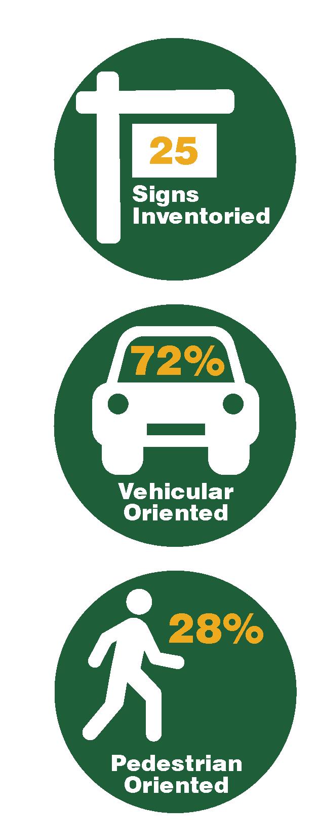
Less than a quarter of the existing signage consists of Distance, Parking, and trail signs. A majority of these signs are located along Routes 5 and 20 on the eastern side of the Village.
Over three quarters of the existing signage is informational, a majority of those signs consisting of Gateway, Recreational and Cultural Interest, and school championship recognition signs.
A majority of the signs inventoried are in Good or Excellent condition. A small percentage of signs are in Poor Condition consisting of a Historic Marker and a Distance Sign on Routes 5 and 20 East of the Village Limits.

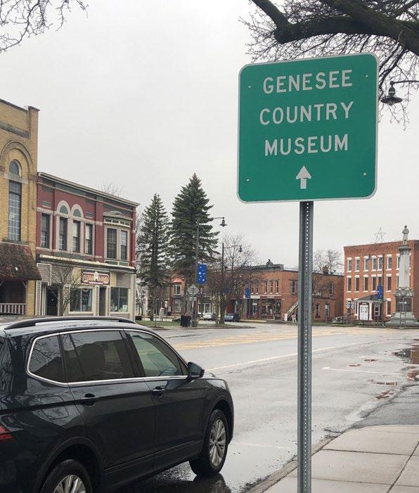
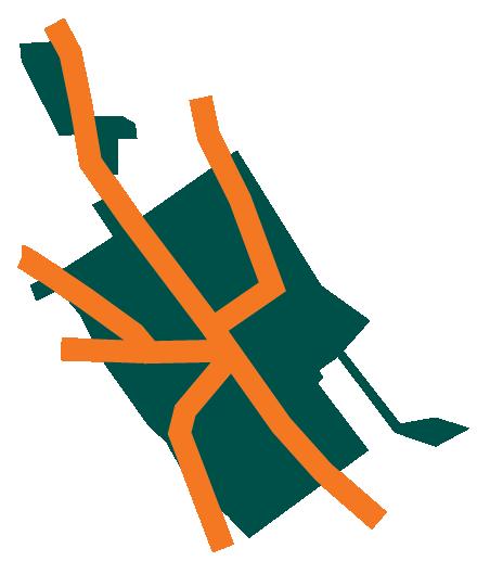
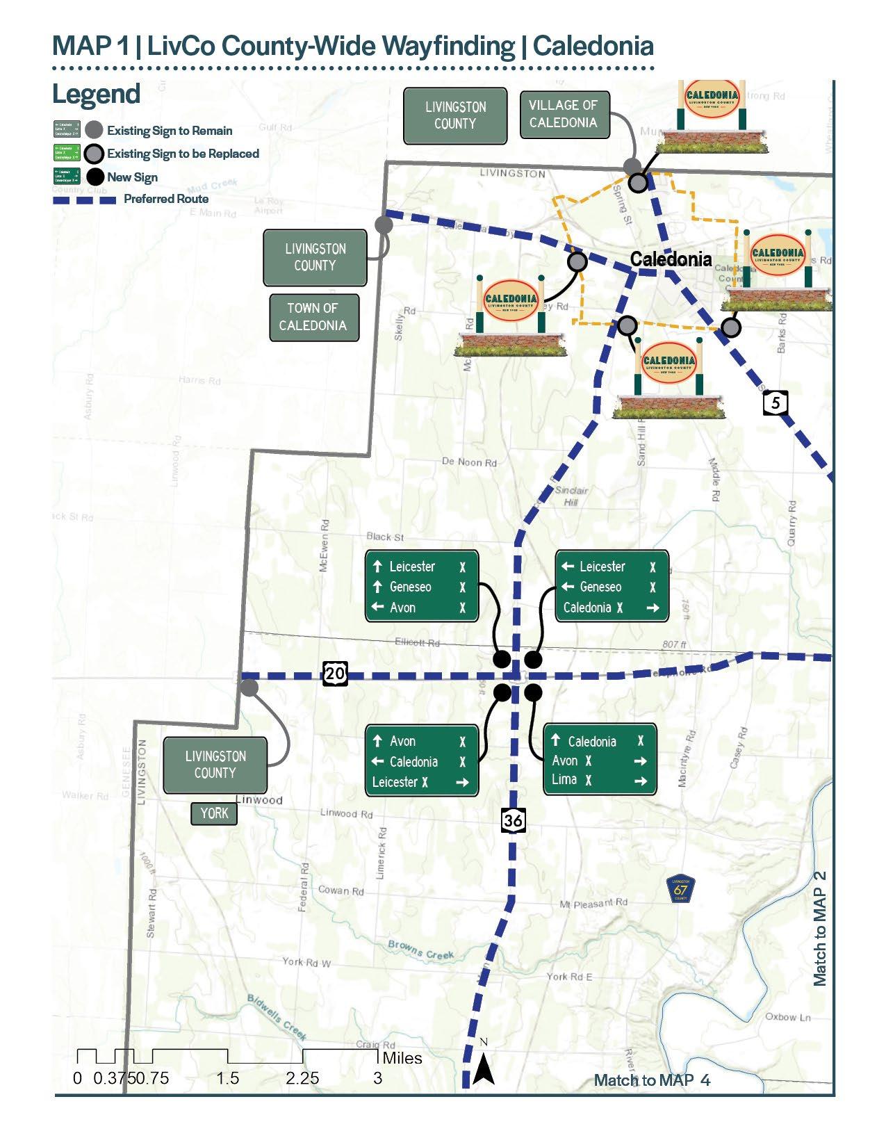
Caledonia is located in the northwest corner of Livingston County. Routes 5 and 36 are the major roadways in and out of the Village connecting Caledonia to Avon and Leicester, and to Mumford in Monroe County and LeRoy in Genesee County. The Genesee Country Village and Museum, although not located in Caledonia or Livingston County, is located approximately two and a half miles from the Village center and attracts nearly 100,000 visitors to the region annually.
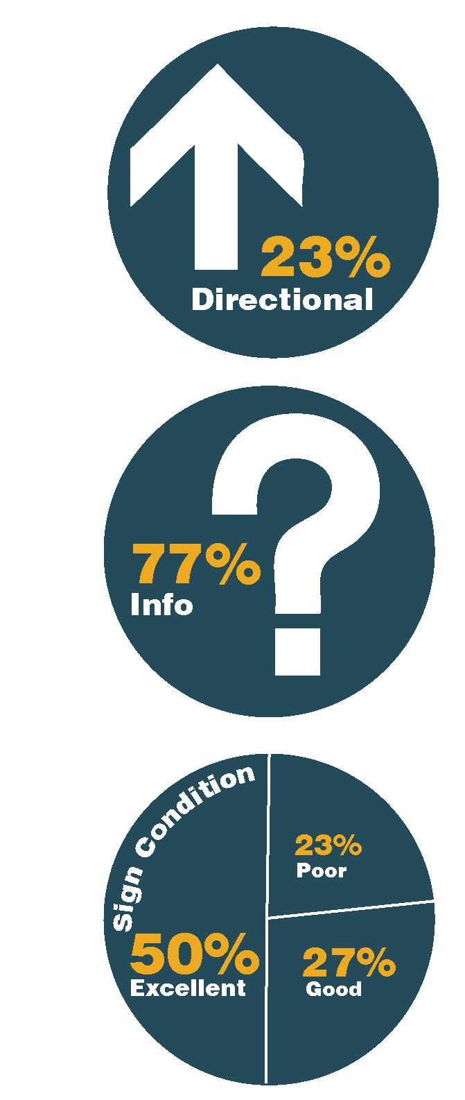
26 signs were inventoried in the Village of Caledonia. A majority of the signs are located in close proximity to Routes 5 and 36 and at the Village boundary.
Historical Marker 5 Destination Guide Sign 4 Gateway Sign 4 Other 4 Recreational and Cultural Interest Sign 4 Distance Sign 2 Community Entrance Sign 1 County Entrance Sign 1 Parking Sign 1
Less than a quarter of the existing signage consists of Directional or Distance signs. These signs are concentrated around the intersection of 5 and 36.
A majority of the signage in Caledonia is geared toward a person in a vehicle.
Pedestrian signs are less prevalent, all of them being Historical Markers.
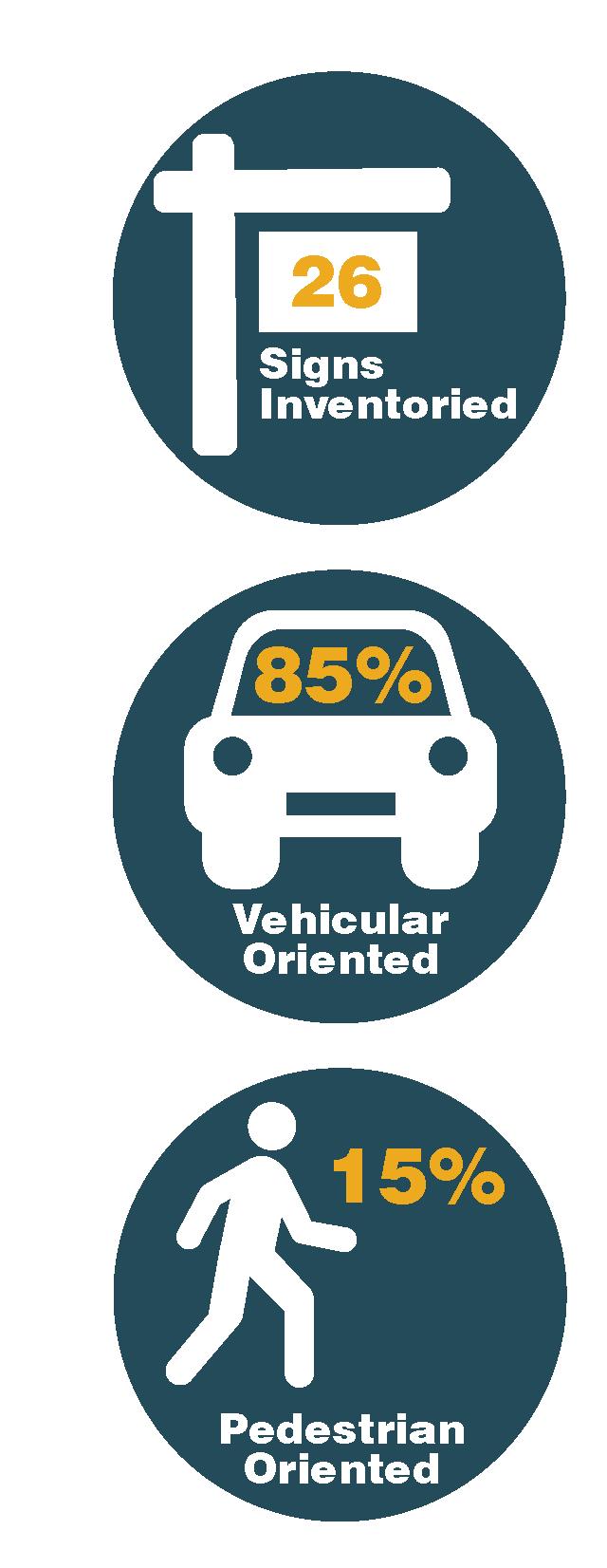
Over three quarters of the existing signage is informational, a majority of those signs consisting of Gateway, Recreational and Cultural Interest, and Historical Marker signs.
A majority of the signs inventoried are in Excellent or Good condition. A small percentage of signs are in Poor Condition, a majority of those being Historic Markers.
Dansville is located in the southeast corner of Livingston County adjacent to Steuben County. Routes 36 and 63 are the major roadways in and out of the Village connecting Dansville north to Mount Morris, Geneseo, and Livonia. I-390 is immediately adjacent to Dansville and connects to the Village with two exits making Dansville a key gateway to Livingston County. Stony Brook State Park, although not located in Dansville or Livingston County, is approximately two and a half miles from the Village center and draws visitors to the region with a variety of outdoor recreational and camping opportunities.
Distance Sign 8
Destination Sign 4 Gateway Sign 4 Other 4 Parking Sign 4
Community Entrance Sign 3 Historical Marker 2 County Entrance Sign 1 Directional Sign 1 Recreational and Cultural Interest Sign 1
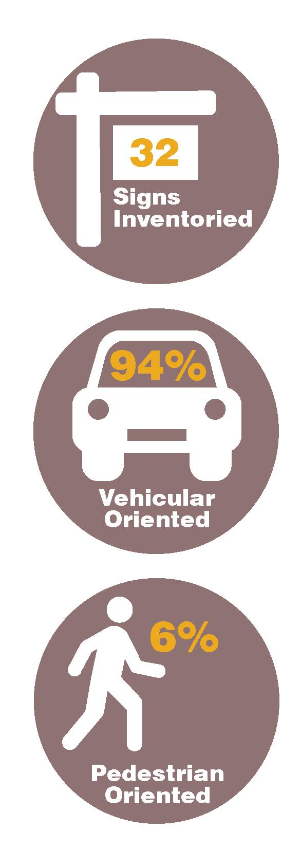
32 signs were inventoried in the Village of Dansville. A majority of the signs are located in the Village core and along Route 36 leading to and from I-390.
A majority of the signage in Dansville is geared toward a person in a vehicle.
Approximately 6% of the signs inventoried are pedestrian oriented, consisting of Historical Markers and Recreational and Cultural Interest signs.
Over half of the existing signage consists of Distance, Destination, and Parking signs. A majority of the signs are located in the Village core and along Routes 36 leading to and from I-390. Nearly half of the existing signage is informational, a majority of those signs consisting of Gateway, Historical Makers, Recreational and Cultural Interest, and community organization signs.
Three quarters of the signs inventoried are in Excellent or Good condition. One quarter of the signs are in Poor Condition consisting of damaged Gateway Signs and deteriorating Parking Signs.
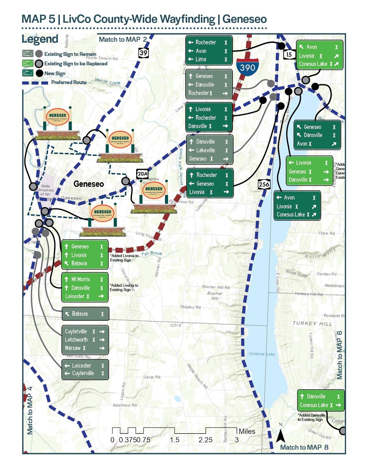
Geneseo is located in the heart of Livingston County. Routes 20A, 39 and 63 are the major roadways in and out of the Village connecting Geneseo to Mount Morris, Leicester, Avon, and Livonia. Geneseo is the County Seat for Livingston County and the home of SUNY Geneseo, bringing students, their families and visitors to Geneseo from across the region, northeast United States and Canada.
Distance Sign 8 Gateway Sign 5 Historical Marker 5 Parking Sign 5 Destination Sign 4 Community Entrance Sign 2 Other 2 Kiosk 1
32 signs were inventoried in the Village of Geneseo. A majority of the signs are located in the Village core and along Route 20A leading to and from Mount Morris.
A majority of the signage in Geneseo is geared toward a person in a vehicle.
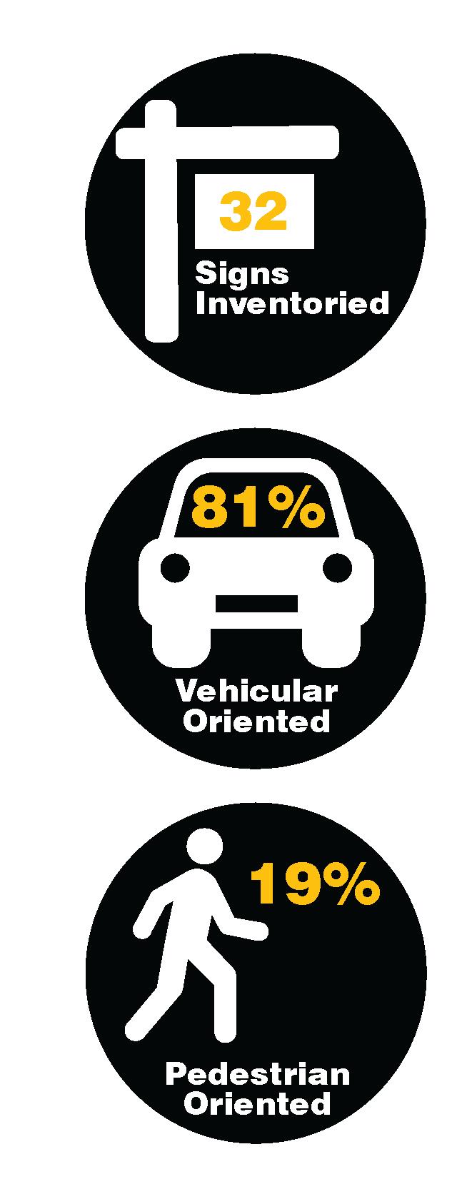
Just under 20% of the signs inventoried are pedestrian oriented, consisting mostly of Historical Markers.
Over half of the existing signage consists of Distance, Parking, and Destination signs. A majority of the signs are located in the Village core and along Route 20A.
Nearly half of the existing signage is informational, a majority of those signs consisting of Gateway, Historical Makers, Recreational and Cultural Interest, and Community Entrance Signs.
All of the signs inventoried are in Excellent or Good condition.

Leicester is located in the western part of Livingston County, west of Geneseo. Routes 20A and 36 are the major roadways in and out of the Village connecting Leicester to Mount Morris, Geneseo, and Caledonia. Leicester is just east of the Wyoming County border, and although smaller in size than the other nine Villages, it is a gateway into Livingston County from the west.
Distance Sign 5 Gateway Sign 4 Historical Marker 2 Other 2 Directional 1 Recreational and Cultural Interest Sign 1
15 signs were inventoried in the Village of Leicester. A majority of the signs are located in the Village’s central square.
A majority of the signage in Leicester is geared toward a person in a vehicle.
Only 13% of the signs inventoried are pedestrian oriented, consisting mostly of Historical Markers.
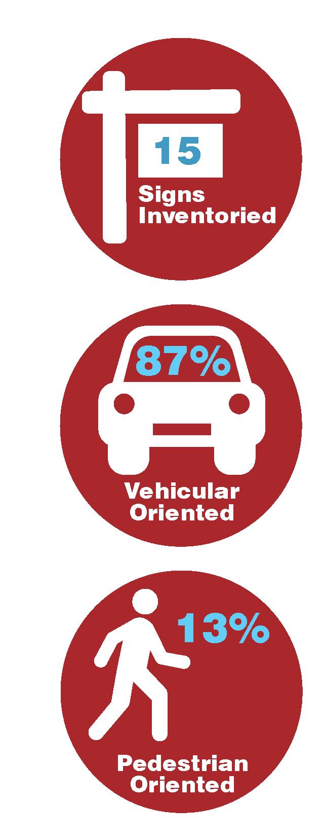
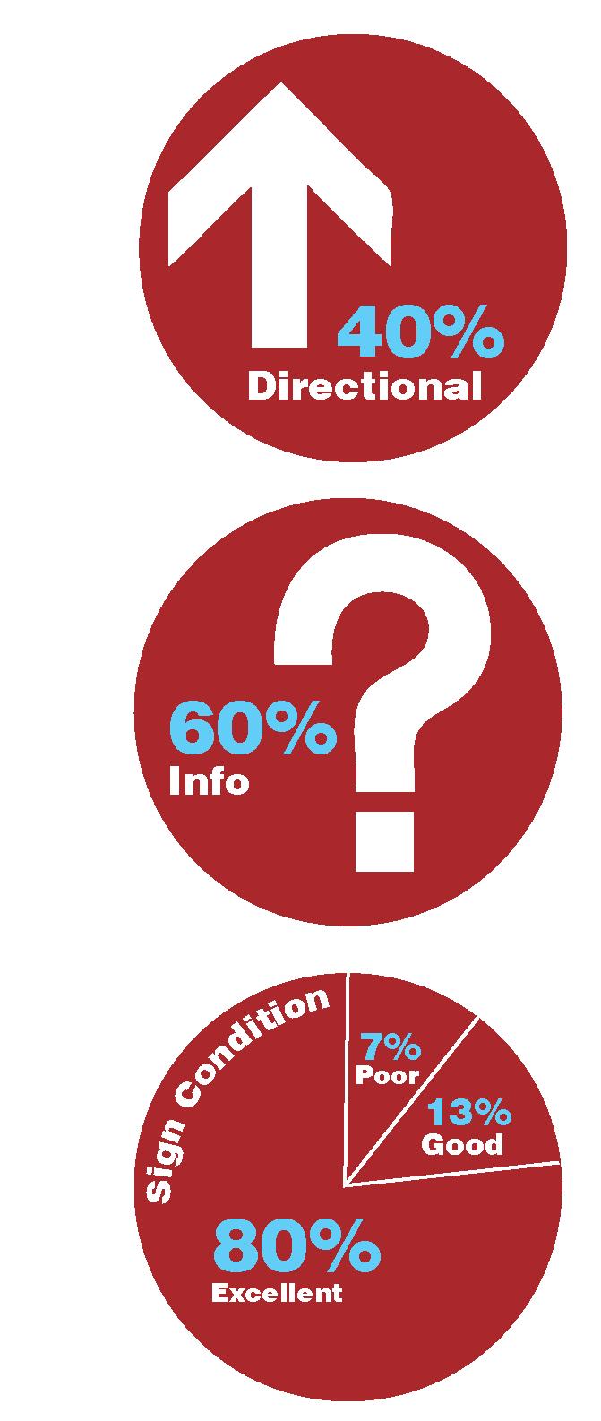
Just under half of the existing signage consists of Distance, and Directional signs. A majority of the signs are located in the Village’s central square. Over half of the existing signage is informational, a majority of those signs consisting of Gateway, Historical Makers, and community directory signs.
93% of the signs inventoried are in Excellent or Good condition. Historical Markers make up the 7% of signs in poor condition.
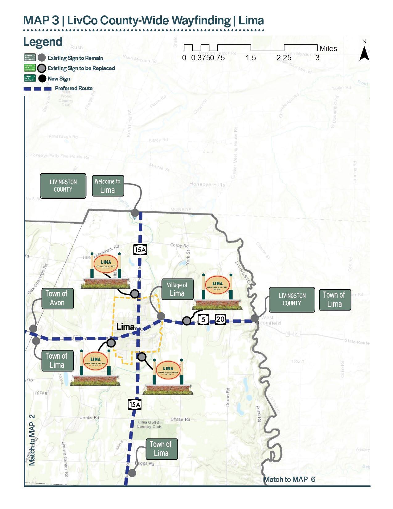
Lima is located in the northeast part of Livingston County. Routes 15A and 20 are the major roadways in and out of the Village connecting Lima to Avon and Livonia. Honeoye Falls in Monroe County is to the north and West Bloomfield in Ontario County is to the east making Lima a gateway into Livingston County.
Historical Marker 8 Destination Sign 6 Other 5 Gateway Sign 4 Community Entrance Sign 2 Parking Sign 1
Recreational and Cultural Interest Sign 1
27 signs were inventoried in the Village of Lima. A majority of the signs are located at the crossroads of Routes 15A and 20 and at the Village boundary.

Less than half of the signage in Lima is geared toward a person in a vehicle.
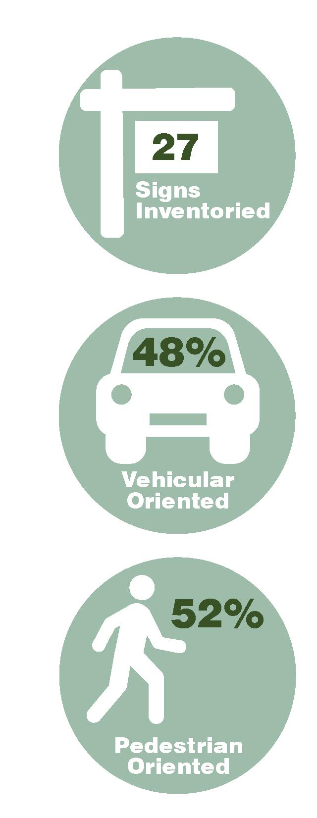
Just over half of the signs inventoried are pedestrian oriented, consisting mostly of Historical Markers.
Just over a quarter of the existing signage consists of Distance, Directional and Parking signs.
Nearly three quarters of the existing signage is informational, a majority of those signs consisting of Historical Markers, Gateway Signs, and bus stop signs.
70% of the signs inventoried are in Excellent or Good condition. Historical Marks make up the 30% of signs in poor condition.

Livonia is located in the eastern part of Livingston County. Routes 15 and 20A are the major roadways in and out of the Village connecting Livonia to Geneseo and Avon. Livonia is approximately two miles from Conesus Lake which draws recreational water users and summer residents to the Finger Lakes region and Livingston County.
Gateway Sign 3 Parking Sign 3 Recreational and Cultural Interest Sign 3 Community Entrance Sign 1 Kiosk 1
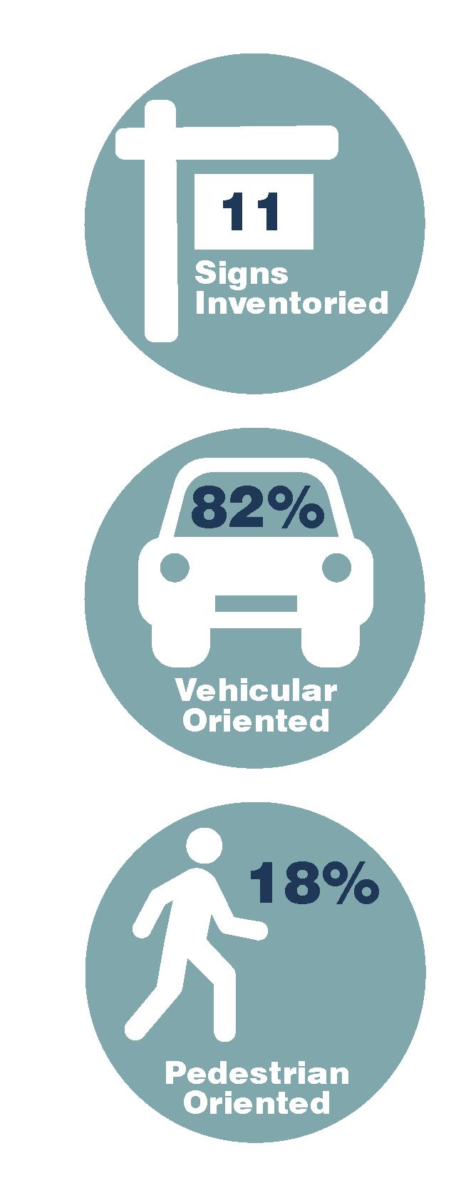
11 signs were inventoried in the Village of Livonia. A majority of the signs are located at the crossroads of Routes 15 and 20A and at the Village boundary.
A majority of the signage in Livonia is geared toward a person in a vehicle.
Under a quarter of the signs inventoried are pedestrian oriented, consisting of Kiosk and Cultural and Recreational Interest Signs.
Just over a quarter of the existing signage consists Parking signs. Nearly three quarters of the existing signage is informational, a majority of those signs consisting of Gateway Signs, Recreational and Cultural Interest Signs, and Kiosks.
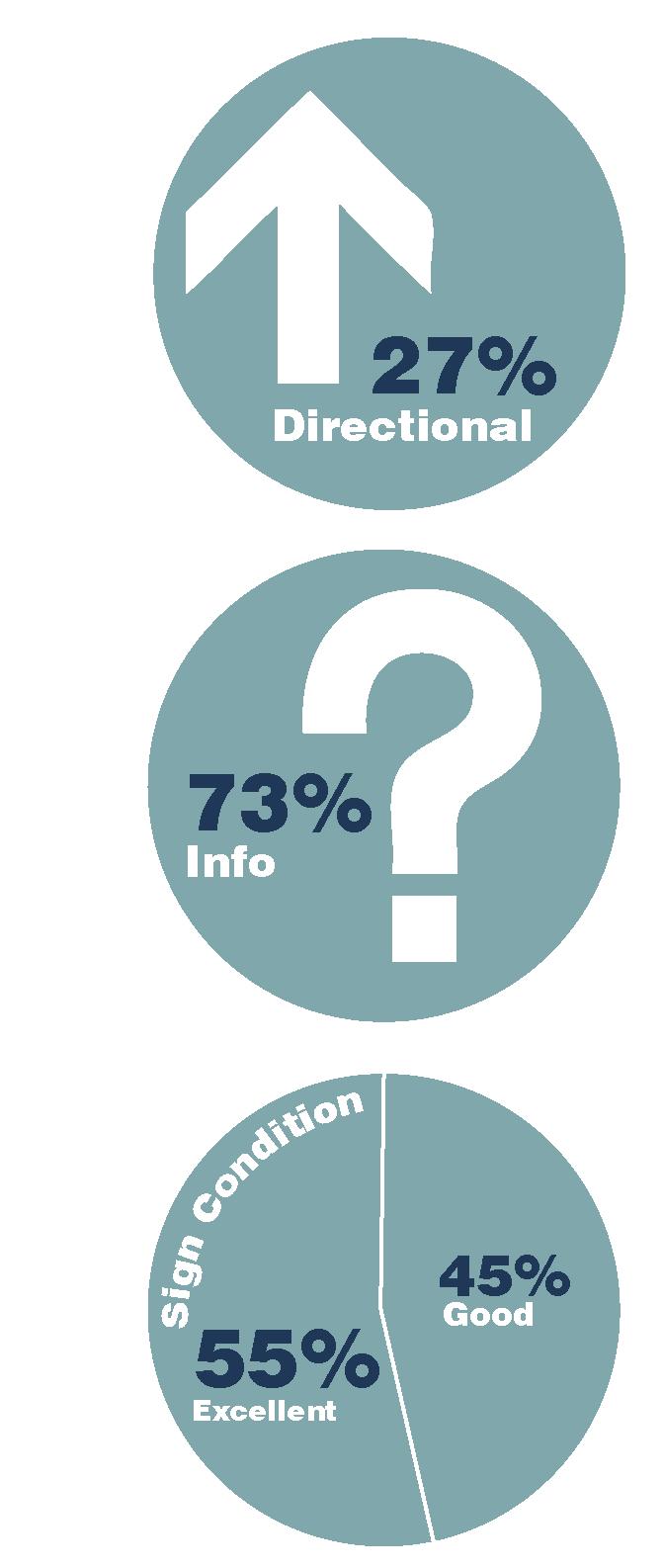
100% of the signs inventoried are in Excellent or Good condition.
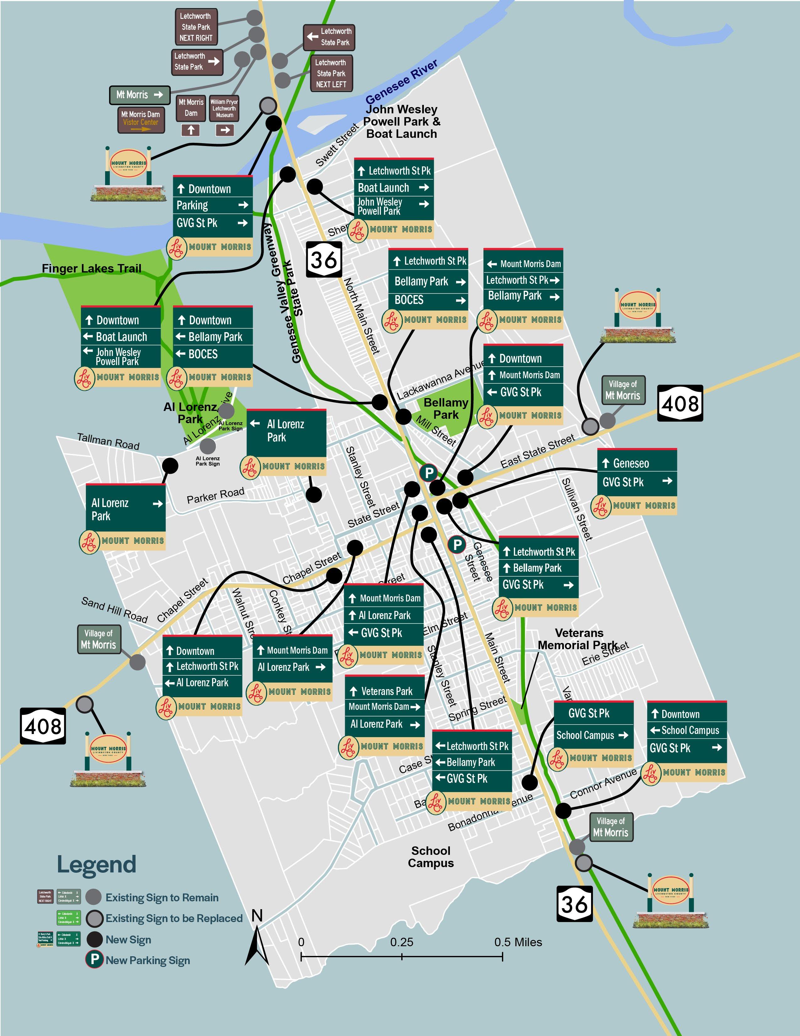
Mount Morris is located in the western part of Livingston County. Routes 36 and 408 are the major roadways in and out of the Village connecting Mount Morris to Geneseo, Leicester and Nunda. The northern entrance to Letchworth State Park is located in Mount Morris. The Genesee Valley Greenway State Park traverses north and south through the Village of Mount Morris connecting to other trail systems including the Letchworth State Park Trails and Finger Lakes Trail.
Destination Sign 18 Trail Sign 10
Gateway Sign 5 Kiosk 4 Other 3 Community Entrance Sign 3
Recreational and Cultural Interest Sign 3 Distance Sign 2 Service Sign 2 Directional Sign 1 Parking Sign 1
52 signs were inventoried in the Village of Mount Morris. A majority of the signs are located at the crossroads of Routes 36 and 408 and at the Village boundary.

Over half of the existing signage consists of Destination Signs and Trail Signs guiding people to Letchworth State Park and to the Genesee Valley Greenway State Park.
A majority of the signage in Mount Morris is geared toward a person in a vehicle. Just over a quarter of the signs inventoried are pedestrian oriented, consisting mostly of Trail Signs and Kiosks associated with the Genesee Valley Greenway State Park.

Over a quarter of the existing signage is informational, a majority of those signs consisting of Gateway Signs, Recreational and Cultural Interest Signs, and Kiosks.
100% of the signs inventoried are in Excellent or Good condition.
408
Portage Street VILLAGE OF NUNDA EXISTING SIGN LOCATION MAP
Melodee Lane Woodworth Lane LEGEND Vehicular Viewer (100%) Decision Making Point
North Walnut Street Nunda Kiwanis Park 0 0.4 0.2 Miles
Village Park
436

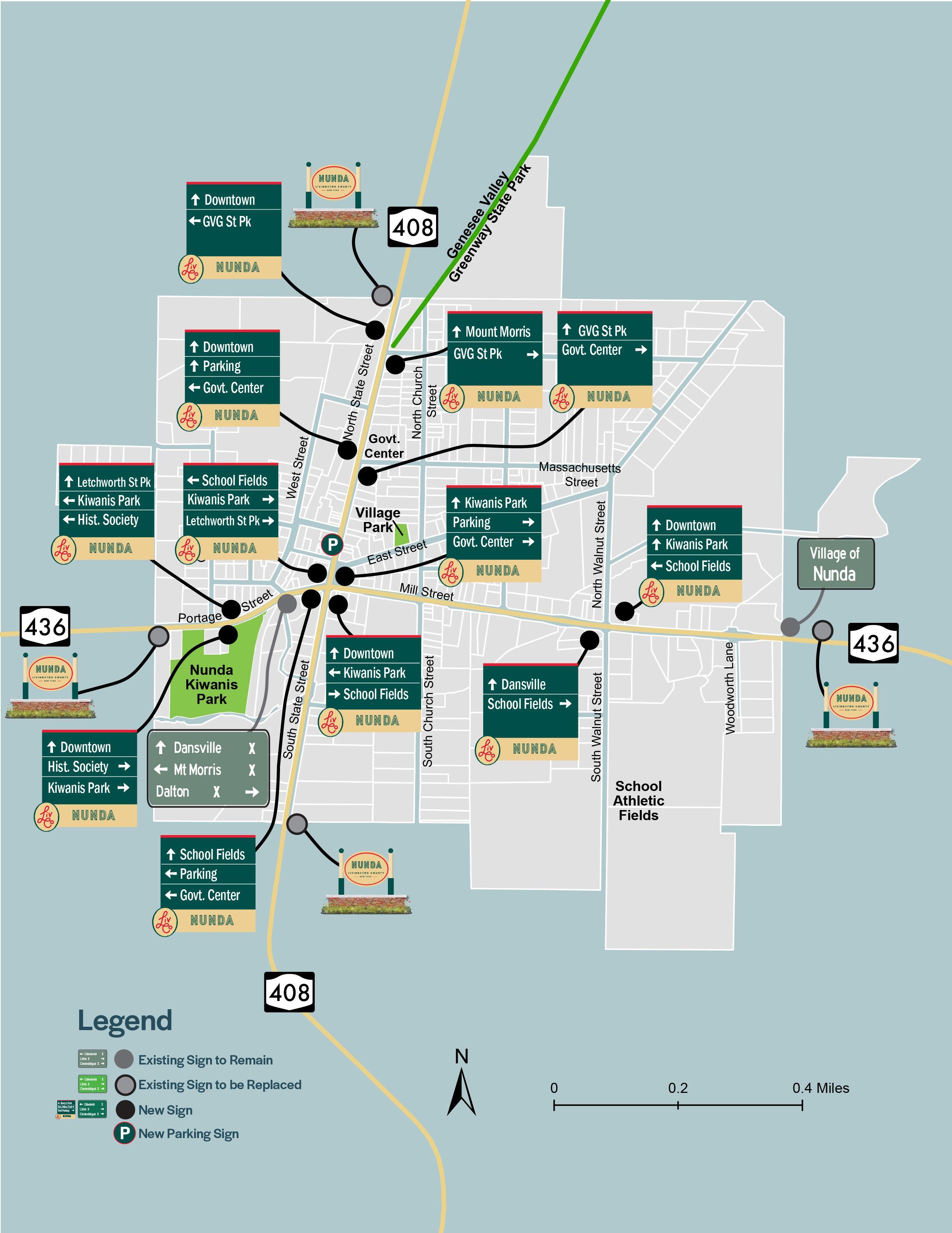
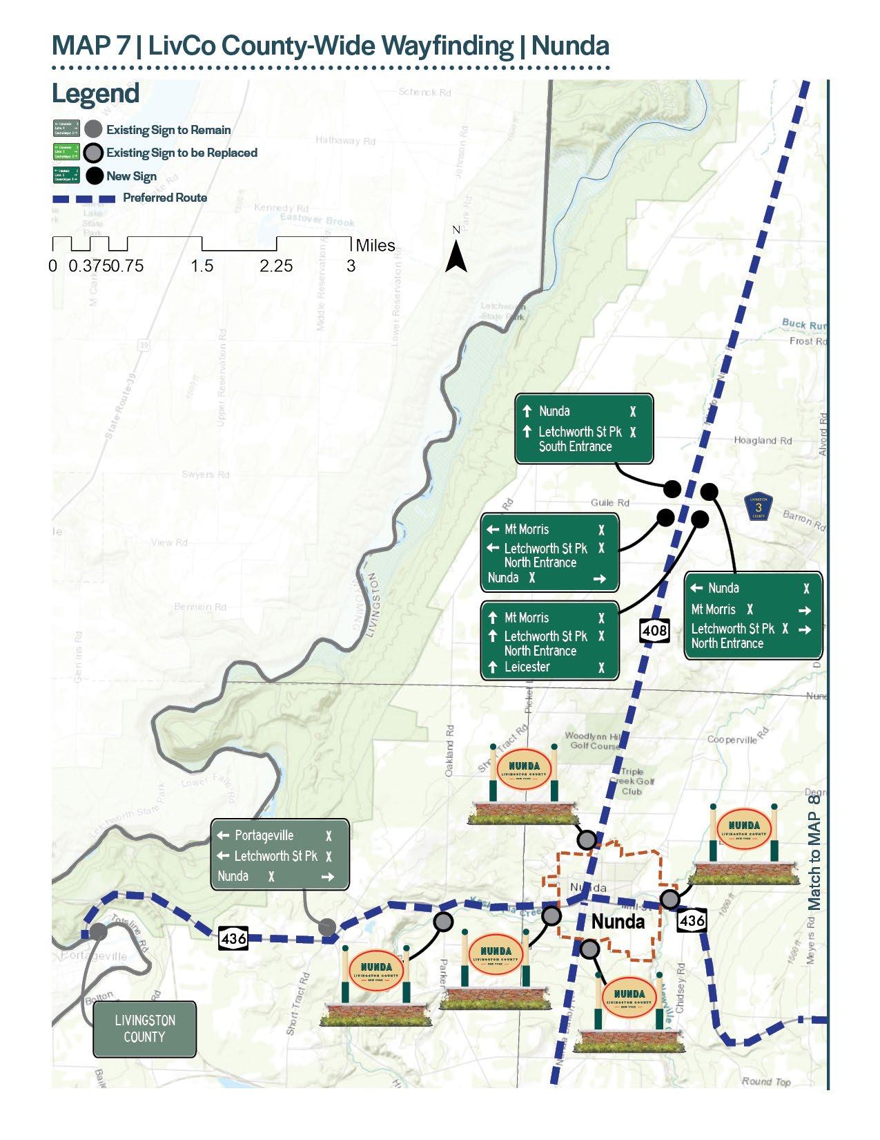
Nunda is located in the southwestern part of Livingston County. Routes 408 and 436 are the major roadways in and out of the Village connecting Nunda to Mount Morris and Dansville. The Genesee Valley Greenway State Park connects to the Village at the northern Village limits. Portageville is located just west of Nunda in Wyoming County and is the location of the southern entrance to Letchworth State Park and additional connections to Genesee Valley Greenway State Park.
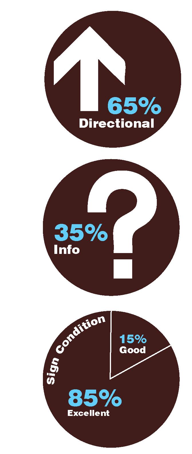
9 signs were inventoried in the Village of Nunda. A majority of the signs are located at the Village boundary.
Gateway Sign 5 Other 2 Distance Sign 1 Parking Sign 1
Less than a quarter of the existing signage consists of Distance Signs and Parking Signs.
All of the signage in Nunda is geared toward a person in a vehicle.
No pedestrian oriented signs exist in Nunda.
Over three quarters of the existing signage is informational, a majority of those signs consisting of Gateway Signs and community organization signs.
Nearly a quarter of the signs inventoried are identified to be in Excellent or Good condition. 34% of the signs, including Parking and Gateway Signs, were in poor condition with peeling paint or bent.
The Genesee Valley Greenway State Park traverses north/south through five counties including Livingston County, connecting state parks, streams, rivers and natural resources. Three of the nine Livingston County Villages have direct connections to the Genesee Valley Greenway State Park. In Avon, the Erie-Attica Trail connects to the Greenway from the north western border of the Village, In Mount Morris, the Greenway traverses through the heart of the Village and in Nunda, the Greenway connects to the northern border of the Village. In conjunction with current Genesee Valley Greenway State Park initiatives, opportunity exists to enhance wayfinding signage to connect and highlight this natural asset and recreation amenity.
The following destinations were identified as key County-wide attractions for inclusion in the in the LivCo Wayfinding Strategy.
Determining wayfinding destinations in Livingston County is a two-pronged approach. First, the system should direct visitors to the major destinations and Villages, then help guide people to the destinations within each of the nine downtowns. Below were the County-wide destinations identified: 1. Village of Avon
Village of Caledonia
Village of Dansville
Village of Geneseo
Village of Leicester
Village of Lima
Village of Livonia
Village of Mount Morris
Village of Nunda
Conesus Lake
Hemlock Lake
Genesee Valley Greenway State Park
Letchworth State Park 14. Genesee Country Village and Museum (in Genesee County) 15. Stony Brook State Park (in Steuben County)
Based on field visits, best management practices and interviews with community leaders, primary destinations within each Village were identified for inclusion within the wayfinding system.
Avon: P
1. Historic Downtown 2. Town and Village Hall 3. Library 4. Public Schools 5. Commercial Park 6. To Drive In & Flea Market 7. Avon Driving Park 8. Berry’s Park (cartop boat launch) 9. Case Park 10. Circle Park 11. Five Arch Bridge 12. Erie -Attica Trail 13. Genesee Valley Greenway State Park 14. Commercial District (located outside the map boundary) 15. Post Office Public Parking
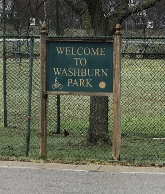
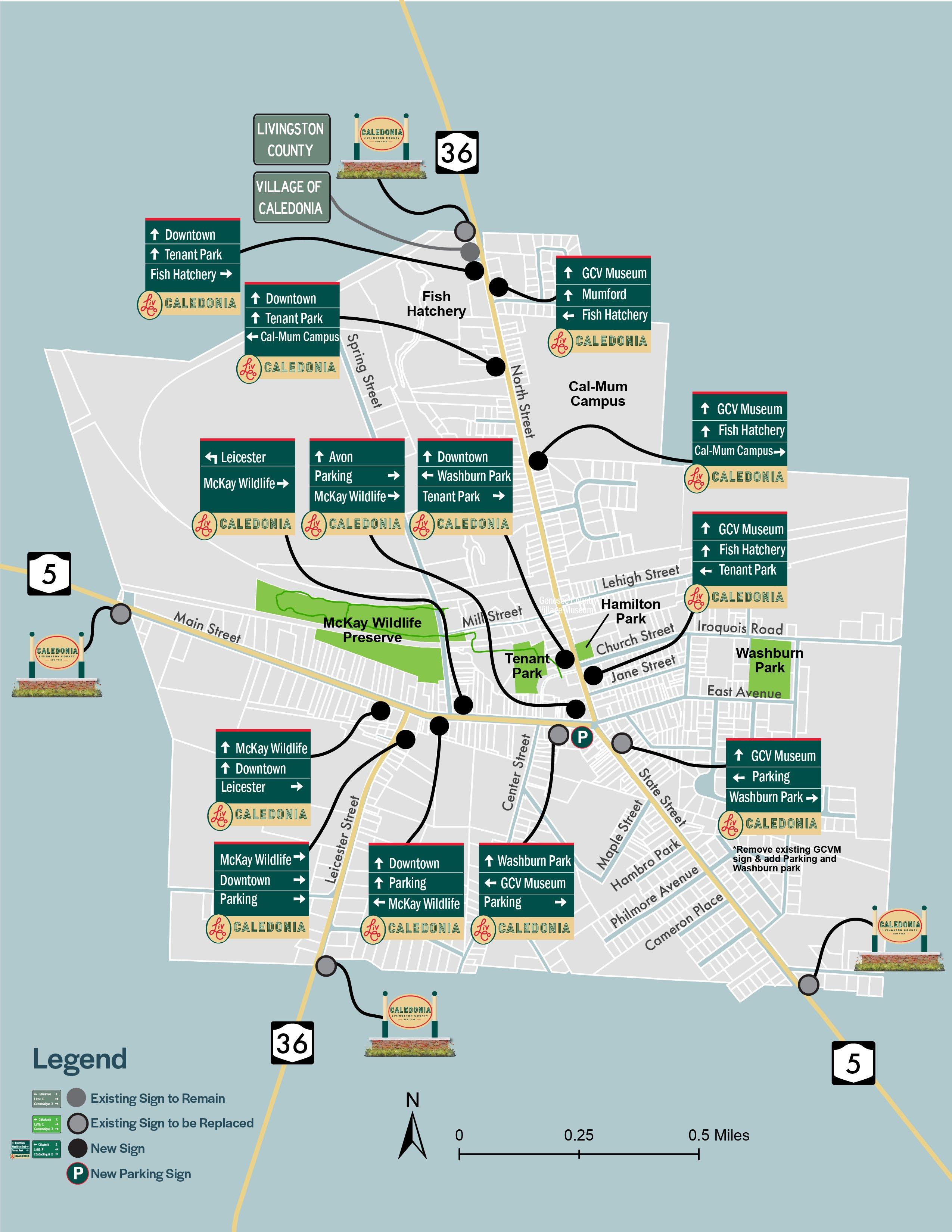
Caledonia: 1. Downtown Caledonia 2. Library 3. Cal-Mum Campus 4. Big Springs Museum 5. Fish Hatchery 6. Hamilton Park 7. McKay Wildlife Preserve 8. Tenant Park 9. Washburn Park 10. To Genesee Country Village & Museum Public Parking
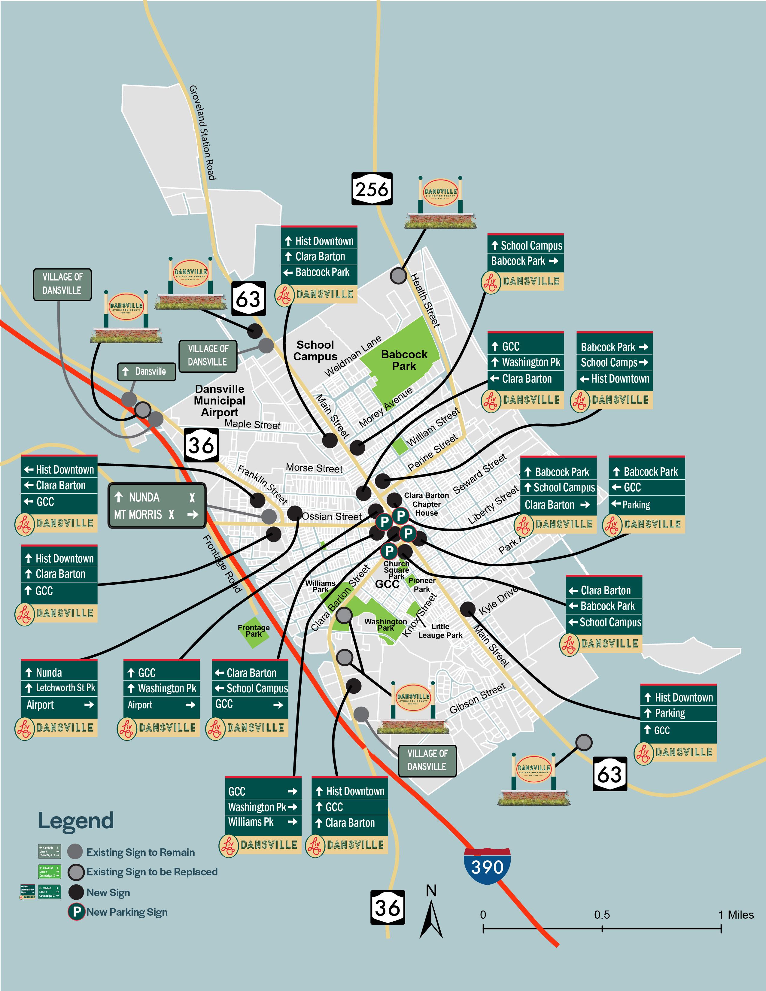
Dansville: 1. Historic Downtown District 2. Clara Barton Chapter House 3. Library 4. Historical Society 5. Dansville Municipal Airport 6. School Campus 7. Genesee Community CollegeDansville Campus 8. Babcock Park 9. Church Square Park 10. Frontage Park 11. Pioneer Park 12. Washington Park 13. Williams Park 14. Little League Park Public Parking
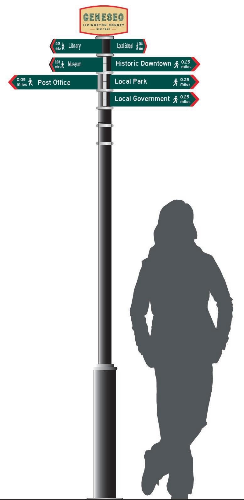
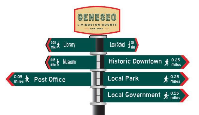
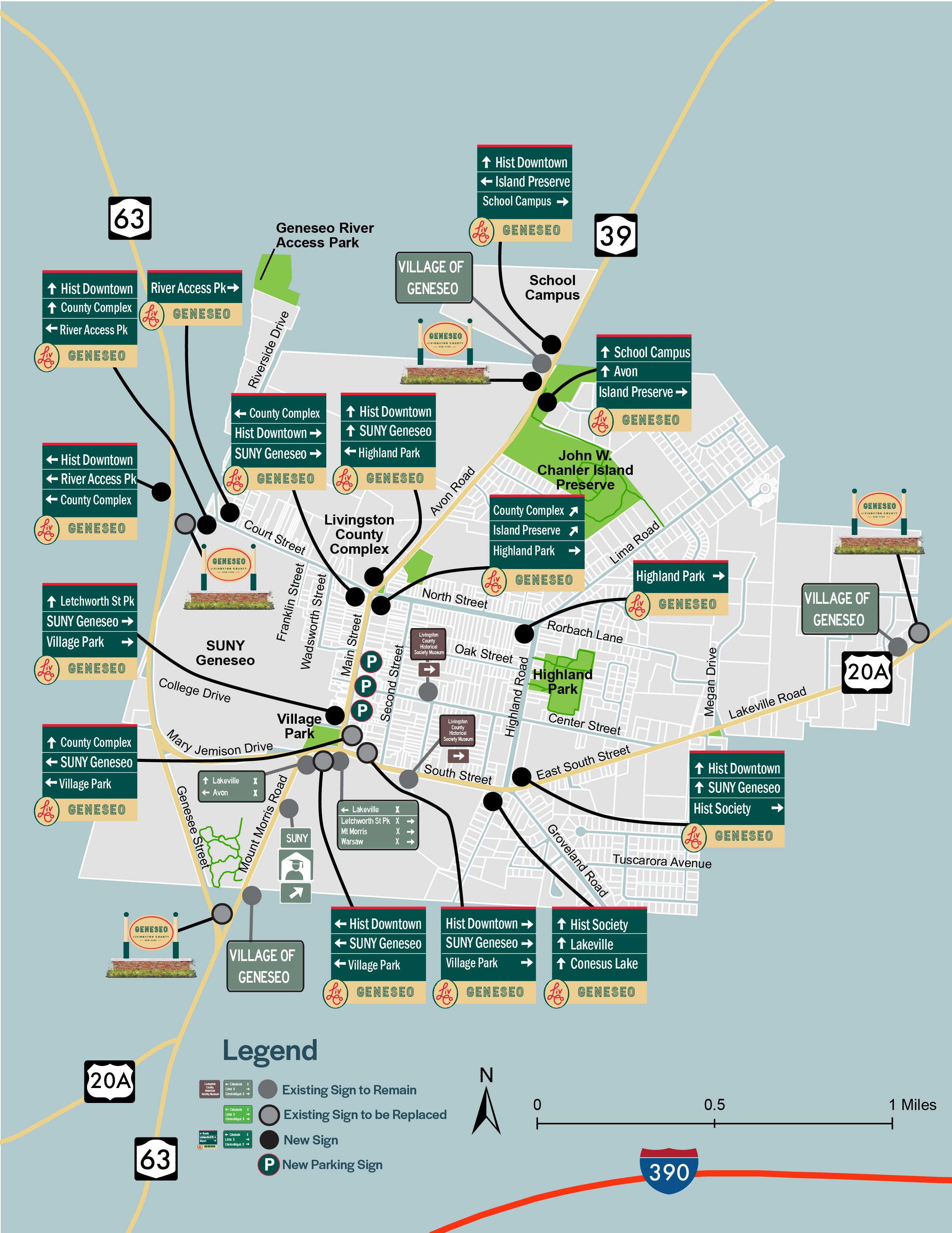
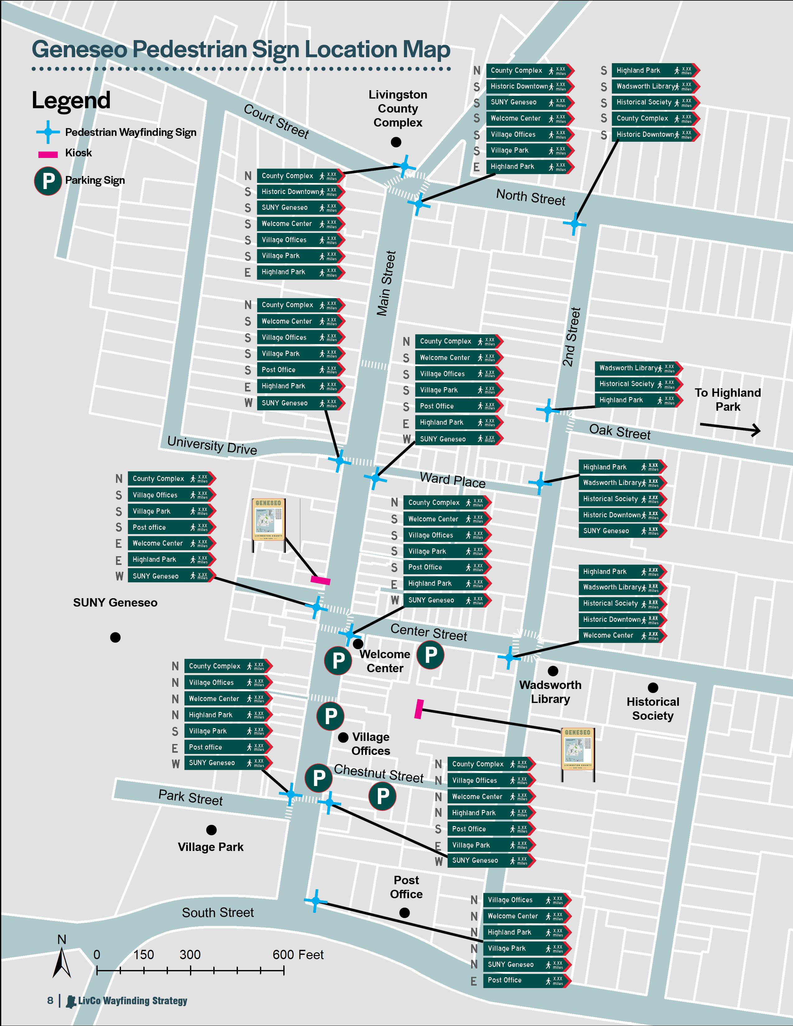
1. Historic Downtown District 2. Livingston County Complex 3. Welcome Center 4. Village Office 5. Wadsworth Library 6. Historical Society 7. SUNY Geneseo 8. School Campus 9. Highland Park 10. John W. Chanler Island Preserve 11. Village Park 12. Geneseo River Access Park 13. To Indian Fort Nature Preserve 14. Post Office
Public Parking P
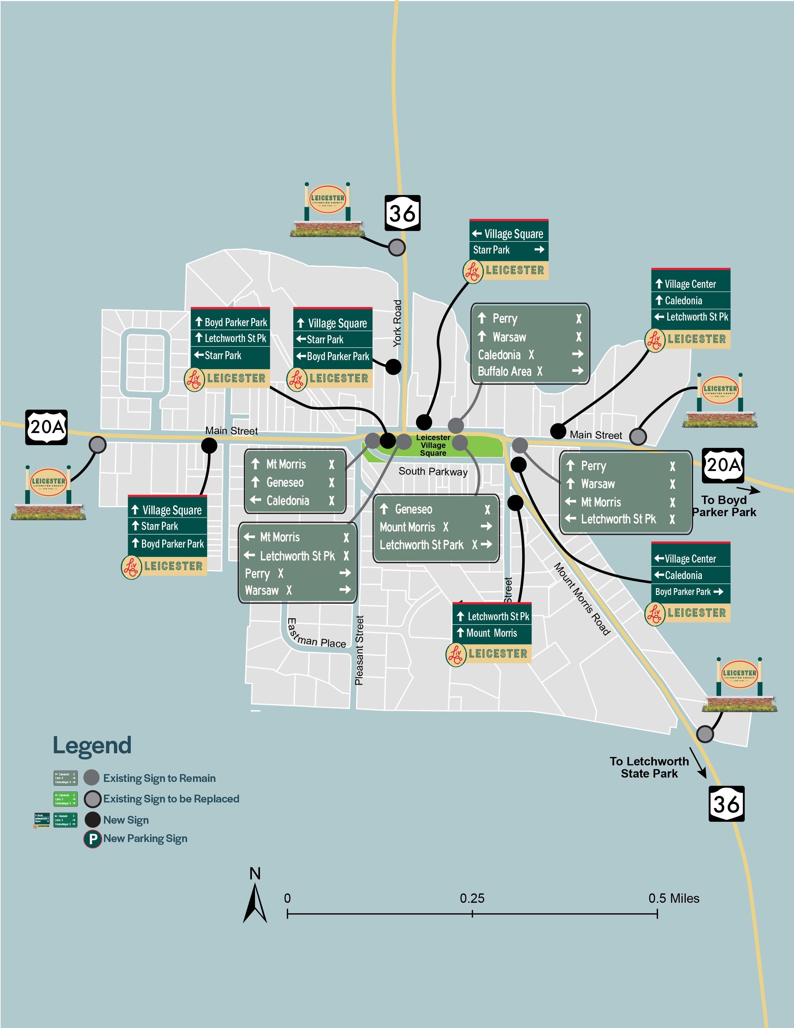
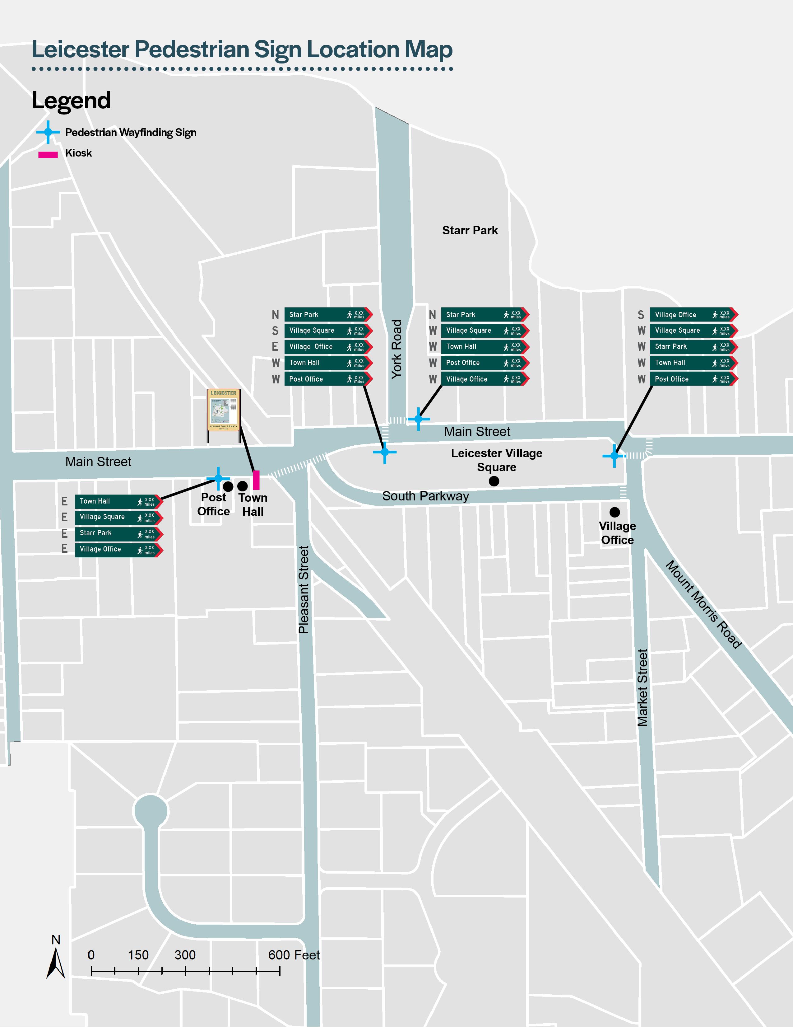
Leicester:
Geneseo: 1. Leicester Village Square 2. Starr Park 3. To Boyd Parker Park 4. To Letchworth State Park 5. Village Office 6. Town Hall 7. Post office
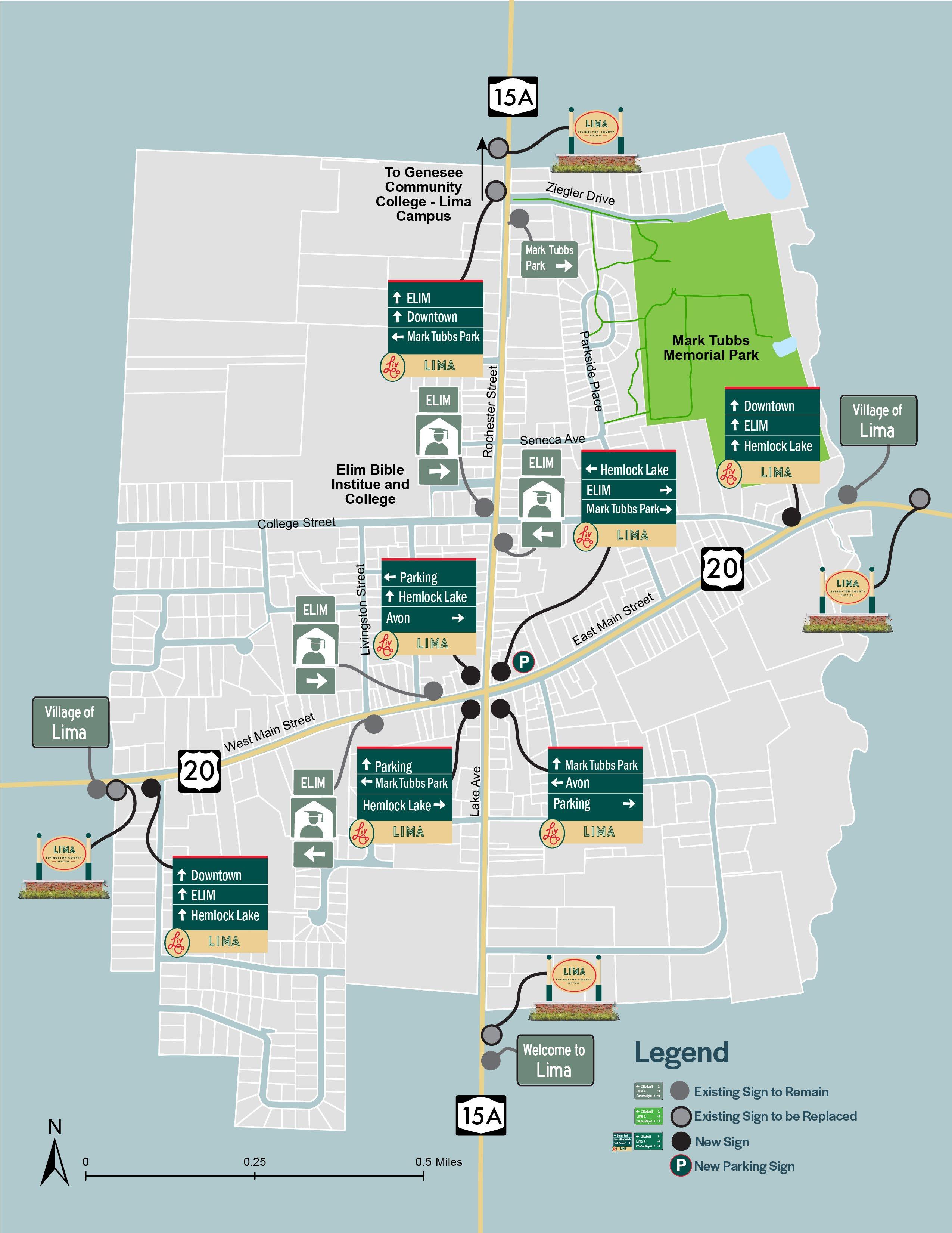
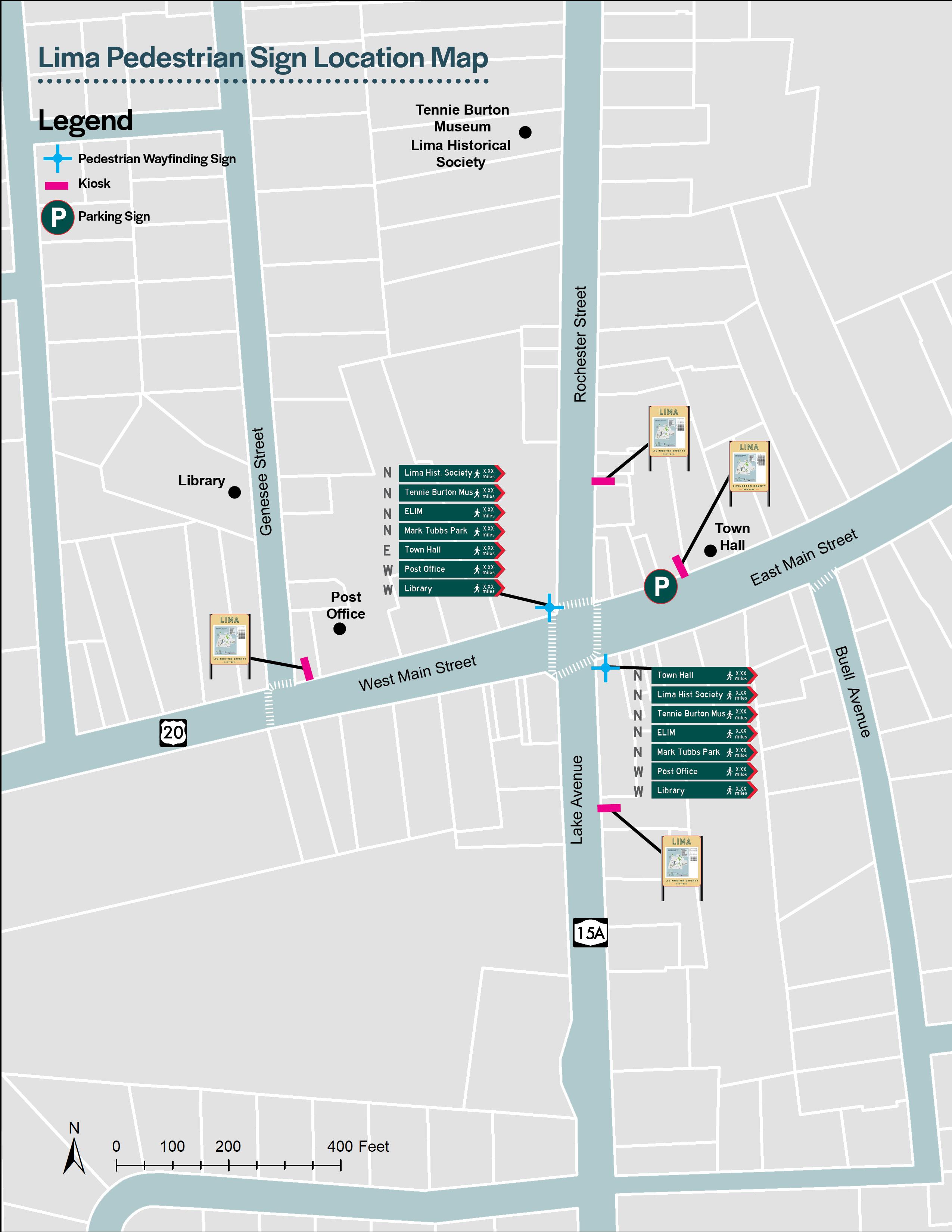
Lima: 1. Downtown 2. Town Hall 3. Post Office 4. Library 5. Tennie Burton Museum 6. Lima Historical Society 7. Elim Bible Institute & College 8. GCC - Lima Campus 9. Mark Tubbs Memorial Park
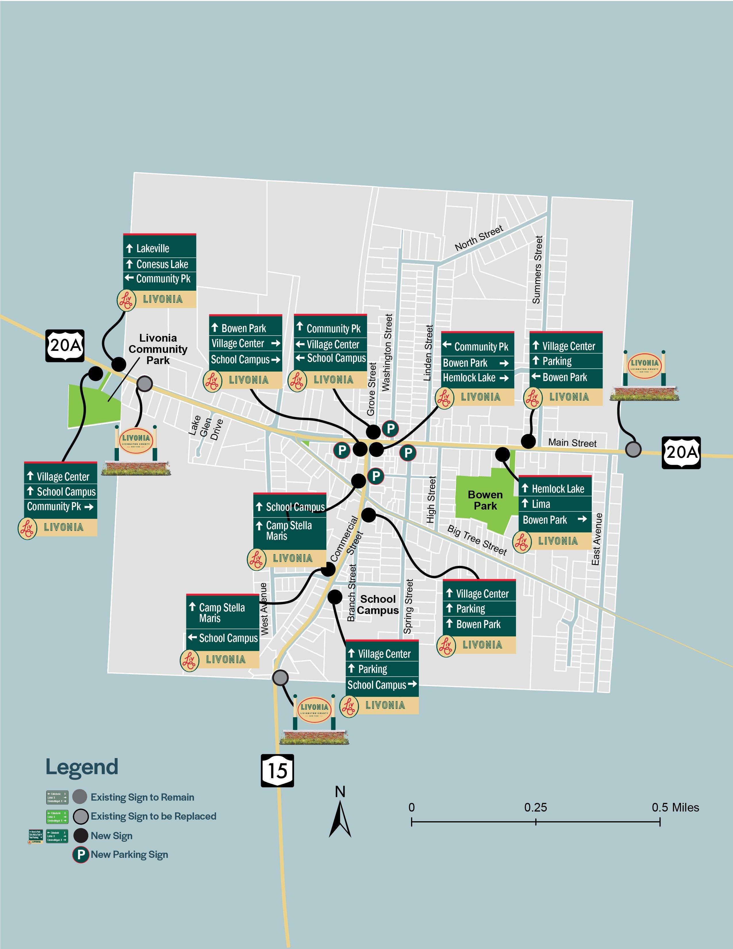
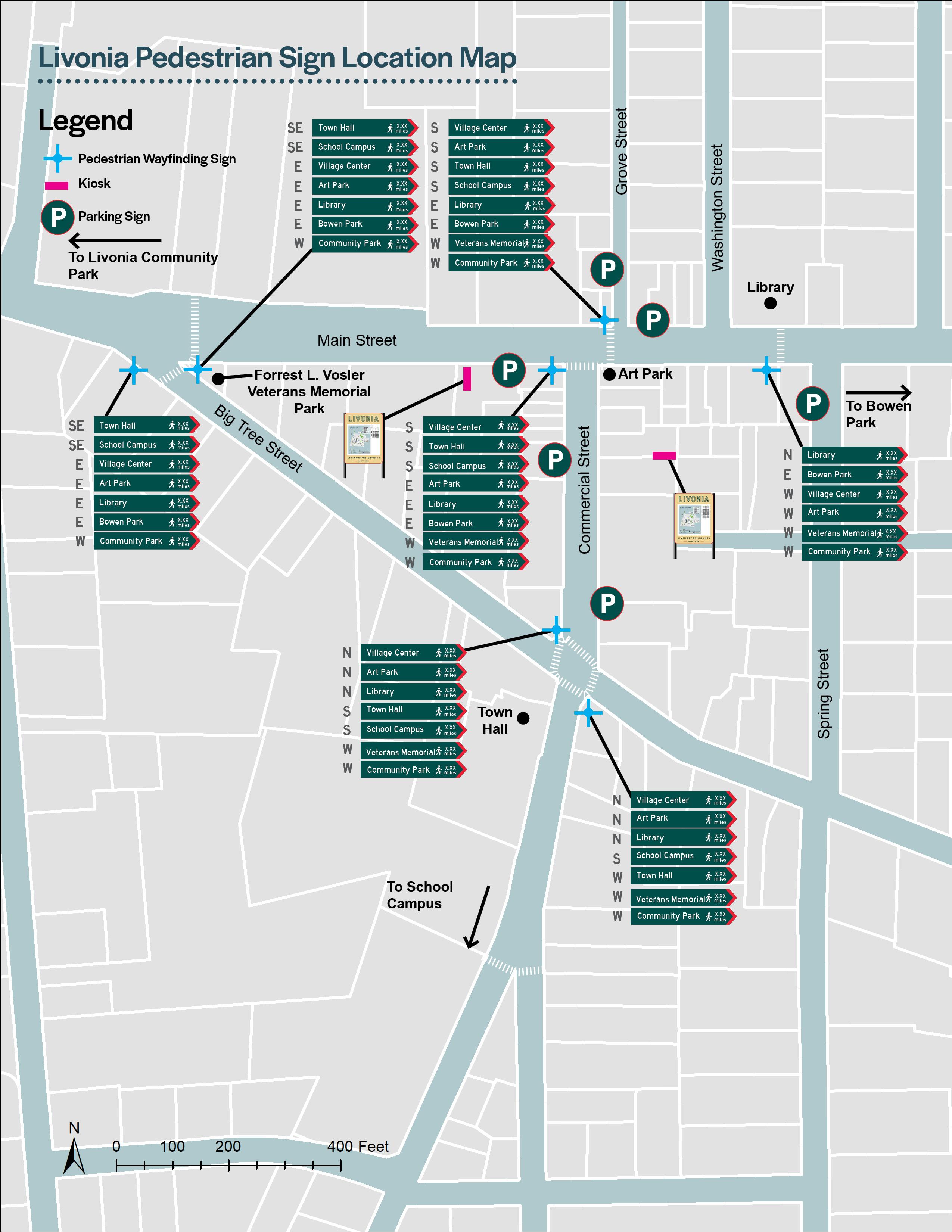
Livonia: 1. Village Center 2. Library 3. School Campus 4. Art Park 5. Bowen Park 6. Forrest L. Vosler Veterans Memorial Park 7. Livonia Community Park 8. To Conesus Lake 9. To Lakeville Park(Vitale Park) 10. To Hemlock Lake Park 11. Camp Stella Maris Public Parking P
Mount Morris:
1. Downtown 2. Library 3. School Campus 4. Al Lorenz Park 5. Bellamy Park 6. John Wesley Powell Park & Boat Launch 7. Patriots Park 8. Veteran’s Memorial Park 9. Genesee Valley Greenway State Park 10. Letchworth State Park Entrance 11. Genesee River Bridge 12. Finger Lakes Trail 13. To Mount Morris Dam/ Information Center 14. BOCES 15. Mill Mansion Museum Public Parking P
Nunda: 1. Downtown 2. Government Center 3. Library 4. Historical Society 5. School Athletic Fields 6. Nunda Kiwanis Park 7. Village Park 8. To Oakland Locks 9. To Letchworth State Park 10. Genesee Valley Greenway State Park Public Parking P
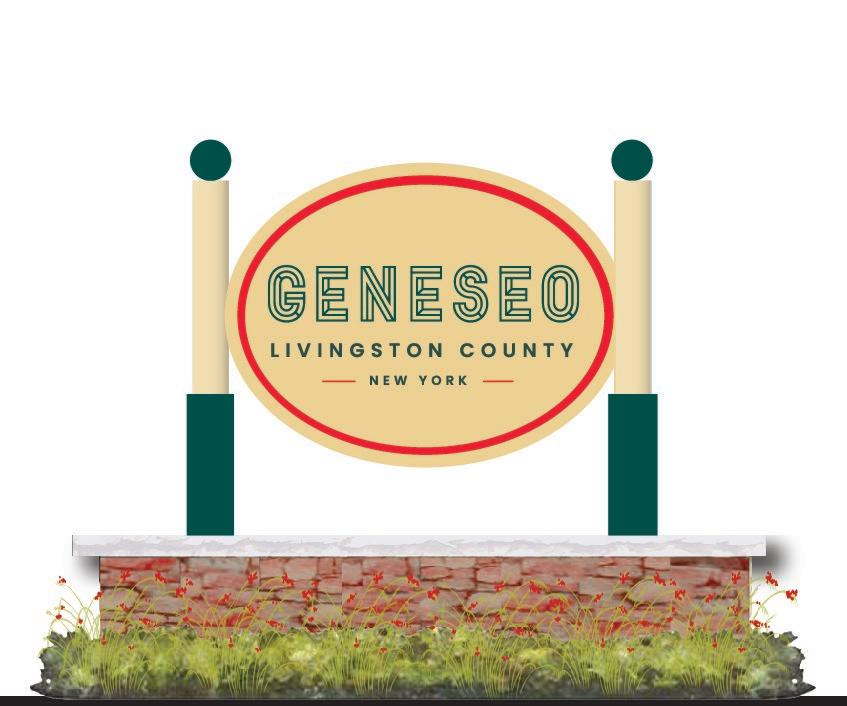
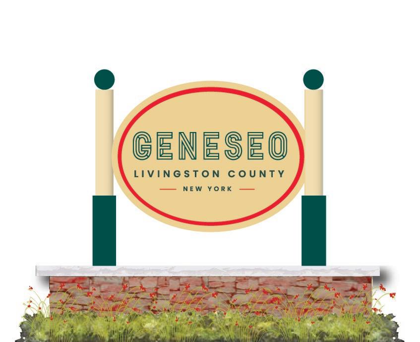
The purpose of wayfinding is to provide an informative, functional and identifiable system that clearly directs users to significant destinations within Livingston County and each of the nine Villages. Consistent design, including colors and materials, are key components for ensuring an identifiable and recognizable wayfinding system. The proposed system includes a hierarchy of signage to address the needs of a variety of users at the County level (gateway and destination) and at the Village level (gateway, destination, identification and kiosk signs).
The sign designs reflect the 2022 re-branding effort undertaken by the County to promote the downtowns. The design team considered local needs and best management practices when developing the sign hierarchy and concepts for Livingston County.
Prior to the final design and installation of signs, site specific surveys should be conducted to confirm property ownership, the location of under and above ground utilities, and any other potential conflicts. Coordination with applicable regulatory agencies such as each Village government, Livingston County, and the New York State Department of Transportation (NYSDOT), should occur to obtain the necessary permits and approvals prior to design, fabrication, and installation.
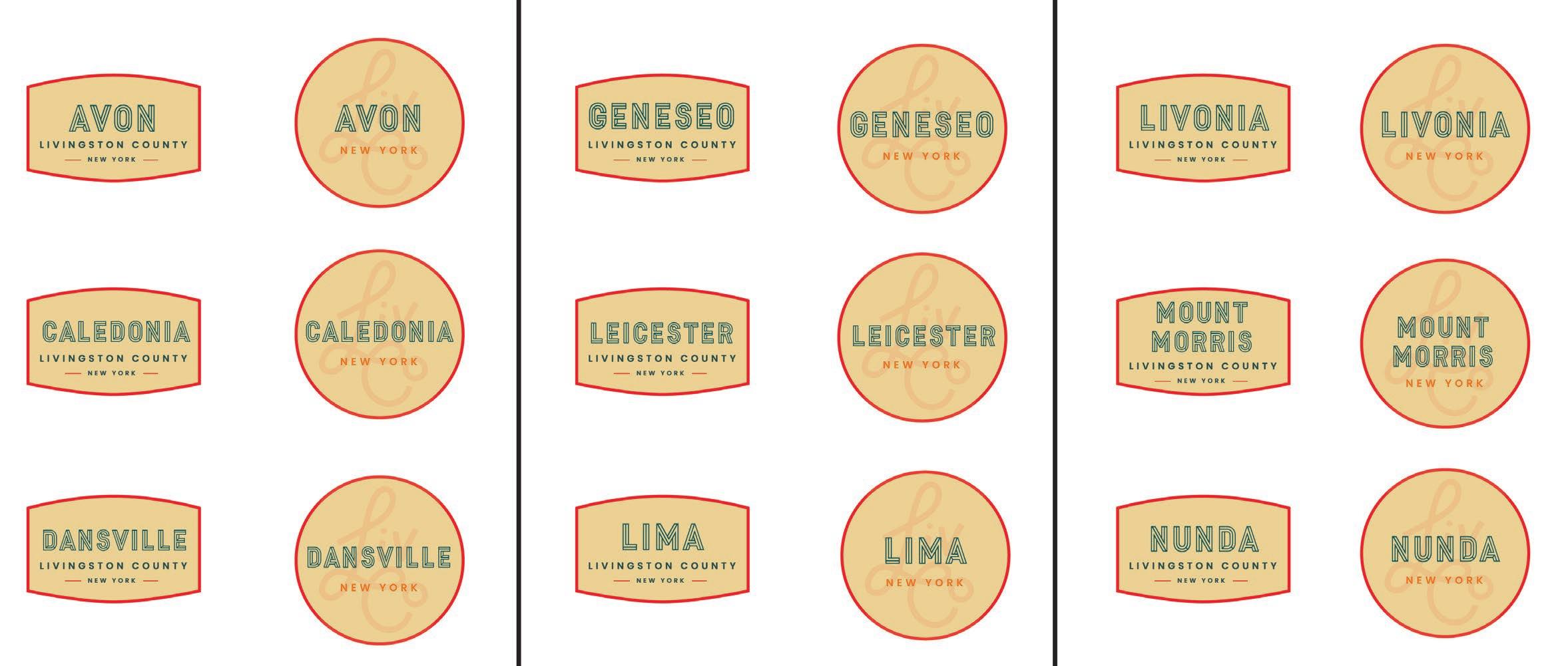
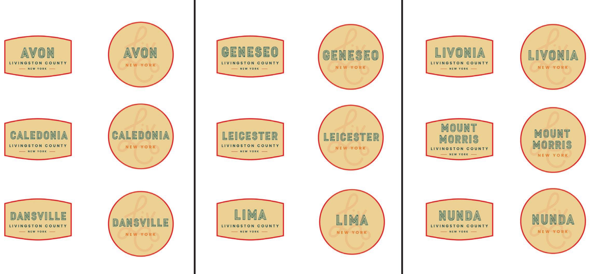
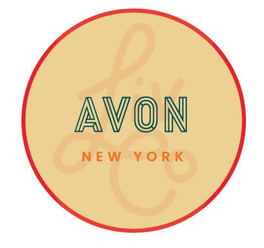
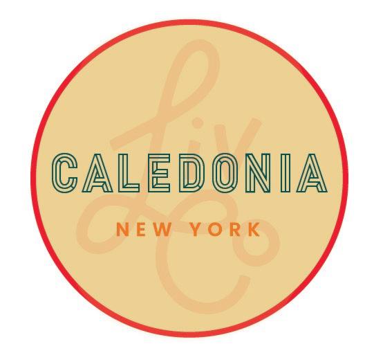
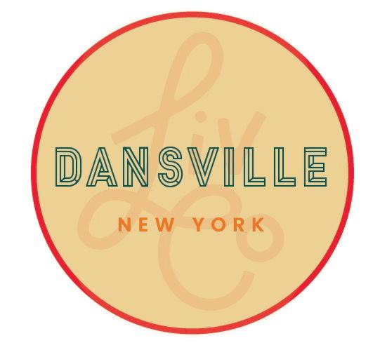
In 2022, Livingston County underwent a re-branding effort to promote the County’s unique downtown areas on a broad scale, to encourage tourism, and to foster economic growth. The wayfinding program is just one initiative in which the larger branding will be used to visually and cohesively connect downtowns throughout Livingston County, while simultaneously highlighting their unique identity and attributes. An overall LIVCO brand was established, as depicted below, with the ability to be applied to each downtown. The recommended wayfinding system incorporates the colors and logos created as part of the 2022 LIVCO re-branding initiative.

General design guidelines which were considered when developing the Livingston County comprehensive wayfinding strategy include the following:
• The number of messages on vehicular wayfinding sighs should conform to New York State Department of Transportation (NYSDOT) and Manual of Uniform Traffic Control Devices (MUTCD) standards. On vehicular signs, no more than 3 destinations should be listed.
• Organize messages (top to bottom) by nearest destination and by the direction they are in. Destinations straight ahead are first, to the left second and to the right third.
• When there is space provided, the sign messages should always be composed on a single line.
• Clearly delineate between destinations heading in different directions.
• Indicate distance from the sign/message to the destination when applicable depending on sign type.
• If abbreviating a destination is necessary, be sure the abbreviations are easily recognized and are consistent throughout the entire system.
• There should be a strong contrast between letter color and sign background for legibility.
• Use a 6” capital letter height on vehicular signs located on roads with a posted speed limit over 25 MPH, 4” capital letter height on roads with a posted speed limited under 25 MPH. Recognizing that all communities and sign settings are not the same, a dialogue between the NYSDOT or other regulatory agencies shall take place to determine the appropriateness of sign and font size as relate to MUTCD standards.
• Use accessibility symbols where appropriate.
• Vehicular wayfinding sign materials and sizes should conform to NYSDOT and MUTCD standards.
• Tie system together through hardware, color palettes and sign geometry.
• Simplify nomenclature and use consistently in all media (print, maps, web and signage).
• Design signs so they can be used on their own poles or existing poles.
• Set height at minimum 7’ from bottom of the sign to the sidewalk or the ground plane.
• Make sign panels changeable for easy updating and maintenance.
Based on the existing conditions analysis and input received through the public engagement process, a Sign Hierarchy was developed to infill gaps in the existing system. The goal of the sign hierarchy is to create a comprehensive and easily identifiably wayfinding system throughout nine Villages of Livingston County. The proposed sign hierarchy includes the following sign types:
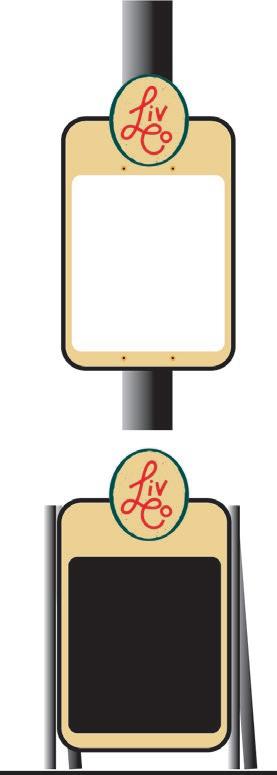
Typically located at major entrances to a Village or municipality. These signs will be the first exposure visitors will have to the wayfinding signage system.
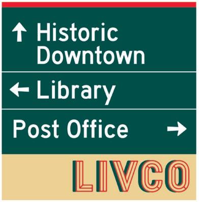
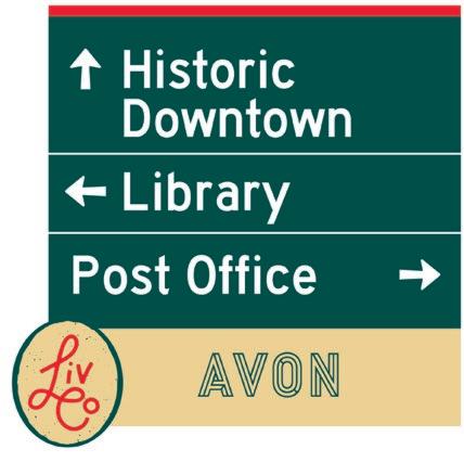
Located at major decision points within the Village limits these signs will direct vehicular traffic to the downtown core, available public parking and major destinations within each Village.
One of the easiest and most inexpensive ways to promote the LIVCO brand is with Light Pole Banners. These banners can be seasonally changed or incorporated into an existing light pole banner program in each Village.
Available public parking should be clearly identified. The round “P” will be located at all public parking facilities. A consistent sign color will be utilized throughout Livingston County providing consistency in the system.
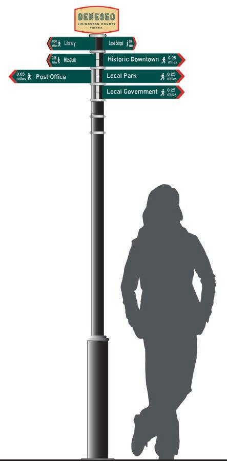
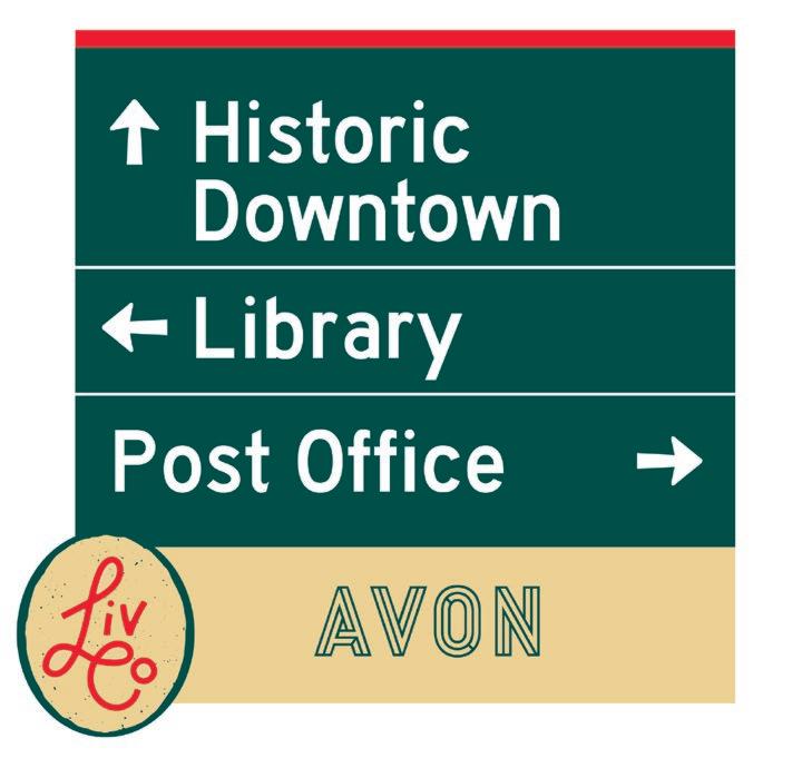
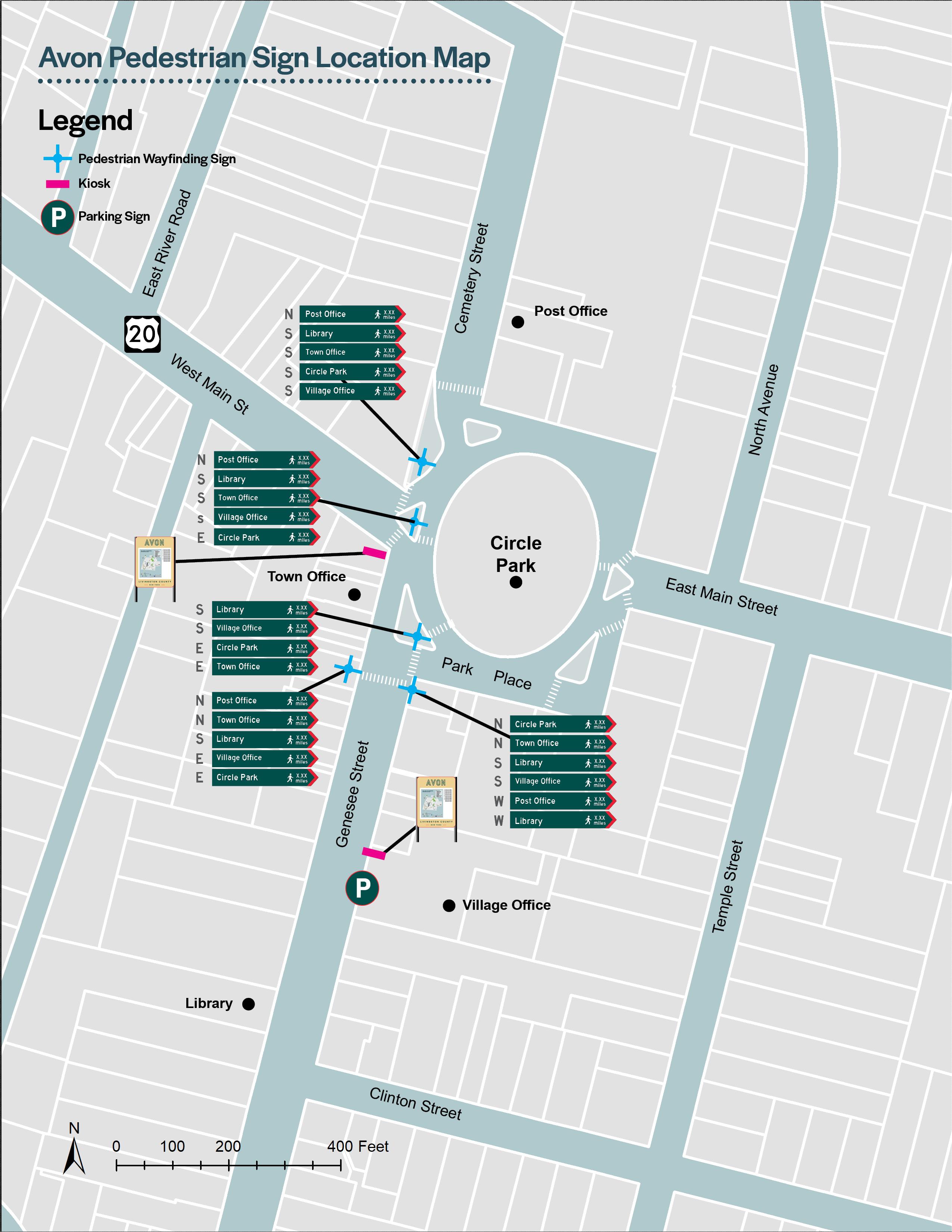
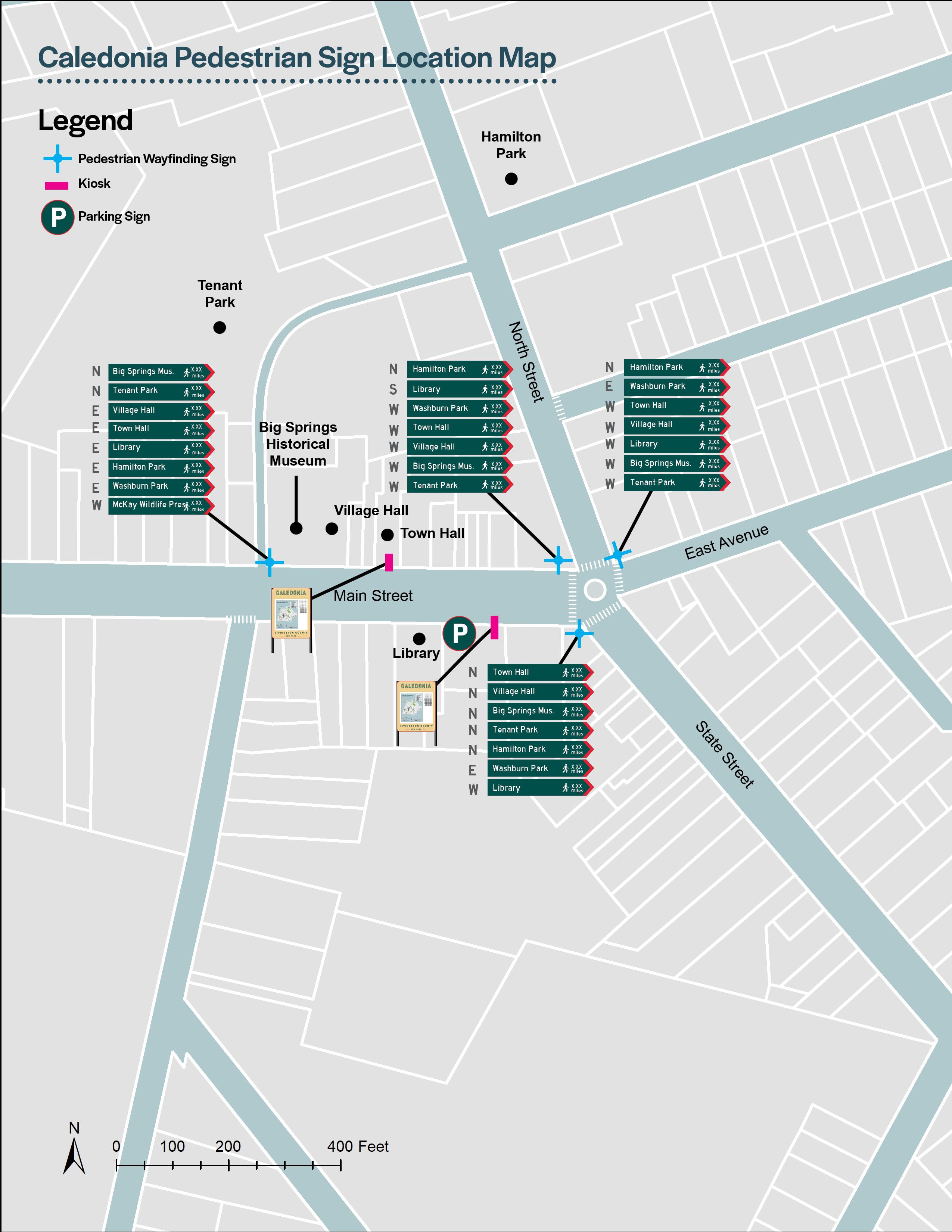
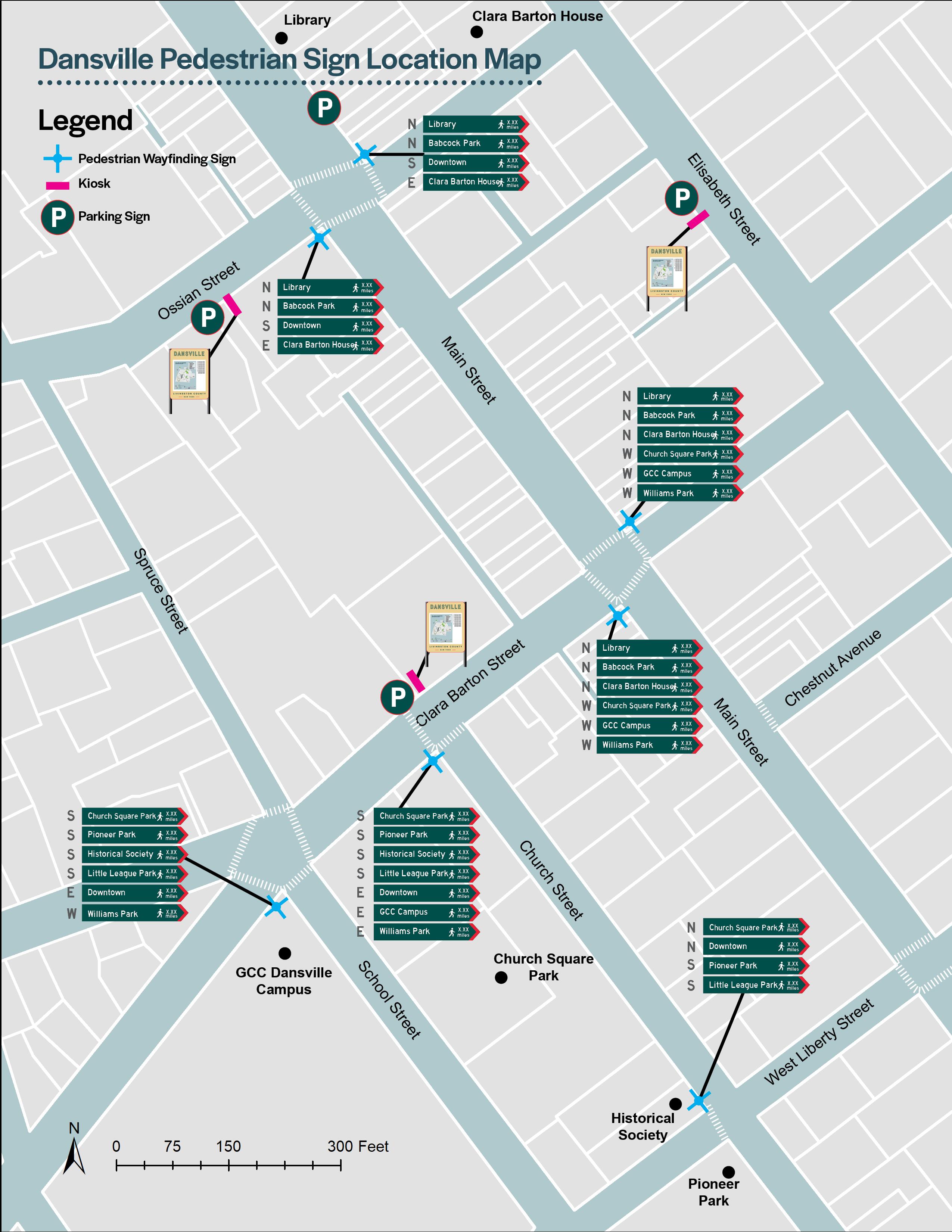
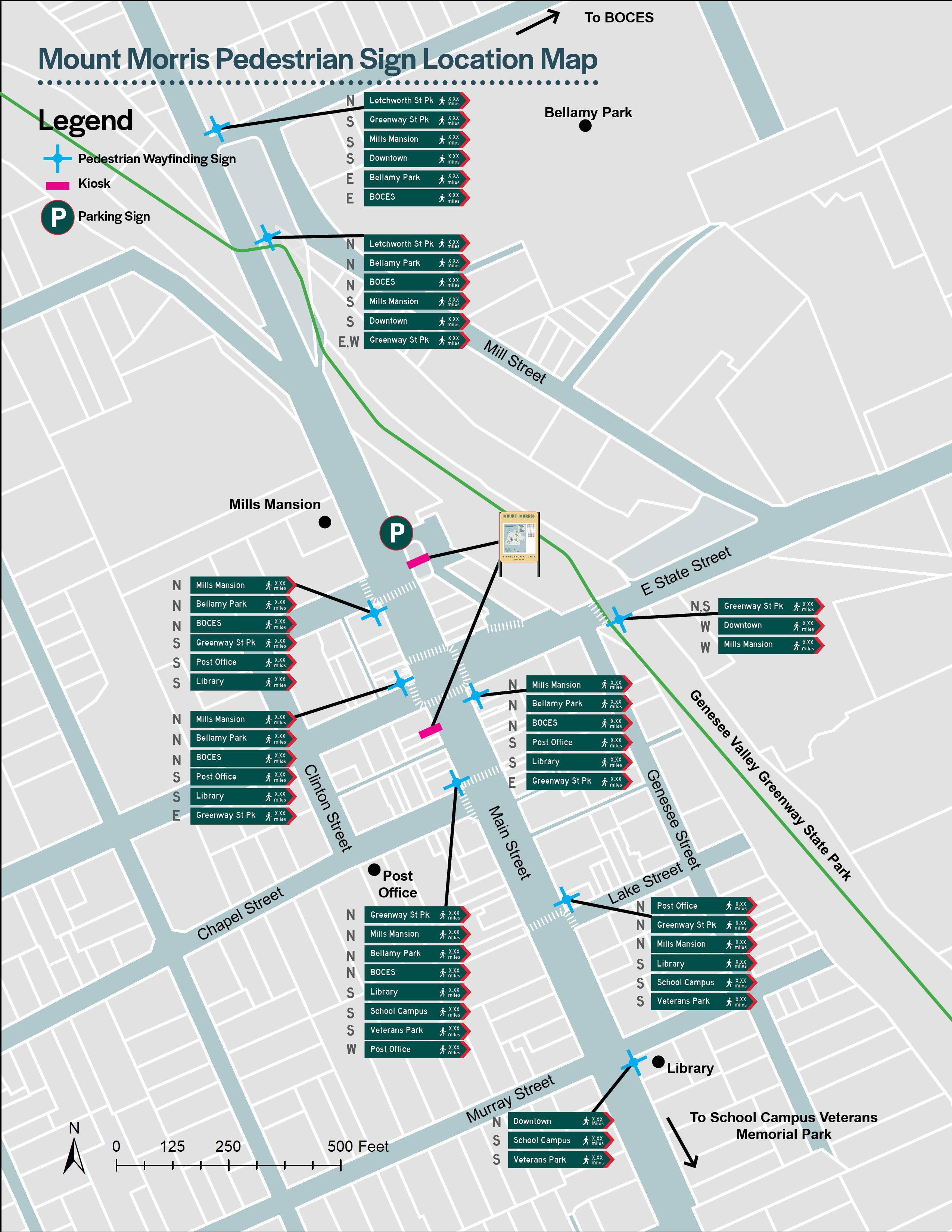
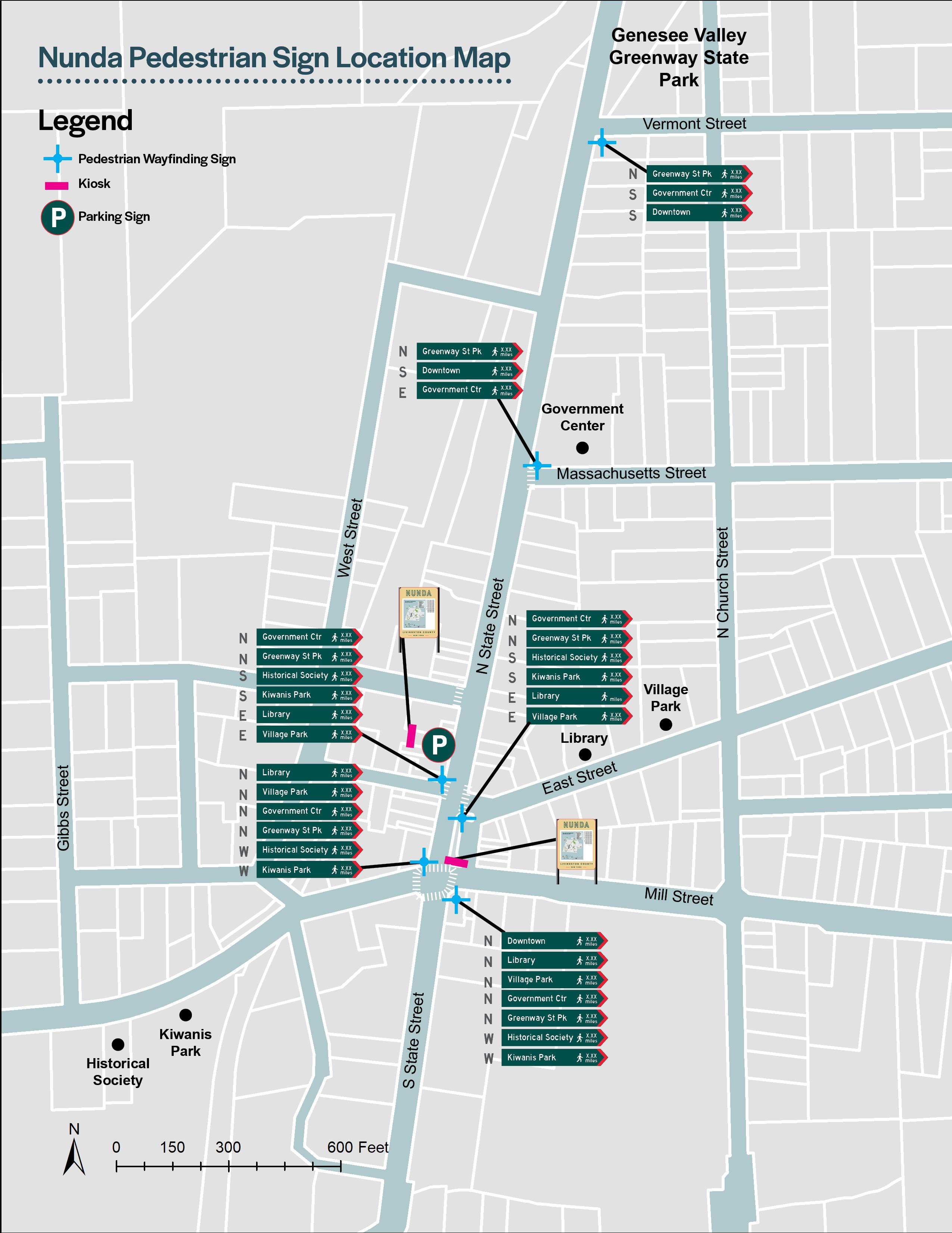
In the downtown core of each Village, Pedestrian Directional signs will be located at major destination points, directing visitors who are on foot to downtown destinations and attractions.
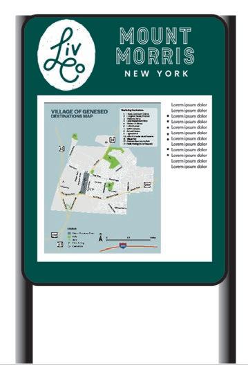
Kiosks can display a variety of information including a downtown map listing business, restaurants and local attractions, County-wide destinations and interpretive historic information. Kiosks are typically located in public parking facilities or at major destinations to act as the first point of information for a user exiting their car.
The most flexible sign in the hierarchy, Temporary Signs offer the ability to quickly advertise and brand local short-term events such farmers markets, festivals, and downtown businesses.
Aspects of the sign hierarchy can be customized for each of the nine Villages, creating a unique identity while still providing a cohesive County-wide brand. The sign hierarchy and potential customization options are presented on the following pages.


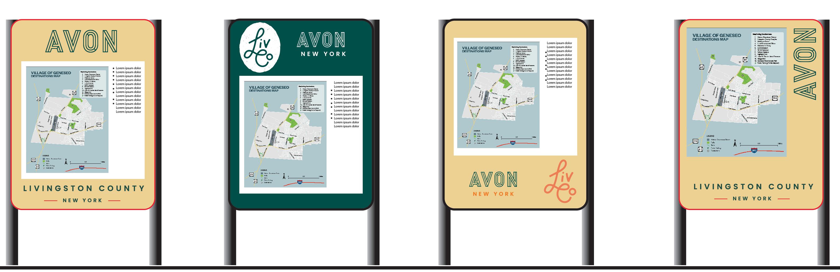
The Gateway Monument Sign is reserved for major entry points into each of the nine Villages. They are recommended on the right side of the road, perpendicular to the path of travel, however unique circumstances may warrant the Gateway Monument Sign to be located on the left side of the road. Each sign location should be evaluated on a case-by-case basis, keeping in mind sign distances, visual clearance, sign clutter and vehicular and pedestrian safety.
Prior to the installation of the Gateway Monument Signs, site specific surveys should be conducted to confirm property ownership, the location of any under ground and above ground utilities, and any other potential conflicts. Coordination with applicable regulatory agencies should occur to obtain the necessary permits and approvals prior to final design, fabrication and installation.
Panel can be fabricated out of wood, wood composite or aluminum sign construction. Color and logo shall comply with the LIVCO branding.
Gateway Monument Sign can be constructed with or without the stone base if space allows. Stone base should be composed of natural stone facing and cap. Landscaping can be incorporated to highlight the Gateway Monument Sign and blend it into the surrounding environment.
COST: $15,000 - $22,000 EA
Cost of Gateway Monument Sign does not include permit fees, utility installation or relocation, land acquisition or final design details.
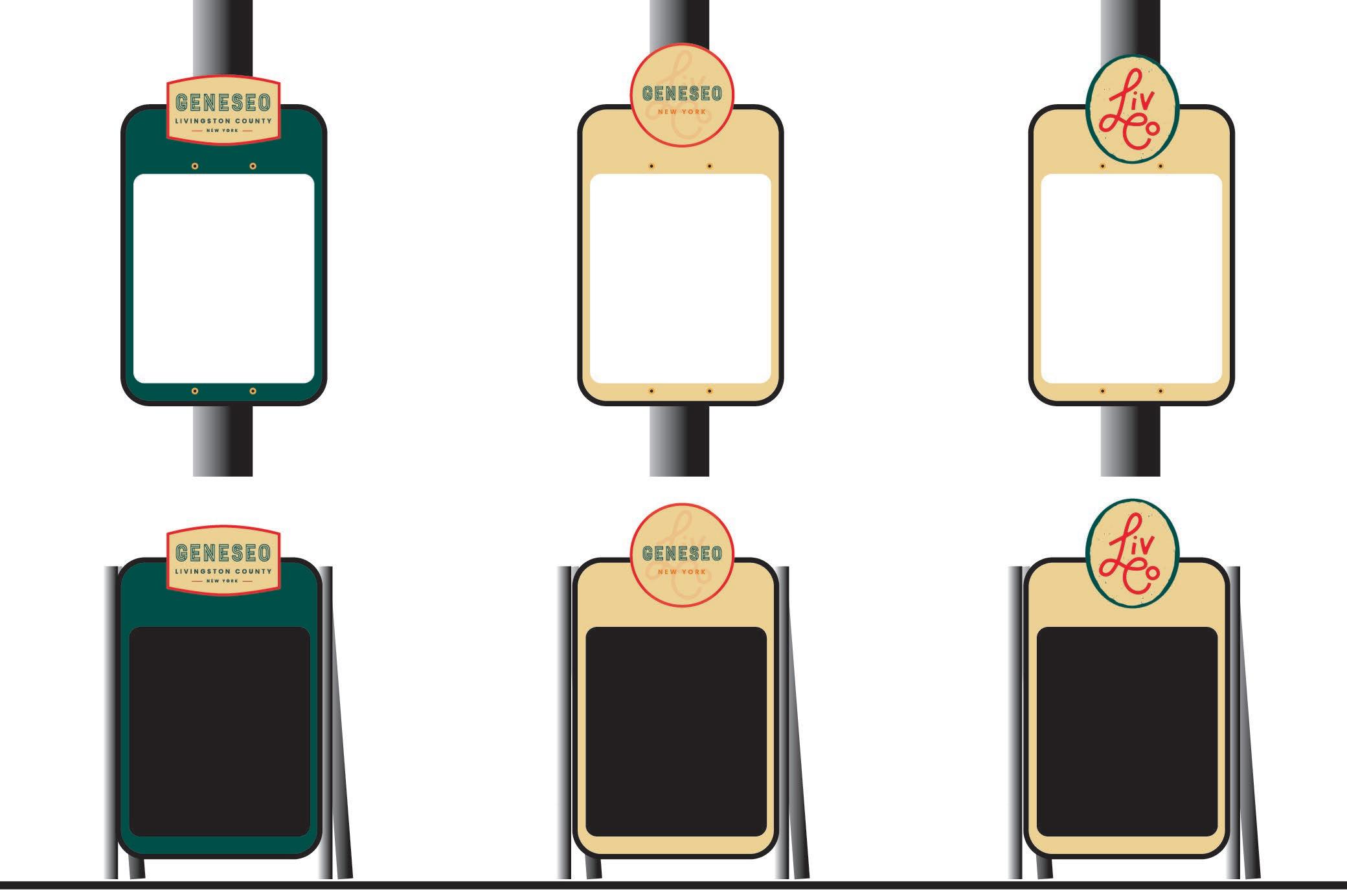
Five Gateway Monument Signs were developed using the 2022 LIVCO brand incorporating classic shapes and elements typically found on village gateway signs. Having a variety of sign designs for each Village to choose from, will help provide a unique identity for each Village while being consistent with the overall County-Wide brand. Livingston County will work with each Village to determine the best fit for sign shape, color and logo type.
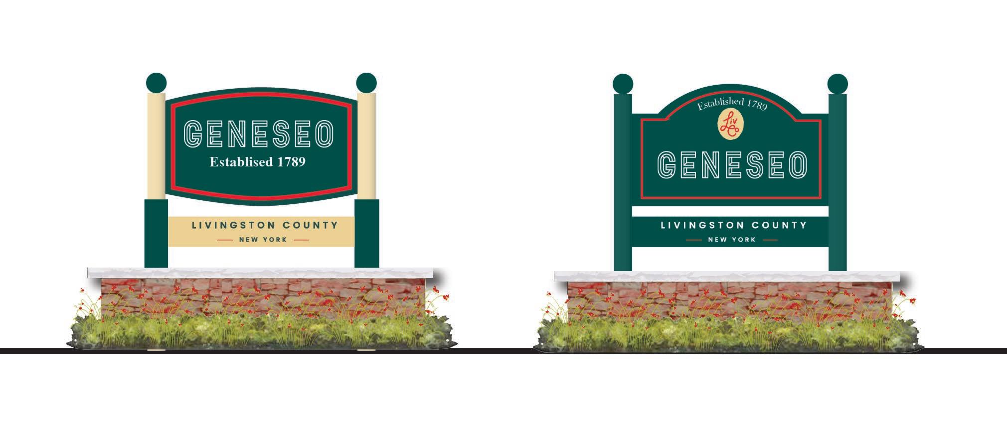
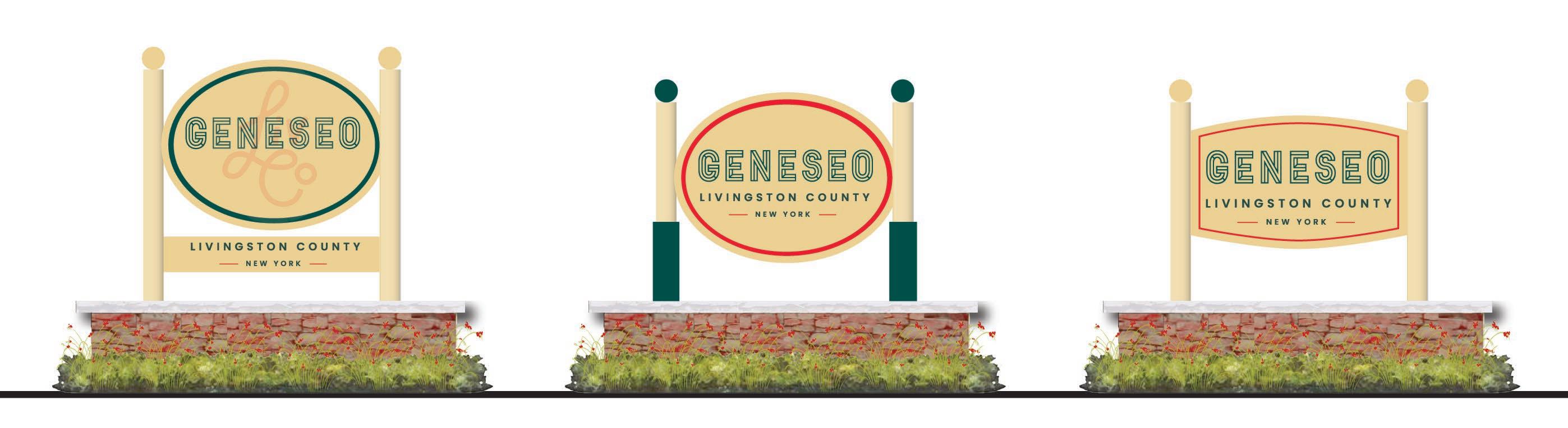
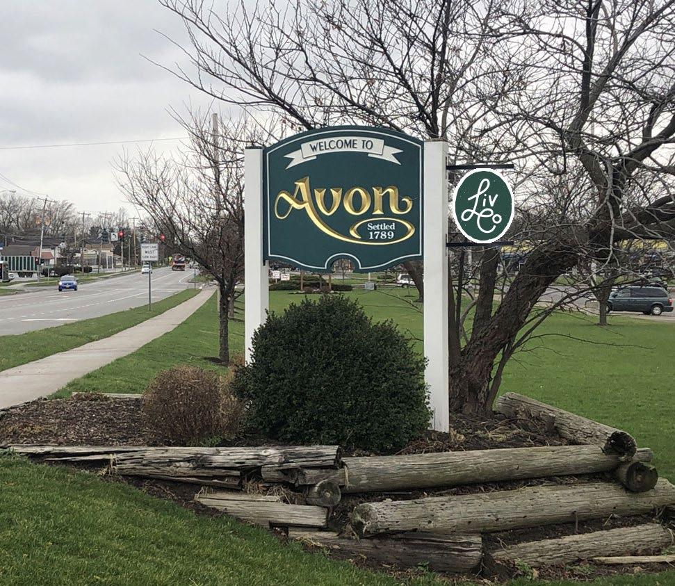
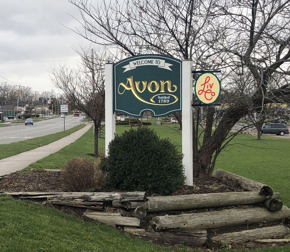
A majority of the existing gateway signs for each of the nine Villages are in good or excellent condition, with some of the signage being installed in the last year or two. Options to modify existing gateway signs with the LIVCO brand have been provided, to help tie existing gateway signs into the overall wayfinding system until they are identified for future replacement. The images below provide a variety of attachment methods which can be used to brand existing gateway signs. COST:
Vehicular Directional Signs are placed at decision making points and located on the right side of the road, perpendicular to the path of travel. Each sign location should be looked at on a case-by-case basis, keeping in mind sight distances, visual clearance, sign clutter, and vehicular and pedestrian safety. The placement of the Vehicular Directional Signs shall follow NYSDOT standard details and specifications for sign placement.
Prior to the design and installation of the Vehicular Directional Sign, site specific surveys should be conducted to confirm property ownership, the location of under and above ground utilities, and any other potential conflicts. Coordination with applicable regulatory agencies should occur to obtain the necessary permits and approvals prior to design, fabrication, and installation.
Single sided, reflective aluminum sign panel. Reference NYSDOT standard details and specifications for material requirements. Font shall have a 6” capital letter hight and comply with the MUTCD Standard Alphabets Font. Color shall comply with the LIVCO brand and any NYSDOT and MUTCD requirements.
Sign shall be mounted on (2) Type A high capacity sign posts and comply with NYSDOT standard details and specifications.
Cost of Vehicular Directional sign does not include permit fees, utility installation or relocation, land acquisition or final design details.
Vehicular Direction Signs for each Village will contain the LIVCO button along with the Village’s name. Colors and fonts are consistent with the LIVCO brand.
Vehicular Direction Signs located on County campuses and facilities, and not specific to one of the nine Villages, can incorporate the LIVCO overarching logo.
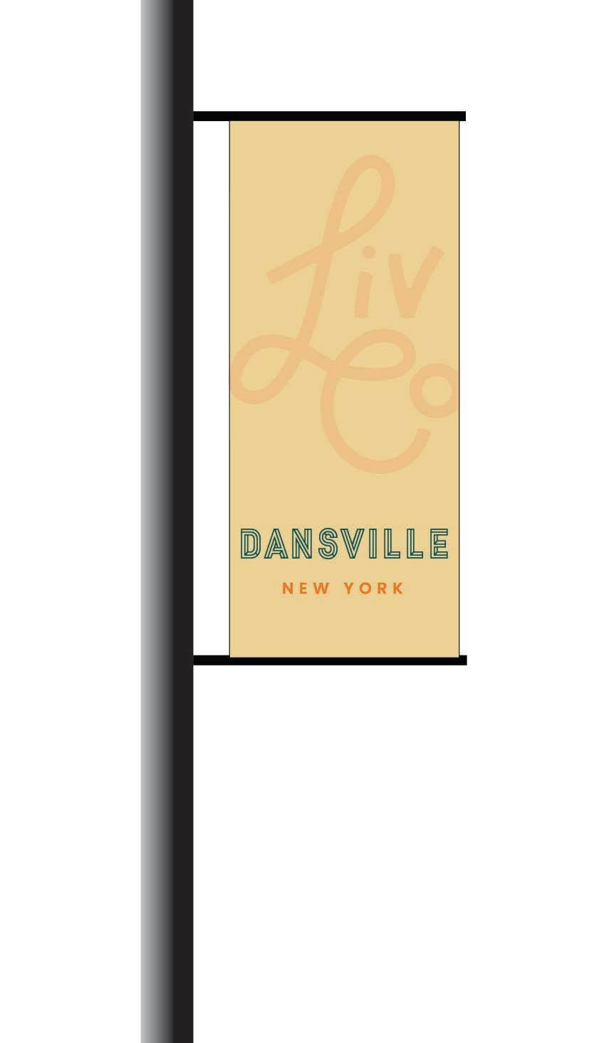
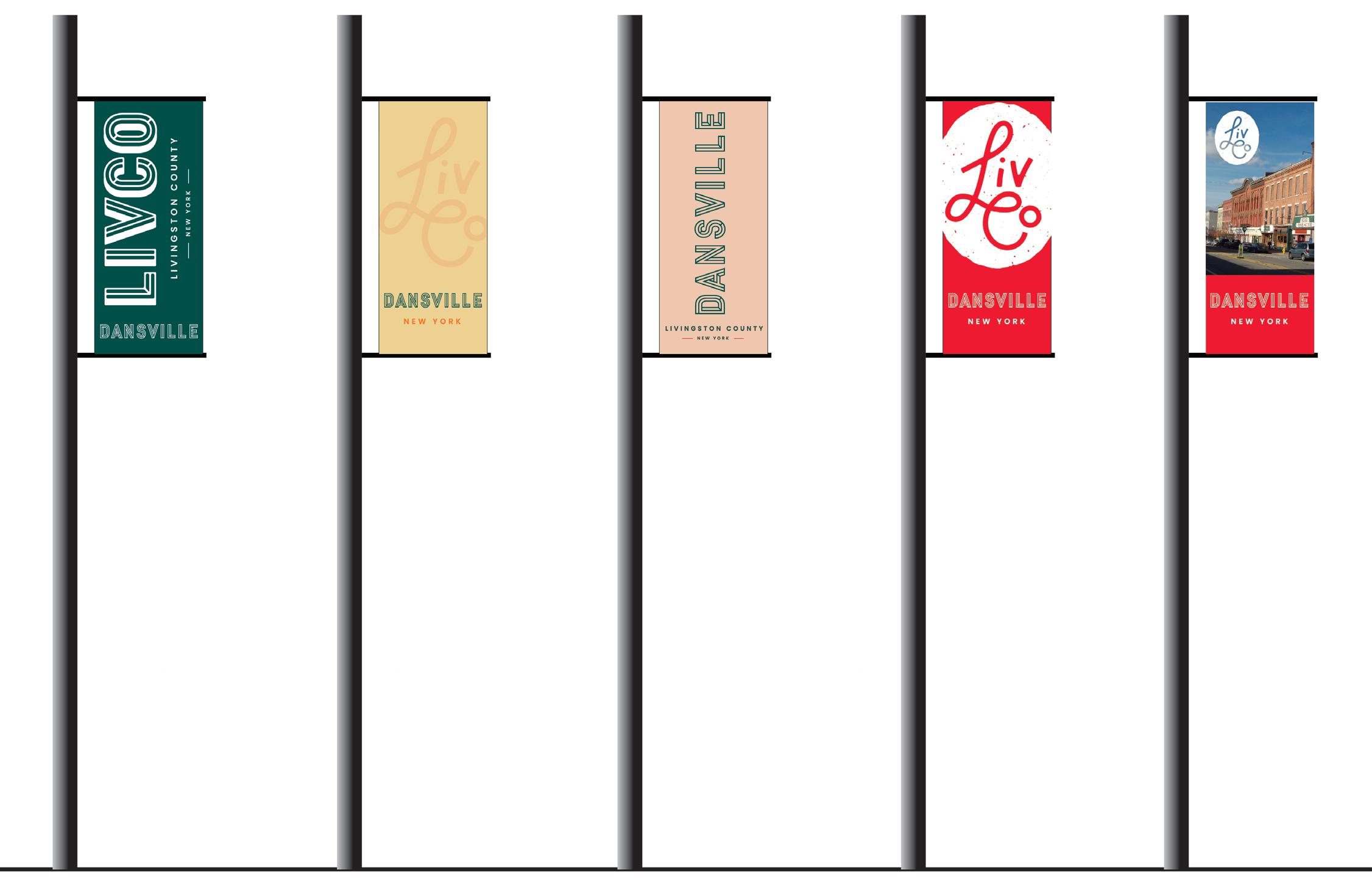
Light Pole Banners should be located along major vehicular corridors in each of the nine Villages. Prior to the design and installation of the Light Pole Banners, ownership of existing light/utility poles shall be determined and permission received from owner. Coordination with any existing light pole banner programs in each of the nine Villages should occur to include the LIVCO brand, while supporting the individuality and banner needs for each Village.
Double sided 13 mi. scrim vinyl banner. Banner graphics and colors shall follow the LIVCO brand. Final logo and color selection shall be coordinated with each Village.
Light Pole Banners shall be installed with typical banner brackets and stainless steel bands.
COST: $325 EA
Cost of Light Pole Banners includes fabrication, brackets and connection hardware. Cost does not include permit fees or final design details.
Five Light Pole Banners were developed using the 2022 LIVCO brand incorporating the various logos and colors from the brand assets, while providing the ability include Village specific imagery. Having a variety of light pole banners for each Village to choose from, will help provide a unique identity for each Village while being consistent with the overall County-Wide brand. Livingston County will work with each Village to determine which banner or banners would be most appropriate to incorporate into existing light pole banner programs.
Parking Signs are located at the entrance to a public parking facility. These signs can be mounted on an existing light pole or new sign post. Prior to the installation of Parking Signs, ownership of existing light poles shall be determined and permission granted. Coordination with applicable regulatory agencies should occur to obtain the necessary permits and approvals prior to fabrication and installation.
Single sided, reflective aluminum sign panel. Reference NYSDOT standard details and specifications for material requirements. Color shall comply with the LIVCO brand and any NYSDOT and MUTCD requirements.
Sign shall be mounted on existing light poles where available or on (1) Type A high capacity sign post. Sign posts shall comply with NYSDOT standard details and specifications.

COST: $1,450 EA
Cost of Vehicular Directional sign does not include permit fees, utility installation or relocation, land acquisition or final design details. 7’ Min.
+/18”
Pedestrian Directional Signs are located at major decision making points along a path of travel. Each sign should be oriented away from the road and towards the pedestrian walkway, preventing confusion between vehicular and pedestrian signs. Each sign location should be evaluated on a case-by-case basis, keeping in mind sight distances, visual clearance, sign clutter, and vehicular and pedestrian safety.
Prior to the design and installation of the Pedestrian Directional Signs, site specific surveys should be conducted to confirm property ownership, the location of under and above ground utilities, and any other potential conflicts. Coordination with applicable regulatory agencies should occur to obtain the necessary permits and approvals prior to design, fabrication, and installation.
COST: $11,700 EA
Cost of Pedestrian Directional Sign includes the installation of concrete foundation. Cost does not include permit fees, utility installation or relocation, land acquisition or final design details.
10”
Two options for the top button on the Pedestrian Directional Sign are provided for each Village to choose from. Once a Village selects their style of button, that style shall be used consistently within that Village.
The fingers of the Pedestrian Directional Sign shall incorporate the green and red colors from the LIVCO brand for each of the nine Villages.
Kiosks are designed to be double sided, containing a map graphic on one side and an interpretive panel on the other, or a lockable display cabinet to allow for rotating displays and information sharing. The map graphic highlights key destinations and provides direction to other points of interest. The interpretive panels detail historic events or significant information about the setting the Kiosk is located in. If space allows, Kiosks can have 3 panels to provide additional information.
Prior to the design and installation of the Kiosks, site specific surveys should be conducted to confirm property ownership, the location of under and above ground utilities, and any other potential conflicts. Coordination with applicable regulatory agencies should occur to obtain the necessary permits and approvals prior to design, fabrication, and installation.
1/8” thick fused resin graphic panel. Content for Kiosk map and interpretive panel graphics will be specific to each individual Village and Kiosk. Frame shall be constructed to allow for easy removal and replacement of graphic panel.
Two, 4” square posts. Posts and frame structure shall be constructed out of aluminum and powder coated black. Optional cabinet shall contain tempered glass and a lockable mechanism to restrict access into the cabinet.
COST: $16,000 EA
Four options for color and logo placement are provided for each of the nine Villages to choose from to provide diversity among the Kiosk design in each Village while remaining consistent with the LIVCO brand.
+/- 4’
Cost of Kiosk includes the installation of concrete foundations. Cost does not include permit fees, utility installation or relocation, land acquisition or final design details. +/-
The most flexible sign in the hierarchy, Temporary Signs offer the ability to quickly advertise and brand local short-term events including farmers markets and festivals. They can be purchased by individual business or by local municipal or business organizations.
Temporary Signage can be incorporated in two ways:
• Corrugated Plastic Board - Signs can be easily printed onto corrugated plastic board, much like a typical real estate or political yard sign. The signs can be customized for specific events and equipped with grommets for easy attachment to existing poles or fences with zip ties.
• A-Frame or Sandwich Board - These signs can incorporate an area for interchangeable content specific event information or could be made of a chalk board material for quick changes in information. The signs are easily movable and can be incorporated into a typical streetscape environment if space allows.
For both options, local zoning codes should be reviewed to ensure compliance with any regulations in place for Temporary Signage.
COST: $215 EA
Cost does not include permit fees or final design details.
The top button on the Temporary Signage can be one of the two design options, similar to the Pedestrian Directional Sign, or be the typical LIVCO logo button if a more generic sign is desired.
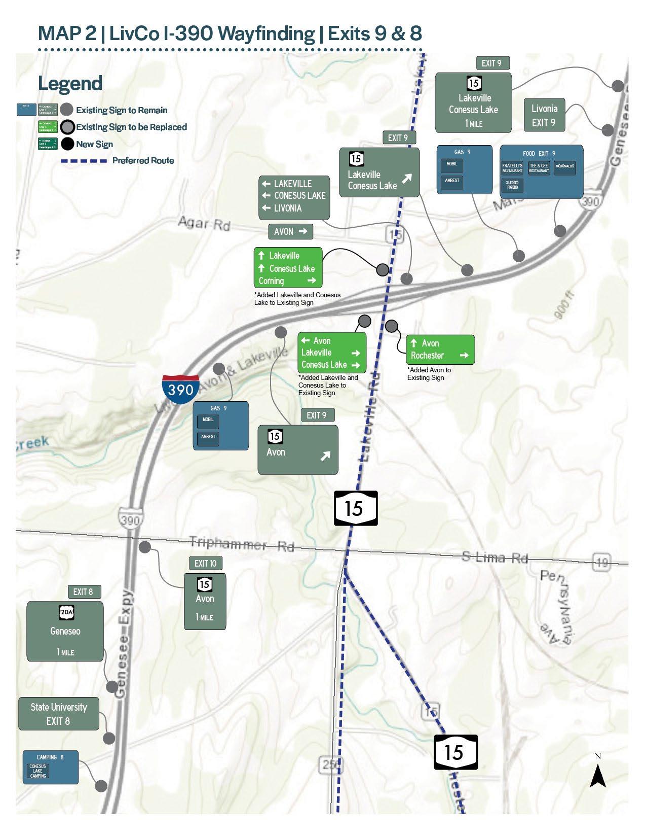
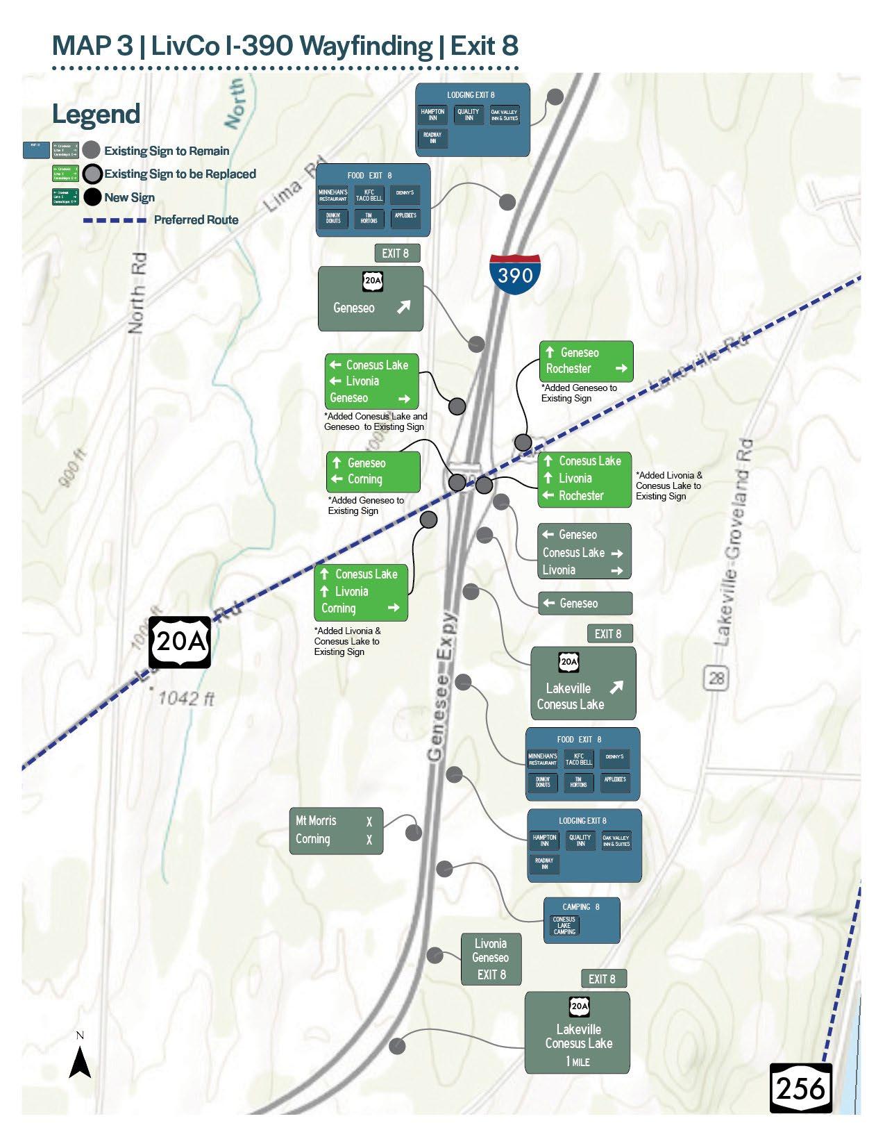
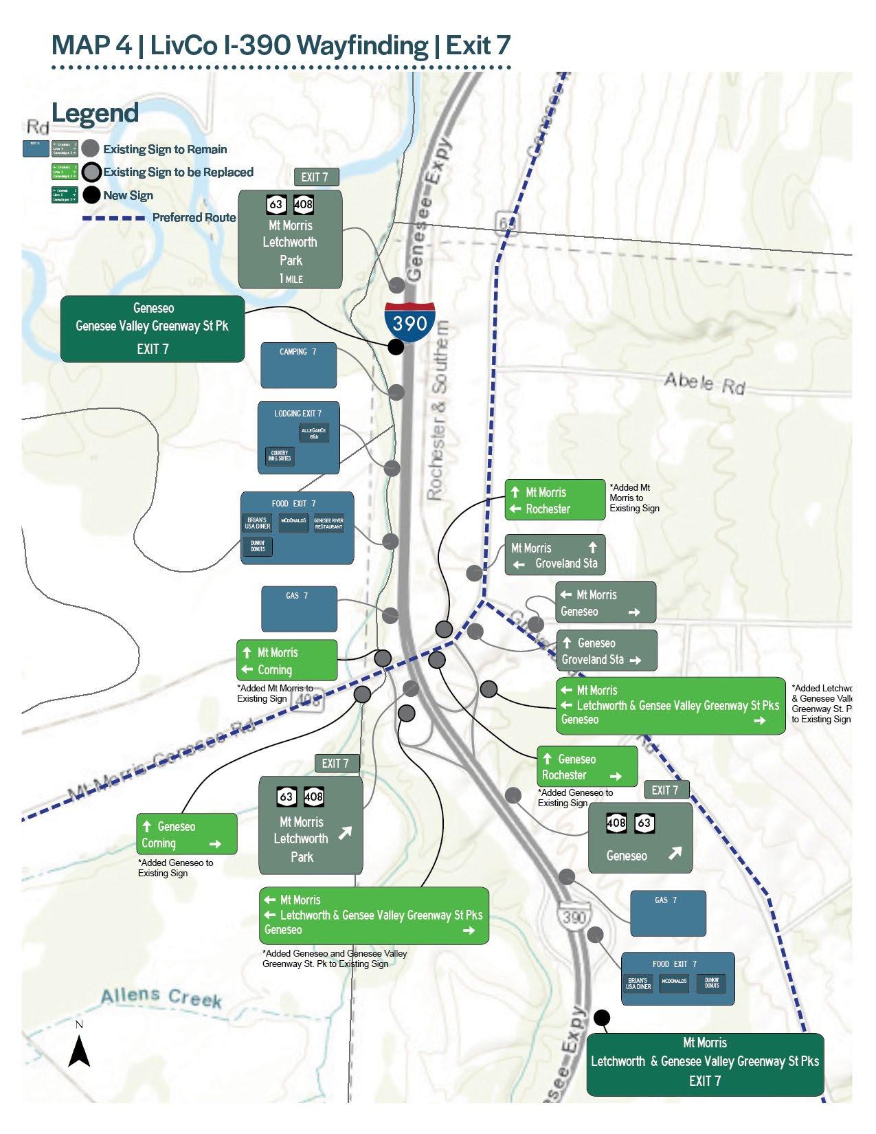
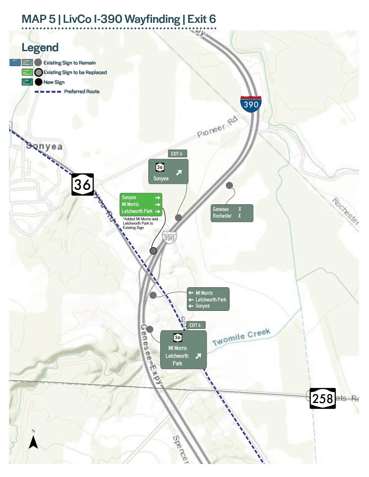
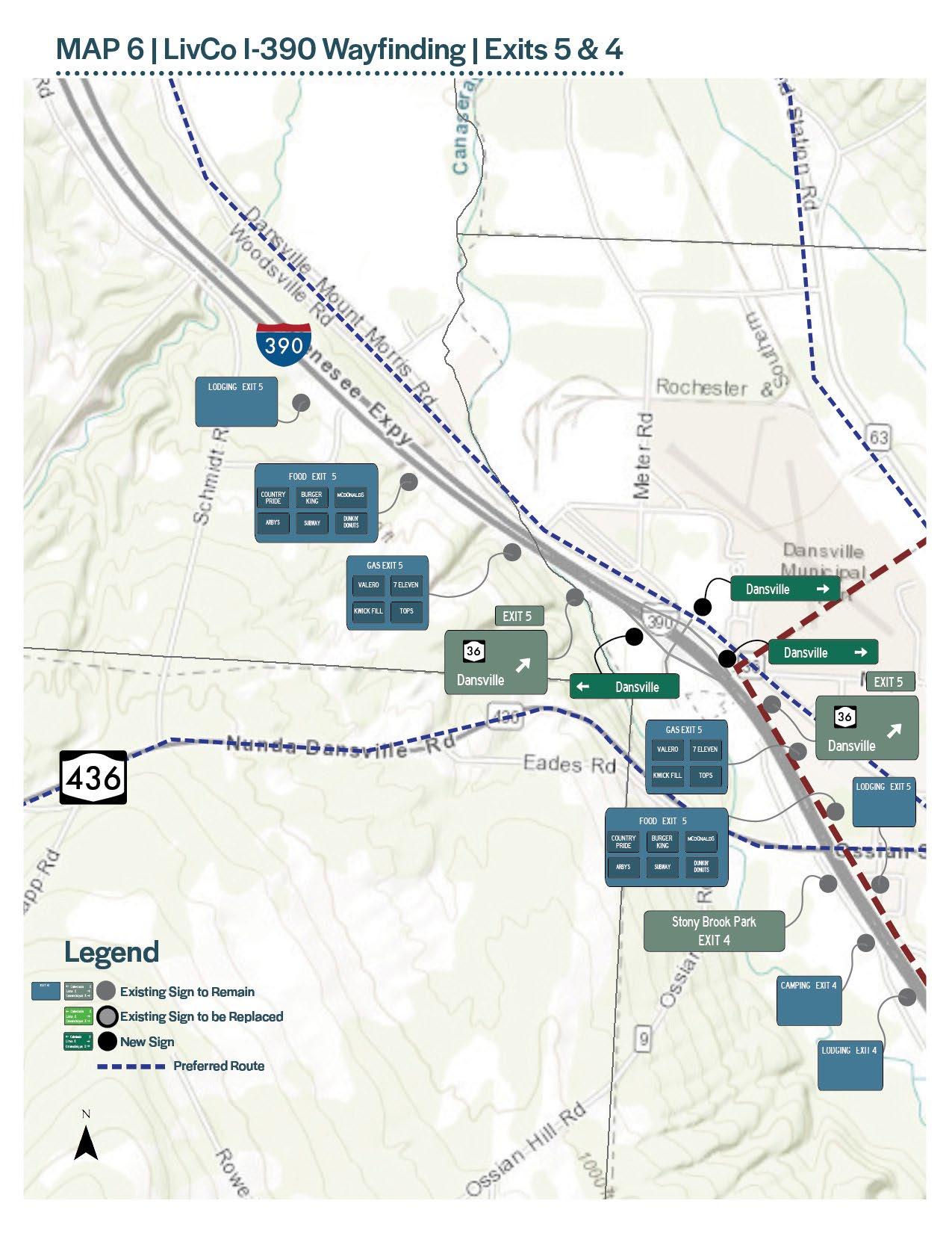
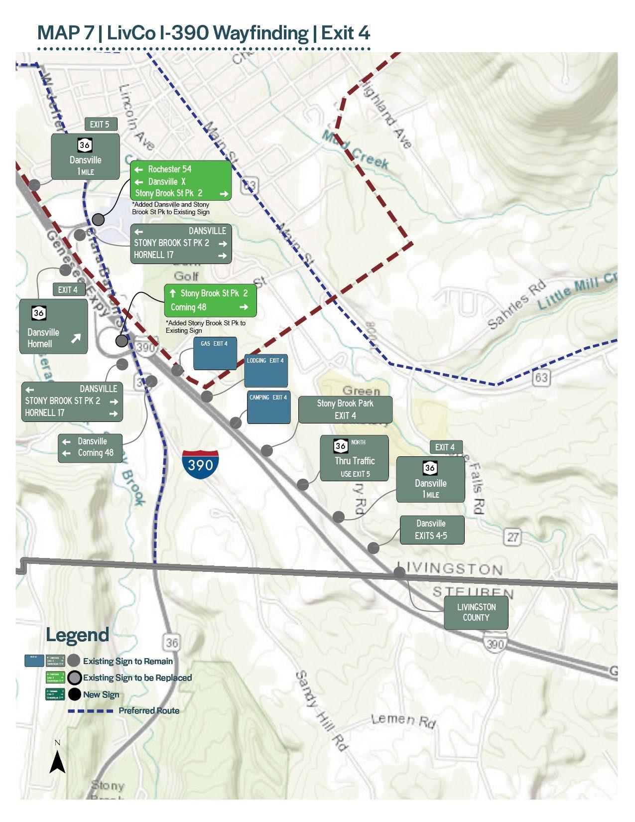
This chapter provides recommendations for placement and messaging of vehicular and pedestrian wayfinding signage in the nine Villages. In addition, recommendations are provided to enhance or supplement the existing NYSDOT signage between each of the nine Villages and along I-390.
Through a series of committee, stakeholder and public meetings, major destinations were identified in each of the nine Villages of Livingston County. Knowing where you want to direct vehicular and pedestrian traffic is key in identifying decisions points, locating signs and providing the correct sign messaging. For each of the nine Villages, a Vehicular and Pedestrian sign location plan was developed. The number of signs for each community will vary based on their physical size and the number of destinations located within the Village limits. The following plans represent the complete overall system for each Village, which have the ability to be phased in over time as funding resources become available.
The location of the Village vehicular signage is approximate. Coordination with the New York State Department of Transportation (NYSDOT) will need to take place as the signage moves into detailed design and implementation. As signs are planned for installation, the proper permits and locating of existing signs, utility poles and other features will need to be identified to meet municipal and NYSDOT requirements.
In addition to providing the tools to navigate around each of the nine Villages, defining clear routes and providing wayfinding signage between each of the Villages is important for tourism and economic prosperity. The following maps provide possible enhancements to the standard green and white NYSDOT signage, to guide vehicular traffic to each of the nine Villages and destinations throughout Livingston County. Adding or modifying existing destination signs on state highways will be reviewed by NYSDOT on a case by case basis during future capital improvement projects.
In addition to state routes and local roads, I-390 travels north/south through Livingston County. This plan considers additional signage or modifications to existing signage to help guide visitors to each of the downtowns from this corridor. Adding or modifying existing destination signs on I-390 will be reviewed by NYSDOT on a case by case basis during future capital improvement projects. NYSDOT Traffic & Safety board will refer to the goals and recommendations in this plan and make adjustments when appropriate. It will be important for Livingston County, the nine Villages and/or a designated organization to champion the wayfinding recommendations, and stress the importance of their implementation to NYSDOT in regards to regional tourism and economic development.
Although no recommendations have been made in this plan, the NYSDOT Specific Services LOGO sign program (blue service signs) allows for the inclusion of qualified facilities (camping, gas, accommodations) to be included on the service signs for a fee. General or generic destinations such as downtowns are not allowed. More information on the program can be found at www.dot.ny.gov/programs/nys-signs.

To guide Livingston County and the nine Villages in the implementation of the Wayfinding Strategy, planning level cost estimates and phasing plans were developed for each Village. This information is key in planning for future capitol improvement funding and considering future grant opportunities. Recognizing the signage priorities for each Village may be different, phasing plans were developed to help each of the Villages plan for and prioritize the installation of the wayfinding system as funds become available. As the wayfinding system is implemented, efficiencies and cost savings may be realized with the repeat utilization of a preferred sign manufacturer, implementation of signage in bulk quantities and the sharing of detailed design drawings amongst the nine Villages and the County.
Livingston County may choose to jump start the implementation process by installing or providing Banner, Parking, Kiosk or Temporary signage with the LIVCO brand for each of the nine Villages. Implementing these sign types all at once will help introduce the LIVCO brand County-wide and create efficiencies and reduce design cost with the exception of the Kiosk design. The Kiosk structure itself will be standard for all nine Villages, but the map and graphic panels must be custom designed for each Kiosk location.


The following cost estimates and phasing plans apply to each of the nine Villages only. Signage located on State Routes or on I-390 will be the responsibility of the NYSDOT. The Village cost estimates assume each Village will be taking on the implementation of the Wayfinding Strategy on their own, incorporating their specific branding and incurring all design costs. For each sign type a 20% construction contingency is incorporated into the planning level cost estimates to account for any unknown factors that may arise during implementation. A detailed breakdown of the planning level cost estimates can be found in Appendix A.
The following planning level cost estimate reflects the recommendations made on the Village of Avon Vehicular and Pedestrian Sign Location Maps. Dollar figures are estimated from 2021 and include final design, fabrication, installation and construction contingency costs. A detailed breakdown of the cost estimates for each sign type by Village can be found in Appendix A.
MONUMENT GATEWAY (4) $9,000 $39,500 $88,000 $136,500
VEHICULAR DIRECTIONAL SIGN (19) $8,500 $38,000 $84,500 $131,000
LIGHT POLE BANNERS (20) $1,000 $1,000 $6,500 $8,500
PARKING SIGN (1) $1,000 $700 $1,500 $3,200
PEDESTRIAN WAYFINDING SIGN (5) $6,000 $26,000 $58,500 $90,500 KIOSK (2) $6,500* $14,000 $32,000 $52,500
TEMPORARY SIGNAGE (10) $1,000 $1,000 $2,200 $4,200
* Cost includes map/interpretive panel design for each Kiosk location.
GRAND TOTAL $426,400
To successfully implement the Vehicular and Pedestrian recommendations in the Village of Avon, a Phasing Plan is outlined below to prioritize sign installation as funding sources become available.
INSTALLATION (0 TO 1 YEAR) - $26,250
Phase IA sets the stage for the system and introduces users to the LIVCO brand. Livingston County may look to initially install (1) Kiosk at parking facilities in each of the nine downtowns, introducing the brand and providing the first point of contact users will have with the system.
PHASE IB: PRIORITY SIGNAGE (0 TO 1 YEAR) - $12,700
Installation of Light Pole Banners and Temporary Signage for special events is an easy cost effective way to bring recognition to the brand and system identity.
PHASE II: SHORT TERM (1 TO 3 YEARS) - $134,200
Phase II builds off of the recognition of the wayfinding system identified in Phase I. Phase II includes the installation of Vehicular Directional and Parking Signs.
PHASE III: MID TERM (3 TO 5 YEARS) - $116,750
Signage installed as part of Phase II will direct users to the downtown core and available public parking in the Village of Avon. Building off of Phase II, Phase III includes the installation of the remaining Kiosks and Pedestrian Wayfinding signs at key pedestrian decision making points in the Village of Avon.
PHASE IV: LONG TERM (5 YEARS +) - $136,500
Realizing the existing Village of Avon gateway signage is in good or excellent condition, Phase IV recommends the installation of new Monument Gateway Signs as existing signs become damaged or are in need of repair/ replacement. Priority locations included the southern, eastern and western Village limits.
The following planning level cost estimate reflects the recommendations made on the Village of Caledonia Vehicular and Pedestrian Sign Location Maps. Dollar figures are estimated from 2021 and include final design, fabrication, installation and construction contingency costs. A detailed breakdown of the cost estimates for each sign type by Village can be found in Appendix A.
MONUMENT GATEWAY (4) $9,000 $39,500 $88,000 $136,500
VEHICULAR DIRECTIONAL SIGN (13) $6,000 $26,000 $58,000 $90,000
LIGHT POLE BANNERS (20) $1,000 $1,000 $6,500 $8,500
PARKING SIGN (1) $1,000 $700 $1,500 $3,200
PEDESTRIAN WAYFINDING SIGN (4) $4,700 $21,000 $47,000 $72,700 KIOSK (2) $6,500* $14,500 $32,000 $52,500
TEMPORARY SIGNAGE (10) $1,000 $1,000 $2,200 $4,200
* Cost includes map/interpretive panel design for each Kiosk location.
GRAND TOTAL $367,600
To successfully implement the Vehicular and Pedestrian recommendations in the Village of Caledonia, a Phasing Plan is outlined below to prioritize sign installation as funding sources become available.
PHASE IA: KIOSK INSTALLATION (0 TO 1 YEAR) - $26,250
Phase IA sets the stage for the system and introduces users to the LIVCO brand. Livingston County may look to initially install (1) Kiosk at parking facilities in each of the nine downtowns, introducing the brand and providing the first point of contact users will have with the system.
PHASE IB: PRIORITY SIGNAGE (0 TO 1 YEAR) - $12,700
Installation of Light Pole Banners and Temporary Signage for special events is an easy cost effective way to bring recognition to the brand and system identity.
PHASE II: SHORT TERM (1 TO 3 YEARS) - $93,200
Phase II builds off of the recognition of the wayfinding system identified in Phase I. Phase II includes the installation of Vehicular Directional and Parking Signs.
PHASE III: MID TERM (3 TO 5 YEARS) - $98,950
Signage installed as part of Phase II will direct users to the downtown core and available public parking in the Village of Caledonia. Building off of Phase II, Phase III includes the installation of remaining Kiosks and Pedestrian Wayfinding signs at key pedestrian decision making points in the Village of Caledonia.
PHASE IV: LONG TERM (5 YEARS +) - $136,500
Realizing the existing Village of Caledonia gateway signage is in good or excellent condition, Phase IV recommends the installation of new Monument Gateway Signs as existing signs become damaged or are in need of repair/replacement. Priority locations included the eastern and western Village limits along Route 5.
The following planning level cost estimate reflects the recommendations made on the Village of Dansville Vehicular and Pedestrian Sign Location Maps. Dollar figures are estimated from 2021 and include final design, fabrication, installation and construction contingency costs. A detailed breakdown of the cost estimates for each sign type by Village can be found in Appendix A.
MONUMENT GATEWAY (6) $13,500 $59,500 $132,000 $205,000
VEHICULAR DIRECTIONAL SIGN (15) $6,700 $30,000 $67,000 $103,700
LIGHT POLE BANNERS (20) $1,000 $1,000 $6,500 $8,500
PARKING SIGN (4) $1,000 $2,600 $5,800 $9,400
PEDESTRIAN WAYFINDING SIGN (7) $8,000 $37,000 $82,000 $127,000 KIOSK (3) $9,500* $21,500 $48,000 $79,000
TEMPORARY SIGNAGE (10) $1,000 $1,000 $2,200 $4,200
* Cost includes map/interpretive panel design for each Kiosk location.
GRAND TOTAL $536,800
To successfully implement the Vehicular and Pedestrian recommendations in the Village of Dansville, a Phasing Plan is outlined below to prioritize sign installation as funding sources become available.
PHASE IA: KIOSK INSTALLATION (0 TO 1 YEAR) - $26,250
Phase IA sets the stage for the system and introduces users to the LIVCO brand. Livingston County may look to initially install (1) Kiosk at parking facilities in each of the nine downtowns, introducing the brand and providing the first point of contact users will have with the system.
PHASE IB: PRIORITY SIGNAGE (0 TO 1 YEAR) - $22,100
Installation of Light Pole Banners and Temporary Signage for special events is an easy cost effective way to bring recognition to the brand and system identity. Existing parking signs are lacking or in poor condition in the Village of Dansville and should be replaced/installed as part of Phase IB.
PHASE II: SHORT TERM (1 TO 3 YEARS) - $308,700
Phase II builds off of the recognition of the wayfinding system identified in Phase I. Phase II includes the installation of Vehicular Directional and Monument Gateway Signs. Existing gateway signage in the Village of Dansville are in poor condition and should be replaced in the short term. Priority locations include gateway signs on Clara Baron Street and on the northern Village limits on Routes 36 and 63.
PHASE III: MID TERM (3 TO 5 YEARS) - $179,750
Signage installed as part of Phase II will direct users to the downtown core and available public parking in the Village of Dansville. Building off of Phase II, Phase III includes the installation of remaining Kiosks and Pedestrian Wayfinding signs at key pedestrian decision making points in the Village of Dansville.
The following planning level cost estimate reflects the recommendations made on the Village of Geneseo Vehicular and Pedestrian Sign Location Maps. Dollar figures are estimated from 2021 and include final design, fabrication, installation and construction contingency costs. A detailed breakdown of the cost estimates for each sign type by Village can be found in Appendix A.
MONUMENT GATEWAY (4) $9,000 $39,500 $88,000 $136,500
VEHICULAR DIRECTIONAL SIGN (15) $6,600 $30,000 $67,000 $103,600
LIGHT POLE BANNERS (20) $1,000 $1,000 $6,500 $8,500
PARKING SIGN (5) $1,000 $3,300 $7,300 $11,600
PEDESTRIAN WAYFINDING SIGN (13) $15,000 $68,500 $152,000 $235,500 KIOSK (2) $6,500* $14,000 $32,000 $52,500
TEMPORARY SIGNAGE (10) $1,000 $1,000 $2,200 $4,200
* Cost includes map/interpretive panel design for each Kiosk location.
GRAND TOTAL $552,400
To successfully implement the Vehicular and Pedestrian recommendations in the Village of Geneseo, a Phasing Plan is outlined below to prioritize sign installation as funding sources become available.
PHASE IA: KIOSK INSTALLATION (0 TO 1 YEAR) - $26,250
Phase IA sets the stage for the system and introduces users to the LIVCO brand. Livingston County may look to initially install (1) Kiosk at parking facilities in each of the nine downtowns, introducing the brand and providing the first point of contact users will have with the system.
PHASE IB: PRIORITY SIGNAGE (0 TO 1 YEAR) - $12,700
Installation of Light Pole Banners and Temporary Signage for special events is an easy cost effective way to bring recognition to the brand and system identity.
PHASE II: SHORT TERM (1 TO 3 YEARS) - $115,200
Phase II builds off of the recognition of the wayfinding system identified in Phase I. Phase II includes the installation of Vehicular Directional and Parking Signs.
PHASE III: MID TERM (3 TO 5 YEARS) - $261,750
Signage installed as part of Phase II will direct users to the downtown core and available public parking in the Village of Geneseo. Building off of Phase II, Phase III includes the installation of the remaining Kiosks and Pedestrian Wayfinding signs at key pedestrian decision making points in the Village of Caledonia.
PHASE IV: LONG TERM (5 YEARS +) - $136,500
Realizing the existing Village of Geneseo gateway signage is in good or excellent condition, Phase IV recommends the installation of new Monument Gateway Signs as existing signs become damaged or are in need of repair/replacement. Priority locations included the northern and southern Village limits along Routes 39 and 63.
The following planning level cost estimate reflects the recommendations made on the Village of Leicester Vehicular and Pedestrian Sign Location Maps. Dollar figures are estimated from 2021 and include final design, fabrication, installation and construction contingency costs. A detailed breakdown of the cost estimates for each sign type by Village can be found in Appendix A.
MONUMENT GATEWAY (4) $9,000 $39,500 $88,000 $136,500
VEHICULAR DIRECTIONAL SIGN (7) $3,200 $14,000 $31,200 $48,400
LIGHT POLE BANNERS (20) $1,000 $1,000 $6,500 $8,500
PARKING SIGN (0) $0 $0 $0 $0
PEDESTRIAN WAYFINDING SIGN (4) $5,000 $21,000 $47,000 $73,000 KIOSK (1) $3,000* $7,250 $16,000 $26,250
TEMPORARY SIGNAGE (5) $1,000 $500 $1,100 $2,600
* Cost includes map/interpretive panel design for each Kiosk location.
GRAND TOTAL $295,250
To successfully implement the Vehicular and Pedestrian recommendations in the Village of Leicester, a Phasing Plan is outlined below to prioritize sign installation as funding sources become available.

PHASE IA: KIOSK INSTALLATION (0 TO 1 YEAR) - $26,250
Phase IA sets the stage for the system and introduces users to the LIVCO brand. Livingston County may look to initially install (1) Kiosk at parking facilities in each of the nine downtowns, introducing the brand and providing the first point of contact users will have with the system.
PHASE IB: PRIORITY SIGNAGE (0 TO 1 YEAR) - $11,100
Phase I sets the stage for the system and introduces users to the LIVCO brand. Initial installation of Light Pole Banners and Temporary Signage for special events, is an easy cost effective way to bring recognition to the brand and system identity.
PHASE II: SHORT TERM (1 TO 3 YEARS) - $48,400
Phase II builds off of the recognition of the wayfinding system identified in Phase I. Phase II includes the installation of Vehicular Directional Signs.
PHASE III: MID TERM (3 TO 5 YEARS) - $73,000
Signage installed as part of Phase II will direct users to the downtown core and available public parking in the Village of Leicester. Building off of Phase II, Phase III includes the installation of Pedestrian Wayfinding signs at key pedestrian decision making points.
PHASE IV: LONG TERM (5 YEARS +) - $136,500
Realizing the existing Village of Leicester gateway signage is in good or excellent condition, Phase IV recommends the installation of new Monument Gateway Signs as existing signs become damaged or are in need of repair/replacement. Priority locations included the norther, southern, and western Village limits.
The following planning level cost estimate reflects the recommendations made on the Village of Lima Vehicular and Pedestrian Sign Location Maps. Dollar figures are estimated from 2021 and include final design, fabrication, installation and construction contingency costs. A detailed breakdown of the cost estimates for each sign type by Village can be found in Appendix A.
MONUMENT GATEWAY (4) $8,800 $40,000 $88,000 $136,800
VEHICULAR DIRECTIONAL SIGN (7) $3,000 $14,000 $31,200 $48,200
LIGHT POLE BANNERS (20) $1,000 $1,000 $6,500 $8,500
PARKING SIGN (1) $200 $700 $1,450 $2,350
PEDESTRIAN WAYFINDING SIGN (2) $2,500 $10,500 $23,500 $36,500 KIOSK (4) $13,000* $29,000 $64,000 $106,000 TEMPORARY SIGNAGE (5) $1,000 $500 $1,100 $2,600
* Cost includes map/interpretive panel design for each Kiosk location.
GRAND TOTAL $340,950
To successfully implement the Vehicular and Pedestrian recommendations in the Village of Lima, a Phasing Plan is outlined below to prioritize sign installation as funding sources become available.
PHASE IA: KIOSK INSTALLATION (0 TO 1 YEAR) - $26,250
Phase IA sets the stage for the system and introduces users to the LIVCO brand. Livingston County may look to initially install (1) Kiosk at parking facilities in each of the nine downtowns, introducing the brand and providing the first point of contact users will have with the system.
PHASE IB: PRIORITY SIGNAGE (0 TO 1 YEAR) - $11,100
Phase I sets the stage for the system and introduces users to the LIVCO brand. Initial installation of Light Pole Banners and Temporary Signage for special events, is an easy cost effective way to bring recognition to the brand and system identity.
PHASE II: SHORT TERM (1 TO 3 YEARS) - $50,550
Phase II builds off of the recognition of the wayfinding system identified in Phase I. Phase II includes the installation of Vehicular Directional and Parking Signs.
PHASE III: MID TERM (3 TO 5 YEARS) - $116,250
Signage installed as part of Phase II will direct users to the downtown core and available public parking in the Village of Lima. Building off of Phase II, Phase III includes the installation of the remaining Kiosks. Pedestrian Wayfinding signs will be located at key pedestrian decision making points.
PHASE IV: LONG TERM (5 YEARS +) - $136,800
Realizing the existing Village of Lima gateway signage is in good or excellent condition, Phase IV recommends the installation of new Monument Gateway Signs as existing signs become damaged or are in need of repair/ replacement.
The following planning level cost estimate reflects the recommendations made on the Village of Livonia Vehicular and Pedestrian Sign Location Maps. Dollar figures are estimated from 2021 and include final design, fabrication, installation and construction contingency costs. A detailed breakdown of the cost estimates for each sign type by Village can be found in Appendix A.
MONUMENT GATEWAY (3) $7,000 $30,000 $66,000 $103,000
VEHICULAR DIRECTIONAL SIGN (11) $5,000 $22,000 $49,000 $76,000
LIGHT POLE BANNERS (20) $1,000 $1,000 $6,500 $8,500
PARKING SIGN (6) $1,000 $4,000 $8,700 $13,700
PEDESTRIAN WAYFINDING SIGN (7) $8,200 $37,000 $82,000 $127,200 KIOSK (2) $6,500* $14,000 $32,000 $52,500
TEMPORARY SIGNAGE (5) $1,000 $500 $1,100 $2,600
* Cost includes map/interpretive panel design for each Kiosk location.
GRAND TOTAL $383,500
To successfully implement the Vehicular and Pedestrian recommendations in the Village of Livonia, a Phasing Plan is outlined below to prioritize sign installation as funding sources become available.
PHASE IA: KIOSK INSTALLATION (0 TO 1 YEAR) - $26,250
Phase IA sets the stage for the system and introduces users to the LIVCO brand. Livingston County may look to initially install (1) Kiosk at parking facilities in each of the nine downtowns, introducing the brand and providing the first point of contact users will have with the system.
PHASE IB: PRIORITY SIGNAGE (0 TO 1 YEAR) - $11,100
Phase I sets the stage for the system and introduces users to the LIVCO brand. Initial installation of Light Pole Banners and Temporary Signage for special events, is an easy cost effective way to bring recognition to the brand and system identity.
PHASE II: SHORT TERM (1 TO 3 YEARS) - $89,700
Phase II builds off of the recognition of the wayfinding system identified in Phase I. Phase II includes the installation of Vehicular Directional Signs and Parking Signs.
PHASE III: MID TERM (3 TO 5 YEARS) - $153,450
Signage installed as part of Phase II will direct users to the downtown core and available public parking in the Village of Livonia. Building off of Phase II, Phase III includes the installation of the remaining Kiosks and Pedestrian Wayfinding signs at key pedestrian decision making points in the Village of Livonia.
PHASE IV: LONG TERM (5YEARS +) - $103,000
Realizing the existing Village of Livonia gateway signage is in good or excellent condition, Phase IV recommends the installation of new Monument Gateway Signs as existing signs become damaged or are in need of repair/replacement.
The following planning level cost estimate reflects the recommendations made on the Village of Mount Morris Vehicular and Pedestrian Sign Location Maps. Dollar figures are estimated from 2021 and include final design, fabrication, installation and construction contingency costs. A detailed breakdown of the cost estimates for each sign type by Village can be found in Appendix A.
MONUMENT GATEWAY (4) $8,800 $40,000 $88,000 $136,800
VEHICULAR DIRECTIONAL SIGN (18) $8,000 $36,000 $80,000 $124,000
LIGHT POLE BANNERS (20) $1,000 $1,000 $6,500 $8,500
PARKING SIGN (1) $200 $700 $1,450 $2,350
PEDESTRIAN WAYFINDING SIGN (9) $10,500 $47,500 $105,000 $163,000 KIOSK (2) $6,500* $14,000 $32,000 $52,500
TEMPORARY SIGNAGE (5) $1,000 $500 $1,000 $2,500
* Cost includes map/interpretive panel design for each Kiosk location.
GRAND TOTAL $489,650
To successfully implement the Vehicular and Pedestrian recommendations in the Village of Mount Morris, a Phasing Plan is outlined below to prioritize sign installation as funding sources become available.
PHASE IA: KIOSK INSTALLATION (0 TO 1 YEAR) - $26,250
Phase IA sets the stage for the system and introduces users to the LIVCO brand. Livingston County may look to initially install (1) Kiosk at parking facilities in each of the nine downtowns, introducing the brand and providing the first point of contact users will have with the system.
PHASE IB: PRIORITY SIGNAGE (0 TO 1 YEAR) - $11,000
Phase I sets the stage for the system and introduces users to the LIVCO brand. Initial installation of Light Pole Banners and Temporary Signage for special events, is an easy cost effective way to bring recognition to the brand and system identity.
PHASE II: SHORT TERM (1 TO 3 YEARS) - $126,350
Phase II builds off of the recognition of the wayfinding system identified in Phase I. Phase II includes the installation of Vehicular Directional and Parking Signs.
PHASE III: MID TERM (3 TO 5 YEARS) - $189,250
Signage installed as part of Phase II will direct users to the downtown core and available public parking in the Village of Mount Morris. Building off of Phase II, Phase III includes the installation of remaining Kiosks. Pedestrian Wayfinding signs will be located at key pedestrian decision making points in the Village of Mount Morris.
PHASE IV: LONG TERM (5 YEARS +) - $136,800
Realizing the existing Village of Mount Morris gateway signage is in good or excellent condition, Phase IV recommends the installation of new Monument Gateway Signs as existing signs become damaged or are in need of repair/replacement. The anticipated cost for Phase IV is approximately $80,000.

The following planning level cost estimate reflects the recommendations made on the Village of Nunda Vehicular and Pedestrian Sign Location Maps. Dollar figures are estimated from 2021 and include final design, fabrication, installation and construction contingency costs. A detailed breakdown of the cost estimates for each sign type by Village can be found in Appendix A.
MONUMENT GATEWAY (4) $8,800 $40,000 $88,000 $136,800
VEHICULAR DIRECTIONAL SIGN (12) $5,500 $24,000 $53,500 $83,000
LIGHT POLE BANNERS (20) $1,000 $1,000 $6,500 $8,500
PARKING SIGN (1) $1,000 $700 $1,450 $3,150
PEDESTRIAN WAYFINDING SIGN (6) $7,000 $32,000 $70,000 $109,000 KIOSK (2) $6,500* $14,000 $32,000 $52,500
TEMPORARY SIGNAGE (5) $1,000 $500 $1,100 $2,600
* Cost includes map/interpretive panel design for each Kiosk location.
GRAND TOTAL $395,550
To successfully implement the Vehicular and Pedestrian recommendations in the Village of Nunda, a Phasing Plan is outlined below to prioritize sign installation as funding sources become available.
PHASE IA: KIOSK INSTALLATION (0 TO 1 YEAR) - $26,250
Phase IA sets the stage for the system and introduces users to the LIVCO brand. Livingston County may look to initially install (1) Kiosk at parking facilities in each of the nine downtowns, introducing the brand and providing the first point of contact users will have with the system.
PHASE IB: PRIORITY SIGNAGE (0 TO 1 YEAR) - $11,100
Installation of Light Pole Banners and Temporary Signage for special events is an easy cost effective way to bring recognition to the brand and system identity.
PHASE II: SHORT TERM (1 TO 3 YEARS) - $86,150
Phase II builds off of the recognition of the wayfinding system identified in Phase I. Phase II includes the installation of Vehicular Directional and Parking Signs.
III: MID TERM (3 TO 5 YEARS) - $135,250
Signage installed as part of Phase II will direct users to the downtown core and available public parking in the Village of Nunda. Building off of Phase II, Phase III includes the installation of the remaining Kiosks and Pedestrian Wayfinding signs at key pedestrian decision making points in the Village of Nunda.
PHASE IV: LONG TERM (5 YEARS +) - $136,800
Realizing the existing Village of Nunda gateway signage is in good or excellent condition, Phase IV recommends the installation of new Monument Gateway Signs as existing signs become damaged or are in need of repair/replacement.
Successful implementation of the Livingston County Wayfinding Strategy will likely require a combination of federal, state and local funding. Available funding sources change annually; therefore Livingston County and/or the nine Villages should evaluate federal funding opportunities and the New York State Consolidated Funding Application (CFA) on an annual basis and identify potential match funding in annual operating budgets.
The Surface Transportation Block Grant program (STBG) provides flexible funding that may be used by States and localities for projects to preserve and improve the conditions and performance on any Federal-aid highway, bridge and tunnel projects on any public road, pedestrian and bicycle infrastructure, and transit capital projects, including intercity bus terminals.
Market
New York is a grant program established to strengthen tourism and attract visitors to New York State by promoting destinations, attractions and special events. Funding is available for tourism marketing initiatives and capital/construction project that will create an economic impact by increasing tourism throughout the state.
By expanding walking and biking options and/or connections to transit, Transportation Alternatives Program (TAP) funding helps communities deliver safe, transformative, and innovative projects of value to the public. Programs and projects defined as alternatives to single occupancy vehicle (SOV) transportation contribute to the revitalization of local and regional economies. Projects are expected to improve mobility, accessibility, and the community’s transportation character such that the street network is more vibrant, walkable, and safer for all transportation mode users; pedestrians, bicyclists, transit users, and drivers.
Similarly, the Congestion Mitigation and Air Quality Improvement Program (CMAQ) provides funding to State and local entities for transportation projects that reduce vehicle emissions and traffic congestion in areas where air quality does not meet or previously did not attain the National Ambient Air Quality Standards.
Limited federal and state funding opportunities for wayfinding development have led many communities to allocate local funding for these types of projects. The most common sources of funds a the municipal level included department allocations (public works or economic development) or inclusion in annual budgets or Capital Improvement Program (CIP).
Wayfinding implementation could be substantially funded utilizing private donations by businesses, corporate sponsorships and various fundraising efforts, including the sale of advertising space on informational kiosks.
In addition to wayfinding signage, creating an inviting, comfortable and navigable environment is critical to downtown economic revitalization. A series of downtown placemaking recommendations provide a manual of general streetscape design guidelines for consideration by each Village. High level streetscape recommendations tailored to each individual Village are also identified based on site observations, best management practices and related planning initiatives.
The following section describes five key principles to consider when making improvements to the public realm. Streetscape enhancements not only create an aesthetically pleasing environment, they help to encourage tourism, recreation and economic development. The following five design elements are meant to guide the decision making process in regards to public realm improvements, across each of the County’s downtowns. These general guidelines should be applied to each downtown in a manner consistent with local zoning codes, design standards and recent/ongoing planning initiatives.
Street Trees: Recommended street tree species and planting techniques to aid in tree health and longevity.
Street Amenities: Streetscape elements that improve the pedestrian experience and foster a unique sense of place.
Pedestrian Access / Safety: Sidewalk and street crossing features related to pedestrian movement, accessibility and traffic calming.
Parking Solutions: Strategies to maximize public parking along streets or public parking facilities.
Alleyscape: Features to brighten alleys creating an inviting and safe environment for pedestrian movement.
The recommendations on the following pages provide high level guidance for streetscape enhancements and should not be used as a stand-alone resource, but rather as a complement to any existing design standards and zoning codes, New York State Department of Transportation (NYSDOT) regulations and standards, the Manual on Uniform Traffic Control Devices (MUTCD), and the National Association of City Transportation Officials (NACTO) guidance to name a few.
Any streetscape improvements should be designed specifically for their location and obtain approval by respective Village officials and any other governing agencies prior to construction or installation.
Street trees, whether in-ground or in planters, provide numerous aesthetic, ecological, and health benefits. They soften the urban environment by providing an organic, pedestrian-scale canopy. In addition to their ability to frame views and provide seasonal interest, street trees can absorb and treat stormwater, improve air quality, mitigate urban heat island effect, and provide needed shade and valuable habitat.
• Complete an assessment of existing street trees to determine their condition and correct course of action for maintenance or replacement. The Recommended Urban Trees Site Assessment and Tree Selection for Stress Tolerance by Cornell University is a good reference to utilize when assessing the health of a tree or with new tree selection.
• Introduce new trees where existing trees are missing, dead, or in severe decline.
• Livingston County is located in Zones 5b and 6A of the USDA Plant Hardiness Zone Map. The ability for a tree to grow in these hardiness zones should be confirmed by a local landscape architect or nursery prior to purchase and installation. Native or adapted tree species should always be used and invasive species should be avoided at all times.
• Plant a diverse selection of trees to help minimize the impact of tree disease or insect infestations.
• Street Trees
• Tree Planters
• In-Ground Tree
• Trees have varying canopy forms and branching patterns. Activity planned around a tree should be considered with tree selection. Trees with low branching habits are not appropriate for streetscape environments. Upright or columnar trees will create less conflict with pedestrians and vehicular traffic.
• Seasonal interest is important when selecting tree species. Trees with unique branching habits, vibrant fall color and interesting bark help to create a dynamic four-season streetscape.
• Where overhead wires are present, small ornamental trees should be considered. The canopy of these trees have less of a chance of interfering with overhead wires and flowering species can provide visual interest in the early spring.
Watering during the first year or two of establishment is important to the health of a tree. Trees should be pruned regularly to promote healthy growth and avoid sidewalk conflicts. Choosing species with minimal leaf and litter drop can reduce tree cleanup needs.
Robin Hill Service Berry (20-25’ Ht / 12-15’ Sprd.)
Freeman Maple (50-70’ Ht / 10-15’ Sprd.)
American hornbeam(20-25’ Ht /20-25’ Sprd.)

Skyline Honeylocust (30-40’ Ht / 25-35’ Sprd.)
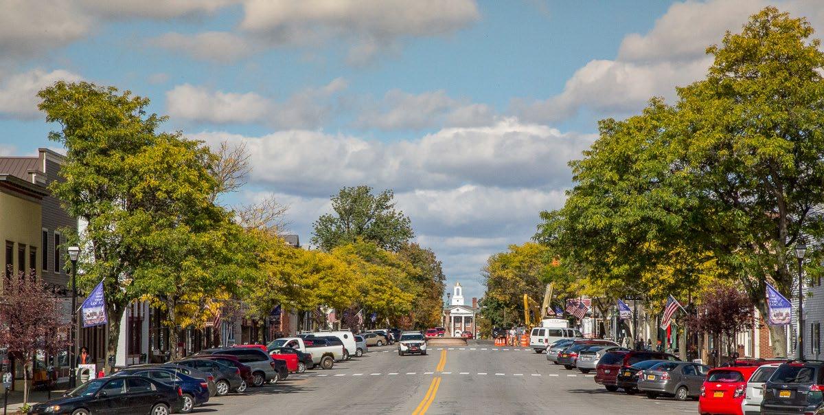
Red Maple (40-50’ Ht / 30-50’ Sprd.)
Tulip Tree (60-80’ Ht. / 30-50’ Sprd)

Linden Tree (50-80’ Ht / 30-50’ Sprd.)
Northern Red Oak (50-60’ Ht / 50-60’ Sprd.)


White Spruce (20-40’ Ht / 10-15’ Sprd.)

When in-ground street tree planting is not permitted or desired, planters can provide an above ground street tree option, and/or bring vegetation to areas with limited space. Strategically located planters can provide a sense of separation between pedestrian and vehicular traffic.
• Depending on the tree species and growth habit, 20-30’ spacing between planters is recommended.
• In Livingston County, trees selected for planters should be adaptable to cold hardiness zones one or two levels colder than Zones 5b and 6a on the USDA Cold Hardiness Map.
• Select smaller tree species.
• Supplement tree planting with perennials and/or annuals.
• Use planters to create a buffer between differing uses.
• Consider a tree program to rotate potted trees in and out of the Village every 10-15 years.
Routine watering throughout the year, especially during the summer months is essential to tree survival in planters. Trees should be pruned regularly to promote healthy growth and avoid overhead branching conflicts in pedestrian and vehicular areas.
Self watering planters should be considered to reduce the frequency of manual watering and provide consistent moisture.
Planting smaller trees in planters might be a solution where in-ground tree plantings cannot be accomplished. The smaller trees still offer street tree benefits such as shade and may be used to act as a barrier between pedestrian and vehicular uses.
Flowering Dogwood (20-25’ Ht / 12-15’ Sprd.)
Japanese Tree Lilac (20-25’ Ht / 12-15’ Sprd.)
Eastern Redbud (20-25’ Ht / 20-25’ Sprd.)
Ginkgo Biloba (Goldspire)(30-40’ Ht / 25-35’ Sprd.)
Tree Planters can add interest to open spaces or define differing uses
Smaller tree species suitable for above ground tree containers.

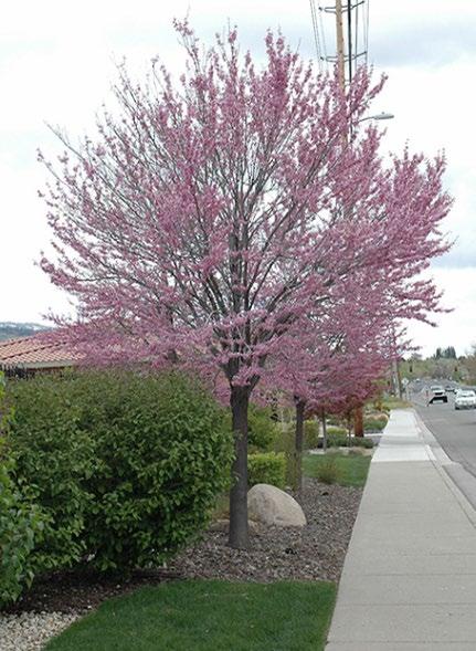
Tree planters can also integrate seating elements creating a multi-purpose street amenity (Image Credit:Streetlife).

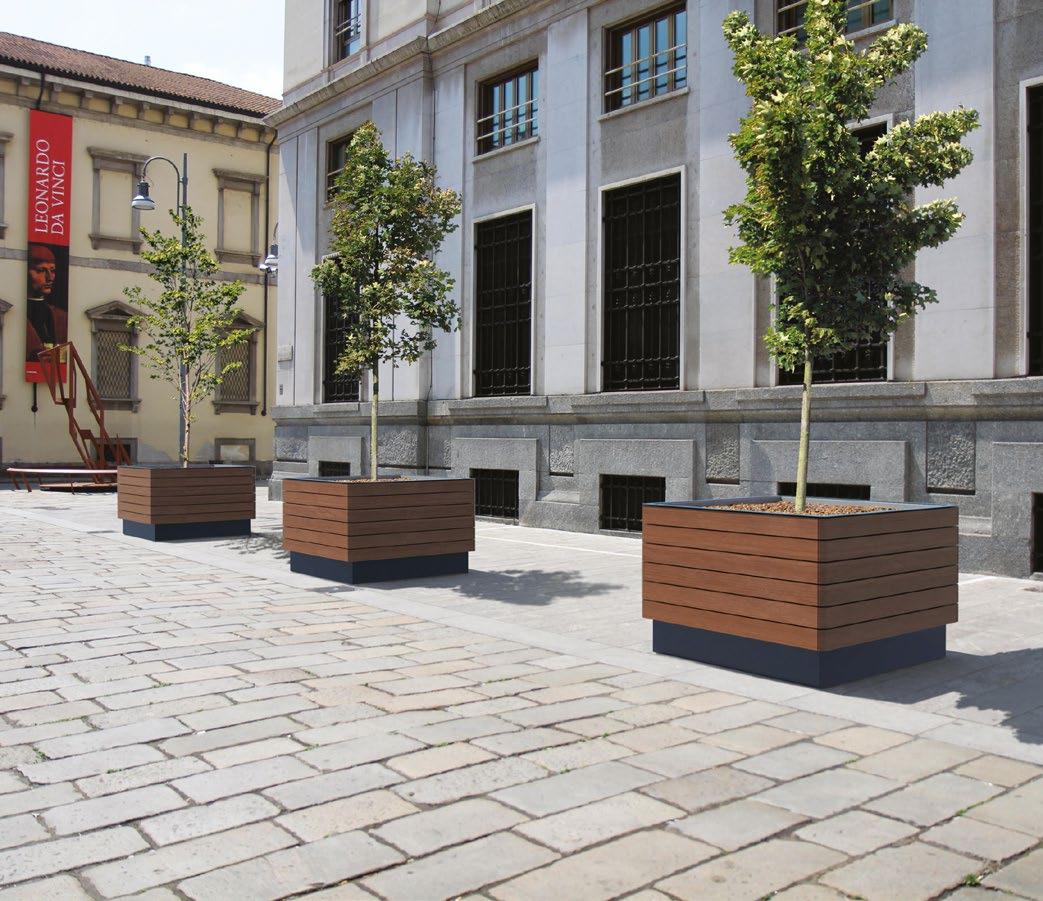
Where space is available in the streetscape environment, in-ground tree pits may be the solution for the inclusion of street trees. Creating a hospitable underground environment for root growth and water absorption is key to the survival of street trees and their overall performance.
• Replace dead or dying trees.
• Choose appropriate species after completing tree assessment. The Recommended Urban Trees Site Assessment and Tree Selection for Stress Tolerance by Cornell University is a good reference to utilize when selecting new street trees.
• Install structural soils or root cells such as Silva Cells to provide adequate soil volumes for tree health and longevity.
• Incorporate appropriate tree grates or pervious treatments around tree pits to allow for proper aeration and water absorption, and to ensure an ADA accessible streetscape environment.
• Depending on the size of the tree, in-ground street trees are recommended to be planted 20-30’ apart.
• The location of light poles and underground utilities will need to be considered when planting street trees. Street trees are typically located 10-15’ away from light poles. Local zoning codes should be reviewed for tree spacing requirements.
• Installation of permeable surfaces and structural soils in and around tree pits minimizes sidewalk heaving and maximizes the trees access to resources. These practices should be considered in all new street tree plantings.
• It is recommended that trees need a minimum of 300-600 cubic feet of soil for small trees, 800-900 cubic feet for medium trees and upwards of 1,200-4,000 cubic feet for large trees. If adequate soil volume cannot be accomplished, underground root systems such as root cells or structural soils can be incorporated to effectively increase the available area for root growth.
• Consider placing street trees in a continuous line with consistent spacing to establish a visual rhythm and canopy along the street.
Watering during the first year of establishment is important to the health of the tree. Trees should be pruned regularly to promote healthy growth and avoid sidewalk conflicts. Choosing species with minimal leaf and litter drop can reduce tree cleanup needs.
Tree grates should have minimal openings to prevent the accumulation of litter and to provide an ADA accessible surface. Openings in tree grates should be no greater than 1/2” wide for ADA compliance (Image Credit: IronSmilth).
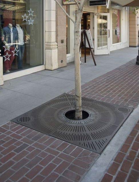
Soils under sidewalks need to be compacted in order to provide adequate support for the concrete or paver surface treatment. CU Structural Soils are a mixture of crushed gravel (approximately 1” in diameter) and soil which not only supports the sidewalk surface but provides voids in the subbase material allowing for the growth and expansion of tree roots.
• Help prevent sidewalk heaving by allowing tree root systems to expand under the sidewalk surface. Larger root systems increase the stability of the tree during storm and wind events.
• In combination with pervious sidewalk treatments, CU Structural Soils allow water to infiltration to the tree’s root system.
• Incorporating CU Structural Soils into tree pit plantings expands the soil volume available for root growth, resulting in larger, healthier trees in the streetscape environment.
The above diagram shows how structural soils can expand tree root growth beyond the limits of the tree pit. (Image Credit: Cornell University).
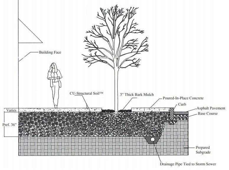
The trees in the photo above were planted at the same time. On the left, greater soil volume is available resulting in larger healthier trees. On the right, a constrained soil environment is stunting the growth of the trees in the pavement. CU Structural Soils help to provide greater soil volume in a streetscape setting resulting in larger healthier trees. (Image Credit: Cornell University)
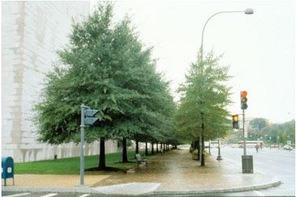
A well coordinated design palette of amenities enhance the quality, identity and economic vitality of a place. Design elements such as benches, bike racks, trash receptacles and lighting, create visually interesting environments that promote social interaction and enhance a sense of place. They encourage the use of the street as a public space, and when thoughtfully executed, can also be used to brand and promote an area.
• Install a family of site furnishings throughout each of the downtowns that work together to create a strong sense of place and promote each Village as a unique destination.
• Site furnishings should be placed strategically in order to contribute to the overall character of each Village, provide useful areas for relaxation and bike storage while allowing for unencumbered pedestrian flow.
• Furnishings should be purchased from a reputable site furnishing manufacture to ensure the quality of the amenities can withstand high traffic areas and winter conditions.
• Site furnishings come in a variety of materials and colors. Metal, wood or a combination of both is most appropriate.
• The use of wood creates a warm, naturefriendly atmosphere.
• Powder-coated metal finishes are more durable and offer a wide range of colors. Unique pops of color incorporated into site furnishings can provide a distinct identity in a downtown setting.
• Site furnishings should be selected from a palette of materials that will support the branding of each Village as a cultural destination. Branding should respect the desired character of the Village while also creating a contemporary appeal.

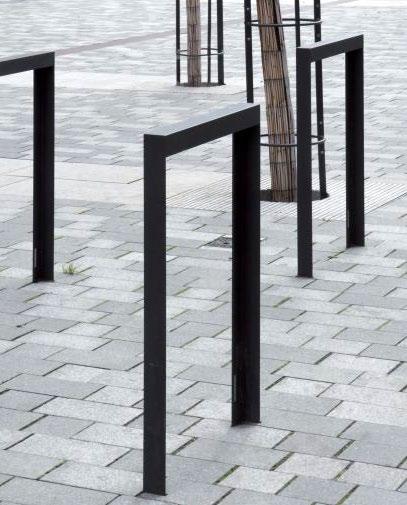


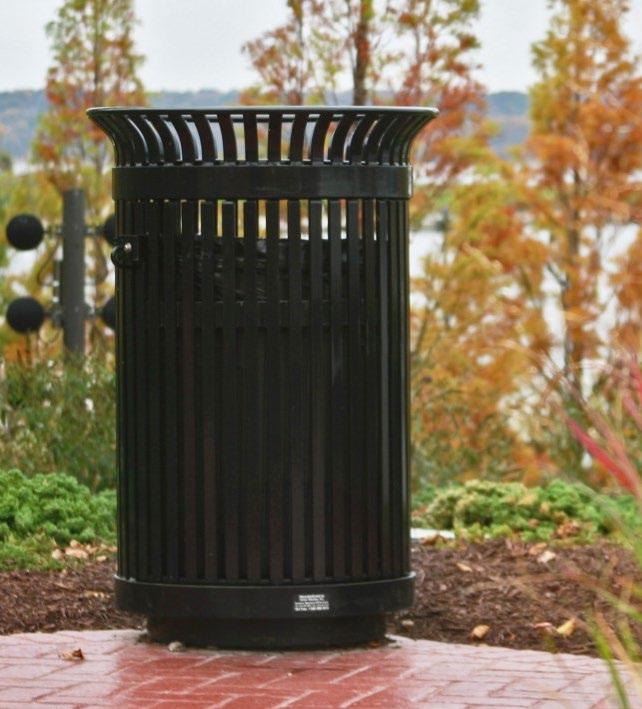

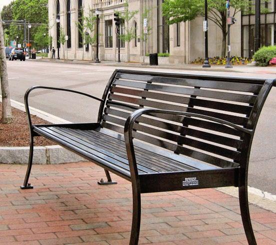


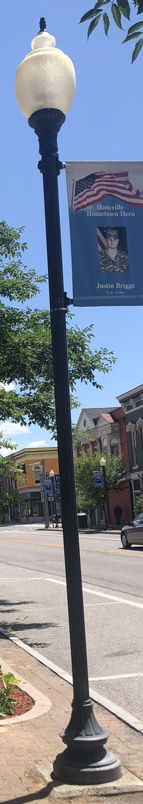
Benches, tables and chairs activate the streetscape by creating spaces for people to relax and gather. These elements, when strategically placed, can create a welcoming environment that encourages people to spend more time. Examples of public seating include benches, seat walls and movable tables and chairs.
• Install benches that will contribute to the Village character at frequent intervals throughout the downtown and at strategic locations like pocket parks or public transportation stops.
• Target areas where businesses are concentrated to provide public seating options for patrons.
• Consider safety and security when identifying locations and design of seating. See design considerations in sidebar.
• Seats made of wood experience less extreme temperature changes in the winter and summer months providing a comfortable place to sit in all seasons.
• When deterring skateboarding or other activities, consider bench seating with perpendicular metal slats or incorporate arm rests.
• Consider bench seating configurations that will facilitate conversation.
• Wood materials like Teak or Ipe will naturally weather over time to a gray patina and tend to be more durable in hot and cold weather environments. These wood materials will last longer than composite or plastic slats and require less maintenance.
• If sidewalk space is limited and an outdoor dining or retail space is desired, consider the introduction of parklets in the streetscape environment.
Most reputable bench manufactures have the ability to provide replacement parts for their current and past product lines. This will allow for easy replacement of broke or damaged pieces, keeping the aesthetic look of the streetscape elements consistent.
Bench style should compliment each Village’s character and style and fit in with other pedestrian amenities.


Existing bench in Avon offers respite outside local shops as well as a buffer between pedestrians and vehicular parking.
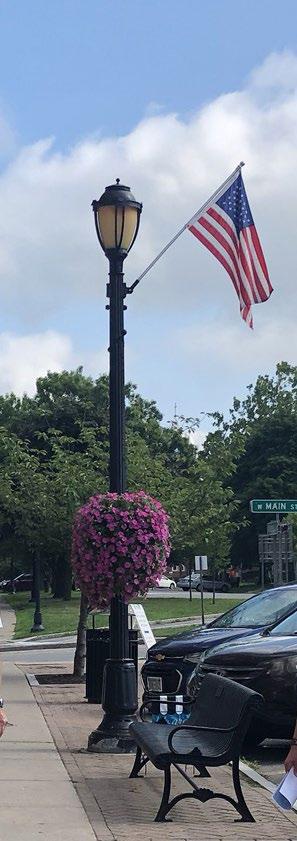
Parklets offer a unique way to expand the usable sidewalk environment. Platforms and vertical barriers help to temporally transform a parking spot into an outdoor cafe or gathering space. Coordination with local and state agencies is key to obtain approval, any necessary permits, and insure safety measures are in order to install a parklet.
The way benches and chairs are arranged in the streetscape can influence how people interact. The above image shows an arrangement that encourages social interaction and conversation. A pop of color also helps contributes to a vibrate streetscape environment.
Incorporating bicycle amenities into the streetscape has potential to encourage bicycle use and visitorship to each of the Villages. Bike racks are common streetscape elements that reduce the need for vehicular parking and encourage cyclists to visit local retail establishments. Bike repair stations are increasingly popular amenities found in the streetscape environment that support cyclists’ needs and promote locations as bicyclefriendly destinations.
• Install new bike racks that will contribute to the Village character at frequent intervals throughout the downtown.
• Bike racks should provide at least two points of attachment for secure locking.
• Place bike repair stations in areas of high bicycle use at trailheads and/or public parking facilitates. Adequate space will need to be provided to allow proper maneuvering of the bike at the repair station.
• Place bicycle amenities in high visibility locations for safety and to leverage potential branding opportunities.
• Locate bike racks in areas with existing business or places where people gather. Avoid placing bike racks in locations that are remote and far away from activity centers.
• Bike amenities come in a variety of materials. Utilizing a combination of wood and metal can add a contemporary / warm feel to the streetscape.
• Providing targeted applications of color on bike racks can increase the vibrancy of the streetscape year-round. Most manufactures provide a wide variety of colors to choose from to fit in almost any streetscape application.
• Bike racks can also be artistic elements. Creating unique yet utilitarian bike racks can define the character and identity of a downtown. Conducting an art call to soliciting designs by local artists can also help influence community pride sense of ownership.
The level of maintenance required will depend upon the materials and finishes selected. While powder-coated metal bike racks are a durable way to utilize color, they do require occasional touch up as a result of the constant rubbing of bicycles.
Surface mounted models are often preferred by municipalities as they are easier to repair and/or replace when hit by a car or tipped as a result of snow plowing. In-ground systems can cause impacts to the surrounding walk when hit and require a greater effort to repair to replace.
Have you ever been enjoying a bike ride when you suddenly found yourself with a flat tire or broken chain? Having a bike repair station nearby could help save the day. These stations can incorporate a variety of tools including pumps, pressure gauges, screwdrivers, tire levers and chain tools. While providing a convenient repair function, locating these stations can also help foster the identity of a cycle-friendly Village or community. Proper locations for bike repair stations would include trailheads (including the Genesee Valley Greenway State Park), public parks, parking facilities and in the streetscape environment if space allows.
The above bike rack installed at part of the ArtWalk project in Rochester, NY is not only a unique artistic element in the landscape, it provides multiple connection points to secure a bike.
Bike racks can be functional while also serving as public art elements (Image Credit: Santa & Cole).

When clustered together, bike racks can help provide separation between pedestrian and vehicular uses. (Image Credit: Forms + Surfaces).
Bike racks should provide at least two bike locking points. As shown in this photo, bike racks also have the potential to introduce a pop of color into the Streetscape (Image Credit: Forms + Surfaces).
Lighting illuminates the streetscape environment and provides a sense of safety and security. The design of lighting elements can also contribute to a unique sense of place and identity.
• Pedestrian lighting should be installed primarily in buffer zones and should be coordinated to ensure it does not conflict with street trees and site furnishings.
• Consider having light poles powder-coated or repainted. A bright color that ties into the visual theme for each Village could be an effective way of creating a unique sense of place.
• Illuminate alleyways to create inviting passages for visitors as they travel between public parking facilities and the Village core.
• Critical locations such as intersections and crosswalks, transit stops and seating areas should be well lit and highly visible.
• Dark sky compliant lighting elements are recommended to reduce light pollution.
• The type, scale and design of a lighting element plays an instrumental role in achieving a sense of place, particularly at nighttime, when lighting is necessary to create a safe and welcoming pedestrian experience.
• Pedestrian-scale light fixtures are typically 12 to 15 feet tall.
• Light poles provide opportunity for hanging banners and flower baskets to enhance the streetscape character.
• String lights offer a festive atmosphere in alleys or over roadways, promoting an area as a cultural and economic center.
• Fixtures and poles should complement the character of the streetscape.
• Warm LED lighting should be used to provide consistent and welcoming light.
LED lighting has lower energy and maintenance costs. Broken bulbs or fixtures should be replaced as needed and stickers/ tags removed for poles on a regular basis. Finishes should be touched up as necessary, particularly after the plowing season.
Light poles can act a canvas for unique art installations, like this mosaic light pole located along ArtWalk in Rochester, NY
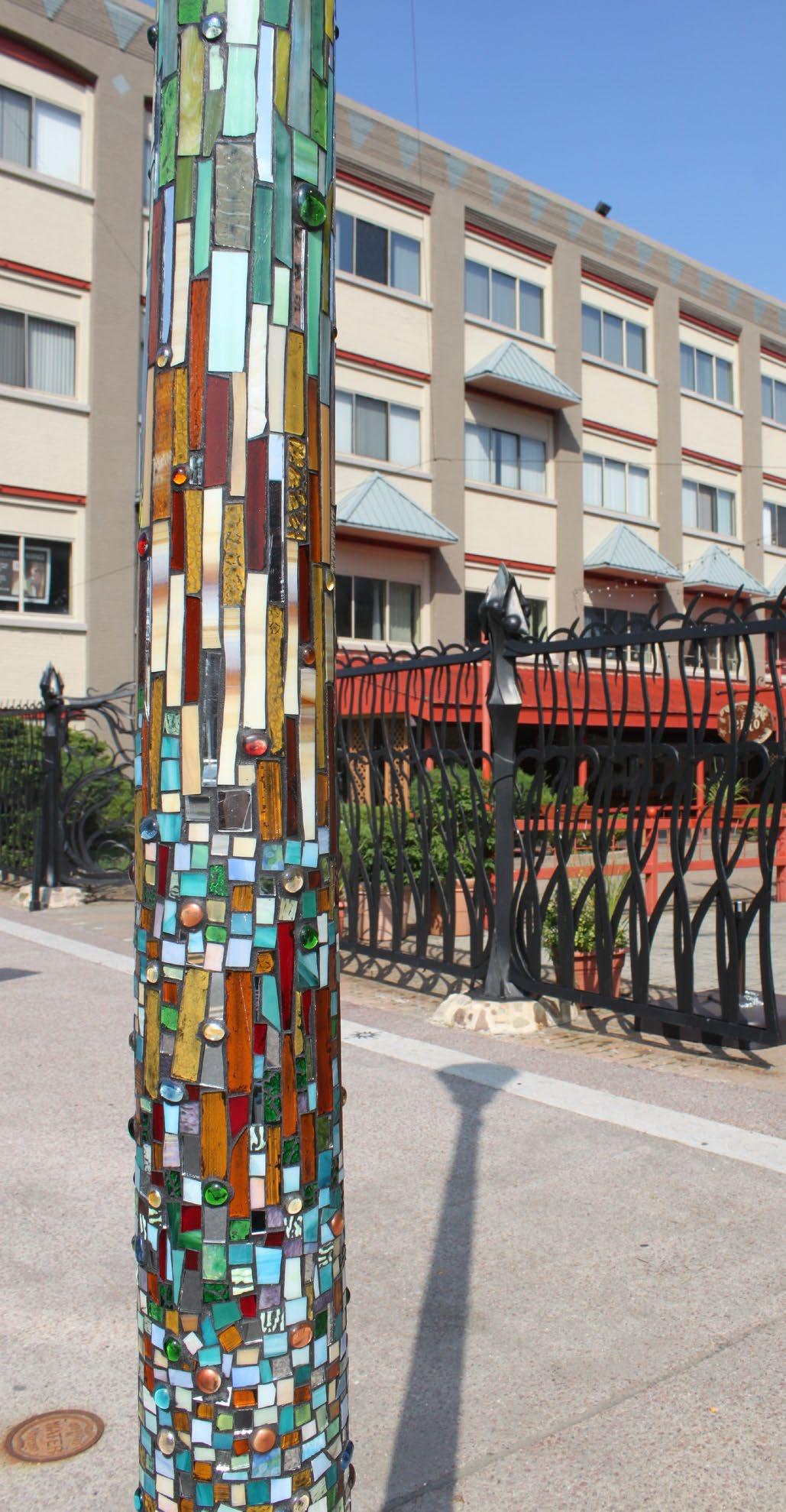
This pedestrian light poles has LED technology set within a traditional style fixture.


Artistic light columns can enhance gateways and entrances to alleyways.
(Image Credit:Left: eBom-OpenPillar/ Above:Forms+Surfaces).
Lighting in alleyways helps improve safety of the space while also creating a unique and welcoming ambiance (Image Credit: MedCity Beat).
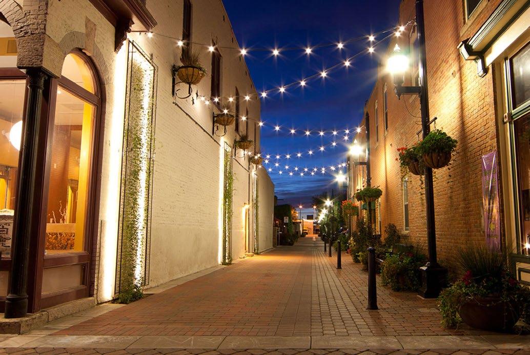
String lights at select locations over the roadway provide a distinctive identity and sense of place (Image Credit: cuocophoto).

Well-designed and strategically placed waste and recycling receptacles are a key component in maintaining an inviting downtown experience. Receptacles should be placed along all main streets in each Village to facilitate a clean streetscape environment.
• Waste receptacles should be located near areas of high pedestrian activity such as intersections, seating areas, transit stops and key destinations.
• If necessary, replace existing waste receptacles with new receptacles as a phased course of action, as they should be consistent with the chosen street furniture palette for each downtown.
• Receptacle selection needs to be coordinate with local trash removal practices to ensure proper/compatible emptying methods.
• Trash and recycling bin combos should be considered for installation in the streetscape environment. These bins help to reduce the amount of recyclable waste heading to the landfill and promote a environmentally conscious community.
• Design should be coordinated with the site furnishings to contribute to the overall street character.
• The most effective recycling bins are located immediately adjacent to waste receptacles and are differentiated through different size and shape openings as well as bold, supporting graphics
• Receptacles should be surface mounted to ensure that they remain in designated locations.
Receptacles should be emptied on a set schedule to prevent trash from overflowing and being thrown on the ground. Solar compactors incorporated into new receptacles can increase capacity and decrease maintenance costs by reducing the frequency of removal.
Combined and clearly marked waste and recycling bins can be effective in keeping trash out of recycling bins (Image Credit: Waste Wise Products).
Trash receptacles can provide a canvas for public art, like these tile mosaic art receptacles in Oakland, CA (Image Credit: JL, Laughing Squid).

Trash receptacles should belong to the same amenities palette as other site furnishings (Image Credit: mm cité).
Receptacles can come in a variety of colors to fit in the streetscape environment (Image Credit: Landscape Forms).

Public art is a powerful placemaking tool that can contribute to a sense of place and inspire those who experience it. Art has a way to uniquely liven and activate a space, and if thoughtfully executed, public art has the potential to reinforce a community’s identity. When used as a focal point, it can enhance gateways, anchor public gathering spaces, and thematically tie a downtown together.
• Use materials that are suitable for the local climate to ensure longevity of the art installation.
• Locate works of art properly to prevent obstruction of views or critical site lines in the streetscape environment.
• Incorporate sculptures or murals as key focal points at gateways or gathering spaces.
• Engage local and regional artists to participate in the process of art installation to create a sense of community ownership and promote local talent. Conducting an art call or competition is a way to solicit design ideas and create excitement in the process.
• Public art can transform utilitarian elements such as light poles, traffic signal boxes and waste receptacles into unique streetscape elements.
• A sequence of public art can serve as beacons, facilitating movement throughout a space or Village setting.
• Large, sculptural pieces should be considered at gateways and plazas, while art incorporated on more functional objects, such as site furnishings, sidewalks and light poles could be located throughout.
• Install permanent and temporary “everyday” art, such as pavement markings, banners, and trash can murals throughout the downtown.
Partnerships with local community groups and the formation of maintenance agreements should be considered in the art selection / installation process. This will help ensure works of art are well maintained and withstand the test of time.
Painting or applying mosaic tiles to utilitarian objects like trash bins can liven a streetscape environment (Image Credit: Old Oakland Neighbors)

These permanent structures located on ArtWalk in Rochester NY, house temporary revolving public art exhibits. School groups and local artists take turn providing unique art displays throughout the year.
Murals bring blank walls to life and add vibrancy to the streetscape (Image Credit: Buffalo Rising).
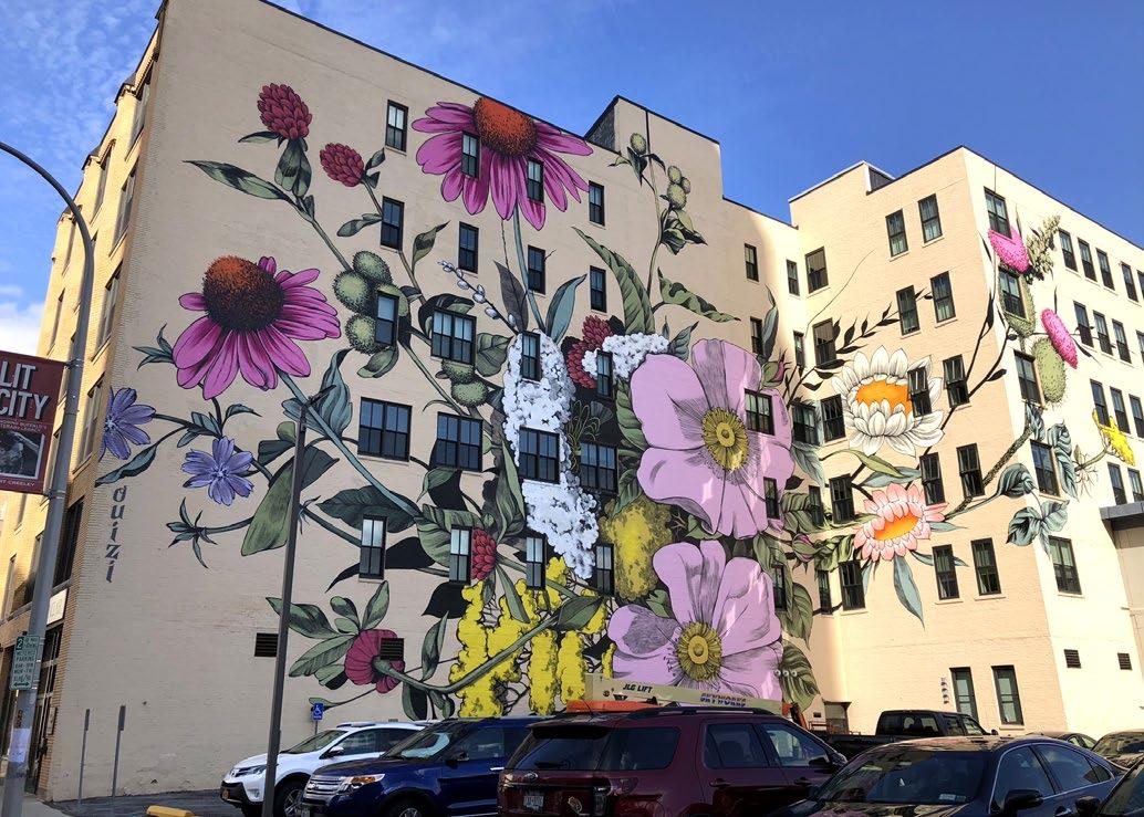
Artistic pavement markings can be an effective way to encourage movement through an area, like these sidewalk stamps in Seattle, WA. (Image Credit: Vaughn Bell)
Large works of art can mark gateways or be located in public gathering spaces (Image Credit: Curbed New York-Johnny Fogg, Catskill,NY).
Public restrooms are an additional amenity that when introduced into the downtown can contribute to visitors comfort and elongate stays. A number of options are available to introduce public restrooms into the downtown environment, ranging from temporary to permanent installations.

Portable toilets are free standing, single stall, gender neutral facilities. People often have negative perception of these facilities. To make them less visibly obtrusive, a structure can be designed to house portable toilets or units could be turned into public art.

Restroom trailers are becoming more popular in the finger lakes for weddings, festivals and outdoor sporting events, where permanent restrooms are not available and traditional portable toilets are not desired. These trailers provide additional privacy and contain the comforts of home including electricity and running water. Trailers can range in size, luxury and cost.
Permanent structures can be custom designed and include green technology (water conservation, natural lighting). These facilities are more costly and will require connection to water, sewer and electric utilities.
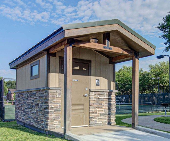
Incorporating green infrastructure into the streetscape environment can help reduce the volume of stormwater entering the sewer system, reduce the amount of impervious pavement allowing stormwater to filter into the ground, and provide an aesthetically pleasing streetscape amenity. Green infrastructure practices can include pervious pavement, rain gardens and in-ground planters.
Incorporating pervious pavement in the sidewalk can help reduce stormwater runoff and allow rainwater to infiltrate into the ground. The image to the right shows pervious concrete in the “tree lawn” area adjacent to the curb. The color and texture also help highlight the main path of pedestrian travel.
Adjacent to public parking facilitates or in park settings, rain gardens can collect stormwater allowing it to infiltrate into the ground and provide an aesthetic landscape feature. The image to the right shows planting and stone mulch that can be incorporated into the infiltration area. A catch basin is provided to accommodate stormwater overflow in larger rain events.
In a downtown setting, in-ground planters can be used to collect stormwater runoff. The image to the right demonstrates how curb drops allow stormwater to enter the planter at the road edge, allowing water to infiltrate into the soil. Plants able to tolerate water inundation should be incorporated into the planter and elements such as decorative fencing can help formalize the feature in the streetscape environment.
Sidewalks are critical infrastructure for pedestrian movement throughout the Village streetscape. They enhance connectivity, provide access to storefronts, public parks, transportation facilities and residential areas. Sidewalks are also important public spaces, providing opportunities for spontaneous social interactions and outdoor dining space.
• Repair and replace sidewalks in poor condition.
• Infill sidewalk gaps to provide safe pedestrian access to public parks and other destinations.
• To meet ADA standards, all walking surfaces must be a minimum 5’ width. In high traffic areas, and 8-10’ width is preferred for pedestrian maneuvering and traffic flow.
• Ensure all curb ramps at pedestrian crossings are ADA accessible with proper slopes and detectable warning devices..
• Sidewalks / Sidewalk Gaps
• Curb Extensions
• Crosswalks / Curb Cuts
• Structural soils incorporated into the sidewalk subsurface will help create a hospitable environment for street trees.
• Consider treatments that combine a variety of materials to highlight paths of travel and contribute to an aesthetically pleasing streetscape environment.
• Incorporate public art into the pavement treatments with decorative inlays or sandblasted designs as described in the Public Art best practices.
Regular maintenance of sidewalks is critical to maintain a safe, accessible pedestrian environment. Maintenance varies in scope from regular litter and debris removal, to intermittent replacement to address heaving and material deterioration. If well-maintained, sidewalks can last up to 25 years.
When selecting a sidewalk material including colored concrete, textured concrete, or pavers, winter snow removal and ice melting practices should be considered to ensure durability and longevity.
In Nunda, gaps existing in the sidewalk connecting the Village to Kiwanis Park. There is also a lack of separation between the pedestrian and vehicular environment. (Image Credit: Google).
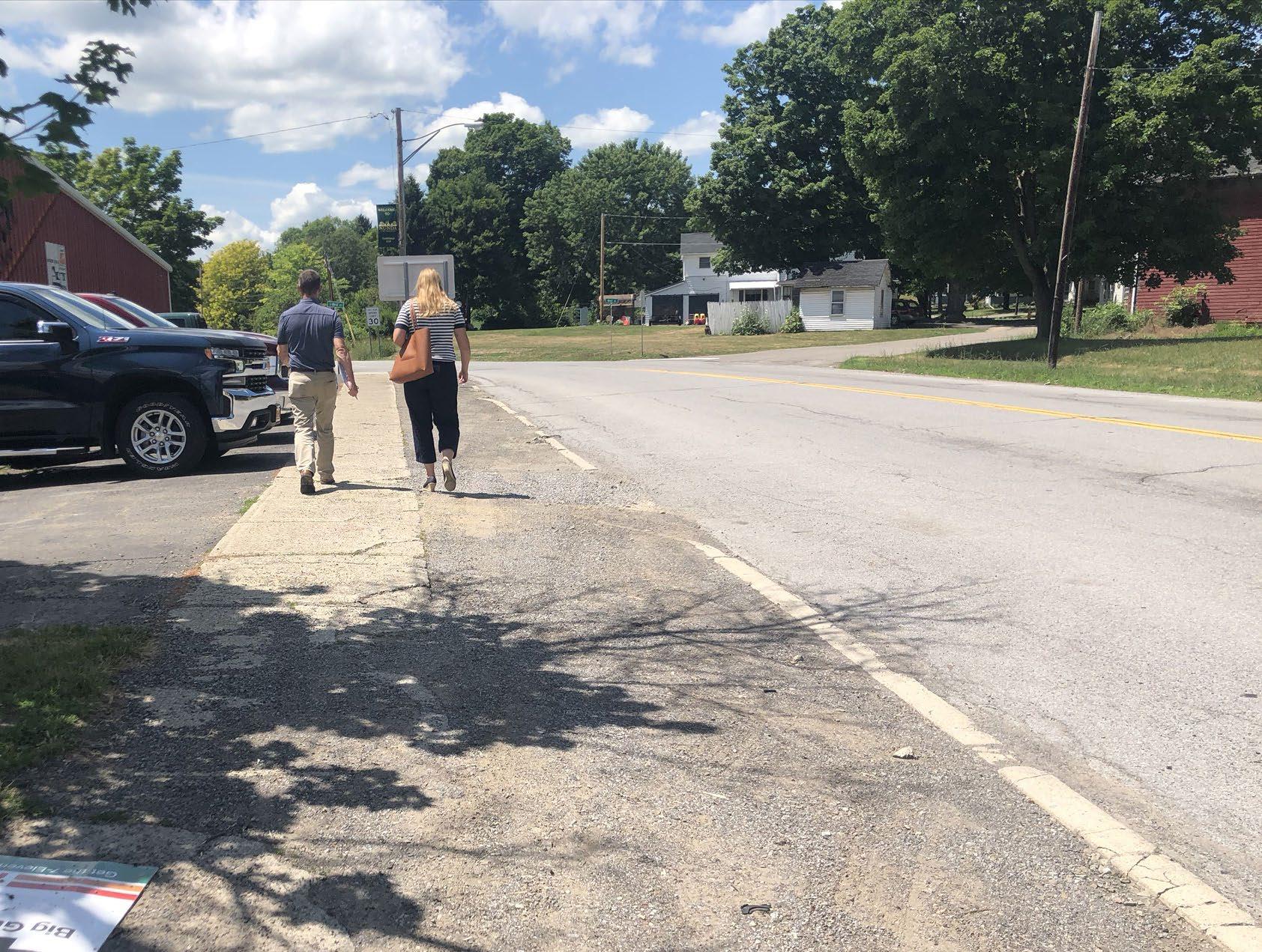
A combination of materials can help add character to a Village sidewalk, while also defining use zones. The standard concrete in the center is the main path of travel. The brick areas to the side are amenity zones containing trees, light poles and site furnishings. The area to the left also provides and unloading area for parked cars.
A variety of sidewalk materials can be used in a Village setting to provide functional pedestrian space while also creating an aesthetically pleasing streetscape. Below are a few materials to consider when making sidewalk improvements.
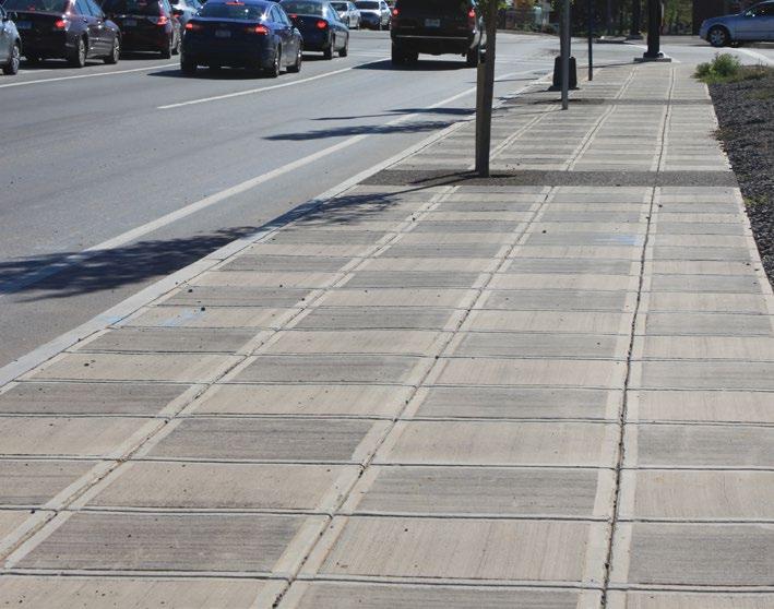
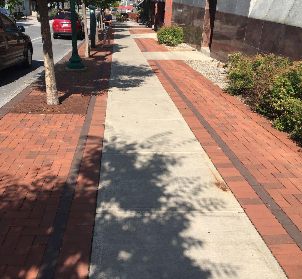
Standard Concrete - Typically used in the main path of travel.
Exposed Aggregate Concrete - Used in the main path of travel and as an accent treatment.
Stamped Concrete - Used as an accent pavement out of the main path of travel. Comes in a variety of colors and patterns.
Pavers- Used as an accent pavement. Comes in a variety of colors and sizes. Can also be installed as a pervious pavement.


Flexi-Pave - A pervious treatment typically used in tree pits. This material is a good substitute for tree grates in narrow sidewalks where additional walking surface is desired.
Pervious Concrete - This material allows stormwater to filter through and has a contrasting appearance to standard concrete. It is not recommended to use sand in the winter months to treat these walking surface to prevent the voids in the pavement from clogging.

Curb extensions narrow the roadway and aid in traffic calming, shorten crosswalk distances, improve pedestrian visibility, define on-street parking, and create additional sidewalk space for site amenities, public art and green infrastructure practices.
• Installation of curb extensions will require coordination with local and/or state agencies.
• Curb extensions are typically located at intersections and mid-block pedestrian crossings and are approximately 6-8’ in width. The length of a curb extension can vary, but a 10-20’ length is recommended if streetscape amenities are to be incorporated. Special attention will need to be made to the curb radii to ensure curb extensions do not impede traffic flow and maintenance practices.
• Sight distances will need to be considered when locating items in a curb extension to ensure site lines remain unobstructed.
• The new space created by a curb extension can include the following: site furnishings, green infrastructure, street trees, public art, lighting, and/or interpretive signage.
• Curb extensions may require the relocation of fire hydrants to maintain adequate curbside access and the reconfiguration of storm sewer utilities to provide positive roadway drainage. Green infrastructure practices could be incorporated to help accommodate the change of stormwater flow and capture.
In the winter months, installation of flexible delineators along the perimeter of curb extensions is recommended to draw attention to these features for snow removal. Typical sidewalk maintenance will be needed and potential trash/plant litter removal will be necessary if rain gardens are incorporated into the curb extension.
Tactical urbanism demonstrations can be used to help educate the public on the benefits of curb extensions and test an idea before spending resources to design and construct. This image is from a demonstration project in
NY; feedback from this exercise indicated that a 6 foot wide curb extension did not interfere with traffic flow and provided valuable pedestrian space.
Curb extension with green infrastructure in Portland, OR (photo credit: Justin Martin).
Intersections are critical nodes serving all modes of transportation. Accessible pedestrian crossings are fundamental to ensuring safe, predictable, and efficient pedestrian movement.
• Upgrade all curb ramps and crosswalks to ensure compliance with the Americans with Disabilities Act (ADA) regulations. Any roadway or sidewalk improvement project should include the following:
ADA accessible curb ramps at all pedestrian crossings.
Detectable warning surfaces at every intersection approach.
High-visibility crosswalks and all pedestrian crossings. Ladder bar style crosswalks have been shown to be the most visible to vehicular traffic.
• Implement new mid-block crossings where feasible as recommended in the Village specific recommendation plans.
• All signalized intersections should include pedestrian signals equipped with visual and audible cues. The length of the pedestrian crossing will need to be taken into consideration when determining signal crossing times.
• Rapid Flashing Beacon (RRFB) pedestrian signals should be considered at mid-block and other un-signalized crossings. Local and NYSDOT standards and approval will be needed for implementation.
Routine monitoring and maintenance of intersection pavement markings, curb ramps and signals/signage is necessary to ensure positive guidance is given to all users.
Existing crosswalk in Geneseo. Curb ramp does not meet ADA standards but contains high visibility crosswalks.
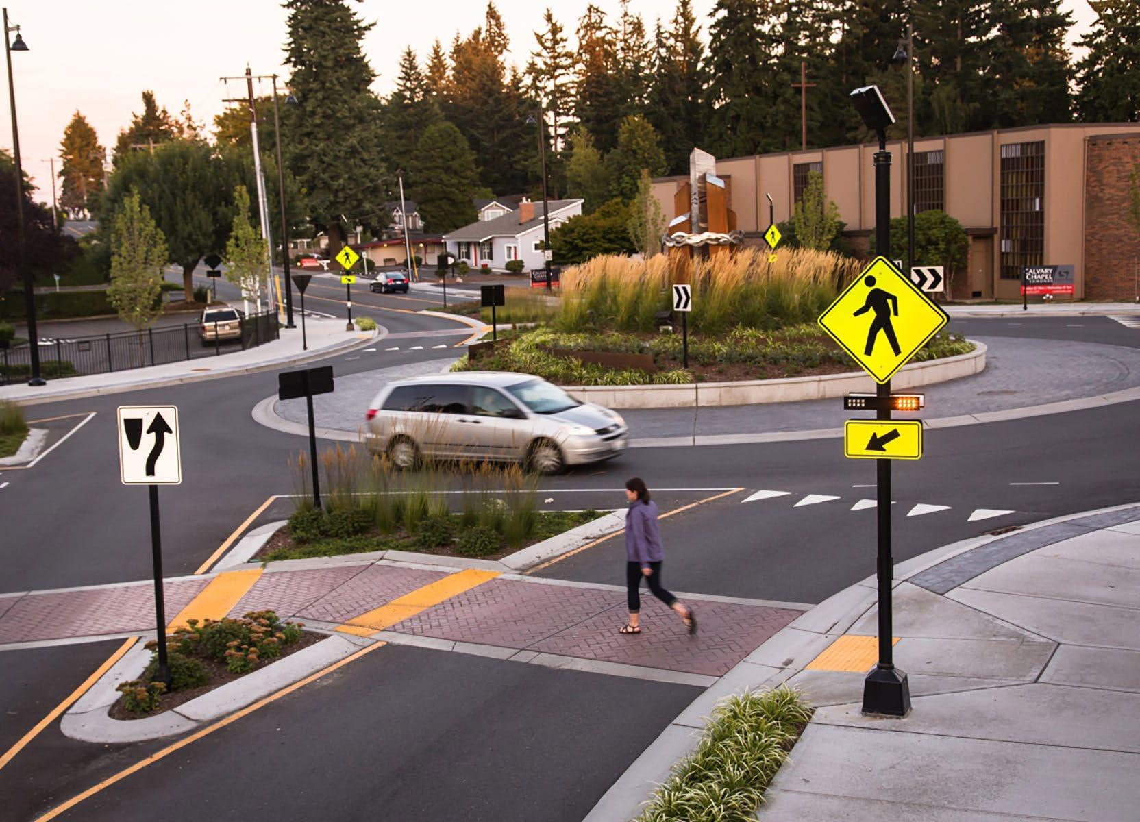
Easy to find, safe and adequate public parking can improve access and visitorship to each of the downtowns. The applicability of these parking solutions may vary between the nine Villages, but should be considered in any streetscape or public parking facility improvement project.
A unique consideration in Livingston County is the presence of a strong Amish Community. The Amish community actively participates in local farmers markets and frequent local businesses. Creating safe and convenient locations to hitch a horse and buggy will help prevent light poles and other streetscape elements from being used for this unintended purpose, and will create a welcoming environment for the Amish population.
• Complete a parking demand analysis to determine if existing parking accommodations (# of spaces) are adequate for each of the nine Village’s needs.
• When parking demand reaches 85% occupancy, evaluate if metered parking is appropriate/ necessary.
• Evaluate existing accessible (ADA) parking stalls and determine if they are located proximate to high volume destinations and there are an adequate number (1 per 25 available public spaces).
• Understanding vehicular traffic flow when locating horse and buggy hitching posts is essential in preventing potential conflicts with vehicles and pedestrians. Space needed for a single horse and buggy is comparable to one angled parking spot.
• Implement time limitations for downtown parking during peak periods.
• Install clear and adequate directional, regulatory and location (“P” signs for offstreet) signage for on-street and off-street parking facilities.
• Clearly define public vs. private parking in all facilities.
• Restripe on-street and off-street parking facilities to clearly delineate parking stalls and maximize capacity. This can be achieved with parallel and diagonal frontend or back-in parking stalls.
• Incorporate electric vehicle charging stations in public parking facilities and clearly sign their location.
• Explore the installation of smart meters for on -street parking and public parking facilities where meters are appropriate. Smart meters can accommodate a variety of payment methods and have the ability to be linked with parking apps, providing real time parking availability information to visitor’s smart phones.
• Villages with significant business concentrations should consider restricting on-street parking for business employees to free up spots for customers.
Maintenance of public parking facilities including striping, signage, meters, and adequate lighting should be accounted for in the capital improvement budgets for all nine Villages.
Incorporate technology including electric vehicle charging stations and smart meters. Smart meters accommodate a variety of payment methods and can be linked with parking apps, giving real time parking availability information on your smart phone.
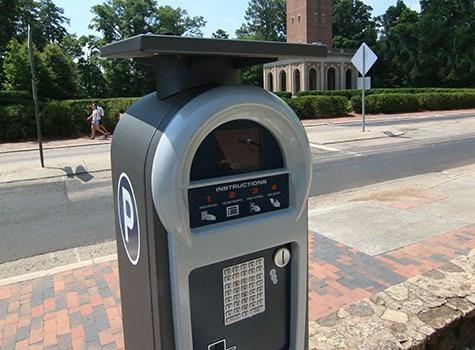
Maximize parking by providing clearly marked parking stalls. The photo above demonstrates front-end diagonal parking. Diagonal back-in parking can be considered when parking stalls are located immediately to on-road bike facilities, helping to reduce vehicle/ bike conflicts.
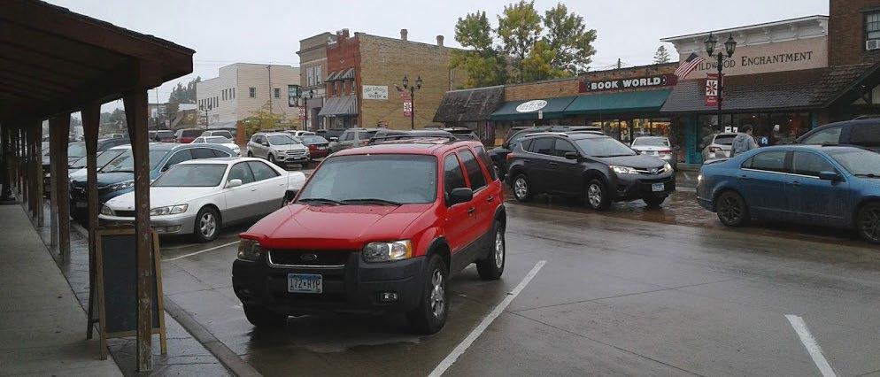
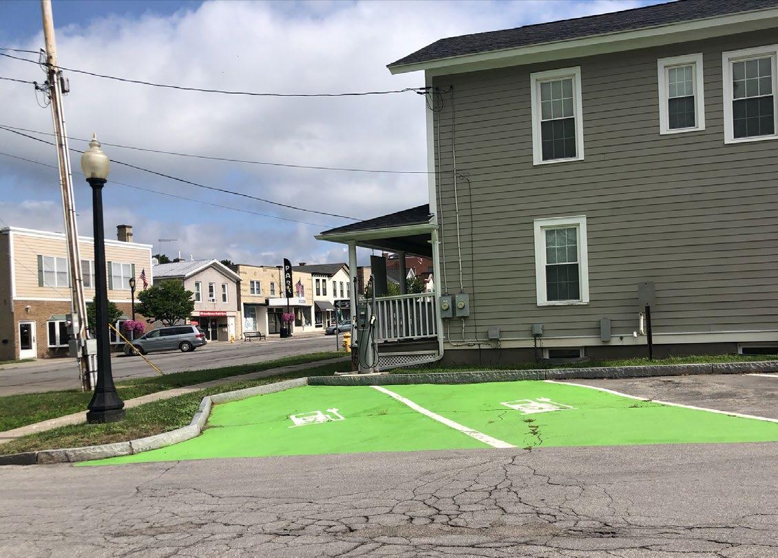
Clearly define parking regulations and public vs. private parking on all Village streets and public parking facilities.
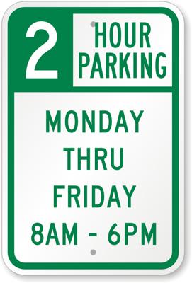
Designated horse and buggy parking and hitching posts can be provided in downtowns with an active Amish population.
In the Villages of Livingston County, alleys provide pedestrian and/or vehicular access between public parking facilities and Main Street corridors. Creating inviting, safe and welcoming alleyways help draw pedestrian traffic into Village business districts, potentially creating positive economic benefits.
• Locate alleyways in all nine Villages and determine ownership. If publicly owned, develop plans to create safe, welcoming and convenient pedestrian access points to downtown main streets.
• Determine if alley is intended for pedestrian access, vehicular access or both. Provide treatments that clearly define uses and promote safe movement for all modes of transportation.
In
• Lighting installations can brighten the alley space and enhance the sense of safety.
• Incorporate placemaking elements such as decorative pavements, site furnishings or public art to create a welcoming environment.
• Consider naming alleys to identify location.
• Install signage to define alley entrances.
• If alley is large enough, consider programming opportunities to compliment adjacent farmers markets or festivals.
Alley maintenance would be similar to any other streetscape/downtown environment. Opportunity exists to partner with community groups and/or business improvement districts to help plant and maintain flower baskets.
Pedestrian only alleys can be a safe space for those who move at a different pace. They can be bright and inviting with the introduction of public art at the ground level (Image credit: Joe Hass).

Lighting elements, pavement treatments and site amenities help to create warm and inviting spaces.
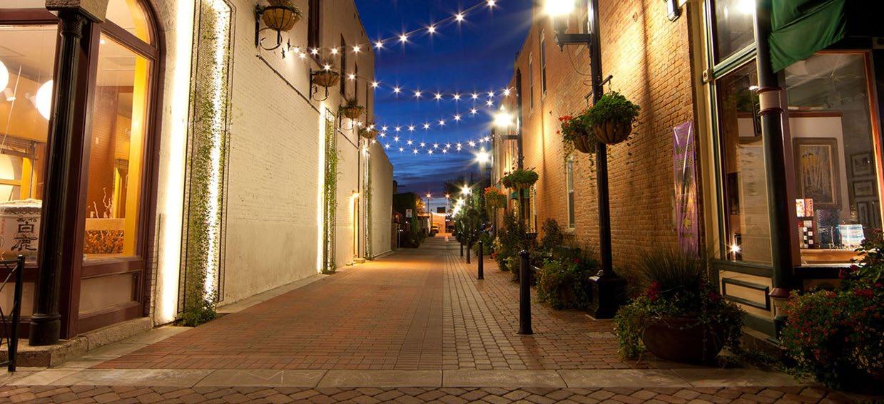
Signage or unique gateway elements can be used to identify and alley access point. These ”uptown artways” in Iowa help define the entrance to a unique space or passageway (Image Credit: ArtPlaceAmerica.com).
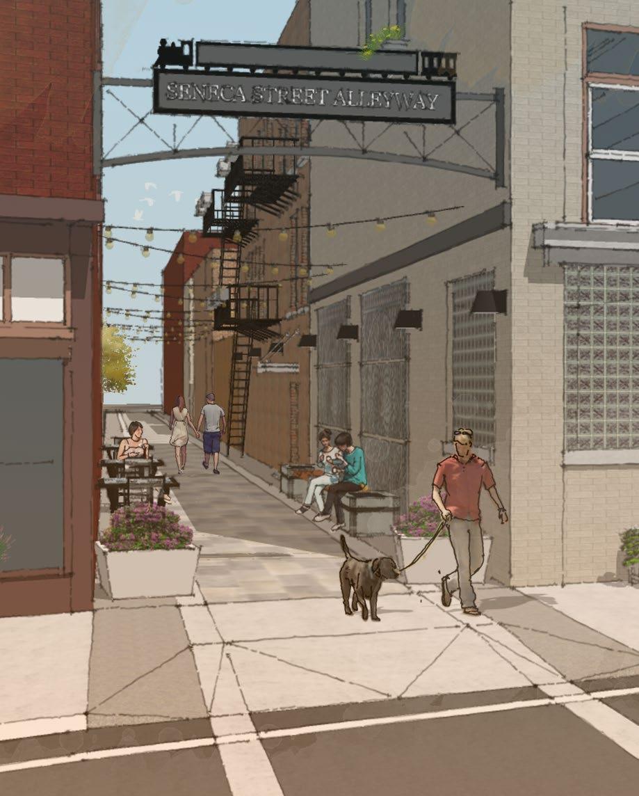
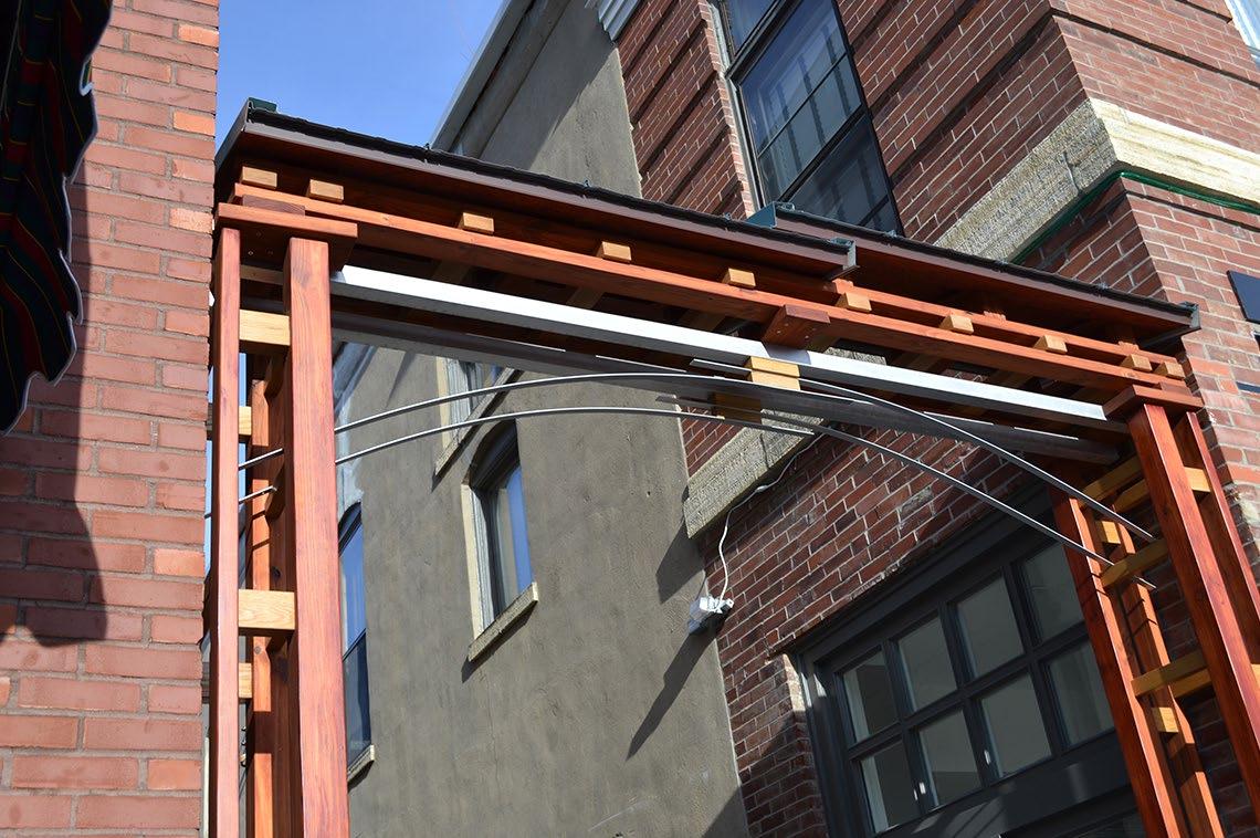
Page Intentionally left blank.
Using the General Streetscape Design Guidelines as a base, high level recommendations tailored to each of the nine individual Villages are provided on the following pages. These recommendations are based on site observations, input gathered at community stakeholder and public meetings, and best management practices. Related past and on-going planning initiatives were reviewed to provide consistency with suggested recommendations and the future vision of each community.
The following recommendations should be considered conceptual and will require detailed design for implementation. As streetscape or public improvement projects are identified, these recommendations should be considered and can be a useful tool when applying for design and construction funding opportunities. Streetscape improvement projects should follow local zoning codes and design standards, and may require local and state agency approvals / permits.
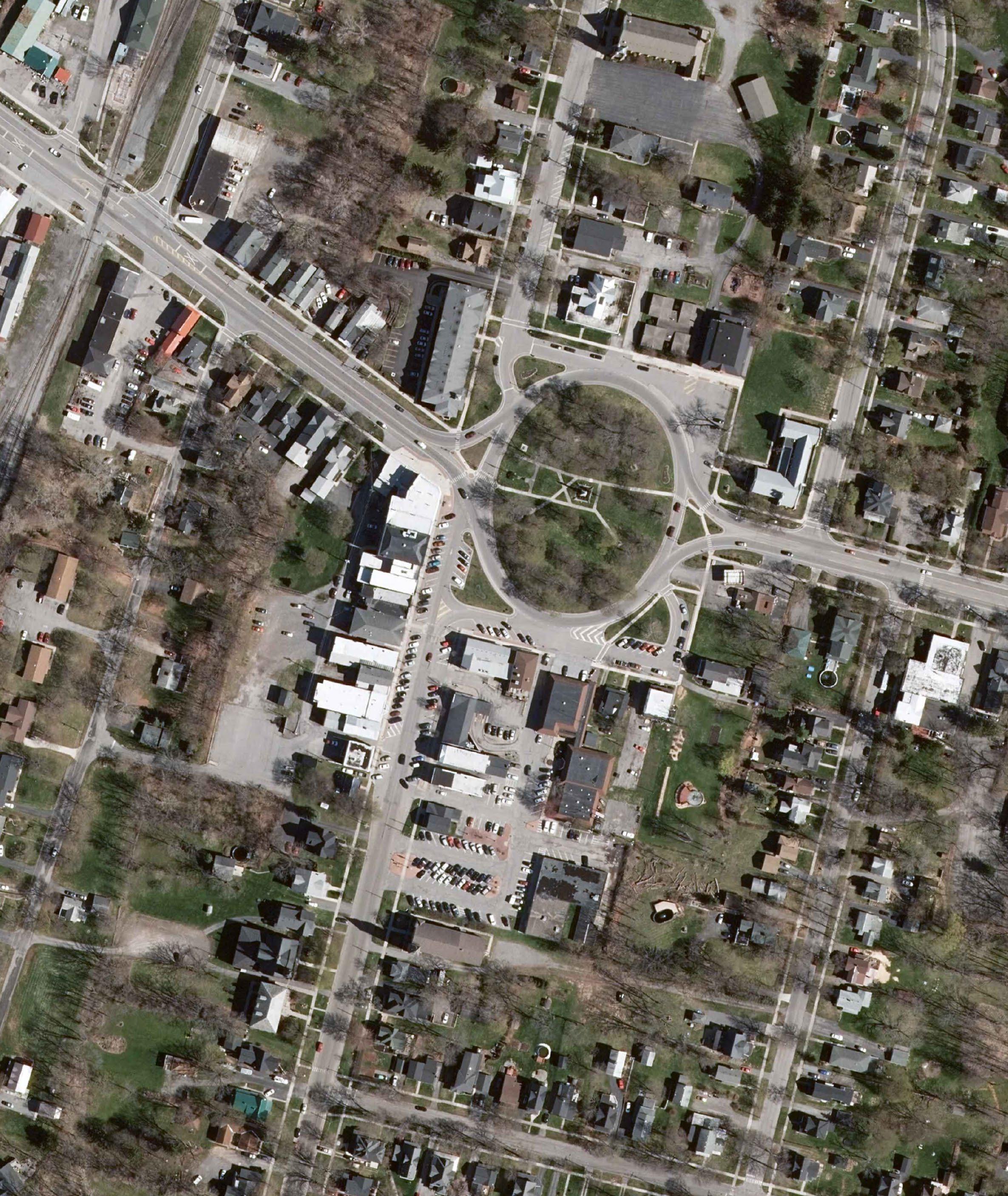


• Evaluate existing street trees and replace missing and dying trees, consistent with street tree guidelines.
• Implement streetscape enhancements along Genesee Street, including sidewalk repair and installation of additional amenities such as benches, planters and bike racks.
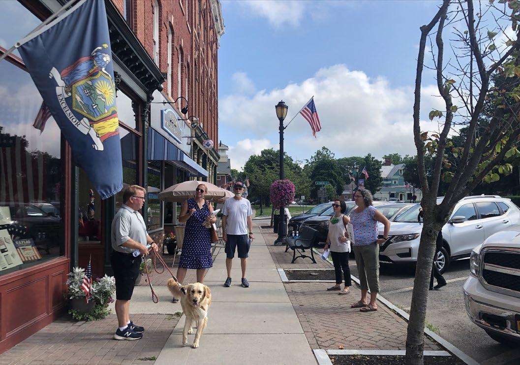
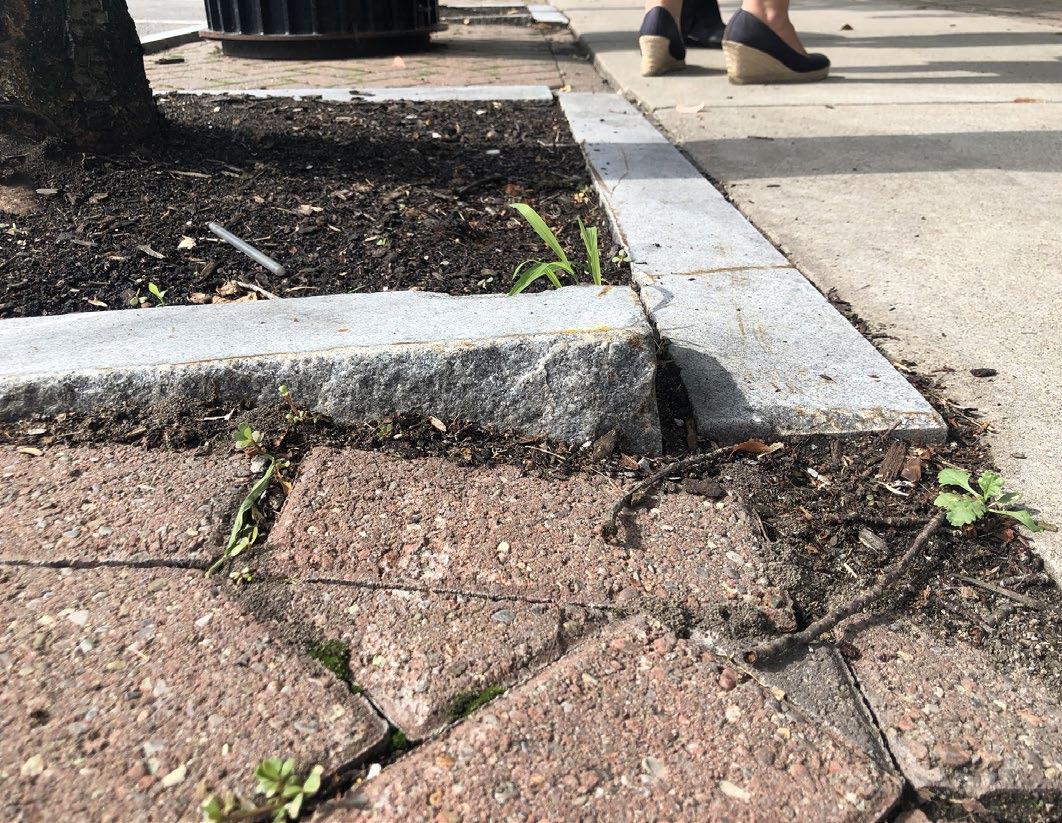
• Incorporate green infrastructure when feasible, consistent with the streetscape amenities guidelines.
• Install new historic markers at historic sites in the Village.
• Enhance existing pedestrian crossings to Circle Park and explore the installation of a new pedestrian crossing from the Genesee Street / Park Place intersection.
• Incorporate sharrow bike symbols around Circle Park and connect to proposed bike lanes on 5 & 20.
• Extend medians around Circle Park which will narrow the pavement openings to the circle, reducing conflict points.
• Explore the installation of a mid-block crossing on Genesee Street between Park Place and Clinton Street.
• Implement intersection improvements at the Genesee Street / Clinton Street intersection to incorporate bumpouts, enhanced crosswalks and all-way stop signs.
• Explore solutions to eliminate parking / vehicular path of travel conflicts at the corner of Genesee Street and West Main Street.
• Restripe parking on west side of Genesee Street to maximize parking.
• Improve pavement surface and striping in off-street public parking facility west of Genesee Street, and clearly delineate public vs. private parking for off-street parking facilities on both sides of Genesee Street.
• Expand upon proposed public art projects and enhance the alley near the fire station and the alley to the right of Edward Jones.
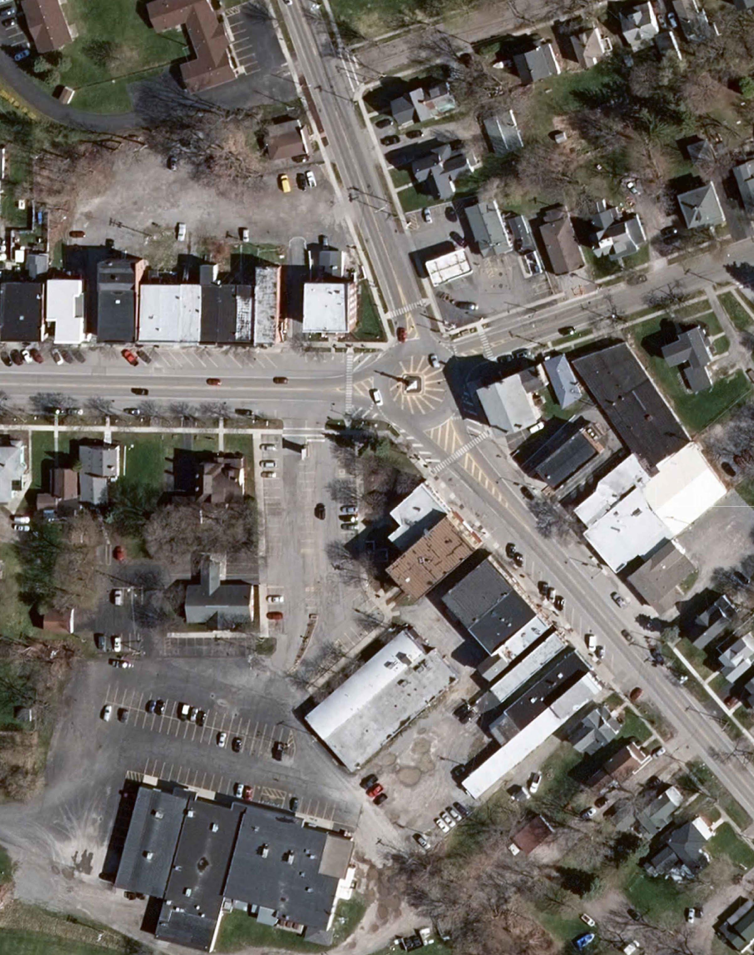
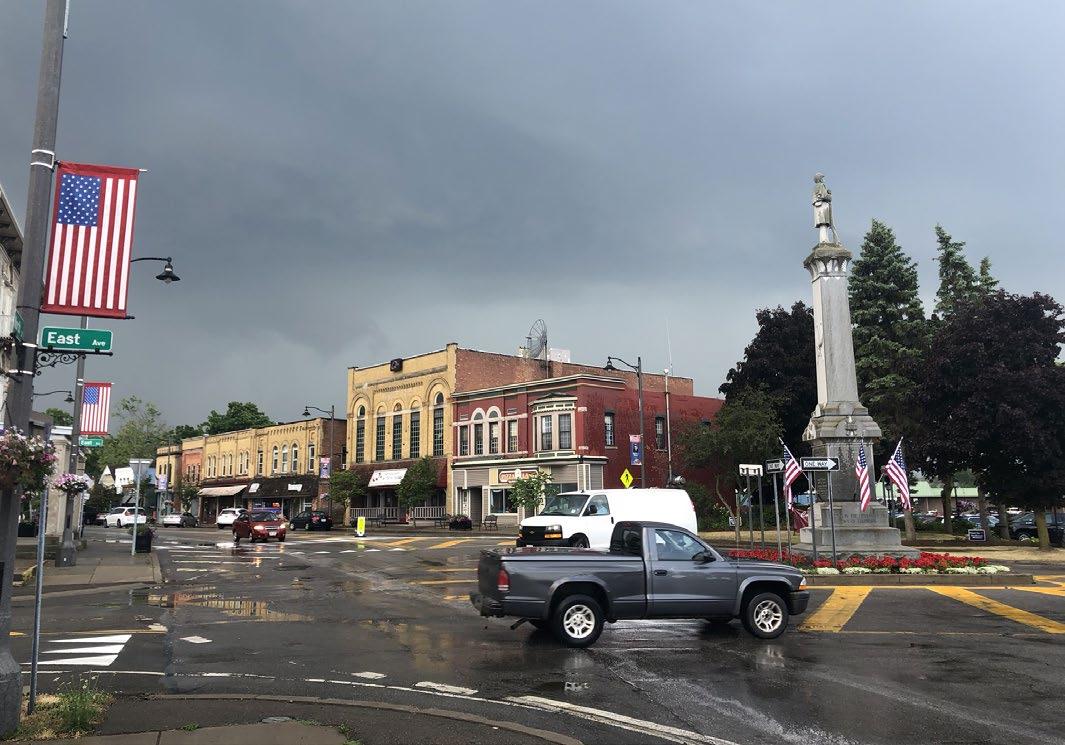
• Evaluate existing street trees and replace missing and dying trees, consistent with street tree guidelines.
• Implement streetscape enhancements including sidewalk repair, specifically at the southeast corner of State Street and East Avenue,
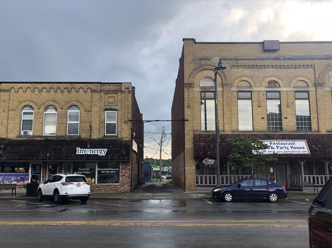
• Incorporate additional benches, planters and bike racks.
• Incorporate green infrastructure when feasible, consistent with the streetscape amenities guidelines.
• Incorporate vibrant color or artistic elements into streetscape amenities and pavement treatments, building on the unique artistic character of the Village of Caledonia.
• Enhance crosswalks at roundabout to bring attention to pedestrians and improve safety for all users.
• Explore options for better defining the path of travel at the roundabout. Drivers ignore the striping in the road, creating potential traffic conflicts. An option could include raised/ curbed medians with a contrasting pavement treatment. Any improvements will need to take into account truck traffic and cannot impede the ability for trucks to maneuver the roundabout.
• Resurface and better define parking spaces in the parking lot behind the buildings north of Main Street. Stripe parking stalls and clearly mark public vs. private parking.
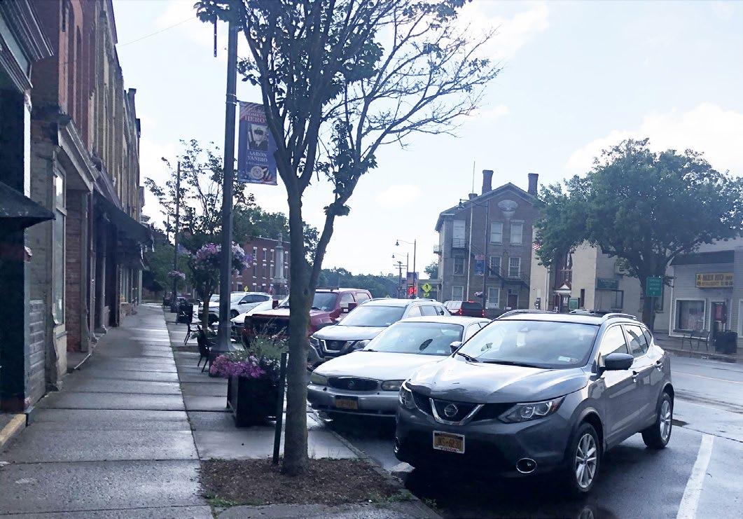
• Clearly define public vs. private parking in the parking lot behind the buildings on the corner of State Street and Main Street.
• Enhance the alleyways on Main Street and State Street with public art and lighting.
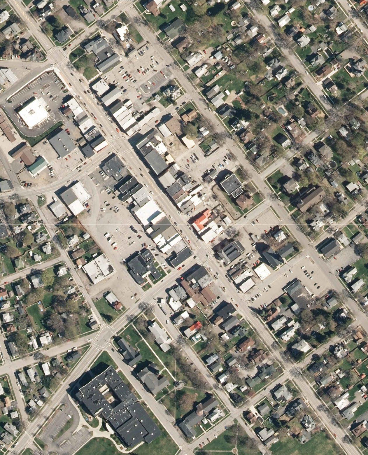
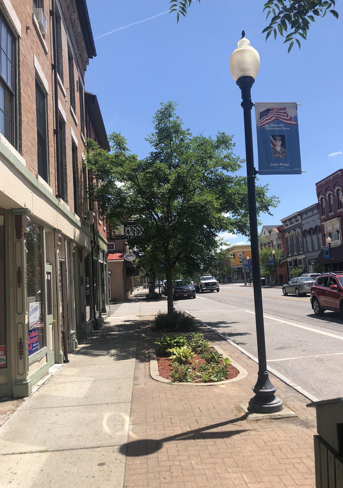
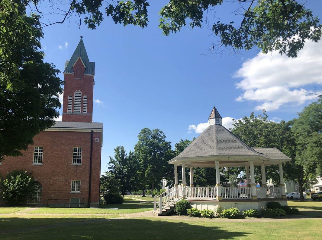
• Evaluate existing street trees and replace missing and dying trees, consistent with street tree guidelines.
• Place additional benches, bike racks and planters in the pedestrian environment.
• Incorporate green infrastructure when feasible, consistent with the streetscape amenities guidelines.
• Enhance crosswalks at major intersections along Main Street with high visibility striping and / or contrasting pavement colors to bring attention to pedestrians and increase safety.
• Explore the installation of bumpouts at key intersections on Main Street. Bumpouts will shorten pedestrian crossings, help define on-street parking, and act as a traffic calming measure. Any improvements will need to take into account truck traffic and cannot impede the ability for trucks to maneuver through the Village of Dansville.
• Enhance the pedestrian connection from Main Street to Church Square Park and Pioneer Park via Clara Barton Street and W Liberty Street. In addition to wayfinding signage, his can be achieved with decorative pavement treatments and unique elements in the landscape such as colorful light poles and site amenities, art installations, or historic interpretive stations guiding pedestrians to the parks.
• Clearly define public vs. private parking in the parking lots behind the buildings on Main Street, through striping and signage.
• Enhance the alleyways between the public parking facilities and Main Street with decorative elements such as public art, lighting and ornamental paving treatments.
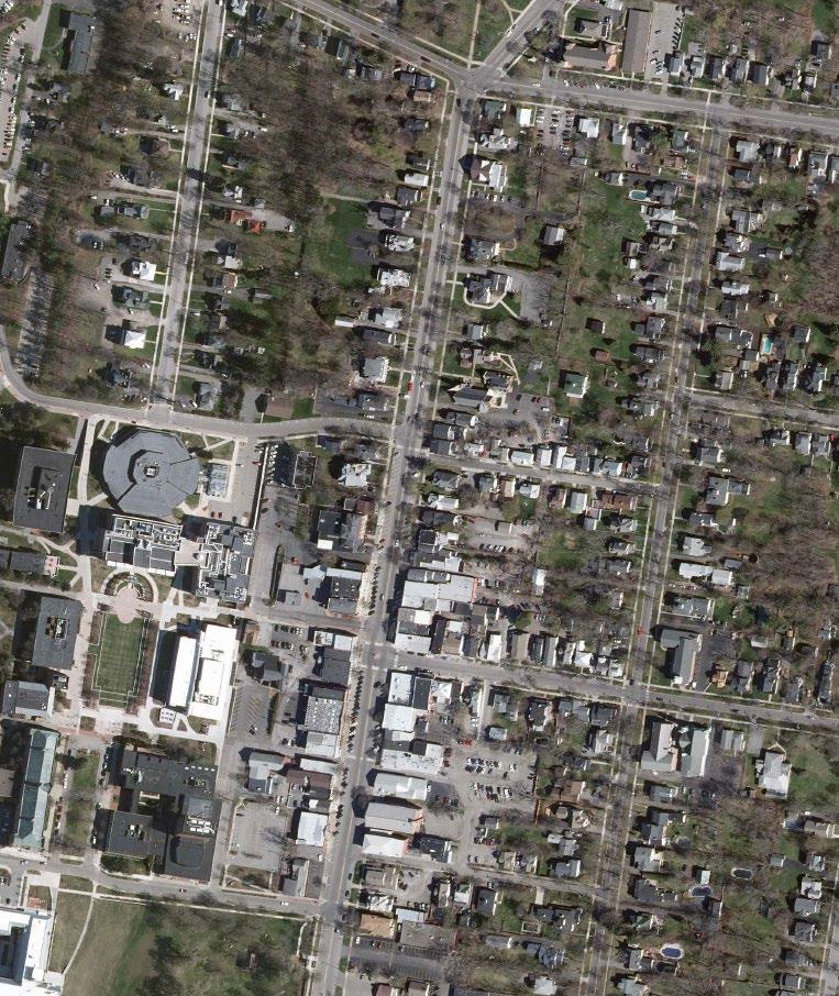
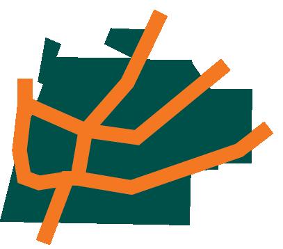
• Evaluate existing street trees and replace missing and dying trees, consistent with street tree guidelines.
• Install additional streetscape amenities including benches, bike racks, planters and historic markers throughout the Village. Consider bench /seating configurations that will facilitate conversation.
• Incorporate green infrastructure when feasible, consistent with the streetscape amenities guidelines.
• Explore intersection alternatives for Main Street and Center Street to protect the Bear Fountain from further damage by vehicular collisions. Improvements should protect the fountain and improve pedestrian safety while maintaining vehicular flow through the intersection.
• Install a cohesive bike facility through the Village of Geneseo with the use of a variety of treatments including bike lanes, sharrows and multi-use facilities.
• Improve major intersections on Main Street to include enhanced pedestrian crossings and curbed bumpouts to shorten crosswalks and define parking.
• Consider two new mid-block crossings on Main Street at Chestnut Street and in front of Big Tree Inn to enhance the walkability of downtown, by providing additional convenient and safe pedestrian crossings.
• Provide additional accessible parking on Main Street adjacent to accessible curb ramps.
• Clearly define public vs. private parking spaces in off-street parking facilities. Add signage in the parking facility behind Main Street between Center Street and Chestnut Street.
• Enhance existing alleyways with public art, lighting, and pavement treatments to create a welcoming pedestrian environment.
Improve curb ramps to be ADA accessible and provide additional streetscape amenities including benches and bike racks.
Enhance
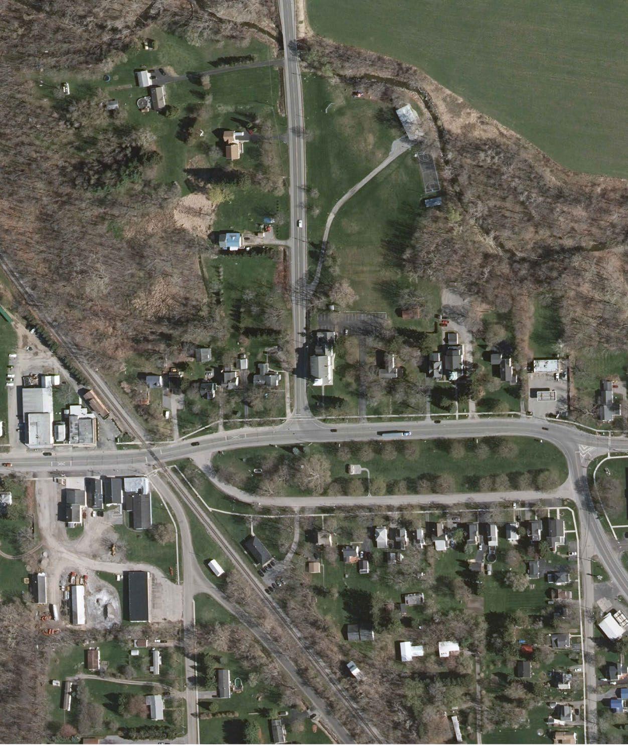
• Evaluate existing street trees and replace missing and dying trees, consistent with street tree guidelines.
• Install planters at regular intervals along both sides of Main Street. Both planters and street trees will buffer pedestrians from vehicular traffic and create a welcoming aesthetic environment.
• Install bike racks, benches and planters along Main Street to create a welcoming environment and encourage outdoor seating for businesses.
• Improve the intersection of Main Street and York Road to better define vehicular path of travel. Install enhanced crosswalk treatments crossing both York Road and Main Street to connect pedestrians to Village Park and Starr Park.
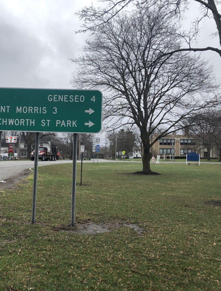
• Realign the intersection of Main Street and Mt. Morris Road to better define the vehicular path of travel and shorten pedestrian crossings. Install enhanced crosswalk treatments crossing both Mt. Morris Road and Main Street.
• Consider a mid-block pedestrian crossing on South Parkway to connect the existing sidewalk system on south side to the Village Park.
• Provide a continuous sidewalk on the south side of Main Street along Village Park to define a dedicated pedestrian path.
• Create a pedestrian connection from Main Street to Starr Park.
Provide continuous sidewalk on the south side of Main Street along Village Park
Create stronger connections to Village Park.
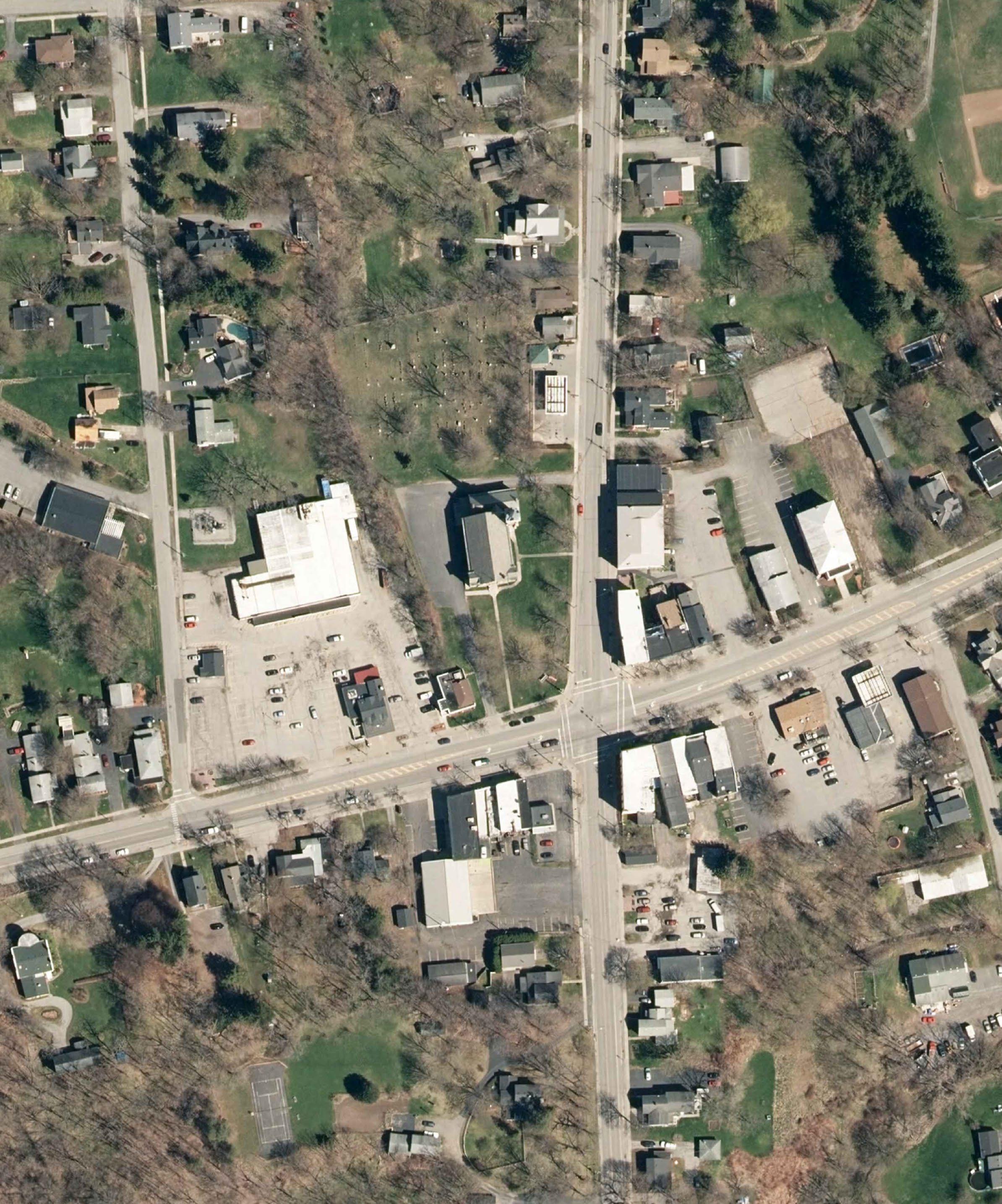

• Replace missing and / or dying street trees and incorporate additional trees into the streetscape environment. Consider trees in large planters for seasonal placement / removal, consistent with street tree guidelines.
• Enhance the existing pocket parks in the Village with pedestrian amenities, pavement treatments and additional landscaping to screen from adjacent parking lots.
• Build upon existing streetscape with additional pavement treatments, benches, bike racks, planters and ornamental lighting.
• Explore the feasibility of relocating overhead power lines on Main Street to de-clutter the streetscape environment and create opportunity for second floor / balcony uses on Main Street buildings. Relocating power lines can be a costly endeavor. Coordination with the utility company and exploration of funding sources will need to occur for implementation.
• Incorporate improvements at the Main Street and Lake Avenue / Rochester Street intersection including curbed bumpouts to shorten pedestrian crossings and enhanced crosswalk treatments. Green infrastructure could be incorporated in bumpouts to reduce the amount of pervious space and create an aesthetic streetscape feature.
• Enhance pedestrian crossing at Main Street and Genesee Street with bumpouts to shorten the crossing. Incorporate decorative crosswalk treatments at this intersection.
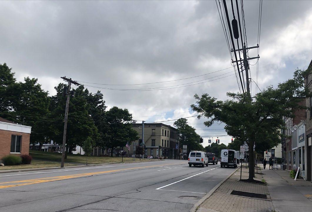
• Restripe public parking facility to maximize number of parking spaces.
• Improve alleyway between off-street public parking facility and Rochester Street to include public art, lighting and ornamental paving to create a welcoming and inviting pedestrian environment.
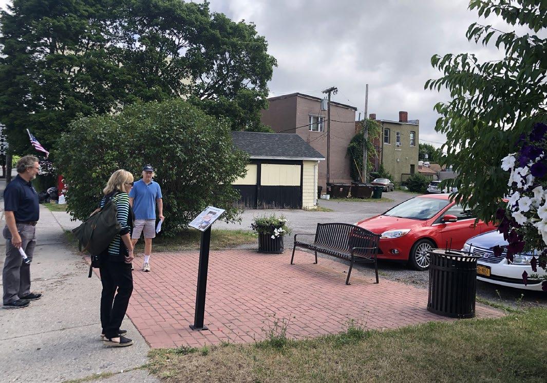
Enhance existing pocket parks
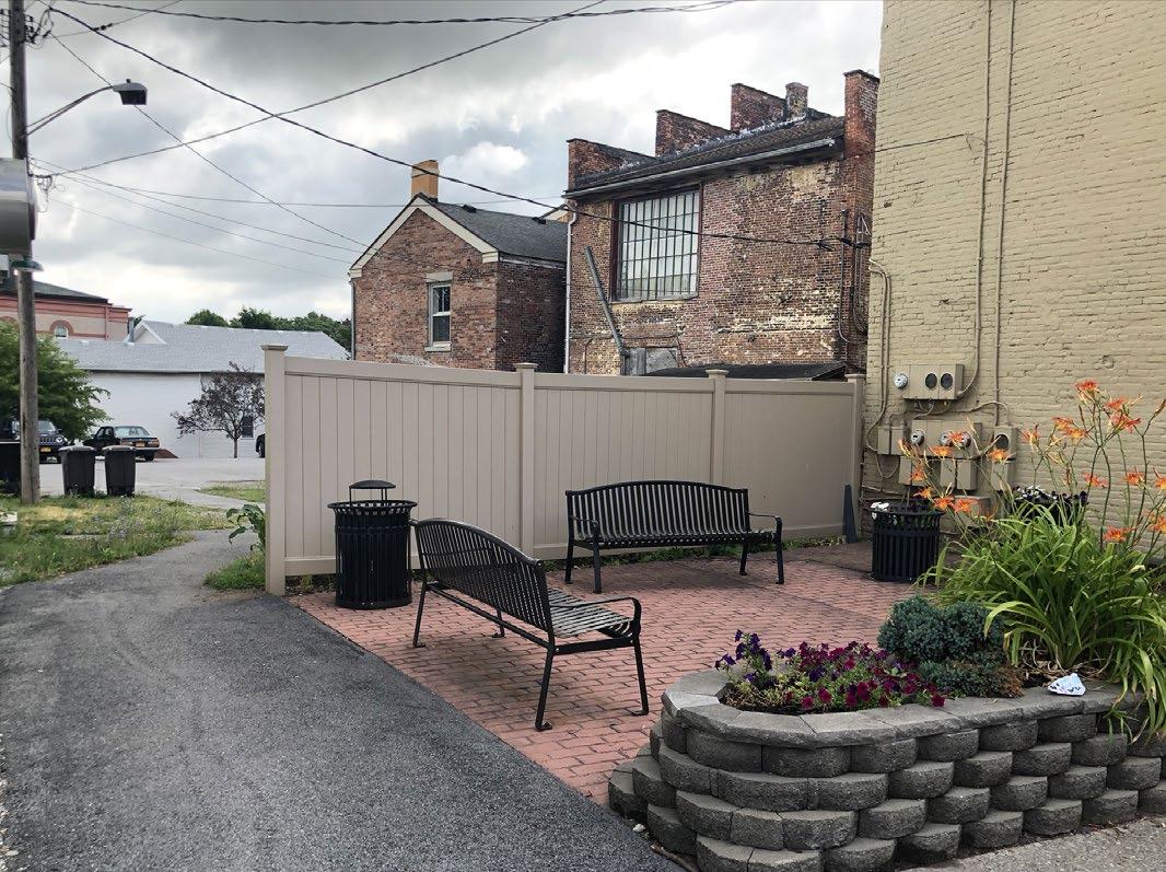
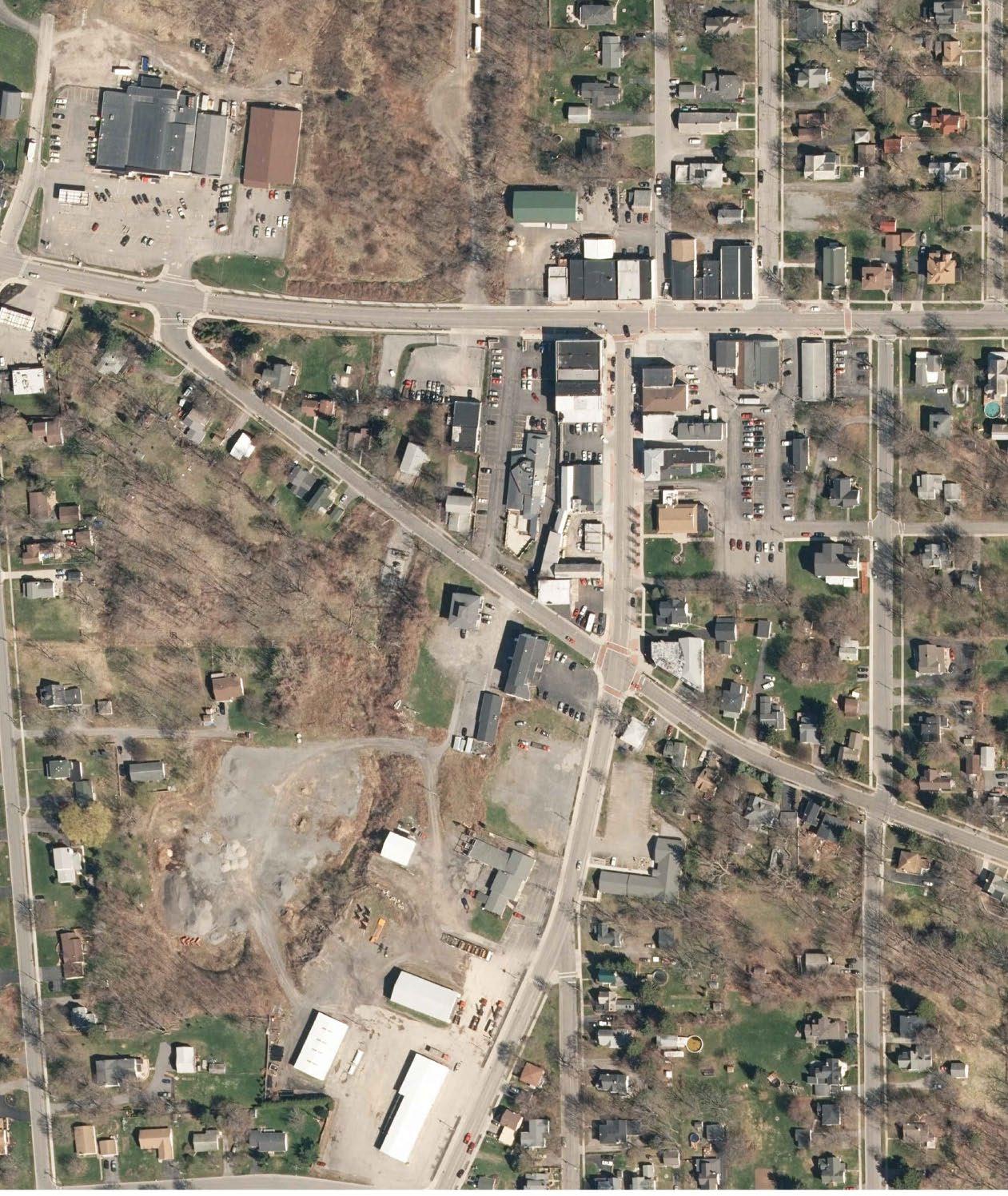
• Evaluate existing street trees and replace missing and dying trees, consistent with street tree guidelines.
• Establish a Village Art Trail that leverages the new Art Park by continuing public art installations throughout the downtown.
• Supplement existing streetscape environment through the incorporation of additional benches, bike racks, planters and trash receptacles in a coordinated style.
• Incorporate green infrastructure practices including porous pavements at tree pits and rain gardens in road island when feasible.
• Clearly define public parking facilities with pavement striping and regulatory signage.
• Create strong connections from public parking facilities to Commercial Street and Main Street through the incorporation of lighting, gateway signage and the inclusion of public art.
ALLEYSCAPE
• Enhance alleyway connection between public parking lot and Commercial Street. Incorporate public art, lighting, and ornamental pavements.
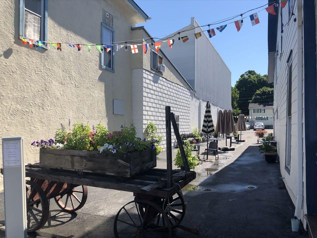
Replace dying and missing street trees
Enhance alleyway connections
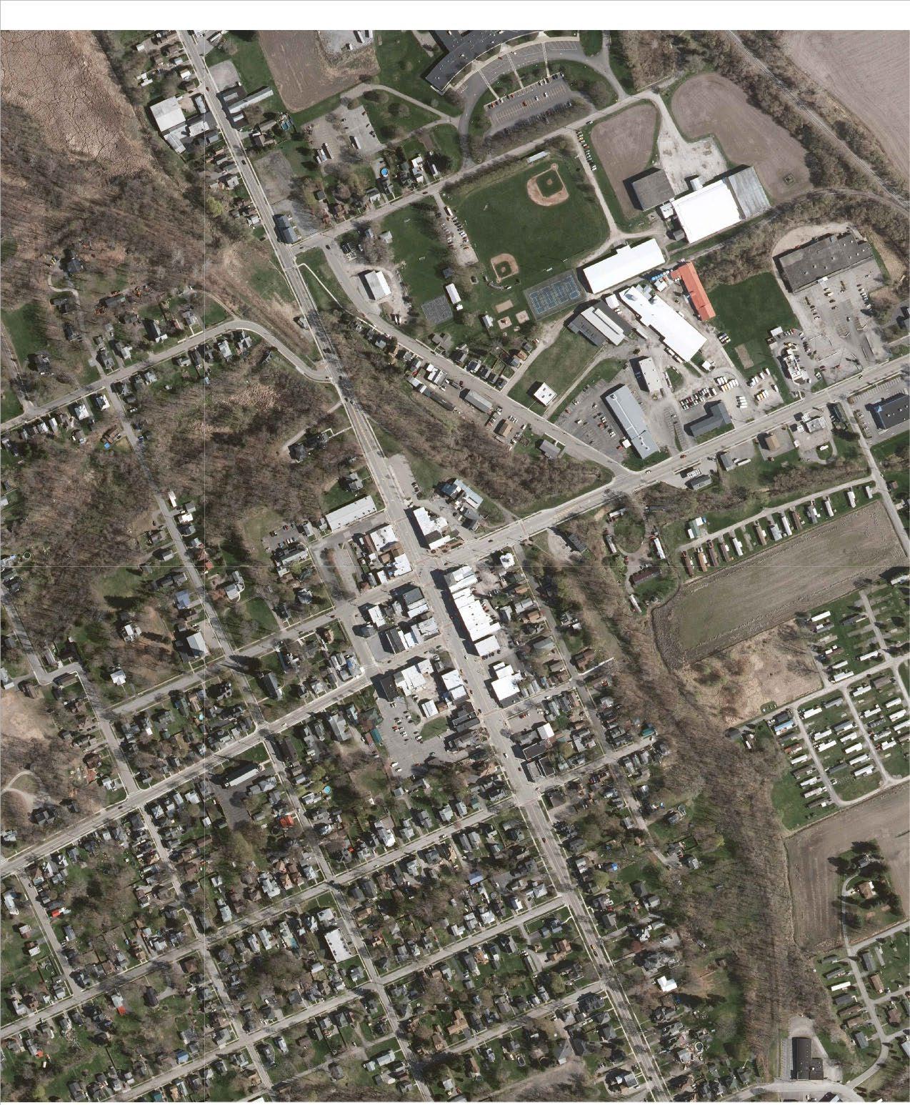
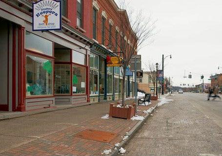
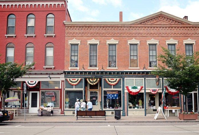
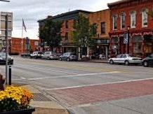
• Evaluate existing street trees and replace dying or missing trees to fill in existing gaps on both Main Street and East State Street, consistent with street tree guidelines.
• Identify and install uniform streetscape materials that are durable and long-lasting in the Village core including benches, bike racks, planters and trash receptacles.
• Incorporate green infrastructure practices including porous pavements at tree pits and rain gardens in road island when feasible.
• Reduce crossing distance at crosswalks with curbed bumpouts and install enhanced crosswalks at Main Street intersections.
• Review lane configuration, travel lane and shoulder widths on Main Street for potential bike space enhancements. Install bike facilities on East State Street to connect to Genesee Valley Greenway State Park.
• Formalize entrance to Bellamy Park and install new sidewalk and crosswalks to connect park to Main Street.
• Improve Genesee Valley Greenway State Park Crossing on East State Street by reducing the length of the westbound right-turn lane to narrow the pavement width and shorten the pedestrian crossing. Install enhanced pedestrian crossing to bring more awareness to pedestrian / vehicular interactions where trail crosses the street.
• Buffer and screen surface parking lots to enhance the aesthetic character of the streetscape.
• Continue to evaluate the inclusion of additional electric vehicle charging stations in public parking facilities.
Replace dying and missing street trees
Enhance
Enhance pedestrian crossings
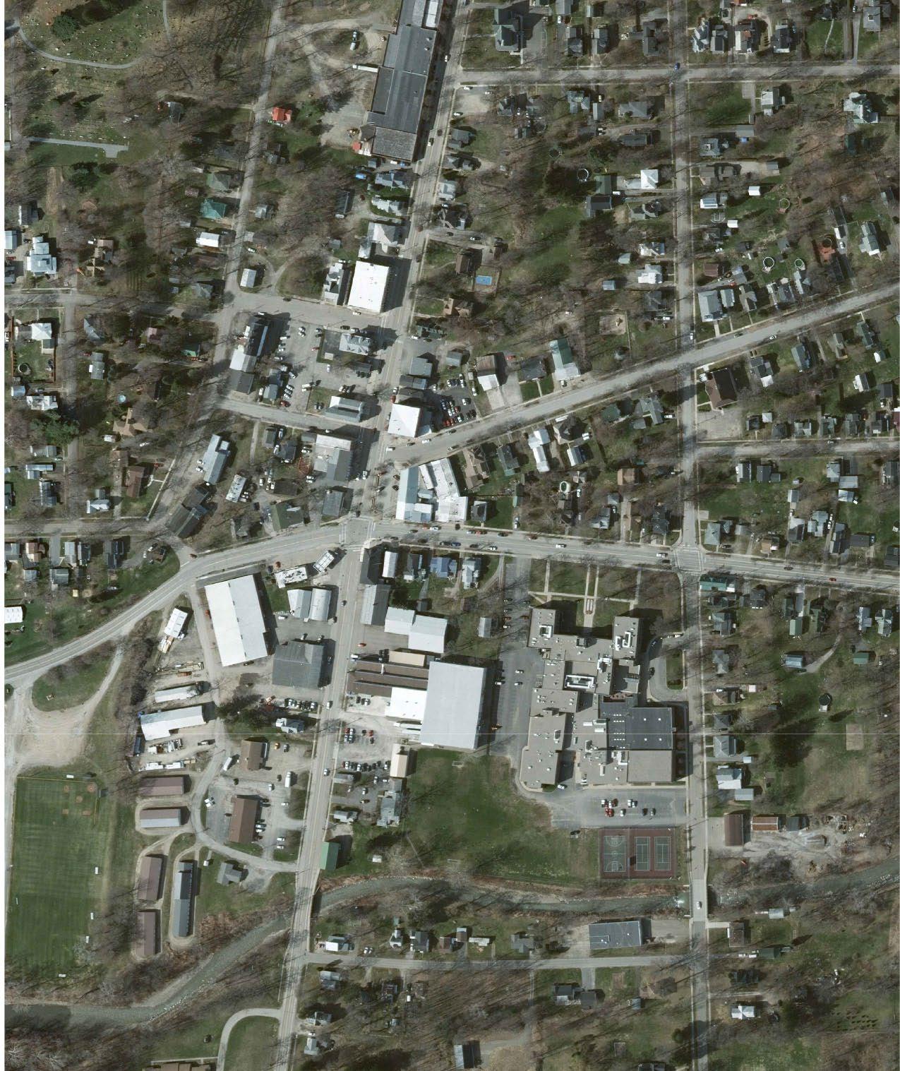
• Evaluate existing street trees and replace missing and dying trees, consistent with street tree guidelines.
• Enhance streetscape on North State Street to include additional benches, bike racks and trash receptacles.
• Incorporate green infrastructure practices including porous pavements at tree pits and rain gardens in road island when feasible.
• Complete sidewalk on Mill Street west of North State Street to create safe pedestrian access to Kiwanis Park.
• Improve intersection of North State Street and Mill Street to enhance pedestrian safety with the installation of enhanced crosswalks to facilitate the safe movement of students to and from the athletic files in Kiwanis Park.
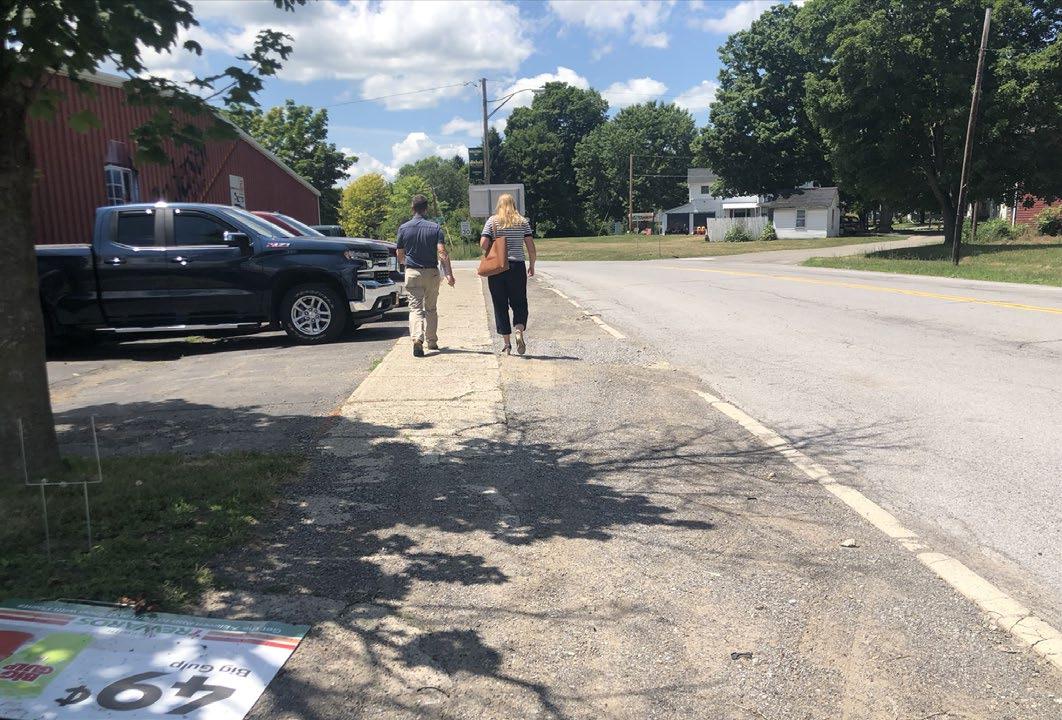
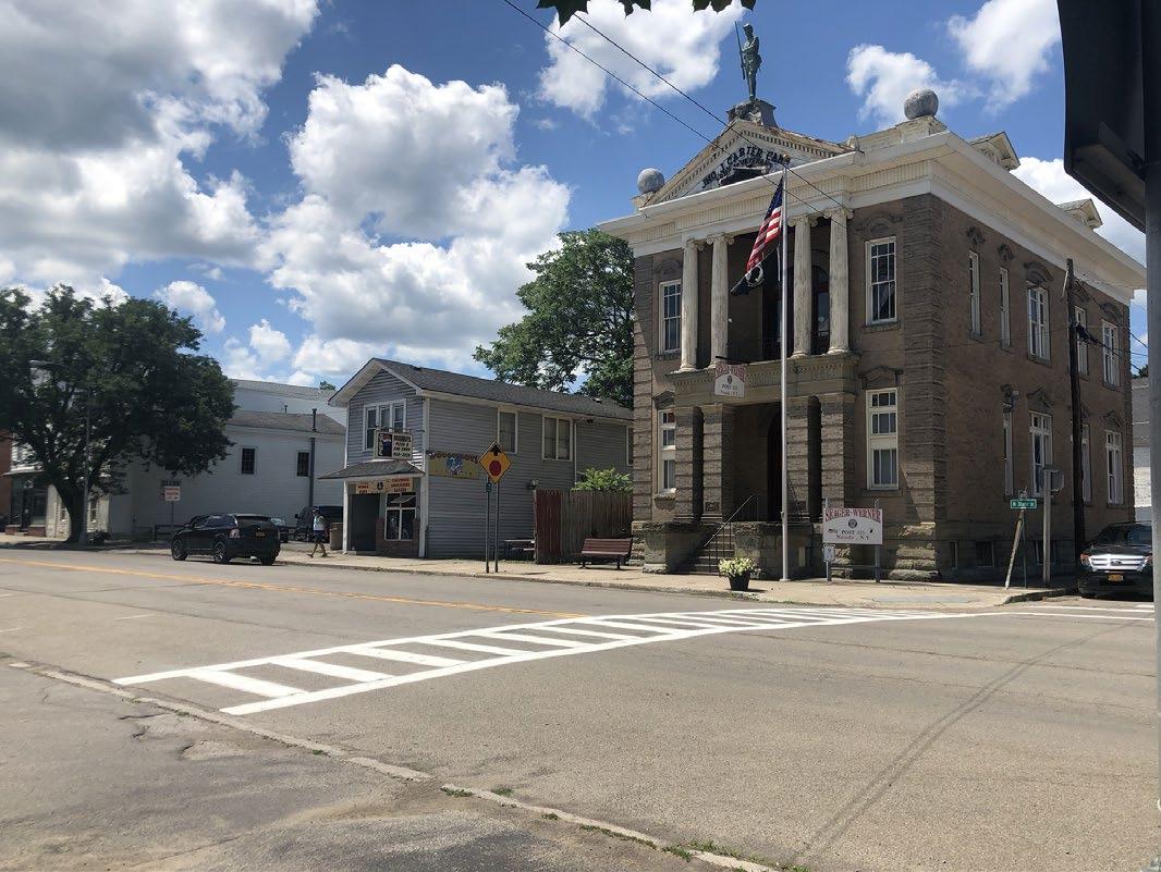
• Consider new mid-block crossings on North and South State Street to accommodate flow of pedestrian traffic from employment facilities to parking lots on the opposite side of the street.
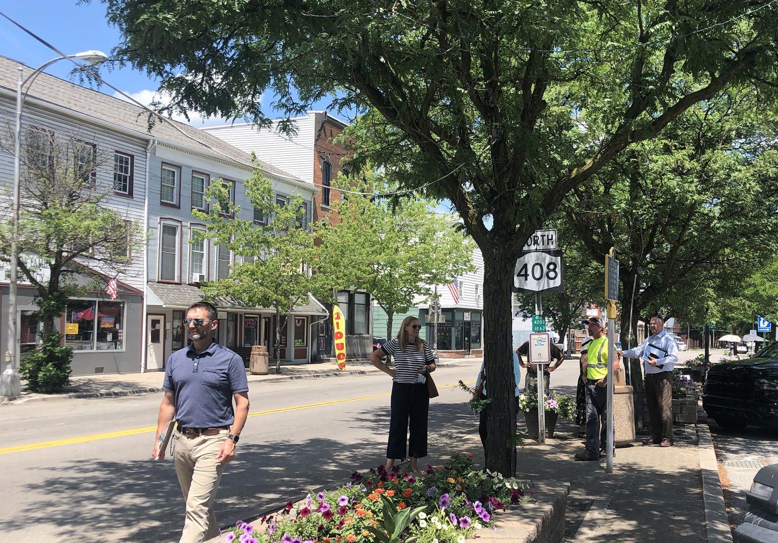
• Incorporate specialty parking elements into public parking facilities including Amish hitching posts to facilitate access for this segment of population, and electric charging stations.
Project Budget Cost Estimate (PLANNING LEVEL)
Monument Gateway Sign
Monument Gateway Sign with Stone Base
UnitQuantity
December 12, 2022
Unit Price (2022 $) Cost
EA 1 $22,000 $22,000 $22,000 4
$88,000
Basic Work Zone Traffic Control (5%) LS 1 $4,400
Mobilization (4%) LS 1 $3,520 Survey Operations (4%) LS 1 $3,520
Contingency (20%) LS 1 $17,600 Construction Inspection / RPR (12%) LS 1 $10,560 Final Design (10%) LS 1 $8,800 $136,400
Ground Mounted Sign panel with Z-Bars
SF 25 $110 $2,750
High Capacity Type A Sign Posts EA 2 $850 $1,700 $4,450 19 $84,550
Basic Work Zone Traffic Control (5%) LS 1 $4,228
Mobilization (4%) LS 1 $3,382 Survey Operations (4%) LS 1 $3,382 Contingency (20%) LS 1 $16,910 Construction Inspection / RPR (12%) LS 1 $10,146 Final Design (10%) LS 1 $8,455 $131,053

LIVCO Branded Banners
EA 1 $215 $215 Banner Mounting Brackets EA 2 $55 $110 $325 20
$6,500
Contingency LS 1 $1,000 Final Design LS 1 $1,000 $8,500
Parking Sign
Parking Sign SF 6 $100 $600
High Capacity Type A Sign Posts EA 1 $850 $850 $1,450 1 $1,450
Basic Work Zone Traffic Control (5%) LS 1 $73
Mobilization (4%) LS 1 $58 Survey Operations (4%) LS 1 $58
Contingency (20%) LS 1 $290
Construction Inspection / RPR (12%) LS 1 $174
Final Design LS 1 $1,000 $3,103
Pedestrian Wayfinding Sign
Heritage Style Octopus Wayfinding Directional Sign System with Logo
EA 1 $9,000
Project Budget Cost Estimate (PLANNING LEVEL)
Item Description
Monument Gateway Sign
Monument Gateway Sign with Stone Base
Basic Work Zone Traffic Control (5%)
UnitQuantity
December 12, 2022
Unit Price (2022 $) Cost
EA 1 $22,000 $22,000 $22,000 4
SUB-TOTAL
$88,000
LS 1 $4,400
Mobilization (4%) LS 1 $3,520
Survey Operations (4%) LS 1 $3,520
Contingency (20%) LS 1 $17,600
Construction Inspection / RPR (12%) LS 1 $10,560
Final Design (10%) LS 1 $8,800 $136,400
Vehicular Directional Sign
Ground Mounted Sign panel with Z-Bars
High Capacity Type A Sign Posts
SF 25 $110 $2,750
SUB-TOTAL
EA 2 $850 $1,700 $4,450 13
$57,850
Basic Work Zone Traffic Control (5%) LS 1 $2,893
Mobilization (4%) LS 1 $2,314 Survey Operations (4%) LS 1 $2,314 Contingency (20%) LS 1 $11,570 Construction Inspection / RPR (12%) LS 1 $6,942 Final Design (10%) LS 1 $5,785 $89,668
LIVCO Branded Banners
EA 1 $215 $215
SUB-TOTAL
Banner Mounting Brackets EA 2 $55 $110 $325 20 $6,500
Final Design LS 1 $1,000 $7,500
Parking Sign
Parking Sign SF 6 $100 $600
High Capacity Type A Sign Posts EA 1 $850 $850 $1,450 1 $1,450
Basic Work Zone Traffic Control (5%) LS 1 $73
Mobilization (4%) LS 1 $58 Survey Operations (4%) LS 1 $58 Contingency (20%) LS 1 $290
Construction Inspection / RPR (12%) LS 1 $174
Final Design (10%) LS 1 $145 $2,248
Pedestrian Wayfinding Sign
Heritage Style Octopus Wayfinding Directional Sign System with Logo
EA 1 $9,000 $9,000
SUB-TOTAL
SUB-TOTAL
SUB-TOTAL (KIOSKS)
SUB-TOTAL
Project Budget Cost Estimate (PLANNING LEVEL)
Monument Gateway Sign
Monument Gateway Sign with Stone Base
UnitQuantity
December 12, 2022
Unit Price (2022 $) Cost
EA 1 $22,000 $22,000 $22,000 6
SUB-TOTAL
$132,000
Basic Work Zone Traffic Control (5%) LS 1 $6,600
Mobilization (4%) LS 1 $5,280 5 LS 1 $5,280
Contingency (20%) LS 1 $26,400
Construction Inspection / RPR (12%) LS 1 $15,840 Final Design (10%) LS 1 $13,200 $204,600
Ground Mounted Sign panel with Z-Bars
SF 25 $110 $2,750
SUB-TOTAL
High Capacity Type A Sign Posts EA 2 $850 $1,700 $4,450 15 $66,750
Basic Work Zone Traffic Control (5%) LS 1 $3,338 Mobilization (4%) LS 1 $2,670 Survey Operations (4%) LS 1 $2,670 Contingency (20%) LS 1 $13,350 Construction Inspection / RPR (12%) LS 1 $8,010 Final Design (10%) LS 1 $6,675 $103,463
LIVCO Branded Banners
EA 1 $215 $215
SUB-TOTAL
Banner Mounting Brackets EA 2 $55 $110 $325 20 $6,500
Final Design LS 1 $1,000 $7,500
Parking Sign
Parking Sign SF 6 $100 $600
High Capacity Type A Sign Posts EA 1 $850 $850 $1,450 4 $5,800
Basic Work Zone Traffic Control (5%) LS 1 $290
Mobilization (4%) LS 1 $232 Survey Operations (4%) LS 1 $232 Contingency (20%) LS 1 $1,160
Construction Inspection / RPR (12%) LS 1 $696
Final Design (10%) LS 1 $580 $8,990
Pedestrian Wayfinding Sign
Heritage Style Octopus Wayfinding Directional Sign System with Logo
EA 1 $9,000 $9,000 Foundation for Pedestrian
SUB-TOTAL
Project Budget Cost Estimate (PLANNING LEVEL)
Item Description
Monument Gateway Sign
Monument Gateway Sign with Stone Base
Basic Work Zone Traffic Control (5%)
UnitQuantity
December 12, 2022
Unit Price (2022 $) Cost
EA 1 $22,000 $22,000 $22,000 4
SUB-TOTAL
$88,000
LS 1 $4,400
Mobilization (4%) LS 1 $3,520
Survey Operations (4%) LS 1 $3,520
Contingency (20%) LS 1 $17,600
Construction Inspection / RPR (12%) LS 1 $10,560
Final Design (10%) LS 1 $8,800 $136,400
Vehicular Directional Sign
Ground Mounted Sign panel with Z-Bars
SF 25 $110 $2,750
SUB-TOTAL
High Capacity Type A Sign Posts EA 2 $850 $1,700 $4,450 15 $66,750
Basic Work Zone Traffic Control (5%) LS 1 $3,338
Mobilization (4%) LS 1 $2,670 Survey Operations (4%) LS 1 $2,670 Contingency (20%) LS 1 $13,350 Construction Inspection / RPR (12%) LS 1 $8,010 Final Design (10%) LS 1 $6,675 $103,463
LIVCO Branded Banners
SUB-TOTAL
EA 1 $215 $215 Banner Mounting Brackets EA 2 $55 $110 $325 20 $6,500
Final Design LS 1 $1,000 $7,500
Parking Sign
Parking Sign SF 6 $100 $600
High Capacity Type A Sign Posts EA 1 $850 $850 $1,450 5 $7,250
Basic Work Zone Traffic Control (5%) LS 1 $363
Mobilization (4%) LS 1 $290 Survey Operations (4%) LS 1 $290 Contingency (20%) LS 1 $1,450 Construction Inspection / RPR (12%) LS 1 $870
Final Design (10%) LS 1 $725 $11,238
Pedestrian Wayfinding Sign
Heritage Style Octopus Wayfinding Directional Sign System with Logo
EA 1 $9,000 $9,000
SUB-TOTAL
Project Budget Cost Estimate (PLANNING LEVEL)
Monument Gateway Sign
Monument Gateway Sign with Stone Base
UnitQuantity
December 12, 2022
Unit Price (2022 $) Cost
EA 1 $22,000 $22,000 $22,000 4 $88,000
SUB-TOTAL
Basic Work Zone Traffic Control (5%) LS 1 $4,400
Mobilization (4%) LS 1 $3,520
Survey Operations (4%) LS 1 $3,520
Contingency (20%) LS 1 $17,600
Construction Inspection / RPR (12%) LS 1 $10,560
Final Design (10%) LS 1 $8,800 $136,400
Ground Mounted Sign panel with Z-Bars
SF 25 $110 $2,750
High Capacity Type A Sign Posts EA 2 $850 $1,700 $4,450 7 $31,150
Basic Work Zone Traffic Control (5%) LS 1 $1,558
Mobilization (4%) LS 1 $1,246 Survey Operations (4%) LS 1 $1,246 Contingency (20%) LS 1 $6,230
Construction Inspection / RPR (12%) LS 1 $3,738 Final Design (10%) LS 1 $3,115 $48,283
LIVCO Branded Banners
EA 1 $215 $215 Banner Mounting Brackets EA 2 $55 $110 $325 20 $6,500
Final Design LS 1 $1,000 $7,500
Parking Sign
Parking Sign SF 6 $100 $600 High Capacity Type A Sign Posts EA 1 $850 $850 $1,450 0 $0
Basic Work Zone Traffic Control (5%) LS 1 $0
Mobilization (4%) LS 1 $0 Survey Operations (4%) LS 1 $0 Contingency (20%) LS 1 $0 Construction Inspection / RPR (12%) LS 1 $0
Final Design (10%) LS 1 $0 $0
Pedestrian Wayfinding Sign
Heritage Style Octopus Wayfinding Directional Sign System with Logo EA 1 $9,000 $9,000 Foundation for Pedestrian Wayfinding
SUB-TOTAL
Project Budget Cost Estimate (PLANNING LEVEL)
Monument Gateway Sign
Monument Gateway Sign with Stone Base
Basic Work Zone Traffic Control (5%)
UnitQuantity
December 12, 2022
Unit Price (2022 $) Cost
EA 1 $22,000 $22,000 $22,000 4
SUB-TOTAL
$88,000
LS 1 $4,400
Mobilization (4%) LS 1 $3,520
Survey Operations (4%) LS 1 $3,520
Contingency (20%) LS 1 $17,600
Construction Inspection / RPR (12%) LS 1 $10,560
Final Design (10%) LS 1 $8,800 $136,400
Vehicular Directional Sign
Ground Mounted Sign panel with Z-Bars
SF 25 $110 $2,750
High Capacity Type A Sign Posts EA 2 $850 $1,700 $4,450 7 $31,150
Basic Work Zone Traffic Control (5%) LS 1 $1,558
Mobilization (4%) LS 1 $1,246 Survey Operations (4%) LS 1 $1,246 Contingency (20%) LS 1 $6,230
Construction Inspection / RPR (12%) LS 1 $3,738 Final Design (10%) LS 1 $3,115 $48,283
LIVCO Branded Banners
EA 1 $215 $215
Banner Mounting Brackets EA 2 $55 $110 $325 20 $6,500
Final Design LS 1 $1,000 $7,500
Parking Sign
Parking Sign SF 6 $100 $600
High Capacity Type A Sign Posts EA 1 $850 $850 $1,450 1 $1,450
Basic Work Zone Traffic Control (5%) LS 1 $73
Mobilization (4%) LS 1 $58 Survey Operations (4%) LS 1 $58 Contingency (20%) LS 1 $290
Construction Inspection / RPR (12%) LS 1 $174
Final Design (10%) LS 1 $145 $2,248
Pedestrian Wayfinding Sign
Heritage Style Octopus Wayfinding Directional Sign System with Logo
Foundation for
EA 1 $9,000 $9,000
SUB-TOTAL
Project Budget Cost Estimate (PLANNING LEVEL)
Monument Gateway Sign
Monument Gateway Sign with Stone Base
Basic Work Zone Traffic Control (5%)
UnitQuantity
December 12, 2022
Unit Price (2022 $) Cost
EA 1 $22,000 $22,000 $22,000 3
SUB-TOTAL # OF MONUMENT GATEWAY SIGNS SUB TOTAL (MONUMENT GATEWAY)
$66,000
LS 1 $3,300
Mobilization (4%) LS 1 $2,640
Survey Operations (4%) LS 1 $2,640
Contingency (20%) LS 1 $13,200
Construction Inspection / RPR (12%) LS 1 $7,920
Final Design (10%) LS 1 $6,600 $102,300
Vehicular Directional Sign
Ground Mounted Sign panel with Z-Bars
High Capacity Type A Sign Posts
SF 25 $110 $2,750
SUB-TOTAL
EA 2 $850 $1,700 $4,450 11
$48,950
Basic Work Zone Traffic Control (5%) LS 1 $2,448
Mobilization (4%) LS 1 $1,958 Survey Operations (4%) LS 1 $1,958 Contingency (20%) LS 1 $9,790 Construction Inspection / RPR (12%) LS 1 $5,874
Final Design (10%) LS 1 $4,895 $75,873
LIVCO Branded Banners
EA 1 $215 $215
SUB-TOTAL
Banner Mounting Brackets EA 2 $55 $110 $325 20 $6,500
Final Design LS 1 $1,000 $7,500
Parking Sign
Parking Sign SF 6 $100 $600
High Capacity Type A Sign Posts EA 1 $850 $850 $1,450 6 $8,700
Basic Work Zone Traffic Control (5%) LS 1 $435
Mobilization (4%) LS 1 $348
Survey Operations (4%) LS 1 $348
Contingency (20%) LS 1 $1,740
Construction Inspection / RPR (12%) LS 1 $1,044
Final Design (10%) LS 1 $870 $13,485
Pedestrian Wayfinding Sign
Heritage Style Octopus Wayfinding Directional Sign System with Logo
EA 1 $9,000 $9,000
SUB-TOTAL
Project Budget Cost Estimate (PLANNING LEVEL)
Monument Gateway Sign
Monument Gateway Sign with Stone Base
Basic Work Zone Traffic Control (5%)
UnitQuantity
December 12, 2022
Unit Price (2022 $) Cost
EA 1 $22,000 $22,000 $22,000 4
SUB-TOTAL
$88,000
LS 1 $4,400
Mobilization (4%) LS 1 $3,520
Survey Operations (4%) LS 1 $3,520
Contingency (20%) LS 1 $17,600
Construction Inspection / RPR (12%) LS 1 $10,560 Final Design (10%) LS 1 $8,800 $136,400
Vehicular Directional Sign
Ground Mounted Sign panel with Z-Bars
SF 25 $110 $2,750
SUB-TOTAL
High Capacity Type A Sign Posts EA 2 $850 $1,700 $4,450 18 $80,100
Basic Work Zone Traffic Control (5%) LS 1 $4,005
Mobilization (4%) LS 1 $3,204 Survey Operations (4%) LS 1 $3,204 Contingency (20%) LS 1 $16,020 Construction Inspection / RPR (12%) LS 1 $9,612 Final Design (10%) LS 1 $8,010 $124,155
LIVCO Branded Banners
SUB-TOTAL
EA 1 $215 $215 Banner Mounting Brackets EA 2 $55 $110 $325 20 $6,500
Final Design LS 1 $1,000 $7,500
Parking Sign
Parking Sign SF 6 $100 $600
High Capacity Type A Sign Posts EA 1 $850 $850 $1,450 1 $1,450
Basic Work Zone Traffic Control (5%) LS 1 $73
Mobilization (4%) LS 1 $58 Survey Operations (4%) LS 1 $58 Contingency (20%) LS 1 $290
Construction Inspection / RPR (12%) LS 1 $174
Final Design (10%) LS 1 $145 $2,248
Pedestrian Wayfinding Sign
Heritage Style Octopus Wayfinding Directional Sign System with Logo
Foundation for
EA 1 $9,000 $9,000
SUB-TOTAL
SUB-TOTAL
Project Budget Cost Estimate (PLANNING LEVEL)
Monument Gateway Sign
Monument Gateway Sign with Stone Base
UnitQuantity
December 12, 2022
Unit Price (2022 $) Cost
EA 1 $22,000 $22,000 $22,000 4
SUB-TOTAL
$88,000
Basic Work Zone Traffic Control (5%) LS 1 $4,400
Mobilization (4%) LS 1 $3,520
Survey Operations (4%) LS 1 $3,520
Contingency (20%) LS 1 $17,600
Construction Inspection / RPR (12%) LS 1 $10,560 Final Design (10%) LS 1 $8,800 $136,400
Vehicular Directional Sign
Ground Mounted Sign panel with Z-Bars
SF 25 $110 $2,750
High Capacity Type A Sign Posts EA 2 $850 $1,700 $4,450 12 $53,400
Basic Work Zone Traffic Control (5%) LS 1 $2,670
Mobilization (4%) LS 1 $2,136 Survey Operations (4%) LS 1 $2,136 Contingency (20%) LS 1 $10,680 Construction Inspection / RPR (12%) LS 1 $6,408 Final Design (10%) LS 1 $5,340 $82,770
LIVCO Branded Banners
SUB-TOTAL
EA 1 $215 $215 Banner Mounting Brackets EA 2 $55 $110 $325 20 $6,500
Final Design LS 1 $1,000 $7,500
Parking Sign
Parking Sign SF 6 $100 $600
High Capacity Type A Sign Posts EA 1 $850 $850 $1,450 1 $1,450
Basic Work Zone Traffic Control (5%) LS 1 $73
Mobilization (4%) LS 1 $58 Survey Operations (4%) LS 1 $58 Contingency (20%) LS 1 $290
Construction Inspection / RPR (12%) LS 1 $174
Final Design (10%) LS 1 $145 $2,248
Pedestrian Wayfinding Sign
Heritage Style Octopus Wayfinding Directional Sign System with Logo
Foundation for
EA 1 $9,000 $9,000
SUB-TOTAL


