

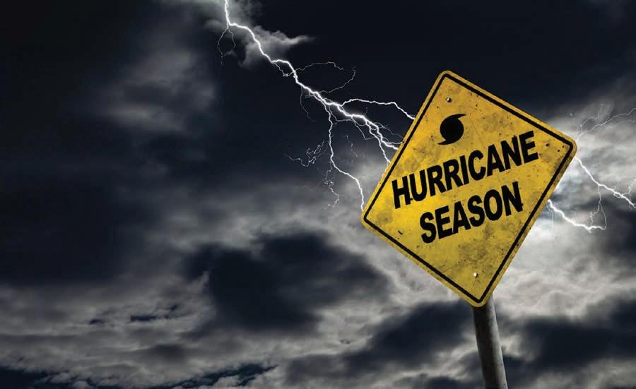
PLAN AHEAD STORMS DON’T MESS AROUND
VILLAGE OF ISLAMORADA


Reliable Care for Unpredictable Weather.
When storms roll in, Virtual Urgent Care is standing by. No travel, no waiting rooms — just care you can count on, right from your phone. Add us to your hurricane prep list and stay safe, wherever you are.
if needed.

FINANCIAL CHECKLIST HURRICANE

Online & Mobile Banking
Bank anytime, anywhere. Manage your account 24/7 with Mobile Deposit, Direct Deposit, Bill Pay, person-to-person and bank-to-bank transfers. Log in or enroll today on our KeysBank Mobile App or at KeysBank.com.
Debit Cards
Use your debit card for quick cash access when banks are closed or if you have to evacuate. FSB does not charge a fee for using your debit card at any ATM* or Publix Presto! ATMs. You can also get cash back with purchases at many businesses. Instant Issue debit cards are available at all Keyswide locations.
Emergency Cash & Checkbook
Electronic means of payments may not be available if there is a power failure. Be sure to have cash and your checkbook on hand for purchases.
Secure Important Documents
Make copies of your insurance papers, Social Security cards, birth certificates, mortgages, and other important documents. Originals can be stored in a First State Bank Safe Deposit Box.**
Hurricane Loans &
Credit Cards
A Mortgage, Home Equity Line of Credit, or Personal Loan can provide money on hand to prepare and, if necessary, recover quickly from a hurricane. We also offer personal and business credit cards. Apply online at KeysBank.com.
Download the KeysBank Mobile App for access to your account 24/7


CONTENTS
P. 8 Plan in place Keep these contacts in times of a storm
P. 12 Time to leave Essential evacuation tips
P. 16 Prep for loved ones Consider pregnant women, babies and pets
P. 18 Safe reentry Stickers get you back in
P. 20 Extra help Resources for specialneeds population
P. 21 Wet to dry Special message for mariners
P. 22 Safe quarters Storm shelter options
P. 26 List of essentials Hurricane supply must-haves
P. 28 Run from water Understand storm surge dangers
P. 30 Get the latest Download these apps
Publisher Jason Koler jason@keysweekly.com
Managing Partner Britt Myers britt@keysweekly.com
Creative Director Stephanie Mitchell stephanie@keysweekly.com
Editors Jim McCarthy jim@keysweekly.com
Mandy Miles mandy@keysweekly.com
Alex Rickert alex@keysweekly.com
Art/Design Javier Reyes javier@keysweekly.com
Copy Editor Mike Howie mike@keysweekly.com
Account Executives
Patti Childress patti@keysweekly.com
Jill Miranda Baker jill@keysweekly.com
Stephanie Mitchell stephanie@keysweekly.com
Production Manager Anneke Patterson anneke@keysweekly.com
Art/Design
Irene de Bruijn irene@keysweekly.com
Web Master
Travis Cready travis@keysweekly.com
Executive Administrator Char Hruska char@keysweekly.com
Contributors


P. 32 It’s electric Utilities offer safety tips
P. 33 Power packs Safe generator operation
P. 36 Batten the hatches Find a snug spot for the boat

Brad Bertelli
Mark Hedden
Cover Photo
Keys Weekly file photo
Digital Support Overseas Media Group


P. 42 Post storm Debris sorting and no illegal dumping


A MESSAGE FROM THE MAYOR
The 2025 Atlantic hurricane season officially begins on June 1 and continues through November 30. While September and October are typically the most active months for storm activity in the Florida Keys, it’s essential that we remain vigilant and prepared throughout the entire season.
If you have not yet obtained your hurricane reentry sticker for your vehicle, I urge you not to wait until a storm is approaching. Reentry stickers are available at the Tax Collector’s Office at 88800 Overseas Highway on Plantation Key — please take care of this important step today.
Visit www.islamorada.fl.us, click on the “Residents” tab, and navigate to “Hurricane Preparedness” to access important information and resources to help you prepare before, during, and after a storm. I also encourage everyone to sign up for emergency alerts to stay informed throughout the season.
Our village is fortunate to have dedicated and experienced staff who are well-trained in emergency management. The lessons we learned from Hurricane Irma in 2017 continue to guide our efforts and strengthen our resolve. With preparation and community cooperation, we will be ready to face any storm and recover stronger than ever.
Please do your part to protect your family, your home, and our beautiful community. Now is the time to review your evacuation plans, check your emergency supplies and stay informed. And if an evacuation order is issued, I urge you to take it seriously and follow it promptly.

Let’s stand united as a community and face this season with preparedness, resilience, and care for one another.

Sharon Mahoney
Mayor, Islamorada, Village of Islands
Sharon Mahoney Mayor
Don Horton
Vice Mayor
Steve Friedman Council Member
Deb Gillis Council Member
Anna Richards Council Member
Ron Saunders Village Manager
Village of Islamorada 86800 Overseas Highway, Islamorada, FL 33036
305.664.6400
www.islamorada.fl.us
Terry Abel Fire Chief
Lissette Quintero Captain, MCSO
By Jim McCarthy
PAY ATTENTION TO THE FORECAST
Advancements better pinpoint storm tracks and necessary actions
Emergency management and weather officials stand ready should a storm threaten the Florida Keys. For residents, early preparations and planning should be at the forefront to protect themselves, loved ones and property.
After all, each storm is different. And it only takes one to affect a community.
Thanks to advancements in technology, forecasters are gaining better intel on a storm’s path, when it could make landfall and what area should be bracing for a hit. Today, average track errors in a five-day forecast are far less than a two-day forecast in 1990, said Jon Rizzo, warning coordination meteorologist for the National Weather Service Key West.
In addition, hurricane reconnaissance by aircraft into the belly of a developing storm has led to improvements in predicting possibilities for rapid intensification, or an increase in wind speed of at least 35 mph in a 24-hour period.
“This means National Hurricane Center forecasts are actually identifying some tropical storms and hurricanes as being candidates for rapid intensification over the next 24 hours, and explicitly putting that into the official forecast,” Rizzo said.


NWS offers an improved track error cone map (example here from Hurricane Helene) to include watches and warnings over that of the track cone. In this example, the inland hurricane wind warnings (in red) stand out and communicate the threat much more effectively than the narrowing forecast track cone. NWS/ Contributed
Forecasts delivered by Rizzo ahead of a threatening storm help Florida Keys emergency management officials in determining what actions, if any, need to be taken for the safety of residents.
“We have to work closely with the National Weather Service to make accurate decisions when it comes to evacuating. When we do say evacuate, we do so knowing we have good information. When we say go, you gotta go,” said Shannon Weiner, Monroe County Emergency Management director.
Improved forecasts are not only benefiting emergency management, but they’re also helping residents avoid having to pack their belongings and hit the road needlessly.
“Evacuations here in the Florida Keys have decreased over the years because the accuracy is increasing through the National Weather Service,” said Weiner. “We have a better understanding of the threats due to technology.”
In 2022, Hurricane Ian skirted 75 miles west of Key West. Despite its proximity to the lower island chain, residents weren’t ordered to evacuate. Hurricanes Milton and Helene in 2024 also tracked west of Key West. Track models from the National Weather Service showed no serious threats to the island chain from the two major storms, leading to no calls for an evacuation.
Residents are urged to visit trusted sources, like nhc.noaa. gov, for weather information during hurricane season. Also, residents should know weather impacts, including wind and storm surge, can occur outside the cone.
The Atlantic hurricane season runs from June 1 to Nov. 30, 2025.
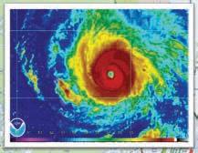
A satellite image of Hurricane Helene. NASA WORLDVIEW


TAKE STORM SEASON SERIOUSLY
The Keys have a plan — do you?
Another hurricane season is here. Are you prepared?
Despite all the uncertainty and uneasiness surrounding hurricane season, which begins June 1 and ends Nov. 30, what we do know is technological and meteorological advancements give us time to prepare and potentially evacuate should emergency management officials give the order.
The Florida Keys boasts a laidback lifestyle, but the island chain and its officials take storms seriously, and always have a plan in place. When a hurricane threatens the Keys, local emergency management officials with Monroe County and the municipalities spring into action, prepared to protect storm-seasoned residents and visitors. The plan aims to:
• Reduce vulnerability of people to damage, injury and loss of life and property.
• Prepare for prompt and efficient response and recovery.
• Prepare for prompt and efficient rescue, care and treatment of victims.
• Provide a setting of rapid and orderly restoration of services and rehabilitation of affected property.
• Provide for interagency coordination to facilitate immediate delivery of assistance.
The preparedness plan is activated once the county officials declare a local state of emergency. Depending upon the level of the threat of the approaching storm, the various agencies will take action in coordination with Monroe County’s Emergency Operations Center (EOC).
At timed intervals before landfall, different parts of the plan will be implemented. These may include early evacuations for visitors, boaters and special-needs residents; coordination of response and recovery teams; any necessary mandatory evacuations for residents; and all necessary interagency coordination.
City and county officials have a disaster preparedness plan for residents and visitors, and residents should prepare a plan for their loved ones and pets. Use the expansive resources in this guide to formulate your plan, and make sure you follow it when needed. A government-authored preparedness guide is also available online from FEMA and Florida Division of Emergency Management.
ISLAMORADA
www.islamorada.fl.us
305.664.6400
Facebook: @ IslamoradaFloridaKeys
MCSO law enforcement:
305.664.6480
Fire (non-emergency):
305.664.6490
Sewer Emergency: 305.359.0813
EMERGENCY HOTLINES
Monroe County
Emergency Information
Hotline: 800.955.5504
www.monroecountyem.com
State of Florida Emergency
Information: 800.342.3557
Poison Control: 800.222.1222
WEATHER INFORMATION
National Weather Service, Key West www.weather.gov/key
305.295.1316
Facebook: @NWSkeywest
National Hurricane Center
www.nhc.noaa.gov
Facebook: @NWSNHC
NOAA Weather Radio: 162.450 MHz
MONROE COUNTY
www.monroecounty.fl.gov
305.294.4641
Facebook: @MonroeCountyBOCC
Monroe Fire Rescue
305.289.6004
Monroe County
Emergency Management
305.289.6018
Monroe County
Sheriff’s Office
www.keysso.net
305.289.2351
Facebook: @FloridaKeysSheriff
Monroe County School District: 305.293.1400
College of the Florida Keys
305.296.9081
SOCIAL SERVICES
Special Needs Evacuation Assistance: 305.292.4591
Florida Keys American Red Cross: 305.294.9526
Florida Keys United Way uwcollierkeys.org
Monroe County Social Services: 305.292.4408
UTILITIES
Florida Keys Electric Co-op
305.852.2431
Florida Keys Aqueduct Authority: 305.296.2454
Key Largo Wastewater Treatment District
305.451.4019
MEDICAL
Mariners Hospital
305.434.3000
STAY INFORMED
The Monroe County Sheriff’s Office’s smartphone app, simply called Monroe County Sheriff’s Office, keeps residents informed of emergency situations ranging from traffic accidents to hurricane evacuation. The free app is available for both iPhone and Android. Residents can also receive the latest information by phone, email, landline and more by registering for Alert! Monroe. Visit monroecounty-fl.gov/alertmonroe to sign up. Monroe County Emergency Management uses the app Everbridge for the Special Needs Registry for shelter and evacuation assistance.
Be Storm Ready NOW
Keeping you and your family safe during a weather emergency
Storm Preparedness Checklist
Non-perishable food and water (one gallon per person, per day) for 7 days.
Manual can opener.
30-day supply of medications.
Infant formula, preferably ready-to-eat.
Stay Safe
Battery-powered or crank weather radio.
Pet supplies, including: Food, water, and medications.
First aid kit.
• NEVER use a gas-powered generator indoors, in a garage, or within 20 feet of windows or a window air conditioner.
• Use a battery powered carbon monoxide alarm to prevent CO poisoning.
• Protect yourself from insects when outside by covering your skin (long-sleeved shirt and pants), and use insect repellant containing DEET, picaridin, or oil of lemon eucalyptus.
• Drain any standing water to prevent mosquitoes from breeding.
Special Needs Shelters
The Florida Department of Health in Monroe County, in partnership with Monroe County Emergency Management, provides shelter to those with special medical needs during an evacuation.
• This shelter should only be used as a last resort.
• To see if you qualify or to pre-register for the special needs shelter, visit MonroeCountyEM.com/SpecialNeeds.
For more information, call 305-293-7500 or visit Monroe.FLhealth.gov.


SERVICE FROM OCEAN REEF TO KEY WEST!


MORE THAN 30 YEARS OF EXPERIENCE | LOCALLY OWNED & FAMILY OPERATED CFC 057546


Pay attention to official messages
Local officials take evacuation decisions seriously when an impending hurricane (Category 3 or higher) is tracking toward the Florida Keys.
To ensure a safe and efficient evacuation, the Florida Keys have a detailed and phased plan to get residents out of the danger zone to a safer place, such as the Monroe County shelter in Miami-Dade County (see page 22).
All Keys agencies and government offices, including the U.S. Navy, Coast Guard, hospitals, county health department, public works departments, utilities, schools and even volunteer charitable organizations, work in unison to ensure a seamless evacuation operation. All decisions are made locally with input and advice by the National Weather Service office in Key West.
EVACUATE WHEN TOLD OR FACE DANGEROUS CONDITIONS

For years, Monroe County had a very simple evacuation plan based on hours to landfall, phases and zones. Per Monroe County Emergency Management Director Shannon Weiner, “Generally, we call for the evacuation of visitors and special-needs populations first.”
In some scenarios — like a rapidly intensifying hurricane — county officials might not distinguish among population groups or zones of the Keys. For example, if a small storm has the potential to escalate, evacuations might be called more urgently.
In other words, circumstances could be miserable. Residents should decide based on what’s proper for the most vulnerable person in their group — whether that is an elderly aunt or a newborn.
Monroe County Emergency Management officials, as well as other agencies, will disseminate hurricane information through a variety of media. Check the Keys Weekly’s Facebook page or website of your local municipality; tune in to channel 76 on Comcast Cable; follow the U.S. National Weather Service Key West on Facebook.
KNOW YOUR ZONE
Monroe County has a comprehensive plan that calls for phased evacuation with five zones established from MM 0 to Ocean Reef. The evacuation plan is intended to avoid unnecessary evacuation if some zones are expected to be affected and others not. So, know your zone if local officials order evacuations. NOTE: Evacuation zones are different from re-entry zones after a hurricane.


In the event of a Category 3 or higher storm, or if officials expect a storm to strengthen to those levels, evacuation is mandatory for everyone. County shelters are only open for a Category 1 or 2 storm.
Staying put during hurricanes won’t be a pleasant experience — even if it’s on the lower end of the category scale. Grocery and drug stores could be closed. Power could go out and weather conditions will be hot. And water could be shut off.


Zone 1: MM 0 to MM 6
Zone 2: MM 6 to MM 40
Zone 3: MM 40 to MM 63

Zone 4: MM 63 to the three-way stop at County Road 905-A
Zone 5: County Road 905-A to mainland Monroe, including Ocean Reef


Reimagine. Revamp. Refresh.


At D’Asign Source, whether you’re remodeling, furnishing your space, or crafting the home of your dreams— inside and out—we’ve got you covered. Our expansive 25,000-square-foot showroom brings everything under one roof, with expert staff ready to guide you every step of the way. Visit us today and start turning your vision into reality.
305-743-7130 | DAsignSource.com | 11500 Overseas Hwy, Marathon | MM 53


PEACE OF MIND
During
• Do you have a Monroe County License?
• Do you have general liability and workman's comp insurance?
• Are you familiar with Monroe County Building Regulations?
• Will you pull a permit if my work requires it?
• Have you done this type of work before?
• Are you self performing the entire project?
• Will you supply releases of liens for your subcontractors and suppliers?
• Does your contract state the contractor will apply for the permit by a certain date?
• Does your contract state the contractor will start the job within a certain time period after the permit is issued?
• Does your contract state the contractor will complete the job within a certain time period?
• How many projects is the contractor working on now? Does he have the capacity to complete my work?
• Do you have recent examples of similar work or references I can call to evaluate your work?

Monroe County
PROTECT YOUR BOAT DURING
A HURRICANE
Use our boat tie-down service.
Whenever a threat exists during hurricane season, our service crew will strap down your boat until the threat has passed. CALL US TODAY TO SIGN UP!


By Keys Weekly staff
Set alternate birth plans, consider nutritional needs PRIORITIZE PREGNANT WOMEN, BABIES & CHILDREN
Storm preparations shouldn’t occur at the very last minute, especially if your household has an expectant mother, newborn or young child. Keep the precious ones at the forefront during storm season by coming up with a different set of plans in case emergency management officials call for an evacuation. Also, add formula to the supply list and consider ways to soothe children during uneasy times.
HAVE A BACKUP BIRTH PLAN
According to the Florida Keys Healthy Start Coalition, pregnant women who may be giving birth at home should have an alternative plan in the event of an evacuation. During major storms, Monroe County officials could issue either a voluntary or mandatory evacuation. Many local services such as emergency response and hospitals could be limited or even closed during evacuations, so pregnant women are encouraged to heed orders to leave.
An alternative birth plan should take into account finding a hospital that’s located away from the storm’s path, as well as having a place near the hospital to stay before the birth. Also, notify your local doctor about the hurricane plans.
Pregnant women should continue healthy habits such as exercising, reducing stress, taking prenatal vitamins, eating nutritious foods and following up on prenatal care during and after the storm.
LOAD UP ON BABY NUTRITIONAL NEEDS


comfort must kit water


For the baby, nutritional and comfort needs must be considered when creating a hurricane kit for the home or the car. Babies 6 months and younger need to have a supply of breast milk or formula. For babies who drink formula, the family needs to have a supply of safe drinking water and a method to sanitize bottles (or use disposable bottles). Pack at least three full days’ and nights’ worth of bottles, water and formula.


Consider packing comfort items for your child such as favorite blankets, pajamas, music or toys. Having plans for the child’s comfort items and nutritional needs can ease some of the burden of the storm.
Last but not least, don’t forget to stock up on extra baby wipes and diapers. Supplies can be slow to restock in stores after a storm.
CONSOLING CHILDREN DURING A STORM
Children are affected by changes in mood and environment due to disasters just as much as adults. Fear, anxiety and stress may last long after the initial impact. That’s why parents should do everything they can to minimize the effect. Experts suggest parents limit a child’s exposure to media coverage of the storm, as well as listening to and comforting your child to ease their fears, and establishing routines and norms even if away from home.


PREPARE YOUR PETS
Pack supplies & keep them comfortable
When it comes to hurricane planning and preparation, remember to keep the furry friends in your household in mind.

After all, your pets rely on you and the decisions you make to evacuate when a Category 3 or higher storm is approaching. If you’re staying home to weather a weaker storm, remember that conditions outside won’t be ideal for a walk. Also, the sounds of thunder could make your pets uncomfortable.
Hurricane Katrina in 2005, which ravaged New Orleans, revealed the folly of trying to separate humans from their animals. Many people and pets lost their lives. Now, however, there’s legislation in place mandating space for animals at shelters. There is never a reason to leave behind domesticated animals when leaving your home in times of an approaching hurricane. Here’s how to keep your pet safe in the event of a hurricane.
food and water for two to four weeks. Keep dry food sealed in waterproof containers and pack bowls of food and water as well as a can opener if necessary. Also, pack kitty litter and trays and bring bags to clean up after your pet.
DURING THE STORM, IF YOU CANNOT EVACUATE
• Find a safe room for riding out the storm. Consider a room located toward the interior of the house and a place without windows.
• If you can, stay with the pet to provide comfort. If crated, ensure they have adequate water and food.

BEFORE THE STORM
• Microchip your pet, and have your pet wear a collar with an ID and a rabies tag. Carry photos of your pet to help should they go missing.

• Keep an emergency kit in the room. The kit should include food, water, litter and any medications.
• Know where your pet likes to scurry and hide.
• Secure exits to prevent the pet from escaping outside.
• Remember, all Keys shelters are pet-friendly destinations. The shelters are located at Key West High School, Sugarloaf School, Marathon High School and Coral Shores High School. Read more about pets at shelters on page 22.

• Consider a harness or leash for your cat. Give enough time to get them used to wearing the harness before an impending storm. Get a harness especially for cats that can wriggle out of anything else. It could prevent a stressed-out, thunder-shy kitty from darting away to hide.
• Have an evacuation pack for your pet. Make sure to include
AFTER THE STORM
• Ensure the storm has fully passed, no wires are down and there’s no major flooding before letting a pet out.
• Give your pets time to get reoriented if they haven’t been outside for several days.
• Keep pets away from downed power lines.
• To provide continuous comfort after a storm, find a safe and quiet environment, even if it’s not their home.

NEVER LEAVE YOUR PET WHEN EVACUATING!


STAYING IN THE KEYS DURING A CATEGORY
1 OR 2 STORM? MONROE COUNTY OFFERS
4 PET FRIENDLY SHELTERS:
• KEY WEST HIGH SCHOOL
• SUGARLOAF SCHOOL
• MARATHON HIGH SCHOOL
• CORAL SHORES HIGH SCHOOL
Scan the code for the FKSPCA’s Preparedness Guide and to learn details about the requirements of the pet friendly shelters. fkspca.org/humane-education-events/ hurricane-preparedness


KEY WEST 5711 COLLEGE RD 305-294-4857
MARATHON 10550 AVIATION BLVD 305-743-4800
SAFE, ORGANIZED REENTRY

Obtain this sticker to get back into the Keys
forecast to strike.
“The whole gist of the sticker is get people into the county faster and keep traffic moving into the Keys,” Weiner said.


When a hurricane forces residents to leave the Florida Keys, reentry back into the island chain — when deemed safe by emergency management officials — must be carried out in an orderly, staged manner.
Enter the reentry sticker for local residents.
The colored badge, which can be stuck on the lower corner of the driver side’s windshield, denotes where a Monroe County resident lives, all while letting sheriff’s deputies manning checkpoints know you’re a legitimate resident and have a reason to come back.
Locals can obtain a sticker by visiting the Monroe County Tax Collector’s office. When you go to obtain your sticker, bring proof of residency, such as a Florida driver’s license and vehicle registration. Out-of-county residents who have Keys residence can show a property tax bill to get a sticker for their vehicle.
When the Florida Keys are in the cone of a major hurricane, the last thing anyone wants to do is worry about the reentry decal system for your car. After all, those last few moments are spent bringing all the lawn furniture inside, buying clips for your storm shutters and extra food and water for your family and pets.
Shannon Weiner, county emergency management director, urges residents to obtain a reentry sticker before a hurricane threatens the area — hurricane season begins June 1. Stickers will not be available once a state of emergency is declared in Monroe County, which occurs several days before a storm is
The Monroe County Tax Collector’s office is responsible for providing reentry decals. Per Monroe County Emergency Management: Residents may obtain one sticker for each registered vehicle by providing proof of residency at a Monroe County Tax Collector’s office.
Those who don’t have a reentry sticker and want to reenter the Keys, be sure to have supporting documentation with you to show you’re a Keys resident. It can be a utility bill, tax bill, etc.
Stickers are barcoded and color-coded for zone-by-zone reentry. Stickers for Lower Keys residents from the south end of the Seven Mile Bridge to Stock Island (MM 40 to MM 4) are dark pink, while Middle Keys residents from the south end of the Long Key Bridge to the north end of the Seven Mile Bridge (MM 64 to MM 47) get aqua stickers. Upper Keys residents from the county line, including Ocean Reef, to the north end of the Long Key Bridge, (MM 113 to MM 64) will have a purple decal. The City of Key West requires its own sticker, which is white.
Once you obtain the sticker, go ahead and put it on the lower driver side windshield of the vehicle it’s registered to. The sticker can’t be reused for reentry with another vehicle.
For those wondering when they’ll be able to return to the Keys, emergency management officials encourage people to sign up for the Alert! Monroe system. It enables people to receive emergency alerts and information via text messages, phone calls or emails. Sign up at www.monroecountyem.com/alertmonroe.
Visit www.monroecounty-fl.gov/916/Reentry-Vehicle-Windshield-Stickers.


2025 hurricane season reentry stickers are available at your local taxcollector’soffice.
Residents from Ocean Reef to Stock Island: Stickers are available at the Monroe County Tax Collector’s office locations from 8 a.m. to 4:45 p.m. Monday through Friday.
TAX COLLECTOR LOCATIONS:
Key West
1200 Truman Ave., Ste 101, or the DMV at 3304 N. Roosevelt Blvd.
Big Pine Key
247 Key Deer Blvd. (Tuesday through Thursday 9 a.m. to 3 p.m.)
Marathon 3015 Overseas Highway
Plantation Key 88800 Overseas Highway
Key Largo 101487 Overseas Highway


ENSURE YOU HAVE TRANSPORTATION
To meet the special needs of residents with physical and mental challenges during evacuations and sheltering, Florida law requires each local emergency management agency in the state to maintain a registry of disabled persons in the agency’s jurisdiction.
“Our special-needs residents will be screened, transported, sheltered and cared for under the same precautions as the general population,” said Shannon Weiner, Monroe County Emergency Management director.
With Monroe County’s system, Everbridge, registrants will be notified by telephone, text, email or smartphone of a pending evacuation and be given specific instructions to follow when evacuating to the special-needs shelter. Officials will make every attempt to reach out via the methods the registrant chooses when he or she registers. Eligible conditions for the special-needs shelter include, but are not limited to: Being dependent on supplemental oxygen; limited mobility; needing assistance with daily activities such as feeding, medications and hygiene; moderate dementia; cognitive impairment; immobile or wheelchair-bound; in need of wound care and/ or in need of constant supervision.

nitive impairment; immobile or wheeland assessed for program eligibility.
Special-needs registry aids most vulnerable

tion. At that time, the registrant must make a decision whether or not to evacuate with the help of county officials, as there will be no second phone call. Those who decide to take part will be directed to the nearest staging area or arrangements will be made to pick them up. Registrants must have belongings and supplies packed and ready to go.
EMERGENCY BUS
Monroe County encourages individuals living in storm surge planning zones and mobile homes to have arrangements in place to stay outside of the areas called for phased evacuations during a tropical storm or hurricane. Monroe County Emergency Management will activate specific emergency evacuation bus pickup stops along U.S. 1 as directed by the Monroe County Sheriff’s Office.
All applications will be reviewed by medical staff from the Department of Health and assessed for program eligibility. Ineligible applicants will be referred to applicable sheltering options, which may include a general population emergency shelter or a specialized medical facility or nursing home.
include a general population emergency

The special-needs registry is not a replacement for having an evacuation plan of your own. Residents should try to seek help or shelter from family, friends or neighbors in a hurricane or other disaster. Public shelters should be a last resort.
Residents who have registered and requested transportation assistance will be notified through a specified method of communication in advance of evacua-


“Monroe County regular bus service (Key West

“Monroe County regular bus service (Key West Transit and Miami-Dade Express) run free of charge, utilizing all regular stops, to the general population shelters designated open when a general population evacuation has been called,”

al population shelters designated open when a general population evacuation has been called,” Weiner said.


buses between
It is the responsibility of the residents to get to the designated pickup site. The buses placed into service for the evacuation will have displays that read “Emergency Evacuation” and these buses will only travel between the Keys and the out-of-county hurricane shelter.
HOW DO I SIGN UP?


HOW DO I SIGN UP? app for smartphones at everbridge.com/app or


register on their own, or do not have access to the internet, case manager, family or friends.
The registration portal can be reached by visiting monroecountyem.com, clicking the “Preparedness” tab and selecting Special Needs Registry. Applicants may also download the Everbridge app for smartphones at everbridge.com/app or through the App Store for iPhone and Google Play for Android devices. Residents who are unable to register on their own, or do not have access to the internet, may seek assistance through a home health care provider, primary care physician, case manager, family or friends.


By
CALLING ALL MARINERS
Stay connected and seek dry land

Mariners should heed local alerts, be prepared to leave their vessels should the going get worse and have a plan during hurricane season.
As local emergency management officials say, a boat is no place to ride out in times of a hurricane.
Those living on boats should stay connected with credible sources for weather information, like hurricanes.gov and weather.gov/ key. Hurricanes and strong tropical storms can bring storm surge, flooding, wild winds, blinding rain, tornadoes, powerful waves and currents.
The best place for your boat in a hurricane is out of the water. If that is not possible, find a snug harbor. If you cannot secure your boat in a snug harbor, mooring in a sheltered location can be a good alternative to exposed harbors or crowded marinas.
All preparations should be complete before the arrival of 34knot sustained winds. County emergency management officials say people shouldn’t be thinking about riding out a storm at sea. No matter how valuable your boat may be to you, it’s not worth risking your life.
“One of the most dangerous mistakes is staying aboard a boat during a hurricane,” Monroe County Emergency Management states. “Once the wind starts howling, you cannot count on a Coast Guard response.”
EMERGENCY CONTACT NUMBERS FOR MARINERS
U.S. Coast Guard Command Center: 305.292.8727
NOAA National Weather Service: 305.295.1316
Monroe County Emergency Management (activated during storms): 800.955.5504
Broadcast Notice to Mariners (BNM) www.navcen.uscg.gov/ subscribe-email-rss-feeds


Keys Weekly staff
Mark Hedden/Keys Weekly
SHELTER LOCATIONS
CATEGORY 1-2 HURRICANES
• Key West High School
2100 Flagler Ave., Key West
• Sugarloaf School
255 Crane Blvd., Sugarloaf Key
• Marathon High School
350 Sombrero Beach Road, Marathon
• Coral Shores High School
89901 Overseas Highway, Tavernier


CATEGORY 3-5 HURRICANES
• Monroe County does not have shelters for a hurricane at or beyond Category 3. Evacuation is mandatory for everyone.
• During an evacuation order, Monroe County residents seeking shelter on the mainland will be informed of shelter locations. Sheltering options may include Florida International University (FIU), the E. Darwin Fuchs Pavilion at the Miami-Dade County Fair and Exposition (which allows pets), and other facilities within Miami-Dade County, based on their availability on a per-storm basis. Special-needs individuals will be transported to the special-needs shelter at FIU. Information will be made available via Monroe County official alerts, Monroe County website and press releases, social media sites, MCTV Channel 76 & 99, and by local media and other local official government agencies.


WHAT TO BRING
Water and food


• Drinking water in plastic containers.
• Non-perishable food in cans or sealed containers.
• Special dietary foods, baby food, formula, manual can opener, paper products, utensils.
• Portable ice chest with ice.
Clothing and bedding
• Clothes and shoes.
• Sleeping bag, blanket, pillow, lightweight portable lounge chairs.
• Rain gear.
• Wash cloths, towels, soap, toothbrush, feminine products, paper towels, toilet paper.
Baby supplies
• Clothes, diapers, formula, bottles, food and blankets.
Medications and first aid supplies
• Medication clearly marked with your name, dosage, type of medication and doctor’s name. Persons must be able to selfadminister all medications.
• First aid supplies in a waterproof box.
Important papers
• Name and address of doctors.
• Name and address of nearest relative.

• Identification and valuable papers. Miscellaneous
• Games, cards, toys, batterypowered radios, flashlights.
• Shower and eat before leaving home.
SHELTER RULES
› Residents are required to complete registration before entering the shelter.
› Residents will be assigned to a space.
› No weapons, alcohol or illegal drugs.
› No smoking allowed in shelters.
› “Lights out” quiet time will be enforced.
› Children must be attended to at all times. Parents are not allowed to leave the premises without them.
PETS AT SHELTERS
All Monroe County general population shelters are pet-friendly. Pets accepted include dogs, cats, ferrets, birds, reptiles and pocket pets such as hamsters, gerbils and rabbits under 10 pounds. It is highly recommended that pets be pre-registered before a sheltering event. In order to pre-register your pet you must complete an online registration. You will be required to attest to the fact that you have read and will comply with the pet-friendly shelter agreement and the pet-friendly shelter checklist. Pre-registrations are only valid for the calendar year in which they were submitted.
While at the shelter, all pets must be properly caged. Owners must present the medical history and current vaccination records for each pet upon checking into a pet-friendly shelter.
For more information on pets at shelters, including a shelter agreement, supply checklist and registration, scan the QR code:


41 Coco Plum Dr. Marathon Office 305-743-2558 Fax 305-289-7635 marathon@aesouth.com
24265 Mountain View Dr. Bonita Springs Office 239-317-4588 bonita@aesouth.com
Proud Member of the Florida Keys Contractors Association


Stay Ahead of the Storm
Order Checks. Keep checks on hand to pay for emergency expenses and to have your account and routing numbers available.
Secure Additional Funds. Apply for a Keys Visa® Credit Card, Keys Personal Loan or Keys EzCash Line of Credit to help pay for unexpected expenses.

Bank Anywhere. Enroll in Online Banking and download our Mobile App to transfer money, pay bills and apply for a loan. Anywhere at anytime.

Link your Accounts. Link your Keys FCU accounts with accounts at other financial institutions to transfer money electronically.
Get Connected. Store our contact information and like us on your favorite Social Media site to stay up to date with financial and emergency updates.


Ready to Respond


Power Outage Prep:
to Do Before It Happens
Make Sure FKEC Has Your Contact Information
X When you call FKEC, the phone system automatically matches your phone number to your electrical equipment for faster restoration.
X Email is used to share important updates, especially during storms. Update via www.FKEC.com, SmartHub, or call 305-852-2431.
Ensure
24-Hour Access to Your Meter
X Keep the area around your meter clear of plants and debris.
X If your meter is behind a locked gate, provide a key or code so FKEC can gain access. Info is kept secure and only used when needed.
Check Breakers First
If your power goes out, check your breaker before reporting the outage. About 33% of outages are caused by tripped breakers.
Report Outages Quickly
X Call 305-852-2431 and use the automated system; Or text “outage” to 45183 (Your number must be pre-registered for texting.)
Learn more or access FKEC’s LIVE POWER OUTAGE MAP at www.FKEC.com

Safety First
Stay away from downed lines. Call 911 if there’s immediate danger, then report the line to FKEC at 305-852-2431.


HERE’S A STEP-BY-STEP GUIDE
1. DO NOT DRAIN THE POOL
Why: The weight of the water keeps the pool in the ground. Draining it can cause it to “pop” out due to hydrostatic pressure from saturated soil.
2. BALANCE THE WATER CHEMISTRY


Shock the pool with chlorine to prevent contamination from debris and rainwater.
Ensure pH, alkalinity, and sanitizer levels are correct.
3. LOWER THE WATER LEVEL SLIGHTLY
Reduce by 1–2 feet if heavy rain is expected, but do not drain completely.
Lowering too much risks structural damage.
4. TURN OFF THE POWER
Shut off all electrical power at the circuit breaker to the pool equipment: pump, heater, chlorinator, lighting, etc.
Disconnect equipment where possible.
5. SECURE OR STORE LOOSE ITEMS
Remove pool accessories: toys, skimmers, vacuums, ladders, and furniture.
Store them indoors or anchor them safely to avoid flying debris.
6. PROTECT THE POOL EQUIPMENT
Cover the pump, filter, heater, and chlorinator with waterproof plastic wrap or a tarp.
If flooding is likely, remove and store the pump and motor indoors if possible.
7. DO NOT USE THE POOL AS A PLACE TO STORE FURNITURE
Pool furniture can damage the finish and tile.
Instead, store indoors or tie down securely away from the pool.
8. TRIM NEARBY TREES AND BRANCHES
Do this in advance of the storm season to minimize risk of debris.
9. USE A POOL COVER ONLY IF IT’S DESIGNED FOR STORMS
Most standard covers can be damaged or become hazardous.
Remove soft or solar covers. Use hurricane-rated safety covers if available.
10. AFTER THE STORM
Inspect the pool for debris, water level, and equipment condition.
Test and balance water chemistry.
Check electrical systems before turning power back on. Call a professional if unsure.
STOCK UP ON SUPPLIES
Now is the time to check your cache of storm supplies with hurricane season beginning June 1. For new residents who aren’t familiar with hurricane preparation, this list will help determine the items to buy and put away for those stormy days. Think about the items you need if you’re leaving the house to get away from the storm’s path, as well as what you need to be properly supplied if you stay behind for a lesser storm. Remember those handy tools, jugs of water, an old-fashion radio, solar-powered phone chargers and battery-powered lights. And here’s a pro tip: Take pictures of your home before a storm hits for insurance purposes.
FOOD
• Gas or charcoal for the grill.
• Manual can opener.
• Non-perishable foods such as carbs: crackers, cereal, popcorn & chips.
• Vegetables & fruit – canned vegetables and fruit.
• Protein: canned tuna, soup or stew, peanut butter, beef jerky, canned sausage, nuts or ham.
• Staples such as salt, pepper, sugar, mustard.
• Drinking water, sport drinks.
• Instant coffee.
• Energy drinks.
THE BASICS
• First aid kit.
• Sunscreen.
• Mosquito repellent.
• Acetaminophen.
• Prescription medicines.
• A watertight, easy-to-carry container to store essentials and paperwork.
SANITATION
• Toilet paper, towelettes.
• Soap, liquid detergent.
• Feminine supplies.
• Toothbrush, toothpaste, hair brush, shaving supplies.
TOOLS & SUPPLIES
• Cash.
• Bleach.
• Gasoline.
• Gloves.
• Disposable respirators.
• Face masks.
• Propane gas.
• Coolers.
• Heavy-duty garbage bags.
• Battery- or solar-operated charging pack for cellphone.
• Tools, such as a saw, rake, machete, pruning shears, power drill, utility knife.
• Duct tape, screws, nails, tarps, buckets.
• Mess kits, paper cups, plates and plastic utensils.
• Classic radio with extra batteries.
• Enough flashlights for everyone, with extra batteries.
• Matches in a waterproof container.
• Napkins, paper towels.
• Aluminum foil.
• THIS GUIDE.
• Towels, bedding.
• Work clothes, heavy shoes, hat, sunglasses.
EVACUATION SUPPLIES
• Gas cans (preferably filled).
• Important papers and photo albums.
• Important recovery tools (chainsaw, drills, etc.).
• Pet crates.
• Masks, gloves and sanitizer.
• Immediate supplies of food,
SPECIAL NEEDS ITEMS
• Infant needs: formula, bottles, baby food, diapers, rash cream, fever medicine, decongestant, anti-diarrhea medicine.
• Pets: papers, leash, collar with ID, crate, food, bowls, litter, bed Important documents. (Keep these documents in a waterproof, portable container.)
• Will, insurance policies, contracts, deeds, stocks and bonds.
• Passports, social security cards, immunization records.
• Bank account numbers.
• Credit card account information.
• Important telephone numbers.
• Family records (birth, marriage and death certificates).
• Proof of occupancy.
• Pictures of your home pre-storm (for insurance purposes).
DISASTER KIT TIPS
• Water: Store water in sanitized bathtubs, washing machines and water heaters. Have at least one gallon of water per person, per day, for seven days.
• Cooking: Do not use charcoal or gas grills indoors.


• Do not run generators indoors.


RUN FROM THE WATER
Get out when forecasts call for life-threatening storm surge
Storm surge is often the greatest threat to life and property along the coast during and after a hurricane.
A number of deaths from major hurricanes have resulted from the ocean’s rise due to storm surge. Hurricane Katrina, which made landfall near New Orleans in 2005, was a prime example of how surge can cause damage and destruction. Some 1,500 people lost their lives during Katrina and many of those deaths occurred directly and indirectly from storm surge.
More recently, onshore winds from Hurricane Helene in 2024 produced record storm surge levels and coastal flooding along the western Gulf Coast of Florida. Major flooding, debris and damages to structures were observed from the Keys north to Florida’s Big Bend region.
rule of thumb for those living on the lowest ground in the Keys is from this question: Have you observed king tide, or ‘sunny day’ flooding typically in autumn on your street or property? If that answer is ‘yes’ you are living on the lowest elevations in the Keys and will be most at risk for devastating storm surge.”
WHAT INFLUENCES SURGE?
The larger the storm, the higher the surge. This is due to stronger winds from larger storms pushing onto a larger area of the ocean. Those winds will stay around longer due to the storm’s size.
The angle at which a storm approaches a coastline, winds and slope of the ocean bottom and coastline shape also contribute to surge from a given storm.
During the peak of a storm surge event, it is unlikely that emergency responders will be able to reach you if you are in danger. If a tropical storm or hurricane is threatening your community, visit nhc. noaa.gov to see a map which will show potential storm surge flooding for your area.


In Florida’s Big Bend region, where the Category 4 Helene inflicted its wrath, storm surge inundation of 12 to 16 feet above ground level occurred from just west of Keaton Beach through Steinhatchee, where small coastal communities were devastated. Helene was responsible for 176 fatalities in the U.S. In Florida, 14 deaths were caused by storm surge, according to NOAA.
On the open coast, a faster storm will produce a higher surge. And higher surge is produced in bays, sounds and other enclosed bodies of water with a slower storm.
WATCHES VERSUS WARNINGS

“Know your risk from storm surge. This includes knowing how high the elevation of the ground is outside (or under) your home,” said Jon Rizzo, warning coordination meteorologist for National Weather Service Key West. “One clear
Look out for storm surge watches and warnings. A storm surge watch indicates the possibility of life-threatening, rising water moving inland from the shoreline within a specified area, generally within 48 hours of a storm’s arrival. The watch may be issued earlier when other conditions, such as the onset of tropical storm-force winds, are expected to limit the time available to take protective actions for surge (e.g., evacuations).
A storm surge warning is the likelihood of life-threatening water that’s rising and moving inland from the shoreline within a specified area within 36 hours of a storm’s arrival. A warning could be issued earlier when other conditions such as the onset of tropical stormforce winds are expected to limit the time available to take protective actions for surge, like evacuations.
TAKE EVACUATION ORDERS SERIOUSLY “Storm surge can cause water levels to rise quickly and flood large areas sometimes in just minutes, and you could be left with no time to take action if you haven’t already evacuated as instructed,” says the Florida Division of Emergency Management.
KeyWest.Health


Scan to schedule today

At KeyWest.Health, we offer a uniquely comprehensive caring approach to primary care.
Our blend of traditional care with modern healthcare innovations creates a truly personalized and effective healthcare experience.
Let us be your partner in prioritizing your well-being.
At Keywest.Health, we specialize in delivering advanced cosmetic and personalized healthcare services tailored to meet your unique needs.
FACE & BODY ADVANCED AESTHETICS
INCLUDING BUT NOT LIMITED TO:
• Wrinkle relaxers and llers from FDA-approved pharmaceuticals
• Vampire Treatments Facial, Facelift, P & O Shot
• Skin tightening and lifting procedures
• Medical Managed Weight Loss Programs
Hair Restoration and Transplant
PRIMARY CARE & CONCIERGE SERVICES SUCH AS:
Diabetes • High blood pressure • Respiratory diseases
Skin Biopsies • Pre Operative Clearances & Post Surgical Care
• Pain & IV therapy treatments
3720 N Roosevelt Blvd, Key West 305.514.0482, shannon@keywest.health
APPS PROVIDE IMPORTANT ALERTS
Stay informed before, during and after a storm
By Keys Weekly sta


ALERT! MONROE
Alert!Monroe is an Everbridge mass notification system used by Monroe County Emergency Management to quickly share emergency notifications with residents. Notifications can include severe weather, evacuation information, fires and other emergencies, as well as general important routine county information and announcements. Residents must visit monroecountyem.com and click on the Alert! Monroe button in order to obtain alerts.


WINDFINDER
Get detailed and accurate forecasts for wind, weather, tides and waves through this useful app. It’s easy to use and free of charge.

MONROE COUNTY
SHERIFF’S OFFICE
Stay informed of emergency situations in the Florida Keys during storm season, such as hurricane evacuation.

GAS BUDDY
Do you need to find a nearby gas station as you evacuate the Florida Keys? Find the best prices with the gas map. Sort by price, location and important things like restrooms. Download free of charge.

NATIONAL HURRICANE CENTER
This comprehensive hurricane tracker app includes satellite imagery animations, National Weather Service alerts, tropical weather push notifications and weather prediction center graphics. Download for free.

MY RADAR
This easy-to-use weather app displays an animated weather radar around your current location to show what kind of weather is heading your way. Get a snapshot of the weather while you’re on-the-go. A “pro” version is available for $5.99.


mary@houstoninsuranceagency.net


POWER & PROTECTION

Florida Keys power companies are among the best to provide power restoration following a hurricane. When you see the power company trucks on the road after a storm, give them plenty of room to work — and thank those crews for what they’re doing. Take the time, now, to prevent outages when you can, and prepare for what may come.
INSPECT LINES AROUND THE HOME
Check power lines surrounding your home before a storm. Take a close look at the “service drop” lines connecting your home to the nearest power pole. If you see limbs and trees with the chance to damage those lines in high winds, call FKEC at 305852-2431 (Upper and Middle Keys) or Keys Energy at 305-2951010 (Lower Keys and Key West).
KNOW WHEN TO GO
Those who are dependent on electric-powered, life-sustaining medical equipment should have an emergency plan for backup power or a plan to relocate when a storm warning is issued. Residents are encouraged to seek safety and follow any evacuation orders set by Monroe County.
DOWNED LINES ARE DANGEROUS
Like a ripple in the water, electricity from a downed line flows into the ground in a big circle up to 35 feet away. Getting near a downed power line can be deadly. Stay clear of all downed power lines or electrical equipment. Assume all cables and wires are energized and stay away. Call 911, FKEC at 305-852-2431 or Keys Energy at 305-295-1010 to report fallen power lines which present a clear and imminent danger to you or others.
SURGE PROTECTION
SAFETY FIRST
• NEVER run a generator in an enclosed space, including indoors or in storage areas under your home.
• A running generator should be placed at least 20 feet from the house.
• ALWAYS direct the exhaust gases from the generator away from your home and neighbors.
• If possible, plug appliances directly into your generator and use heavy-duty outdoor-rated extension cords.


Implement meter-mounted surge protection. To protect your home from power surges, use a surge protector mounted at the electric meter in combination with plug-in surge protectors for individual voltage-sensitive electronic devices. Before a storm threatens, make sure you have all the equipment needed to secure your house or business. FKEC customers can get Meter-Treater Meter-Based Surge Protection; visit fkec.com/services/surge-protection/.
STAY INFORMED
During a storm, FKEC and Keys Energy Services will use all means of communication to keep customers informed. FKEC customers can sign up for outage texting. This service allows FKEC to send you power outage and restoration information as well as allowing you to report outages via text – your mobile number must be pre-registered with FKEC to report via text. More information is at www.fkec.com/ outage-center. Keys Energy customers can find outage information at keysenergy. com/powerstatus.
Before, during and after a storm, FKEC will share valuable information at www. fkec.com, on Facebook @FloridaKeysElectricCooperative and email on file. FKEC encourages members to have a current email address. FKEC members can update contact information through the SmartHub online/mobile app or at fkec.com/access-your-account.
Keys Energy will provide information at keysenergy.com, on X at Keys Energy Services and on Facebook @keysenergy. If you have internet access after a storm, Keys Energy Services and FKEC websites feature outage maps which show where power is out throughout the utilities’ service area.
Keys Energy customers can scan the QR code to request a tree trim.
FKEC customers can scan the QR code to request a tree trim.
By Alex Rickert
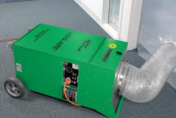
POWER PACKERS
Choosing a generator that can give the right juice when you need it
Anyone who’s lived through a hurricane knows: In the immediate aftermath, when the power’s still out and internet is nowhere to be found, generators are worth their weight in gold. But before you go sprinting to Home Depot during the sales tax holidays, have a plan in mind. What’s your budget, what do you realistically NEED to power up after a storm, and what resources will it take to stay up and running? And perhaps the number-one priority: Do you have what it takes to hook the generator up in the first place?
HOW MUCH JUICE?
Don’t expect to pull the little generator off the back of your bully netting rig and be able to power your central air system with it. Thankfully, the question of “how much power” is a simple addition problem. Total up all the things you expect to turn on at the same time, figure out if you can afford the generator that will power them all, and decide if you can make some cuts if necessary.
If you choose to go with a larger model, make sure you can realistically keep it fueled for long periods in an area where gasoline may be hard to come by. Some larger generators can easily drink upwards of 15 gallons of gas per day.
Keep in mind that for smaller devices like laptops, phones and lights, companies offer an ever-expanding array of portable power banks, some with solar charging options, that can be used safely indoors.
POWER ESTIMATES FOR TYPICAL HOME APPLIANCES, ACCORDING TO CONSUMER REPORTS:
Refrigerators: 6-700 watts
Window air conditioners: 1,000 watts
Laptops: 200 watts
Smartphone charger: 20 watts
Washing machine: 1,200 watts
Lightbulbs: 5 to 80 watts PER BULB
Central air conditioner: ~1,000 watts per ton of cooling capacity
Portable generators can generally be divided into recreational, mid-sized and large categories, each with its own array of features, plugs and maximum wattage. Remember, even if a smaller generator produces the wattage to power a bigger appliance, it may not have the 220-volt plug necessary to link up with appliances like dryers and washing machines. For larger items like central air, make sure your generator can temporarily supply the larger power loads needed to start these appliances. And keep in mind that in the case of some appliances like refrigerators, you don’t need to run them 24/7. Run them just long enough to keep them cold, and manage how many times you let cold air out by opening them.

INVERTER GENERATORS VERSUS TRADITIONAL PORTABLE GENERATORS
While traditional generators use a motor running at a fixed speed to generate power, which can be beneficial for heavy-duty use running high-powered appliances over long spans, inverter generators are typically designed from the ground up to be quieter and more fuel efficient. They alternate the speed of their engines based on the power drawn from the generator at that time, and can therefore be more fuel efficient.
IT’S ALL ABOUT CONNECTION
Larger generators may be able to hook into your house’s main breaker panel, running nearly the entire house in the absence of regular power. But you’ll need the right equipment, and a safe setup, to do so and ensure your safety and that of the power company’s linemen after a storm. The Florida Keys Electric Co-op offers GenerLink, a meter collar that allows for easy connection to portable generators. It also prevents power from generators from causing “back feed,” sending power back into the grid and potentially harming utility crews. Visit fkec.com/services/gen-connect to learn more.


WHAT TO KNOW ABOUT YOUR H2O TO KNOW
NAMING STORMS


There are some things to know about your home’s water before, during and after a hurricane. For instance, do you know where your water valve is located? Or how much water should you store for your family and you in the event water isn’t running through the pipes for days? Follow these tips from the island chain’s water provider, the Florida Keys Aqueduct Authority, to ensure you’re adequately prepared in times of a storm. For more information, visit fkaa.com or call 305-296-2454.
SHUT OFF THIS VALVE
Shut off the home’s water valve (typically found on the exterior wall of the home). Some water heaters may also need to be shut off. Check with the manufacturer. Customers with a low pressure sewer system pump on their property are asked to shut off the breaker to their grinder pump (located in the dedicated electric box outside of the home).
WATER STORAGE
For drinking and cooking, save enough water for seven to 10 days. Fill the bathtub and containers with water for non-drinking purposes.
WHEN TO BOIL WATER
If a notice is issued, disinfect your water by either boiling for one minute, adding one-eighth teaspoon of bleach per gallon or using purification tablets (purchase at outdoor retailers). Alerts will be issued to keep you informed.
STAY CONNECTED
Follow the Florida Keys Aqueduct Authority on Facebook, Fl Keys Aqueduct on X or visit fkaa.com. Register for priority calls at fkaa.com to receive neighborhood specific notices via phone, text and email.
Forecasters worldwide use short, distinctive names for tropical storms and hurricanes. The National Hurricane Center says the practice of naming storms is especially important when exchanging detailed weather information among hundreds of widely scattered weather stations, coastal bases and ships at sea.
Atlantic tropical storms have been named from lists since the early 1950s. The lists are used in rotation and recycled every six years (the 2025 list will be used again in 2031.) While the lists originate from the Hurricane Center, the process of retiring and replacing hurricane names is overseen by the World Meteorological Organization (WMO).
A list changes only if a storm is so deadly or costly that the future use of its name for a different storm would be inappropriate for reasons of sensitivity. Several storm names have been retired since the lists were created – you’ll never again see hurricanes with names like Katrina, Irma, Ian or Harvey, among others.
Several hurricane names were retired by WMO due to the death and devastation they brought in 2024. Beryl was the earliest Atlantic basin Category 5 hurricane on record, with major impacts in the Caribbean. Beryl was responsible for 34 fatalities in Jamaica and the Yucatan Peninsula of Mexico.
Hurricanes Helene and Milton caused catastrophic damage in Florida and other parts of the southern U.S. A Category 4, Helene caused catastrophic flooding across the southern Appalachians, storm surge flooding along portions of Florida’s west coast and widespread damage from the Gulf Coast to the North Carolina mountains. Helene caused 248 fatalities — the deadliest hurricane since Katrina in 2005 — and $78.7 billion in damages, according to WMO.
Milton made landfall near Siesta Key as a Category 3. The hurricane caused 12 fatalities in the U.S. and an estimated $34.3 billion in damages.
The naming system for hurricanes has changed over time, according to Jon Rizzo, warning coordination meteorologist for the National Weather Service in Key West. Traditionally, in a system overseen by the WMO, lists of male and female names were used in the six-year rotation. In the past, Greek letters were used to name storms after the list was exhausted in an active hurricane season. Today, that’s no longer the case. If a season exhausts its 21-name list, it can draw from an approved list of supplemental storm names for use in any season.


By Keys Weekly staff

SAFE SPACE
Find a snug spot for the boat or sail away
If there’s a hurricane, the best place for the boat is far away from the storm track.
Many Keys residents with small- to mid-size boats choose to trailer their boat to a safer location. If that’s your plan, be ready to go early: Monroe County’s phased evacuation calls for high-profile vehicles to leave first. After that, boats are not allowed on the highway. And no one evacuating with kids and pets in a crowded car wants to follow behind someone towing a boat the length of U.S. 1 during an evacuation.
Captains who intend to sail to their evacuation destination must also leave early; at some point during a mandatory evacuation the Snake Creek drawbridge in Islamorada will be locked down so vehicular traffic flows smoothly out of the Keys. Also, the weather will get nasty.
If you can’t sail or tow the boat away from the storm, take the boat out of the water and stow it in a garage or on the lee side of a building. Tie the boat to the trailer and the trailer to an immovable object — such as a palm tree. Do not fill the boat with water. Boats are designed to keep water out and filling it with water could cause structural damage.
If it’s not possible to stow the boat on land, find a spot in a protected harbor. Again, the early bird will get the best spot, though it’s recommended to keep checking on the vessel as the harbor fills with other boats to ensure safe clearances between vessels. Take everything off the boat — sails, electronics, etc. Heavy and extra anchors are needed for this option and enough line should be on hand to allow a scope of at least 10:1 for each anchor.
Many working Keys captains adhere to the time-honored tradition of stowing their vessels in a “hurricane hole,” or a narrow inlet lined with mangroves. These protected spots block the wind and provide a tie-off. The best location for a hurricane hole — preferably scouted ahead of time — is one far enough inland to avoid the most severe winds and tides, yet close enough to reach under short notice.
The last option mariners should consider is leaving the boat at the dock. In a strong storm, high winds and waves will batter the vessel against the dock or lift and destroy both. A better option is to tie off in the center of the canal, again using immovable objects on land and the strongest part of the boat such as a mast, not a cleat. This requires cooperation with other boat-owning neighbors to ensure each boat has sufficient room. Also, leave some slack in the lines to allow for tidal change. Use extra fenders and also chafe protection so the lines don’t get severed.

Elevate your health and well-being with cutting-edge solutions that optimize body composition, performance, longevity and vitality. At New You Health Clinic, we offer advanced therapies and treatments to help you feel, look and live at your peak.
CUSTOMIZED
Tailored
Supporting balanced health and vitality
For enhanced wellness and performance
Personalized guidance for long-term health TRANSFORM
LUMECCA WE OFFER BOTOX, LIP FLIPS, DERMAL FILLER AS WELL AS:
The most powerful, intensely pulsed light (IPL) to treat pigmented and vascular lesions. In just 1-3 sessions, Lumecca improves the appearance of: age spots, ascular lesions, rosacea, freckles and sun damage.
A fractional skin treatment that stimulates the underlying layers of the dermis. By targeting the deeper layers of the skin, the tissues are triggered to reveal a more radiant, youthful appearance. Can be used on face, periorbital region, abdomen, thighs, legs and buttocks.


Nothing is more important than the structural integrity of your home, and its repair requires a specialized process and a high level of expertise. We work closely with engineers and designers to carefully remove, repair and reinforce the structure so you can be assured of a sound home.

As with any steel reinforced concrete structure, exposure to the elements can cause irreversible, cosmetic as well as structural damage. Let us evaluate your seawall or dock, and give you expert recommendations for its repair.


We specialize in concrete repair and replacement. Each of these is a specialized process and requires a high level of expertise to achieve optimum results. When you work with Randy and his team of professionals, you will be assured that your job will be completed correctly and with no detail overlooked!


AFTER THE STORM
Sort your debris; illegal dumping is a crime
There’s plenty to consider when cleaning and sorting debris for pickup following a hurricane. Following these specific guidelines for hurricane-related debris and household garbage will make for an easier and quicker removal. FEMA-eligible, hurricane-related debris will be picked up free of charge by Monroe County contractors in unincorporated areas, Layton and Key Colony Beach. Key West, Islamorada and Marathon have contractors who will pick up debris free of charge.
DEBRIS PLACEMENT
Never place debris directly under power and cable lines or on utility boxes (electric or water). Keep the debris away from fire hydrants and utility poles. Residents are urged not to place debris on vacant lots or other private property.
VEGETATION
Only clear damaged vegetation that has fallen and/or constitutes a hazard to life or property. Take pictures to prove there was a hazard in case a complaint is filed.
ILLEGAL DUMPING IS A FELONY
Illegally dumping household appliances, construction materials, boats, trailers, RVs and vegetative debris on county-owned vacant land and rights of way and streets could land you in serious trouble — you very well could face a felony charge. The extra disposal cost is paid by Monroe County taxpayers for those who do not dispose of items properly.
LARGE
ITEMS – beds, dressers, appliances, carpeting, etc. – can be removed by local haulers. Boats, boat trailers, RVs without motors, campers and other big items can be disposed of at one of Monroe County’s three transfer stations at a price per ton. Contact a transfer station regarding pricing: Cudjoe Key: 305.745.2513; Long Key: 305.664.2263; and Key Largo: 305.367.4236.

SEPARATING DEBRIS
Homeowners will be asked to sort debris into the following categories:
• Household garbage: bagged trash, discarded food, packaging and papers.
• Construction debris: building materials, drywall, lumber, carpet, furniture, mattresses, plumbing.
• Vegetation debris: tree branches, leaves and logs.
• Household hazardous waste: oil, batteries, pesticides, paints, cleaning supplies and compressed gas.
• Appliances: refrigerators, washers, dryers, freezers, air conditions, stoves, water heaters and dishwashers.
• Electronics: televisions, computers, radios.
For more information, visit monroecountyem.com/914/hurricane-debris-removal.
Every storm is different. Listen to and read local media, as well as county and your local municipality through social media. These outlets will provide direction and instruction on how/when debris will be collected/picked up.


By Brad Bertelli
2005: A HURRICANE SEASON TO REMEMBER
Well, here we go again. Hurricane season is about to kick off. For some, it can be an uncomfortable time of year, and not just because of the sweltering temperatures. The threat of a storm produces more anxiety in some than in others, especially when the dreaded “cone of uncertainty” starts showing up on television screens.
Weather forecasters implore you not to focus on the center path of the storm because hurricanes are unpredictable. They wobble and jerk as they mark their paths. When living inside the threat of the cone, it is only natural to hope it wobbles and jerks down some other path — even when you know that if it spares your neck of the woods, it will likely blast through another.

Some hurricane seasons are less forgiving than others. With 27 named storms (and one unnamed), the 2005 season was a doozy. There were so many they ran out of names. The last six were assigned Greek letters, as was protocol, and included Tropical Storm Alpha, Hurricane Beta, and Tropical Storm Zeta.
Power and devastation were themes during a season that spawned four Category 5 hurricanes: Emily, Katrina, Rita and Wilma. It also spawned Dennis, which left an interesting mark on the Florida Keys after it blew by in July – though not in the usual hurricane way. Dennis was a major hurricane as it roared up on Cuba. The island and its mountain ranges zapped some of its strength, and the hurricane emerged in the Gulf of Mexico as a Category 1 storm.
Dennis passed 125 miles west of Key West and made landfall along the Florida panhandle near Navarre Beach as a Category 3 storm. Still, the hurricane made at least one lasting impact on the Florida Keys.
Too often, what they are capable of is underappreciated until that power hits home. A fine example can be attributed to righting a wrong that occurred on May 17, 2002. The wrong happened when the retired 520-foot USS Spiegel Grove, a Navy Landing Ship Dock, was towed to a spot off the coast of Key Largo and intentionally sunk as part of an artificial reef program. Despite the best-laid plans, when the ship was scuttled and settled 130 feet below the Atlantic’s surface, it came to rest on its side instead of its intended upright position.
Three years later, though Hurricane Dennis passed well west of Key Largo, the storm produced sufficient wave action 130 feet below the surface to right the Spiegel Grove and set the nearly two-football-field-long ship upright.
Katrina was a late August storm that crossed southeastern Florida as a Category 1 hurricane before emerging in the Gulf of Mexico, intensifying, making a second landfall in southeast Louisiana and a third in Hancock County, Mississippi. Katrina broke the levees separating Lake Pontchartrain from New Orleans and flooded 80% of the city.
When Rita formed in September, it passed between Cuba and the Florida Keys on its way into the Gulf of Mexico, where it strengthened into a Category 5 storm with sustained winds of 180 mph. After roaring across the Gulf, it made landfall as a Category 3 hurricane just east of the Texas-Louisiana border.
In the Keys, Hurricane Wilma was the storm that left the most significant impact on the island chain. Wilma’s eye passed 70 miles north of Key West and churned up the Gulf of Mexico into Florida Bay. The eye of the storm made landfall as a Category 2 storm on the Collier County side of the Ten Thousand Islands. It was Oct. 24. In the Keys, Wilma produced widespread flooding from coastal surges along the Florida Bay and Gulf of Mexico side of the island chain. According to the Monroe County Emergency Management website, 60% of all the homes in Key West experienced flooding. Flooding events occurred up and down the Keys.
The critical thing to remember about every hurricane season is that it is not about the path or the landfall but about the respect for the power of nature. The 2005 hurricane season resulted in the loss of 3,473 lives.
Graffiti on hurricane shutters at a house on Flagler Street in Key West after Wilma. DALE McDONALD COLLECTION/Florida Keys History Center

Some of the services we provide include:
• Impact Windows & Doors
• Service Repairs
• Shower Enclosures
• Balcony Enclosures
• Glass Railings
• Installation on a New Construction (Contractors provide the bucks, and we include the installation and provide the waterproofing.)
We also offer financing through Ygrene’s Pace Program and an installation warranty with our installations.
Benefits of Getting Impact Windows and Doors:
• Noise Reduction
• Energy Efficiency
• Increased Home Value
• Hurricane Protection
• Protection Against UV Fading with Low-E
• Home Insurance Savings
Contact us today to schedule your consultation and get ready for this hurricane season.
Prepare your home for what’s ahead with impactresistant windows and doors.

We are fully licensed and insured.
Certified General Contractor


Island Dental
If you are looking for a caring, qualified dentist in Key West, then look no further. From your first contact with our office, you will notice that Island Dental is not your typical dentistry. We've worked hard to build an exceptional team of dedicated, caring and experienced professionals committed to the dental health of you and your family.
Our services include: General Dentistry | Teeth Whitening Crowns | Preventive Care | Periodontal Exams | Botox
DR. LOUIS SPELIOS


The Key Largo Wastewater Treatment District (KLWTD) and Islamorada, Village of Islands are at work before, during and after a storm to keep the central sewer collection system and processing plant fully operational.
KLWTD service area: Mile Marker 106 to the north end of the Tavernier Creek Bridge Islamorada service area: south of the Tavernier Creek Bridge to the south end of Lower Matecumbe Key
While the wastewater system is designed to operate during most significant storm events, there are a few conditions where service may be interrupted. It is important for our customers to understand these situations.
WIDESPREAD POWER OUTAGES
EXTREME WIND WITH RAIN FLOODING
MANDATORY EVACUATIONS and RECOVERY
Sewer facilities are on generator back-up and are regularly tested and prepared for power interruptions. If you have an on-site (grinder pump) system, you will need to conserve sewer usage until power is restored to your home.
Heavy rain with extreme winds (over 50 mph) can pose a threat to power generators. The system may be temporarily interrupted during these periods but will be restored immediately after.
Rising water above the in-home drains can allow for the infiltration of large amounts of water into the sewer system. During periods of flooding, portions of the collection system may be temporarily shut down to avoid overwhelming the system.
During periods of mandatory evacuations, service may be interrupted. The system will be restored, usually before re-entry is allowed to the general public.
"Reduce Usage" means: Water usage should be for essential sanitary purposes only. Minimize toilet flushing, avoid use of washing machines and dishwashers.
✔ Do not park or place debris on or next to air terminals, utility boxes or manhole covers.
✔ Notify your wastewater district of leaks or system failures.
✔ Never drain storm waters into the sewer system – it’s against the law.
✔ Follow us on Facebook for updates during extreme weather conditions.

