Land and Sky Scenic Byway
about the
byway
T
he Land & Sky byway runs north and south through Cheyenne, Sherman and Wallace Counties. Aptly named, this byway gives an unparalleled taste of Kansas landscape and open sky; from the craggy badlands in the northern half of the byway, to the smooth, open views and hills of the high plains in the southern part of the byway.
GETTING THERE Interstate 70, Exit 17; U.S. Highway 36, U.S. Highway 40. All three highways cross the scenic byway.
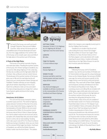
A Taste of the High Plains This byway is the perfect example of big sky and wide-open plains. Traveling the southern portion of the byway, from Sharon Springs to Goodland, you can see for miles along Highway 27. On a clear day, the blue sky is endless and the high plains fields full of wheat, milo, sunflowers and corn stretch forever. The landscape of the southern section of the byway gives way to hills and the road takes bends and sharp turns as it winds between Sharon Springs and Goodland. Travelers will enjoy an ever-changing agricultural rainbow depending on time of year. Catch the sunflowers in late summer, and watch the crops and grazing pastures change from various hues of greens, golds and browns from spring through fall.
TIME TO TRAVEL 1.5 hours without stops
Americana, Art & Culture The Land and Sky byway transports visitors to another space and time. The stretch of highway passes between Central and Mountain time zones. But it is also chock full of history, ranging from the homesteaders of the late 1800s to the car-crazed Americana of the 1950s. On the southern end of the byway stop at Penny’s Diner in Sharon Springs, for a home cooked meal and a bit of art and culture, complete with checked floor tiles and red bar stools found in a shiny rail car-style building. Traveling north, take a jaunt west off K-27 to Mount Sunflower before journeying to Goodland, where you can check out the restored White Eagle Gas Station. Northeast of Goodland, you will find the Kidder Massacre historic marker near the Kuhrt Ranch. The soldiers
RESOURCES Cheyenne County Development Corporation (785) 332-3508 ccdcks.com
LENGTH 88 miles
ROADWAY Kansas Highway 27 WHEN TO SEE Summer and fall to catch the harvest season and year round to enjoy all four seasons SERVICES Gas, food and lodging are available in all three counties and in the communities of St. Francis, Goodland and Sharon Springs.
SHERMAN COUNTY CONVENTION & VISITORS BUREAU (785) 890-3515 visitgoodland.com WALLACE COUNTY VISITORS BUREAU (785) 891-3564 travelwallacecounty.com
Kansas Byways
24
ksbyways.org
killed in the massacre were originally buried south in the Fort Wallace Post Cemetery. Goodland is an excellent stop for art and culture along the byway. Known for its largerthan-life rendition of Vincent Van Gogh’s Three Sunflowers in a Vase, the town hosts an Art in the Parks program, and is also dotted with murals depicting the area’s history. Aviation enthusiasts should stop at the High Plains Museum to see the first American patented helicopter. Arikaree Breaks Following the byway north of Goodland, travelers may visit the communities of Wheeler and St. Francis before coming upon the unique landscape known as the Arikaree Breaks. Formed some 10,000 years ago, the ravines and canyons specific to this craggy scenery were formed by winds and ancient waterways. They were built of Pierre Shale, Ogallala sand and gravel, and loess silt believed to be from the Arikaree and Republican rivers. Today, the surprising canyons and rolling hills are streaked with buffalo grass, sage, prickly pear cactus and yucca plants. This is in stark contrast to the high plains of the southern section of the byway. Be sure to download the self-guided driving tour of the Arikaree Breaks. Maps of the area are available at the Information Center in St. Francis or the Kansas Travel Information Center on I-70 milepost 7, just west of Goodland. History enthusiasts will want to stop at Horse Thief Cave along County Road 17. Another interesting site is Cherry Creek Encampment located one mile northwest of K-27 and US-36. The encampment honors the memory of Cheyenne tribe members who fled the Sand Creek Massacre and were joined by other plains tribes totaling some 3,000 Natives. The Sand Creek Massacre sparked 25 years of war on the plains, culminating in the Battle of Wounded Knee in South Dakota in 1890. —By Kelly Gibson