WEDNESDAY, May 16, 2018
www.kamloopsthisweek.com
LOCAL NEWS
A5
DID YOU KNOW? Criss Creek is a corruption of Chris’ Creek, named for Christopher Pumpmaker, a noted haymaker who settled near Deadman Creek in 1869. — Kamloops Museum and Archives
NEWS FLASH? Call 778-471-7525 or email tips@kamloopsthisweek.com
INSIDE KTW
CHEW ON THIS, DAWG
Viewpoint/Your Opinion . . . . A8-9 National News . . . . . . . . . . . . . . A15 Community . . . . . . . . . . . . . . . . .A17 Business . . . . . . . . . . . . . . . . . . . A23 Sports . . . . . . . . . . . . . . . . . . . . . .A27 Classifieds . . . . . . . . . . . . . . . . A36
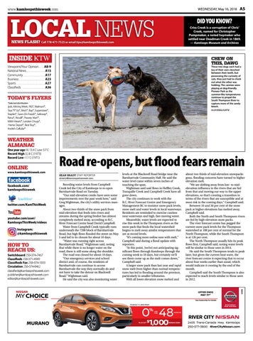
These two dogs each had a toy of their own clenched between their teeth, but possessing the curiosity of cats, they just had to check out what the other was holding. The canines were playing at dog-friendly Pioneer Park as the summer-like temperatures continue to propel the South Thompson River to capture more of the sandy beach. ALLEN DOUGLAS/KTW
TODAY’S FLYERS *Selected distribution
Jysk, Mining Week, YIG*, Walmart*, Toys “R” Us*, Brick*, Bay*, Superstore*, Staples*, Save-On-Foods*, Safeway*, Rona*, Rexall*, Peavey Mart*, M&M Meats*, London Drugs*, Home Depot*, Best Buy*, Andre’s Cellular*
WEATHER ALMANAC
One year ago Hi: 13 .4 C Low: 5 .7 C Record High 32 .8 C (1973) Record Low -1 .1 C (1971)
Road re-opens, but flood fears remain
www.kamloopsthisweek.com
SEAN BRADY STAFF REPORTER sbrady@kamloopsthisweek.com
facebook.com/ kamloopsthisweek
twitter.com/KamThisWeek
youtube.com/user/ KamloopsThisWeek/videos Instagram: @kamloopsthisweek
HOW TO REACH US:
Switchboard 250-374-7467 Classifieds 250-371-4949 Classifieds Fax 250-374-1033 Circulation 250-374-0462 classifieds@kamloopsthisweek .com publisher@kamloopsthisweek .com editor@kamloopsthisweek .com
Receding water levels from Campbell Creek led the City of Kamloops to re-open Barnhartvale Road on Tuesday. “Our mid-elevation creeks have seen some improvements over the past week here,” said Greg Wightman, the city’s utility services manager. About two-thirds of the snow pack from mid-elevation that feeds into rivers and streams during the spring freshet has almost completely melted away, according to B.C. River Forecast Centre head David Campbell. Water from Campbell Creek typically runs underneath the 7200 block of Barnhartvale Road, but high flows flooded the street on May 5 and led to its closure for about 10 days. “Water was running right across Barnhartvale Road,” Wightman said, noting that while there is no longer water on the road, there is still some along the shoulder. The road was closed for about 10 days. “Our emergency services and school district and, of course, the residents of Barnhartvale can continue to access Barnhartvale the way they normally do and not have to take the detour on Blackwell Road,” Wightman said. He said the city was also monitoring water
levels at the Blackwell Road bridge near the Barnhartvale Community Hall. He said the water level came within seven inches of touching the span. Wightman said said flows in Heffley Creek, Tranquille Creek and Campbell Creek have all gone down. The city continues to work with the B.C. River Forecast Centre and Emergency Management BC to monitor snow pack levels, snow melt and water levels in local waterways. Residents are reminded to exercise caution near waterways and high, fast-moving water. Meanwhile, water levels are expected to rise this week in the Thompson rivers as the snow pack that feeds the local watershed begins to melt away amidst temperatures that are at record levels. “It’s coming more online now with melt,” Campbell said during a flood update with reporters. “At this point, [we’re] not anticipating significant flows through Kamloops through the coming week to 10 days, but certainly we’ll see them come up as the melt comes down,” Campbell said. A larger snow pack than last year and rapid snow melt from higher than normal temperatures has led to flooding around the province, particularly in smaller tributaries. With all lower elevation snow melted and
NISSAN
about two thirds of mid-elevation snowpacks gone, flooding concerns have turned to higher elevation melt. “We are shifting away from low- to midelevation influence in the rivers that are fed from that and moving our way to the upper elevations, so that’s creating a transition in terms of the rivers that are susceptible and at most risk in the coming days.” Campbell said. Between 10 and 30 per cent of the snow pack at higher elevations has melted away, Campbell said. Both the North and South Thompson rivers are fed by high-elevation snow packs. The river forecast centre has pegged the current snow pack levels for the Thompson watershed at 108 per cent of normal for the North Thompson, while the South Thompson is at 126 per cent. The North Thompson usually hits its peak flows first, Campbell said, noting water levels will be similar to those seen in 2014. He said the South Thompson tends to peak later, but given the current heat wave, the river forecast centre is expecting that to occur about four weeks earlier than usual, which would indicate it cresting by the end of the month. Campbell said the South Thompson is also expected to reach levels similar to those seen in 2012.
OFFER ENDS MAY 31ST
MY CHOICE SALES EVENT
*See Dealership for Details
FINANCE* A 2018 FROM
0 48 %
MURANO
®
PLUS GET
APR FOR
MONTHS
1,000
$
1
BONUS CASH
2405 Trans-Canada Hwy. Kamloops 250-377-3800 · RiverCityNissan.com
D#30150
ONLINE