We extend our heartfelt thanks to the entire team for their dedication and hard work in building this Conservancy and bringing this publication to life. Special thanks are extended to Ashleigh MacLeod for her wonderful design input and great attention to color.
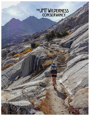
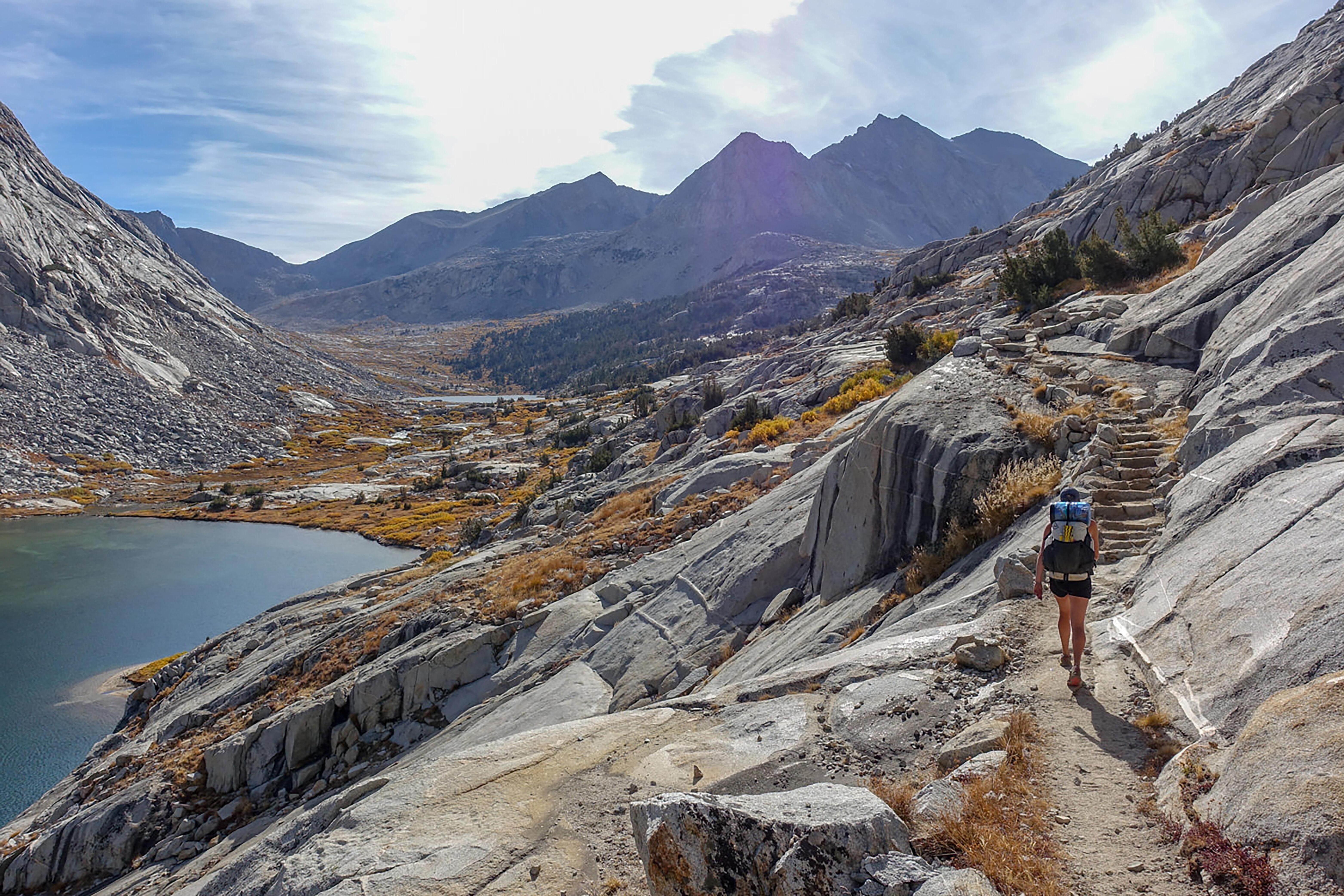
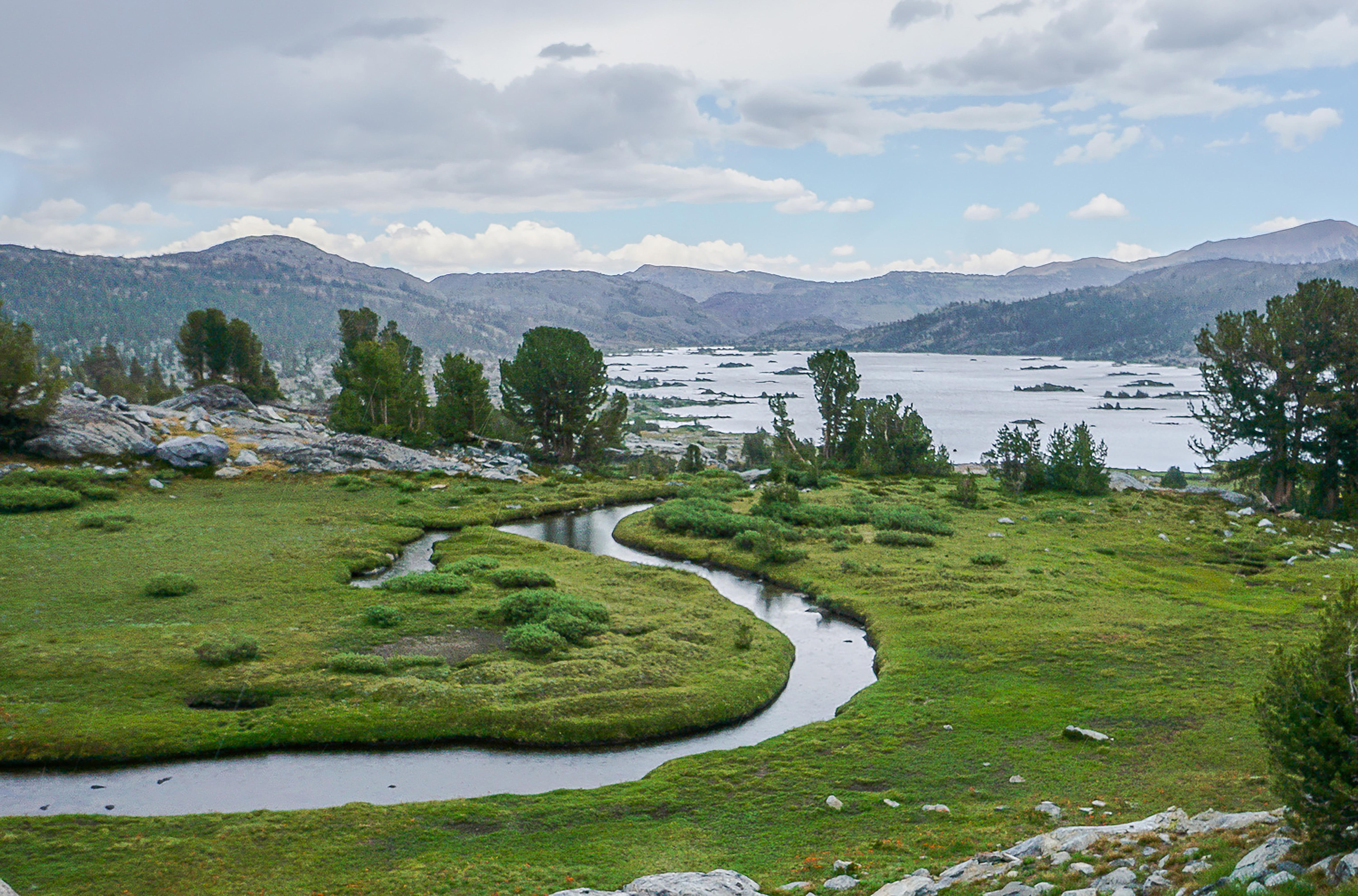
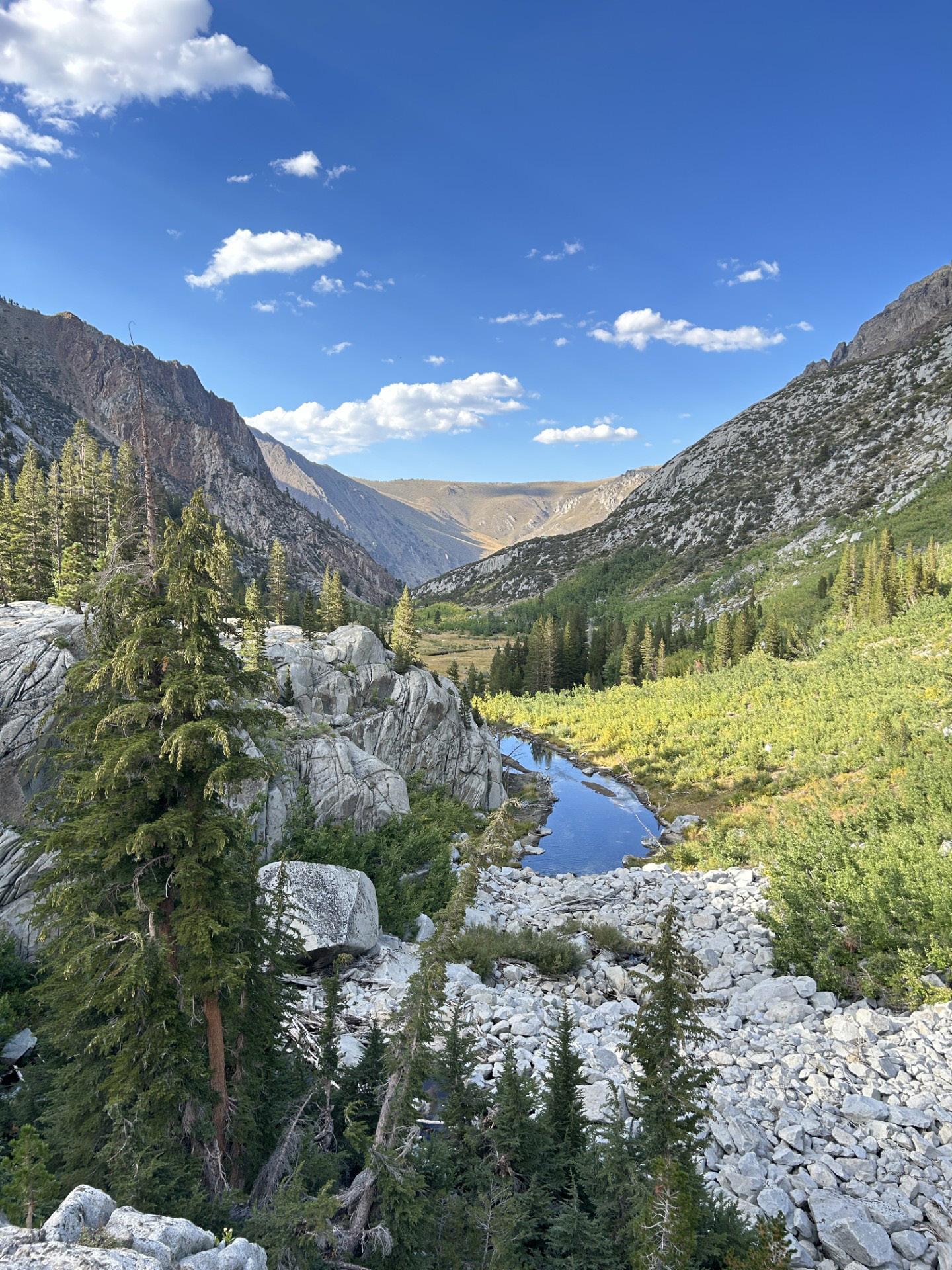
River flowing into Thousand Island Lake
President’s Letter
2025 has been a year of enormous growth and challenge. We more than doubled our project expenditures and assumed the role of project lead for three landscape-scale restoration projects in watersheds along the mighty San Joaquin River.
First, after 2 ½ years of study and design, the Reds Meadow Valley/ San Joaquin River Restoration Project is entering its final phase before breaking ground in September 2026. We have combined funding lined up from the California Natural Resources Agency (CNRA) and the Wildlife Conservation Board (WCB), and are now looking only for the private sector Donor Match required by mid-January 2026.
Second, the Evolution Valley Project -- along the South Fork of the San Joaquin River -- has completed inoffice CAD design and the “ground truthing” phase of the Interdisciplinary Team (IDT) site assessment. While in a brief holding pattern due to the federal shutdown, we expect to finalize design and planning over the winter months.
Third, the Lost Valley Project, on the west side of Sierra National Forest focuses on an extensive meadow ecosystem where the waters of the SF San Joaquin converge in the main channel. The river runs about 5 miles between Muir Trail Ranch and Florence Lake. A proposal to clear extensive conifer incursions and restore several large meadows was positively previewed by the WCB for a Design & Planning Grant in June 2026. If funded (with a WCB Donor Match required there too!), we anticipate starting office design and modeling phase in fall 2026.
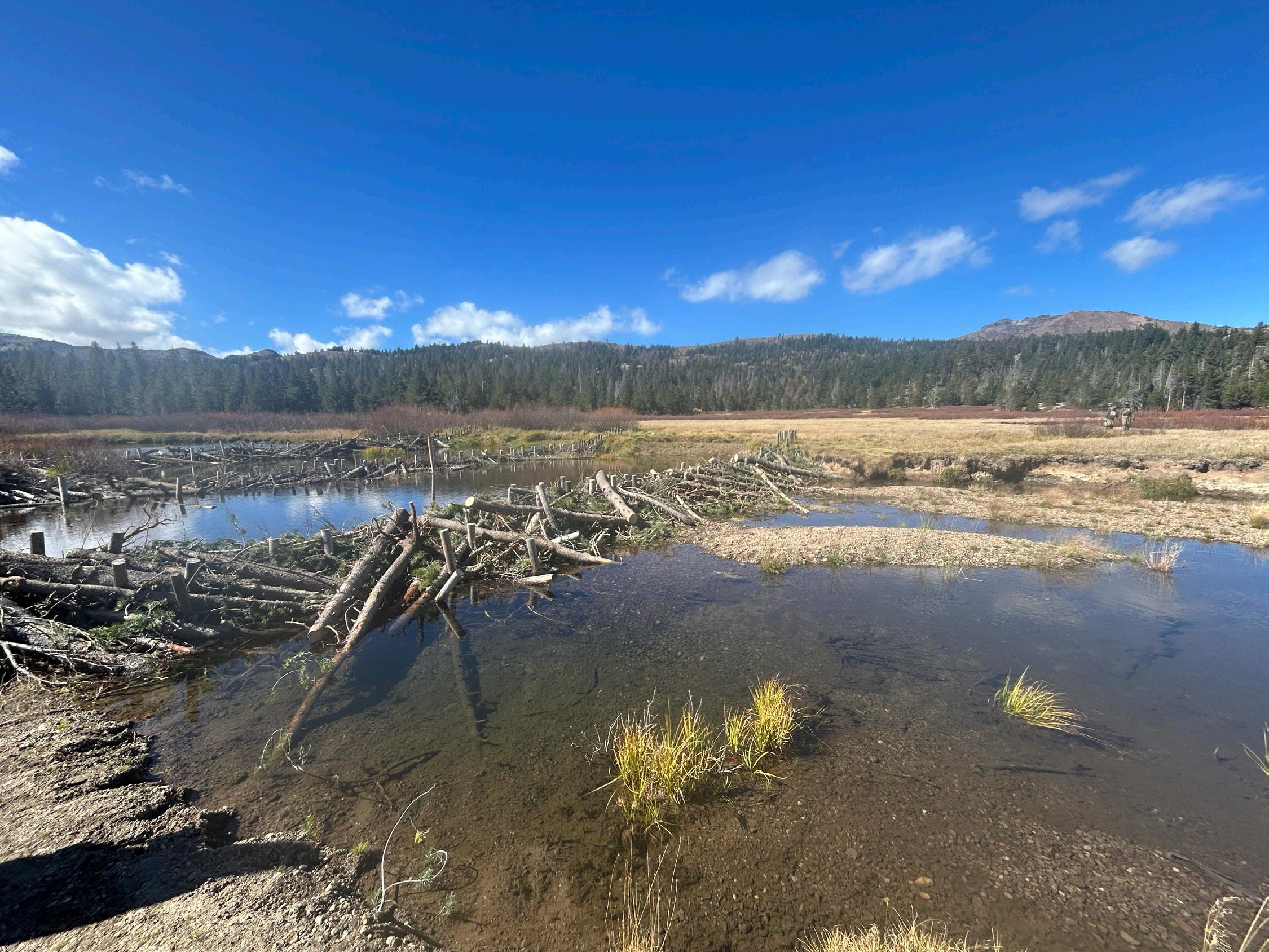
Meanwhile our legacy field program has advanced greatly in both quality and accountability. These projects focus on impacted terrain deep in the backcountry – areas scarred by illegal camping, or deeply incised trails through meadows due to poor way-finding. With the launch of our Field Stewards Program, we put experienced hands in the field to ensure all restoration crews meet high standards of quality, durability, and asthetics. The Stewards have also begun training in process based restoration (PBR) applying in-stream treatments that mimic beaver dams to slow and spread water. Several remote backcountry meadows are in the queue to begin this work next season.
Recognizing that GIS field data is essential for tracking ecosystem recovery and identifying needs for follow-up—a process called “Adaptive Management”—we centralized this function under a dedicated GIS Specialist. He continues to master the ArcGIS platform that is widely adopted by the scientific community and our federal partners. We now publish high quality annual reports on the Sierra Meadows Partnership.Org public site, contributing to statewide tracking of meadow expansion and carbon capture. These reports are instrumental in planning and coordinating each subsequent year’s field projects with greater accuracy and efficiency.
Our Monitoring Program continues to thrive, offering undergraduate majors in environmental fields the opportunity to learn data-collection and analysis on the ArcGIS platform. Recruited from universities across the country, these interns also gain essential wilderness
1 A note of sorrow in the passing this fall of two titans of environmental activism: Robert Redford September 16th, and Jane Goodall October 1st.. Our global awareness was raised by their efforts. Living their lives in quiet dignity and firm conviction, they were a symbol of hope that we must and can restore this our world.
gave us hope and proof that JMT Wild is now playing a significant role in montane meadow and riparian ecosystem renewal. The wholesale restructuring of federal public land management continues to bring uncertainty and strain. Even so, we can take pride that the State of California recognizes its public lands, both federal and state, are central to water sustainability, climate resiliency, and forest health. It is our deepest hope that millions more will follow our lead in taking action to heal this beautiful planet we all call home.
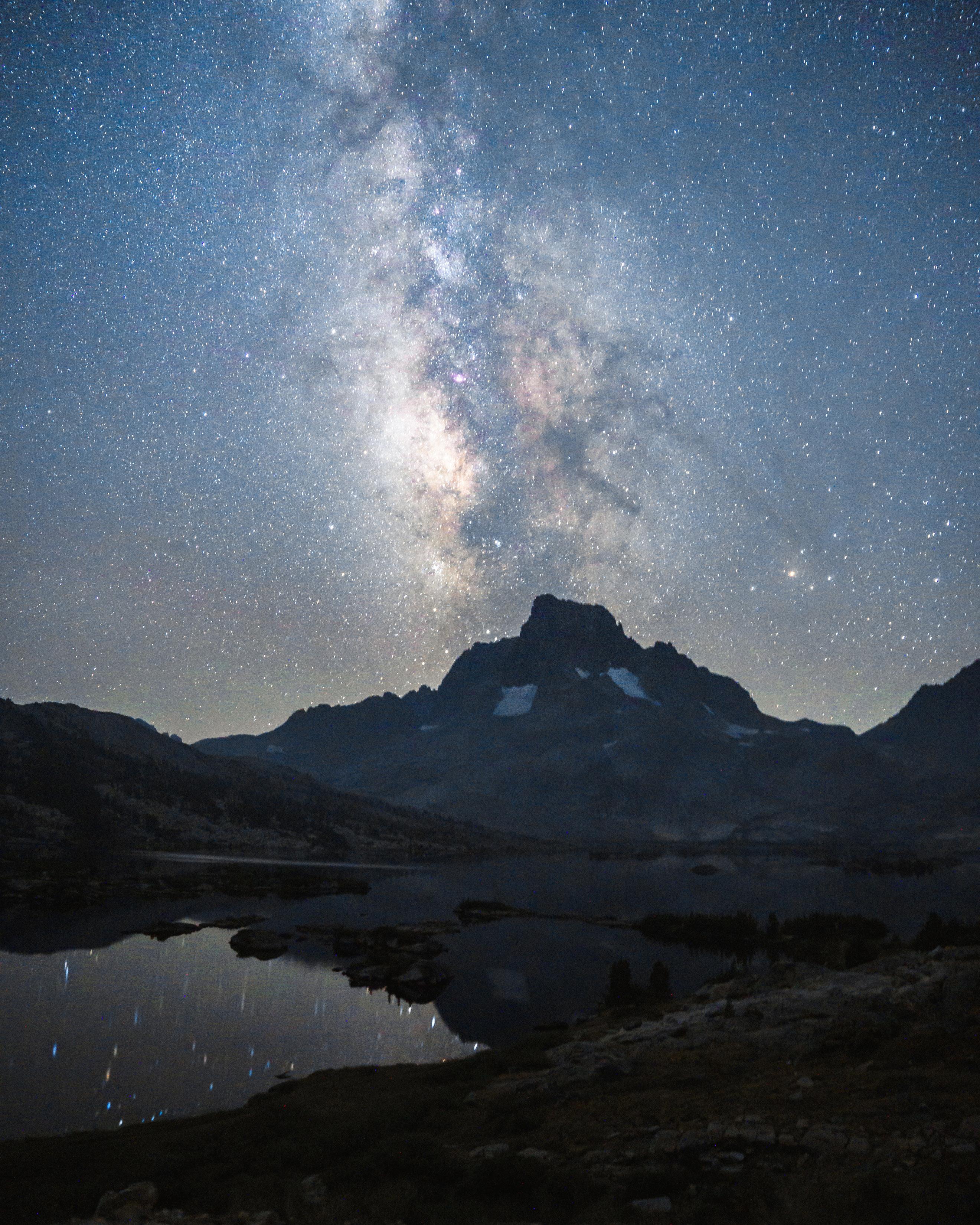
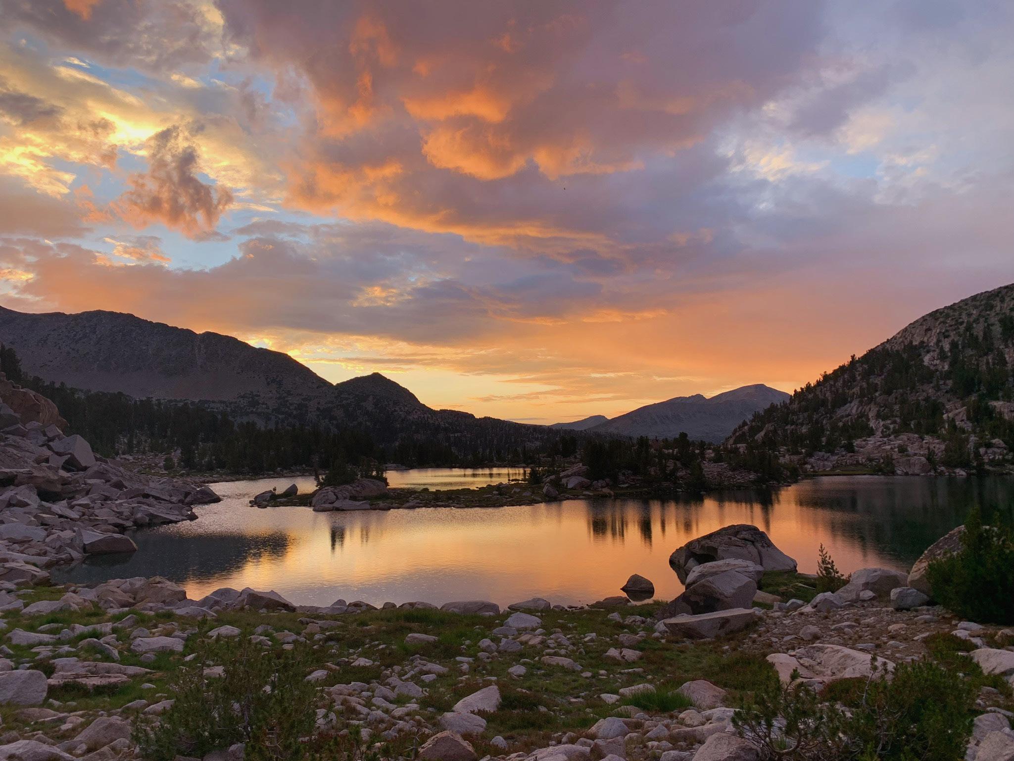
Milky Way over Banner Peak
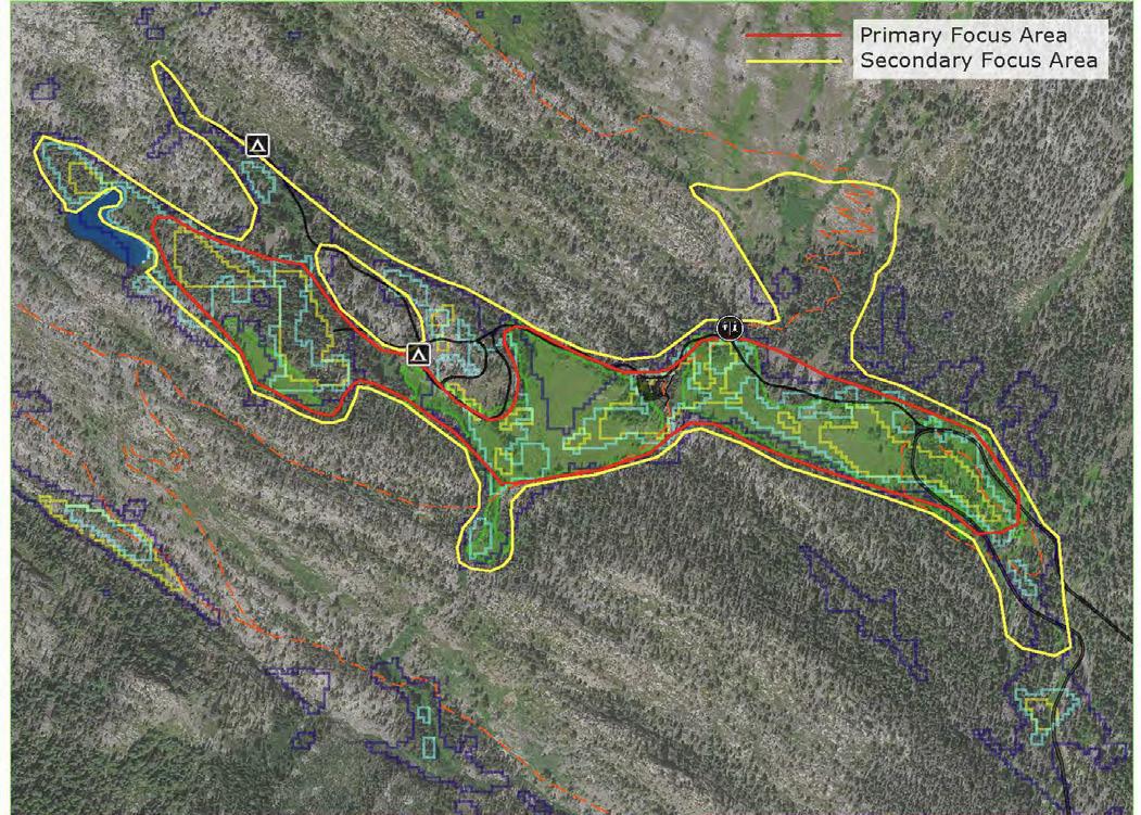
10 Restoring the Sierra’s Riparian Cooridoors Riverbanks & Lake Shores: Science and StewardShip
20 Our First Landscape Scale Project Set to Break Ground in 2026 redS Meadow Valley reStoration project
24 Generations on the Trail
26 State Climate Policy and Nature Based Solutions: a Match that proVideS Multiple BenefitS for cliMate, water, and More.
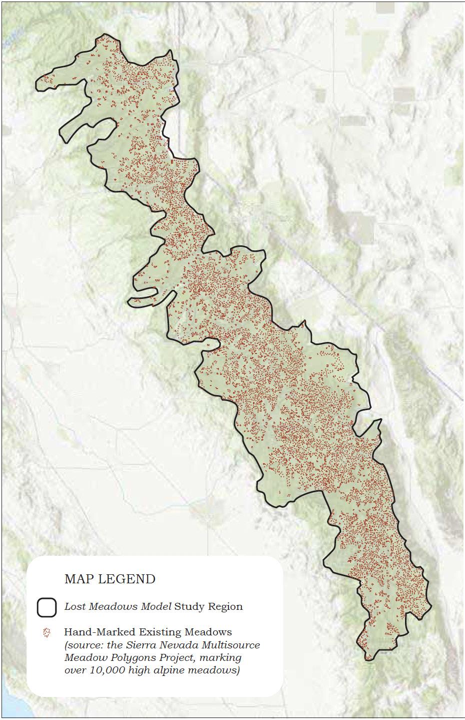
32 Researchers Use Machine Learning to Find Lost Meadows for Restoration
36 My Sierra Summers
40 Ancient Wetlands Living Legacies underStandinG the ecoloGy and conSerVation of Sierra fenS
46 Restoring the Sierra: reclaiMinG reSilience in a chanGed foreSt
50 Restoring History Honoring Heritage
56 Increased Role of terrestrial Systems in Climate Mitigation
Restoring the Sierra’s Riparian Corridor Riverbanks & Lake Shores:
Science and Stewardship
From data-driven monitoring to hands-on restoration, JMT Wild is redefining how the Sierra’s fragile riparian habitats are studied, managed, and renewed.
This season’s work across the wilderness surrounding the JMT was marked by significant advances in how riparian projects are monitored, given prescriptions and repaired for the future. These are the areas adjacent to rivers, streams and lakes, where campsites are prohibited 100 feet from water, yet backcountry travelers frequently set up.
Two of JMT Wild’s initiatives this season stand out: the achievements of the Monitoring Teams and the launch of the Field Steward Program. Together, these efforts reflect scientific rigor and a new level of professionalism in the Conservancy’s approach to restoration of the riparian corridor.
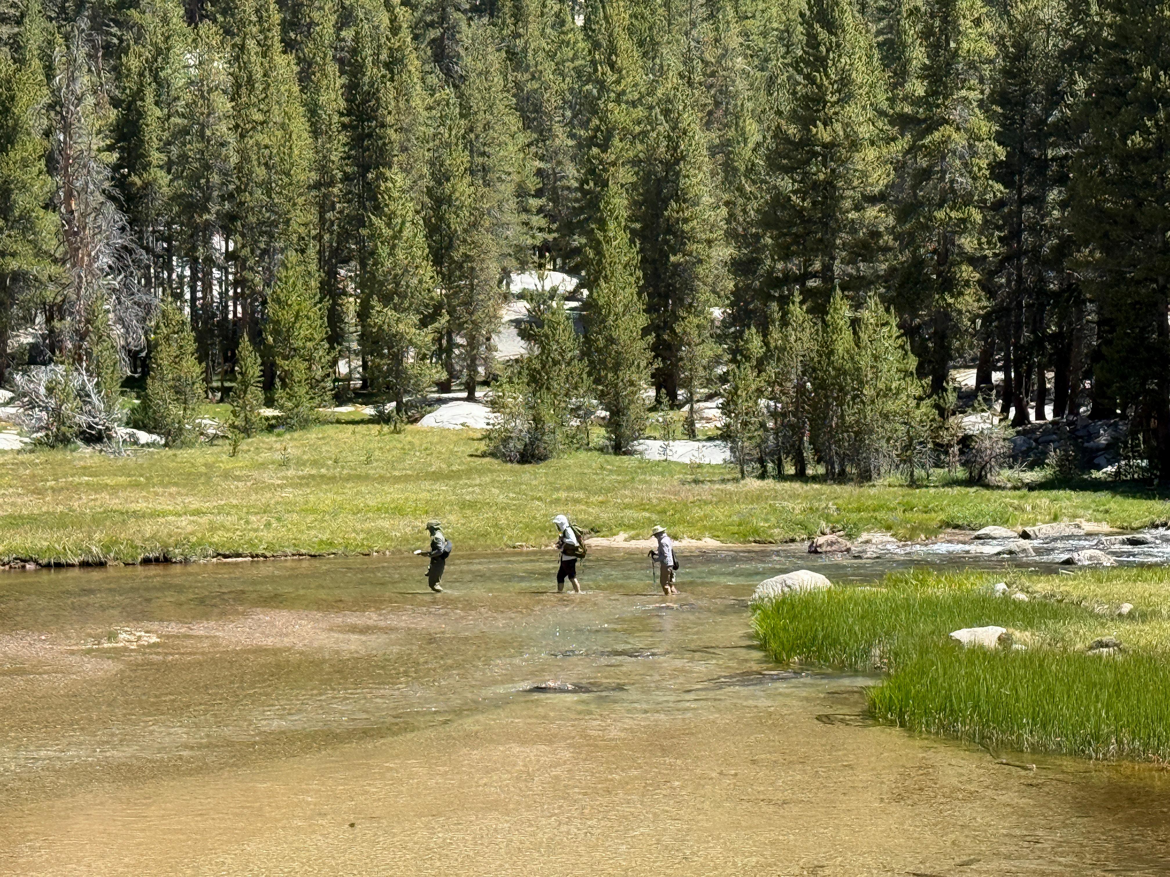
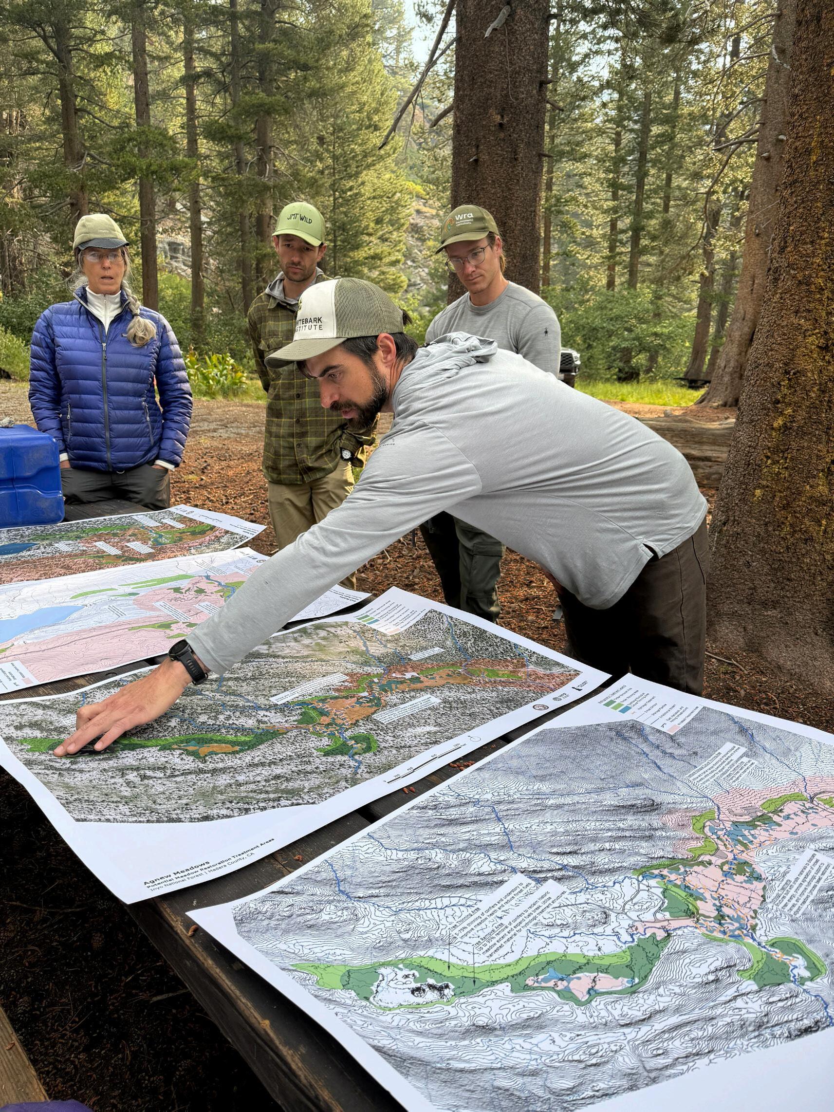
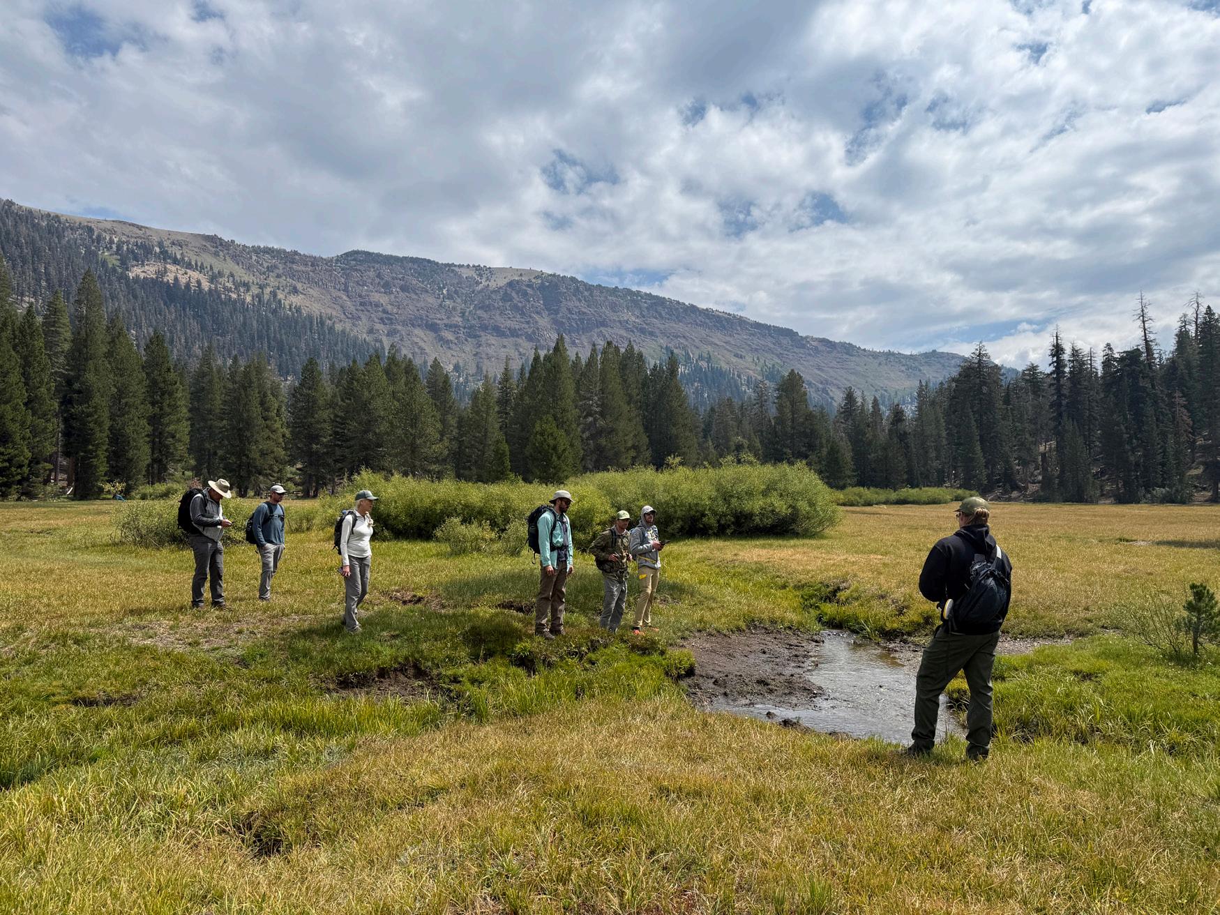
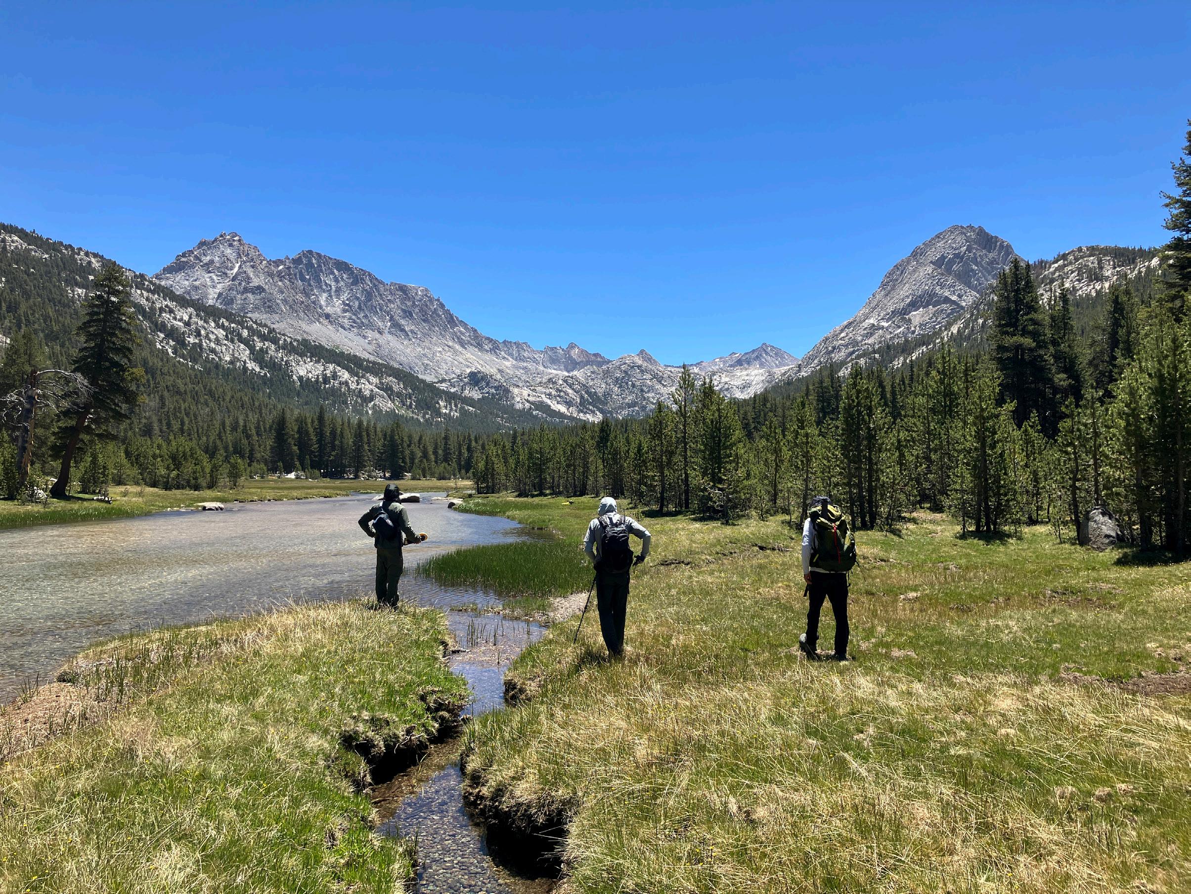
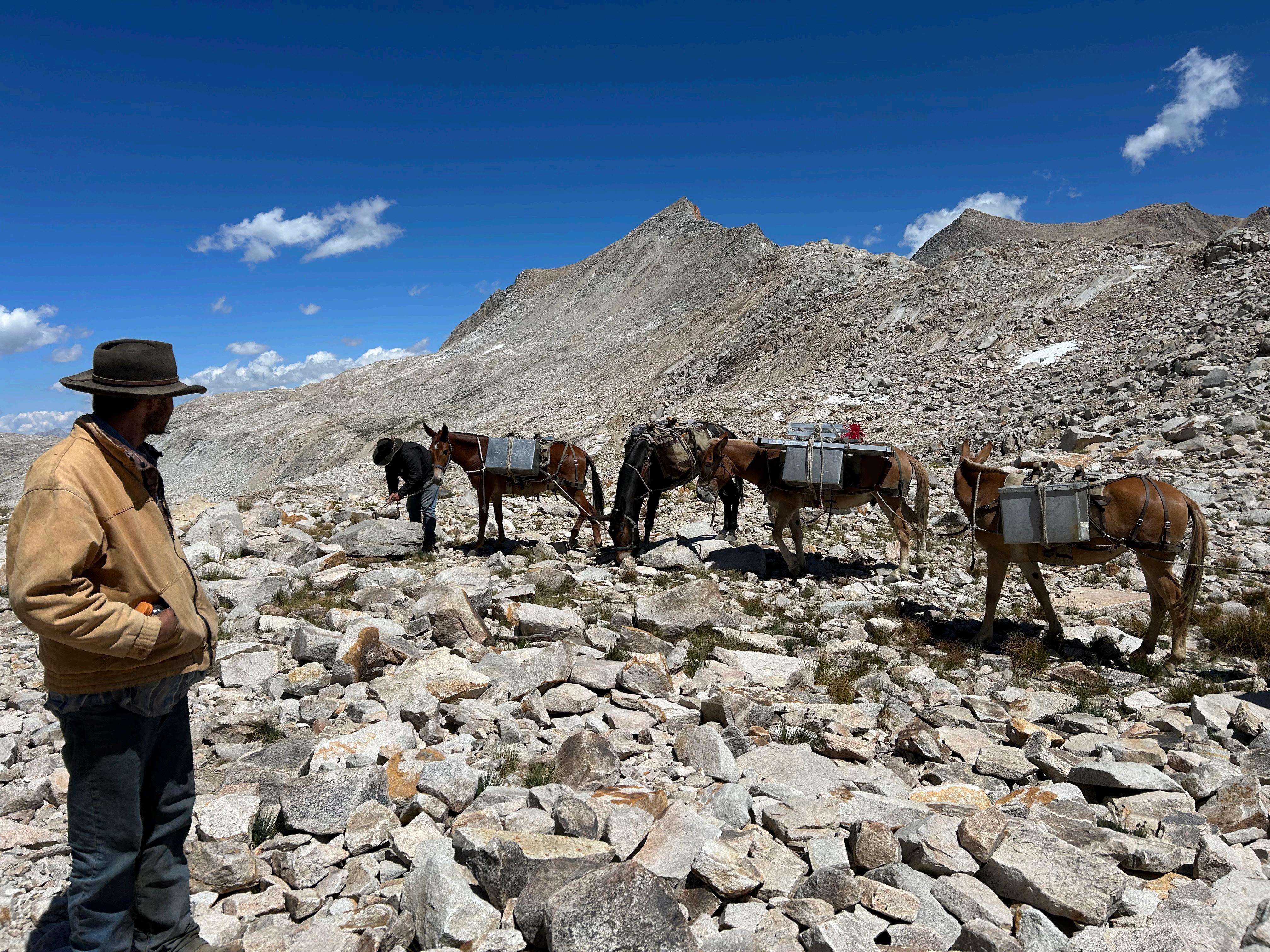
JJMT Wild Staff and WRA Consulting specialists cross Lower Colby Meadow inlet during the site assessment.
Kings Canyon, Summer 2025
Monitoring Teams: Data That Drives Decisions
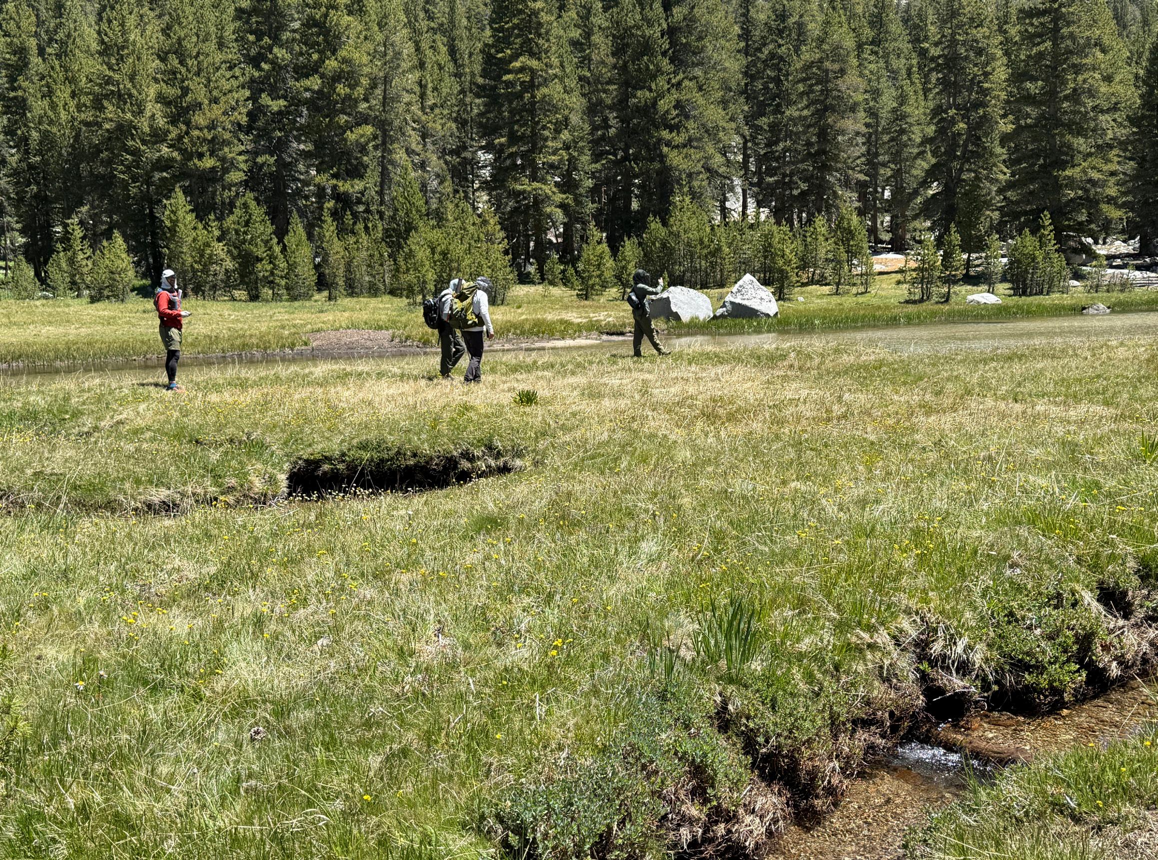
At Duck and Pika Lakes, in the INYO National Forest, our monitoring teams collected baseline data ahead of restoration crews, producing precise maps of illegal campsites, trail impacts on meadows, and shoreline degradation. These datasets were then shared with agency partners, who used them to determine restoration priorities and specific treatments.
In Evolution Valley, in Kings Canyon National Park, teams identified new areas of eligible terrain for dispersed camping that are well suited for campsite setup because they are flat, non-vegetated, durable surfaces. These polygons of eligible terrain will be furnished to backpackers’ apps like Far Out and AllTrails to help redirect recreation away from fragile meadows and riparian zones.
Along Bear Creek, in Sierra National Forest, teams collected baseline and implementation data within a single season, working alongside the field crews and stewards, to provide a complete before-and-after picture of restoration projects.
The teams also played a vital role in effectiveness monitoring, returning to sites restored in previous years to photograph, GIS locate and document narratives about their growth and durability. This longterm perspective is essential for adaptive management—showing where restoration holds and where adjustments in successive seasons may be needed.
Beyond their technical contributions, Monitoring Teams served as landscape-level surveyors of broad watersheds and connected meadow systems, often hiking a hundred miles or more in a season to gather information that would otherwise remain elusive. Their work ensures that decisions about where to invest time, resources, and labor are grounded in field evidence rather than guesswork.
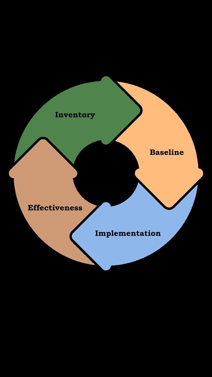
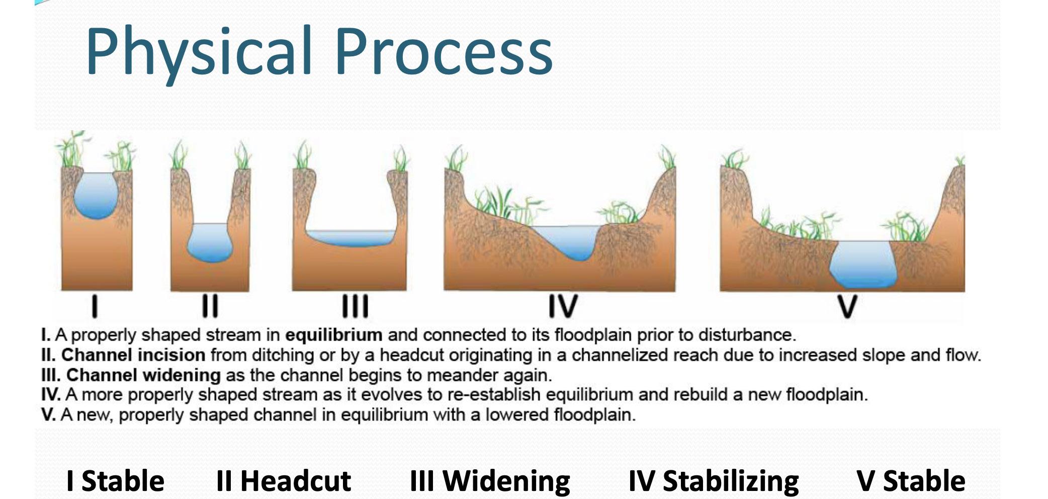
The approach is systematic, following a four-part cycle:
Inventory damaged terrain within a watershed or meadow ecosystem.
Baseline to document the damaged conditions immediately before restoration.
Implementation to record the post-treatment newly restored landscapes.
Effectiveness to measure each season’s progress and track long-term recovery.
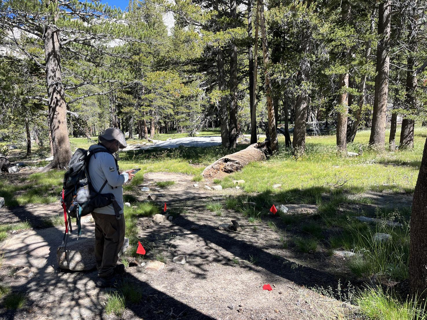
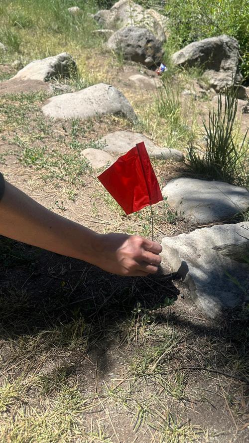
Measuring tapes are utilized to get exact measurements for monitoring
Flags are utilized to get exact data sets for monitoring
R aising the s tanda R d O f
R est OR ati O n
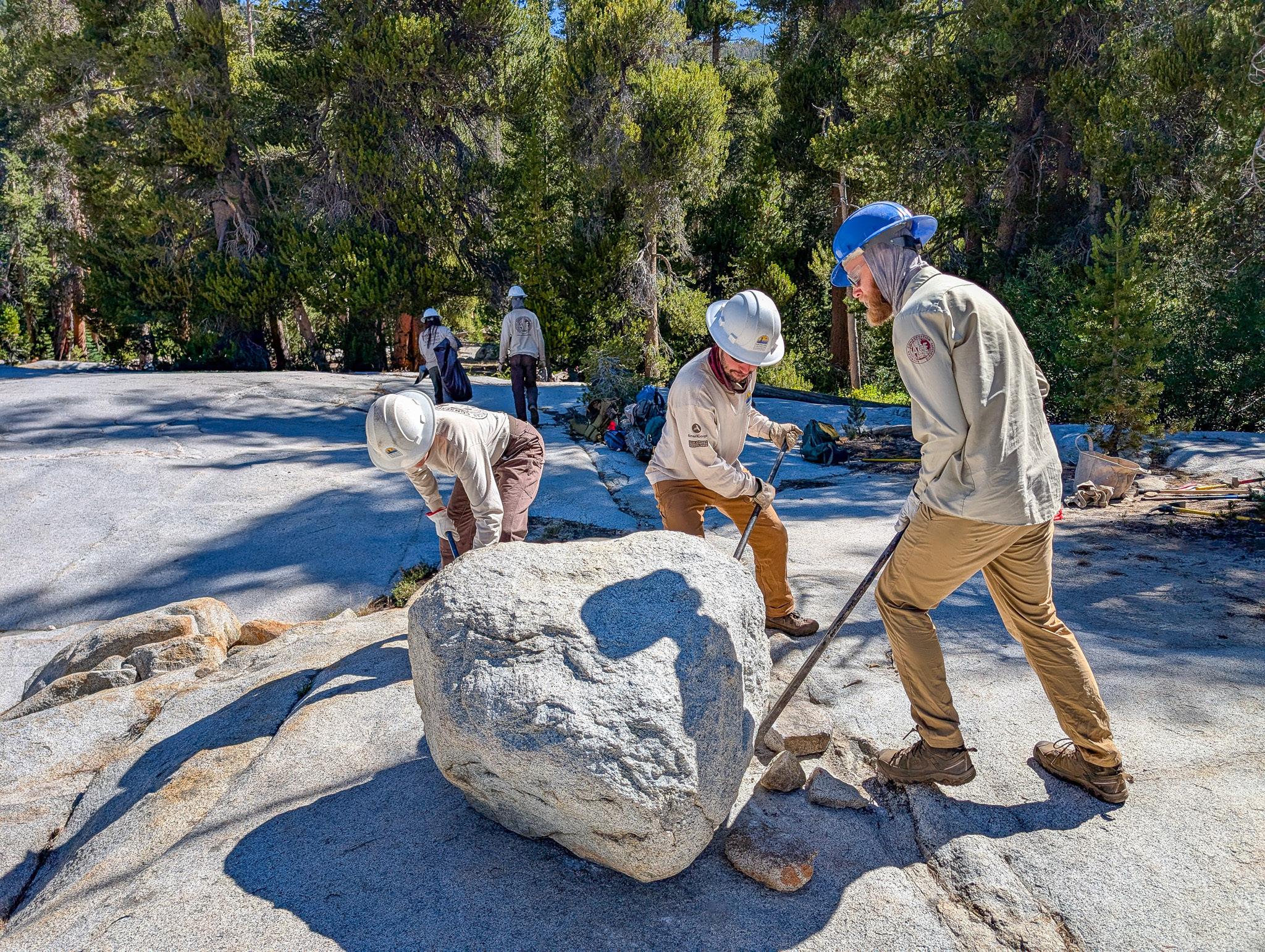
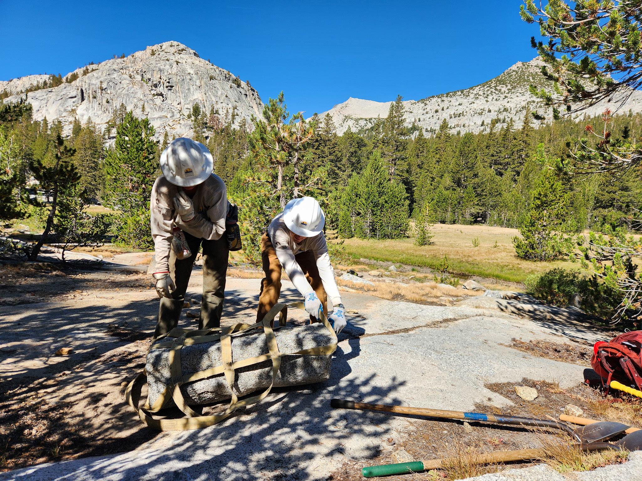
The Field Stewards Program, introduced this year under the leadership of Spencer Collom, JMT Wild’s Program Director, adds a new layer of quality control and leadership in the backcountry. In addition to managing the Conservancy’s Riparian Habitat Projects and overseeing the Monitoring Teams, Spencer guided the launch of this program to ensure restoration projects meet the highest quality-control standards.
Field Stewards are trained Conservancy employees embedded directly with work crews from partner organizations such as the American Conservation Experience (ACE) and the Eastern Sierra Conservation Corps (ESCC). Their role is to translate restoration planning into on-the-ground implementation, ensuring that projects are executed with quality, durability, and precision. Many of our Field Stewards are former Forest or Park Service employees with years of trail and restoration experience already under their belts.
Field Steward Kevin Magallanes looks over a meadow. Summer, 2025
The results were immediately visible. In the Bear Creek Corridor and Rosemarie Meadows, Stewards guided crews through the delicate process of decommissioning illegal campsites and restoring the terrain to its natural state. This involved de-compacting soils, spreading organic material, digging and placing boulders and rocks deep in the surface, a process called iceberging.
Once soil treatments are done, the surface is re-naturalized using surrounding duff, natural debris, logs, and weathered wood. These crews finished ahead of schedule, with results that met or exceeded technical and landscape design expectations.
At Garnet Lake, restoration efforts were complicated by wildfire activity and extreme air quality, which made it difficult to keep work consistent. Field Stewards have been instrumental in providing stability through those challenges, ensuring that projects meet the Conservancy’s high standards. Their presence not only improved efficiency and workmanship, but also offered valuable mentorship for the work crews, many of whom are pursuing conservation professions.
In its first year, JMT Wild’s Field Stewards Program proved itself as a cornerstone of our future restoration strategies.
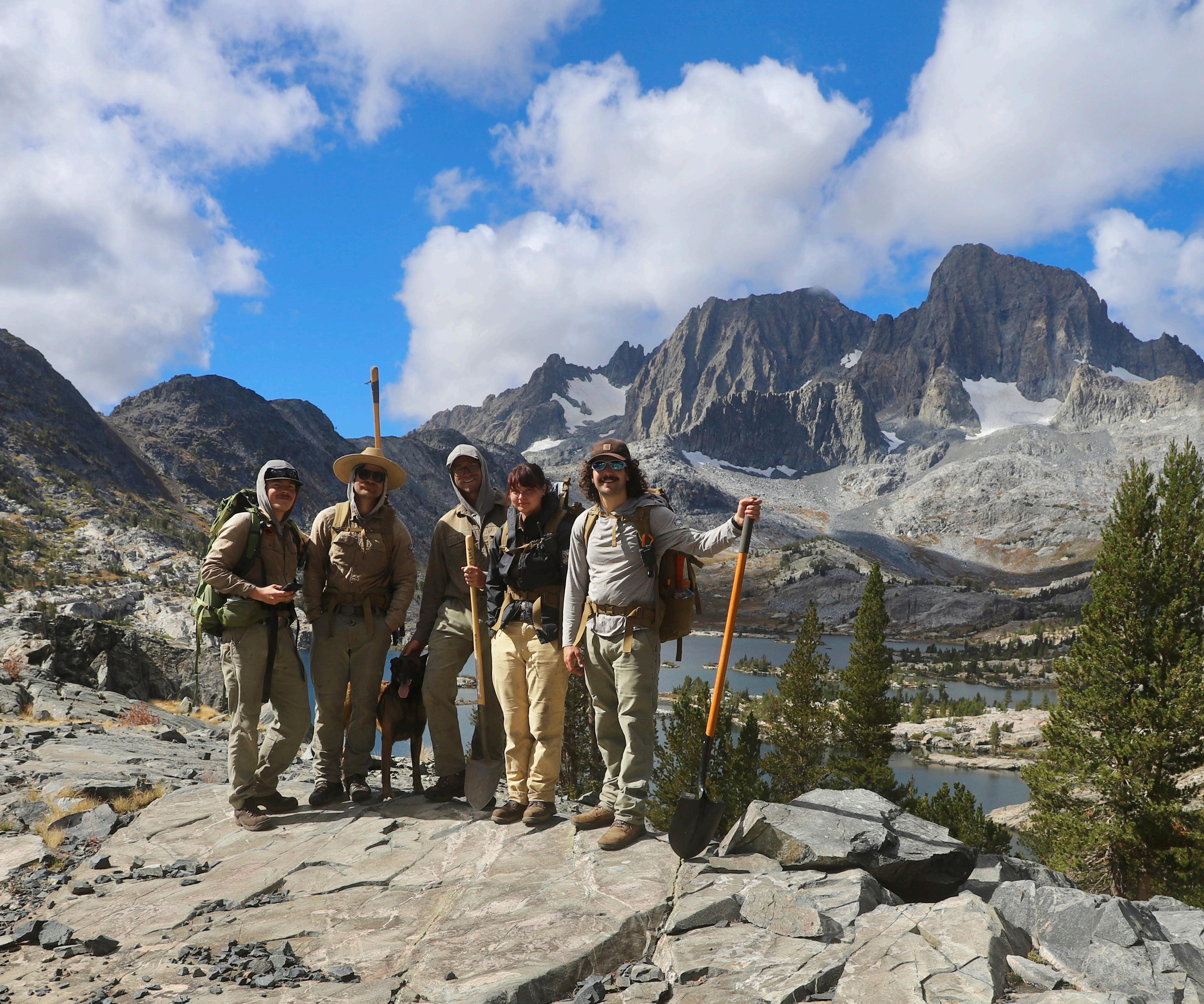
Field Stewards Sam Woosley, Kevin Magallanes, Chad Van Cutsem, Fiona Flores, and Nicky Fuhrman Summer, 2025
Field Stewards oversee boulder iceberging Summer, 2025
Field Stewards oversee restoration work. Summer, 2025
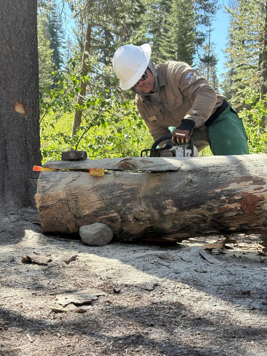
Field Stewards doing saw work Summer, 2025
Scaling in the JMt Backcountry
Critical to the Conservancy’s environmental impact has been learning how to scale projects to
Design
Detailed office studies were completed at several landscapes: Sallie Keyes Meadow in Sierra National Forest; Evolution Valley in Kings Canyon National Park; Garnet and Thousand Island Lake in Inyo National Forest, and by far our largest project, Reds Meadow Valley along 6 miles of the San Joaquin River west of Mammoth Lakes.
These involved use of the USFS Lost Meadows Model to locate the historic flood plain, the collection of current satellite and LiDAR data of the geographies, and design of proposed treatments, including the use of in-stream beaver dam analogues (BDAs).
Following the in-office CAD integration and design, and with proposed schematic treatment maps in hand, interdisciplinary teams (IDTs) coordinated and planned logistics for the backcountry hikes needed to reach the remote landscapes. Meeting at designated rendezvous points, and armed with satellite-enabled iPads and other instruments, the IDTs methodically
walked the terrain, moving around meadow peripheries, hiking up drainages, closely observing and recording conditions, and following geomorphic clues about how best to restore the ecosystem.
Site Assessments
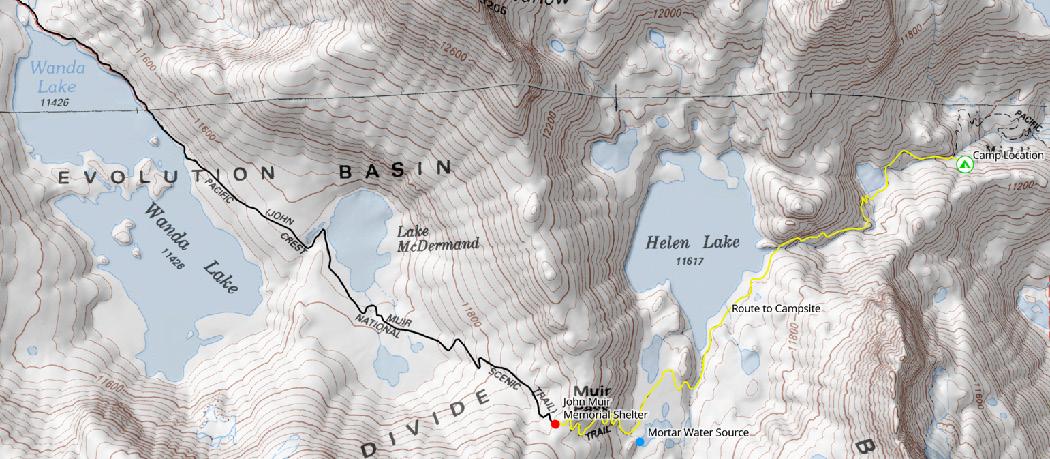
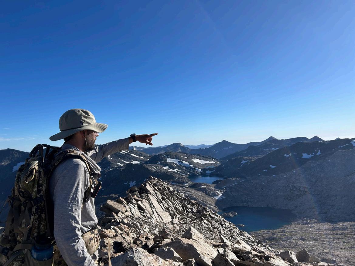
The all-important final field assessment took place in Evolution Valley where five connected meadows along 5 miles of the JMT, as well as several ancient fen systems (see pg. 40 re Fens) were assessed. Hiking in from Florence Lake about 20 miles, people took 3 days to walk the land recording data and comparing notes as they went.
Four meadows showed signs of serious degradation with deeply incised stream channels draining water too quickly, upland conifers advancing into open meadows, and past interventions like check dams failing to restore balance. Once back at the office, the information was consolidated and compared in All Hands team meetings.
Site assessment in Evolution Valley, Kings Canyon National Park, July 2025
The second of the two largest site assessments took place at Reds Meadow Valley where two and a half years of prior work was brought to bear. The assembled IDT, including Inyo National Forest, Natural Resources leadership, and JMT Wild staff took two full days to walk the 200 acres of each large meadow system at Agnew and Reds Meadows and finalize the first stage of restoration.
Monitoring
Meadow Monitoring focuses on measuring the meadow ecosystem through the use of field instrumentation and seasonal data to measure effectiveness as recovery begins. This season, under the leadership of Project Manager Michael Piatti and Senior Landscape Architect Logan Eagan, the Conservancy
began its design of a Meadow Monitoring Program, collaborating with the Sierra Meadows Partnership and Trout Unlimited on the current state of the science. Various test instruments and measuring techniques were compared, with TU offering its experience on the Kern River Plateau, to determine the most effective and balanced approach.
Board member, Rob Dunbar of Stanford University, assisted with leading-edge options using ultra-light weight drones and high-resolution spectral imaging. An initial draft of protocols was determined, and the field installation of water pressure monitors in marked locations was put in motion.
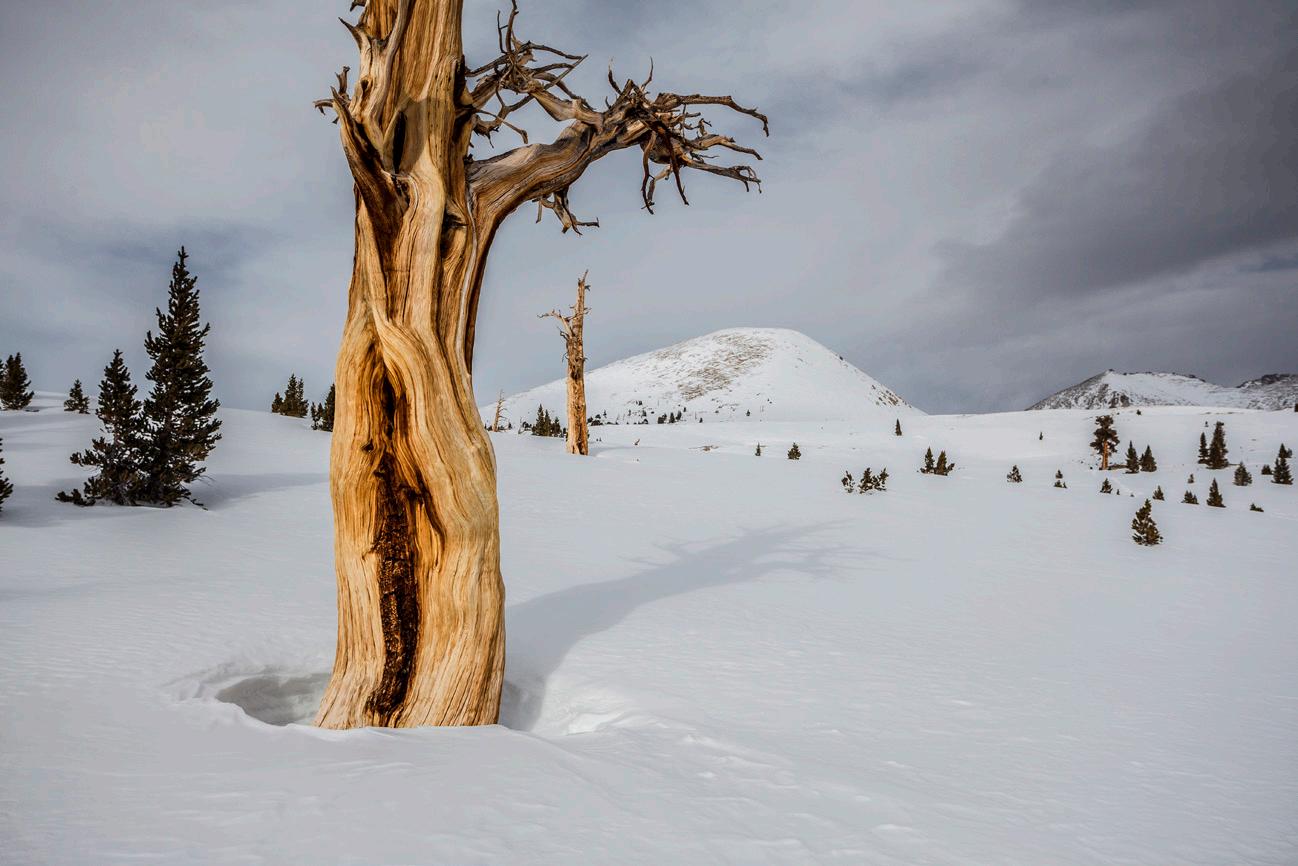
Montane meadows, i.e. those that are covered in snow during winter and explode with vegetation each spring, are some of the Sierra Nevada’s most vital ecosystems. Due to human impacts for over two centuries, nearly 70% of our Sierra meadow terrain has been subsumed due to grazing impacts, the loss of indigenous cultural stewardship, the near eradication of the beaver, and development and recreational impacts.
Meadow systems act as “green” reservoirs capturing snowmelt, filtering and storing water, and slowly releasing it to rivers that sustain millions downstream. They are also biodiversity hotspots, home to rare plants, amphibians, and birds. Just as importantly, healthy meadows lock away enormous amounts of carbon in their soils, making them essential to California’s climate resilience.
Montane Meadow covered in snow during the winter months.
Our First Landscape Scale Project
Set To Break Ground in 2026 Reds Meadow Valley Restoration Project
Just west of Mammoth Lakes, Reds Meadow Valley is one of the Sierra Nevada’s most heavily visited landscapes. The San Joaquin River runs beneath the jagged Minarets, with meadows, forests, lakes, waterfalls and the basalt columns of Devils Postpile National Monument drawing thousands of visitors each summer. The historic loss of Indigenous stewardship, and decades of grazing, road building, and sharply increasing recreation have left significant damage.
The Challenge and The Vision
For years, the Inyo National Forest has documented the strain of more than 20,000 visitors and 900 vehicles entering the valley on peak days. Six campgrounds and hundreds of parking spaces were added without a master plan, pushing roads into sensitive meadows, increasing erosion and reducing water quality. The result is compacted soils, eroding stream banks, and declining habitat along this six-mile corridor.
Two of these campgrounds were located in the middle of large meadow ecosystems on the north and south ends of the Valley, which when coupled with sustained grazing of pack stock, have put them into sharp decline. The JMT Wilderness Conservancy has taken the lead role in restoring this high-elevation riparian ecosystem in partnership with the Inyo, scientists and specialists, environmental consultants and Tribal leaders.
Over the last three years, JMT Wild began collaborating with the Sierra Meadows Partnership, Yosemite Conservancy, and Trout Unlimited to draw on their restoration expertise. The Conservancy then assembled a project team of landscape architects, environmental consultants, hydrologists, botanists, and Tribal knowledge holders to design a restoration plan that restores ecological health across the landscape, while supporting recreation in the valley.
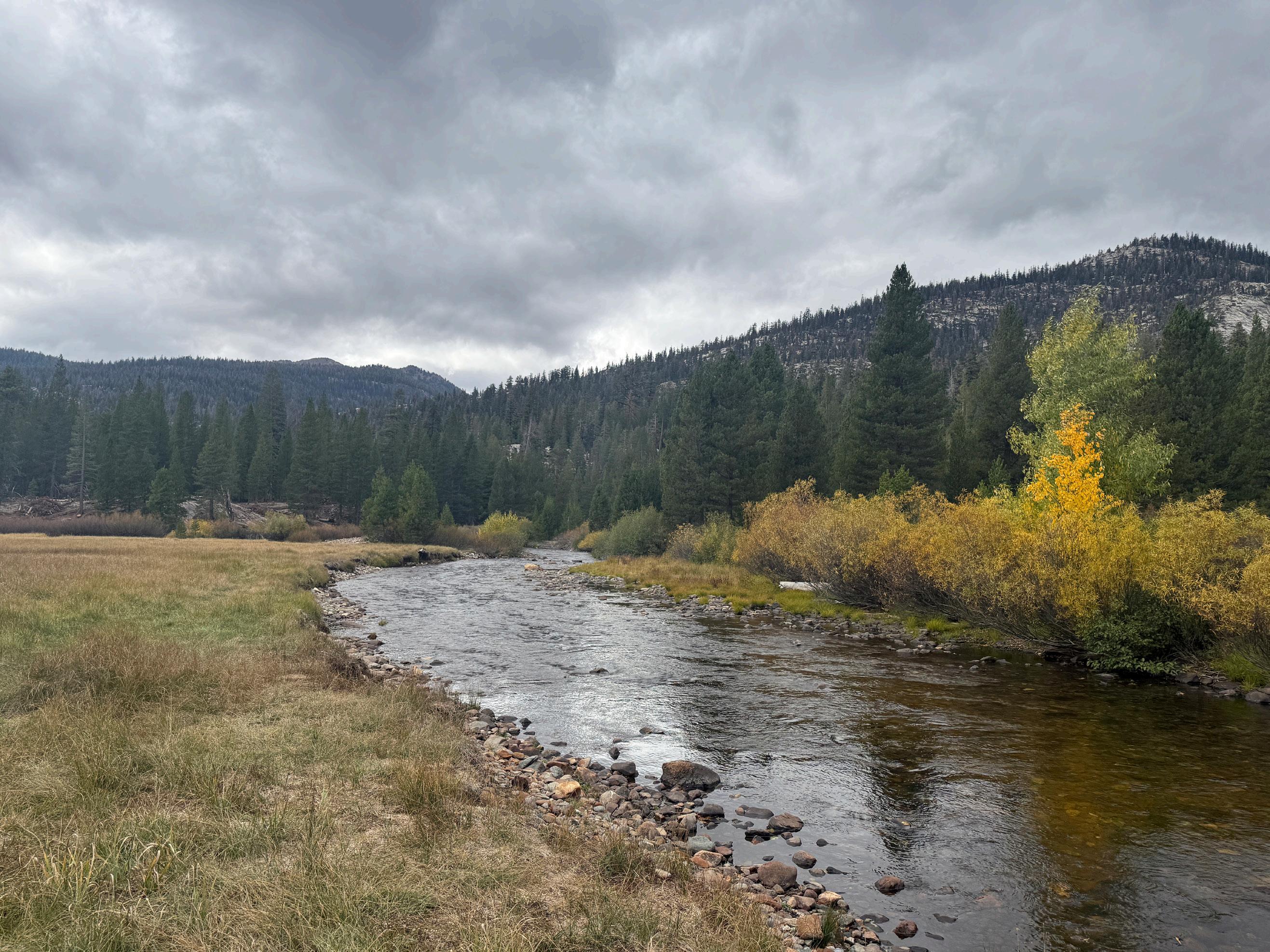
San Joaquin River in the riparian corridor where the Reds Meadow Valley Restoration Project is taking place; adjacent to Minaret Falls CampGround
sCienCe, TeChnology, and TradiTion
In 2023, the project incorporated the Lost Meadows Model, a satellite-based tool developed by the US Forest Service at its Arcata Research Station. Using LiDAR data, the State’s inventory of 10,000 key Sierra meadows and machine learning, the model maps historic floodplains and identifies opportunities to recover meadow acreage that had been subsumed in conifer forest over the ages. Records searches and additional public surveys were added, and the CAD modeling was integrated and completed.
Alongside advanced modeling, the project was guided by extensive study and input by scientists and specialists in the field. JMT Wild also consulted the North Fork Mono Tribe for cultural insights and practical restoration strategies to consider in the design planning.
ground TruThing The Plan
In 2024, interdisciplinary teams of scientists, consultants, and Tribal representatives walked nearly 400 acres of meadows and drainages, documenting erosion, grazing impacts, channel incisions, and conifer encroachment.
Using drones for more precise LiDAR mapping, GPS field notes, and onsite design sessions, the team created treatment maps to guide restoration.
Planned interventions include:
• Conifer removal and thinning to restore meadow extent and reduce wildfire fuels
• Hydrologic treatments such as beaver dam analogs to slow water and repair incised channels
• Meadow expansion into historic floodplains identified by the Lost Meadows Model
• Cultural thinning led by Tribal partners to restore balance and biodiversity
naVigaTing The legal PaTh
Large-scale restoration in California requires compliance with federal and state environmental laws, such as the National Environmental Policy Act (NEPA) and the California Environmental Quality Act (CEQA). Recent reforms are helping to speed the process. Through the state’s Cutting the Green Tape initiative, Reds Meadow is being reviewed under a new exemption for restoration projects, saving significant time.
JMT Wild expects permits to be finished this winter, allowing a 2026 groundbreaking.
Measuring suCCess
Restoration requires long-term monitoring. JMT Wild is building a Meadow Monitoring Program that combines drone technology with remote sensing metrics such as NDVI (Normalized Difference Vegetation Index) to measure vegetation health and water retention.
Piezometers were installed in Reds Meadow Valley this fall to measure groundwater levels and track how restored meadows retain and release water over time.
The data from these instruments will provide a clear picture of hydrologic recovery and guide adaptive management in the years ahead.
looking ahead
Ground break is anticipated for July 2026, beginning with in-stream treatments and possibly some cultural burning. But the project will take at least 5 years to complete. The goal is clear: open and restore meadow terrain, support re-vegetation, fill and spread incised streams, and build more resilient habitats that sustain wildlife and water for California.
For readers interested in the full scope of planning, science, and fieldwork, robust details are available in JMT Wild Journal, Volume 1.
Sotcher Lake and the meadow at its inlet which JMT Wild is expanding from conifer incursion and restoring as part of the Reds Meadow Valley Restoration Project
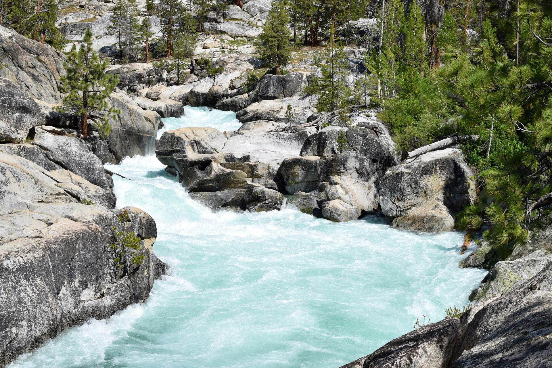
Lyle Fork of the Tuolumne River. A National Wild and Senic River Yosemite National Park
Generations on the Trail
Marla Stark
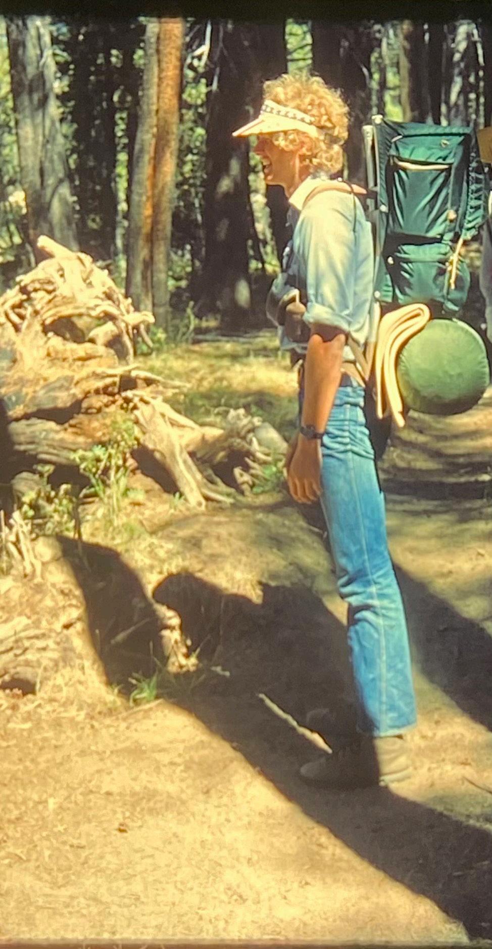
Our hikes in the Sierra backcountry for more than a decade in my late teens and twenties always started with a telephone call from my older brother, Rick. He’d call my younger sister, Liz and me offering a day to meet at our family home in Lodi. It was usually a Thursday night, so we could drive from school or work, throw our gear and food out on the living room floor, and pack up everything in our backpacks to get on our way by 7 PM or so. An extra Friday allowed us to push a week into 10 days, the maximum food weight we could carry.
Crossing the central valley floor and heading into Yosemite, we would arrive at Tuolumne Meadows very late at night throwing our pads and sleeping bags on the side of Tioga Road for an early morning rise. The ranger station was not far off, where we’d grab our permit and head out. Most times we’d hike the Rafferty Creek trail to Vogelsang High Sierra Camp where we often had friends working on staff
there. On some of our longer expeditions, we would hike the JMT up Lyell Canyon taking a southward turn at the Ireland Lake trail junction to wander and fish the high lakes there or staying on the JMT to camp below Lyell Glacier.
Once we decided to summit Mt. Lyell, at 13,114’ elevation, one of the ‘teen’ers that the Sierra crest is so famous for. It was an adventure, with our older brother leading the way. We followed the ridgeline, traversing across talus fields and huge boulders some of which moved under our foot treads. Just before the summit, you had to cross the glacial snow field, pot marked with sun dimples. One slip and you’d end up several thousand feet below on a bed of granite rocks, a thrilling way to meet your end. We did it without crampons or an ice ax, just solid toe grabs and steel nerves. It is a wonder we made it!
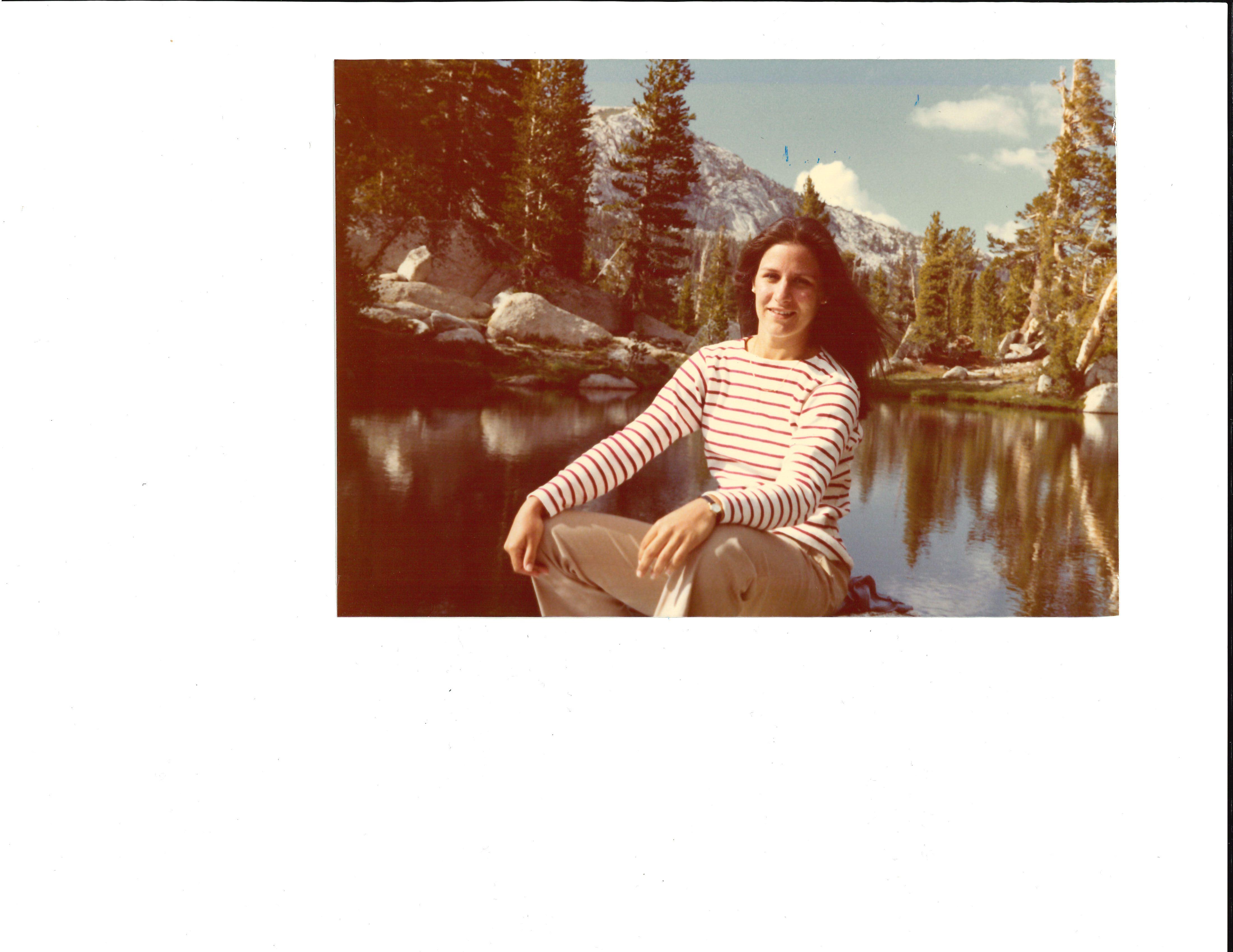
Marla Stark, President & Chair near Mt. Vogelsang, Yosemite National Park August 1972
Those hikes left us feeling quiet and collected inside, strong of body and mind, in real appreciation of the exquisite beauty of the earth.
at least 12’ off the ground at a point 10’ from the trunk. I was the lucky victim who stood on Rick’s shoulders to manage the tying and balancing of the sacks. There were a few precarious teeters during our years hiking, but luckily no falls!
To defend our food, we always brought a “wrist rocket”—this was a large sling shot supported by a brace along one forearm and around the wrist, and an extra thick rubbery band with a chamois carrier for the ammunition. With a good sized stone, it packed a wallop, startling and stinging an approaching bear who swiftly turned and ran away.
On our Mt. Lyell summit trip, we set up camp at the foot of the glacier counter-balancing our food in the one solid grouping of trees nearby. Sometime around 2 or 3 AM, we all heard the grunting and rustling of bears. Peering out from our tents, we saw a mother bear who had gotten her cub up in a tall, thin pine sapling adjacent to our tree. With the mother bear stretched to full height steadying him from below, the little guy was near the top. Together, they let the tree slowly lean into a region close to our suspended food sacks with outstretched paw inches away. It was very savvy bear gymnastics!
collected a group of perfectly-sized rocks to stack by his tent, our personal Sierra armory.
Our brother was a fly fisherman. He often wandered around in sunset hours catching a bug or two, and then duplicating them with his mobile fly-tying kit. His favorite hook size for Sierra trout was a 22, so tiny he had to use miniature needle nose pliers to flatten the barb. In those days, only a true fly fisherman fished with barbless hooks to reduce any injury or trauma to his beloved trout. We used a 4 weight fly rod, so light and nimble we could manage any of the tight corners on the Sierra streams and coves. Still the rainbows, goldens, and cutthroats were elusive—you had to “sneak up on them” lest they see your shadow and bolt.
That was more than 45 years ago now. Although Rick died in 2023, his voice still resonates when I hike the JMT today. Without knowing what modern science tells us about the benefits to the human body and mind from these outdoor adventures, we just knew those hikes left us feeling quiet and collected inside, strong of body and mind, in real appreciation of the exquisite beauty of the earth and the wonder of the natural world.
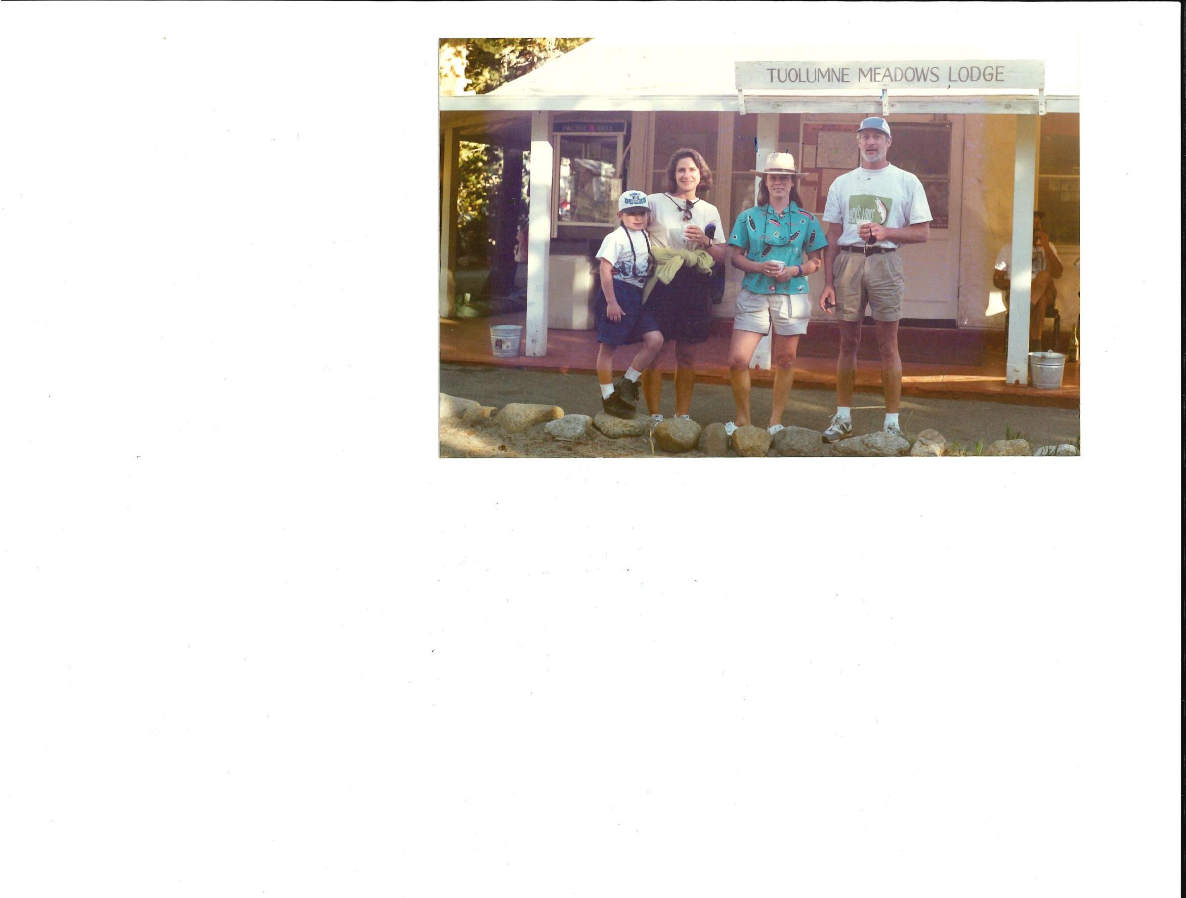
Elizabeth Stark, Marla and Spencer, Richard Stark Tuolomne Meadows, Yosemite National Park August 1994
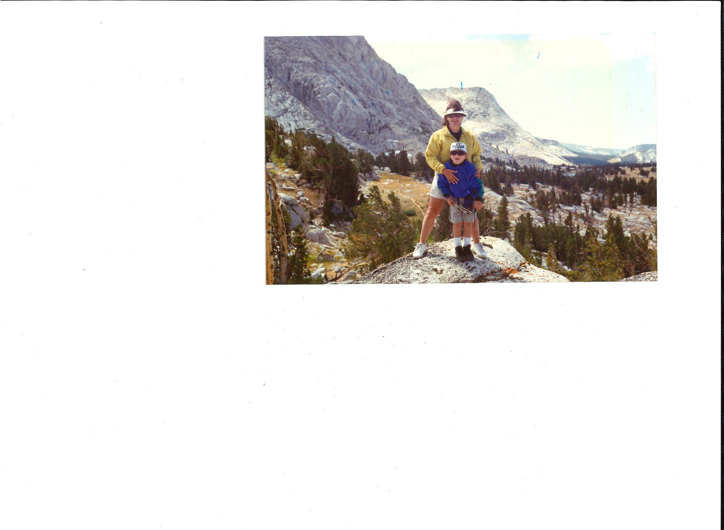
Marla with 9-year old son Spencer Collom, now JMT Wild Program Director Ireland Lake, Yosemite National Park August 1994
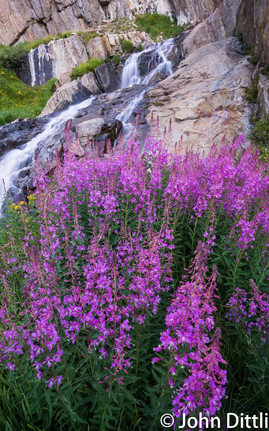
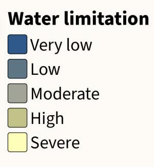
Wildflowers alongside a rushing waterfall
STATE CLIMATE POLICY AND NATURE-BASED SOLUTIONS:
A MATCH THAT PROVIDES MULTIPLE BENEFITS FOR CLIMATE, WATER, AND MORE
Felicia Marcus
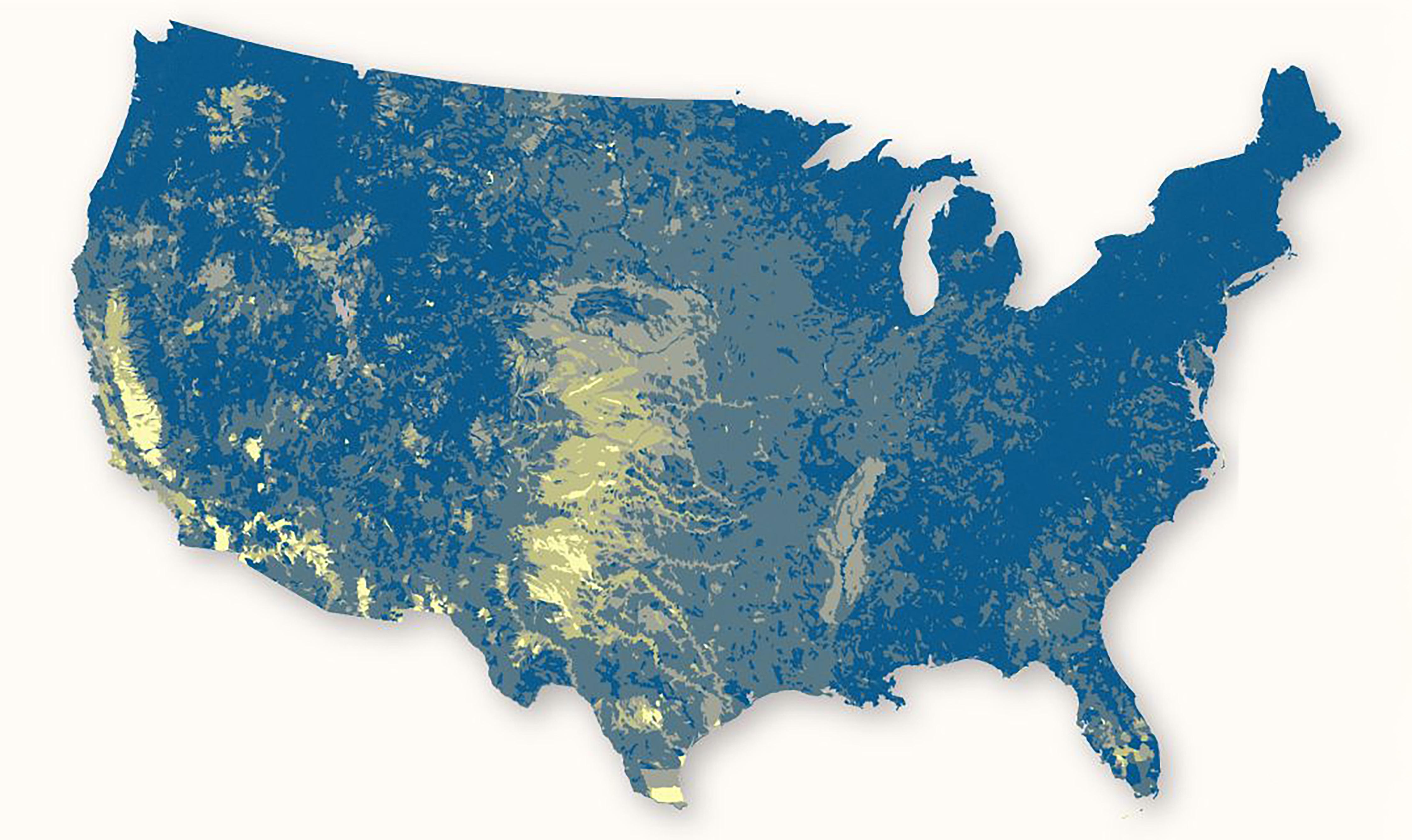
Significant opportunities exist to combine climate policy and nature based solutions (NBS). These opportunities have the potential to yield multiple societal and environmental benefits — including water benefits — but need focused attention to realize their potential. Ecologically-based forest restoration, wet or mountain meadow restoration, “healthy soils,” and other agricultural practices can yield these multiple benefits. The upper Colorado River Basin, with its iconic forests and an abundance of vast, high-mountain meadows and grazing lands, offers significant potential to deploy NBS at scale as does the Sierra Nevada.
While each state presents unique considerations, meeting the climate challenge requires that all states develop climate policies with complementary energy and NBS strategies. They can do so while incorporating other benefits to water, wildlife, and public safety. This is a “both/ and” issue, not an “either/or” choice. Many states already have climate policies, most of which also have complementary clean energy and/or energy efficiency policies. Fewer have complementary NBS policies linked to climate, or to climate and water together. California has advanced furthest in developing and implementing regulatory and complementary energy and NBS policies. Colorado and New Mexico are also developing programs to add naturebased solutions to their climate and complementary energy policies.
To understand the ongoing development of international, national, and state climate policies incorporating nature-based solutions, Stanford researchers reviewed state-level policies that address or have clear synergies with climate, water and NBS, with particular focus on the Colorado River Basin states. The resulting report identifies policies and practices that states can adopt to gain multiple benefits for climate and water resilience through their climate policies and programs. The report examines opportunities to integrate nature-based solutions that provide water benefits, as well as the barriers to this integration. Recommendations follow for state climate policymakers and for non-state actors who can overcome at least some of these barriers. Those recommendations include developing complementary state NBS climate strategies and funding, the development of better quantification and mapping of opportunities, support for multiple-benefit quantification, and developing a “community of practice” in the basin to overcome silos of discipline and geography.
“What the JMT Wilderness Conservancy is doing to restore the meadow ecosystems of the central Sierra Nevada is precisely what we need to go beyond theory and put multiple-benefit strategies into action on the ground.
The central and southern valleys of California that are served by the Sierra Nevada snowpack along the JMT are some of the driest in the lower 48 States.
The Conservancy is doing the hands-on implementation work necessary to make our water supply more resilient while providing multiple benefits for people, wildlife and ecosystems.”
- Felicia Marcus
Points for Policy Makers
Potential synergies exist between state climate policies and nature-based solutions (NBS) that provide multiple benefits, including enhanced water supply, improved water quality, expanded terrain for carbon capture, and improved forest health. California is a leader on all fronts and sets the standard for other policy makers across America.
Under the auspices of the California Department of Fish & Wildlife (CDFW), initiatives for Process Based Restoration (PBR) are organized under one of the State’s NGOs, CalPBR.org. The techniques are also being pushed through the State’s broad public grant programs, primarily through the Wildlife Conservation Board (WCB) and the Sierra Nevada Conservancy (SNC).
The most promising area of NBS or PBR techniques is forest management. Taking the initiative in light of the international call for land based restoration to combat carbon emissions from catastrophic wildfires, California created the Wildfire & Forest Resilience Task Force and has expended billions of dollars. The Task Force organizes state programs and resources to better serve communities, public land managers and public/private collaborations. Efforts focus on restoring forests ecologically to a more natural, and less combustible, state.
One specific and welcome addition to these programs is the integration of montane and wet meadow restorations into forest health planning and programs. This brought together the potential to realize benefits that address water and ecological concerns while creating natural firebreaks and refugia.
California is also taking the lead with the re-introduction of beavers into the Sierra. The Beaver Restoration Program is a state initiative to re-establish beaver populations as ecosystem engineers. Their work in building dams and slowing and spreading water helps with watershed restoration, drought mitigation, and climate resilience. The program involves population surveys, non-lethal conflict management for landowners, beaver translocations and re-introductions. In 2024, the Program was adopted by the Legislature ensuring its long-term funding..
California’s regulatory carbon offset or cap & trade programs are yielding enormous funding for NBS and PBR techniques. The California Air Resources Board (CARB) oversees the state's offset program, where carbon credits are given for a variety of terrestrial efforts. These include forest management that protects and enhances carbon sequestration. Extending this further, the CDFW recently organized the Wetlands Restoration for Greenhouse Gas Reduction Program as part of its greater Climate Investments. The Program aligns public grants with efforts to restore alpine and wetland meadow ecosystems across the state.
The enhanced financing opportunities in California through the WCB and SNC, and the programs outlined here, are providing the incentives for private and public partners to accelerate implementation of NBS/ PBR with climate and water benefits.
JMT Wild is following those incentives and leveraging the polices enacted in the State.
About the Author: Felicia Marcus is the William C. Landreth Visiting Fellow at Stanford’s Water in the West Program. She previously served in leadership roles in government and non-governmental organization sectors, most recently serving as Chair of the California State Water Resources Control Board.
River cascades past wildflowers
Researchers Use Machine Learning to Find Lost Meadows for Restoration
By: Melissa Kuntz, Science Delivery Specialist, US Forest Service, Pacific Southwest Research Station.
Mountain meadows provide many benefits to forests, wildlife, and people, but they can disappear over time due to climate change and human activity. U.S. Forest Service scientists at the Pacific Southwest Research Station are using machine learning models to identify areas in California’s Sierra Nevada mountains where meadows once existed and can be restored to improve landscapes.
“Over time, a meadow and its many functions can be degraded and lost to the encroaching forest. Spaces that were once moist and open become filled with trees that can carry wildfire farther across the landscape,” said Dr. Karen Pope, a Forest Service research ecologist.
“Using machine learning and other tools, we now have a model that helps us see the potential for discovering lost meadows across larger landscapes. Once we know where they were, we can envision the possibility of restoring them.”
Meadows provide habitat for a diversity of species and support pollinators.
Pope and fellow ecologist Adam Cummings used information about terrain and hydrology (water movement) characteristics in existing meadows to train machine learning models to predict where meadows may have been in the past. Across 60 Sierra Nevada watersheds they found the potential for almost three times than what exists today. They also looked at places where restoring “lost meadows” could capture sediment from areas left bare from wildfires, and where restored meadows could support wildfire management.
“Meadows are like a hub in a wheel that connects habitat, water, climate, fire – all the things we care about in forest systems,” said Cummings. Meadows ‘slow, spread, and sink” the flow of water, so they support consistent stream flow in dry times and capture sediment which improves the quality of water that goes to human communities.
Eric Nicita, a soil scientist for the Eldorado National Forest said, “Meadows are usually small but have an outsized importance for watersheds. They are where water is stored, cooled, and filtered. And when it comes to wildfire , meadows’ wet conditions and lack of trees create natural breaks in vegetation that can interrupt the path of a burn.”
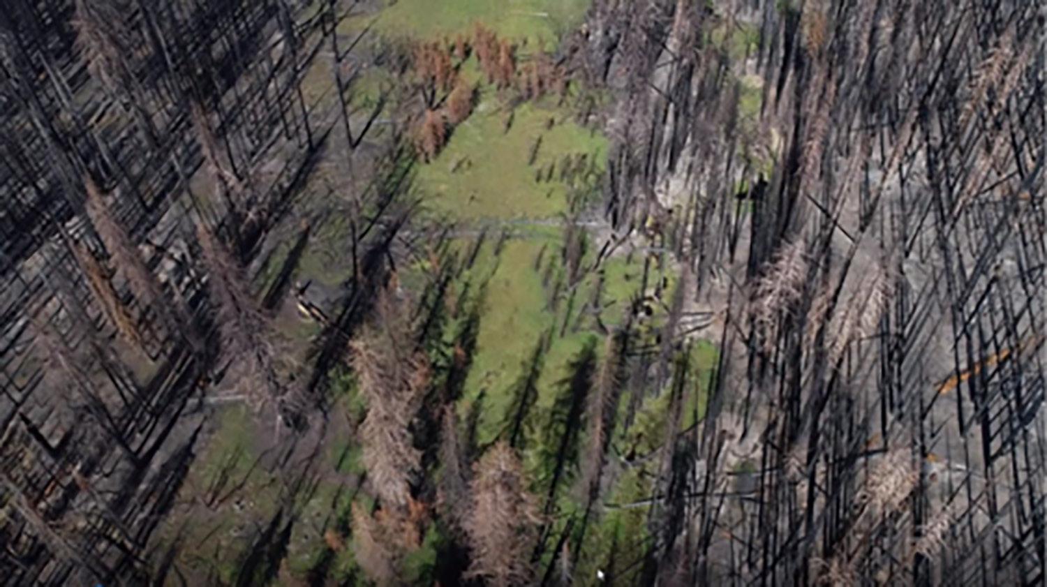
Pope and Cummings found several examples where existing meadows could be expanded or restored to better link and enlarge the network of wildfire containment features. They found that existing and lost meadows within the burn area of the 2020 Creek Fire could catch more sediment after fire and quadruple groundwater storage if they were restored.
Once lost meadows are identified, restoring them is similar to thinking like a beaver.
“We can jump start natural recovery processes by strategically placing locally-sourced wood, mud, and brush dams in incised meadow streams to create speed bumps for water and sediment,” Pope explained.
Burned trees from wildfires can help form the non-permanent structures which help slow and spread the flow of stream water, which in turn helps sediment settle out and rebuild stream beds and soils. As the soil and water conditions are restored, the diversity of meadow organisms – including plants, fish, insects, amphibians and birds – return and thrive.
Photo Credit: Geospatial Technology and Applications Center
This meadow in Sierra National Forest was heavily encroached upon by lodgepole pines. In its degraded diminished footprint, it was unable to interrupt and stop a wildfire. Restored in its historic flood plain as a larger meadow, it might have.
The Forest Service has made the maps of potentially lost meadowlands in the Sierra Nevada publicly available through the Forest Service Data Archives. Land managers and stewards are now thinking about meadow restoration at a watershed scale, instead of on a meadow-by-meadow basis.
“It’s important to look at whole watersheds including uplands and waterways, doing comprehensive restoration at larger scales with more people involved,” says Pope, “We can’t do that without seeing the potential.”
Karen Pope, US Forest Service, Pacific Southwest Research Station,—quoted in this article—is a leading aquatic ecologist who specializes in meadow ecosystem restoration, climate resilience, and native species recovery in alpine terrain.
The JMT Wilderness Conservancy is privileged to have Dr. Pope as our Senior Scientific Advisor, advising the organization’s restoration initiatives with science-driven solutions. With decades of research experience, Dr. Pope’s expertise informs JMT Wild’s efforts to restore high-alpine meadows, their supporting watersheds, and critical riparian habitats, and fortify these ecosystems against the impacts of a changing climate.
My Sierra Summers
Lyle Smith
How It Began
My parents loved the outdoors and introduced my siblings and me to hiking from an early age. I have three siblings—one younger brother and two older sisters—and our first experience in the High Sierra backcountry dates back to 1963, when my brother was four and I was seven. My parents were avid members of the Sierra Club and enthusiastic about their outings. For several years, we participated in what were called Wilderness Threshold trips.
These excursions brought together six to eight families with young children, each hiking six to eight miles to a designated basecamp where we would spend the week. A pack train would deliver our food and equipment, and from there, we were on our own. Each family took turns cooking, while we spent our days exploring nearby lakes and high meadows.
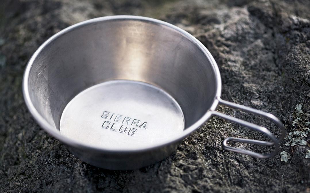
From those early trips, I fell in love with the high alpine meadows, where little streams meandered through lush grass and vibrant wildflowers. Back then, you could dip your Sierra Club cup straight into the stream and drink the crisp, cold water. Over the years, we had to start using iodine crystals in our canteens and boiling our water. Today’s water filters are a big improvement, but I still miss the era of pristine, drinkable water.
As we grew older, we transitioned to moving trips, covering more ground and traversing many sections of the JMT. We started with burro trips, where each family was responsible for packing and leading their own mule down the trail. By the time we were teenagers in the 1970s, we had graduated to full backpacking trips.
One particularly memorable experience took place on a trip that began at Mineral King trailhead. Late one afternoon, we set up camp below Florence Peak as summer thunderclouds gathered. Young and ambitious, we decided there was still time to climb the peak, so off we went. As we ascended, the clouds darkened, and by the time we reached the summit—just under 12,500 feet—the static electricity in the air was so strong that our hair stood on end. Realizing our precarious situation, we turned and ran back down as fast as we could. That night, we endured one of the wildest thunderstorms I’ve ever experienced, with some of our group’s tents flooding in the deluge.
How the Sierra Has Changed
When I hike the JMT today, people often ask me how the Sierras have changed over my lifetime. The spectacular grandeur that has always drawn me here remains, but on closer inspection, the changes are undeniable.
Decades ago, high-altitude snowfields were far more common, their sculpted sun cups making traversing them a challenge. I still remember the pink and red streaks my boots left on the snow, colored by the algae that thrived there. Today, weather patterns are increasingly unpredictable—some years, early-season snowfall makes trails impassable, but by the following year, everything has melted away due to rising temperatures. I once hiked to a high lake in the middle of summer that was still covered in ice, complete with skating tracks from the previous winter. Those experiences are rare now.
The impact of human activity is also evident. Even in the 20th century, the backcountry was never empty—people have always been drawn to the JMT—but it was easier to find solitude. Though certain high-traffic areas showed signs of wear, the wilderness still felt untouched. Today, the sheer volume of visitors has taken a toll. The increase in thru-hiking on both the JMT and PCT has contributed to this shift. When I first started hiking the Sierras, thru-hiking was a rarity—we almost never encountered long-distance hikers. Now, most of them need to cover significant ground each day, which sometimes means setting up camp without adhering to the required distances from lakes, streams, and meadows. This increased foot traffic damages fragile ecosystems, which take years to recover on their own.
The trails themselves have also suffered. Decades of use have left them deeply rutted, particularly in meadows, where erosion disrupts the natural flow of water. As these ecosystems degrade, they impact not just local flora and fauna but the entire hydrology of the region.
Why I Support JMT WILD
When I was young, the High Sierra represented adventure and discovery, leaving me with lifelong memories. Over the years, I have come to appreciate that this landscape is more than just a place of beauty—it is a vital ecological system, an essential water source that has sustained California for millennia. Today, as I walk these same trails, it’s clear that this fragile system needs help. Human activity—both on a macro and micro scale— has placed an increasing strain on the land, and we must do everything we can to reverse this trend.
This is why I support JMT WILD, both as a donor and a board member. The Sierra has given me so much over the past sixty years. Now, it’s our responsibility to give back.
Lyle Smith, JMT Wild Board Member Retired Senior Executive, Micro-Semi Corporation. Longtime Sierra Club member and avid backpacker.
l iving l eg A cies
Understanding the Ecology and Conservation of Sierra Fens
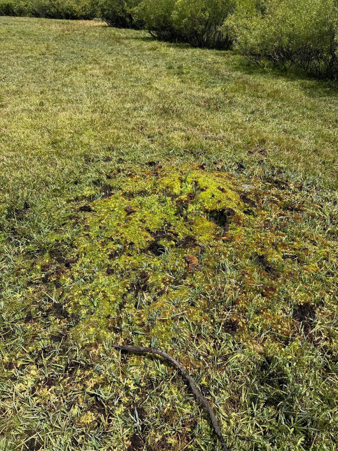
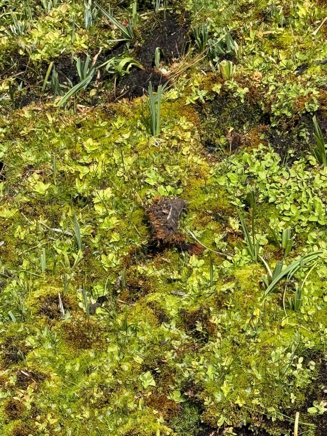
McClure Meadow, Kings Canyon National Park, July 2025. A sizable network of peatland fens was located in this meadow. Visible in this photograph, they can be identified by tufts of moss, sedges and bulrushes in the left foreground, and several places at the right center.
What is a Fen?
Fens are a type of wetland ecosystem characterized by waterlogged soils and a rich diversity of plant and animal life. These ecosystems are particularly notable in peatland meadows, where the complex interplay of hydrology, vegetation, and soil composition contributes to their unique formation and growth. Understanding the origin and development of fens is vital for conservation efforts and for appreciating their ecological importance.
Types of Fens in California
• Sloping fens: Found on hillsides where groundwater flows across slopes.
• Basin fens :Develop when lakes or ponds fill with vegetation.
The Origin of Fens
During our site assessment of Agnew Meadows in Reds Meadow Valley, we found a complex network of more than 40 fens within a peatland meadow system. It was located in the central wetland plain pictured here.
• Spring mound fens : Localized mounds formed by concentrated groundwater discharge.
• Lava discontinuity fens : Unique Peatlands formed where volcanic rock forces groundwater upward
Article based on:
United States Forest Service, Department of Agriculture, fs.usda.gov
“What is a Fen?”
We also encountered a half dozen fens in the watershed drainages supporting the meadow system in Evolution Valley, Kings Canyon National Park. Lying within water channels conveying sustained water supplies from slow snowmelt or springs, they were an oasis of green foliage, peat, mosses suffuse with wildflowers. Walking the JMT, one was compelled to stop and gaze in wonder at the abundance.
Over long periods of time, the accumulation of organic material in water-saturated areas leads to the formation of peat. Plants such as sedges, grasses, and reeds thrive in these environments, further enriching the soil and creating a habitat conducive to biodiversity. The presence of these native plants encourages the development of a stable community, supporting a variety of organisms ranging from amphibians to numerous insect species. Many are critical to the rich biodiversity chain in California.
Ecological Importance
Fens are significant ecosystems that provide numerous ecological services. They serve as important carbon sinks, helping to mitigate climate change by sequestering carbon in the form of peat and dense vegetation. The diverse plant communities within fens act as habitats for a wide variety of fauna, greatly contributing to regional biodiversity. And fens improve water quality by filtering contaminants, infiltrating and replenishing ground water stores, and reducing flood risks by absorbing excess water during spring snowmelt.
Conservation Challenges
Fens face numerous threats, including agricultural expansion and pack stock grazing, development of roads or infrastructure, recreation activities, and climate change. All three impacts are present in Reds Meadow Valley, and particularly within and around Agnew Meadows. Recreational use and grazing are the prime cause in Evolution Valley. These pressures have altered hydrology and nutrient dynamics, resulting in the degradation of these vital ecosystems. We can assume many fens historically present here have been lost.
JMT Wild’s conservation efforts are essential to protect and restore these fens, emphasizing sustainable grazing and infrastructure development practices that allow for both recreational use and animal husbandry, while preserving ecological viability and long-term health.
Growth and Dynamics
The growth of fens in peatland meadows is a dynamic process influenced by several factors and takes hundreds if not a thousand years. Hydrological regimes play a critical role; changes in water level, whether due to natural drought or human-induced alterations, can dramatically impact plant communities.
In Agnew Meadows human-caused impacts from pack stock grazing, expanding recreation, and severe climatedriven droughts have taken a toll.
In Evolution Valley, it was the construction and use of the JMT itself a century ago that bisected these complex systems, compacting the soils and impeding normal hydrological function.
Fens in peatland meadows represent a crucial component of wetland ecosystems, embodying complex interactions of hydrology, vegetation, and soil dynamics. The ones we found in Agnew Meadows and along Evolution Valley are complex and rare finds. Their origins, characterized by a unique hydrological regime and nutrient availability, has allowed for the establishment of rich biodiversity. As the Conservancy navigates the challenges posed by the environmental degradation caused by our human interactions, understanding and conserving these vital ecosystems is imperative for the health of our planet.
Peatland meadow north of Sotcher Lake, Inyo National Forest. JMT Wild is clearing this meadow of conifer incursions and restoring better hydrological support as part of the Reds Meadow Valley Restoration Project.
Restoring the Sierra:
Reclaiming Resilience in a Changed Forest
Hayley Reid M.S. Natural Resources Management JMT Wild East Side Project Manager
Forests in the Sierra Nevada have undergone profound structural and ecological changes over the past century, largely driven by shifts in land and fire management practices. Widespread fire suppression, combined with extensive livestock grazing and commercial logging, significantly altered forest composition, density, and function. Understanding how these forests have changed over time offers critical insight into both historical and current forest conditions and highlights the ecological challenges these landscapes face today, underscoring the urgency of restoration-based management approaches.
Prior to widespread Euro-American settlement, Sierra Nevada forests were shaped by frequent, low- to moderate-intensity fires. These fires burned regularly but typically in patchy patterns that reduced fuel loads without killing most overstory trees. Fire scars on long-lived trees and tree ring studies show that these fires maintained opencanopy conditions with widely spaced, fire-tolerant species. These fire regimes fostered structural diversity and contributed to ecological resilience across the landscape.
Historically, Sierra Nevada forests featured relatively low tree densities and supported a dynamic mosaic of meadows, shrublands, and open woodlands. These heterogeneous landscapes provided habitat for a wide array of plant and animal species and played a key role in sustaining regional hydrology. Regular fire limited the buildup
of surface fuels and curtailed conifer encroachment into grasslands and wet meadows, thereby supporting a more balanced and stable water cycle.
However, beginning in the late 19th century, federal land management policies, especially those emphasizing fire exclusion, profoundly transformed forest dynamics. The suppression of both natural ignitions and Indigenous cultural burning practices, which had long maintained open, fire-adapted landscapes, allowed tree densities to increase dramatically. Commercial logging removed many of the largest and most fire-resistant trees, while favoring shade-tolerant, fire-sensitive species. At the same time, heavy livestock grazing compacted soils, altered plant communities, and disrupted natural fire cycles, further enabling the expansion of woody vegetation into historically open meadows and grasslands.
Today, tree densities in the Sierra Nevada have increased dramatically compared to pre-settlement conditions. Small- to medium-diameter trees now dominate once-open stands, and dense thickets have replaced previously sparse forests. In many areas, canopy cover has nearly doubled, creating conditions that fuel high-severity wildfires. The accumulation of surface fuels and increased competition among trees have elevated the risk and intensity of modern wildfires.
Looking forward, restoring resilience in Sierra Nevada ecosystems will require a holistic approach, one that integrates fire history, hydrological dynamics, Indigenous stewardship, and landscapescale restoration. Identifying and restoring historical meadow footprints, reestablishing natural fire regimes, and reconnecting fragmented habitats are all critical strategies. The last century has revealed the unintended consequences of fire suppression and land-use changes. The path ahead demands that we embrace fire as a fundamental ecological process and that we weave together the insights of ecological science with the traditional knowledge systems that have long stewarded these lands.
At the same time, restoring forest resilience must go hand in hand with efforts to protect and recover the meadows and riparian corridors that thread through them. These systems not only support rich biodiversity but also play an outsized role in storing water, regulating streamflows, and buffering climate extremes. By focusing our restoration efforts on reestablishing hydrological function (removing conifers from degraded meadows, reconnecting stream channels, and restoring native vegetation), we can help revitalize the ecological heart of these landscapes. In doing so, we advance our shared mission: to heal High Sierra ecosystems from the headwaters down, ensuring they remain vibrant and resilient for generations to come.
“we can help revitalize the ecological heart of these landscapes. In doing so, we advance our shared mission: to heal high Sierra ecosystems from the headwaters down”
-Hayley Reid M S
Yosemite Valley overrun with connfiers
Restoring History Honoring Heritage
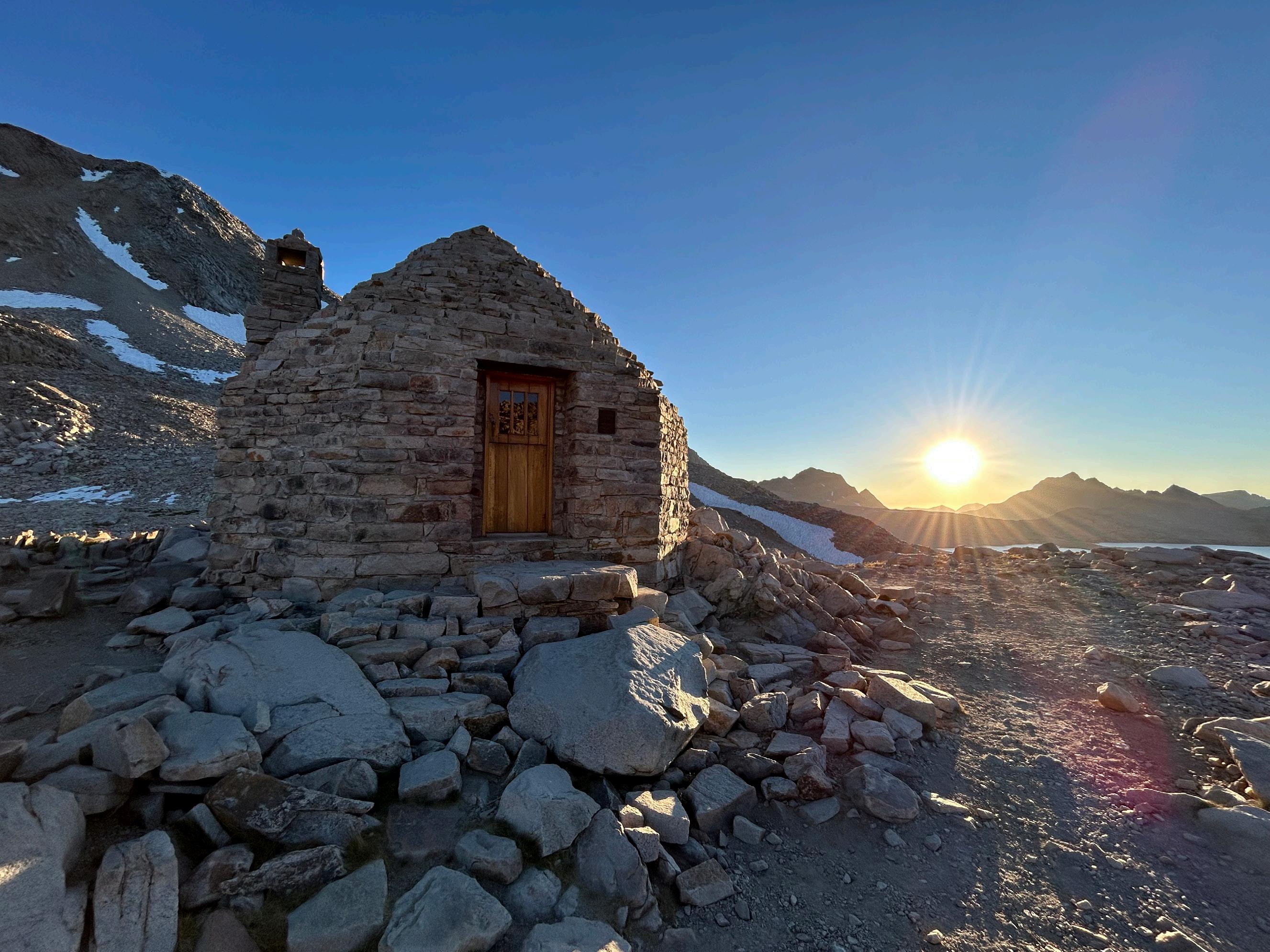
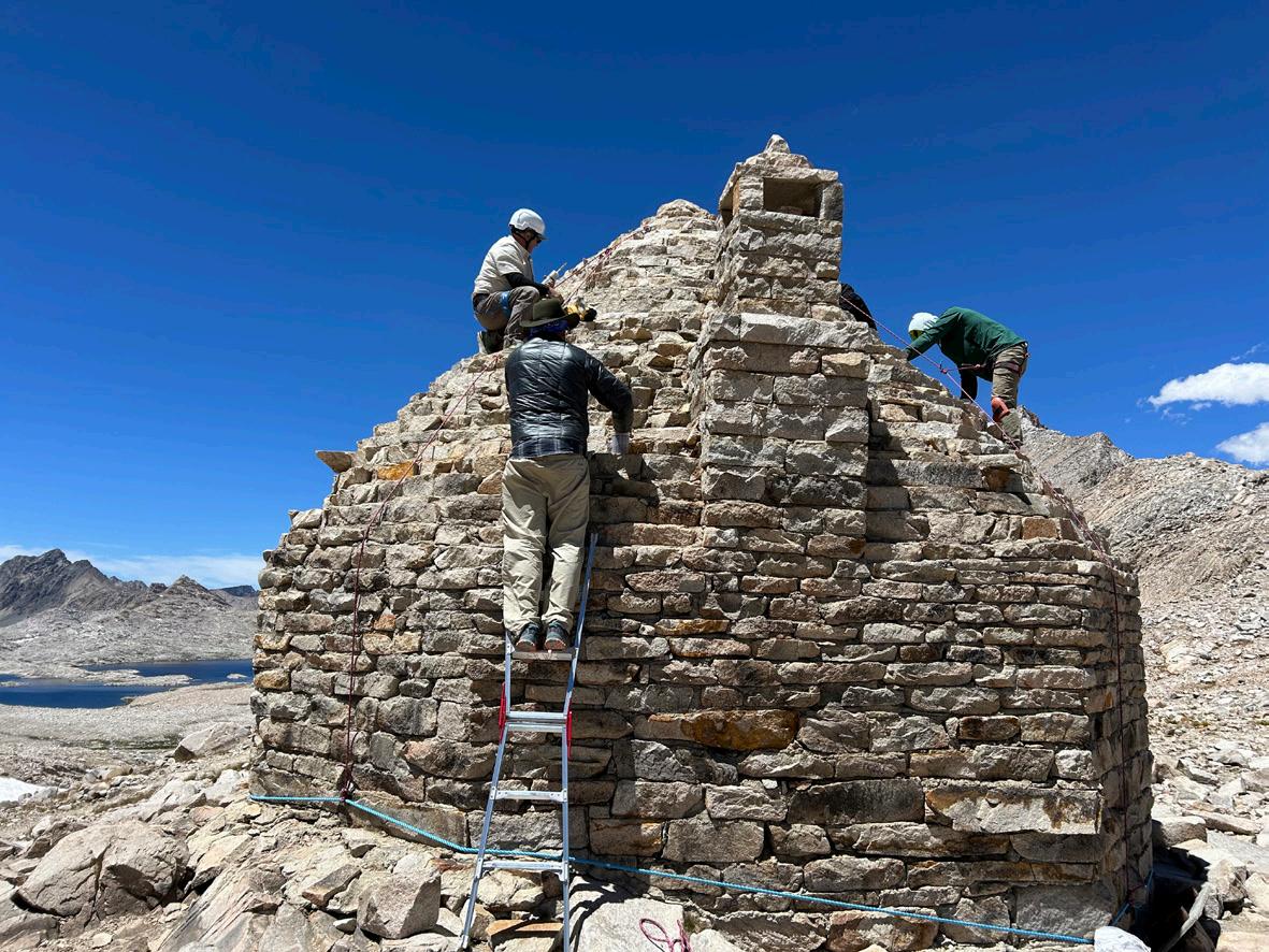
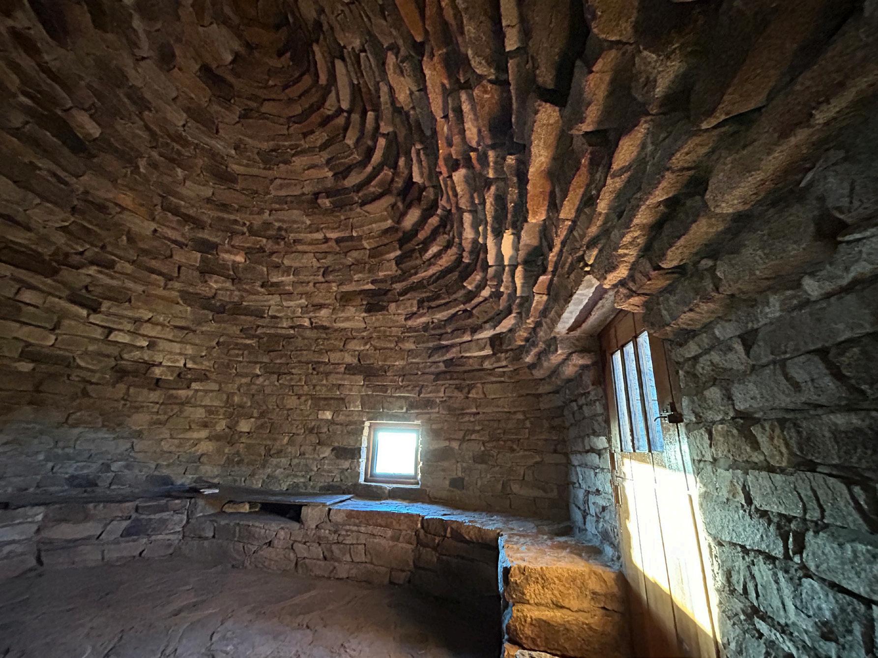
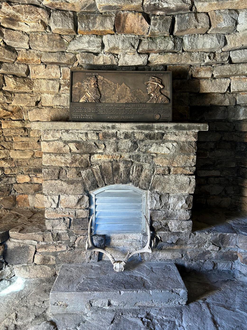
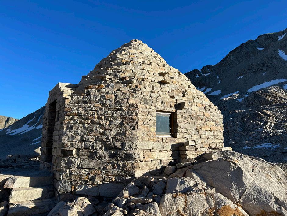
Perched at nearly 12,000 feet atop Muir Pass, the John Muir Memorial Shelter—known affectionately as the Muir Hut—has long stood as a symbol of endurance, craftsmanship, and reverence for the Sierra Nevada wilderness. Constructed in 1930 by the Sierra Club as a memorial to John Muir, the stone hut offers refuge to weary travelers along the John Muir Trail, a place to pause amid summer storms and reflect on the vast alpine beauty surrounding them.
This season, nearly a century after its completion, the JMT Wilderness Conservancy restored this iconic landmark to ensure its preservation for generations to come. The project was led by Special Projects Manager Michael Piatti, who guided a team of expert stonemasons and preservation specialists through a 15-day backcountry effort to stabilize and rejuvenate the historic structure.
Sun rises over Muir hut
Left: Michael Piatti, JMT Wild Project Manager points out Muir hut in the distance to the team that is working on restoring the mortar.
Time and harsh alpine conditions had taken their toll on the Muir Hut. The conical granite roof showed signs of deterioration, with failing mortar joints allowing water infiltration. Moisture had weakened the walls and led to mold and mildew within the interior. The restoration team set out to reverse this damage through a combination of traditional craftsmanship
Meeting at Mono Creek Campground, the team— consisting of a historic mason, a carpenter, a skilled laborer, and logistics support—reviewed every detail of the operation before beginning their ascent.
Their journey to Muir Pass required a logistical ballet: materials and tools ferried across Florence Lake, transported by a 1950s-era Mercedes Unimog to Muir Trail Ranch, and then packed onto mules for a twoday climb to the 12,000-foot summit.
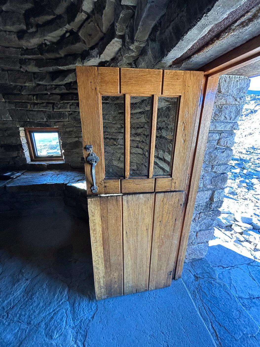
Once on site, the team worked methodically to meet their preservation goals. The top priority was sealing the roof against future water intrusion by re-grouting and re-pointing weakened mortar joints. Additional improvements included refinishing the hut’s Dutch door, replacing its broken window, and installing protective grills over the chimney and fireplace to enhance airflow and prevent wildlife intrusion.
For two weeks, the Muir Hut hummed with quiet joints by hand, carefully maintaining the original character of the masonry.
The Dutch door, fully restored and sealed with a fresh coat of lacquer, once again gleamed like new. Installing the fireplace grill proved one of the more delicate challenges, requiring the historic mason’s expertise to fit the prefabricated metalwork seamlessly into the irregular native stone.
The Work in Motion
Despite the physical and logistical demands, the team’s efforts proceeded ahead of schedule. Once the work was complete, they stayed behind a few extra days to assist the packer with safely loading equipment onto mules for the long return journey—22 miles and nine hours—of descent back to Muir Trail Ranch, beneath a rising moon.
From Top: restored celing and mortar, restored door, restored and blocked off fireplace
A Legacy Preserved
Guided by sustainable practices and respect for the fragile alpine environment, the restoration of the Muir Hut honors both its original builders and the generations of hikers who have sought refuge within its walls.
For those who traverse the John Muir Trail, the shelter remains more than a waypoint—it is a living monument to environmental activism and the stewardship of these landscapes. With this project complete, JMT Wild has ensured that the Muir Hut will continue to stand as a testament to the enduring connection between people and the wilderness that inspired John Muir himself.
The Finial: A Crowning Achievement
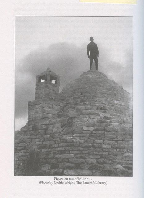
In a 1935 photograph by famed wilderness photographer Cedric Wright, a lone figure stands atop the completed John Muir Memorial Shelter, silhouetted against the Sierra sky. By scaling this historic image, experts recently confirmed that the shelter’s original granite finial stood 27 inches tall with an 11-inch base—a detail that guided today’s restoration.
The original finial, weighing nearly 300 pounds, was likely installed using a full wooden scaffold erected around the conical roof. Archival photos show Forest Service crew members dismantling heavy timber supports—evidence of the remarkable engineering it took to raise the massive stone to the summit using pulleys and chains.
For the 2026 restoration, JMT Wild’s historic masons are evaluating potential methods to restore the finial with modern precision: cutting it into three pieces for safe transport by mule and reassembly at nearly 12,000 feet or flying it in by helicopter—a method requiring extreme precision to lower the 300-pound stone into place. Now, a new idea has emerged: to hand-tool the finial atop Muir Pass using native granite, just as it was likely crafted a century ago, then lift it by pulleys into place. With donor support, JMT Wild’s team will finish this remarkable effort completing the century-long story of its craftsmanship.
John Muir Memorial Shelter stands tall at 11,955 feet
Increased Role of terrestrial Systems in Climate Mitigation
National Institute of Health, “Terrestrial Carbon Removal & Sequestration”, copyright 2019, National Academy of Sciences
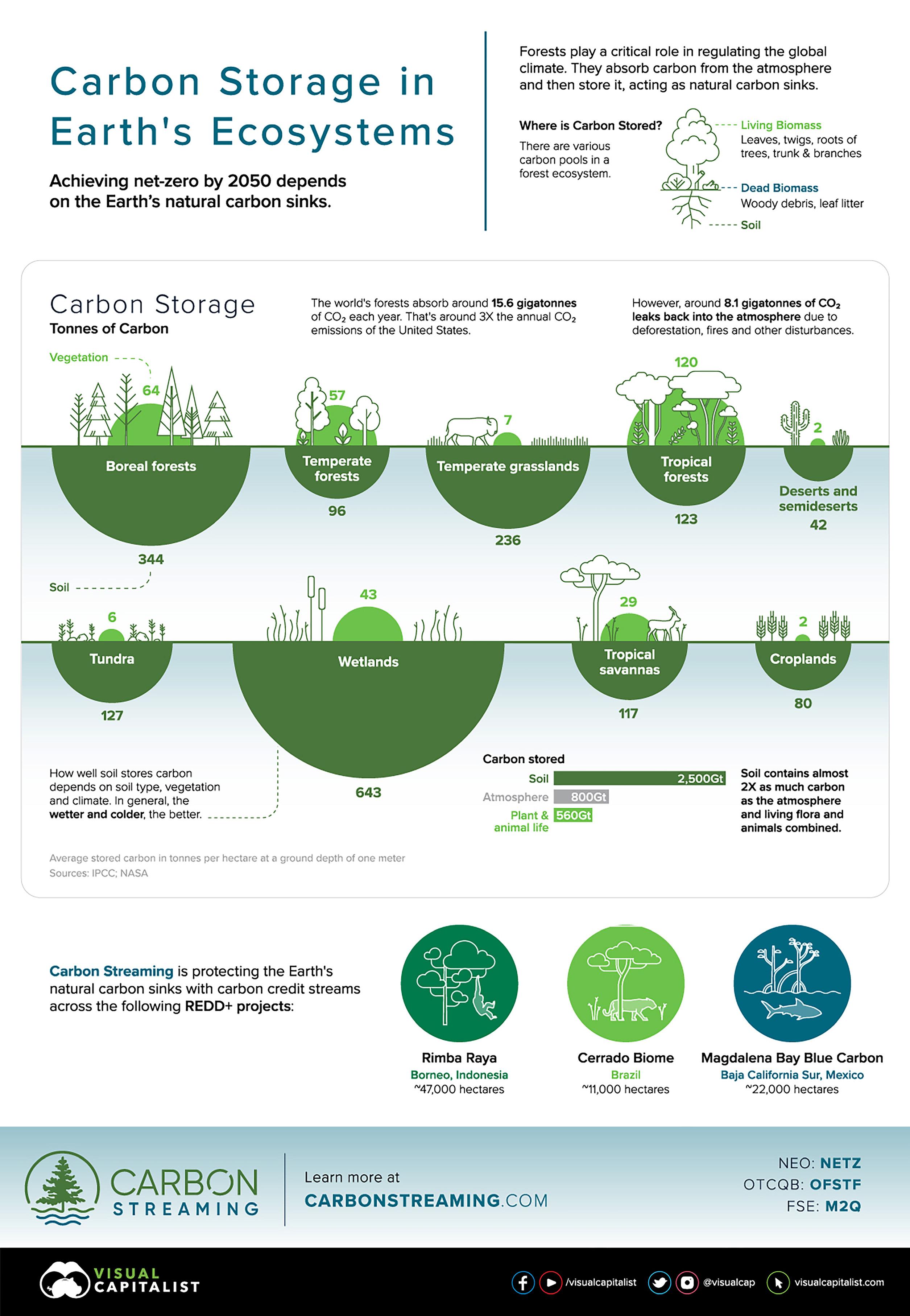
The rationale for pursuing terrestrial carbon sequestration as a CO2 removal strategy is at least three-fold. First, the “technology” for carbon capture and storage already exists, via the uptake of CO2 by plants and its storage in longer-lived biotic carbon pools, providing opportunity for storage that is energetically and economically competitive with other carbon removal and mitigation options.
Second, there is a significant storage capacity based on the magnitude of historical carbon stocks compared with much lower contemporary stocks. To a large extent, terrestrial carbon sequestration approaches can be seen as a reversal of previous ecosystem degradation changing land use and management to favor greater biomass and soil carbon stocks.
Third, increasing biomass and soil carbon stocks may confer additional ecosystem service benefits, including watershed protection, increased biodiversity, and improved soil health and fertility. In contrast, ecosystem service benefits, including biodiversity, may be reduced if the carbon sink–creating activities change disturbance regimes or other landscape characteristics that affect species.
United
Nations, Intergovernmental Panel On Climate Change, “SPECIAL REPORT: Climate Change and Land”, published August 8, 2019
“Neither our individual or societal identities, nor the world’s economy would exist without the multiple resources, services and livelihood systems provided by land ecosystems and biodiversity. The annual value of the world’s total terrestrial ecosystem services has been estimated at 75 trillion USD in 2011, approximately equivalent to the annual global Gross Domestic Product (based on USD2007 values) (medium confidence).
Land and its biodiversity also represent essential, intangible benefits to humans, such as cognitive and spiritual enrichment, sense of belonging and aesthetic, and recreational values. Valuing ecosystem services with monetary methods often overlooks these intangible services that shape societies, cultures and quality of life and the intrinsic value of biodiversity. The Earth’s land area is finite. Using land resources sustainably is fundamental for human well-being (high confidence). {1.1.1}”
“Mitigation response options related to land use are a key element of most modelled scenarios that provide strong mitigation, alongside emissions reduction in other sectors (high confidence). More stringent climate targets rely more heavily on land-based mitigation options, in particular, carbon dioxide removal (CDR) (high confidence). Across a range of scenarios in 2100, CDR is delivered by both afforestation (median values of –1.3, –1.7 and –2.4 GtCO2 yr–1 for scenarios RCP4.5, RCP2.6 and RCP1.9 respectively) and bioenergy with carbon capture and storage (BECCS) (–6.5, –11 and –14.9 GtCO2 yr–1 respectively).”
“Climate change threats in the Sierra Nevada include rapid amplification of fire intensity and frequency, driven by a feedback loop of higher temperatures, negative water balance, and loss of water-retaining ecosystems. The cycle can be short-stopped locally by the restoration of montane meadow wetlands, exactly the kind of work that JMT Wild has become adept at.
There is an important co-benefit in the enhanced carbon storage capacity of high mountain meadows following restoration, a benefit that counts towards California’s net C budget as the state moves to net-zero CO2 emissions by 2045.
Policy makers, including those in California, are increasingly looking to landscape-scale terrestrial strategies to manage climate impacts. JMT Wild’s efforts now work at scale to that end.”
- Rob Dunbar
Rob Dunbar, Professor at Stanford University, Doerr School of Sustainability; Senior Fellow, Woods Institute for the Environment—Quoted here—is a pioneering climate scientist whose work qpans oceanography, paleoclimate, and ecosystem resilience. A member of the JMT Wilderness Conservancy Board of Directors, Dr. Dunbar brings decades of research experience in climate systems and environmental change to guide JMT Wild’s science-driven restoration and resilience initiatives across the Sierra Nevada.
Restoring Function, Recording Change:
The Science Behind Reds Meadow Renewal
Michael Piatti JMT Wild Project Manager
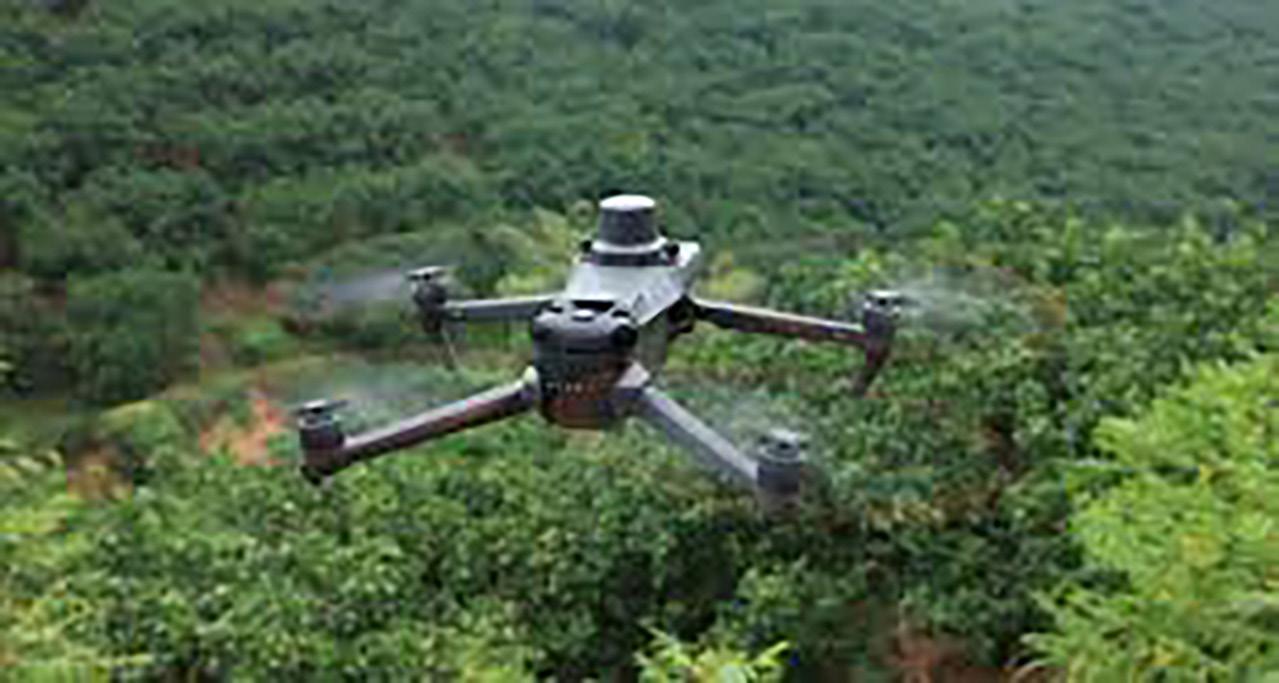
Healthy meadows are essential to resilient mountain watersheds, providing habitat, water storage, and natural filtration. Across the Sierra Nevada and beyond, restoration efforts increasingly rely on advanced monitoring technologies to assess meadow condition and guide adaptive management. The Reds Meadow Valley Restoration Project attempts to utilize tools such as drones, satellite-based indices, piezometers, paired with Traditional Ecological Knowledge (TEK)—to restore hydrologic and ecological function.
Located in the Middle Fork of the San Joaquin watershed within Inyo National Forest, Reds Meadow Valley has endured more than a century of human and climatic stress—from overgrazing and recreational impacts to altered fire regimes and climate-driven hydrologic shifts. The project’s goal is to restore natural geomorphic, hydrologic, and biotic processes in two meadow complexes, while reducing infrastructure impacts from nearby recreation sites. Monitoring is central to this mission, ensuring that restoration actions—like low-tech, processbased restoration—are achieving measurable ecological recovery.
Satellite imagery and drone-based monitoring play a critical role in assessing vegetation vigor and water content. Using the Normalized Difference Vegetation Index (NDVI) and Normalized Difference Water Index (NDWI), our team can quantify how meadow health changes over time. These indices, derived from nearinfrared and visible light bands, allow us to track how restoration influences late-summer vibrancy of green vegetation—an indicator of a meadow’s ability to retain water. At Reds Meadow, high-resolution aerial imagery (~3 m or better) will be collected annually to detect subtle shifts in vegetation vigor and hydrologic function over years of recovery.
The depth of the water table is one of the strongest indicators of meadow health. In the Reds Meadow project, up to 20 piezometers—simple groundwater wells equipped with pressure sensors—record water levels continuously. This data helps determine whether restoration efforts are successfully raising groundwater tables and re-establishing floodplain connectivity. These measurements also complement NDVI analyses: as water tables rise, increases in vegetation vigor are expected, signaling ecological recovery.
Lightweight drones and fixed ground photo points provide visual confirmation of structural performance and vegetation response. These images document headcut stabilization, channel aggradation, and conifer removal—qualitative but powerful evidence of change. The combination of drone imagery and satellite analysis offers a multiscale view of meadow dynamics, supporting both site-level management and broader regional comparisons.
While technology supplies unprecedented precision, Traditional Ecological Knowledge ensures that monitoring and management remain culturally grounded. Indigenous perspectives on hydrology, vegetation patterns, and seasonal cycles provide context for interpreting data trends and shaping restoration priorities. TEK encourages long-term, relationship-based stewardship that complements the time-series datasets produced by satellites and sensors.
The integration of technological and traditional approaches allows meadow restoration projects like Reds Meadow to be adaptive, cost-effective, and deeply informed. Continuous data collection through drones, satellites, and piezometers supports responsive management decisions, while TEK ensures those decisions respect ecological history and human connection to place. Together, these methods create a holistic framework for monitoring and sustaining meadows—living landscapes where science and stewardship meet.
Courtesy of Colorado State University
A NEW MISSION IN ACTION
Last year we took steps to embrace the USFS Lost Meadows Model , layering historical records data and LiDAR for CAD design, and virtual modeling. With these, we began designing our projects around the expansion and recovery of landscape-scale meadow ecosystems and adjacent watersheds.
Now, with a strong team in place and clear objectives guiding our way, both our mission, (what we do) , and our vision, (what we aspire to achieve) , have come into full focus.
Mission
our Working to restore the watersheds, wilderness, and wildlife in the high Sierra Nevada following the John Muir Trail (est. 1915) for all life in California
&
Vision
To advance enduring alpine & forest stewardship along John Muir’s “Range of Light”
Acknowleding Our Founding 1915 Society Members
$1,000,000 +
Sierra Nevada Brewing Company
Guy & Jeanine Saperstein
$200,000-$999,000
S. D. Bechtel, Jr. Foundation
Jennifer Johnson & Susanne Scovern
William & Jeanne Landreth
Frances Hellman & Warren Breslau
$50,000-$199,000
Tim & Wendy McAdam
Charles Robel
Doug Collom & Marla Stark
William + Flora Hewlett Foundation
The Hellman Foundation
Art & Joanne Hall
Charles & Ann Johnson
$10,000 - $49,999
Lyle Smith & Diane Strachowski
Steve Neal & Michele Rhyu
Brad & Judy O’Brien
Ronald & Barbara Peyton
Alan & Caron Lacy
Heslep Family Foundation
Carol & Stephen Hart
Marty & Barbara Winter
Gretchen Augustyn
Jennifer Augustyn
Peter & Sabrina Landreth
Jesse Rodgers
Boswell Family Foundation
Kate Ridgway & Rick Holmstrom
Wendy Hutton
Harrick Family Foundation
Cam & Bruce Brugler
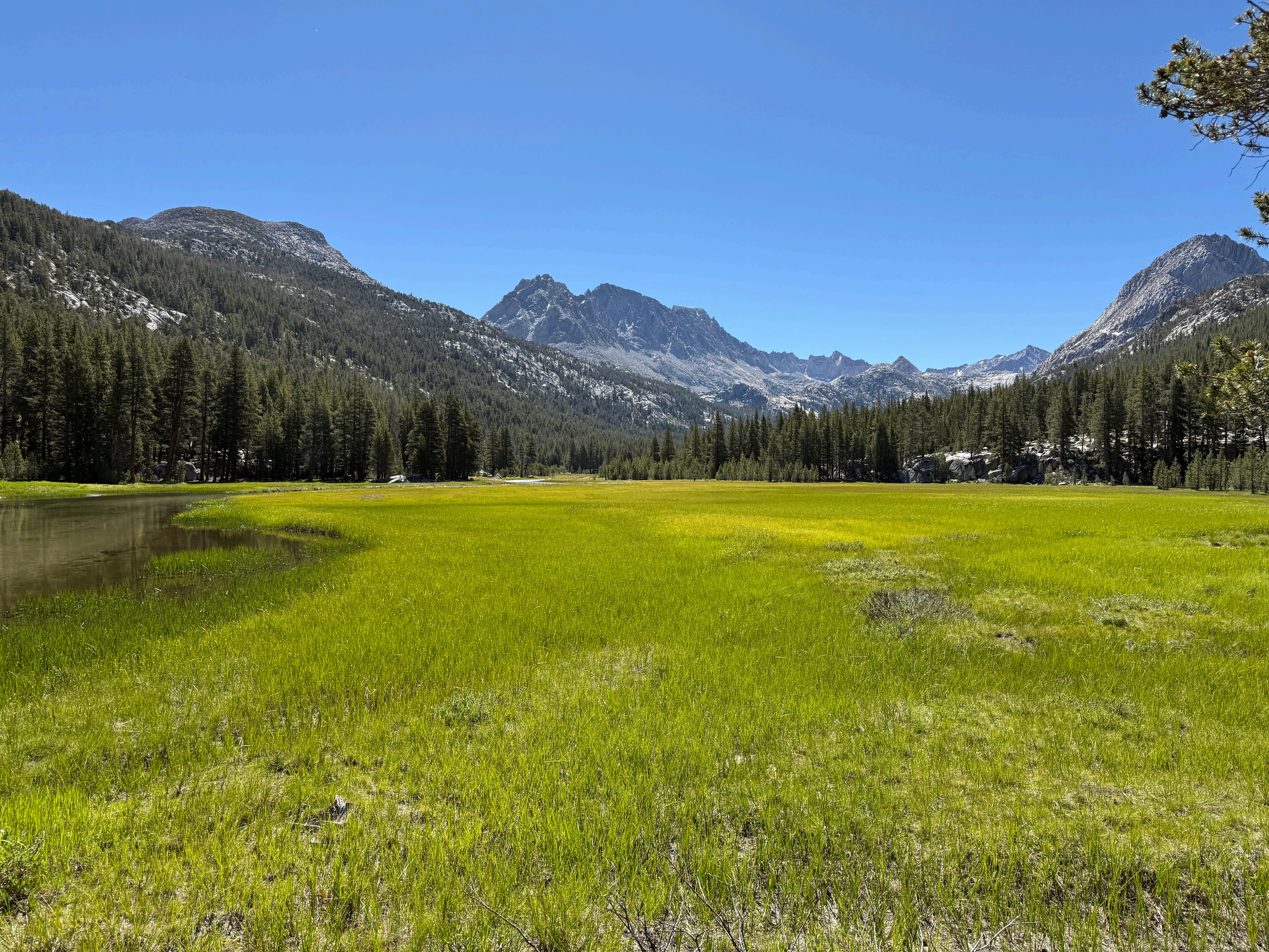
High Sierra meadows like this one are California’s living reservoirs—storing water, capturing carbon, and sustaining life across the state.
10 Year Public/ Private Funding Opportunity
In November 2024 Californians passed Proposition 4 “The Climate Bond” authorizing $11 billion in public funding for climate risks. Of that, over $1 billion has been allocated to the Wildlife Conservation Board (WCB) to advance water sustainability, riparian habitat recovery, and climate mitigation -- all priorities that align with JMT Wild’s mission.
The WCB is now awarding funds through rolling grant applications. JMT Wild has initiated a long term strategy to secure this funding, and has successfully completed the pre-application for a $5 million grant to implement the Reds Meadow Valley/San Joaquin River Restoration Project. (See JMT Wild Journal, Vol 1)
Each WCB grant requires a private sector donor match. A higher percentage match significantly increases the likelihood of final approval. We would like $3 million or 60% in matching funds to secure this grant opportunity. The Conservancy also needs general operating support for its growing portfolio of landscape-scale restoration work. Expanding into process-based restoration of damaged montane meadows requires additional office capacity in finance, communications, and fundraising.
Your philanthropic commitment, in a single larger gift or a multi-year pledge for 3 to 5 years, will have a lasting impact. We are seeking donor match commitments now.
Please contact LeadershipMatch@JMTWilderness.org for more details.
Marla Stark President & Chair Former Chief Legal Counsel, Wind RiverSystems Inc.
Doug Collom
Adjunct Professor, Wharton School of Business; Former Partner, Wilson Sonsini Goodrich & Rosati
Board of Directors
Sierra Grossman Vice President, Corportate & Social Responsibility, Sierra Nevada Brewing Co.
Rob Dunbar Professor Stanford University, Doerr School of Sustainability; Senior Fellow, Woods Institute for the Environment.
Herb Fockler
Seinor Of Counsel, Wilson Sonsini Goodrish & Rosati
Lyle Smith
Adjunct Lecturer, Stanford University; Former Silicon Valley Engineering Executive
Tim McAdam General Partner, Technology Crossover Ventures (TVC)
John Fore Former Partner, Wilson Sonsini Goodrish & Rosati
Matthew Adams Trustee, Ansel Adams Gallery, Yosemite National Park; Ansel Adams’ grandson.
Ron Bernal
Venture Partner, NEA; Former Partner Sequel Venture Partners, Sutter Hill Ventures
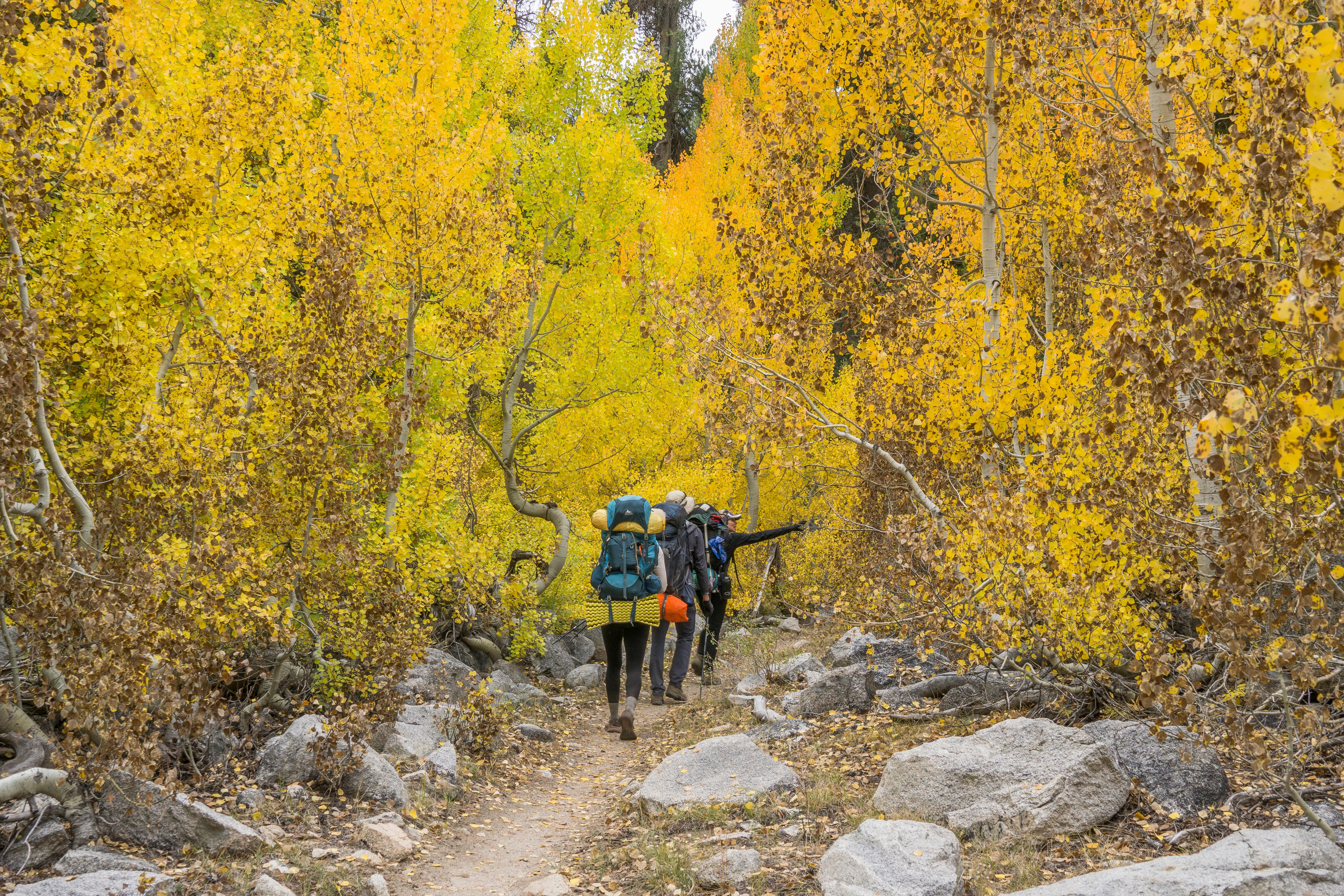
Two roads diverged in a yellow wood, And sorry I could not travel both and be one traveler, long I stood and looked down one as far as I could to where it bent in the undergrowth;
Then took the other, as just as fair, And having perhaps the better claim, Because it was grassy and wanted wear; Though as for that the passing there had worn them really about the same,
And both that morning equally lay In leaves no step had trodden black. Oh, I kept the first for another day! Yet knowing how way leads on to way, I doubted if I should ever come back.
I shall be telling this with a sigh Somewhere ages and ages hence: Two roads diverged in a wood, and I—I took the one less traveled by, And that has made all the difference.
Please Join Us
Your investment matters. A lasting impact for all life in California. Visit us online at www.jmtwilderness.org