1 minute read
INNOVATOR FROM THE FIELD


MTA Harlem River Line Truss Bridges – Aerial LiDAR Project

Advertisement
Bronxville
and Scarsdale, NY
For this project, GEOD was contracted to provide topographic mapping of the Railroad Right-Of-Way for 3,800 linear feet in Bronxville and 13,150 linear feet in Scarsdale in Westchester County, NY.


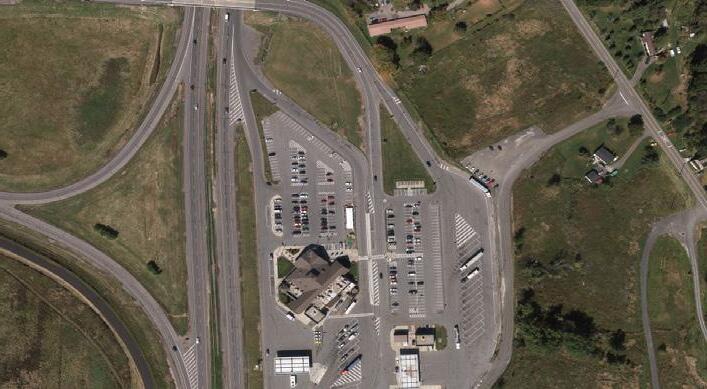
Because the time frame for this project was July thru October, 2022 (summer months in full foliage conditions), a combination of 12 ppm² Aerial LiDAR and 3.6cm GSD Aerial Imagery was harnessed to develop the base-mapping, with the LiDAR specifically being used to model the terrain in obscured areas. Mapping was delivered in MicroStation V8i at 1”=30’ scale with 1ft contours created from a SelectCAD feature based DTM.
Project Owner: Metropolitan Transit Authority.