1 minute read
GEOD Strengthens In-House Drone-Based LiDAR Capabilities


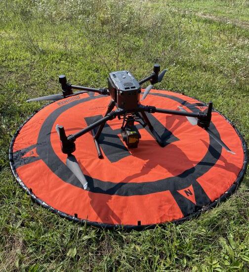
that provides airborne LiDAR scanning at rates up to 240,000 pts/s using multiple returns. This results in the capability to acquire dense, accurate point cloud data in both open and forested landscapes. Newly acquired post-processing software from DJI and Terrasolid will help in the QA/QC of this data. The new RGB camera payload for the M300 RTK provides highly accurate geo-tagged imagery through the use of RTK positioning. Images will now be acquired with photo center coordinates down to near centimeter level accuracy. This will help to both reduce the number of groundbased control targets and facilitate photogrammetric mapping in both traditional and challenging terrain.
Advertisement
With the new M300 RTK drone and it’s two state of the art payloads, GEOD continues to provide it’s clients with the very latest in data acquisition technologies, to facilitate the most accurate and efficient workflows for client deliverables.
GEOD has recently increased its operational capabilities with the addition of an enterprise level drone (sUAS), new payloads, and new post-processing software packages. The new drone was added to our fleet to specifically address the needs in both our surveying and photogrammetry departments.
For years, GEOD has used its current drone fleet to perform and supplement traditional field surveys with high resolution, geo-referenced imagery and their derived geo-spatial data products. Our new drone, a DJI Matrice 300 RTK, will further increase our ability to produce these products through the use of multiple payloads with additional on-board technologies. With new LiDAR and RGB sensor payloads, GEOD now has a wide range of both active and passive systems to capture and derive highly accurate point clouds to be used for geo-spatial product generation. The LiDAR payload for the M300 RTK is an active system